|
Trails of the Past: Historical Overview of the Flathead National Forest, Montana, 1800-1960 |
|
MISSIONARY ACTIVITY AND EARLY EXPLORATION
Introduction
Jesuit missionaries and early explorers of the upper Flathead Valley such as railroad and government surveyors provided some of the first written descriptions of the area. The Louisiana Purchase of 1803 gave the United States possession of the Missouri Valley, but the Columbia River Basin, including northwestern Montana, was occupied jointly by British and Americans until the Oregon Treaty of 1846 gave the United States undisputed title to land south of the 49th parallel. Oregon Territory was created in 1848. Later subdivisions of this vast land meant that northwestern Montana at various times was part of Oregon Territory, Washington Territory, Idaho Territory, and then Montana Territory (created in 1864). Montana became a state in 1889. Many of the early scientific expeditions to the area were first and foremost boundary surveys. The various railroad and government surveyors provided written descriptions of northwestern Montana, but settlement remained low because of the great difficulties of access and discouraging reports about the long winters.
The original St. Ignatius Mission in the Mission Valley no longer exists to recall the Jesuit influence, but the more recent church is still in use.
Missionary Activity
Four Iroquois had come to live among the Flatheads in the early 1820s and had passed along their Catholic instruction. Beginning in 1831, the Flatheads sent several delegations east to St. Louis requesting Christian teachings. Pierre-Jean DeSmet was the first Jesuit in Montana, arriving in the Bitterroot Valley in 1840. St. Mary's Mission, located in the Bitterroot Valley, closed in 1850 due to Blackfeet hostility, and the missionaries sold the property to John Owen, an American trader. In 1866 a new mission opened there again. The St. Ignatius Mission, founded south of Flathead Lake in 1854, served Flathead, Kootenai and Pend d'Oreilles. In 1855, over 1,000 Native Americans of various tribes settled in the vicinity of the mission in the lower Flathead Valley, and many took up an agriculture-based way of life (Schoenberg 1960:5, 19, 21, 24-25; Toole 1959:57).
The Jesuit missionaries extended their influence throughout the area that is now western Montana. For example, in 1842 Father DeSmet visited a camp of 30 lodges northwest of Flathead Lake (in the area of today's Kila). Missionaries regularly visited the Kootenai living in the Tobacco Plains area, and in the spring of 1857 the Kootenai constructed a chapel near Fort Kootenai, the HBC trading post. The Jesuits abandoned this chapel a few years later, however (O. Johnson 1950:12-14).
Railroad Surveys
Some of the early government surveys in northwestern Montana were associated with the building of railroad lines across the United States and Canada. Spurred by increasing western settlement, the United States government hoped to build a transcontinental railroad in the 1850s. Governor Isaac Stevens of Washington Territory was in charge of the northernmost railroad survey from the headwaters of the Mississippi to Puget Sound (Hamilton 1957:94).
Stevens detached Assistant Engineer A. W. Tinkham to explore a route from the Blackfoot River west to the Jocko. Tinkham and his party missed their intended route and followed the Swan River north instead. They then turned west and "chopped" their way over the Missions into the Flathead Valley, where they headed south. Tinkham was next assigned to find a suitable pass through the Rockies. In 1853 he and a small party traveled up the Flathead River to Flathead Lake and along its western shore. North of Flathead Lake, he reported:
we...emerge upon an open prairie bottom of good soil...Trail on the right bank of the river, but not in sight of it. High, nearly level ground, partly prairie, partly wood land, extends to where Flathead river issues from the mountain ridge on its eastern side [Bad Rock Canyon]. Good road to this point. Winding on the base of the mountain, the trail is rocky and very rough, but after a short distance the mountains again recede from the river. The same nearly level upland is renewed. Henceforward, to the prairie east of the Rocky mountains, the trail is absent; always woods. Trail to camp much obstructed by fallen timber (from US Explorations and Surveys, 1853-56, part one of vol. I:372, in Vaught Papers 1/11).
Tinkham and his party followed the Middle Fork up Nyack Creek and over Cut Bank Pass, and then they continued on east to Fort Benton thinking they had crossed the pass known as Marias Pass, which was actually farther south. The next year railroad surveyor John Doty approached Marias Pass from the west but did not cross over it because of a shortage of time (Hamilton 1957:94-95, 112-116; Sheire 1970:76-78; Buchholtz 1976a:23).
In 1854 John Mullan set out to find a practical route from the north end of the Flathead Valley via the Kootenai River to the Spokane area. He and his companions traveled up the west shore of Flathead Lake and continued north along the Stillwater River (which he called the Maple. River) to the divide between the Flathead and Kootenai drainages. In his report, Mullan commented on the "Rugged, snow-capped mountains" to the east and north and the "excessively thick forest" through which they proceeded north. Mullan felt this was not a favorable route, but years later, in 1904, the Great Northern Railway was relocated to this route (Hamilton 1957:124-125; I. Stevens 1860:179).
Despite these 1850s surveys through the Flathead Valley, the first American transcontinental railroad was built far to the south (it ran through Utah). The Central Pacific Railroad, as it was called, was not completed until 1869 (Thompson 1985:84).
In 1882 professor and world explorer Raphael Pumpelly visited the area on behalf of Henry Villard, a railroad magnate who was interested in the resources of the areas contiguous to the Northern Pacific Railroad line being built to the south of Flathead Lake. The party was stopped by heavy snows. Pumpelly returned in 1883 with a group that included William Logan (later the first superintendent of Glacier National Park). The group crossed Cut Bank Pass and helped to publicize the region made more accessible by the railroad line to the south (Buchholtz 1976a:32; Sheire 1970:103-105).
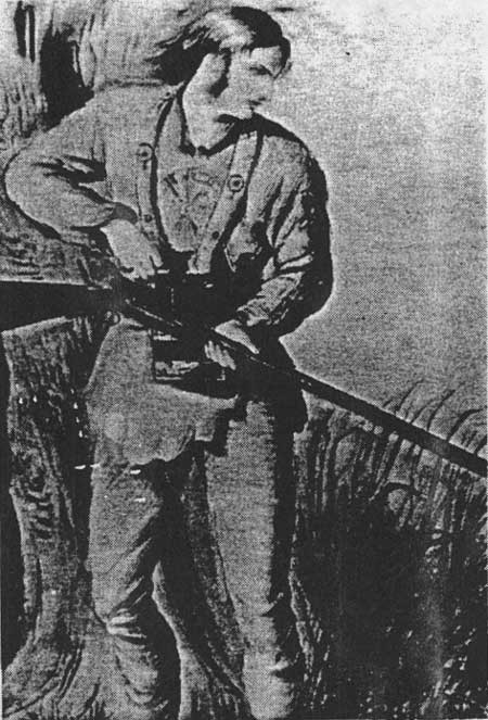
The British were also searching in the 1850s for railroad passes through the Rockies. John Palliser, an Irish country gentleman who delighted in buffalo hunting and explorations, led an expedition that explored the British prairies north of the border looking for practical passes across the Rockies (see Figure 5). His magnetic observer, Lt. Thomas Blakiston, crossed North Kootenay Pass in 1858, following the Wigwam to the Kootenai River. On his return trip he crossed the Whitefish Divide via Trail Creek, along the way naming Waterton Lakes for a celebrated British naturalist, Charles Waterton (Spry 1964:2, 164, 169, 174; Thompson 1985:72-73, 76-78; Blakiston 1859:320-321, 327-334, 337, 339). Blakiston was one of the first recorded travelers through the North Fork of the Flathead on the U. S. side of the boundary.
|
| Figure 5. John Palliser (from watercolor by Mary Severn, reproduced in Spry 1964). |
International Boundary Surveys
Between 1857 and 1860, British and American crews surveyed the international boundary (the 49th parallel) traveling east from the Pacific Ocean to the Rockies and west from Lake of the Woods, Minnesota, to the summit of the Rockies. The crews included specialists such as astronomers, surveyors, naturalists, geologists, surgeons, artists, and interpreters who all helped describe the area to outsiders. The survey parties cleared a 40' swath along much of the boundary, sometimes in parallel lines when their astronomical observations differed. While in the headwaters of the Columbia River, the British used the Kootenai River as its main source of supplies. The Americans used the Grave Creek trail from Tobacco Plains and also traveled along the North Fork (Thompson 1985:96-97, 99-101).
In the early 1900s the international boundary line was resurveyed and new concrete monuments replaced the original piles of stones (see Figure 6). Joe Eastland, a guide for the United States Geological Survey (USGS) survey crew under a man named Chapman, described the survey as follows:
Chapman was a good man but he seemed to be out to make a record. He had the finest bunch of pack mules I ever saw - seventeen hands high and they were supposed to jump anything they could see over; we paid no attention to trails. Besides carrying the grub and camp equipment, these mules carried the transits and other instruments, oats for feed, and cement and water to make altitude monuments on all the highest peaks. The pack bags for carrying cement and water were made of heavy solid leather. We usually worked from daylight to dark (O. Johnson 1950:264).

|
| Figure 6. Placing of concrete boundary monument in area now within Glacier National Park (courtesy of Glacier National Park, West Glacier). |
Other Early Explorations
In 1873 Lt. Charles A. Woodruff and Lt. John T. Van Orsdale returned from a military reconnaissance to Fort Colville via the Flathead Valley. They traveled up the Middle Fork to the mouth of Nyack Creek, probably crossing over Pitamakin Pass. On their trip they named Lake Terry - now known as Lake McDonald - in honor of a well-known western general named Alfred Terry. In 1883 Van Orsdale published a letter in a Fort Benton newspaper describing the scenery of the area and recommending that it be set aside as a national park. He was the first to do so in writing (Sheire 1970:97-98).
In 1890 an Army detachment of African-American soldiers under Lt. George P. Ahern explored the mountains along the Canadian border. They traveled up the Belly River, crossed Ahern Pass, and continued to the Camas Creek Valley of the North Fork of the Flathead. With axemen cutting out the way ahead of them, they covered a total of about 370 miles on foot or in the saddle. At the end of their trip they emerged into the Flathead Valley, which one of the travelers described as follows: "Dense forests of pine, spruce, hemlock, etc., crowd the valley of the Flathead and those of its tributaries on the east down nearly to Flathead lake. Here on the prairie-like openings a few ranches have been established" (Culver 1891:188-193).
| <<< Previous | <<< Contents>>> | Next >>> |
|
region/1/flathead/history/chap2.htm Last Updated: 18-Jan-2010 |