|
War in the Pacific
Asan and Agat Invasion Beaches Cultural Landscapes Inventory |

|
| PART 2b |
HISTORY
Phase II 1944
On July 28th the airstrip on Orote Peninsula was secured, and by July 30th, Apra Harbor was secure and ready to accept vessels. Phase I — to secure the FBL, was complete. It had been a tough 10 days of struggle, but for the first time the men could rest and regroup. The 3rd Marine Division sent scouts to the front to determine enemy positions and numbers. The remaining men had a first chance, since W-Day to wash, shave and get into fresh clothes. These two days also were spent completing unloading operations. Once complete, the riflemen of the 3rd Marines were able to return to their units and the 19th Marines assumed control of the shore party activities.
On July 31, one of the patrol units liberated the first large group of Chamorros and was then told of another concentration camp near As Inan (east coast of Guam). The patrol unit reached that compound and freed 2,000 Chamorros. Soldiers willingly gave their rations and cigarettes to the undernourished men and women who were almost overcome with joy at once again seeing Americans. Men of the 77th Division soon forgot the long, tiresome cross-island march. The full realization of the expression: "liberation of enslaved peoples", came to the troops (Lodge 1998:130).

1944 photo of the Bordallo family at the Agat refugee camp after
fleeing a concentration camp in Manengon Valley (Rogers 1995).
Second Period of American Liberation 1944
Chamorros were brought from the Japanese concentration camps to U.S. refugee camps at the site of Old Agat Village. Facilities were sparse and consisted of old tents and crude shacks for housing. Guamanians clustered about sharing mess lines and water lines with the U.S. Marines until a civilian kitchen and mess line were set up. The first night housed over 700 refugees. By August 5, there were over 6,689 seeking protection from the Japanese soldiers (Apple 1980). At the peak, 18,000 Chamorros were housed. By August 3, many began returning to their homes and ranches (livestock), arms and carts full of food (GMP 1983:17).
Immediately following W-Day American Seabees moved onto Asan Beach and began to build Camp Asan. It served as the island command troops headquarters for the Seabees. This facility, at Asan Beach, would come to serve many purposes over time.
After the fighting ceased, 18,000 Chamorros were counted as compared to the 23,915 counted by the Japanese in January 1944. These people were encouraged to return to their homes and farms to once again produce food for the civilian population. Because many lands were now within military possession for airfields, firing ranges, training areas, campsites and supply depots, it became necessary for the military to establish new villages. The new village of Agat was built just south of the old Santa Rita village site. Chamorros were paid as labor crews to help rebuild their villages, schools, and churches. Americans also extended efforts to re-establish the copra and other industries. Fishing, forbidden under Japanese rule, was again encouraged (Lodge 1998:163). Aerial seeding of a legume (tangen-tangen) was accomplished by the U. S. Navy to reduce soil erosion especially on steep slopes and ridges.
President Truman signed the Organic Act of Guam on August 1, 1950 (made effective on July 21, the six year anniversary of Liberation Day in 1944). The act stated that Guam, like Puerto Rico and the U.S. Virgin Islands belongs to the United States as unincorporated territories. The Organic Act of Guam, gave Guamanians American citizenship and a civilian government. Unincorporated territories are extended no promise of statehood or status equal to statehood and have no voting rights in the U.S. presidential elections.
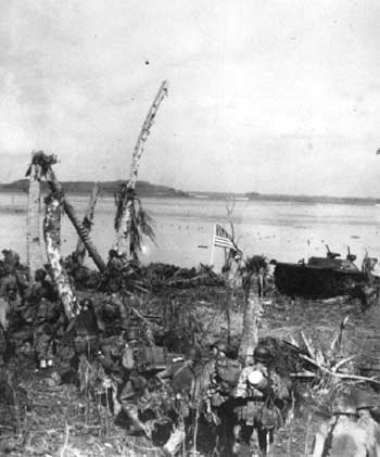
Historic photo of one of the first American flags to fly over
Guam since 10 December 1940. Planted by U.S. Marines 8 minutes after
they hit Agat Beach destroying vegetation along the beach heads on July
21, 1944 (U.S. Marine Corps 1944).
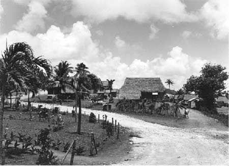
Typical village constructed by the military government to house
Guamanians displaced by the war (this photo is of Sinajana village
located north east of Agat Village) (U.S. Marine Corps 1944).
National Park Service and the National Register
In 1950, the U.S. Department of the Interior replaced the Navy Department as the federal agency responsible for Guam. Within this year Governor Manuel F. L. Guerrero, Office of Territories, requested the Department of the Interior visit Guam to determine any historically significant properties that should be set aside as park lands. It was determined that there was land significant to WWII, but no formal arrangements were made for a park. In the 1960's, the request was repeated and in response, War in the Pacific National Park was proposed to Congress. However, Congress did not accept the proposal until August 18, 1978 (GMP 1983).
Both Asan and Agat beaches are in close proximity to the villages of Asan and Agat. Both units of land were used for a variety of uses after the war. Asan Beach was first the site of the Seabees Island Command Troop Headquarters, then became Camp Asan, for the Civil Service from 1945-47. This complex became a Navy hospital for the Vietnam War, in the mid 1960's and was abandoned by 1972. It was then used to house Vietnamese refugees in 1975. It was a park owned by the Government of Guam when it was proposed to Congress, and in 1978 became part of War in the Pacific National Historic Park.
War in the Pacific National Historical Park was listed in the National Register on August 18, 1978. The Agat Invasion Beach was listed in the National Register on March 4,1975. The Asan Invasion Beach was listed on the National Register on February 14, 1979.
Existing Conditions
Today, Asan and Agat beach units consist of residential, commercial, and light industrial properties owned by private residents, Government of Guam, and the National Park Service. Asan Beach is one contiguous segment of land with visitor facilities at the west end. Agat Beach Unit is one contiguous unit with four segments presently owned by the National Park Service. Two of these segments, Apaca and Ga'an Point have developed visitor facilities including interpretive displays, picnic pavilions, bar-b-que grills, restrooms, and parking areas. Memorials and monuments have been added throughout the park and are scattered throughout the landscape. In the three segments that accommodate visitors, Asan Beach, Apaca Point, and Ga'an Point, the landscape is primarily grassy coastal flats with coconut groves at the shoreline and limestone forests on the rocky outcroppings.
Circulation patterns are directly related to the topography and natural terrain of the island. Presently, the primary road along the west central section of the island, near Asan and Agat beaches is Marine Drive. It runs along the shore on the coastal flat. A few arterial roads extend off Marine Drive to intersect the island and connect with the eastern coastal road. Collector streets and private drives also branch off of Marine Drive and lead to residential areas. Marine Drive is the eastern boundary for the both the Asan and Agat beach units. The NPS Visitor Center, located approximately halfway between Asan Point and Adelup Point, has access off of Marine Highway into a U-shaped paved parking area. The beach area to the north and south, maintained by NPS, abuts the highway and has only private drives accessing residences and businesses. The entrance to Asan Beach area connects to a wide crescent shaped drive that terminates at a paved parking area. This drive was constructed with the Navy field hospital complex built during the Vietnam War around the mid-sixties.
Four footpaths extend from the Asan Beach parking area. One path, to the north, is a winding sidewalk that parallels the beach then circles west to reconnect with the entry road. The second path, to the west, circles out to Asan Point and offers an extension leading to the U.S. Armed Forces Memorial. This path to the memorial is a concrete sidewalk that was eroded and broken by storm surges during Supertyphoon Paka which occurred December 16, 1997. It was repaired according to the Emergency Rehabilitation Plan (ERP 1998). These paths were not present during the historic period.
Two other paths, connecting to the entry road, lead up to Asan Ridge. One begins behind the restrooms and the other is further west. Both connect perpendicular to a ridgeline path. These three paths are primitive: clay and rock with vegetation trimmed back. The slopes are steep and often rocky with only a few concrete blocks inserted for steps. The rough footing, combined with the steep slope, adds to the historic character of the scene and lets one begin to imagine the conditions during the battle. Atop the ridge, rougher tertiary paths require concentrated attention and cause the pillboxes and caves, tucked behind dense vegetation, to come as a surprise. It is undetermined if this ridgeline path was present during the battle. It is doubtful because it would expose the location of Japanese caves and pillboxes. However, the primitive character of these paths, along Asan Ridge, contributes to the hiker's experience and ability to imagine the historic conditions.
Today, the Agat Beach Unit of the park, between Apaca Point and Bangi Point has access points from Marine Drive. The northernmost visitor area is Apaca Point. It has two access drives and two parking areas. The northernmost drive is the northern park boundary. The center visitor area is Ga'an Point with one U-shaped access and parking area. Bangi Point, the southernmost unit, has no access or parking. Only two paved pathways are located within the Agat Beach Unit. A paved sidewalk leads from the parking area to the beach at Ga'an Point. At Apaca Point a sidewalk leads to the beach area with gun emplacements and interpretive signage. A branch veers off to the northwest and circles an outcropping with Japanese defense caves. Both sidewalks are new, replaced after super-typhoon Paka in 1998. These sidewalks are not historic and do not contribute to the historic landscape.All entry roads, parking areas, paved and unpaved interpretive paths throughout the Asan and Agat beach units are modern additions to the landscape. None of these circulation features were present during the period of significance.
Many Japanese defensive structures remain on the landscape. Preservation of the historic features, the site itself and the historic character commemorates this event in American history. It commemorates the 1,857 U.S. Marines, soldiers, sailors, airmen, and coast guard who died, the 6,053 who were wounded, over 11,000 Japanese and Korean soldiers who died and the unknown number of Chamorro people who died throughout the Japanese occupation and the actual battle. (Gailey 1988:187), (GMP 1983:17).
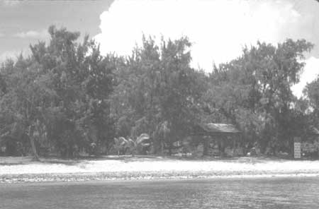
Contemporary photo of Agat Beach (CLI Team/PISO/2001).
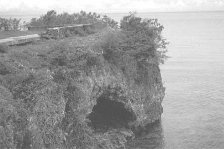
Contemporary photo of a cave at Apaca Point, located on the north end
of Agat Beach (CLI Team/PISO/2001).
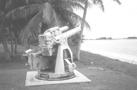
Contemporary photo of Japanese coastal defense gun (CLI
Team/PISO/2001).
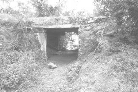
Contemporary photo of a defense structure at Agat Beach (CLI
Team/PISO/2001).
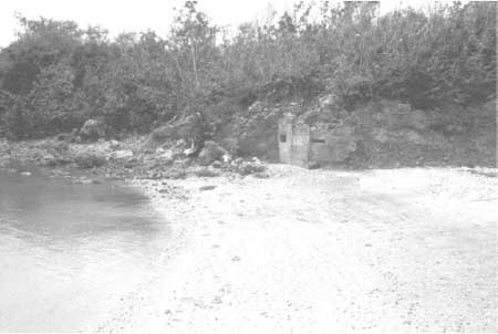
Contemporary photo of Japanese pillbox at Agat Beach (CLI
Team/PISO/2001).
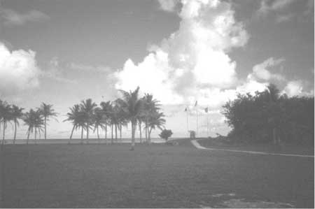
Contemporary photo of Ga'an Point located at Agat Beach (CLI
Team/PISO/2001).
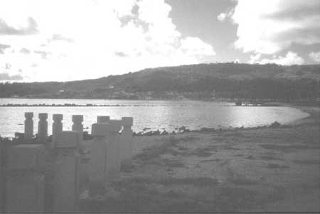
Contemporary view from Asan Beach towards Agelup Point (CLI
Team/PISO/2001).
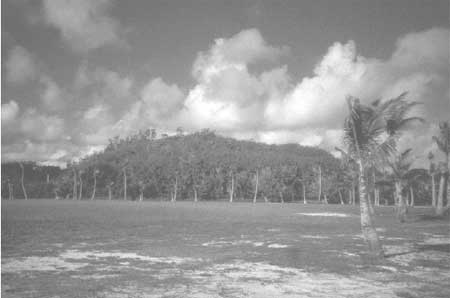
Contemporary photo of Asan Ridge (CLI Team/PISO/2001).
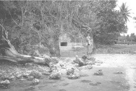
Contemporary photo of a pillbox at Asan Beach (CLI
Team/PISO/2001).
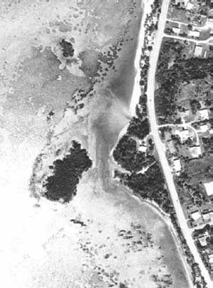
Contemporary aerial photo of Bangi Point located in the Agat Beach
Unit (Air Survey Hawaii 1999).
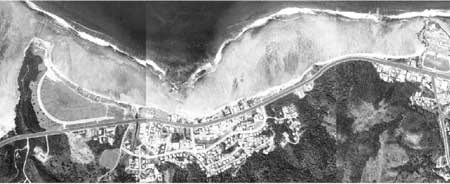
Contemporary aerial photo of Asan Beach Unit (Air Survey Hawaii
1999).
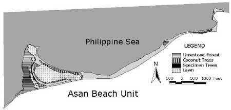
Map illustrating existing vegetation at the Asan Beach Unit
(CLI Team/PISO/2001).
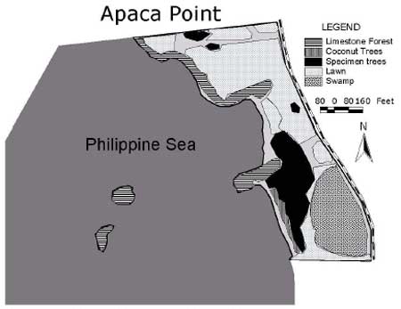
Map illustrating existing vegetation at the Agat Beach Unit
(CLI Team/PISO/2001).
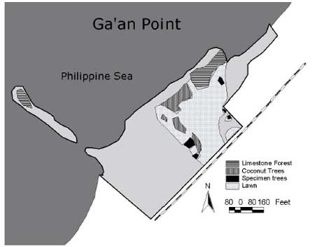
Map illustrating existing vegetation at the Agat Beach Unit
(CLI Team/PISO/2001).
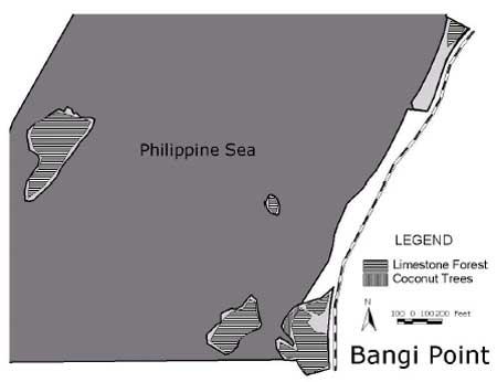
Map illustrating existing vegetation at the Agat Beach Unit
(CLI Team/PISO/2001).
| <<< Previous | <<< Contents >>> | Next >>> |
wapa/cri/part2b.htm
Last Updated: 03-may-2004