|
National Park Service
Confinement and Ethnicity An Overview of World War II Japanese American Relocation Sites |

|
Chapter 10
Poston Relocation Center
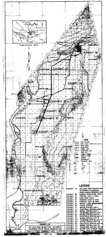 Figure 10.1. Colorado River Indian Reservation. (National Archives) (click image for larger size) |
The Poston or Colorado River Relocation Center was located in La Paz County, Arizona, 12 miles south of the town of Parker. Poston was named after Charles Debrille Poston, the first Superintendent for Indian Affairs in Arizona. Poston was directly responsible for the establishment, in 1865, of the Colorado River Reservation, where the center is located (Figure 10.1). La Paz County is a fairly recent political entity; during World War II the Poston area was part of Yuma County.
The Colorado River is about 2-1/2 miles west of the relocation center; this section of the Colorado River Valley from the relocation center vicinity north to Parker Dam is known as Parker Valley. At only 320 feet elevation, the area lies within the lower Sonoran desert. Summers are hot, and, because of the proximity of the river, humid; in the winter days are cool and nights cold.
The Colorado River Indian Reservation Tribal Council opposed the use of their land for a relocation center, on the grounds that they did not want to participate in inflicting the same type of injustice as they had suffered. However, the tribe was overruled by the Army and the Bureau of Indian Affairs (BIA). In a verbal agreement the WRA turned over administration of the center to the BIA. The BIA considered the relocation center an opportunity to develop farm land on the reservation with the benefit of military funds and a large labor pool. The WRA took did not take full control of the center until December 1943.
The Poston Relocation Center consisted of three separate cantonments at three-mile intervals. Known officially as Poston I, II, and III, the evacuees nicknamed them Roasten, Toasten, and Dustin. Construction on Poston I began March 27,1942, with the contractor Del Webb, later of Sun City fame. Del Webb had a large work force already mobilized for military contracts, and built Luke Air Force Base near Phoenix in March 1941. However, the relocation center was Del Webb's biggest challenge up to that time. Webb had a construction job in progress at Blythe, and when he got the contract to build the camps he diverted his crew to Parker. With equipment brought up from Blythe, the initial ground clearing was done in one day (Figure 10.2).
Using 5,000 workers on a double work shift, Poston I was completed in less than three weeks (Figures 10.3-10.5). The pine specified for construction was in short supply, so heart redwood was substituted. When the redwood shrunk much more than expected, millions of feet of thin wood strips had to be ordered to fill the cracks (Finnerty 1991). Because of the heat in Arizona, the standard tarpaper barracks construction was modified so that the buildings had double roofs. A new contract was awarded to Webb to build Poston II and III within 120 days (Finnerty 1991). Guard towers were not constructed at Poston, as they were at the other relocation centers; here they were considered unnecessary because of the isolated location, in the desert at the end of a road.
 Figure 10.2. Poston site partially cleared. (Clem Albers photograph, Bancroft Library, University of California, Berkeley) |
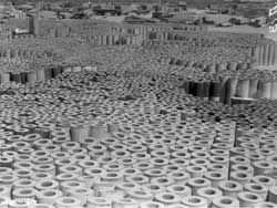 Figure 10.3. Rolls of roofing paper at the Poston site. (Clem Albers photograph, Bancroft Library, University of California, Berkeley) |
 Figure 10.4. Unloading lumber at the Poston site. (Fred Clark photograph, Bancroft Library, University of California, Berkeley) |
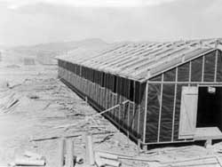 Figure 10.5. Construction underway at Poston I. (Fred Clark photograph, Bancroft Library, University of California, Berkeley) |
The relocation center began operation May 8, 1942, with the arrival of 11 Japanese-American volunteers. Within days there were 250 more volunteers, who cleaned up and prepared the barracks for the arrival of over 7000 evacuees over the next three weeks (Leighton 1945). The maximum population for all three cantonments was 17,814, reached in September 1942. Poston was the largest relocation center in the country, and the third largest city in Arizona. Evacuees were from the Mayer, Salinas, Santa Anita, and Pinedale assembly centers.
By the fall of 1942 heating stoves had not yet been installed, so barracks and offices were unheated, and extremely cold without wallboard or insulation. Evacuees huddled around makeshift bonfires within each block for warmth. In addition, promised clothing and clothing allowances had not been delivered, and salaries had not been paid since September. Adding insult to injury, government resources were spent to fence in the evacuees rather than to remedy these problems or to construct chicken and hog farms that could alleviate food shortages. Further, the administration was seen as curtailing the power of the evacuees' representative council, misappropriating supplies meant for evacuees, and fomenting paranoia by soliciting information about troublemakers.
Given the discontent, all that was needed was a spark for the center to come close to open revolt. In November 1942 a suspected informer was beaten and administration officials arrested two Kibei men. Demanding that the arrested men be released, workers went on strike on November 19, and the police station was picketed. The unity of the strikers wavered, however, when many found the use of Japanese national symbols by some demonstrators (flags and music) too anti-American. The assistant director, in charge during the director's absence, resisted recommendations from some of his staff to call in the military to break the strike, and negotiated with the leaders of the protest. The strike ended peacefully on November 24, when a compromise settlement was reached by the director and members of the evacuees' Emergency Executive Council. The suspect was released on his own recognizance and the case was turned over to the U.S. Attorney, who later declined to prosecute the case.
Most of the administration staff who had advocated a hard-line stance against the strikers soon left (Leighton 1945). Tensions slowly abated, and the evacuees and staff gradually returned to their routines as conditions improved. The last evacuees left Poston November 28, 1945. A few Hopi Indian families moved in before the last Japanese Americans left to keep the farms going. After the relocation center was closed, the barracks and other buildings were sold, moved, and reused, and fields were converted to Reservation use.
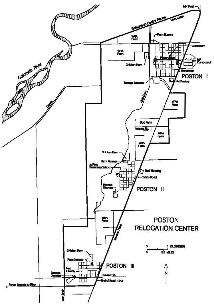 Figure 10.6. Poston Relocation Center. (click image for larger size) |
The three separate camps, Poston I, II, and III, were laid out from north to south at about 3-mile intervals along what is now known as Mohave Road, which at the time ended at the south end of the project at Poston III (Figure 10.6). The three camps were surrounded by a single fence. Although the fence excluded Mohave Road, traffic was controlled by a military police post about 1 mile north of Poston I. All three camps were bounded on the east by Mohave Road and on the west by the "main drain" canal.
There was a gate house at the Poston I entrance off Mohave Road at 7th Street; Poston II and III did not have gate houses. In all three camps, numbered streets ran east-west, lettered streets ran north-south. The only named streets were in the staff housing area east of the main road at Poston I: Military Street and Indian Street ran east-west, Sollier and Skidmore Avenues ran north-south.
Poston I, the largest of the three units, was the farthest north. It included administration offices, three staff housing areas, warehouses, 36 residential blocks for evacuees, and the hospital and military police compound for the entire center (Figure 10.7).
The evacuee residential blocks at Poston I were laid out both north and south of a fire break between 6th and 7th Streets (the firebreak is the location of the present Poston Road). The blocks were generally grouped by fours, separated by fire breaks. Each block contained fourteen 20-by-100-foot barracks, a mess hall, a recreation building, a men's latrine, a women's latrine, a laundry, an ironing building, and a fuel oil shed. Recreation halls were used for various purposes, including a sewing school, churches, service organizations, beauty and barber shops, and internal police offices.
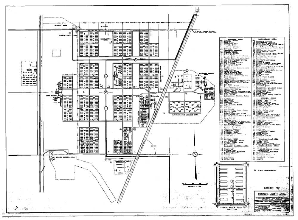
Figure 10.7. Poston I central area.
(National Archives)
(click image for larger size)
Internees added their own improvements to the residential area, such as ponds, gardens, and trees and other vegetation to cut down on the dust and heat (Figures 10.8 and 10.9). Ditches ran east-west and north-south through the fire breaks, and three swimming pools were constructed along the ditches. A fire station was located east of Block 30. The mess hall in Block 32 was used for an agricultural office. Evacuees constructed a large stage in the firebreak west of Block 4 (Figure 10.10), and canteens were located east of Block 28 and west of Block 34.
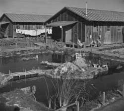 Figure 10.9. Pond at Poston I. (Francis Stewart photograph, Bancroft Library, University of California, Berkeley) |
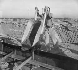 Figure 10.15. Pouring foundation for school. (Francis Stewart photograph, Bancroft Library, University of California, Berkeley) |
Since no arrangements had been made for schools, evacuees built their own classrooms and school auditoriums. The elementary school at Poston I was located west of Blocks 19 and 30, and included an office, library, auditorium, 10 classroom buildings, and covered walkways. The high school, located west of the evacuee residential area, included an office, library, auditorium, auto and wood shop, and eight classroom buildings. Sufficient lumber was not available, so walls were constructed of adobe, a material foreign to most evacuees (Figures 10.11-10.15). Many evacuees considered the material inferior and too labor-intensive. The difficult work was exacerbated by the 115-degree temperatures, and the fact that the adobe ruined their clothes (Leighton 1945). The elementary school auditorium and classroom buildings, although now abandoned, still stand.
 Figure 10.8. Poston I. (WRA photograph, National Archives) |
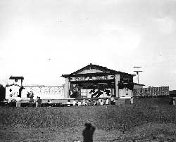 Figure 10.10. Kabuki theater at Poston I. (WRA photograph, University of Arizona, Special Collections) |
 Figure 10.12. Drying adobe bricks. (Francis Stewart photograph, Bancroft Library, University of California, Berkeley) |
 Figure 10.13. Adobe brick factory. (Francis Stewart photograph, Bancroft Library, University of California, Berkeley) |
 Figure 10.11. Evacuee making adobe brick. (Francis Stewart photograph, Bancroft Library, University of California, Berkeley) |
 Figure 10.14. Mixing mud for adobe bricks. (Francis Stewart photograph, Bancroft Library, University of California, Berkeley) |
Next to the residential area in the northwest corner of the fenced area was the domestic water pumping plant, which included a pump house, steel tank, watchman's house, and a farm equipment storage building (evacuee-built).
The Poston I administration area, to the left of the entrance south of 7th Street, had seven buildings. A staff housing area was located just to the west in Block 34, and had eight apartment buildings, eight small houses, a mess hall, and two offices. South of the administration area was the warehouse area (Blocks 51, 61, 62), with 42 buildings, plus an evacuee-built ice storage and a butcher shop, maintenance shops, a box factory, and a crematory. Burial services were under contract to a Yuma firm that started construction of a crematory next to the hospital. However, the evacuees forced the crematory to be moved to the warehouse area, as the hospital location was thought to be bad for morale (Bailey 1971:97-98).
The hospital, with 17 buildings with connecting walkways, was south of the staff housing and west of the warehouse area. At the far south end of Poston I, south of the warehouses, was the camouflage net factory, with a warehouse, weaving shed, cutting shed, office, and latrine. Just to the west of the net factory was an evacuee-built tofu factory.
 Figure 10.16. Machine shop at Poston I. (Francis Stewart photograph, Bancroft Library, University of California, Berkeley) |
East of Mohave Road at Poston I were other facilities, outside the main security fence. An administration office and market/snack bar were located at the corner of Mohave Road and 7th Street (now Poston Road). Farther east was the military police compound with 12 buildings, a pump house, and a water tank. Two staff housing areas and a shop/garage area were built between the snack bar and the military police compound using evacuee labor. In the staff housing areas there were 11 houses, 20 apartments, six warehouses, an office, a latrine, four laundries, and eight other small buildings. In the garage and motor pool area there were 11 buildings including an office, gasoline station, machine shop (Figure 10.16), repair shops, paint shop, horse shed, and corral.
Ancillary facilities at Poston I were located within the fence, near the evacuee residential area. To the west of the barracks was a chicken farm, with a warehouse, pump house, water tank, four brooder houses, 12 laying houses, 14 small coops, and a privy built by evacuees. Northwest of the barracks was a farm nursery, with a lath house, arrow weed shed, warehouse, and tool shed, all of evacuee construction. The sewage treatment plant, which included a pump house, clarifier, digester, and sludge beds, was located just southwest of the barracks area.
Three and a half miles south of Poston I, Poston II included an administration area, staff housing, a garage area, warehouses, and a net factory, as well as evacuee residential blocks (Figures 10.17 and 10.18). The camp was bisected by a north-south canal, which fed a large swimming pool in the center of the camp. Block numbers were consecutive, beginning with 201 to distinguish the numbers from those of Poston I.
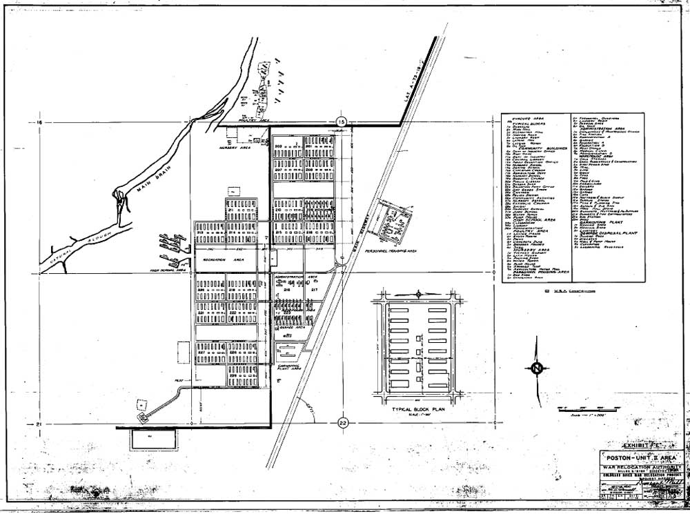
Figure 10.17. Poston II central area.
(National Archives)
(click image for larger size)
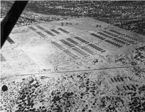 Figure 10.18. Aerial view of Poston II construction. (Fred Clark photograph, Bancroft Library, University of California, Berkeley) |
Staff housing at Poston II was located on the east side of Mohave Road, outside the fenced area. It included a carpentry shop, two houses, eight apartments, and two evacuee-built sheds. The entrance to Poston II was at 7th street. The administration area, located within the fence south of the entrance (Blocks 217 and 218) had ten buildings, including a cold storage building, a medical clinic, a fire station, five office buildings, a storage building, and a post office.
The warehouse area, south of the administration area in Block 223, included 20 buildings. The garage area, south of the warehouse area, included a gasoline station and an evacuee-built shed. Farther south still was the net factory, with two weaving sheds and a latrine.
On either side of 7th street were the 18 evacuee residential blocks, in groups of three or four separated by fire breaks. One of the blocks served as the elementary school. The high school, west of the residential area, was constructed by the evacuees of adobe. It included an office, library, and 10 classroom buildings. The fire break to the east of the high school served as the recreation area and athletic fields.
A chicken farm, with 15 laying houses, two brooder houses, four storage buildings, two sheds, and a privy (all evacuee-built), was located north of the evacuee residences. A farm nursery was located northwest of Block 202; the nursery included a lath house, a victory garden, and a packing shed, all built by evacuees. Between the nursery and Block 202 were a pump house, water tower, and storage tank.
The sewage treatment plant for Poston II was located southwest of the residences. It included a pump house, clarifier, digester, sludge beds, and sewage lagoon.

Figure 10.19. Poston III central area.
(National Archives)
(click image for larger size)
Poston III, the farthest south of the three units, included an administration area, a garage area, and a net factory, as well as 18 evacuee residential blocks (Figure 10.19). Block numbers began with 301. The administration area, garage, and warehouses were located north of the entrance, in a triangular area formed by Mohave Road, 3rd Street, and "I" Street. The administration area, in Blocks 313 and 314, included a mess hall, staff quarters, a garage, three offices, a clinic, a fire station, and a firemen's dormitory. The garage area, in Block 301, included five warehouses, a gasoline station, and a garage. The warehouse area, in Block 302, included 15 warehouses and a privy.
The 18 residential blocks at Poston III were arranged in three groups of six blocks; one of the blocks (Block 324) was used as the elementary school, and another (Block 310) for community services. The high school, constructed by the evacuees, was located in a large open space between the administrative area and the northernmost residential block. It included an office, library, auditorium, and seven classroom buildings, all of adobe. The west central open area, between the two westernmost residential blocks, included a net factory with a weaving shed and a latrine, a recreation area with two swimming pools and a stage, a motor pool, and a dry goods store.
The Poston III chicken farm was to the north of the high school, and included 11 laying houses, two brooder houses, a store room, and an office. Southwest of the chicken farm and northwest of the high school was the farm nursery, with an office, a nursery, and a privy, all evacuee-built. To the west of the southernmost residential area was the sewage treatment plant, which included a pump house, clarifier, digester, and sludge beds.
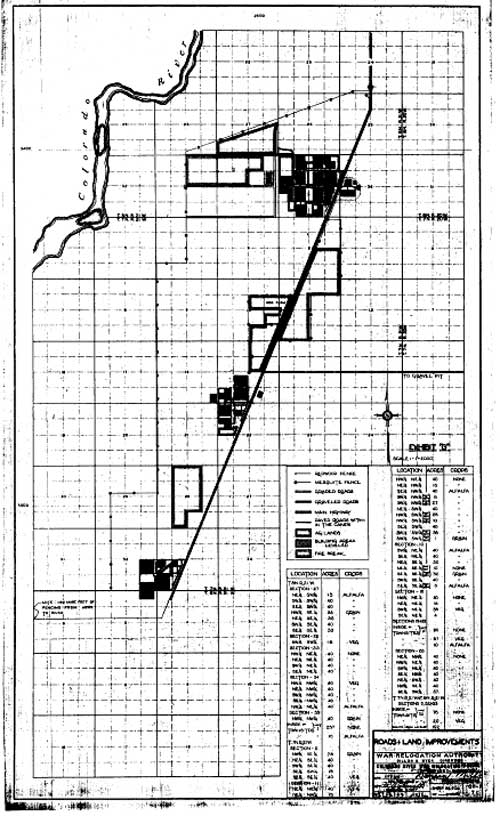 Figure 10.20. Farms at the Poston Relocation Center. (National Archives) (click image for larger size) |
Unlike most other relocation centers, at Poston the agricultural fields and developments were within the fenced security area (Figures 10.20-10.22). In 1943, 368 acres were cultivated; in 1944, over 1,400 acres of vegetables and 800 acres of field crops were under cultivation. In addition to the chicken farms at each of the three units mentioned above, there was a hog farm located between Poston I and II, with hogs subsisting mainly on center garbage. The hog farm contained 12 pens with sheds and feeding floors, six farrowing pens, and pasture. Facilities also included two small watchman's houses (8 foot by 10 foot, and 10 foot by 14 foot in size), a 20 foot by 100 ft warehouse, a 30 foot by 36 foot processing house, a motor house, cold storage, an 18-1/2 by 33 foot slaughter house, a latrine, a water tank, a pump house, a garbage can washing station, and a fuel tank (Figure 10.23).
An additional warehouse for the relocation center area was built along the railroad outside of Parker. It included a railroad spur with unloading platforms, five warehouses, one refrigerated warehouse, fuel oil storage tanks, a substation, a water tank, a water tower, and a pump house (Figure 10.24).
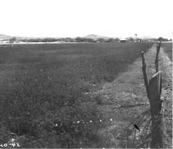 Figure 10.21. Alfalfa field north of Poston. (Clem Albers photograph, Bancroft Library, University of California, Berkeley) |
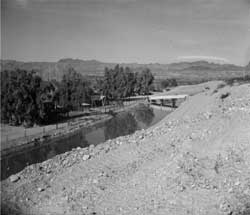 Figure 10.22. Main irrigation ditch at Poston. (Clem Albers photograph, Bancroft Library, University of California, Berkeley) |
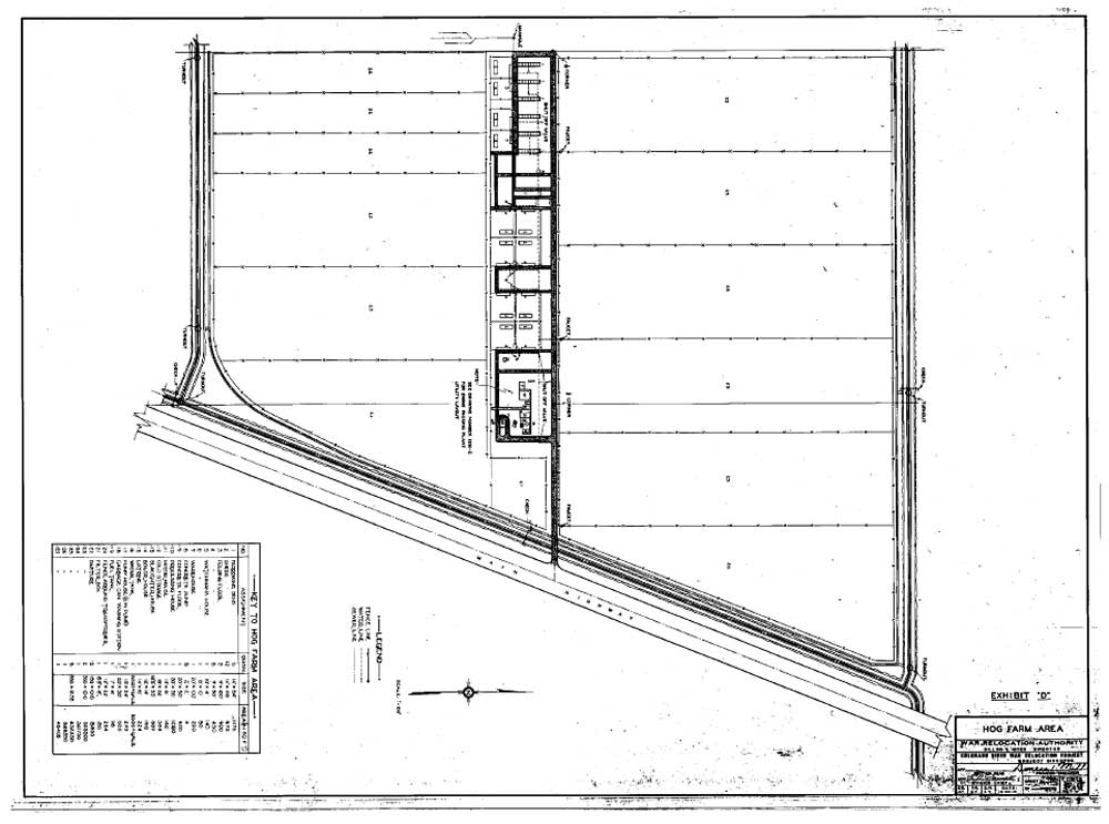 Figure 10.23. Poston Relocation Center hog farm. (National Archives) (click image for larger size (~80K) ) | |
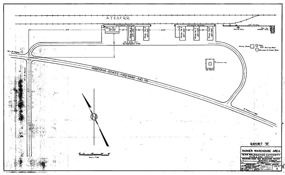 Figure 10.24. Parker warehouse area, Poston Relocation Center. (National Archives) (click image for larger size (~64K) ) | |
Poston I
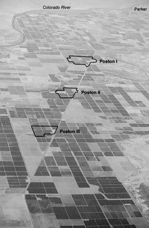 Figure 10.25. Oblique aerial view of the Poston area today. |
Most of the countryside around the three units that formed the Poston Relocation Center is covered by irrigated farm fields (Figures 10.25 and 10.26). The most prominent remains at the site today are those of the Poston I elementary school, where the adobe auditorium and nearby school buildings are still standing (Figures 10.27-10.31. At the southwest corner of the auditorium there is a dedication plaque that reads "POSTON ELEMENTARY SCHOOL UNIT I — JUNE 1943 ..S IF — BUILT BY THE JAPANESE RESIDENTS OF POSTON." Unfortunately the school buildings are now abandoned and currently in poor condition, and without stabilization will soon be damaged beyond repair.
A small housing area and trailer park is now across the road from the auditorium and school buildings to the west, in what used to be a firebreak containing a swimming pool. Beyond the elementary school all that remains of the evacuee area at Poston I are a few concrete slabs at the site of the high school, now a farm residence.
East of Mohave Road, the former garage area at Poston I is now used as a maintenance yard. A large building, the same location and shape as the machine shop on WRA blueprints, probably dates to the relocation center era (Figure 10.32). Portions of at least four other buildings in the garage area survive as well (Figure 10.33). To the south of the garage area, the staff housing area is marked only by roads lined with large palm trees (Figure 10.34). Although the 1970 USGS map depicts the buildings, all are now gone, and there is a recent housing development on the land just to the south.
The sewage treatment plant for Poston I lies abandoned within farm fields about 3/4 mile west of Mohave Road. It is in good condition and still has a lot of the associated pumps and other equipment not found at the other two Poston sewage treatment plants (Figures 10.35 and 10.36).
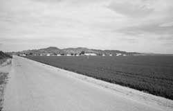 Figure 10.26. Barracks area at Poston I today. |
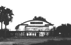 Figure 10.27. Poston I elemetary school auditorium today. |
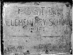 Figure 10.28. Plaque at the Poston I elementary school auditorium. |
 Figure 10.29. Interior of the Poston I elementary school auditorium. |
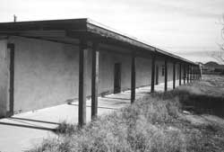 Figure 10.30. Classroom building at the Poston I elementary school. |
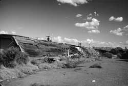 Figure 10.31. Collapsed porch at the Poston I elementary school. |
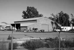 Figure 10.32. Poston I machine shop today. |
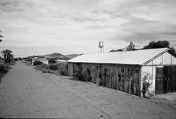 Figure 10.33. Poston I garage area today. |
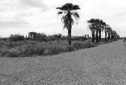 Figure 10.34. Poston I staff housing area today. |
 Figure 10.35. Clarifier at the Poston I sewage treatment plant. |
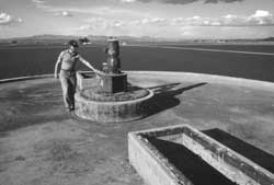 Figure 10.36. Top of digester at the Poston I sewage treatment plant. |
Poston II
Very little remains of the camp at Poston II. Most of the area is farm fields (Figure 10.37), and the La Pera Elementary School occupies what was once the recreation area. To the west of the elementary school, in what was the high school area, there is an auditorium, closed reportedly due to asbestos hazard (Figure 10.38). The auditorium itself is not likely a relocation center building since an auditorium is not shown on the July 1945 WRA blueprint of Poston II. However, there are a few inscriptions in a sidewalk at the auditorium, which indicate that some of the sidewalks there are remnants of the relocation center high school. The inscriptions include the numbers "221" and "229" (residential block numbers) and the initials "CK." Another inscription was found just north of Tahbo Road on the east side of the canal that ran through Poston II (Figure 10.39). On an overturned concrete block in the canal bank is the inscription "yumeda 2-12-1943" (Figure 10.40).
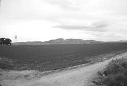 Figure 10.37. Barracks area at Poston II today. |
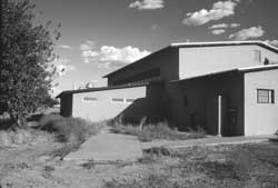 Figure 10.38. School auditorium at the site of the Poston II elementary school. |
About 1/4 mile west of Mohave road there are two concrete slabs that may be foundations of relocation center buildings. One, now with a mobile home on it, is located along the canal that bisected Poston II in what would have been the warehouse area. Measuring roughly 20 foot by 100 ft in size, the slab is aligned north-south like the warehouses were. In the net factory area there is a 30 foot by 275 foot slab with 6-1/2-foot-square base blocks about 10 feet from each corner (Figure 10.41). This slab is aligned east-west like the net buildings were.
The most visible remains of Poston II are of the sewage treatment plant, on an unnamed dirt road about -1/2 mile west of Mohave Road (Figure 10.42 and 10.43). On the east side of the highway, the former staff housing area at Poston II now has churches, residences, and a relocation center hospital ward building moved from Poston I (Figure 10.44), according to local residents. The building, lacking its double roof but otherwise in fair condition and currently being remodeled, is located behind the Poston Community Baptist Church. According to Pastor Herb Schneider, the church wants to replace or rehabilitate the structure. Another relocation center building at the church, a moved barracks, was recently torn down.
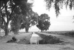 Figure 10.39. Ditch through the center of Poston II. |
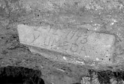 Figure 10.40. Inscription in concrete block in ditch bank at Poston II. |
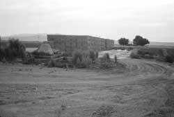 Figure 10.41. Concrete slab foundation at the site of the Poston II camouflage net factor. |
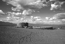 Figure 10.42. Poston II sewage treatment plant today. |
 Figure 10.43. Clarifier and overturned manholes at the Poston II sewage treatment plant. |
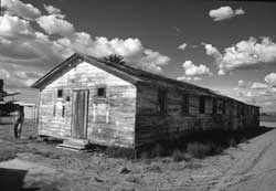 Figure 10.44. Relocation center hospital building at the site of the Poston II staff housing area. |
Poston III
The only intact remains of Poston III are those of the sewage treatment plant, located on the north side of Navajo Road about 3/4 mile west of Mohave Road (Figure 10.45). All else are now farm fields under irrigation (Figure 10.46). Navajo Road follows the section line, which places it within the firebreak between 6th and 7th streets. Concrete rubble, perhaps from relocation center foundations, was noted along canals and berms in the Poston III area.
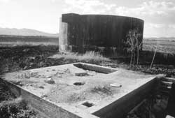 Figure 10.45. Poston III sewage treatment plant today. |
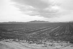 Figure 10.46. Barracks area at Poston III today. |
Security Features
 Figure 10.47. Concrete slab foundation at the site of the Poston Relocation Center military police compound. |
No portion of the security fence, the sentry post north of Poston I, or the gate house at Poston I remains. It appears that probably only one concrete foundation slab remain at the military police compound (Figure 10.47).
Outlying Area
The farm fields and irrigation ditches constructed by the evacuees are still in use and have been greatly expanded. The remains of the relocation center hog farm are located northwest of the intersection of Mohave and Polacca Roads (Figure 10.48). The portion of the hog farm closest to Mohave Road still has some intact slabs (Figure 10.49); most of those on the western end of the area have been up-rooted and piled. An inscription in the intact concrete slab foundation of the pump house reads "Div. of Soil 3/21/43" (Figure 10.50).
 Figure 10.48. Site of the Poston Relocation Center hog farm today. |
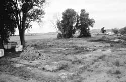 Figure 10.49. Concrete slab foundation at the site of the Poston Relocation Center hog farm. |
Along the railroad just east of the town of Parker are the remains of the relocation center warehouse complex. The western edge of the warehouse area is now occupied by a Chevrolet dealer, and there is little of the warehouses or unloading platforms (Figure 10.51). However, four fire hydrants (Figure 10.52), which would have been located to the rear of the warehouses, are extant, as are several concrete slab foundations that likely date to the relocation center. One, measuring 25 feet by 38-1/2 feet, held the fuel oil storage tanks, and has six 9-1/2-foot-diameter stains from the storage tanks (Figure 10.53). A second slab foundation, 6 feet by 12 feet in size, was for the electrical substation, and a third slab, approximately 25-1/2 feet in diameter, supported the water tank. Other slabs for pumps and the water tower are partially visible, partially covered by sediments.
Many relocated buildings from the relocation center are in the surrounding area and in the town of Parker. Some still have their distinctive double roofs and other evidence of their former use: for example, a barracks now within Parker has a double roof and tin can lid patches over knot holes (Figures 10.54 and 10.55). The Colorado River Indian Tribe's old Head Start school, although lacking the double roof, was once a relocation center building (Figure 10.56). In addition to the relocation center hospital building at Poston II, there is another hospital building a little over 2 miles north of Poston I (Figure 10.57).
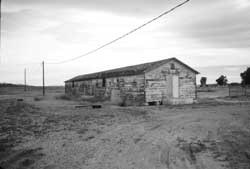 Figure 10.56. Relocated barracks formerly used as Head Start School. |
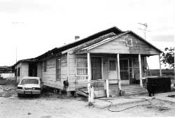 Figure 10.57. Hospital building north of Poston I. |
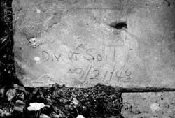 Figure 10.50. Inscription at the Poston Relocation Center hog farm. |
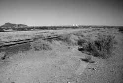 Figure 10.51. Site of the Poston Relocation Center Parker warehouse area today. |
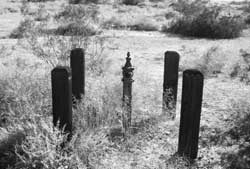 Figure 10.52. Hydrant at the site of the Parker warehouses. |
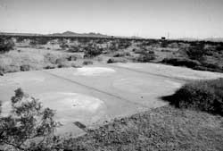 Figure 10.53. Concrete slab foundation for the fuel oil storage tanks at the Parker warehouse area. |
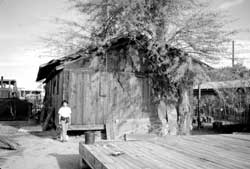 Figure 10.54. Barracks moved to the town of Parker. |
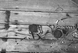 Figure 10.55. Can lids used to patch knot holes in barracks floor. |
Interpretation
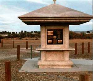 Figure 10.60. Kiosk at Poston I. |
Along Mohave Road at Poston I there is a large monument and kiosk, complemented by sidewalks, palm trees, sitting areas, and a water fountain (Figures 10.58-10.60). The location next to a fire station, was chosen in part to help deter vandalism. The monument, dedicated in 1992, consists of a 30-foot- high concrete column with a 7-foot-wide hexagonal base shaped like a Japanese stone lantern. The kiosk, dedicated in 1995, is four-sided with an overhanging pyramidal roof. Both the monument and kiosk have interpretive signs which discuss the history of the relocation, Japanese-American military service, and the Colorado River Indian Tribe reservation (Figures 10.61 and 10.62).
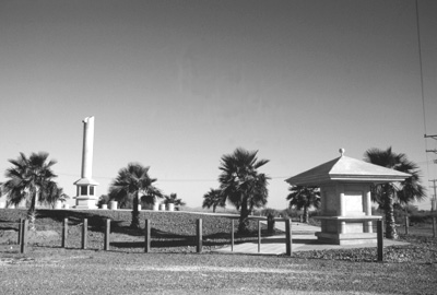 Figure 10.58. Monument and kiosk at Poston I. |
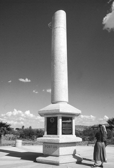 Figure 10.59. Monument at Poston I. |
 Figure 10.62. One of four interpretive signs at the Poston I kiosk. |
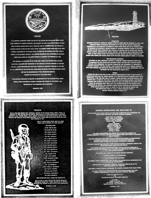 Figure 10.61. Plaques at Poston monument. |
| <<< Previous | <<< Contents>>> | Next >>> |
wacc/74/chap10.htm
Last Updated: 20-Feb-2004