|
National Park Service
Confinement and Ethnicity An Overview of World War II Japanese American Relocation Sites |

|
Chapter 14
Citizen Isolation Centers
After the riot at the Manzanar Relocation Center in December 1942, the War Relocation Authority (WRA) decided to remove so-called troublemakers from the relocation centers. An isolation center was established at an abandoned Civilian Conservation Corps (CCC) Camp at Dalton Wells, near Moab, Utah, which had been vacant only 15 months (Figures 14.1 and 14.2). The Dalton Wells camp was used as-is, with no fence or other improvements. Like the relocation centers the isolation center was run by the WRA, headed by Ray Best, who would later be the director of the Tule Lake Segregation Center.
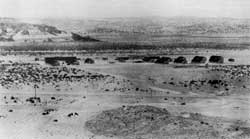 Figure 14.1. Dalton Wells CCC Cap in 1937. (from Louthan 1993) |
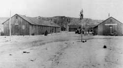 Figure 14.2. Administration building at the Dalton Wells CCC Camp. (from Louthan 1993) |
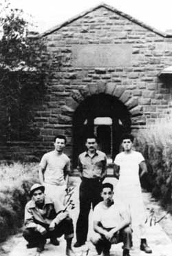 Figure 14.3. Leupp Isolation Center. (Henry Ueno photograph from Drinnon 1987) |
On January 11, 1943, sixteen men from Manzanar were the first arrivals at Moab. Within a few months others from Manzanar and the other relocation centers were also sent to the isolation center, for "crimes" as minor as calling a Caucasian nurse an old maid (Drinnon 1987:104). No formal charges had to be made, transfer was purely at the discretion of the relocation center director (Myer 1971:65). This led to indiscriminate incarceration. For example, thirteen leaders of two separate Young People's Associations at the Gila River Relocation center were sent to Moab. The administration was having troubles with one of the groups and sent the leaders of both on the mistaken assumption that they were related.
Conflict between those opposed to the relocation and sympathizers carried over from the relocation centers to the isolation center. Further, living conditions were much harsher than in the relocation centers so protests over treatment and conditions continued. To further segregate the population seven inmates at the isolation center were transferred to the Grand County jail in Moab.
At its peak the Moab facility held 49 men (Louthan and Pierson 1993). On April 27, 1943, the inmates were moved to an abandoned Indian boarding school at Leupp, Arizona (Figures 14.3 and 14.4). The transfer to Leupp was ostensibly "for the purpose of bringing together the families of those persons sent to [Moab]." However, "incorrigibles" were to be placed in an isolated, fenced area of the camp (WRA Report cited in Louthan et al. 1994), and no families were ever transferred to Leupp.
Most of the Moab inmates were moved to Leupp by bus. Five of those held in the Grand County jail, however, were forced to make the 11-hour trip confined in a four by six foot box on the back of a flat-bed truck. On arrival at Leupp, four inmates were transferred to jail in the nearby town of Winslow for a few days before being placed in a jail occupied by six others at Leupp (Embrey et al. 1984). The prison atmosphere at Leupp was enforced by four guard towers, a cyclone fence topped with barbed wire, and the 150 military police who outnumbered the inmates by more than 2 to 1 (Negri 1985).
 Figure 14.4. Mess hall at the Leupp Isolation Center. (Henry Ueno photograph from Embrey et al. 1986) |
More evacuees were transferred to Leupp, for such infractions as drawing pictures that did not meet administration approval, leading a work walk-out, or trying to form a union. Francis Frederick, in charge of internal security at the isolation center, remarked in a letter to a friend "What [the WRA] call dangerous is certainly questionable" (Drinnon 1987).
When Ray Best transferred to Tule Lake and was replaced by Paul Robertson, conditions at Leupp improved as the new director became aware of the injustice and illegality of the incarceration (Louthan and Pierson 1993; Negri 1985). On December 2, 1943, the Leupp facility was closed and the 71 inmates present were transferred by train to the segregation center at Tule Lake (Myer 1971:77). The transfer was to have taken place a month earlier, but it was delayed when the military police had to be called in to control demonstrations at Tule Lake.
Moab Isolation Center, Utah
The site is at Dalton Wells, Utah, east of U.S. Highway 191, about 13 miles north of the town of Moab. At the highway, low concrete pillars flank the entry road (Figure 14.5). Cottonwood and tamarisk trees to the east (between the highway and Courthouse Wash) mark the camp location (Figure 14.6). The area shows recent use for stock grazing, with corrals, sheds, troughs, and water tanks.
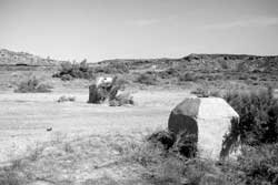 Figure 14.5. Concrete entrance pillars, Moab Isolation Center. |
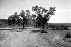 Figure 14.6. Administration area, Moab Isolation Center. |
Historical photographs show 18 board-and-batten buildings, including eight barracks, at the camp in the 1930s. Later photographs show three or four additional buildings. As is common at CCC camps, the Moab camp is divided into three sections: an administration area, a support area, and a barracks area. The administration area is to the north of the current access road and the support and barracks areas are to the south.
In the administration area probable building locations are indicated by small concrete slabs, barren leveled areas, large cottonwood trees, and other remains. South of the slabs and trees there are rock alignments and rock rubble at what may have been the camp flagpole location. A retaining wall on the east side of the administration area and a concrete well box are likely from the CCC era. Near the well is a more recent well with windmill supports.
In the support are, along the east side of the camp along the wash, there are large concrete foundations for what appears to be a generator building, a garage, and a blacksmith shop (Figures 14.7 and 14.8). A concrete loading dock along the wash has collapsed.
 Figure 14.7. Concrete slab in support area, Moab Isolation Center. |
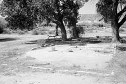 Figure 14.8. Concrete slab in support area, Moab Isolation Center. |
In the barracks area there is little indication of former buildings and the area is partly covered by a pond and its berm. There is, however, what appears to be a concrete floor trough for a laundry room, overgrown with vegetation. It may be associated with a much larger buried slab. A single rock alignment was found along a road that once connected the barracks and administration areas.
Outlying remains associated with the camp include a CCC-built concrete and rock cistern to the north and two explosives sheds dug into the hillside west across the highway from the camp (Figure 14.9).
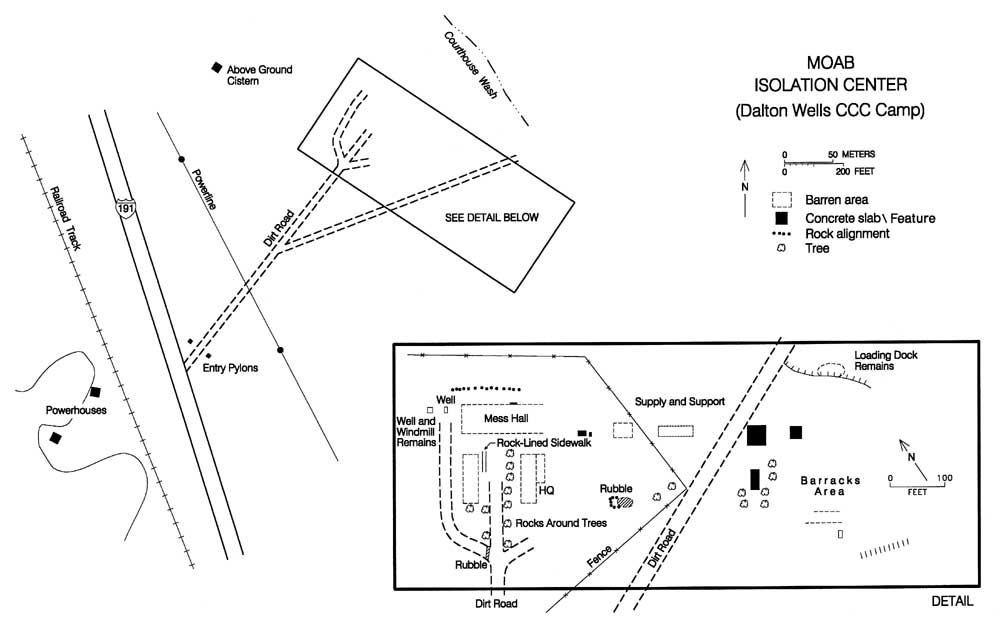
Figure 14.9. Moab Isolation Center.
(click image for larger size (~52K) )
The site was listed on the National Register of Historic Places in 1994 for its association with the New Deal CCC work program and the World War II Japanese American relocation. There is no historical marker at the site, but the Dan O'Laurie Museum in Moab has a photograph on display of the camp with the simple caption: "1937 — Dalton Wells Civilian Conservation Corps Camp — It was a prison for Japanese-American Citizens in 1943."
Leupp Isolation Center, Arizona
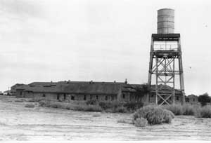 Figure 14.10. Leupp Boarding School. (Museum of Northern Arizona Photo Archives) |
The Leupp Isolation Center, in northeastern Arizona about 30 miles northwest of Winslow, was located at an abandoned Indian boarding school on the Navajo Indian Reservation. Historical photographs show the boarding school, built in the 1920s, with substantial red sandstone buildings which housed 500 Navajo children (Figure 14.10; Drinnon 1987). The school was closed in early 1942 apparently due to its location in the flood plain of the Little Colorado River (Negri 1985). Today the area, now called "Old Leupp," has just a few residences and a presbyterian church. The current town of Leupp is about 2 miles northwest.
Catherine "Tink" Borum, now of Winslow, Arizona, provided information about the Leupp community that helped confirm the site's location. Her parents ran the trading post in Old Leupp, and they lived on the second floor of that building (Figure 14.11). She was nine years old on April 15, 1943, the day the first soldiers came to Leupp. The military consisted of one captain, two second lieutenants and 150 troops. The trading post continued to operate during this time, selling to soldiers as well as to Indians.
In the 1940s the main road from U.S. Route 66 entered (Old) Leupp from the south, ran through Leupp, and went on to the Sunrise trading post near the current town of Leupp. The raised road bed south of Leupp is now part of a protective levee system (Figure 14.12), but the concrete bridge abutments at the Little Colorado River are still in place.
The only building left at the boarding school is the superintendent's house (Figure 14.13). Other remains there include sidewalks, foundations, and a few manholes (Figures 14.14-14.16). No remains of the sentry building, guard towers, or barbed wire fence built by the WRA are present. According to Ms. Borum, the military leveled all the buildings with bulldozers when they abandoned the site. Debris from the destruction and removal of buildings was perhaps used to build new levees, or reinforce existing ones.
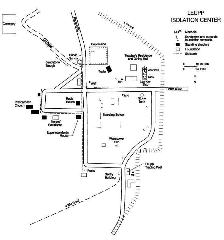
Figure 14.17. Leupp Isolation Center.
(click image for larger size (~48K) )
Vegetation is taking over much of the former boarding school, but in the central portion of the site, where the majority of the buildings would have been, there are scattered remnants of concrete and sandstone foundations (Figures 14.17 and 14.18). To the northeast there are three foundations identified by Ms. Borum as the teacher's residence, dining hall, and laundry (Figure 14.19). The former trading post, in use as recently as 1972, has been destroyed by vandals. Remains there include concrete, sandstone, bricks, and mortar (Figure 14.20).
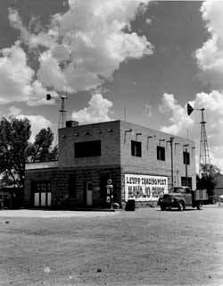 Figure 14.11. Leupp Trading Post. (Museum of Northern Arizona Photo Archives) |
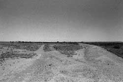 Figure 14.12. Old highway south of Old Leupp. |
 Figure 14.13. Former superintendent's residence at Old Leupp. | |
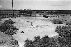 Figure 14.15. Concrete slab at the Leupp Isolation Center. |
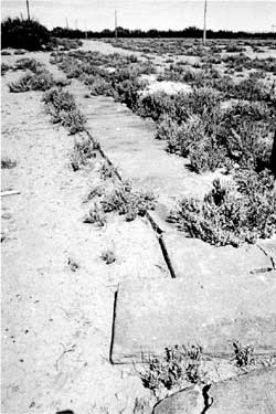 Figure 14.14. Sidwalk remnants at the Leupp Isolation Center. |
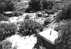 Figure 14.16. Water tower foundation blocks at the Leupp Isolation Center (block in foreground is inscribed with the name "KNOX". | |
 Figure 14.19. Leupp Trading Post today. |
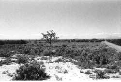 Figure 14.18. Site of the Leupp Isolation Center. |
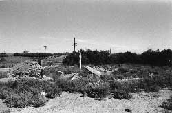 Figure 14.20. Foundation of the dining hall at the Leupp Isolation Center. |
| <<< Previous | <<< Contents>>> | Next >>> |
wacc/74/chap14.htm
Last Updated: 20-Feb-2004