|
NATIONAL PARK SERVICE
Atlantic and Gulf Coasts Recreation Area Survey |

|
UNDEVELOPED SEASHORE AREAS IN ALABAMA AND MISSISSIPPI
|
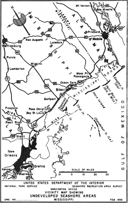
| Undeveloped Seashore Areas of Alabama and Mississippi (Vicinity Map) (click on image for an enlargement in a new window) |
Alabama
Perdido Bay
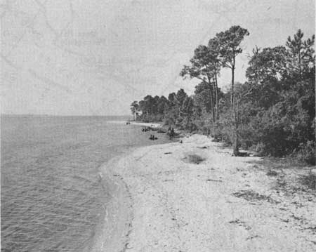
An irregularly shaped bay, forming part of the boundary between Alabama and Florida, 13 miles west of Pensacola Bay entrance and 26 miles east of Mobile Bay entrance, containing several small beaches. The water is shallow, dark in color, but with no surf or tide. The beaches are 20 to 30 feet wide, about 1/2 mile long, and light brown in color, and the sand is fine. There are no dunes or marshes but interesting cliffs of some 40 feet in height. Dense forest cover extends from near the shore and back to the uplands. The timber is composed mostly of pine, black oak, live oak, magnolia, red bay, maple and myrtle. A strip of shoreland about 1/2 mile in depth and containing approximately 2,000 acres would provide recreation opportunities for picnicking, camping and swimming. This possibility should be given consideration in a region where there is a paucity of such opportunities.
|
| Perdido Bay Area |
Perdido Pass
The barrier reefs on both sides of Perdido Pass, a water passage that connects Perdido Bay with the Gulf of Mexico, known as Alabama Point and Florida Point, possess beaches of good quality. The slope of the foreshore and beaches is gentle and the sand is fine, white and clean. Sand dunes are numerous and rise to a height of 15 to 20 feet. Vegetative cover is principally grass and low shrubs. The beach area at Alabama Point is 1 mile in extent and at Florida Point, 2 miles. The State of Alabama plans to build groins on both sides of the pass, bridge the 1/4-mile pass from Alabama Point to Florida Point and develop the 2-mile section of Florida Point as a State beach area.
Dauphin Island
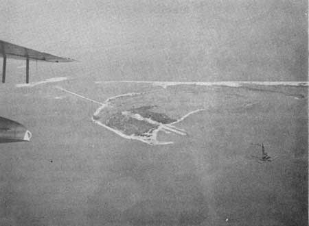
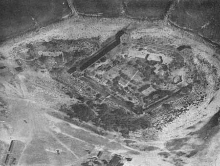
This barrier-reef island, 15 miles long and from one-half to one mile in width, lies off the coast of Alabama, between Petit Bois and the main seaward passage to Mobile Bay. There are scattered pine on the eastern portion, salt marsh in the center, and dunes and beach on the western portion. The dunes are numerous and low; the beaches are wide and clean but somewhat steep. There are indications of erosion at both ends of the island. Fort Gaines is located at the eastern end of the island. A causeway has been recently completed connecting the island to the mainland. Development companies are rapidly absorbing the island. The westernmost end of the island (3 miles) is undeveloped and is worthy of consideration for public seashore recreation purposes.
|
| Dauphin Island |
|
| Fort Gaines |
Horn Island
Mississippi
| Location: | Off the mainland, between Ship Island and Petit Bois Island, southeast of Biloxi, Mississippi. |
| Accessibility: | By boat only. |
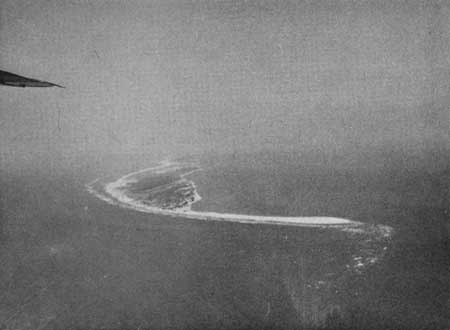
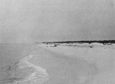
| Description of Area: | The best of the undeveloped islands off the Mississippi coast is about 15 miles long with an average width of one-half mile. It contains about 4,500 acres of land. The beach is wide, gently sloping, with a fairly steep foreshore, and with scattered areas of erosion along the seaward side. The sand is clean, fine and white and the water is clear and clean. Dunes on the Gulf side are moderately high and stable. There are dense stands of slash pine and live oaks in elevated areas of the inner island, along with some fresh-water ponds and considerable marsh grass. |
| Present Use: | An abandoned military reservation occupies the west end of the island; the remainder of the island is undeveloped and uninhabited. |
| Analysis: | The area possesses very good qualifications for public seashore recreation purposes. It is understood that the State of Mississippi has expressed interest in its acquisition and will endeavor to acquire certain portions of it. |
|
| Horn Island |
Ship Island
Mississippi
| Location: | Off mainland, between Cat Island and Horn Island, 11 miles south of Biloxi, Mississippi. |
| Accessibility: | By boat only. |
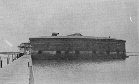
| Description of Area: | The best known of Mississippi offshore islands and often proposed for inclusion in the National Park System, the area is 8 to 9 miles long and from 500 to 4,000 feet wide, and contains about 1,350 acres of land. The eastern portion contains the island's only forest cover, 300 to 400 acres of slash pine and live oaks. The beach varies in width and is gently sloping, with a fairly steep foreshore and shallow offshore. The sand is white, fine and clean; the dunes vary in height and stability. While the western portion of land is low and unstable and possesses little cover, there is considerable migratory birdlife on the island. Mosquitoes are often prevalent. Fort Massachusetts is an outstanding historic site on the island. |
| Present Use: | The fort and most of the island are owned by the Joe Morgan American Legion Post of Gulfport. |
| Analysis: | Certain portions of the island should be retained for public recreation purposes. There is considerable interest in public acquisition of the island and in linking it with others off the Mississippi and Alabama coasts by causeway from the mainland. If sufficient interest is manifested by the States of Mississippi and Alabama, the island should be given every consideration as a public recreation area. |

|
| Ship Island |
|
| Fort Massachusetts |
Mississippi
Petit Bois Island
The island is 10 miles south-southeast of Pascagoula, Mississippi, and is the easternmost island of the four off the Mississippi coast. It is 9 miles long and averages slightly less than 1/2 mile in width. In general, it is an area of beach, dunes, salt and fresh-water marshes, a few small fresh-water ponds, and some palmetto and pine cover. The sand beach is wide, flat and clean. The dunes are fairly high and stable. The timber has been cut over and only a few scattered groups of tall pine remain. The island is undeveloped and accessible only by boat. The eastern half of the island is a wildlife refuge. If the island becomes accessible, through the linking together of these offshore islands as proposed, it will be more valuable as a potential seashore recreation area.
Cat Island
This T-shaped sand island lying 8 miles off the mainland, south of Gulfport and Pass Christian, is wooded for most of its length and has very little vegetative cover across the "top" of the T. This latter portion has wide, clean beaches, low, drifting dunes, and an irregular and deeply-pocketed offshore. The southern tip of the island is awash at high tide and there are evidences of erosion at the northern end. The island is undeveloped except for a pier and a few small buildings. It is reputed to be owned by a few wealthy sportsmen, and is accessible only by boat. The island is not as desirable as Horn or Ship Islands and does not possess their potentialities for seashore recreation.
| <<< Previous | <<< Contents>>> | Next >>> |
rec_area_survey/ag/al-ms.htm
Last Updated: 25-Jun-2007