|
NATIONAL PARK SERVICE
Atlantic and Gulf Coasts Recreation Area Survey |

|
UNDEVELOPED SEASHORE AREAS IN FLORIDA
|
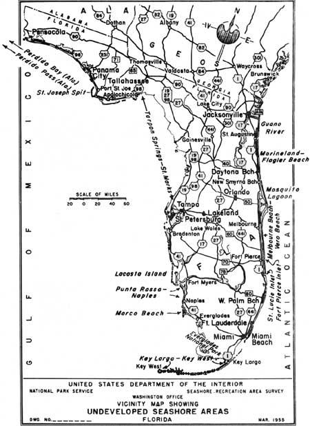
| Undeveloped Seashore Areas of Florida (Vicinity Map) (click on image for an enlargement in a new window) |
Florida
Guano River
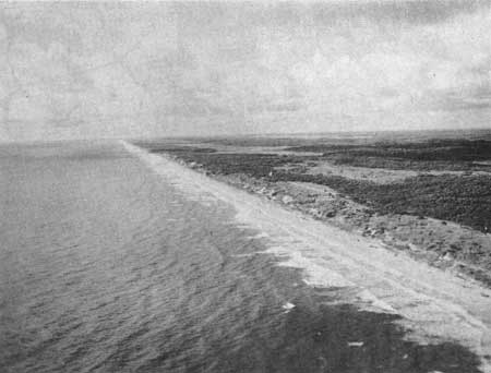
A strip of coastline between Jacksonville and St. Augustine extending some 14 miles and containing about 10,000 acres of land. The sand beach has good quality, an average width of about 200 feet and a moderate slope. The dunes reach a height of about 50 feet and are generally stable. Highway A1A traverses the dunes, about 400 to 500 feet back from the beach, the full length of the area. This portion of the seashore possesses the characteristics that are desired of a seashore recreation area but it is in many individual ownerships and the development of the ocean-front highway will open the entire area for development. It may be feasible for the State to purchase land between the highway and the ocean-front for right-of-way, thereby preserving a portion of the area for recreation purposes.
|
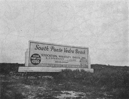
| Developer's Signboard, Guano River Area |
|
| Guano River Area |
Marineland-Flagler Beach
This area is a portion of the mainland, and lies immediately south of the community of Marineland and a few miles north of Flagler Beach. It extends for about 7 miles, has an average width of three-quarters of a mile and contains approximately 3,000 acres. The beach is of medium quality with a stony foreshore and some marine growth. The vegetation is sparse. Highway A1A is being reconstructed on a new location which will traverse and despoil this undeveloped section.
Fort Pierce Inlet (North)
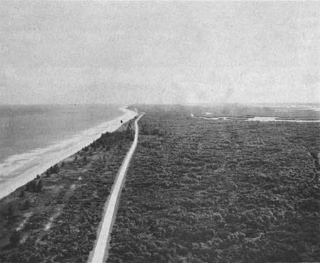
This area is located near the southern end of a long, barrier reef which begins at Sebastian Inlet and extends southwardly to Fort Pierce Inlet. It is about 4 miles in length with a width of not more than 1 mile and contains approximately 2,000 acres of land. The beach is about 200 feet wide, clean, white, gently sloping, but with a steep foreshore. The dunes are low and stabilized. The marshes are dense with a low cover of mangrove. Highway A1A traverses the area from north to south. It may be well to consider this area for acquisition as highway right-of-way which would permit public recreation.
|
| North of Fort Pierce Inlet |
Mosquito Lagoon
Florida
| Location: | On Florida east coast south of New Smyrna Beach. |
| Accessibility: | By road from New Smyrna Beach and Titusville. |
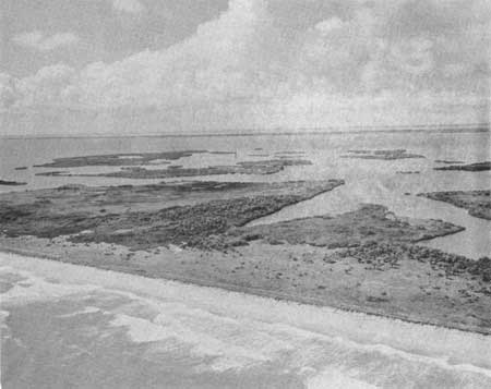
| Description of Area: | A narrow reef, 24-1/2 miles in length and averaging about one-fourth mile in width which contains about 9,700 acres in its maze of small islands, mangrove and salt marshes. The beaches on the seaward side are less than medium width and steep, with a steep foreshore. The sand is hard, clean and white but coarse. The dunes are low and stabilized. The vegetation is dense and approaches the natural and primeval. It is an excellent wildlife refuge. |
| Present Use: | The reef contains a few cottages, some small fishing villages, and an ocean drive. |
| Analysis: | An exceptionally long stretch of beach, possessing excellent natural and historical values, and in an undeveloped condition, is most unusual in Florida. The area is highly desirable for public recreation use. |
|
| Mosquito River Lagoon |
Melbourne Beach-Vero Beach
Florida
| Location: | South of Melbourne Beach to 2 miles east of Vero Beach. |
| Accessibility: | By car from either end. |
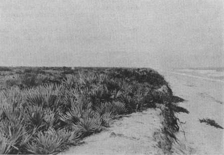
| Description of Area: | This area is a good example of a Florida east-coast barrier reef. It has a length of about 24 miles, averages one-fourth mile in width and covers about 7,000 acres of land. The beaches are good throughout the length of the area, although somewhat narrow and steep. The sand is white and clean. Grasses occur on the seaward elevation of the dunes. Trees and shrubs of good size and number grow on the flat of the dunes back to the river marshes. Most of the trees are palms, oaks and pines. South of Sebastian Inlet there are many citrus groves. |
| Present Use: | Melbourne Beach, south to Sebastian Inlet, contains scattered single-family dwellings and a trailer camp. Route A1A traverses the length of the reef. South of the inlet the citrus groves occur and the reef is owned almost in its entirety by corporations. Route A1A runs from Wabasso to Fort Pierce Inlet. |
| Analysis: | The presence of Route A1A, real estate development activity and citrus fruit groves indicate that this area already has passed beyond the stage where it could be considered as available for purposes of public recreation. |
|
| Near Sebastian Inlet |
Keys
Florida
| Location: | Off the eastern coast, south of Miami to the Marquesas Keys in the Gulf of Mexico. |
| Accessibility: | Many served by Overseas Highway (U. S. Highway 1) and spur roads. |
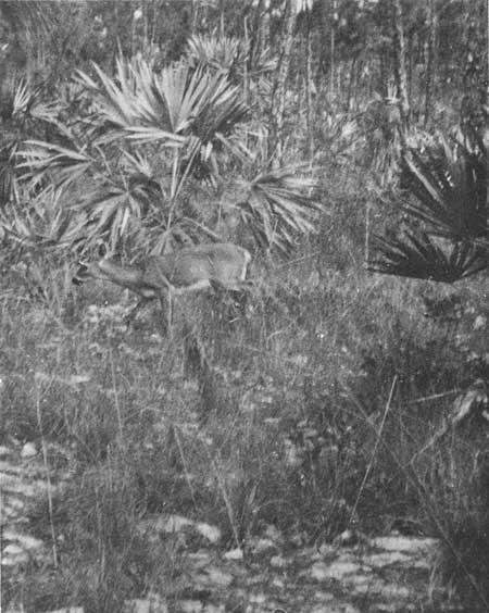
| Description of Area: | The famed keys of Florida extend southwestwardly from Miami in a great sweeping crescent for about 160 miles. They are hundreds in number and vary in size, with Key Largo being the largest, 30 miles long and 3 miles wide. The lower-lying keys are composed mostly of mangrove swamps, and the keys with greater elevations contain palms and oaks, and some pines. The key deer inhabit nine of the keys, four of which (Big Pine, Summerland, Cudjoe and Ramrod) are accessible by car. Big Pine is the most important of these keys. No-Name, Big Torch and Middle Torch Keys are important biologically, but are not accessible by car. The undeveloped keys possessing potentialities for public recreation, other than bathing, are Key Largo, Long Key, Big Pine, Cudjoe, and Sugarloaf. There are no good sand beaches. The fishing is excellent. |
| Present Use: | The keys are an outstanding tourist attraction and are being developed for that purpose. Spur roads are being built to keys off the Overseas Highway. |
| Analysis: | The protection of the key deer, particularly at Big Pine Key, is important, as is the preservation of the unique and important vegetation found in the keys area. |
|
| Key Deer, Big Pine Key |
Marco Beach
Florida
| Location: | Just north of Cape Romano. |
| Accessibility: | By car on paved road. |
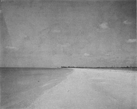
| Description of Area: | The area occupies the western half of the island and is about 1 mile in width and 4 miles in length. It is a rolling area of about 2,800 acres, triangular in shape. It has an extremely clean, dazzling white sand beach with a tropical background of coconut palms. The area is well-known to shell collectors for the variety and quality of shells found there in abundance. The subtropical vegetation is in a nearly natural condition and of varied character. There is almost no dune area behind the beach. The island is one of the most productive archeological sites on the Florida west coast. Indian shell mounds are plentiful and each of the three villages was built on ancient Indian townsites. |
| Present Use: | Little development of any kind. |
| Analysis: | One of the outstanding seashore areas on the western Florida peninsula, it is scenically attractive and most suitable for public recreation use. |
|
| Marco Beach |
Florida
St. Lucie Inlet
An area of 7,000 acres consisting of two segments on either side of St. Lucie Inlet, the one to the north running for 20 miles and the one to the south about 4 miles. The vegetative cover is excellent, ranging from grasses and low shrubs on the dunes, to generous, forestlike expanses of palms, oaks and pines. The dunes are low and generally stable. The beaches, however, are narrow, steep and terraced, as is the foreshore. Dead stumps of trees on the beach indicate the amount of erosion that has taken place. Because of this badly eroding condition, the area is not considered feasible for acquisition and development as a public recreation area.
Punta Rassa-Naples
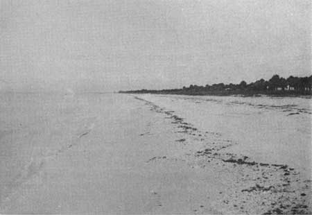
The coastal area south from Punta Rassa to Naples on the Gulf coast consists of a number of offshore islands, mangrove reefs and marshes. This stretch embraces about 12,000 acres of land and 38 miles of shoreline with a good cross section of all the seashore characteristics that are typical of the Florida west coast. The choice areas have been depleted, however, and the ones remaining are of inferior quality and size for public recreation purposes.
|
| North of Naples |
|
| v |
Lacosta Island
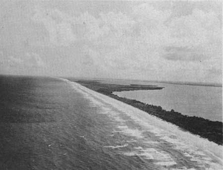
Two barrier-reef islands off the mainland--Lacosta Island and and unnamed island to the south--which lie directly west of Fort Myers and south of Boca Grande, have a total length of 12 miles and an average width of one-half mile. Both islands are accessible only by boat or plane, and are completely undeveloped. In the center portion of both islands the beaches are wide and gently sloping. At the north and south ends of the islands erosion is taking place. The dunes, where stable, are covered with vines and grass and on the sound side by low-growing shrubs. There are a few stands of palms and pines, and stretches of mangrove. The islands are too inaccessible and unstable at the present time to be given consideration as public seashore recreation areas.
Tarpon Springs to St. Marks
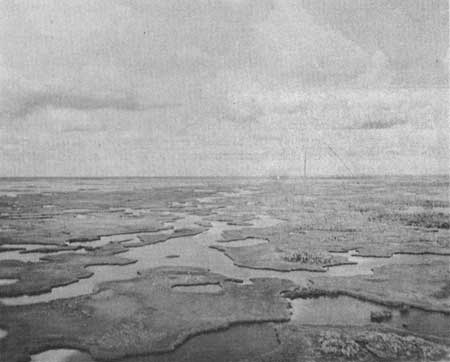
This portion of the west coast of Florida extends for a distance of about 200 miles. It has very little value for purposes of public recreation, but does have high value as a wildlife refuge and a forest preserve. The general character of the area is that of a gradual merging of shallow, muddy foreshores, mangrove islands, salt marshes and swamp forests. Here and there will be found a few sand beaches, low, coastal ridges, and dry, pine flats. But for the most part the area is just one long, forbidding swamp.
|
| Homosassa Swamp, West of Mouth of St. Martins River |
St. Joseph Spit
Florida
| Location: | 10 miles south of Port St. Joe. |
| Accessibility: | By car from either end. |
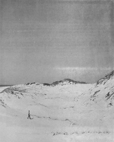
| Description of Area: | An L-shaped spit some 20 miles in length, one-half mile in width, similar in character and shape, on a smaller scale, to Cape Cod. It has an attractive, medium width, white sand beach, gradual in slope, and clear, shallow water well offshore. There are high rolling dunes, as large as any in Florida, both vegetated and partially bare, and a forested area that extends from the dunes to the bay. The primitive and isolated character of the 5,050-acre spit, along with good vegetative cover, has made it a haven for wild animals. Birdlife is varied but not unusual. |
| Present Use: | Air Force and Coast Guard installations. |
| Analysis: | The scenic quality, biological, archeological, historical and recreation values of the area make it most desirable for public use. |
|
| St. Joseph Spit |
| <<< Previous | <<< Contents>>> | Next >>> |
rec_area_survey/ag/fl.htm
Last Updated: 25-Jun-2007