|
Death Valley
Historic Resource Study A History of Mining |

|
SECTION III:
INVENTORY OF HISTORICAL RESOURCES THE WEST SIDE
A. Southern Panamints and West Side Road
1. Panamint Mining District
a) Formation and Establishment of Boundaries
The precursor of the Panamint Mining District was the Telescope District, organized in 1860 by members of the Dr. S.C. George expedition who had penetrated into the Wildrose and Panamint regions. Named for nearby Telescope Peak, this early district was located on a spur of the Panamint Range bordering Death Valley on the west. Although the mines in the area were not heavily worked in the first few years after their discovery, the late 1860s and early 1870s saw some rough beginnings of a mining industry there. An 1872 newspaper article speaks favorably of the richness and extent of the Telescope District mines, which, it states, had been located some three years earlier. The lead, silver, and gold ores were said to be comparable to those of Cerro Gordo, besides being easy to smelt because of the nearby pinyon pines and clay necessary for the reduction process. [1]
On 1 February 1873 four notices were posted in the mountains of the Panamint Range, informing the prospecting community that:
There will be held at the camp of R.C. Jacobs & Co., in Mormon Canyon at the southern end of the Panamint Mountain Range, on February 10, 1873, a miners' meeting, for the purpose of organizing a new mining district, and forming laws to govern the same. All claim owners are respectfully invited to be present at said meeting.
R. C. Jacobs
W.L. Kenneday [Kennedy]
R. Stewart [2]
The meeting was subsequently held as advertised, resulting in the formation of the Panamint Mining District. Boundaries were established as follows:
Commencing in "Windy Canyon" (a point four miles north of Telescope Peak) at a point called Flowery Springs, and running thence in an easterly direction, following the said "Windy Canyon" to the summit of the range; thence down the east side and out to the center of Death Valley; thence southerly to "Mesquit Springs," on the eastern slope of "Slate Range;" thence westerly to the summit of "Centrie Canyon," and down the same to its mouth, continuing the same course westerly to the center of "Slate Range Valley;" thence northerly to a point in "Panamint Valley" ten miles due west from "Flowery Springs;" thence easterly ten miles to the place of beginning." [3]
Laws and regulations were adopted and Robert Stewart elected recorder for a one-year term beginning 10 February 1873. The recorder's office was to be located in Surprise Valley, where most of the principal claims were found.
b) The District's Future Seems Assured
By 30 August 1873 the prospects of the new district still looked favorable:
It is represented by experts, who have visited it for speculative purposes, as being one of the very richest and most prolific districts on the Pacific Slope in silver ores. Some one hundred silver lodes have been discovered and located, which for body and richness stand, at least in the State of California, unrivalled--the lodes running from two to thirty feet in width, and assaying from $200 to $1,200 per ton of ore. [4]
Even allowing for the tendency toward excitability and gross exaggeration common to the average California mining prospector of this era, men of some experience and supposed sound judgement and caution felt that this district had distinct economic possibilities. The best route to the mines was said to be from Havilah by stage to Little Owens Lake, seventy miles away by the Havilah and Independence stage route, and from there by mule trail, "a short two day's ride of fifty-five miles." [5]
Newspaper clippings and journals of the time give some indication of the ensuing fortunes of the Panamint District. In December 1879 some Panamint miners organized the "Breyfogle" District twenty miles north of Panamint. The main lode, of the same name, produced ore assaying from around $500 to almost $4,000. [6] By the year 1881 the Inyo Consolidated Mining Company of New York, which had purchased the Garibaldi and North Star mines in the Rose Springs (Wildrose) District circa 1876, had also purchased the only mill and several promising locations in the Panamint District and were working vigorously with much success, the mines and mill having produced about $60,000 worth of ore already. [7]
c) Mining Activity Spreads in Southern Inyo County
In July 1887 valuable ores were stilt being discovered in the surrounding country, but discouraging to miners was the fact that the rich ore could not be shipped easily or speedily to market. By May 1894 the California mining news correspondent of the Engineering and Mining Journal was projecting 11a decided tendency toward a mining boom in Southern California this year. Never within 10 or 12 years has such general interest been manifested as is shown at present. There are now more new enterprises, and apparently substantial ones, than ever before. . . ." By this time a new district referred to as South Park was springing up around Red Rock and Goler canyons, with lucrative results appearing inevitable. [8] The Redlands Gold Mining Company was in business by the summer of 1894 and was enthusiastically purchasing prospects. It even erected a ten-stamp mill five miles south of Panamint Canyon, which two years later, however, was not producing much. [9] Hampering progress in this more southerly area too was its distance from a railroad and lack of wood and water.
A correspondent of the Pacific Coast Bullion made a trip to Death Valley about this time, and in addition to describing the sights and geologic wonders of the area, reported on the current mining situation. Panamint City, he said, now housed only a watchman guarding the mill and storehouses, leaving itinerant prospectors the run of the town. He went on to explain that lawsuits had closed the mines for awhile, but the litigation was now settled and eighteen claims had been recently patented; unfortunately the current price of silver was too low to work them profitably.
The correspondent remarked that few mines were being worked in the Panamints. Charles Anthony's Defiance Mine near Post Office Spring at Darwin was operating, although no mill existed on the property. The only other mining activity centered around the Redlands Gold Mining Company. Heavy transportation costs were still hindering mining in the mountains contiguous to Death Valley. [10]
The revival of a large-scale mining industry in the Panamint District in the late 1800s evidently centered around Tuber Canyon properties. In April 1897 a Mr. Donahue and others purchased property there for $15,000 preparatory to commencing exploratory work. [11] A correspondent to the Independent wrote from the new town of Ballarat in the Telescope Range in June 1897 that "the future of this camp and district as a gold mining proposition is very bright and assured." [12] The country had a good water supply, plenty of wood available on the nearby summits of the Panamint Range, and fruit could be grown in the mountains. Quail were an abundant food source. [13] Among current activities mentioned was the work in Tuber Canyon, where development and prospecting were pushing ahead vigorously, with considerable San Francisco capital being invested there. [14] The Tuber and Aurora claims were active, while in Jail Canyon the Gem and Burro groups were being worked. In Pleasant Canyon, near the old town of Panamint, the Worldbeater and other Montgomery properties had closed down until a new bigger mill nearer the mines could be bought and installed. Claims in the Mineral Hill and Redlands Canyon areas further south were showing some unrest, with many claims changing hands. The prospecting stage here had passed, and efforts were now being made to further develop those lodes whose extent and richness were becoming evident. A custom mill was sorely needed, although it was being rumored that a three-stamp mill would be moved into the vicinity soon. [15]
Other southern Inyo County mining efforts consisted of "chloriding" operations, notably in Shepherd's, Cottonwood, and Emigrant canyons, where development of the lodes was much hampered by their inaccessibility. Revenue Canyon mines on the western edge of Panamint Valley also harbored rich strikes. [16]
The new town of Ballarat was now the gathering place for Panamint Range miners, prospectors, and the Indian community. The Fourth of July celebration in the year 1897 was replete with "foot races, hammer and stone-throwing, burro and horse racing, giant powder salutes and a grand tug of war, in which every male inhabitant and visitor to the place, Indians included, took part, save one who from his immense size and strength was debarred from either side and officiated as referee." [17] Talks on the significance of the day entertained the visitors from almost every canyon in the evening. A stage and mail line between Ballarat and Garlock was about to commence, consisting of a single round trip weekly, to be increased to tri-weekly when cooler weather came and mining activity resumed. The main portion of the town's business and freight came through Mojave and Garlock (which evidently had the nearest custom mill, 150 miles away) because of lower freight charges and passenger fares from that direction. Although mail communication was desired through Owens Valley and Independence, the residents there were antagonistic toward facilitating this because of the camp's close communication and financial ties to the southern towns. [18]
Also in this year mention was made of construction of a Randsburg Railway from Kramer station on the Santa Fe and Pacific to Randsburg, and a possibility evidently existed of the line being projected to Salt Lake City, thus making another transcontinental route. The Los Angeles trade would be increased tenfold, it was argued, by bringing the line north into the Panamint Valley from Kramer and tapping the Searles borax fields, the Argus and Slate ranges, and all the mining camps in Redlands Canyon, Mineral Hill, Pleasant Canyon, Happy Valley, Surprise, Hall, Jail, and Tuber canyons, and the Wildrose area, not to mention the Argus, Revenue, Snow Canyon, and Modoc mines on the west side of the valley. [19]
By 1897 new placer locations had been found on the east side of the Panamints, panning $30 to $40 per day. The central Panamints were still quiet, Panamint City now containing but two residents, sole witnesses to the steady decay of the town's large stores, saloons, and billiard halls full of furniture. The only operating business was a large, fully-stocked hardware and implement store selling goods to miners at incredibly low prices. Several mills in the vicinity full of machinery were idle. [20]
By April 1898 Ballarat sported a population of nearly four hundred, at least one hundred of whom were gainfully employed. It contained substantial adobe houses and was the outfitting point for the Panamint Range, Snow Canyon, and other nearby districts. Mines were being worked near Willow Spring to the south; the Burro Mine in Jail Canyon had recently been bought, the new owner also purchasing the Redland Company's mill; the South Park mines were producing; and the Tuber Canyon mines were doing well, as were the Mineral Hill properties four miles south of Ballarat. [21]
From 1898 to 1899 freight teams left Johannesburg, sixty miles south of Ballarat in Kern County, for the Argus Range hematite iron-ore deposits, some yielding $8 a ton in gold, and for the Panamint District high-grade silver-lead ore mines. Although Johannesburg was the best outfitting point for a prospector coming to Panamint from the south, Keeler, the closest railroad stop to the Panamint Range, was more accessible for people from the north or from Nevada. [22]
d) Interest in the Panamints Spreads to Nevada
By February 1900 the Panamint District continued strong and reported much activity. Ballarat, in the process of heavy construction, held much commercial importance in the area because of its central location arid accessibility to miners in the adjacent mountains, its good water supply, and its proximity to the railroad. Mines in the Panamints were producing ore that could be easily milled or on which cyanide treatment was effective. Principal mines in the western Panamint Range were still in Tuber, Jail, and Pleasant canyons, and at Mineral Hill. In Tuber Canyon a twenty-five-ton Bryan mill had been erected and in Jail Canyon a three-stamp mill was operating. The Radcliffe Consolidated Gold Mining Company was running a twenty-stamp mill in Pleasant Canyon, and ore was being transported from the property by tramway at low cost. [23]
By 1902 the Inyo Gold Company of Los Angeles, which owned mines in Tuber Canyon, near Panamint, and the Tuber Mine at Ballarat, was shipping in a fifty-ton cyanide plant to wash tailings from the Tuber and also ore from there. This was in addition to a six-stamp mill already on the Tuber Mine property. [24] In the early 1900s the Panamint District began attracting the attention of prospectors from the Goldfield, Nevada, area. [25] Because earlier prospectors had been intent only on silver, it was now thought that vast amounts of gold probably remained. Geologically, the southernmost part of the range seemed to be similar to the Tonopah, Goldfield, and Bullfrog districts, and good opportunities were imagined to exist for those who took the time to look.
Jail Canyon was still the best producer in the Panamints, boasting the Gem Group and rich Burro Mine. In Surprise Canyon, Jack Curran had located some good gold claims near Panamint City. The Radcliffe Group in Pleasant Canyon was still producing, as was the World Beater just above it. Coyote Canyon, between Goler and Redlands, was the location of a great strike showing ore of a high assay value, more than $35, some shoots running up to $125 and $230 per ton. Prospects looked good further south except for a lack of capital. [26] New locations were constantly being made, though, since water and wood were plentiful. Several companies were already operating in the Redlands area and it was thought that summer and fall would bring an influx of desert prospectors.
By autumn the entry of prospectors from the Tonopah, Goldfield, and Bullfrog fields into the Panamint region seemed even more imminent, despite the region's isolation from railroad transportation facilities and roads, which cast doubt on the success of every mining venture. But because remote areas of Nevada were proving to be profitable, new hope was seen for the Panamint area, especially because these prospectors from Nevada were familiar with the problems and frustrations of desert mining. [27]
In the meantime the original Panamint Mine seemed slated for a comeback. An October 1905 newspaper article stated that Jack Curran, the "King of the Panamints," had relocated the old mine, which it reported was at one time bonded for $5,000 to an English syndicate. Some later history of the once-roaring silver camp was presented, although some facts, such as those regarding population figures, are open to question. The article reported that $700,000 was spent developing the old mine (improvements, wages, etc.). Currently remains of the twenty-stamp mill, saloons, and stone warehouses could still be seen. The canyon was deserted, the article continued, when silver, once selling for $1.29, was demonetized, and the lack of good transportation facilities in addition made mining in the area unprofitable. After the camp was deserted, the owners of the mine fell into dissension over some matter. The workmen were not paid, and in retaliation took over possession of the property, which they worked until they received due compensation. After setting fire to some of the buildings, they scattered, and the town was left to the elements. [28]
Several more well-known prospects were appearing in the Panamints at this time in Hall Canyon, such as the Pine Tree Mizpah and the Valley View, and prospecting was becoming a much more organized and systematic business. A party of four men from Goldfield came into the Panamint Range in November 1905 equipped with fourteen burros, an elaborate camp outfit, and a determination to cover as large a territory in as short a time as possible. The head of the party, who also held interests in Colorado mines, stated that in the Panamints he saw the same class of ore as at Leadville, but of higher grade. Colorado investors, he allowed, were very interested in the value of ores that could be found here. [29]
During the early 1900s mining in the Panamint section was booming: mineral resources were good, geological conditions promising, new mining camps were being established nearby at Greenwater, and at Emigrant Spring, Harrisburg, and Skidoo, and Nevada mining men were now investing large sums in the Panamint region. Full forces of men were at work, reminding people of the early days of Tonopah and Goldfield. The new camp of "Panamini," mentioned earlier, was predicted to be one of the most prosperous of western mining camps, with water being piped a mile and a half to supply all needs. [30]
Mining was not easy for men in this region, as evidenced by the statement of a mining engineer in 1906 that the bodies of eight prospectors who had died from heat stroke in the Panamints were brought in during his stay. The average temperature for several days was 116°F., even at midnight, while the thermometer would rise to 135°F. by noontime. In contrast, by the first of March 1907 Skidoo and Ballarat were buried in deep snow. Other problems existed in addition to vagaries of the weather, one group of prospectors reporting a difficulty centering around settlers in the Panamint Valley who staked and restaked mining claims, but never worked them, effectively preventing their exploration by bona fide mining men. [31]
The price of silver in 1907 was holding steady, running around 75¢ in New York, as high as it had been for several years. Locations were still being made at this time around old Panamint City. While another new "Panamint" was in the throes of birth just across the mountains in Johnson Canyon, miners arriving to work there were also crossing over to the old townsite and staking claims in this still-mineral-rich area. The finding of high-grade silver ore was mandatory in order to realize a profit because of transportation problems. One miner locating here reported sixteen patented locations around the old mill site, where a dozen vacant buildings were left from the boom days. [32]
e) Consistent Production Continues into Late 1900s
For the next few years mining continued in southern Inyo County on a profitable scale. At Cerro Gordo, Darwin, and other places on the west side of the Panamints steady ore production was maintained. By 1912 the Panamint Mine had been purchased by Al Meyers of Goldfield-Mohawk fame, the property's productive record having reportedly been two to three million dollars. The mine had been idle since 1893, but rehabilitation work was to commence immediately; the ore was to be shipped to Randsburg, the nearest railroad point, seventy miles away.
A summary of Panamint Range mining activity in the early 1920s appeared in the Inyo Independent Most operations in the section were concentrated on the western slope, except for the Carbonate silver-lead mine on the east edge and small gold mines at Anvil Spring in Butte Valley. The Trona Railroad and American Magnesium Company's monorail system were ameliorating somewhat the transportation and isolation problems that had existed in the area for such a long time.
Producing properties were located in Goler Canyon (Admiral Group, Shurlock, Gold Spur); South Park Canyon (Gibraltar); Hall Canyon (Horn Spoon); Jail Canyon (Gem Group, Burro Mine); and Tuber Canyon (Salvage Mine and mill, Sure Thing Group). The Pleasant Canyon mines (World Beater, Radcliffe, and Anthony mines) were now all idle. The Panamint Mine under Myers's ownership was being resurrected by modern mining and milling equipment. [33] The Panamint Mining Company determined at this time to construct a stone and gravel toll road beginning at Surprise Canyon and climbing east 5-1/2 miles to the old Panamint City site. The purpose of the toll was to get revenue from miners in that area to assist in road maintenance, and as such was a venture similar to the later Eichbaum toll road built further north a few years later. [34]
All along the Panamints refinements in technique were expected to finally make the old silver-lead deposits below the 200-foot level pay. By the early 1930s silver was expected to stabilize at a high market figure, and the mining community eagerly anticipated great things for the Panamint Valley and environs. In the mid-1930s Tuber and Jail canyon mines were operating on a large scale, the development of mines in Pleasant Canyon was being well financed, and Goler Wash, now more accessible, was being explored. No big strikes were made during the late 1920s and early 1930s, but prospectors kept combing the hills and earlier operations kept producing. [35]
Leasers and owners both were working in the Ballarat District by the late 1930s, and the consensus of opinion was that "taken as a whole the Panamint Range, while not spectacular, is a consistent [sic] producer, an estimated 5000 tons having been shipped from there during the present year." [36] The diversified resources of Inyo County were just now starting to be fully realized, and companies such as Sierra Talc and the Pacific Coast Talc Co. were involved in development work in the Darwin district. This somewhat offset losses in lead and silver mining in the area, whose condition was stagnant due to the low market price of these particular metals. Despite this, it was concluded by mining officials in the county that "the mining industry in southern Inyo seems to be thriving at the present time. It has as always many difficulties to contend with, especially in the gold producing districts. The greatest need there is milling facilities closer to the properties. It should be borne in mind that the shortest mine to mill [route] established in the immediate vicinity, (and] a program of more and better improved roads would be the greatest single factor toward increased prosperity of the miner and thereby of our whole county. [37]
Overall, production levels reached now seemed to stabilize due to increased values in market prices, newer machinery, and improved roads and processes. On through the 1940s and 1950s the Darwin District, Tecopa District, and Modoc and Slate Range regions continued to produce steadily. The Panamint mines were leased in 1947-48 by the American Silver Corporation, which performed some work on them. The properties that originally initiated exploratory work in the area--the Alabama, Hemlock, East Hemlock, and High Silver patented claims, and the unpatented East Hemlock and High Silver mill sites--were privately owned, as were the Challenge, Comstock, Eureka, Hudson River, Marvel, Stewart's Wonder, Wyoming, Star, Little Chief, Independence, Ida, and Panamint Central patented claims, and Stewart's Wonder, Challenge, Little Chief, and Wyoming patented mill sites, plus four other unpatented claims, but all were idle. [38] Tungsten was later found on the Stewart's Wonder, Challenge, and other claims in the Panamint mines complex, and soon a strong resurgence of interest in the Panamint Range centered around this strategic mineral. The renewed interest was attributable to some price stability occurring as a result of the federal government's stockpile sales policy and to the absence of tungsten imports from mainland China. [39] Exploration in this new field was short-lived, however, as it proved to be further north on Harrisburg Flats.
f) Impact of Panamint and Other Early Mining Districts on Southern Inyo and Death Valley History
The mining districts west of Death Valley have played an important and productive role in Inyo County's economic and social history, and are worth further study on their own. What is important, and what has hopefully been transmitted in this short chapter, is a realization of the extreme and lasting influences exerted by these early communities and their inhabitants on the later mining progress of southern Inyo County, including especially that of Death Valley. The amount of territory covered by Owens and Panamint valley prospectors, and by businessmen on the lookout for a promising investment, was phenomenal, especially in light of the dearth of transportation facilities available at the time. These peregrinations were the primary means by which men in the Death Valley camps and in the Nevada fields further east were kept apprized of mining conditions in surrounding areas and the methods most successfully used in extracting ore. The exploitation of these western mining districts has been at times energetic, at times frenzied, and always sporadic. By dint of much persistence and experimentation, however, the groundwork was laid here for the more systematic and technologically sound methods that ultimately produced such gratifying results in later mining operations in the southern Panamint, Wildrose, and Ubehebe sections of Death Valley during the next few years.
g) Panamint City
The first boom town of the Panamint Range was Panamint City, in an area first discovered in January 1873 by R.C. Jacobs, W.L. Kennedy, and R.B. Stewart, who located eighty or ninety claims in the vicinity. Two necessities for successful milling operations--timber and water--were plentiful near the site immediately south of Telescope Peak and about 100 miles from Independence.
As word of the strike leaked out, excitement once again prevailed in southern Inyo County. Numerous parties left immediately for the district with wagonloads of tools and provisions. Principal lodes were the Wide West, Gold Hill, Wonder, Wyoming, Marvel, Pinos Altos, Surprise, Challenge, Beauty, Chief, Cannon, Venus, King of Kayorat, Esperanza, Silver Ridge, Garry Owen, Balloon, Panamint, Mina Verde, Blue Belle, Sunset, and Pine Tree. [40] Optimism about affairs at Panamint ran high. An August 1873 edition of the Independent quoted a Lagunita, California, resident who told of the "exceedingly fair ores" being taken out of the district. "Panamint prospects are improving daily," he stated, "I think we have in this camp the most intelligent and liberally inclined miners that perhaps ever got together. [41]
To reach the Panamint Valley and the scene of the new strike, on mules or in wagons, afoot or on burros, one had to branch east from the bullion trail at Lagunita (Little Lake), about fifty-five miles distant, and follow a burro path across the Coso and Argus ranges. Jacobs, realizing that the area's development was dependent upon a good communications system, proceeded to raise funds in Los Angeles by subscription for a more convenient road going south of the mountains via what is now Searles Lake and the north end of the Slate Range. Because the future of the Panamint mines seemed promising enough at this point to warrant such investment, money was quickly raised on the West Coast, many of the businessmen there recalling the lucrative trade the city had established earlier with Cerro Gordo.
By mid-June 1874 the road was completed over the Slate Range where it connected with the Surprise Canyon section. Although this latter road was almost immediately washed out by a cloudburst, it was soon repaired and the entire route ready by mid-August 1874, whereupon Jacobs hurriedly shipped in a ten-stamp reduction mill from San Francisco to process ore from his Wonder Mine.
Earlier, around 18 December 1833, E.P. Raines, a well-known mining man and promoter, in an effort to finance the camp, journeyed to Los Angeles to enlist support for the Panamint District. An article in a Los Angeles paper of 13 December stated:
Messrs. Vanderbilt, Kennedy and Rains arrived here Wednesday from Inyo county with some very rich specimens of silver ore from the Panamint district. The specimens are exhibited at the Clarendon creating quite a little excitement, particularly among those who are unfortunately not interested in the lead. The ore is familiarly known as copper silver glance, but does not contain enough copper or other base metals to prevent it from being easily crushed. The claim is situated about sixty miles south east of Cerro Gordo and was located last January by Mr. Kennedy. It presents the most encouraging prospects and will be developed as soon as the necessary tools and machinery can be procured. It is estimated that the ore will turn out about $1,000 to the ton [42]
Raines did finally succeed in persuading Senator John P. Jones of Nevada, who had already made a fortune in the silver mines of Nevada's Comstock lode, to look into the matter in the spring of 1875; impressed, he in turn interested his fellow senator, William M. Stewart of Nevada, and other capitalists in investing in the Panamint lodes. Together they organized the Panamint Mining Company in 1875 with a capital outlay of $2,000,000. [43]
With the entry of these moguls onto the Panamint mining scene, the attention of the western mining community was safely captured. Jones's and Stewart's Surprise Valley Mill and Water Company became the area's principal business enterprise. Stewart ultimately bought up Jacobs's ten-stamp mill; the Surprise Canyon Toll Road that ran up Surprise Canyon to Panamint, built by Bart McGee and others for $30,000; a site for a twenty-stamp quartz mill; and all principal mines of the area. 44 First-class ore was shipped to England for smelting (an indication of its richness); the rest would be reduced in the projected local mill and furnace. [44]
In November 1874 a wagon road from the Owens Valley through the Coso and Argus ranges to the Panamint Valley was opened, and twice-weekly service was initiated. Later in November a second stage line brought visitors east from Indian Wells, connecting with San Francisco and the West Coast. Stages also were routed from San Bernardino and Los Angeles.
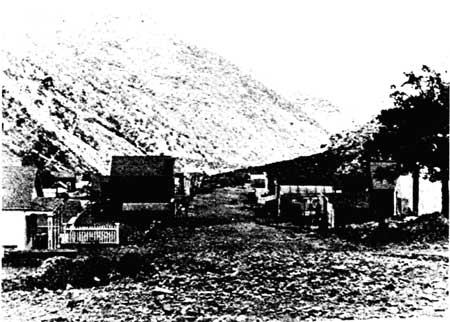
By November 1874 the population of Panamint City was close to 1,000. The main, mile-long, muddy, rutted street was lined with rubbish and tents, about fifty buildings, either frame or stone, and log or rock huts in which the hardy miners huddled for warmth. The town supported many business establishments and the usual number of saloons, all demanding exorbitant prices for goods. The Bank of Panamint was begun, a first indication of stability, and even a newspaper, the tri-weekly Panamint News printed its first issue on 26 November 1874. A cemetery was located a short distance up Sour Dough Canyon.
Senator Stewart soon made known his need for someone to export his ore and bring in machinery essential for the continuing productivity of his mills. Remi Nadeau, the French-Canadian involved in Cerro Gordo freighting, was the logical choice, but too expensive. A San Bernardino freighter was contacted, and he began hauling freight through Cajon Pass and across the Mojave Desert in October 1874, creating as a side effect a vast new business for his hometown. Realizing the profits that were daily being lost, Los Angeles teamsters entered the trade by early November, directing their teams past Indian Wells and on to Panamint. And not surprisingly, soon Remi Nadeau and his Cerro Gordo Freight Company joined in transporting the heavy flow of goods passing between Panamint City and Los Angeles. The latter truly began to share in the prosperity created by the Panamint boom, as lumber, grain, flour, and whiskey passed in large quantities to the growing camp full of thirsty men.
By December 1874, the height of Panamints career, the Surprise Valley Company operated six mines and employed 200 'miners. [45] In the middle of that month Jacobs's ten-stamp mill began production. Population of the camp was now between 1,500 and 2,000 men. A Frenchman, Edmond Leuba, deciding to visit the active town, left Los Angeles around December 1874. He constantly met people on the road going to and from Panamint, attesting to the thriving commercial activity between the two places. Unfortunately he arrived at the mouth of Surprise Canyon at nighttime and had difficulty avoiding the teamsters who were coming down the steep, narrow canyon road even at this time of day. This was a toll road, costing Leuba $3.00 for his two horses and a wagon. Three miles further east the ravine opened out and the lights from many fires were visible in the canyon. Mining blasts sounded every instant. He found a place for his horses in the shelter of a tent and lodging for himself in the dug-out cellar of a restaurant, which he shared with "a dozen figures looking more or less like candidates for the gallows." [46]
Next morning the Frenchman commented on the bright sun and intense heat of the canyon. Panamint camp, he saw, was "composed of about fifty huts made of logs, tents and little houses partly dug out of the rocks." [47] Work there progressed until January when the snow became too deep. At that time many of the miners left camp for warmer regions, and the population dwindled markedly.
|
| Illustration 6. Upper part of Panamint City, 1875. Photo courtesy of G. William Fiero, UNLV. |
Commenting on the quantity of saloons in the town, Leuba next proceeded on a guided tour of the Panamint mines, which he stated
have been very little worked as yet. The deepest shafts are not more than seventy-five feet below the surface and the tunnels showed very little development. But it is in these first workings that they have found the richest ore and that which is easiest to work. Only two mines, so far as I know, have produced good ore to a depth of five hundred to six hundred feet. There is no mill for the reduction of this ore as yet at Panamint. The richest ore is sent to San Francisco at a transportation cost of $80 to $100 a ton, while the second class ore is heaped up at the mouth of the shafts from which it is extracted, awaiting the time when it can be treated here. [48]
Leuba seemed to think the mines were daily diminishing in value, and the reduction processes becoming more and more difficult. He says this condition lasted over into the next year, when Panamint began losing people to Darwin, where lead in the deposits made reduction easier and less costly.
By the spring of 1875 full-scale production in the area was almost a reality, and toward the end of June 1875 the Surprise Valley Company's twenty-stamp mill was started up. Bullion was regularly shipped via the Cerro Gordo Freight Company's mule teams, and work for everyone was plentiful. The economic mainstays of the camp--the Wyoming and Hemlock mines--were producing heavily.
|
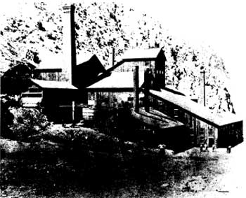
| Illustration 7. Jones's and Stewart's twenty-stamp mill and furnace in old Panamint City. Date unknown, but probably prior to 1877. Photo courtesy of DEVA NM. |
|
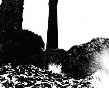
| Illustration 8. Ruins of old Panamint City smelter, date unknown. Photo courtesy of DEVA NM. |
As happens in boom towns, however, the halcyon days could not last, and by the end of 1875 the thriving era of Panamint was coming to a close. As Leuba had noticed, many miners were now heading toward Darwin and the New Coso Mining District, where it was warmer and prospects looked good for employment. The Panamint News even moved there early in November, becoming the Coso Mining News By the spring of 1876 the Wyoming and Hemlock mines were depleted.
This, in addition to other discouraging factors--no new discoveries in the area; the demonetization of silver; setbacks experienced by Jones and Stewart at their silver prospects in the Comstock lode, resulting in depletion of their financial reserves; and the impossibility of realizing a profit on refractory ores whose yield was not commensurate with their recovery cost--caused the Surprise Valley mill and mines to shut down in May 1877. Stories also circulated of "stock jobbing; of grafting and trouble among the grafters; of seizures by stockholders who were not mining men; of fortunes spent in building a mill where a smelter was needed; of consequent failure, disappointment, abandonment and complete depopulation of the once flourishing camp." [49]
h) Personalities
Though the rip-roaring early boom days of Panamint might have ended, the townsite and surrounding area still supported some interesting characters, both male and female. Men such as John P. Jones and William M. Stewart (founders of Panamint City), Jack Curran ("King of the Panamints"), Frank Kennedy ("The Duke of Wild Rose"), January Jones, Clarence Eddy ("The Poet Prospector"), Harry C. Porter ("Hermit of the Range"), Shorty Harris, and Chris Wicht ("Seldom Seen Slim") all made their contributions to the history of mining in the Panamint Range.
The women are not without their share of the limelight, too, however. Notable among them was Mrs. Mary A. Thompson, owner and operator of the Panamint lead mine in 1926. Mrs. Thompson had stirred up some local animosity by not allowing prospectors on certain sections that she considered part of her holdings. She was brought to court over this in Independence where she was convicted and given a suspended sentence. Her affairs did not improve, as seen by a later newspaper report that she was searching for her two children, ages 16 and 20, who, she claimed, had been spirited away by "the lawless element of Death Valley," consisting of "numerous bootleggers who ply their lawless trade far from the seeing eyes of the law." Despite their attempts to steal her mine because she had attempted single-handedly to drive them from the region, she did not intend to give in: "I will fight them until I get my children back and rid Death Valley of them." [50]
In the mid-1930s Mrs. Thompson was still in trouble. Convicted on ten counts of failing to pay wages to laborers, and facing 600 days in jail or a $1,200 fine, she was appealing her case to the superior court at Independence. It must have been quite an interesting court session when, during one afternoon's proceedings, Mrs. Thompson became hysterical and fainted, necessitating an adjournment of court for the day. [51]
A 1969 newspaper article mentions another woman living in the Panamint Range area. In 1935 Panamint Annie (Mary Elizabeth Madison) began her reign as "Queen of Death Valley." A truck driver on the New York to Chicago route, she quit that job and moved to Death Valley to live out her days. Residing in a shack at Beatty, Nevada, she spent her time prospecting and puttering around the junk piles at her home. She was still alive in 1969 at age 58. [52]
|
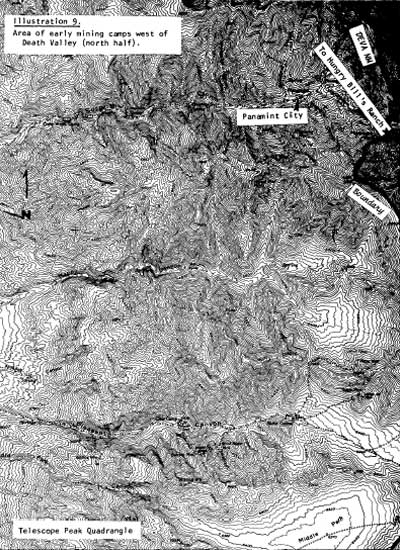
| Illustration 9. Area of early mining camps west of Death Valley (north half). |
|
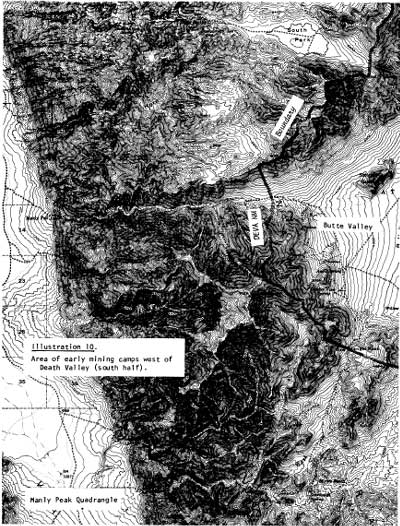
| Illustration 10. Area of early mining camps west of Death Valley (south half). |
i) Sites
The following is an attempt to locate and briefly identify some of the more important mines on the western slope of the Panamint Range. This list is by no means conclusive. An attempt has been made to mention these mines chronologically in order of discovery date. The similarity in name between many of these and other claims within the borders of Death Valley NM makes the task of sorting out relevant material a time-consuming one.
(1) Wonder (of the World?) Mine, Bob Stewart Lode, Mina Verde, and Sunnyside
These mines were among the principal claims filed on by the founders of Panamint City. On 21 June 1873 deeds were submitted by R.C. Jacobs transferring to someone referred to as "Paladio" one-eighth interests in the "Bob Stewart" lode and the Mina Verde, Wonder of the World, and Sunnyside mill sites and timber claims for $1,500 plus other considerations. [53]
In November of the same year notice appeared of the sate by "R.T. [B] Stewart" of a one-half interest in the Wonder Mine for $20,000 to "a San Francisco party by the name of Rains (probably E.P. Raines]." [54] The Wonder Mine was the original find of R.C. Jacobs.
In the Death Valley NM mining office a memo was found with the notation "Scotty's Claim locations." One of these is for a quartz claim "in the Furnace Mountain Mining District," lying on the "Death Valley slope about 40 miles west of Saratoga Springs." Date of discovery was 1 January 1905, the claim to be known as the Death Valley Wonder No. 16 Mine. This would appear to be east of the original Wonder Mine, possibly in the Butte Valley District. [55]
(2) Ino, Jim Davis, Hill Top, Alta, Comstock, Gold Star, World Beater, Big Bill, Elephant, Florence, Gem, General Lee, Gold Note, Golden Terry, Little Till, Lookout, Mammoth, and Summit Mines
By 1897 these claims in Pleasant Canyon were all owned by the South Park Development Company. [56]
(3) Mohawk Lode
This claim was originally filed for record on 18 July 1874 so that a shaft could be sunk and developed for whatever metal it contained. The lode was situated on a hill north of Surprise Canyon and Browns Camp, and was located by C.D. Robinson and R.D. Brown. A second location, filed for record on 8 October 1874 by William Welch and George Ranier[?], locates the claim about 500 feet above the Wonder Mine. [57]
4) Silver Queen Lode
Situated "about 500 yds. SW of the Bullion Lode," this claim was filed for record on 22 August 1874 by C.D. Robinson and John Mantel. [58]
(5) Homestake Lode Home Stake Lode
Two claims by this name appear on the records. The Homestake Lode "situated about 3/4 mile from the mouth of Woodpecker Canon on w. side of the gulch" was filed for record on 7 September 1874 by W.W.(N?) McAllister.
The Home Stake Lode "about 1/4 mile East of Hemlock [Mine]" was filed for record 22 September 1874 by John Kelle and J.B. Durr. [59]
(6) Sheba Lode
This was situated near the summit of the divide between Marvel Canyon and "Canon Gulch," about one-half mile from the divide separating Surprise and "Happy Valley" (Happy) canyons. It was filed for record 8 September 1874 by persons unknown. [60]
(7) Sun Set Mine
A relocation of the Star of Panamint, this claim was filed on 20 October 1874 by Henry Carbery(?), W. McCormick, and W. Scott. [61]
(8) Nellie M Mine
This mine, not to be confused with the Nellie Mine north of Hungry Bill's Ranch in Johnson Canyon, was filed for record on 2 November 1874 by John Small, R.M. McDonell, Charles W. Dale, and L. Rodepouch. It was situated in Woodpecker Canyon on the west side "opposite the third ravine." [62]
(9) Star of the West Mine
Filed for record on 1 December 1874, this mine, located by J.J. Gunn, John Gough, and John Williams, was situated on the west side of Woodpecker Canyon about 200 yards north of the Bismark Mine. [63]
(10) Christmas Lode
"This lode is situated on a hill whose ridge runs nearly eaqual and paralell with Sour Dough Canon, and about one mile from Surprise Valley, said lode is situated between the red formation nearly at the Base of said hill and runs for thirty along crest of the hill Fifteen hundred feet to a white formation at the Northerly line of the lode." It was filed for record 31 December 1874 and claimed by Wellington Hansel Jackel. [64] A North Extension of the Christmas Lode comprised 1,500 feet on the north side of Surprise Canyon filed for record 5 February 1875 by John Fruke, Arthur Bryle, Michael Bryle, and E.H. Boyd. [65]
(11) Christmas Gift Mine and Co. No 1 Mine
To add further confusion, this claim was filed for record on 3 January 1875 by Walter R. Maguire and R.J. McPhee. It was situated "about 300 feet more or less in a North by East direction from the Harrison boarding house. . . ." [66] The No. 1 Mine joined the east end of the Christmas Gift, and was located 5 July 1896 by John Casey, Charles McLeod, and John Curran. [67]
(12) Exchequer Lode
James Dolan, W.W. Kitten, and Thomas Sloan filed this claim about one mile west from the head of Woodpecker Canyon on 25 October 1874. [68]
(13) North Star Mine
Filed for record on 20 January 1875 by M.G. Fitzgerald, A. McGregor, D.J. Sweeny, and M. Holland, ". . . this Ledge to be known as the 'North Star' . . . is situated part on the East side of a ridge running into Narboe Canon & crossing the divide about 1,000 feet West of the Gipsy Bride ledge, between Surprise Valley and Narboe Canon and about 2-1/2 miles in a Northwest direction from the town of Panamint." [69]
(14) Argenta Lode
This claim was filed 27 April 1875, and was located in the center of the west fork of Silver (Sour Dough) Canyon. [70]
(15) Uncle Sam Lode
On 11 April 1880 John Lemoigne filed a claim on the Uncle Sam Lode, situated one mile north of the Torine Mine. [71] (This latter was located 3/4 mile south of the Gambetta Mine and one mile east of a spring in Happy Valley Canyon.) Another Uncle Sam Lode was recorded 17 December 1883 in the Union District about one mile East of the Barns Mill site. [72] In 1931 an application for a patent for an Uncle Sam Lode in the Slate Range Mining District appeared. [73]
(16) Magnet Mine
First mention found of this mine was an 1884 notice that this property in the Telescope Range, south of Panamint, owned by Spear and Thompson, was doing well, much development work having been performed in the past few months. [74] Another report of the mine in 1884 called the Magnet "the only mine in the district [Panamint District] which promises good returns." [75]
(17) Grand View Mine Anaconda Mine
This mine, located rather nebulously "2 miles in northerly direction from spring in Emigrant gulch and about 2 miles in southerly direction from Mineral Hill and about 5 miles in NW direction from Anvil Springs and just south of Buckeye Mine in Panamints," was discovered by W.M. Sturtevant and recorded 11 October 1888. [76] By September 1892 a Grand View Quartz Mine in the Panamint Mining District was owned by the Death Valley Mining Company. The location given of T21S, R45E, would seem to place the mine east of the Panamint City area and north of Gold Hill. [77] This is probably the same mining company owning the lodes in the Gold Hill area. The Death Valley Mining Company, represented by J.H. Cavanaugh, was listed as being delinquent with $23.96 in taxes in 1912. The properties concerned were Lot No. 62, the Anaconda Mine, and Lot No. 63, the Grand View Mine. [78]
In February 1917 the Anaconda Mine (20 acres) and the Grand View Mine (18 acres), owned by John W. Cavanaugh and the Death Valley Mining Company, were offered for sale by the Inyo County tax collector. [79] The two properties were still being advertised a month later. The least amount for which the properties could be purchased was $281.50. [80]
A note in the mining office at Death Valley National Monument stated that the "Anacada (Anaconda?)" quartz and Grand View quartz mines were located near Panamint City in Woodpecker Canyon, "a stones throw away" from the monument boundary. [81]
(18) Willow Spring Mine
This mine, recorded in 1896, was located three miles west of Panamint Toms stone corral. This probably refers to the stone structure up Pleasant Canyon. [82]
(19) Mountain Girl Mine
In 1930 this gold mine was situated at the head of Happy Canyon, about four miles south of the Panamint City townsite. [83]
(20) Black Rock Nos. 1 2 3 and 4
These quartz claims in the Panamint Mining District were deeded in 1922 by J. B. Oven to Mrs. C. Kennedy. [84]
(21) New York Idaho and Dolly Varden Mines
In 1898 a one-third interest in these claims was given by J.F. Ginser to Peter B. Donahoo for $10. [85]
(22) Republican Mine
A mine owned by George Montgomery and associates, it was working steadily and milling high-grade ore in the early 1900s. [86]
(23) Cooper and Mountain Boy Mines
Located near the base of Sentinel Peak, these were owned in the early 1900s by the Gold Crown Company, which intended building reduction works. Much high-grade ore was present. [87]
(24) Valley View Mine
This claim, recorded in 1896, was located on the west side of the Panamint Range, one mile south of Pleasant Canyon and 1-1/3 miles east of Post Office Spring. [88]
2. Gold Hill Mining District
a) History
Some confusion in researching Gold Hill results from the fact that two similarly-named regions existed in the vicinity of Death Valley. A very early Gold Hill Mining District was formed east of Death Valley in the 1860s by a certain Mr. Shaw, and accounts from this area, also referred to as Gold Mountain, appeared quite frequently for a time. The Gold Hill region within Death Valley National Monument is in its southwest corner, in the Panamint Mountain Range, at the northeast end of Butte Valley and north of Warm Spring. It did not see its first activity until around the 1870s. [89]
On 7 May 1875 a Certificate of Work on the Gold Hill No. 1 claim was filed, the work consisting only of an open cut.
It is doubtful that this claim was actually located on what is today known as Gold Hill, because an 1881 location notice for the Bullion Mine, "formerly known as Gold Hill No. 1, Richmond, and Victor Mine," filed by Robert Mitchell, describes it as being situated "at or near head of Quartz Canyon, about 2-1/2 miles from Town of Panamint." [90]
The first positive documented evidence of mining activity occurring on the Gold Hill just north of Butte Valley consists of several site locations filed by Messrs. R.B. Taylor (president of the Citizen's Bank at South Riverside), W.C. Morton, and R.W. Beckerton of South Riverside, San Bernardino County, California. [91] These early claims were filed within the Cleaveland Mining District, which at some early date encompassed, or was thought to, some of these mining properties. No information on the boundaries or establishment dates of this district were found in the Inyo County Courthouse.
|
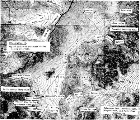
| Illustration 11. Map of Gold Hill and Butte Valley mining districts. |
The ten mines these men located probably included some of the following:
(1) Taylor Quartz Mine and Mill Site
The Taylor Quartz Mine (20.54 acres), situated in the Cleaveland Mining District one hundred yards west of the Treasure Mine, was located first on 11 May 1889 and relocated on 28 August 1890, probably to change the mining district name and at the same time affirm ownership by the Death Valley Mining Company. It was recorded in the district 11 May 1889 and 1 September 1890, and was filed with the county recorder on 6 June 1889. Over $100 worth of assessment work was carried out on the Taylor Mine at Gold Hill, then said to be located in the Panamint Mining District, for the year 1890. The mine was subsequently patented on 21 December 1893. [92]
The directions given for the associated Taylor Mill site (4.42 acres) variously describe it as being located in Indian Toms (also referred to as Panamint Tom's) Canyon, four miles easterly from Gold Hill, and about two or two and one-half miles east from Butte Valley. Water from the mill site, to be used for mining, milling, and domestic purposes, was to be conveyed partly by six-inch-diameter iron pipes and partly by a ditch two feet wide and one foot deep. The mill site, located on 28 August 1890 by the Death Valley Mining Company, and recorded 1 September 1890, was patented on 21 December 1893. [93]
(2) Gold Hill Quartz Mine and Mill Site
The Gold Hill Quartz Mine (19.66 acres) was first located on 30 April 1889 by Morton, Beckerton, and Taylor. Said to be situated in the Cleaveland Mining District, five miles west of Death Valley and about 2-1/2 miles east of the "Chief Mine, it was recorded in Inyo County on 6 June 1889. The mine was relocated in the Panamint Mining District on 28 August 1890 by the Death Valley Mining Company, with the following note appended to its papers:
The above notice was recorded through error in what was thought to be Cleaveland Mining District but upon the 30th day April 1889 and [sic] rerecorded in Panamint Mining District Inyo County Cal. upon day and year as above stated.
The mine location was given as on the north slope of Gold Hill, about two miles east of the Chief Mine and about 500 yards east of the Treasure Mine. Over $100 worth of assessment work was performed on the Gold Hill Mine for the year 1890, and it was subsequently patented on 1 May 1893. [94]
The associated five-acre mill site plus water recorded in the Cleaveland Mining District on 30 April 1889 were to be used by Morton, Beckerton, and Taylor in connection with mining, milling, and domestic purposes. Both mill site and water claim were said to be situated in Marvel Canyon, about five mites west of Death Valley. They were recorded in the Inyo County recorder's office on 6 or 7 June 1889. [95]
(3) Death Valley Mine
The original Death Valley claim in the Panamint Mining District, "situated 1/2 mile south of where the Panamint and Death Valley Trail crosses the summit and on the Death Valley side of the ridge," was discovered by John Lemoigne and others on 6 June 1879. The next possible mention of the claim occurs in the form of a location notice for a Death Valley Mine, situated in the Cleaveland Mining District, "about 1-1/4 miles north of Chief Mine." It was located 13 May 1889 by Taylor and Beckerton and was recorded on 6 June 1889. The claim was evidently relocated and rerecorded on 14 November 1890 by the Death Valley Mining Company, who described the mine as being "Situated 1-1/4 mile NE of Chief Mine and about 2 mites North of Death Valley Mining Company's Boarding House at Gold Hill and adjoins the Beckerton Mine to which it runs parallel in Panamint Mining District." A third relocation notice by the Death Valley Mining Company on 9 August 1893 located the claim "about 1-1/4 miles NE of 'Ibex' Mine and about one mile north of Death Valley Company's Boarding House." Possibly the Ibex Mine is a later relocation of the Chief Mine, about which the writer could find no mention in the county courthouse records. [96]
(4) Treasure Quartz Mine
This claim (20.39 acres) was first located on 30 April 1889 by Beckerton, Morton, and Taylor. Said to be situated in the Cleaveland Mining District, two miles northwest of the "Chief Mine," it was recorded in the county records on 6 June 1889. According to the survey plat of the claim, the mine was relocated on 28 August 1890 and rerecorded 1 September 1890. At the request of R.B. Taylor, president of the Death Valley Mining Company, for an inspection of the claim, the Panamint Mining District recorder found that over $100 worth of assessment work had been accomplished at the mine for 1890. It was patented on 20 March 1893. [97]
(5) No 1 (No One) Mine
This claim, situated in the Cleaveland Mining District, 1,000 feet west of the Taylor Mine and joining the Gold Hill Mine on the east, was located 10 May 1889 by Morton, Beckerton, and Taylor and recorded with the county on 6 June 1889. Over $100 worth of assessment work was performed on the mine in 1890. Whether or not this mine is a relocation of the Gold Hill No. 1 located in 1875 is conjectural. [98]
(6) Silver Reef (Reefe) Mine
This claim was first recorded on 6 June 1889 in the Cleaveland Mining District, having been located on 17 May 1889 by Morton, Taylor, and Beckerton. It was relocated and refiled on 11 December 1890 by the Death Valley Mining Company. In the relocation notice its position is given as "1/2 mile west from Death Valley Mining Company's Boarding House at Gold Hill and is crossed by trail leading from Gold Hill to Panamint in Panamint Mining District." [99]
(7) Ibex Mine (formerly Chief Mine?)
This claim, situated "alongside trail leading from Panamint to Gold Hill about one mile west from Death Valley Mining Company's Boarding House at Gold Hill," in the Panamint Mining District, was not located and filed on until December 1890 by R.W. Beckerton, so it was probably not one of the original ten Gold Hill properties. [100]
(8) May Mine
This claim was located on 7 May 1889 by Morton, Beckerton, and Taylor, and recorded with the county on 6 June 1889 in the Cleaveland Mining District 14 mile southwest of the Chief Mine. Rerecorded and refiled on 11 December 1890 by the Death Valley Mining Company, its location was further stated as "3/4 mile west from Death Valley Mining Co's Boarding House being crossed by trait leading from Gold Hill to Panamint and is on west slope of Gold Hill" in the Panamint Mining District. [101]
(9) Breyfogle Mine
This claim "west of trail going to Panamint and about 600' south of Ibex Mine," was located in the Panamint Mining District on 9 August 1893, and so was not one of the original, ten claims in the area. It was a relocation of the "Bryfogle [sic] Mine' 600' south of Ibex Mine to north of Gold Hill trait which it crosses." A man by the name of S. Smith relocated the mine again as the "Bryfogle Quartz Mining Claim" on 1 January 1896. The mine was described as a lode of quartz-bearing copper adjoining the Nutmeg Mine "on SW side tine and is south of Panamint Trail about 1000 feet and North West of Gold Hill about 3/4 of mile. Is on low divide between Panamint Mts. and Gold Hill." A second notice of relocation in 1896 gave its spelling as "Breyfogle" again and stated it was a relocation of the Breyfogle Mine formerly claimed by Henry Gage. [102]
(10) Oro Grande Mine
The first mention found of this claim was a 9 August 1893 relocation notice filed by Henry T. Gage. The location given was "on south slope of Gold Hill about 2000' west from Taylor patented mine and about 2000' SW from Treasure patented mine in Panamint Mining District." Four years earlier, on 27 May 1889, a Notice of Appropriation for the waters of Oro Grande Springs, "situated 3 mites west of Chief Mine and about 8 miles north of Anvil Spring in NW corner of Butte Valley in Butte Valley Mng. District," was filed by Frank Winters and Stephen Arnold. The waters, to be used for mining, milling, and domestic purposes, were to be developed by ditches, pipes, and flumes. [103]
(11) Beckerton Mine
This mine was located 14 May 1889 by Morton, Beckerton, and Taylor, and recorded with the county on 6 June 1889. It was situated in the Cleaveland Mining District, 1-1/4 miles northeast of the Chief Mine and 1,000 feet north of the Death Valley Mine. [104]
(12) Georgia Mine
This claim was located 19 May 1889 and recorded on 6 June 1889. Also in the Cleaveland Mining District, it was situated 1-1/2 mites north of the Chief Mine and was supposedly a northern extension of the Breyfogle Mine. [105] If so, there must have been an earlier recordation of this latter mine than the one found by this writer.
According to the Inyo Independent the mines in the Gold Hill region were first discovered by an Indian who imparted the information to a man named Carter who immediately told R.B. Taylor, C.M. Tomlin of Riverside, and a Mr. Nolan about them. These four men went and examined the ledges, located several claims, shipped in provisions, and hired two young men, Stephen Arnold and Frank Withers, to work their claims. As incentive they gave the boys some nearby properties, and then returned home. Although word of the find slowly leaked out after the boys returned to the coast, causing others to take an interest in the area, no one knew much about the ore, which was rumored to range from $80 to $250 per ton. It was also said that Taylor was contemplating opening a road into the property. [106]
Papers incorporating the Death Valley Mining Company "to do a general mining business" for fifty years were filed in the office of the Secretary of State on 13 July 1889. The principal place of business was South Riverside, San Bernardino County, California, and the following were listed as directors: R.B. Taylor (S. Riverside), W.C. Morton (San Bernardino City), R.W. Beckerton (S. Riverside), H.R. Woodall (S. Riverside), and J.H. Taylor (S. Riverside). The corporation had one million dollars of capital stock divided into 10,000 shares worth $100 each, though the amount of capital stock actually subscribed was $60,000, raised by the five directors plus James Taylor, Sr., and W.A. Hayt. [107] Soon after its organization the company obtained U.S. patents for at least five of its mines: Treasure (20 March 1893), Gold Hill (1 May 1893), Taylor (21 December 1893), Grand View, and Anaconda.
Further news of the new camp was available a couple of months later, when it was reported that the "ores are rich in gold, the veins strong and well defined, and as far as opened have every indication of permanency." [108] Prospects appeared so encouraging and Taylor and his associates had accomplished enough labor that reduction works seemed warranted. Other miners had also moved into the area and owned promising properties. In these early days at Gold Hill it is probable that Indian labor was utilized at the mines and that they were taking the ore three miles west to Arrastre Spring to process it.
By 1896 the mines at Gold Hill were still being worked. A Richard Decker was evidently running the operations for R.B. Taylor, and the veins still looked promising. [109] The mines produced so well, in fact, that by the fall of 1897 R.B. Taylor and his business partners James P. Mathes of Corona and W.A. Hayt of Riverside were able to sell a group of five of their free-milling mines to an English syndicate for $105,000. The Independent reported that "This is the most important sate of Inyo mining property that has yet transpired in the 'southeastern' districts. . . ." [110] The mines involved were the Treasure, Taylor, Gold Hill, Grand View, and Anaconda, located "about seven miles southeast from Panamint and ten miles northeast from the head [mouth?] of Pleasant Valley; are at the north end of Butte Valley and near the head of Anvil Canyon. . . ." Dumps In the Gold Hill area had already accumulated 500 to 600 tons of ore, not free-milling as had been rumored, but impregnated with copper and iron. Water could be piped to the mines from Arrastre Spring and of course lumber was available on the higher mountains. The only major problem hindering development revolved, as usual, around lack of easy access to mine and market. It was suggested that a road be cut down Butte Valley past Anvil Spring to connect with the old "Coleman road," probably meaning Wingate Pass. [111]
Taylor evidently had negotiated a further sale of Gold Hill property by 1899, for reports were found that he then sold the Gold Hill mine "known as the Death Valley mining property" to New Yorkers for $207,000. They were supposedly going to spend another $100,000 erecting a forty-stamp mill, bringing in other machinery, and in making needed improvements. The sale was made because the owners (Taylor and Beckerton) did not have sufficient capital to fully develop the mine. [112] By the next year the Death Valley Mining Company had reportedly been doing extensive work in opening up its properties in order to fully determine their extent and richness. A sixteen-foot vein of solid auriferous ore had been exposed, and some sort of reduction works were needed. An Inyo newspaper reported that
This section in the near future will become an important factor in the gold production of the State. The veins are large, the nature of the ground admitting of extraction at a minimum expense with water and fuel handy. [113]
The year 1900 also saw the entrance of a new mining company into the Gold Hill region as the Gold Hill Mining Company, a wealthy New York-based firm, announced intentions to begin activities there around the first of March. [114]
Future transactions concerning the Gold Hill Mine are somewhat confusing. In April 1900 the Independent reported that this claim had been resold on the seventeenth "to Mr. Taylor, a banker of South Riverside, for $207,000." [115] In May an article stated that the Gold Hill "lead mines" had been sold to some southern California capitalists (possibly including Mr. Taylor) who were envisioning commencing operations there immediately. [116] By 1904 the Gold Hill Mining and Development Company was in some financial difficulty, appearing on the Delinquent Tax List of Inyo County for the year 1903 because of taxes due on the Taylor Mine and Mill Site (Lots 39A and B, comprising twenty-five acres), the Gold Hill Mine (Lot 37, twenty acres), and the Treasure Mine (Lot 38, twenty acres). The amount assessed the company was $39.46. An assessment of $8.10 for the very same property was made against an L.A. Norveil, who apparently held a mortgage on-these properties, possibly as executor of the W.H. Greenleaf Estate that is mentioned in the assessment. [117] Suffice to say, ownership of the claims had become fairly involved by this time.
No detailed mention of the mines in this area over the next few years came to light. In 1906 two other persons, Ralph Williams and Bob Murphy, were mentioned in connection with mining properties on Gold Hill, and both reports indicate that satisfactory progress was still being made in the area. [118] By 1911 the Delinquent Tax-List of Inyo County listed John W. Cavanaugh as being assessed $25.01 in state and county taxes for the Anaconda Mine (Lot No. 62 Mineral Survey, twenty acres) and the Grand View Mine (Lot No. 63 Mineral Survey, twenty acres). The Gold Hill Mining and Development Company, of which Cavanaugh was the secretary, was assessed $25.51 in overdue state and county taxes again for the Taylor Mine and Mill Site and the Gold Hill and Treasure mines. [119]
In February 1917 these three mining locations are reported as having been sold to the state on 28 June 1904 for 1903 taxes (Deed No. 72). Since no effort had been made in the past five years by the Gold Hill Mining and Development Company to redeem the properties, they were being offered for sale. The total assessment levied, including overdue state and county taxes for 1903, penalties on delinquency and costs, total interest at 7% per year from 1 July 1904, plus smaller miscellaneous costs, fixed the price asked at at leas? $82.60. [120]
The Anaconda and Grand View mines had already been sold to the state on 25 June 1901 for non-payment of taxes during 1900. Cavanaugh and the Death Valley Mining Company were being assessed a total of $149.50 in back taxes, $27.19 in penalties, and $84.99 in total interest charges. This plus miscellaneous costs brought the minimum purchase price of the two properties to $281.50. The minimum purchase price of the Taylor, Gold Hill, and Treasure mines, still up for sale, had fallen slightly, to $799. [121]
The 1932 Journal of Mines and Geology presents a capsulized summary of the current workings at the Gold Hill Mine. It comprised four patented claims on the east slope of the Panamints at an elevation of 5,400 feet. The owners at that time were Fred W. Gray of Los Angeles and William Hyder of Trona, California, but the property was under lease at the time to Miss Louise Grantham, also of Los Angeles. Gray and Hyder said the property, patented in 1894, had been deeded to the state, from whom they bought it in 1919. The owners claimed there were three tunnels on the property (the longest, 300 feet) from which were coming "lead carbonates and galena, with gold and silver as associate minerals." Rumor was that Miss Grantham intended to construct a mill to process the ore at Warm Springs, about four miles southeast of Gold Hill. [122] (More information on this mill will be found in the Warm Spring section of this report.) A 1948 USGS Bulletin stated that the Gold Hill Mine, producing gold, silver, and lead, was owned (or operated) by Messrs. James and Dodson of Lone Pine, California, in 1940. [123]
In 1951 the Journal mentions several Gold Hill area mines: 1) Golden Eagle Group of six claims on the southwest slope of Gold Hill (T22S, R46E, MDM). These were owned by Louise Grantham and development consisted of a 40-foot tunnel with 10-foot winze. High-grade gold, silver, and copper was present, but in this year no activity was recorded; [124] 2) Panamint Treasure Mine (Taylor, Treasure, Gold Hill) on the southeast slope of Gold Hill. This ninety-acre holding comprised the three patented claims above plus three unpatented fraction claims and a mill site at Arrastre Spring, all owned by Louise Grantham and associates of Ontario, California. A 50-foot adit and a 100-foot adit were present on the Taylor Claim with ore assaying on the average 1.02 ozs. gold, 9.4 ozs. silver, and 3.2% lead. From 1931 to 1941, 150 tons of ore were shipped and 300 tons milled, but the property was now idle; [125] 3) Red Eagle Group (Blue Bird Group) on the southwest slope of Gold Hill comprised six unpatented claims also owned by Louise Grantham. Workings on the now idle property consisted of a 50-foot shaft, an open cut, and a 100-foot adit. Assays on the ore returned lead, silver, and smaller amounts of gold. [126]
A partial list of mining claim locations within the monument in 1960 reveals that the Gold Hill area contained at least twelve unpatented and three patented gold, silver, and lead claims. [127] The files in the Death Valley National Monument mining office offer a more complete look at the more recent claims and the present mining situation in the Gold Hill area:
In 1975 Gold Hill proper contained fifteen claims owned by Ralph Harris of Victor Material Co. of Victorville, California, and his son Harold: the Treasure Quartz Mine (patented), Taylor Quartz Mine (patented), and Gold Hill Quartz Mine (patented); Panamint Treasure Fractions #1, #2, and #3 (located 20 February 1937); Golden Eagle #1, #2, and #3 (located 30 July 1935); Red Eagle #1, #2, and #3 (located 31 July 1935); and Bullet #2 and #3 (located 30 April 1942), and #4 (located 19 September 1956). All claims were located for gold, except the Red Eagle Group, which was located for lead and silver. The patented Taylor Mill site, although associated with mining at Gold Hill, is located at Arrastre Spring about four miles west. The Red Eagle Mill site (located either 19 or 24 April 1946) is located at Six Springs, two miles northeast of Arrastre Spring in Six Spring Canyon.
b) Present Status
The claims listed earlier are all included within the Panamint Treasure Claim Group and lie in the vicinity of Gold Hill, north of Warm Spring Canyon, in protracted Sections 14, 23, and 24, T22S, R46E, MDB and MDM.
(1) Gold Hill Area
The Gold Hill area is reached by a rough dirt road taking off in a northerly direction from the Butte Valley Road about 2-1/2 miles west of its intersection with the Warm Spring Canyon Road. About 1/4 mile north on this road some ruts veer to the west, leading about another 2-1/2 miles up a steep four-wheel-drive slope to Arrastre Spring. Proceeding north on the main road, however, for about another two miles leads to a fork in the road, the northernmost route leading up over a hill to a site marked "Prospect" on the USGS Bennetts Well quadrangle. This area is on the Bullet claim, and according to on-site observations made by Rich Ginkus in July 1974, the site contains a 30-foot shaft fifty feet south of the road approximately 1,500 feet from the road's end where remains of two old wooden buildings were found along with a rusting gas or diesel generator. A nearby adit about 100 feet long contained mine rails. Three other smaller cuts are also present. It did not appear that any recent work had been done in the area. [128]
The southern fork leads to an area marked "Mine" (Red Eagle Claim) on the USGS quadrangle. This road has been extended since the area was officially mapped, so that instead of ending in the wash below the prospect area, it switchbacks up the side of the hilt, finally trending on east toward the summit of the saddle south of Gold Hill. The mine workings viewed by this writer along this newer extension of the road appear to be exploratory in nature, consisting of small adits and open cuts along the sides of three gullies, with no structures or mining artifacts in association.
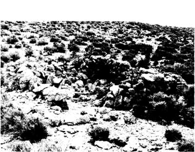
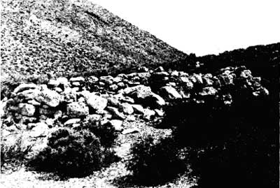
The writer followed along the road to about the 5,000-foot elevation point on the saddle below (south of) Gold Hill. Here were found the remains of a small stone structure, whose walls measured approximately twelve by fifteen feet. Some wood scraps, fragments of metal cans, and pieces of murky white glass lie in and around the ruins. About thirty-seven paces northeast is a small beehive-shaped mound of stones one to two feet high--probably a claim marker. This structure was the only item of historical interest found during this exploration of Gold Hill.
|
| Illustration 12. Ruins of small stone structure on saddle south of Gold Hill, view from northwest. Photo by Linda W. Greene, 1978. |
|
| Illustration 13. View of stone structure from southwest. Photo by Linda W. Greene, 1978 |
(2) Panamint Treasure Claim Group
Investigation of the Panamint Treasure Fraction #1-#3 lode claims, made a month later, proved much more productive. The best way to reach the area (other than by helicopter) is on foot via a burro trail leading west from the Sunset Mine, which is located at the end of a road veering west from the stockpile of the Montgomery (Panamint) Talc Mine. After an exhausting uphill climb of two hours duration the site was found on the southeast slope of a ridge southeast of Gold Hill.
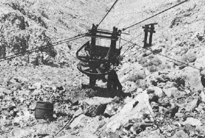
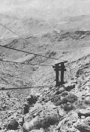
The complex consists actually of two distinct sites. The most easterly one contains two adits--an upper 226-foot tunnel that was worked and a lower one used as living quarters. The second site, around west on the south slope of the same ridge, contains a third adit and a tent site. An extensive tramway system still exists at the first location, complete with cable and supports This was used to transport ore from these main workings down the mountainside 1-1/2 miles probably to the wash just north of the ridge that lies northwest of the Warm Spring Canyon-Butte Valley roads junction. Time did not permit driving up this wash to see if any structures remained at the bottom of the tramway.
|
| Illustration 14. View toward west-northwest of Panamint Treasure Claim. Photo by Linda W. Greene, 1978. |
|
| Illustration 15. Model A frame possibly supporting air compressor for Panamint Treasure adit. Photo by Linda W. Greene, 1978. |
Reportedly, work on the lodes here stopped in 1941, a date that corresponds closely with the cultural remains left on site, of which there are many. Examining the property is difficult because of the steepness of the slope and the fact that it is covered with loose rock from mining activity. Descent to the lower workings is possible only by holding on to the tramway cable.
In front of the upper adit is a Model A frame containing a Phillips 66 battery, which might have functioned as an air compressor. A pipe with a gate valve leads from here to a nearby adit. Various debris (tin cans, rubber hosing, nails, hand drills, a windlass, an axe handle, and drill stems) is scattered over the slope. In the upper adit, whose main tunnel branches off in about seven different directions, creating a fairly large open central area, were many items of interpretive interest. Just inside the entrance on the floor is an almost-full box of bits and some drills (labelled "Timken Roller Bearing Co., Mt. Vernon, O."). A large Fairbanks scale on wheels stands nearby, all its weights still in place. Also on the floor near the entrance are an adze handle, coiled rubber hosing, and a small rusted oil can. In the exploratory tunnel furthest west are two picks leaning against the wall. The tunnel at this point was being excavated upwards for a height of about six feet, and the entire excavation was filled with crickets. Nearby are the remains of a dynamite box and a burlap specimen bag.
As stated earlier, several exploratory tunnels branch off from the main one, but some were backfilled or went in only a few feet. On the south side of the main tunnel is a stoped-out area below a short cut-off bank. An ore cart built from half of a steel drum placed on wheels was pulled by a cable up short wooden tracks to the main tunnel level. Pieces of rope, big sheets of burlap, and blanket remains are scattered around. On one of the latter is imprinted: "Plummer Bag Mfg. Co., Bags, Tarpaulins, & Tents, San Pedro & L.A., 108#. An old shoe, made in Taiwan, lies on the floor. Atlas powder box fragments and fuses are also found.
|
| Illustration 16. Adit to Panamint Treasure Mine to right, storage pit to left. Photo by Linda W. Greene, 1978. |
|
| Illustration 17. Adit used as living quarters, Panamint Treasure Mine. Photo by Linda W. Greene, 1978. |
Near a shallow pit just outside the tunnel entrance is a dugout storage area. Scraps of the Los Angeles Examiner, dated in April (probably 1940 or 1941 judging from the news content), and some canvas bags (sample sacks?), one with a drawstring, were found here. Further searching revealed four dry-cell batteries fastened together, some waxed paper from dynamite boxes, and the head of a sledgehammer.
Below this first tunnel is a stone wall, undoubtedly shoring up the entrance and providing a working platform area. The next tunnel downhill was definitely used as living quarters. A stovepipe projects from the entrance, which has a wood frame opening to which a canvas door is attached. In front of the door were found soldered tin cans and Mason jars. Inside the tunnel are a wealth of household goods: Alber's Flapjack Flour cases, Fluffo vegetable shortening (4 lbs./49¢); a 1941 Saturday Evening Post a dime western magazine; a Los Angeles Times dated 15 December 1940; a five-gallon oil can; a shovel; another Mason jar with vertical ridges encircling it; a saw; a cooking pan; a wall shelf fashioned from an explosives box; a coffee can full of pinto beans; a can of Diamond A cut green beans; a 24-1/2 lb. A-1 flour sack made into a pillow covering; two sacks of flour; a spoon; a skillet; strips of jerky in a bottle; two pie tins; a small square pie pan; two small homemade stools; a four-legged table; and two metal bunks, one with a feather pillow. A cardboard box was found addressed to "K.H. Grantham, Wilmington, Ohio." Nearby was a postcard addressed to "Fritz" from "Mother and Dad Gibson." Outside the entrance are a small warming oven with shelves, a homemade pitcher, a milk can with a wire handle, the remains of a water bag, gear parts, and an electric line fastened to the rocks above the door.
|
| Illustration 18. Metal tramway terminus, Panamint Treasure Mine. Photo by Linda W. Greene, 1978. |
|
| Illustration 19. View south down slope along route of tramway cable. Photo by Linda W. Greene, 1978. |
A metal terminus for the cable tramway is located outside and a little below the tunnel entrance. Lying just west of the terminus, against the rocks are some spare parts and wooden ties, possibly an equipment storage area. The cable tramway operated like a ski lift. Six supports for it are left, one of which is metal, the rest wood. Two buckets lie on the ground under the cable. Visible from this point across the valley to the east, below the trail by which the mine is reached, is another adit, but work here does not appear very extensive.
Farther down the hill and around the slope to the west, is another adit with what appears to be an early tent site in front of it. A rock wall has been built to shore up the cleared space, and timbers are strewn about. Some legs from cots remain. Also found were square-headed nails, a plastic button, china fragments, and purple glass. A large white glass fragment from an apothecary bottle was also found. Inside the adit were boards with pegs that were hung on the wall to store clothes, etc. Two metal bunks and a shovel were also present. On the dump down the hillside in front of the tent site were tin cans, screen fragments, and other debris. Tent stakes were driven into the ground on top of the stone retaining wall.
On top of the ridge above these sites is a claim marker in a cairn: "Panamint Treasure Fraction #1, Aug. 10, 1976, east end center." Also found were some old wooden stakes in cairns with markings that appeared to be "WBV, 8 Bill." Near these are three prospect holes, with a shovel and a horseshoe on a nearby rock. North and east of the mine workings is a marker on the ridge up which the trail came from the Panamint Mine. It consists of a metal cross-shaped plate imbedded in a rock and affixed with melted metal.
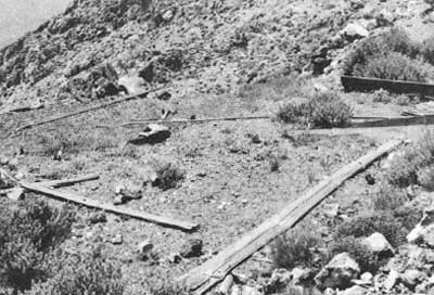
|
| Illustration 20. Tent site, view to southwest, Panamint Treasure Mine. Photo by Linda W. Greene, 1978. |
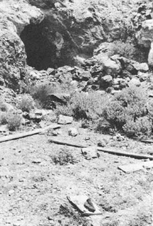
|
| Illustration 21. Adit at northeast corner of tent site, used as living quarters. Photo by Linda W. Greene, 1978. |
c) Evaluation and Recommendations
(1) Gold Hill Area
The Gold Hill Mining District is one of the oldest mining areas within the boundaries of Death Valley National Monument, with prospecting and mining work dating from at least the 1870s. Documentary data regarding specifics on the district is scarce, however, not providing much more than a broad overview of mining activity. Most of the workings that are visible now in the areas marked "Prospect" and "Mine" on the USGS quads date from the 1930s, 1940s, and 1950s, and have no historical significance in themselves. The stone ruins on top of the saddle south of Gold Hill could well be the structure labelled "Iron Cabin" and located in the extreme northwest corner of the claim on the 1891 survey plat of the Treasure Quartz Mine. Whether the name refers to construction materials used on the cabin (corrugated iron), or to its use possibly as a blacksmith shop, is unclear. It appears to have been situated alongside a trail, shown on the plat, cutting across the claim from east to west. The only other structure mentioned in the documentary data is the Death Valley Mining Company's boarding house, but its location appears to have been further west and north of this area. These stone foundations are interesting but do not warrant restoration or stabilization. Nor should they be willfully destroyed, since they are probably part of early Death Valley mining history. A policy of benign neglect is recommended.
(2) Panamint Treasure Mine
This property possesses educational potential and historical significance due to the presence of workings dating from a turn-of-the-century tent site with associated dump up through a mining operation of the 1930s and 1940s. Their further study by historians and historical archeologists relative to the lifestyles and technological processes common to small, remote desert mining operations of the late 1800s and early 1900s is recommended. Any personal items found in the adit near the cable tramway or in association with the earlier site around the corner of the ridge have the potential to yield information pertinent to behavioral patterns of miners from the 1890s through the 1940s, providing data on eating habits, amusements available (reading matter, etc.), type of furniture used, and so forth. The mining-related objects found in the upper adit are scientifically significant because they can contribute to an understanding of the technological processes used on a small desert claim. Many of the houseware and machinery items are makeshift, fashioned from everyday materials at hand, and thus are instrumental in showing the adaptations miners had to make because of their distance from supply sources.
Rarely in the monument does a situation such as this exist where the residents of an area have left the premises virtually intact and nothing has been vandalized or stolen. Even at Harrisburg, where the living quarters are intact, there is no such complete abandonment of mining equipment. Because the Gold Hill Mining District in which this site is located was one of the earliest commercially-operated areas within the national monument, and due to this particular site's long history, excellent research potential, and the obvious assets of being able to use this data for comparative purposes, the site is determined to be of local significance and eligible for nomination to the National Register of Historic Places.
Some uncertainty exists as to whether the aerial tramway and its associated adits are located on the Taylor Quartz Mine site, which is patented, or on the Panamint Treasure Fraction #1 to #3 claim, which is not. If these structures are on unpatented land and the claims are found to be invalid, every effort should be made to preserve the materials on site. Any interpretive effort here would be impractical because of the site's inaccessibility, but selected artifacts could be recorded and then removed to the monument museum collections for study and interpretive use. If the site is on patented property and is not added to the National Register, it is suggested that attempts be made to acquire significant items from the owner after documenting their location and photographing them in situ. If the owner is unwilling to donate or sell them to the park, attempts should at least be made to thoroughly inventory and photograph all artifacts on the site as well as to map the area and designate the relationships of the various components of the site to each other.
d) Related Sites
(1) Arrastre Spring
(a) History
Documentation on early activity at Arrastre Spring is practically nonexistent. A swift perusal of the Index to Land, Water and Mining Claims of Inyo County turned up notice of a filing on an "Erastra Spgs." involving a mill site of five acres, by Messrs. William Bradley, James Bradley, A.F. Brown, and W. Morrison on 25 January 1883, but the subject property was said to be located "near head of Cane Canon." [129] Since no canyon by this name appears in the vicinity of Gold Hill, it would be premature to say that the two sites were the same.
By the 1890s, however, Arrastre Spring was the scene of some activity, for Indians working in the gold mines at Gold Hill were reportedly carrying the ore by burros the 2-1/2 to 3 miles to the arrastra at the spring for reduction. [130] When Louise Grantham and associates took over ownership of the Taylor, Treasure, and Gold Hill mining claims on Gold Hill, included was the patented Taylor Mill site at Arrastre Spring.
(b) Present Status
The spring is reached via a steep, rough road branching to the northwest one-quarter of a mile north of the junction of the Gold Hill and Butte Valley roads. This road ends on a slope below the spring, necessitating a walk of about one-half mile in order to reach the willow grove in which the spring is located. One of the notable aspects of this site is the vast number of prehistoric petroglyphs, numbering in the hundreds, on boulders around the spring. Many of these abstract designs are only about 2-1/2 to 3 inches high.
The remains of the arrastra are located northwest of the spring above a clump of dead willows and behind a large willow thicket that covers many of the remaining rocks. One dragstone and a portion of the arrastra walls are visible. Two holes have been drilled in the dragstone, eighteen inches apart., and fragments of wood are still visible in both of them. The diameter of the arrastra is about six feet. Nine feet southwest of the arrastra remains is a small depression possibly associated with the ore processing in some way. Somewhere in the general vicinity of the spring is the patented Taylor Mill site, although there is evidently some confusion as to its exact location. According to Mineral Survey 3097B, the mill site is located on the monument boundary as shown on the NPS Land Status Map 44 and not at Arrastre Spring. According to the owners, Ralph Harris and Louise Grantham, however, it is definitely at the spring site.
Other than the remains of the arrastra, no artifactual remnants were found in the vicinity except for one metal kerosene can. In the wash below the spring and arrastra are some pieces of timber and metal debris.
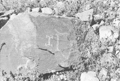
|
| Illustration 22. Petroglyphs along trail on way to Arrastre Spring. Photo by Linda W. Greene, 1978. |
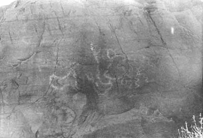
|
| Illustration 23. Petroglyphs on rock wall near Arrastre Spring. Photo by Linda W. Greene, 1978. |
|
| Illustration 24. Remaining wall of arrastra and dragstone, rapidly being overgrown by thicket surrounding Arrastre Spring. Photo by Linda W. Greene, 1978. |
|
| Illustration 25. Close-up view of arrastra wall. Note floor has completely gone to seed. Photo by Linda W. Greene, 1978. |
(c) Evaluation and Recommendations
The historical interest generated by Arrastre Spring hinges mainly on its relationship to the mining activity performed at Gold Hill. It is probable that during the early years of exploration work there, local Indians were employed to help at the mines, and in the process transported the free-milling ore to Arrastre Spring for reduction. The Treasure, Taylor, Gold Hilt, Grand View, and Anaconda mines were all reputed to be free milling in 1897. [131] Exactly how long a period of activity might have been involved here is unknown, although newspaper reports tend to indicate that by the early 1900s enough mining was being pursued that one arrastra simply would not suffice to process all the ore being found. On the other hand, no other mill or reduction plant is mentioned in the area until Mrs. Grantham built the ore-processing plant at Warm Spring around 1937 to treat ore from her Gold Hill mine. Whether any Gold Hill ore was treated at the Butte Valley Stamp Mill around 1917 or in the mill near Willow Spring is conjectural.
The arrastra at Arrastre Spring should be left to benign neglect; it will undoubtedly soon be covered by the surrounding undergrowth. For interpretive purposes, other arrastras can be found within the monument (notably at Warm Spring) that are in better shape and more readily available for viewing by the public. No effort need be made to stabilize or restore this particular example.
3. Butte Valley Mining District
a) History
Butte Valley is a beautifully-secluded spot in the southwest corner of Death Valley National Monument. It descends in elevation from about 4,500 feet on its west edge to around 3,800 feet on the eastern side. From near the middle of its brush-covered floor rises the geologic phenomenon that inspired the area's name--a sandstone peak distinguished by striated bands of deep browns, yellow, orange, blue, and gray that rises to an elevation of about 4,770 feet. Several canyons pierce the mountain ranges that surround the valley on all sides, while a variety of dirt roads radiate from near Anvil Spring, a small oasis toward the southern end of the valley, leading to various operating or abandoned mines in the area.
Access to the valley is gained either from Death Valley to the east or from Panamint Valley to the west. Entrance is probably easiest via Warm Spring Canyon, the road here being well maintained because it services active talc mines. It joins the West Side Road about four miles west and north of its junction with the Badwater Road that parallels the east side of Death Valley. From the junction of the Warm Spring-Butte Valley roads the seven or so miles into the heart of Butte Valley are rugged and washed. This area has been inhabited mainly by weekend prospectors during the past few years, and these homes now are deserted most of the time. Anvil Canyon (to the east, but now impassable), Goler Wash (to the south), and Redlands Canyon (to the west) also enter Butte Valley, but weather conditions and lack of maintenance on these roads make them definite four-wheel-drive routes.
|
|
| Illustration 11. Map of Gold Hill and Butte Valley mining districts. |
The region was first entered for serious mining activity as early as the 1870s, when several mines were located and claimed in the vicinity of Gold Hill, a rich mining deposit in the mountains at the north end of Butte Valley. The Gold Hill District was mined through the 1930s. Butte Valley was also combed in connection with early exploration and development in the South Park, Redlands, Coyote, and Goler canyon areas west of Butte Valley and southeast of Ballarat about fifteen miles. Goler Canyon deposits were supposedly located in 1860 by a German prospector by that name. [132] By 1889 the Butte Valley Mining Company had been incorporated, with its principal place of business in Santa Ana, California. The capital stock of $300,000 was divided into an equal number of shares with a par value of $1.00 each. John G. Kimball, D.M. Tomblin, George L. Morgan, and O.R. Scholl were directors of the company. They must have very quickly established a mill in the Goler Canyon area, because a water location notice for the Mysic Millsite, recorded in the Butte Valley Mining District on 7 June 1889 stated that the site, located by Morton, Beckerton, and Taylor, was in "Goller Canyon" 2-1/2 miles east of the Butte Valley Mining Company mill. [133]
A report on the "Goller" Canyon area appeared in the Engineering and Mining Journal in 1892. It stated that two prospectors, J.A. Mack and D.R. Kimball, had just returned from performing assessment work on their group of mines "known in former times as the Goller mines." Gold, silver, and tellurium were said to abound in the area. The two most promising locations were the Queen of Sheba and the Belmont, both found on the south side of Goler Canyon and up a hill at whose base a Mesquite Springs provided a steady water supply. By 1894 this area was yielding good placers, with gold running as high as $10 and sometimes $20 an eighty-pound sack of ore., Men named Hay and Canfield were the principal locators of these deposits. [134]
The promising quartz veins of the Butte Valley area were being singled out for comment as early as 1898 by the Los Angeles Review, which at the same time noted that lack of communication and transportation facilities had so far prevented Butte Valley from becoming "one of the most productive mining regions in the southwest." [135]
A report on the mineral formation of certain areas in the Panamint Range published in the Independent in 1900 mentioned the Anvil Spring area. The ore veins here, it was stated, were not as large as at Gold Hill but could be profitably worked if undertaken by someone in an intelligent manner; water and pinyon pine were abundant for mining and milling purposes. Probing the mining situation further, the article continued:
The section has had a slow but healthy growth. Two obstacles have greatly retarded its progress; one being lack of capital, the owners being unable to develop their properties sufficiently to enable cheap extraction and placing plants for reduction of the ores. The other, lack of cheap transportation, the ores as a general thing not being of sufficient grade to admit of shipping to distant reduction works, in some cases as far as 70 miles, producing difficulties in successful working of the properties which only capital could overcome. But capital is now taking hold, and with the advent of a railroad the whole section will have new life infused into it and become one of the busiest sections of the State and a large producer of the precious metals. [136]
In the late 1800s there was a large amount of activity in the Anvil Spring area centering around gold and silver veins, with as many as thirty men at work at the camp there at one time. A Randsburg, California, man who visited the Butte Valley camp in 1899 was full of optimism as to its future. In addition to extolling the camp's obvious advantages, he noted the recent name change:
The new mining camp, Striped Butte, formerly known as Anvil Springs, is destined to add a comfortable percentage to California's gold output in the near future. The geological conditions are such as to show, with what has already developed, that it will undoubtedly be a permanent camp. . .
Several sales have recently been made and reduction works will soon be installed.
Two routes were suggested for reaching the area, one via Redlands mill seven miles by pack train; the other over Wingate Pass. The Randsburg gentleman further stated that within a month a good wagon road was to be constructed through a canyon (probably Goler) providing almost direct access to Randsburg. He ends his report on the area by noting that
The natural facilities and climatic conditions make this a mot enviable location for a desert mining camp there being a great quantity of water and the mountains are covered with an abundance of pine timber . . . . There are several parties running arrastras on these mines at present. [137]
By the early 1900s the new Anvil Spring District supported at least two full-fledged mining companies. By the 1920s most of the producing mines in the southern Panamint Range were on the western slope, although the gold claims around Anvil Spring were still being worked. [138] In the 1930s the Western Talc Company held two small claims in Anvil Spring Canyon, employing three men in driving a tunnel. [139]
The precise boundaries of the "Butte Valley Mining District" are hard to pinpoint, a certain overlapping of districts having eventually developed in the area. The mines in the region around South Park were considered part of the South Park Mining District, which often extended into the vicinity of Anvil Spring. The Gold Hill mines north of the valley were first recorded as being in the Cleaveland Mining District and later in the Panamint District, the latter often reaching further south into the Anvil Spring area. Mines in Goler Canyon were recorded a being in the Butte Valley Mining District, as was the lush water supply at Warm Spring. An Anvil Spring District was being referred to by the early 1900s.
The following are some of the early locations filed, all of which are in the Butte Valley area, but some of which were listed as being in other mining districts. No further detailed descriptions of them were found. As in the Panamint District, their similarity in name to later claims in neighboring areas can be a source of some confusion.
(1) Warm Springs (Butte Valley Mining District
The locators of this water source, Frank Winters and Stephen Arnold, stated in May 1889 that the spring would be used for milling and mining purposes and was to be developed by ditches, pipes, and flumes. [140]
(2) Mysic Mill Site (Butte Valley Mining District
Located in "Goller" Canyon by Morton, Beckerton, and Taylor, water on this mill site, situated 21/2 miles east of the Butte Valley Mining Co. mill, was to be used for mining, milling, and domestic purposes. It was recorded on 7 June 1889. [141]
(3) Queen of Sheba Quartz Mining Claim
This claim, not to be confused with the later Queen of Sheba Lead Mine near the mouth of Galena Canyon, was located one-half mile south of Mesquite Springs or Pages (Payes) Mill in Goler Canyon. The site of the former abandoned Eclipse Mine, it was located by D.R. Kimball on 2 January 1891. A later Notice of Intention to hold and work this claim was filed in December 1893. A second location notice for the Queen of Sheba was filed by Kimball and J.A. Mack on 23 January 1896 in which it was further stated that the claim was on the south side of Goler Canyon and adjoining a Trinity Mine on its east end. [142]
(4) Golden Eagle Claim (Butte Valley Mining District
This property, similar in name to the Gold Eagle Claim at Skidoo, was recorded as being 1-3/4 miles south of Pages Mill and located on 22 October 1892 by D.R. Kimball and J.A. Mack. [143]
(5) Emigrant Mining Claim
The questionable description of this particular property, situated about 3-1/2 miles west of Anvil Springs in Butte Valley and on North side of Emigrant Canyon, leaves its actual location open to conjecture. Although it would seem to be located in the Redlands Canyon area, the reference to Emigrant Canyon adds a certain element of doubt. The claim was located by D.R. Kimball and J.A. Mack on 9 January 1893. [144]
(6) Hidden Treasure Golden Treasure and Bunker Hill Claims (South Park Mining District
These three claims, located around 1896, were placed about one mile west-southwest of Anvil Spring in Butte Valley, but were recorded as being in the South Park Mining District. [145]
(7) Nutmeg Mine (Panamint Mining District
Registered in the Panamint Mining District, this claim, described as 'running 750 feet in a North Westerly direction 750 feet in a SE direction about 1-1/2 miles from Anvil Spring on east side of Butte Valley and on east slope of Panamint Range about 300 yards north of spring," would appear to be in the Butte Valley area. James Davis, T.H. Heneby, and others filed on the site on 3 July 1896. [146]
Several sites exist in or near Butte Valley of both historical and archeological interest. These include the stone cabin lived in by Carl Mengel at Greater View Spring; the remains of a three-stamp gold mill, a nearby rock shelter, and some cabin sites northwest of Anvil Spring; stone mill ruins at Willow Spring; and many prehistoric sites, including open campsites, rock shelters, and quarries.
b) Sites
(1) Anvil Spring
(a) History
Anvil Spring and Anvil Canyon both acquired their name after Sergeant Neal, a member of the Bendire expedition of 1867, found an anvil, wagon rims, and some old iron scraps near the spring site in Butte Valley. Although it has been postulated by some that these were remains of a blacksmith outfit brought into Death Valley by Asabel Bennett in 1849, it appears that actually they were a later addition to the spring.
Milo Page, writing about some of the first mining locations in Inyo County, explains that in the fall of 1858, as a discharged government teamster, he and some other fellows in the same situation purchased a team and some supplies at Salt Lake City and headed for San Bernardino along an old Mormon route. Shortly after leaving the Kingston Mountain Range the group met a party of four or five Mormons with a six-mule team pulling a wagon heavily loaded with silver-lead bullion that they were transporting to Salt Lake for refining.
When queried as to the location of their find they said that under instructions from Church leaders they had gone out "to see what they could find," and had succeeded in locating a mine of carbonate ore, near which they had erected a crude furnace for smelting. (Page states that in 1874 he saw the remains of the old furnace near Anvil Spring.)
Eight years after the Mormons worked this mine, several men who had heard of their find left San Bernardino under the leadership of one Joseph Clews. Included in their outfit was a large anvil. Near the carbonate mine, "on the west side of a small valley," was a large spring where they camped; upon their departure from the area a few months later, they threw the anvil into the spring, where it was evidently later seen by the Bendire expedition and from which it was retrieved for use by a Judge Hanson in 1880. [147]
The cycle of mining in the Anvil Spring area was characterized by a continuous note of optimism on the extent and richness of veins, regret over the country's inaccessibility, which made the mines unprofitable, and recurring calls for the custom mill that would quickly turn the Anvil Spring District into the new bonanza area of southwest Inyo County.
The first detailed account found specifically mentioning the deposits at Anvil Spring appeared in 1889. It mentioned promising gold and silver discoveries and the fact that further exploration was needed, but admitted that there was no way to profitably handle the ore. Freight charges to the nearest railhead were $60 per ton, plus $8 on to San Francisco. An additional $15 charge for reduction meant that each ton shipped cost $83 total. [148]
By 1899 prospects for the area still seemed promising, for it was reported in the Mining and Scientific Press that certain Los Angeles parties who had just bought some property at Anvil Spring for $4,000 were planning to erect a mill there within a month. By April of that year at least twenty-five men lived at a chlorider's camp near the spring. This number had risen to thirty by May. [149]
No reduction facilities had been erected in the area by 1900, although a mill was still contemplated and the mines were still producing well. [150] Two months later a letter appeared in the Inyo Independent from a gentleman who had just "struck it rich" at an Anvil Spring mine. Its overwhelming enthusiasm and probably overly-optimistic predictions are typical of the type of information that must be weighed carefully by modern researchers in order to ascertain a true picture of the actual conditions in a mining district. The miner involved is Dick Chilson, who located a claim at Anvil Spring that was owned co-equally with a J.B. Bushard of Ocean View, California. Chilson sent the following letter to his partner, painting a vivid picture of their new-found bonanza:
ANVIL SPRINGS,
Ballarat, Inyo County, 3-18-'00John Bushard, Esq. Dear Sir--I have just put off a blast and took out 800 pounds of ore. It is worth fifty cents a pound. We took out two nuggets this morning, weighing about 200 pounds apiece, and George and I can't get them out of the shaft. You can see the gold and silver in them. They are pure metal. We have taken out about 3000 worth of ore this week. We have a carload of pure metal. You can send a team out; we can keep it hauling ore all the time. We have enough in sight to keep us at work for a year. The ledge is eight feet wide and God knows how much wider, and there is lots of good ore at the bottom of the shaft.
The boys think the ledge is 25 feet wide, and some think the whole hilt is metal. We can't go down any deeper till you come out and get some lumber to put up a hoist, for the richest gold is at the bottom of the shaft and I am anxious to sink down. [151]
A stamp mill is again mentioned as a possibility for the area's future the next month: "Messrs. Bowshard & Son, owners of the Anvil Springs mines, have gone 'inside' to get a stamp mill" for their lead property. [152] What held up acquisition of a mill is unknown, but there seems to have suddenly been a hiatus in mining activity here. A 1903 account reports that no work had been done in the area, which was still only accessible by trail, until recently, and now the Anvil Springs Mining Company had eight claims staked and was preparing to erect a mill. The report hints at formation of another Los Angeles-backed company to work the district. Most of the exploration mentioned is still referred to as preliminary. [153]
Evidently no mill had yet been erected by 1904, or if it had, it was not being run, for in that year both an Under-Sheriff and Sheriff had journeyed from Independence to Anvil Spring to serve some attachment papers on business connected with a suit against the Anvil Springs Mining Company. They reported that George Montgomery's mill at the Worldbeater Mine (located in Pleasant Canyon) was the only operative mill in the district, although five had been erected in this general vicinity and near Ballarat. [154] In 1905 a group of mines lying fifteen miles southeast of Ballarat (which could place them in the Anvil Springs District) were bonded to eastern parties for $250,000, and other properties were also changing hands as new richer strikes were made. [155]
A couple of months later a more detailed description of the Anvil Spring camp appeared. It mentioned that the spring was situated only about six miles from the Redlands mill, so it is possible that ore from the camp was processed there during those years that the area was without a means of reduction. The strength of the district lay in the presence of many medium-sized veins from one to six feet wide, which, despite their size, were long and appeared permanent. Amalgamation could not be used on the ores (ruling out use of the arrastra at Arrastre Spring), which had to be roasted and then subjected to a cyanide process. Isolation was still a problem at this time, reducing the profitability of mining efforts.
Nevertheless, more than a half dozen mines are mentioned as being in operation. These included the Ducummon, owned by Joe Goseline, having a forty-foot shaft containing ore averaging over $50 per ton; the. Midnight Belle, with a hundred-foot shaft and $60 ore; and the Ferris, Goseline, Grey, and Thurman claims, all showing good veins and all with shafts, which were necessary because "the mines are located in a rolling country." This would suggest that the mines had been dug among the foothills to the west of the flat plateau area around Anvil Spring.
The article states that the average assay of ores from the district was between $40 to $50 a ton, with some samples assaying slightly higher, into the hundreds of dollars. These values, although they would be considered high-grade in a district near milling facilities, were too low-grade to mine economically here because they had to be shipped such a distance. Another cry went out for a large custom mill that "could undoubtedly be kept running continuously from a half dozen of the principal mines of the camp." Ending on a note of optimism, the author prophesied that "with abundant wood and water, high grade milling ore, and a delightful climate, Anvil Springs is destined to attract attention in time." [156]
By the next month two of the companies in the district, the Concord and Anvil, were preparing to start work on their respective claims. Once again the properties had "good showings of ore that warrant the erection of reduction plants, and it is predicted that these properties will develop into large producers." [157]
Anvil Spring was also turning into a camping spot for those prospectors, many from the Ballarat area and some from as far away as Cripple Creek, Colorado, who were headed for the porphyry country south of Goler Canyon and east of Anvil Spring on the Death Valley slopes. It had recently been discovered that this southern section of the Panamints contained volcanic formations similar to those in which Tonopah, Bullfrog, and Goldfield were located. These porphyry veins appeared richer, than those occurring in the more common granite, slate, quartzite, or limestone formations. As a result, much location work was being done at this time south and east of Anvil Spring. [158]
Optimism over the deposits in the Panamint Range region near the head of Goler Canyon continued into the next year, prompted primarily by the investment of Eastern capital in the region, forecasting continuing and substantial development work. In 1908 activity still centered around Anvil Spring, drawing miners from as far away as Rhyolite. Two men from there, Charles Shepherd and Joe Murphy, reported a total of forty-two gold and silver claims in the vicinity of the spring. [159]
The grand visions of the future never materialized, and by the 1920s activity in the area was only sporadic during the revival of mining that was taking place throughout the rest of the Panamints. Most producing mines at this time were on the western slope of the Panamints, with only the Carbonate silver-lead mine and minor gold operations at Anvil Spring producing on the Death Valley side. [160] Some new mining locations were being made, but only on a small scale. The Mah Jongg Nos. 1-6 and Topah Nos. 1-4, for example, were originally located in October 1924 by Carl Mengel. These and several other claims in the area managed by the Topah Mining Company, Limited, were offered for sale in 1931 by the Inyo County Sheriff. They were all stated to be in the South Park Mining District, and all went through later relocation and resale proceedings from the 1940s to the 1970s. [161]
A story relating what was probably a typical mining experience appeared in Desert Magazine in 1968. It concerned two prospectors, Ernie Huhn (later connected with mining activities in Warm Spring and Anvil canyons) and Asa M. Russell, who came to Butte Valley in 1925 to see what the area had to offer. They entered via Anvil Spring Canyon and set up camp at Carl Mengel's old stone cabin at Greater View Spring. From this central point they scouted the surrounding hills, eventually searching over Manly Peak to the west. On the southwest slope of this mountain they discovered a rich vein of free-milling gold ore, panning, they estimated, $15,000 a ton, which of course would have made them rich men. Neglecting to mark the site of the discovery, however, they were unable to relocate it by the time they were ready to work the lode three weeks later. [162] The perennial advice to all antique hunters seems applicable here in a somewhat revised form: the time to work a mine is when you find it. How many disappointments in Death Valley might have been avoided if men had not attempted to rely solely on their memories.
The Anvil Springs Mining Company, in the 1920s, owned the Golden Star-Apex Group of lode mining claims, registered in the South Park Mining District, on the east slope of the Panamints. It consisted of five full mining claims: the Golden Star #1-#3, Apex, and Lucky Strike. Adjacent to these was the Ready Cash-Sunrise Group, consisting of nine full mining claims and a fraction: the Summit, California Gold and California Gold #1, Lone Pine, Sunrise, Sunrise #1-#2, Ready Cash, Ready Cash #1, and Nipper (fraction). This latter group was evidently owned by private individuals, F.W. Gray of Los Angeles being one of the early owners of the Nipper fraction.
The overall outlook on mines in this area was still slightly hopeful, for according to Archie Burnett, a mining engineer retained by the Anvil Springs Mining Company, "pannings of the vein on the surface [of the Nipper fraction] show gold in an amount to be easily made commercial." [163] Burnett pointed out that the ore could be treated by simple amalgamation, and that the building of a five-stamp mill was certainly justified by the extent and amount of gold-bearing ore exposed. The mill could also perform custom work for leasers on outlying claims, with provision being made to add another five stamps as the full extent of ore reserves was established. Amalgamation plates and concentrating tables could also be constructed as required. Transportation facilities were certainly not ideal, but no particular difficulties existed other than distance --fifty miles to the Tonopah & Tidewater Railroad at Shoshone. Another important asset of the valley was that the ground was easily mined, making power drilling unnecessary and thus reducing the amount of investment capital needed.
Margaret Long, who made several trips into the Death Valley country, reports visiting the mine and cabin of someone named "Earnest" (Ernie Huh,,?) in the late 1920s, "just across Butte Valley from Telescope Peak." The gentleman, a graduate of the University of Washington, alternately lived there and at Shoshone. [164]
The same Asa Russell mentioned earlier evidently found that rich ledge he and Huhn lost, or else another one just as good, for he returned to Butte Valley around 1930, built a stone cabin at the foot of Manly Peak, and started to tunnel by hand into the Good Faith Mine on the slope of the mountain, performing assessment work on his various claims only two weeks out of every year. [165] This was probably the last serious mining done in the area, for by the 1960s only remains were left of the several mining claims in the Anvil Spring vicinity. The only work performed was annual assessment duties, carried out mostly by absentee owners on weekends. The most current workings at Anvil Spring are those encompassed in the Anvil Spring #1-#3 unpatented claims, covering the hills and open stretches bordering the spring.
(b) Present Status
(1) Anvil Spring and "Geologists Cabin
The Anvil Springs Claim includes the spring itself, the stone cabin immediately north of it, and an old three-stamp mill located in the northwest corner of the claim area.
The stone cabin, known familiarly over the years as the "Geologist's Cabin," is a distinctive landmark in the Butte Valley area. It is not particularly old, however, having been built by Asa Russell (Panamint Russ) when he first started work on his nearby claim. In his article cited earlier concerning his mining ventures in the region, he makes the statement that "my cabins are [at] the base of 7200-foot Manly Peak in the Panamint Mountains, Death Valley, California. I started building them in 1930, the same year I found the gold high up the side of old Manly and began my mining operation. . . ." [166] A picture accompanying the article shows him leaning against a wall near the front entrance of what is, unmistakably, the "Geologist's Cabin." What other structures he refers to is unknown, for no other foundations are visible in the immediate vicinity. (Perhaps he is referring to cabins at his Big Blue #1 Mine also, mentioned later in this section.)
Russell himself has somewhat clouded the early history of this cabin by stating in his article on his prospecting activities in Butte Valley in 1925 that "at Anvil Springs there was a stone house and plenty of water." He further remarks that Carl Mengel, an early German prospector in the vicinity, had also stayed in the cabin at one time. Later he states: "We located the spring and the stone house and set up camp. We were never able to find out who built the house, but it was built to last. It dated back to the early 1880s and was as good as ever." [167]
Because of Russell's later statement that he built the cabin at Anvil Spring in 1930, and because, in a 1929 photo of Anvil Spring by Margaret Long, the "Geologist's Cabin" does not appear, the obvious conclusion is that Russell was simply confusing Anvil Spring with Greater View Spring one-half mile further south, where indeed there is a spring and also an old stone structure possibly built as early as the 1860s or 1870s. This would seem to be proved by the picture of the cabin in which Russell and Huhn camped, which accompanies the article, which definitely is the Mengel cabin at Greater View Spring. Further confusion is provided by the map in the article, which shows Huhn and Russell's location at what is today known as "Russell Camp," another one-quarter mile or so south of Greater View Spring. This particular complex, however, was also built by Russell when he returned to mine in Butte Valley in the 1930s.
Russell developed Anvil Spring by containing it within a rock-lined cistern and covering it with a wooden trap door. An overflow pipe attracts the ever-present burro population, as attested to by the number of tracks visible. Russell had planted concord grapes near the spring and reportedly experienced good success with them.

|
| Illustration 26. North and east elevations of "Geologist's Cabin" at Anvil Spring in Butte Valley. Photo by Linda W. Greene, 1978. |
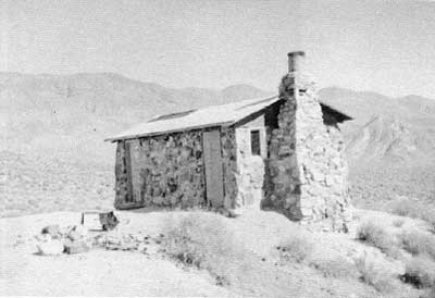
|
| Illustration 27. West and south elevations of "Geologist's Cabin." Note remains of small stone oven on terraced area. Photo by Linda W. Greene, 1978. |
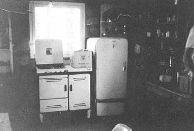
|
| Illustration 28. Interior along north wall of "Geologist's Cabin" in Butte Valley. Photo by Linda W. Greene, 1978. |
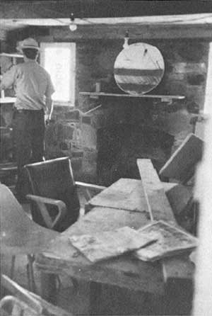
|
| Illustration 29. Interior view toward south wall of "Geologist's Cabin." Photo by Linda W. Greene, 1978. |
The stone cabin has most recently been lived in by a group of six retirees working the Anvil Spring claims. The one-room stone and masonry structure is solidly built with a green composition-paper roof that has been partially ripped off by vandals within the past year. The floor is cement and the wooden roof framing allows for storage space underneath the roof on the interior. Inside the cabin are a gas stove, an empty refrigerator, and shelves stocked with canned goods, some appearing to have been recently added. Two tables (one for eating and one for working) and some chairs are found inside. On the south wall is a built-in fireplace with a round mirror positioned on the mantel. A wooden door (covered by kitchen shelves on the interior) is situated at the north end of the east elevation, and a large window has been placed on the south end. There are also a window on the north elevation, two windows (one on either side of the fireplace) on the south elevation, and two doors (the southernmost one boarded up) on the west elevation.
A small stone oven on the outside terraced area west of the cabin has been vandalized and broken up. This may or may not have been part of the original complex. An outhouse and trash dump lie several yards north of the cabin. The house is wired for electricity, but no signs of a generator were found.
(ii) Butte Valley Stamp Mill and Environs
In the northwest corner of the Anvil Springs Claim are the ruins of a three-stamp mill backing against a small cliff. In front (north) of the stamps are some concrete machinery pilings and foundations, while the wooden framework of the mill itself climbs up the cliff immediately south. The stamp casing is still intact and bears the words "Baker Iron Works--Los Angeles." Metal flashing remains in the chute leading to the stamps from the hill above. Some timbers of the mill were originally painted boxcar-red, and some are green--obviously having been cannibalized from elsewhere. On top of the hill behind the wooden framework are some stone foundations and a concrete platform area.
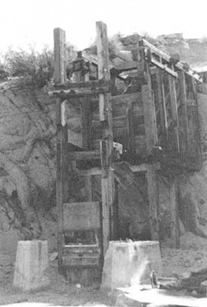
|
| Illustration 30. Butte Valley Stamp Mill. Wooden ore bin is to left of picture. Photo by Linda W. Greene, 1978. |
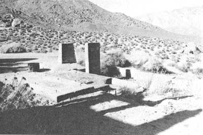
|
| Illustration 31. Concrete foundations of Butte Valley Stamp Mill. Photo by John A. Latschar, 1978. |
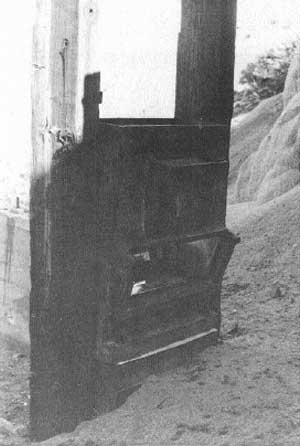
|
| Illustration 32. Stamp casing, Butte Valley Mill. Photo by Linda W. Greene, 1978. |
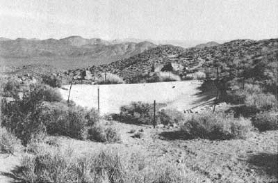
|
| Illustration 33. Cement-lined water reservoir, Butte Valley. Photo by John A. Latschar, 1978. |
|
| Illustration 34. Big Blue #1 Mine of Asa M. Russell in Butte Valley one mile west of Anvil Spring, 1962. Photo by Park Ranger Warren H. Hill, courtesy of DEVA NM. |
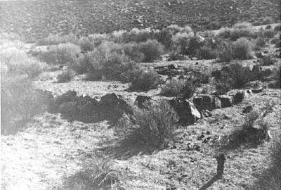
|
| Illustration 35. House or tent site in vicinity of Butte Valley Stamp Mill. Photo by Linda W. Greene, 1978. |
This mill probably serviced the vertical shaft located just south of the concrete platform area. This untimbered excavation with gently sloping sides is at least 100 feet deep. Between the stamp mill and a reservoir several yards southwest of it, a road leads on southwest up a small arroyo to an adit and what appear to be the foundations of two structures or tent sites. A door stoop still remains in front of one of them. This is the location of the Big Blue #1 Mine of Asa Russell, about one mile west of Anvil Spring.
Approximately 200 yards southwest of the mill ruin is a shallow, cement-lined water reservoir with stone reinforcing along the walls. The area has recently been fenced with barbed wire connected to pipe fence posts in an effort to keep burros from walking on the concrete pad. Pipes lead northwest from the reservoir to a small 3 x 2-1/2-foot stone-lined holding pond alongside the road leading west toward "Robber's Roost" and other mine sites.
About fifty yards due north of the large reservoir, and just north of the road, are at least three leveled house or tent sites supported by shallow stone retaining walls. This road leading west from the stamp mill and reservoir ends in a sort of cul-de-sac containing a rock shelter and several mines and prospects. It passes, on the south, a claim marker in the form of a large rock with the words "NW/SE Corner" painted on it. A nearby claim post identifies this as the Majong #6, one claim of twenty acres, owners John Matarazzo and John Persico of Downey, California. Nearby to the west is a filled-in prospect hole.
Remnants of at least five other mining ventures are found on down this road to the west and on trails taking off from the loop the road forms. Two of the undertakings are simply prospect holes, one only about thirty feet deep and the other one having caved in so that no estimate of its actual length is possible. It did, however, have a stone wall built partially across the entrance. These two excavations are located on a road taking off to the southwest from the cave house, which dominates the center of this small valley. Referred to variously as "Robber's Roost" or "Outlaw Cave," this shelter is formed by the overhang of a huge boulder resting on other large rocks and on the hillside itself. The eastern entrance once was protected by a dry-laid masonry wall with a doorway. Although this wall has crumbled somewhat, in earlier times it completely closed in the east facade, effectively sheltering the occupants from the elements. Early views of the site show a high, sturdy dry-stone wall and a stove outside the entrance. [168] At the present time a campfire exists to the southeast in front of the stone wall, and another is found to the north just inside the front entrance. Although tales circulate about such caves being the hideout of robbers or highwaymen, it is more likely that this refuge harbored a desert prospector working nearby claims.
West and up the slope from the rock house is an adit with a cement door frame and wooden door. The tunnel inside connects with a partially caved-in shaft coming down about fifty feet vertically from the hillside above. This tunnel, used as living quarters for a miner in fairly recent times, contained an old iron stove, a rug, bunk, table, shelves, assorted implements, and pyrex dishes. According to the monument photo file this is an old lead mine that in 1962, when its picture was taken, had been inactive for years. According to a 1978 mineral report in the monument files, this is the Mah Jongg No. 6 mining claim. [169]
Further north of this tunnel and shaft are another connecting pair of excavations on the hillside. The sides of the untimbered adit are very crumbly and the collapsed shaft above is only about twenty feet deep.
(c) Evaluation and Recommendations
i) Anvil Spring and "Geologist's Cabin
The stone cabin at Anvil Spring, because of its prominent location on the hillside, has long been a familiar landmark to prospectors and tourists alike who venture into Butte Valley in search of fortune or merely a day's adventure. The lone tree at the spring and the inviting shade of the cabin have attracted picnickers for years, many of whom abused the privilege offered by this oasis, necessitating a padlock on the cabin door.
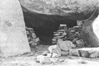
|
| Illustration 36. Cave house west of Butte Valley Stamp Mill. Photo by Linda W. Greene, 1978. |
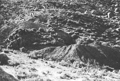
|
| Illustration 37. Old lead mine, 3/4 mile WNW of Anvil Spring, Butte Valley, 1962. Inactive for many years. Photo by Park Ranger Warren H. Hill, courtesy of DEVA NM. |
Although the structure is aesthetically appealing, it is not historically significant in Death Valley mining history. Built in the 1930s, it provided a home base for Asa Russell while he conducted periodic mining work on the slope of Manly Peak. Russell is one of the familiar names associated with mining in Butte Valley, but he evidently did not venture much outside that area. His association with the cabin is not important enough to warrant its nomination to the National Register. Possibly the cabin could be utilized as a backcountry shelter for monument rangers patrolling Butte Valley.
ii) Butte Valley Stamp Mill and Environs
The three-stamp mill situated about 3/8 of a mile northwest of Anvil Spring is of definite historical interest and significance. Current popular guidebooks to the area prolong the story that this gold mill was built by Carl Mengel around 1898, after he had purchased the construction materials in Los Angeles (reportedly salvaging timbers from construction of the old Third Street tunnel) and hauled them through Goler Wash by mule team. [170] This writer has not yet seen any primary documentation to support this statement.
As mentioned earlier, several statements have been found referring to the fact that various mining concerns operating in Butte Valley were contemplating erection of some sort of reduction works as early as 1899. By 1900 Messrs. Bowshard & Son, owners of the Anvil Spring mines, were reported to "have gone 'inside" to get a stamp mill. The Anvil Springs Mining Company, which operated some lode claims in Butte Valley in the 1920s, hired a mining engineer, Archie Burnett, to examine the Golden Star-Apex and Ready Cash-Sunrise Group of mining claims near Anvil Spring. In speaking of the Ready Cash Group, whose principal workings were on the Nipper Claim, 1-1/2 miles west of Anvil Spring, the engineer said that they had been worked considerably in 1896, and the ore shipped to the nearest custom mill at Garlock, 150 miles west, for processing. In that year one shipment of five tons to that distant point netted $120 per ton. In 1912, Burnett says, about twelve tons off the dump were milled and produced $380 in gold bullion. In order to determine projected values, he inspected current tailings "produced from ore from the property which was milled in a small 3 stamp mill nearby. . . . The mill referred to is a small 3 stamp mill erected some 15 years ago [ca. 19131, and whatever the plans of its sponsors may have been, it is quite obvious that little, if any, intelligent effort was made to develop the property itself. [171]
This statement that the mill was built around the first decade of the twentieth century (though it is doubtful that it was the Anvil Springs Mining Company that built it because the report indicates that the Nipper Claim was not owned by them but was merely adjacent to their holdings) is much more plausible than the more romantic explanation that Mengel hauled the materials in from Los Angeles via Goler Wash on muleback prior to 1900. Puzzling, however, are the initials and date "REW Feb 1937" scratched on one of the concrete foundations. Possibly the original mill was added on to by miners or other interested parties in the late 1930s, during which time there was still mining activity in the area, or this may just be graffiti.
The mill itself is unusual in that it held three stamps instead of the usual two or five. Remaining vestiges consist of concrete foundations and machinery pilings and the heavy cast steel housing for the stamps, none of which remain. (As will be mentioned again later, some old mining relics are exhibited at Russell Camp near the front entrance of the house. One of the items is a stamp. Whether or not it came from this mill is uncertain, but the possibility exists.) Although the mill is not sufficiently outstanding in Death Valley mining history to meet the criteria of eligibility for the National Register, and in addition lacks some integrity of design due to the loss of its stamps and other miscellaneous machinery, it should not be destroyed. No stabilization measures appear necessary. The deep vertical shaft on the level above should be capped in some manner to prevent accidents--the current situation is very dangerous for people and animals. Dumps and ground refuse in the general vicinity of the mill offer potential for historical archeology fieldwork. Examination of objects here might help determine more conclusively the time span during which the mill operated.
The reservoir southwest of the mill appears to be a 1930s or 1940s addition, built to implement the mining activity going on in the adits and prospects further west and south. No mention of its construction was found. Neither the reservoir nor the small holding tank (?) west of it are historically significant. The construction period of the stone house or tent foundations north of the reservoir is unknown. Possibly they date from mining activity around the turn of the century; further exploratory work by archeologists might reveal artifacts that would more precisely establish their age. They do not intrude on the visual scene and should be left to benign neglect.
The rock shelter further west is an item of historical, architectural, and archeological interest. Seeking shelter or work space in natural cavities found in the rock cliffs and hillsides in Death Valley has been a custom of the native peoples since prehistoric times. This practice was also followed by prospectors, for rock and cave shelters provided a convenient and instant haven that could be made relatively airtight simply by the addition of a stone entrance wall with a door. [172] The Butte Valley cave house is a particularly good example of latter-day use of such a natural shelter, though through recent camping and recreational use it has lost some of its integrity--the front wall has crumbled and the old stove that used to be located by the front door has been appropriated. Its large size and picturesque setting, in addition to its probably apocryphal reputation as a robber's hideout, make it an interesting resource.
The adits and prospect holes in the surrounding area are not viewed as historically significant. Although some of them were probably originally worked in connection with the earliest mining activity in the area, they have been so thoroughly tested and explored throughout the past forty or fifty years that their original associated artifacts have been removed and even their original appearance has undergone alteration. (Some of these adits might have provided ore for the three-stamp mill if it performed custom work.) The possible tent or house sites located along the road leading off southwest from the stamp mill toward the Big Blue #1 Mine could be examined further by historical archeologists to determine if any estimate can be made of the site's earliest occupation period. Many archeological sites exist in Butte Valley, and it is the writer's understanding that the entire area is being nominated to the National Register of Historic Places as an archeological district. Before any measures are taken to remove any historical structures or to restore the land to its natural state, archeologists should be consulted to make sure no important sites are disturbed.
(2) Greater View Spring
(a) History
Not much data on early settlement at Greater View Spring was found prior to its mention in connection with Carl Mengel, an early prospector in the Butte Valley area and contemporary and friend of such well-known Death Valley personalities as Shorty Harris and Pete Aguereberry. The site is located about one-half mile south of Anvil Spring and commands a grand view over Butte Valley toward the Amargosa Range on the east side of the salt pan.
Carl Mengel was born in San Bernardino, California, in 1868, and after various attempts at mining, farming, and fishing for a living, by at least the early 1900s had entered the Butte Valley region of Death Valley, presumably by way of Goler Wash. He is said to have purchased the Oro Fino Claim in Goler Wash in 1912, and later found even richer deposits there. [173]
In October 1924 Mengel filed on several claims south and west of Anvil Spring: Topah Nos. 1-4, Topah Extension, and Mah Jongg Nos. 1-6. He died in 1944 and his ashes were put in a stone cairn atop Mengel Pass approximately fifty feet outside the boundary of Death Valley National Monument.
After his death the claims located by Mengel in Butte Valley underwent numerous resales through the 1940s, 1950s, and 1960s. The Topaz (Topah) Extension, Topaz (Topah) No. 1, and part of the Topaz (Topah) Extension claims were later amended and located as the Greater View Springs, Greater View Springs No. 1, and Greater View Springs Millsite, respectively, in 1962 when Clinton and Stella Anderson were granted the property by Asa Russell. Work carried out by the couple on these gold, silver, lead, and mercury claims has consisted mainly of small pits, open cuts, and a small adit, mostly on the Greater View Springs Claim. [174]
Stella and Clinton Anderson lived on the homestead, prospecting in the surrounding hills together until Clinton died in 1973. According to a newspaper article featuring Mrs. Anderson's unique lifestyle, she continued to live there, and was later joined by her young grandson Bobby. With no electricity, plumbing, car, or telephone, their contact with the outside world was limited to an occasional ride into town, hitched with a nearby miner, to stock up on provisions. A windmill was once employed to furnish electricity, but it broke down. Mrs. Anderson obviously enjoyed most of her days spent here, feeling that the natural advantages of the Butte Valley area, "the fresh, clean air, the good water, the peace of mind of being out of the hubbub of the city--all these things make you forget the other things you don't have." [175] Although appearing to be over seventy years of age in 1976, Mrs. Anderson spent most of her time in prospecting forays into the neighboring hills, tracing promising veins. Hers was the universal attitude of all miners toward their lot in life--"My claim's not too productive right now, but you never can tell. . ." [176] Mrs. Anderson was not living at Greater View Spring when this writer conducted a site survey of the area, although she reportedly did visit there occasionally from her home in Trona.
(b) Present Status
The Greater View Spring complex consists of a stone cabin (main living quarters), an adjacent frame and tin structure and a trailer also utilized as housing, a workshop, a privy, a garden area, and some miscellaneous foundations. The stone cabin that both Carl Mengel and Stella Anderson lived in has a corrugated-metal roof and a small tin-covered addition (somewhat modified from the original) on the west elevation. The east wall above the eave line is constructed of vertical wood planking, whereas on the west side the corresponding area is covered with corrugated metal. The structure's north elevation abuts the hillside so that the roof edge drains into a ditch dug east-west along the hillside. The interior of the cabin contains a bed, an old chair, a table, canned goods, a sink, a combination oven-fireplace fashioned from a tin drum, a four-burner gas stove, and a refrigerator. The cement floor is covered by a rug, and the rough rock walls on the north are plastered.
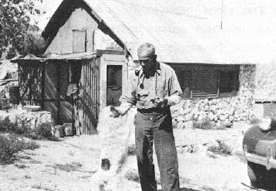
|
| Illustration 38. Carl Mengel with dog "Whitey at his home in Butte Valley, April 1940. Photo courtesy of DEVA NM. |
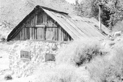
|
| Illustration 39. East elevation of Mengel cabin at Anderson Camp in Butte Valley. Photo by Linda W. Greene, 1978. |
West of the cabin is a corrugated-metal equipment shelter, some miscellaneous lumber and appliances, and what appear to be some stone foundations. A spring is also located here. East of this main cabin is another structure used as living quarters that is sided with corrugated metal except again between the eave line and gables, where vertical wood planking is used. Inside are a stove and a closet still containing men's shirts. East of this cabin is a cement foundation on which a clothesline has been erected. East beyond this, near the entrance gate to the complex, is what seems to be a fenced-in garden area where some attempt at terracing has been made and a small arrastra-like fountain or watering system added. According to one writer, Mengel grew fruit trees on the site and also cultivated a rose garden. [177] On the south side of the road leading into the property are a two-room rectangular wooden house trailer used as living quarters, and containing a bed, stove, and sink; a wooden cabin with a metal roof and siding used as a workshop; and a wood privy. The generating system for the complex is further up on a hill northwest of the residences.
(c) Evaluation and Recommendations
The main importance of Greater View Spring lies in its association with Carl Mengel, one of the lesser-known names in the Death Valley region. Mengel was not strikingly different from other miners except that he was a quiet, dignified individual and stayed longer in one place than most people in that profession. Because of this he left his imprint on Butte Valley. The oldest structure at Greater View Spring appears to be the main stone house. Its exact date of construction and the name of its builder are not known. According to Stella Anderson, the sturdy stone cabin was built by Mormon settlers in 1869. L. Burr Belden states that Mengel "built a rock house and then a second cabin alongside just so he could be hospitable and accommodate visitors." [178]
Although it is difficult to determine who might be correct on this question, a remark of Asa Russell in his article describing his stay at Greater View Spring tends to support Mrs. Anderson's statement. Here Russell quotes his partner Ernie Huhn, who, in speaking of the cabin where they intended to stay in Butte Valley (and which was confirmed earlier in this report as Mengel's stone house), said that "Carl Mengel, who has only one leg, says he came through there with his burros--stayed at the stone house and says the area looks like good gold country to him." [179] This tends to suggest that Mengel did not build the cabin himself but found it there by the early 1900s.
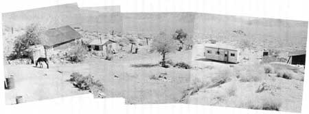
|
| Illustration 40. Panoramic view of Anderson Camp at Greater View Spring, former home of Carl Mengel in Butte Valley. Photos taken by Linda W. Greene, 1978. |
The exact dates of erection of the other outbuildings are also conjectural. Possibly Belden was correct in saying that Mengel added the guest cabin east of the stone house, for the corner of a structure in this location appears in a 1940 picture of Mengel and his dog (Illus. 38). The other items (trailers, workshop, etc.) were added in more recent years either by Asa Russell or the Andersons. Unfortunately no important information was gleaned from perusal of the location descriptions found of the mining claims covering Greater View Spring. No statement was found of any structures standing on the property when Mengel first filed on it in 1924. Data on existing buildings is scanty up to 1961 when it is mentioned that the Topaz Extension included three springs, a stone house, and a cabin. By April 1962 the Topaz Extension (renamed Greater View Springs) supported a stone house, a guest house, fourteen trees, three springs above the houses, and one spring below. The Greater View Springs Millsite contained a stone house in the center of the claim, a small wooden guest house, a garage, four springs, fifteen trees, a wire fence, and a gate. [180]
If Stella Anderson's mining claims are determined to be invalid, the main stone residence at least should be kept. The additional guest cabin east of the stone house, the trailer, workshop/garage, and privy are all later additions that have no historical significance. The possibility exists that the main stone cabin was built long before Carl Mengel entered the Butte Valley area. Whether Mormons had anything to do with its construction has not yet been confirmed, although there is information to the effect that some of these people had visited the Anvil Spring area by at least 1858 and had worked a mine and operated a smelting furnace there. [181]
The uncertainty of the cabin's origin, but the possibility of its erection prior to 1900, and its use as a home by Carl Mengel, are enough to warrant its protection. On the basis of documentary data on the structure found to date, the building does not meet the criteria for eligibility to the National Register. Its connection with Mengel is not significant, its appearance is not architecturally outstanding, and in addition it has undergone loss of integrity through minor structural changes even since its occupation by Mengel--the small screened porch on the west elevation, for instance, has been slightly enlarged and sided with metal, probably to keep out intruders and vandals. The interior construction of the cabin is interesting because the house abuts the hillside on its north elevation, the interior wall here being rock roughly plastered over. In this respect the structure is almost a partial dugout. (Inquiries should be made of the present owner as to whether any of Mengel's personal possessions or any interesting artifacts related to him are still in the area that could be used for interpretive purposes.) An adaptive use might be made of this building as a backcountry camping facility for monument rangers on patrol.
(3) Russell Camp
(a) History
The site appearing on the 1950 Manly Peak quadrangle as Russell Camp is located about one-quarter mile south of Greater View Spring. Asa Merton Russell, a prospector in the Butte Valley area for several years first established the camp in the early 1930s. After retiring from the Los Angeles Water and Power Company in May 1960 he took up permanent residence in the valley in the fall. This was after he had constructed the stone house at Anvil Spring, and was probably an attempt to establish a more permanent location in the valley in a more protected spot.
The cabin, shed, and burro corral complex are located on the Ten Spot Millsite, originally called the Last Chance Claim when it was filed in 1930. A location certificate covering the five-acre Ten Spot Millsite, encompassing a spring, the cabins, and all the miscellaneous equipment on site, was formally filed on 1 July 1940. The mill site was said to be 1-1/2 miles south of Anvil Spring, with its northerly side lines joining the southerly side lines of the Greater View Springs Claim. [182]
One of the first claims Russell filed on was the Lucky Strike Quartz Mining Claim on 11 March 1931. Part of the Butte Valley road toward Russell Camp intersects the northwest corner of this claim, which is about mile northeast of the Ten Spot Millsite. This property was relocated on 9 July 1933. [183]
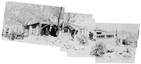
|
| Illustration 41. Complex of structures at Russell Camp in Butte Valley. Note some mining-related structures back on hillside at east end. Photos by Linda W. Greene, 1978. |
Asa Russell also registered several other claims in the area: the Nipper Quartz Mining Claim, located 9 July 1933; the Nipper No. 1 Quartz Mining Claim, located 9 July 1933; the Ready Cash Lode Mining Claim, located 20 July 1947 and relocated 11 March 1974; the Big Blue Quartz Mining Claim, located 9 July 1933 and relocated 11 March 1974; and the Ten Spot Lode Mining Claim, located 1 July 1940. [184]
(b) Present Status
The Ten Spot Millsite, originally used as a residence by Asa Russell, has been lived in most recently by a Steven Penner, one of the claimants of the unpatented Lucky Strike Lode Claim and the Ten Spot Millsite Claim. During the on-site survey made by this writer in September 1978 no one appeared to be living at the complex, which consists of two cabins, some sheds, a burro pen and barn, and some mining-related structures.
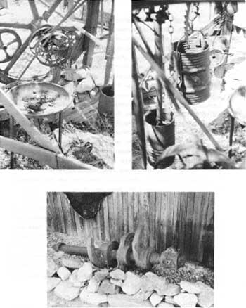
|
| Illustration 42. Display of old mining equipment at Russell Camp in Butte Valley. Photo by Linda W. Greene, 1978. |
Some primitive mining equipment is on display at the entrance gate near the main house. This cabin is built of vertical wood planking and is covered with a metal roof. The cabin adjacent on the east is also of wood planking with metal siding. A metal shed east of this second cabin showed evidence of having been used as a workshop to test ore samples as well as being used to store mining equipment, such as a sluice box. Bird and snake cages are attached to the north exterior shed wall.
Sporadic mining activity has been carried on in the area by both Russell and Penner, the latter most recently working on the Lucky Strike Claim. In January 1978 an ore bin of corrugated sheet metal on wooden supports, containing some ore, was found on the property. No equipment for the crushing, grinding, or separating commonly associated with active milling sites was found. [185] The Lucky Strike workings consist of several prospect pits, the deepest about ten to fifteen feet and four to five feet in diameter. Production from this site has evidently been low, for no records of any have been found. [186]
(c) Evaluation and Recommendations
None of the structures located on the Ten Spot Millsite claim are historically significant. They have been built since the 1930s, and some as recently as 1958. The spring supplying the cabin and trees was developed in 1929 by Russell, and the 500-gallon water tank connected with the extensive water system from the spring to the cabins and elsewhere around camp was added in either the late 1950s or early 1960s. [187] An attempt should be made to acquire the mining relics on exhibit at the camp for the monument's visitor center.
The camp here has always posed a problem, for other people have been encouraged to move into the area by Russell's presence there. Most unsettling to monument authorities, for example, was a notice that appeared in the classified advertising section of the July 1960 issue of Desert Magazine
Prospector retired, with 10 partly developed gold and silver claims and millsite in Panamint Mountains, wants contact with someone interested in prospecting, writing or painting. Should be free and self sustaining. Scenic spot, ideal for health condition. Elevation 4500 ft. good water and cabins.
A.M. Russell
Shoshone, Calif.
The tendency of more and more retirees to establish homes in the Death Valley area under the pretext of mining has been a major problem in the past that hopefully will be resolved by the validity tests conducted by the National Park Service.
(4) Willow Spring
(a) History
Several watering spots known as "Willow Springs" exist in Death Valley arid the surrounding area, several of which are mentioned in connection with early mining activity. Two that were west of Death Valley should be noted: a "Willow Spring" on which water rights were filed around 1874 was located "1-1/4 mites down in canon from Town of Panamint"; [188] another "Willow Springs," the scene of a fair bit of mining work by 1898, was located in the southern end of Panamint Valley and was projected as a possible new townsite when the Utah and Pacific Railroad was extended through to the coast from Utah. The latter, because of its proximity to the Goode Springs District lead ores and to the high-grade Argus Range hematite iron ores, seemed the natural place for a smelter. Among the several mines in the area only one is specifically mentioned by name--the Bowman. This spring is possibly the one known as "Lone Willow Spring" on the east slope of the Slate Range just north of the narrow pass at the south end of Panamint Valley, within a mile or two of Early Spring. [189] The Willow Spring near Gold Valley in the Black Mountains was the scene of some mining enterprises during the Greenwater era, and is discussed in a later section.
No information prior to 1934 was found by this writer relative to the location of claims or construction of buildings at or near the Willow Spring site in the southeast corner of Butte Valley. In 1934 a "Cabin and pipe line and the mining claim [on] which the cabin stands or [is] built on," located at the head of Anvil Canyon in the Panamint Mountains, was sold by Charles Brown, Attorney for Ruth Nellan, to Wallace Todd. The property formerly belonged to M.E. (Bud) Nellan, deceased. [190]
In 1961a quitclaim deed was filed between Wallace Todd and James H. Barker concerning "That placer mining claim (containing twenty acres more or less) known as the Willow Spring Claim, which surrounds Willow-Spring at the head of Anvil Canyon adjoining Butte Valley, in the South Park Mining District . . . . at the center of which claim is a stone cabin. The said claim is the one bought by Wallace Todd in 1934 from Senator Charles Brown, Administrator of the Estate of Bud Nellans [sic], the original locator. . . ." [191] The assumption would be that "Bud" Nellan originally located this claim sometime in the 1920s.
The placer mining claim at Willow Spring was quitclaimed to the Public Domain by Mrs. Barker following this transaction, according to another miner, Ralph Pray. The Death Valley mining office, however, states that Arlene Barker held the ground through another mill site location under the name of Willow Spring for several years. Eventually she and the Keystone Canyon Mining Company, Inc., on 4 August 1973, in order to secure water and site rights for the Silver Butte Lode Mining Claim, filed as co-locators on five acres of nonmineral land to be known as the Willow Spring Millsite and located "in the southwest portion of Death Valley National Monument, at the western terminus of Anvil Spring Canyon. . . ." [192]
190. Bill of Sate, Chas. Brown, Attorney for Ruth Nellan, to Wallace Todd. Dated 25 September 1934, recorded 22 September 1941, Deed Books, Inyo Co., Vol. 53, pp. 363-64.
By 1975, according to correspondence between the monument and the Keystone Canyon Mining Company, the latter had determined that the copper, lead, silver, and gold veins of its Silver Butte Claim in Butte Valley were too sporadic and too low in concentration to warrant further development of the property. They did want to retain the Willow Spring Millsite as a water source. In this same letter the company requested a permit allowing them to burn and dismantle the structures at Willow Spring. [193] A Special Use Permit was granted from 10 April 1975 through 1 October 1976 for "burning and dismantling the cabin and debris. . ." [194] By June of that year the Willow Spring cabin had been razed. All timber was burned, leaving only the masonry walls and sheet metal from the roof. [195] By November 1976 the Keystone Canyon Mining Company reported that a three-man crew had demolished the standing rock walls on the site, all metallic remains (beds, doors, screens, barrels, etc.) had been removed from the area, and the Willow Spring Millsite had been remonumented. [196]
(b) Present Status
Two areas showing historic ruins exist in the Willow Spring area, only one of which was visited by this writer in September 1978 due to limitations of time and fuel. The second site was visited during the Cultural Resources Survey of Death Valley National Monument performed in 1975 by Western Regional Office personnel.
A cement wellhead currently surrounds the Willow Spring source, and on a hill immediately to the west is a modern burro corral. A dismanteled water pipe system leads east from the spring about 200 yards to a masonry water-tank platform located on the hillside above a house site. The structure here was the one the Keystone Canyon Mining Company demolished in 1976. The house was still partially standing when the LCS survey was made, but had already been razed by fire. The walls were solid stone masonry with cement mortar. The house appeared to have had two levels with wood framing. Miscellaneous metal debris, such as bedsprings, drums, screens, etc., twisted by the fire, were still on site near the cabin. These were later removed and the standing rock walls demolished by NPS request at the end of 1976. Much glass, metal (nails and hinges), china, and other household debris remains scattered around the area. A few hundred yards east of the house site and at the edge of the wash bordering the site on the south, a masonry-lined two-compartment cistern was built under a rock overhang.
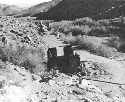
|
| Illustration 43. Cabin ruins at Willow Spring, 1975. Photo courtesy of William Tweed. |
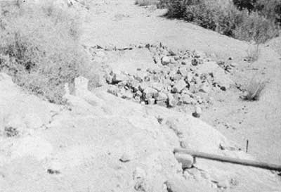
|
| Illustration 44. Cabin ruins at Willow Spring, 1978. Water pipe in foreground leads to high rock on which a water tank once stood. Photo by Linda W. Greene. |
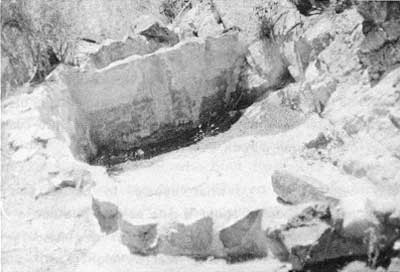
|
| Illustration 45. Masonry-lined cistern built under rock overhang between cabin and mill sites, Willow Spring. Photo by Linda W. Greene, 1978. |
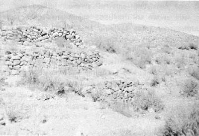
|
| Illustration 46. Mill foundations east of Willow Spring and east of cabin ruins. Photo by Linda W. Greene, 1978. |
What appear to be the ruins of a small stamp mill are located about 1/4 mile east of the house site. All that remains are three foundation levels of dry-masonry walling, each level measuring about twenty feet by eight feet. Some metal debris is scattered around, and immediately in front of the lowest foundation wall some pipes stick up through the ground. No purple glass was seen on the site.
About 1/4 mile further east from the mill ruins and on the north side of the road are two building sites not visited by this writer. According to the 1975 LCS survey there are two building sites here, one with a concrete floor and an adjacent site consisting only of a small leveled spot. At the prospect site shown on the USGS Manly Peak quadrangle about 1/4 mile southeast of these building sites, and 1-2 mile east of Willow Spring, no structures remain. A building site along the road leading south from the Anvil Spring Canyon Road contained much 1920s period and later debris. The road to the mine (the Silver Butte?) ends at a masonry retaining wall, possibly the foundations of a loading area, in the canyon below two mine tunnels and a dump a short walk up the hill. The adit mouth is braced with wooden timbers. Several 1920s-1930s car wrecks were also found in the area.
(c) Evaluation and Recommendations
The exact age of the various mill ruins and house sites in the Willow Spring vicinity and further east is hard to determine. The earliest document found pertaining to the Willow Spring Millsite is a 1934 bill of sale, but it suggests that the site might originally have been worked in the 1920s. No information could be found on who built the house or lived in it, although possibly it was the fellow referred to in the early bill of sale as the "original locator" of the claim, Bud Nellan. According to Bill Tweed and Henry Law, who visited the other sites in the area during the LCS survey, assorted garbage on the site of the two building foundations northeast of the mill ruin suggests a 1930s or later occupancy period. At the mine site southeast of this location, various parts of 1920s autos were found. The stamp mill is probably the most significant ruin and raises the most intriguing questions. It is unfortunate that more information has not come to light on this structure. No mention of a mill in this vicinity was found, although as previously cited, references exist to a Butte Valley Mining Company mill in "Goller Canyon" in 1889 and to a Pages (or Payes) Mill in Goler Canyon around the early 1890s. These mill ruins might date from at least the early 1900s or late 1890s, since there is no mention of a mill being constructed later during mining activities in the area from the 1930s on, which time period is fairly well documented, or having any connection with the claimants of the Willow Spring Millsite from the mid-1930s on (the bill of sale in 1934 mentions only a cabin and pipeline on the property). It is recommended that the stamp mill foundations not be disturbed, but be treated with a policy of benign neglect. Stabilization is not necessary, nor is reconstruction feasible primarily because of lack of data.
None of the Willow Spring ruins meet the criteria for eligibility to the National Register. The paucity of data found on them to date would seem to indicate a lack of importance in the area. The LCS crew determined that the Willow Spring remains did not hold potential for further historical or archeological investigation or evaluation. It is suggested by the available documentary evidence and from on-site observations that this part of Butte Valley was mined most actively during the 1920s and 1930s, although initial discoveries might have been made during the early 1900s when the Anvil Spring Mining District was at its peak.
(5) Squaw Spring
(a) History
No early historical data was found on the shanty located at Squaw Spring. The area has not been mentioned in connection with any early mining activity.
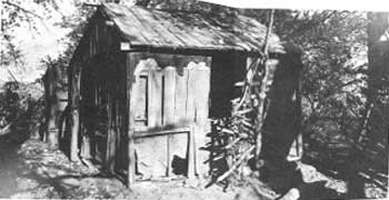
|
| Illustration 47. Squaw Spring cabin. Photo courtesy of William Tweed, 1975. |
(b) Present Status
Squaw Spring, last visited by NPS esearch personnel in December 1975, is reached via a rough jeep trail 6-1/2 to 7 miles east and south from the building sites in the Willow Spring area. The difficulty posed by condition of the road, whose surface has been even further deteriorated by rains since 1975, and limitations of time and fuel precluded this writer's reaching the cabin site. In 1975 remains consisted of a two-room wood frame house of poor quality and light construction, fashioned mainly of panels from wooden orange crates covered with tarpaper and having chickenwire screens. The cabin stands very near Squaw Spring in a cottonwood grove also harboring exotic plant species such as oleanders and watercress. On the edge of the grove and on a hill above the cabin and spring is a windmill made out of a Studebaker frame. No well is visible beneath it, so it is surmised that it drove an electric generator.
(c) Evaluation and Recommendations
No documentary data was found on this structure. The LCS crew referred to it as a "HoovervilIe Shanty," and suggested that it was lived in by a squatter during the Great Depression. The site contains some items of historical interest and possible interpretive value. Its isolated situation and the unfavorable condition of its access road suggest that there has been little vandalism to the site through the years. Lack of data on the cabin precludes according it any associative significance with either people or mining events in Death Valley. As a possible exemplification of a 1920s Depression-era lifestyle in an isolated desert region, the cabin should be left to benign neglect.
4. Anvil Spring Canyon
a) History
Ernest Huhn first located a single claim here in the late 1930s at an elevation of about 2,100 feet. The property was then acquired by the Western Talc Company in the late 1930s or early 1940s, which commenced driving an exploratory adit trending north and then east in an attempt to reach the talc vein. The only other works consist of several pits and trenches. Three men were employed at the mine, living in a tent and carrying on their work by means of a portable compressor. As of 1961 the deposit was still unproductive and generally unexplored. [197]
b) Present Status
Anvil Spring Canyon was not traveled by the writer because there is no longer an established road through it. The route, therefore, has not been explored for evidences of mining activity, but it is known that no active mining is currently taking place there. The area has not been subject to either historical or historical archeological survey.
5. Wingate Wash
a) History
(1) Location and Derivation of Name
Wingate Wash flows from the Amargosa River across the southwest corner of Death Valley National Monument southeast of Butte Valley. The pass itself is a break in the mountain range that forms the western wall of Death Valley, the Panamints stretching northward and the Brown and Quail mountains veering to the southeast. From the west the road into Death Valley through Wingate Wash turns east about two miles north of Layton Canyon. A low-gear, short, and relatively abrupt slope leads to the broad pass, which is about five miles wide, ten miles long, and about eleven miles outside the present monument boundary. Since World War II the west side of Wingate Pass, located on the Naval Ordnance Test Station Range, has been open to travel only by special permission. [198] Today the road leading into Death Valley over Wingate Pass intersects the Warm Spring Canyon road from the south near the Panamint Mine site at the mouth of Warm Spring Canyon.
It has been surmised that either Lieutenant Bendire, when crossing the Panamint Mountains through this pass on his 1867 expedition, named it to honor Major Benjamin Wingate, who died in 1862 of wounds received during the Battle of Valverde, New Mexico, or that it is a modification of "Wind Gate" or "Windy Gap," names bestowed by twenty-mule-team drivers to characterize the strong gusts they had to battle as they came through the pass. [199]
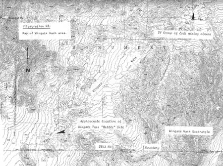
|
| Illustration 48. Map of Wingate Wash Area. |
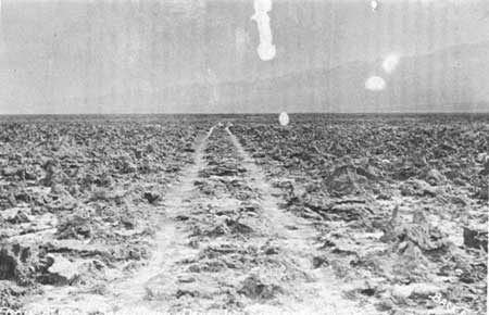
|
| Illustration 49. Devil's Golf Course Road, pre-1930s. Photo courtesy of DEVA NM. |
(2) Chloride Cliff Trail
After the discovery of silver at Chloride Cliff circa 1873 and the start of limited mining operations there, a road was needed to carry the ore south to a transportation center. As a consequence, a road used for only a few years was built heading south, across the salt flats, and along the west side of the valley into the area of present-day Barstow via Wingate Pass, a route that became one of Death Valley's first major connections with "civilization."
(3) Twenty-Mule-Team Borax Route
By the early 1880s the Harmony Borax Works, located about two miles above the mouth of Furnace Creek Wash, needed a new borax freight line from their deposits in the valley to the Southern Pacific railhead at Mojave. A dependable low-cost route was needed, and luckily William T. Coleman was able to utilize part of the old Chloride City trail over Wingate Pass--all that was needed was a good connection from the east side of the valley to the west and a general overhaul of the whole road.
The general 165-mile course followed by the twenty-mule teams was from Mojave northeast past Castle Butte and Cuddeback Dry Lake to Blackwater Well, a water stop. At or near present-day Granite Wells, about seven miles northeast of Blackwater, the route joined the old San Bernardino & Daggett to Postoffice Springs & Panamint City freight road. This was followed twenty-six miles to Lone Willow Spring, another water hole. Six miles north of Lone Willow, the road took off east from the old freight road through Wingate Pass, up Long Valley along Wingate Wash to the lower end of Death Valley, and then up the west side of the salt pan to the Devil's Golf Course road, which cut east to the borax works below the mouth of Furnace Creek. [200]
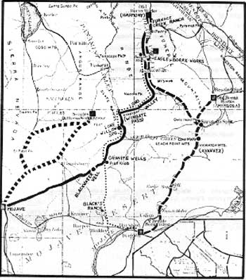
|
|
Illustration 50.
Borax routes in the Death Valley region: heavy solid line--Harmony Borax Works to Mojave broken line--Amargosa-Daggett route square dots--Searles Lake-Mojave route light dots--oldest route, between Eagle Borax Works and Daggett light solid line--Borate-Daggett run Taken from 100 Years of U.S Borax, p. 40. |
Numerous obstacles were involved in building and traversing this route. The major problem involved construction of that part of the road connecting the west side of the valley to the east side where the borax works were located. Because drinkable water could not be found east of the salt pan below Furnace Creek, it was necessary to cross over and travel down the west side toward Mesquite Wells. None of the options available for the route of this connecting road were very promising. Most of the acrid slushy marsh was too soft and wet to support the weight of the borax wagons, which would sink hopelessly into the mire. Of necessity, then, the road had to be constructed across the jagged salt crust which had formed over part of the marsh and where, as described as early as 1892,
there was scarce a level square inch on the whole bed, for the salt crust had, probably through the influences of heat and moisture from below, been torn and twisted and thrown up into the most jagged peaks, pyramids, and cris-crossed ridges imaginable. They were not high--none, perhaps, more than four feet--but there was not even level space for a man's foot between them. [201]
By means of sledgehammers a graded path six feet wide was constructed across an eight-mile-wide bridge of solid salt. [202]
Once the road was completely built, however, many hazards stilt existed. The name "Windy Gap" reportedly was given by the borax mule-team drivers to the pass because of the breezes that seemed to be constantly circulating. (Gudde's less colorful suggestion is that the name "Windy Gap" was recorded by Wheeler on his atlas sheet 65 due to a misreading of Lt. Bendire's notes.) [203]
In addition to wind problems, the gap was known as
the bed of torrents that come pouring down after a cloud-burst on the mountain top. Volumes of water, in foaming waves twenty feet high, are said to be common enough, and others much higher are told about by the white Arabs. When a wave has passed, boulders are found scattered in all directions, gullies are cut out, and at the best only a bed of yielding sand is found for the wheels to roll over. Worse yet, this bed of sand rises on an average grade of one hundred feet to the mile for forty miles, while the grade for short distances is four times as much. [204]
Although use of the road was discontinued by the borax teams around 1888, it was still frequented by miners and prospectors and some monument visitors, most of the latter preferring the easier Saratoga Spring route. The pass came into more and more disuse as modern highways penetrated the new national monument in the 1930s. In 1936 a twenty-mule team that had been used in the "pageant of transportation" that crossed the new San Francisco-Oakland Bay Bridge was shipped by train to Mojave, harnessed to freight wagons, and driven north to the site of Harmony Borax Works over the old road and Wingate Pass, which had been newly reconditioned for the occasion by CCC personnel. [205]
(4) Mining Activity
Even after the end of the freight route through Wingate Pass, interest in the area did not lessen. During the early 1900s the enthusiasm that was' raging anew for the prospects of the Panamint Range region was reaching here also, for a "Ballarat Letter" of 1905 mentioned that many well-known prospectors had left Ballarat for "Wind Gate Pass" and a several weeks prospecting jaunt, the party containing Shorty Harris among others. [206] There evidently was gold to be found there, for in 1907 word reached Rhyolite that a very rich strike had just been made in the vicinity of the pass, and men were flocking to the area. [207]
In 1908 mention was made of several prospecting outfits in the valley, both from neighboring towns such as Rhyolite and from "outside." According to Clarence E. Eddy, referred to as the "poet-prospector," and a well-known personality of the region who had located several placer claims in the vicinity of Bennett's Well, a group from California was planning to relocate some quartz claims in Wingate Wash. [208] Some ore from the Prize Group in Wingate Pass, assayed at this time, showed a gold content of $37.03. The mine was owned by Mike Lane, Tom McNulty, Shorty Harris, and Roy Newton. Some earlier samples from this group had assayed $157.40 and $58.70. [209] Another group of claims must have been staked by the same men, for in the next month they were reported as owning the Gold Links Group. Average results from the bottom of the twenty-five-foot shaft on the property returned $10 in gold, 4 ozs. in silver, and 64% lead. Some samples had assayed as high as $500. [210]
In June of 1908 an article appeared on discoveries made by Shorty Harris in the Hidden Springs area, ten miles southeast of Wingate Pass. Although Harris was displaying great optimism for the future of the area, others were skeptical of the find's potential, stating that the samples seen were not unlike those that could be found at several points within Death Valley. Due to a lack of water, little development had been carried out so far. The site was pronounced accessible by wagon road from Panamint or Goldfield or by way of Daggett or Barstow. [211] Although the showing of these claims appeared good, the values discovered at depth were not as high as surface showings. A week after the Rhyolite Herald's optimistic article on the location, Harris and Lane had returned to Rhyolite, disappointed in their prospects in Wingate Pass. [212] Their bad luck discouraged neither other prospectors, a couple of whom (Ernest Mattison [Death Valley Slim] and Bill Keys) mined for lead ore in the pass, nor themselves, for by 1910 Shorty was sinking a shaft on a thirty-foot gold-bearing dyke there. Tom McNulty, Roy Newton, and Mike Lane had an interest in this mine, also, which by the next month was down fifty feet and exposing $20 ore. [213]
But the big bonanza for the Wingate Pass area was yet to be discovered, and was actually going to revolve around the discovery of new mineral types that had never before been considered valuable by miners in Death Valley. It was only fitting that Shorty Harris should be the one to inaugurate this new era of mining activity. While on a two-month prospecting trip near his gold claims in the Wingate Pass section, Shorty spied some likely-looking rock and chipped out some samples of what everyone in the party declared to be tungsten. The spot was located twelve miles from Hidden Springs, the only water source around. [214] Despite Shorty's firm belief that because of his find his financial worries would soon be at an end, the future of this part of the valley (and of Shorty) did not lie in the development of this discovery.
(5) Epsom Salts Monorail
By 1918 deposits of mineral salts of commercial value (Epsom salts or magnesium sulphate, used chiefly in medicine) were being explored by Thomas Wright and some interested investors in the hills to the south of Long Valley. A temporary mining camp to work the deposits was established in Crystal Hills Wash in the Brown Mountain area, the drawback being that the camp could only be supplied by truck over a sixty-three-mile tortuously-rough road. During the postwar depression, while mining activity here stopped, Wright and his associates attempted to figure out another method of access to the site. The major factor to consider in the mining of these salts was that a cheap form of transportation was needed in order to make it economically feasible to extract the ore. The prospective operators decided that construction work (mainly grading operations) for a narrow-gauge railroad would be impractical and prohibitively expensive. The only answer seemed to be a twenty-eight-mile-long monorail system connecting with the Trona Railroad and the Southern Pacific at Searles, making a direct connection with Los Angeles. [215]
On the west side of Searles Lake, about six miles south of Trona, a new station named Magnesium Siding (Magnesia) was erected by the Trona Railroad. The American Magnesium Company of Los Angeles, with Thomas Wright as president, began construction of its monorail from this point. It then crossed eight miles of the salt lake, entered Layton Canyon up a 7.5% grade to Layton Pass, whose summit is 3,500 feet above sea level and about 200 yards' wide. The track then proceeded through Wingate Pass up the wash to a fork about 7-1/2 miles east. Here the monorail route turned south to the low Crystal Hilts, among which, about four miles from the road fork, are the Epsom salt deposits. Reportedly, grades of up to ten and twelve percent had to be overcome.
The estimated cost of the entire system was around $7,000 a mile in the mountain passes and $5,000 per mite on the flat stretches. The Douglas fir construction consisted of
A central "riding beam," six inches by eight inches in size, . . . supported on a series of A-frames or bents spaced eight feet apart, the central posts of which carried most of the load. The running rail, of standard T-section design and variously reported as being of 50-, 65-, 70- and 80-pounds to the yard, was centered on top of the "riding beam." To the diagonal legs of the A-frames, horizontal crosspieces were affixed extending several inches beyond the legs on either side to enable two-inch by eight-inch side rails to be attached to their ends, parallel to the running rail, to serve as sway stabilizers. Each A-frame was spiked to a broad wooden sill for a base, and the sills were sunk into the ground several inches wherever practical for additional stability. Above ground the structure was laced with supplemental diagonal bracing wherever necessary as a stiffener. [216]
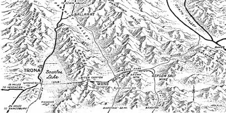
|
|
Illustration 51.
Route of Epson salts monorail. From Desert Magazine (January 1963), p. 13. |
The machinery used on this unique system was of great interest in itself. The basic unit was a rectangular steel frame mounted on two double-flanged wheels, one at either end. Steel supports angling downward parallel to the slope of the A frames were affixed on either side to balance the unit on the rail atop the riding beam. Platforms were added to these steel supports on a horizontal plane just above ground level and loads were stacked on these, balancing each other like saddlebags. [217] The train carriages glided along the single rail attached to a heavy timber running along the top of a series of four-foot-high A frames set ten or twelve feet apart, maintaining their equilibrium by pressing with roller bearings against the guiding rails. The first engine used, which utilized a battery-powered electric motor, was unable to produce sufficient power to haul up grades. The construction of the basic engine was similar to that for the cars:
The homemade, double-flanged, two-wheel-in-line locomotives were powered with rebuilt Dodge engines and kept in an upright position by rollers running to 2 x 6 guides spiked to the sides of the 'A' frames a foot or so above the ground. The balanced load was carried in saddle-bag-like compartments on either side of the locomotive or in similarly designed two-wheel-in-line cars. [218]
To provide more power, Fordson-motored tractor/engines built into a steel frame were introduced, averaging seven miles to the gallon of distillate. They were supposedly capable of pulling fifteen to twenty-five tons at eight miles per hour on the upgrade and ten to fifteen miles per hour on the flat stretches. According to Thompson the engines developed only enough power to pull three loaded cars. Myrick says each locomotive could handle only one or two trailers, depending on their load. Lee says the cars only carried three tons a trip. [219] Permissive maximum speed for the monorail was set at thirty-five miles per hour, though most trains held to thirty on the flatlands (which was still harmful to the track). Each locomotive was restricted to a maximum payload of approximately 3,400 pounds; trailer carloads were permitted up to 8,500 pounds. [220]
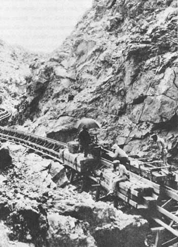
|
| Illustration 52. Epsom salts monorail. Train is just east of Layton Pass in Slate Range. Photo taken in 1924 or 1925. Photo by James Boyles, courtesy of DEVA NM. |
By the fall of 1923, only about sixteen miles of the system had been built, but work on the last twelve miles was fast progressing. Hopes were that a ton of ore could be hauled to the railroad for less than $1.00. [221] The system was finally finished in 1924. Immediately after its inauguration the project had appeared successful for several reasons: no bridges were necessary over rivers or roads; little grading was required because the trestle height could be varied to conform to dips and hills; the equipment, because of its design, ran well despite the varying grades and curves; costs of construction, equipment, and operation were low; and the open trestlework seemed at first to eliminate drainage problems. The American Magnesium Corporation was now one of the two companies producing magnesium in the United States after the war. Germany, which had previously controlled the trade, was expected to try and recover her former position in this regard. [222] This system was also heralded as the godsend that would resolve the problems that had afflicted mining operations along the Panamint and Argus ranges for many years, namely isolation and the need for a cheap form of transportation that would make further prospecting and thorough development of the big lead-silver deposits in the region economically profitable in the future. [223]
The Epsom salts in these deposits south of Death Valley had, according to some, originally "blanketed the surface in a layer from two feet to twelve feet in depth, and portions of it . . . were 100 per cent pure . . . ." According to others the purity of the deposit was low, only around fifteen percent. [224] The purer material was scraped off the surface and the less pure material dug out of the ground. The ore was sacked, sent by monorail to Magnesium Siding, and then via Trona and the Southern Pacific Railroad to a small refinery in Wilmington, California, for processing. It turned out that the high-quality ore was limited in quantity; most of the material could not be scraped up in the large quantities needed without the inclusion of much sand, debris, and other salts. This situation was a serious drawback to the economics of the operation, and it was soon determined that cheaper and purer salts could be found elsewhere.
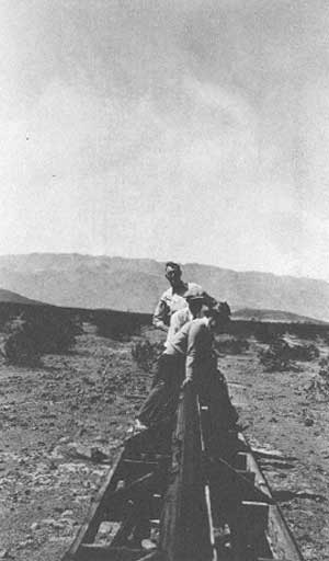
|
| Illustration 53. Monorail in Wingate Pass, 1935. Photo courtesy of DEVA NM. |
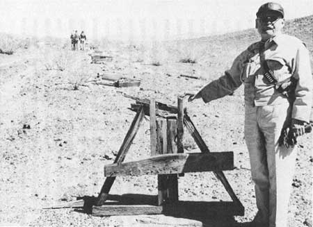
|
| Illustration 54. Supports of old monorail line near top of Wingate Pass. Photo courtesy of DEVA NM. |
In addition, the desert heat was having detrimental effects on the flimsy trestle construction. Despite efforts to improve the system by adding a heavier locomotive with a Buda engine (whose weight caused the Searles Lake trestle to break and tip), and before the introduction of a new more powerful gas-electric engine permitting longer trains and enabling bigger payloads, sun and heat had splintered and warped the green timbers and loosened nails, screws, and bolts. Occasional flooding on portions of the route, the tack of sufficient ore to keep the refinery running at capacity, and a complicated legal situation hampered operations so much that the salt mine was shut down in 1926. In the late 1930s the single rail was scrapped and the riding beam and other horizontal timbers were removed, leaving only a line of A-frames across the countryside. [225]
When Bourke Lee visited the old Epsom salts camp at Crystal Springs, probably in the 1930s, there were still five frame buildings and one stone house grouped near the monorail terminal, complete with cookstoves and pinups on the bunkhouse walls. An interesting sidelight on this whole venture is that Death Valley Scotty, true to form, took entire credit for the enterprise. "Thar's the monorail," he remarked.
I told a feller in Los Angeles thirty years or more ago about an epsom salts deposit. He raised thousands to build this monorail over the mountains to Trona. When they opened it they nearly mobbed me when I told them they would lose it all. Theda Bara and Griffith lost their wads. [226]
(6) Development of Manganese and Lead Silver Deposits
The Wingate Wash area has also contributed in a small way to the national supply of manganese, a hard and brittle grayish-white metallic element resembling iron, although the ore bodies found there on the average are small and low grade. Because of this they are only profitably mined during those times when other sources are cut off, such as during wartime. The following illustration is presented to demonstrate the contribution of Death Valley in this field: in 1954 the total U.S. consumption of manganese was 1,740,648 tons. California's total production from 170 mines during a sixty-seven-year period, from 1887 to 1954, was only about 240,000 tons. The southeastern desert area of the state produced about 80,000 tons of this total, and the New Deal mine specifically, in the southern Owlshead Mountains, five miles west of the southwestern corner of the monument, produced about 15,000 tons of this, mainly during World Wars I and 11. [227]
Information found indicates that a small amount of manganese ore was shipped from one property in Wingate Wash in 1943. (A plat of a group of mining claims near Wingate Pass, owned by Frank W. Orr, Roy Huntley Chapin, and Arthur R. Cassidy, dated 12 November 1940, was found by the writer in the Inyo County Courthouse records. The group consisted of the Manganite Nos. 1-3 claims, and might be the ones referred to here. [228] But it is the Manganite Group in the southern end of Death Valley that has been responsible for most of the manganese production from within the monument. In 1951 the group consisted of six unpatented claims (Reward Nos. 1-3, Good Hope Nos. 1-2, and Reward) in T21N, R2E, SBM, Secs. 28 and 33; Reserves were then estimated at about 40,000 tons of ore with a manganese content of 6.18 to 11.1%. Development work consisted only of a few surface cuts, and activity was sporadic. Total production is estimated at around 1,000 tons. [229] As will be noted later, this group underwent several relocations as a lead-silver mine. The Wingate Wash (Black Dream) Manganese Deposit, whose location is given as about seven miles west of West Side Road in Death Valley alongside the Wingate Wash road in T20N, R1 or 2E, SBM, was idle in 1951. It consisted of eleven unpatented claims owned by Roy C. Troeger. Development comprised a series of open cuts; production by lessees had not exceeded forty tons. [230]
Lead-silver deposits also were discovered in the Wingate Wash area. In 1923 a lead mine owned by Messrs. Gray, Warnock, and Wicht, six miles north of Wingate Pass, was mentioned as having a carload of good grade ore ready to ship, and the extent of the deposit looked promising. [231] In 1960 a Death Valley lead mine, located two miles east of the Wingate Wash Manganese Deposit, was mentioned on a list of mining claims within the monument. [232] The Manganite Group reported on earlier evidently was later referred to as the Canam Mine. Although small deposits of manganese had been mined here during World War II, in 1964 the operators, Canam Mines, Inc., discovered lead and silver ore. [233] By the time several pits were opened in 1969 this property was referred to as the DV Group, encompassing some former Pymco lode claims, and consisted of thirty-three lode mining claims in T21N, R2E, SBM, Secs. 28, 29, and 33. Development through the 1970s resulted in excavation of a pit 150 feet long, 70 feet wide, and 15 feet deep dug on one of the claims. The claimant, Charles Sweet, indicated that in May 1969 about 15 tons of rock from this large pit were shipped to a smelter at Selby, California; the total return was $726.81. In the mid- to late-1970s several shallow holes were drilled and claimants hand-sorted several tons of high-grade rock that was stockpiled awaiting shipment. By 1978 about 9,000 tons of material had been removed from the large pit. [234]
(7) "Battle" of Wingate Pass
Probably the most publicized event in the Wingate Pass area concerns one of Death Valley Scotty's most infamous hoaxes, referred to as the "Battle" of Wingate Pass. Conceived as a last-ditch effort to discourage further investigations by a mining engineer who was insisting on actually seeing Scotty's bonanza gold mine before recommending that his employers invest any money in it, the attack turned out to have almost fatal consequences for one of Scotty's brothers, put Scott himself in and out of jail several times during the ensuing months, and ultimately, six years after the incident, resulted in his confessing in a Los Angeles courtroom to long-term and full-scale fraud and deceit. (The most concise version of this tale appears in Hank Johnston, Death Valley Scotty: "Fastest Con in the West" and serves as the basis for the following account.)
The escapade had its beginnings in February 1906 when a New England mining promoter, A.Y. Pearl, whom Scott had met in New York, interested some bankers and businessmen in investing in Scott's supposedly rich mining properties in Death Valley. Before committing any money, however, the Easterners insisted that Daniel E. Owen, a respected Boston mining engineer who happened to be in Nevada at this time, personally inspect the property and give his opinion of its worth.
Arrangements were accordingly made with all the parties involved, and by February 1906 Owen, Pearl, and Scott were in Daggett preparing for the journey into Death Valley. Other members of the expedition were: Albert M. Johnson, president of the National Life Insurance Company of Chicago (soon to become Scotty's long-term benefactor), who had recently arrived from the East and, intrigued by the stories of Scotty's untold wealth, asked to accompany the party; Bill and Warner Scott, brothers of Death Valley Scotty; Bill Keys, a half-breed Cherokee Indian who had prospected with Scott in the Death Valley region for several years, who had found the Desert Hound Mine in the southern Black Mountains, and who several years later, after the "ambush" incident, moved to a ranch in what is now Joshua Tree National Monument; A.W. DeLyle St. Clair, a Los Angeles miner; and Jack Brody, a local desert character.
The entire trip, if carried out as planned, had the potential of proving extremely embarrassing for Scott, who, after all, did not have a mine to show in order to consummate this lucrative transaction. Desperate for a solution, he turned to his friend Billy Keys and persuaded him to let him show Owen the Desert Hound instead. Although not as large as Scott had reported his bonanza to be, at least the Hound was there on the ground for Owen to see. Papers of agreement were drawn up to the effect that Scott and Keys would split the proceeds from the mine sale.
Later, fearful that Owen would reject this mine as being too small a producer to warrant investment by his employers, Scott devised a scheme that he hoped might succeed in scaring Owen away from the area and dampening his enthusiasm for penetrating into the Death Valley region as far as the mine. A shootout would be staged and hopefully be authentic enough to disrupt Owen's intended mission.
Starting out on 23 February 1906 with two wagons fully loaded with provisions, extra animal feed and fresh water, and a string of extra mules and horses, plus a liberal supply of whiskey, the party journeyed on to camp the next evening at Granite Wells. On Sunday, 25 February, the caravan pushed on twenty-six miles toward Lone Willow Spring, site of their next camp. In the morning Scott directed his brother Bill to stay at the spring with the extra animals and told Bill Keys and Jack Brody to proceed on ahead and look for any danger. After giving these two a reasonable head start, the rest of the party began the trek toward Wingate Pass and, surmounting that obstacle, proceeded on down the wash into the south end of Death Valley. Toward dusk that evening, as the party was trying to decide where to camp, shots were heard and a lone rider appeared from the north. He turned out to be an ex-deputy sheriff from Goldfield, Nevada, who excitedly reported that he had just been fired on from ambush and his pack train stampeded.
Receiving Scott's assurances that he could fight off any outlaws, the party warily resumed its journey. A little further up the road beyond Dry Lake, near the site of the earlier shooting, Scotty suddenly drew his rifle and fired two shots. Startled, the mules pulling Warner Scott and Daniel Owen in the lead wagon began to buck, the force tipping Owen over backwards; a sudden shot from behind a stone breastwork on a cliff to the south hit Warner in the groin. It was at this point that Scotty made the fatal blunder that, in the recalling, forced Owen to doubt the authenticity of the ambush. Upon realizing that his brother had been seriously wounded, Scotty, nonplussed, galloped away toward the "ambushers" yelling at them to stop shooting.
Establishing camp quickly, an attempt was made to close Warner's wounds. In the morning the party headed the wagons quickly back toward Bill Scott and Lone Willow Spring, and eventually toward Daggett, leaving their provisions behind by the side of the road. Keys and Brody never did rejoin the group. Reaching Daggett on 1 March, the group put Warner on a train for Los Angeles; Scotty hurriedly took off for Seattle where he was about to star in a play, "Scotty, King of the Desert Mine." Johnson left immediately for Chicago and, due to some fast legal work by his lawyer, was not involved in any of the ensuing litigations.
The incident struck the fancy of Los Angeles newspapermen, who, however, were hard put to locate the principals involved or determine the true facts of the case. Pearl circulated a good story of fighting off four outlaws, but Owen, disaffirming this tale, and evidently convinced that Scott had meant to kill him, reported the true facts to the San Bernardino County sheriff and later to the press. Two weeks later warrants were issued for the arrest of Walter Scott, Bill Keys, and Jack Brody on charges of assault with a deadly weapon. In an attempt to determine the identify of the party's attackers, the San Bernardino County sheriff, John Ralphs, and an undersheriff entered the Death Valley country to find Keys and Brody. Although these two managed to elude the law this time, the provisions that had been hurriedly left at the scene of the attack by the Scott party were found at Scotty's Camp Holdout; other incriminating evidence took the form of a statement by Jack Hartigan, the Nevada lawman who had also been shot at, that he had backtracked and seen Keys running from the scene after Scott's plea to stop shooting.
Publicity given to Scotty and the incident was becoming unfavorable, many people now deciding it was time to show Scotty up for the fraud and liar he was believed to be Scotty, working in his play out of town while loudly condemning these attacks on his character and reputation, continued to propogate the story of a bona fide attack by outlaws who were after his life and his valuable claims. Sarcastic poems and invective cartoons began to appear in the Los Angeles Evening News his primary accuser, which had earlier asked in an editorial, "What is the truth about this desert freak? He has ceased to be a joke. People are getting shot and action must be taken. . . . " [235]
In the midst of all this attendant publicity that for a while brought full houses to his play, Scotty was arrested around 24 March by order of the San Bernardino sheriff; he was released later that night on a writ of habeas corpus, his bail of $500 having been raised by Walter Campbell of the Grand Opera House. Seemingly true to the profile presented in the News commenting that "He [Scott] occupies the cheapest room in the Hotel Portland, drinks nickel beer, and leaves no tips!," [236] after release from jail this time Scotty asked the crowd in attendance "to have a drink. Every body had visions of wine and popping of corks, but Scotty announced it was a case of steam beer or nothing." [237]
Scotty was arrested again two days later and again released on bail, and then on 7 April 1906 Scott pleaded not guilty to two counts of assault with a deadly weapon. Out again on $2,000 bail, more bad luck was awaiting him in the form of a $152,000 damage suit filed by his brother Warner, now out of the hospital, in Los Angeles Superior Court against Walter and Bill Scott, Bill Keys, A.Y. Pearl, and a "John Doe." Three days later Keys was arrested at Ballarat, and, also pleading not guilty to the two charges against him, was summarily slapped in jail. Luckily for Scotty, Keys kept silent on the whole matter.
On 13 April, for the fourth time in under three weeks, Scotty was arrested; this time A.Y. Pearl and Bill Scott were also taken into custody. All ended up in the San Bernardino County jail. Out again through habeas corpus proceedings the next day, Scott rejoined his acting troupe. Then, on 27 April, only four days before the preliminary hearing on the case was to start, all charges were dismissed by the San Bernardino County Justice at the request of the District Attorney. To the disappointment of many of Scott's detractors, but true to the luck that seemed to always rescue him from tight places, a jurisdictional problem had arisen over the fact that the scene of the shooting was actually in Inyo County, which alone had jurisdiction to prosecute the case. Because Inyo County authorities seemed loathe to proceed, all prisoners were released from custody and the final act of the long, drawn-out affair seemed over.
One newspaper article published soon after Scotty's death (besides stating erroneously that one of the "outlaws" in the fracas had been Bill Scott) charged that Scotty himself moved the surveyor's post marking the Inyo-San Bernardino County line. [238] This seems to be borne out by Scotty's own version of the whole affair, which of course pursues the theory that outlaws were trying to get title to his "claims" by permanently removing him from the scene. After several supposed attempts on his life (this most recent encounter not the only one that had taken place in Wingate Pass) from which he always recovered.
Our gang, including my brother Warner, who was working for me and spying for the other crowd, came into Death Valley through San Bernardino County. The two 'frictions' met in Wingate Pass. They thought we was the Apache gang. Somebody began to shoot.
I said to Johnson, 'Get back where the bullets are thickest.' That was in the ammunition wagon.
I knew something was wrong. When I hollered, 'Quit shooting!' things quieted down. The other gang disappeared. We look around and find Warner has been shot in the leg. The same bullet has gone around and lodged in his shoulder. Johnson took eighteen stitches in it. We hauled Warner a hundred miles to a doctor. Had him in a buckboard. Made it in ten hours.
At this time I had a show troop. While it's playing in San Francisco, I am arrested. I get out on a two-thousand-dollar bond.
Later I was re-arrested, and this time the bond is five thousand, but between the two arrests, I've had time to get things fixed. You remember, the fight took place in San Bernardino County, and i don't want to be tried there.
I decide I'll move the county boundary monument. When I was a boy, I'd been roustabout for the crew. that surveyed that part of the country, so I know it like a book. I go back and move the pile of rock six miles over into San Bernardino County. That puts the shooting into Inyo County.
The trial starts in San Bernardino. I say, 'If you investigate, I think you'll find this affair occurred in Inyo and that this court has no jurisdiction.' The trial stopped. They investigated. Sure enough, they found the boundary marker. According to the way the line ran, the battle occurred over the line in Inyo County.
Inyo County wasn't interested. The case was dismissed. [239]
The true nature of the whole affair was later revealed by Bill Keys who admitted before his death that he and a companion (possibly the teamster Jack Brody, although according to Keys it was an Indian named Bob Belt) had faked the ambush at Scotty's behest. The shooting of Warner had been accidental, his partner being too drunk to aim his gun properly.[240]
Warner Scott dropped his damage suit against his brother on condition that he assume the medical bill of over $1,000 owed to a Dr. C.W. Lawton of Los Angeles. Scott agreed and then promptly left the city. Lawton obtained a judgement against Scotty, but the latter proceeded to ignore it, having no tangible assets anyway.
During the next few years, Scott still had some associations with Wingate Pass, a notice being found that in 1908 he interested Al D. Meyers of Goldfield and a couple of associates in a strike made there. Notwithstanding Scott's earlier famous experience, the men outfitted in Barstow and accompanied him to inspect the property. There is no evidence that they encountered any difficulties, though nothing further was heard of the outcome of the proposition. Bill Keys was also mining for lead ore in Wingate Pass in 1908, in partnership with Death Valley Slim. [241]
Six years after the Wingate Pass incident, however, on 20 June 1912, the past caught up with Walter Scott, and in a rather spectacular trial in a Los Angeles courtroom, Scotty was forced to acknowledge a multitude of sins. In order to secure his release from jail where he had been confined for contempt of court for not paying the doctor's bill for his brother Warner's medical care, Scotty was forced to confess to the shams involved in the ambush in Wingate Pass, in the big rolls of money he always carried (which he confessed were "upholstered with $1 bills"), and in the reports concerning the vast amounts of money he was reputed to have received from the Death Valley Scotty Gold Mining and Development Company. He had, he continued, never located a mine or owned one, and was completely at the mercy of mining promoters and schemers who profited from the advertising his various stunts provided for them. Exposed as a fraud and a cheat, Scott was returned to jail pending further investigation by the District Attorney's office--a long-awaited and seemingly conclusive finale to the strange affair known as the "Battle" of Wingate Pass. [242]
b) Present Status
The Wingate Wash road was not traveled nor was the Wingate Pass summit scaled either during the List of Classified Structures Survey in 1975 or by this writer during field work in 1978. The distances involved were too great and time too limited for such an excursion. Observations on physical remains in these areas, then, are based on secondhand information.
(1) Epsom Salts Monorail
According to Bourke Lee, by about 1930 al that remained at the Epsom salts camp terminal in the Crystal Hills Wash were five frame buildings and one stone house, with iron cots and cookstoves still to be found in some of the buildings. [243] A picture in the monument files (Illus. 54), unfortunately bearing no date but certainly taken after the late 1930s and after the single rail and other horizontal timbers had been taken up for scrap, shows a few A-frame supports left near the top of Wingate Pass, most of which had toppled over and resembled small piles of kindling marking the route. Whether many of these timbers still remain is conjectural, for some have probably been carried off to fuel desert campfires.
(2) DV Group of Silver-Lead Lode Mining Claims
According to the mineral report for this group of claims, the only improvement on site is a six-foot by eight-foot lean-to open on three sides. [244]
(3) Wingate Pass "Battle" Site
The only physical evidence marking this spot was in the form of five stone breastworks erected by Bill Keys and his fellow "outlaw" to give credence to Walter Scott's story that several men were involved in this attempt on his life. In 1910 Shorty Harris, returning from a long prospecting trip to his claims in the Wingate Pass area, and no doubt seeing these mounds, spoke of the "row of counterfeit graves--mounds of rocks arranged as grave coverings where no graves exist." [245]
In 1941 Walter Scott and a New York Sun reporter journeyed over the Wingate Wash road. One of the sights they mentioned seeing twelve miles up in the Wingate Pass saddle was the rock breastworks from behind which Scotty's brother had been shot thirty-five years earlier. Hank Johnston, during the research for his book on Walter Scott, visited the "battle" site about one mile inside the present monument boundary and just north of Dry Lake. Much to his surprise the five stone "forts" were still standing on top of the escarpment south of the road. The chances are good that these structures still remain.
c) Evaluation and Recommendations
(1) Epsom Salts Monorail
It is unfortunate that no section of the route of this historical transportation system extended into the monument boundaries so that some protection could have been afforded it over the years. Although its construction was loosely based on that of a similar railway erected on the north shore of San Francisco Bay in 1876, the idea of building such a system from Searles Lake over Layton and Wingate passes to Crystal Spring was a novel and inventive (although ultimately unsuccessful) approach for the times to the problems faced in getting food, supplies, and ore bags between a railhead and a remote desert mining camp.
It is doubtful that many of the wooden A-frame supports for the track are still extant. In the writer's opinion, however, the route of the Epsom salts monorail (and any ruins associated with it) would be eligible for nomination to the National Register of Historic Places as being of the Second Order of Significance because of its impact on the technological and industrial history of the area. Numerous improvements to the system in regard to engine and car designs and the size and form of the attached bins used to haul the supplies were made over its short lifetime of approximately three years. These revisions provide interesting insights into the peculiar technological problems involved in running the line over desert terrain. Such a nomination, could not be made, however, until a close survey was made of the entire route to ascertain what if anything remains of the railroad.
(2) DV Group of Silver-Lead Lode Mining Claims
From information available there do not appear to be any structures of historical significance on this site, which is of fairly modern vintage.
(3) Wingate Pass "Battle" Site
The Wingate Pass Battle" Site, actually located quite a ways north of the pass itself, is eligible for nomination to the National Register of Historic Places as being of local significance. The "battle" itself was simply another farce perpetrated by Death Valley Scotty, who nevertheless, by means of such antics, probably did more to publicize the Death Valley region than any other man in its history. Although the purpose of the whole escapade on Scotty's part was to save face and protect his reputation for owning a valuable mine, the ultimate consequences turned out to be much more far-reaching than anyone could have thought at the time. The caustic and unfavorable publicity engendered by the affair on the West Coast showed clearly that some people were becoming offended by Scotty's heavy-handed jokes and publicity-grabbing pranks and were beginning to see through to the basic deceit inherent in many of his schemes. It seems people ultimately do tire of being hoodwinked. The culmination of the event in 1912, which Scotty survived and which he ignored by continuing to insist later that he had been ambushed by outlaws, resulted in his public unveiling as a fraud and continual liar. The site of the ambush should be designated by an interpretive marker that briefly outlines the story of the "battle" and indicates the rock "forts" (if still extant) on the cliffside above the road.
(4) Twenty-Mule-Team Borax Route
The route followed west out of Death Valley by freighters from Chloride Cliff and later by the twenty-mule-team borax wagons hauling ore from the Harmony Borax Works to the railhead at Mojave is eligible for inclusion on the National Register. It is considered by the writer to be of national level of significance both because it was one of the earliest transportation routes in the region and because of its association with the famous twenty-mule teams of Death Valley, which later came to be considered part of our national heritage. The 165-mile stretch between the Harmony Borax Works and Mojave began at the plant, crossed the salt pan via the Devil's Golf Course south of Greenland (Furnace Creek Ranch) to the west side of the valley, proceeded down past the site of the deserted Eagle Borax Works, skirting the eastern edge of the Panamints, to Bennetts Well, the first potable water, twenty-six miles away. Mesquite Well (now Gravel Well) lay five miles further south. It was then fifty-three miles to Lone Willow Spring, twenty-six to Granite Wells, six to Blackwater, and a final fifty waterless miles to Mojave. Ten days (averaging seventeen miles per day) were required to make this journey, necessitating ten overnight stops, half of them dry. Water needs were filled by caches of large (500- or 1,200-gallon) iron tanks on wheels that were towed by the teams to the camps from nearby springs and back again for refilling. Stores of hay and grain were also left at these stops. Teams returning north filled the feed boxes and emptied them on the haul south. Sometimes ten outfits at a time maneuvered along the road.
Although this comprises the most famous use of the Wingate Pass road, it was traversed earlier by a man named Ed Stiles who hauled borax from the Eagle Borax Works to Daggett with a twelve-mule team. When this outfit was sold to the Amargosa Works he accompanied it, and along with Superintendent W.S. Perry subsequently formed the twenty-mule teams pulling the enormous handbuilt wagons with seven-foot-high rear wheels. A complete outfit consisted of two wagons carrying ten tons each and dragging a water tank wagon behind. Stiles probably also drove the first caravan between Harmony and Mojave.
For six years (1883-88) the Harmony-Mojave run was made without a breakdown, resulting in about fifteen million pounds of borax being hauled out of the Death Valley region. It was only the discovery of colemanite at Borate nearer the railroad at Daggett, coupled with the collapse of Coleman's financial empire, that ended this operation. The twenty-mule team became the nationally-known romantic trademark of the Death Valley borax industry, and is still used on U.S. Borax products today. It symbolized one of the most ingenious, colorful, and courageous experiments ever attempted in the history of early western transportation. Despite often overpowering heat, lack of adequate water and food, and over 100 miles of grueling desert terrain, the mule teams introduced American borax to the world market and made its production in the Death Valley region the important industry it still is today and its use in American homes an every-day event. A vigorous public relations campaign that captured the public imagination kept the teams in the public eye long after their practical use was over. From 1904 to 1950 they made a series of promotional and ceremonial appearances beginning with the St. Louis World's Fair and including participation in Woodrow Wilson's inaugural in 1917 and several grand tours of the country. [246]
6. Panamint Mine
a) History
The Panamint Mine, about one-half mile south of the mouth of Warm Spring Canyon, is located a short distance west among a group of ridges between Warm Spring and Anvil canyons. The majority of the five claims comprising the property were located in 1935 by Ernest Huhn, probably around the same time he and Louise Grantham were staking the claims that later became the Grantham Mine in Warm Spring Canyon. Southern California Minerals Company of Los Angeles later acquired the property, concentrating most of its sporadic activity in the years between 1952 and 1957. Talc output of the property to 1968 has been around 4,700 tons. [247] It is now owned by Pfizer, Inc.
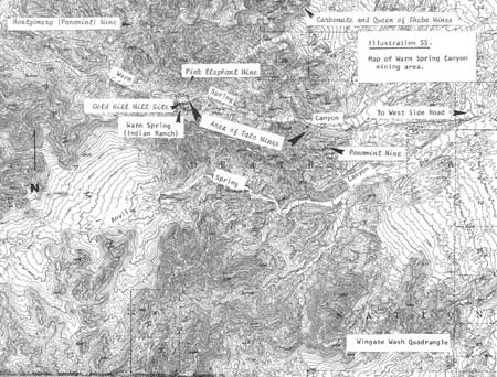
|
| Illustration 55. Map of Warm Spring Canyon mining area. |
b) Present Status
Today the Panamint Talc Group consists of ten unpatented claims: Panamint #3-5 claim, Panamint Millsite, Panamint Millsite No. 1, Panamint Talc Nos. 1-2 lode mining claims, and Panamint Talc Nos. 6-8. The mining area is reached via a dirt road jutting off to the south at the mouth of Warm Spring Canyon. (This route continues on south through Wingate Wash.) About one-quarter mile south on this road are two structures of recent origin. One is a large, two-room, corrugated-metal residence building with a poured concrete floor and plywood walls covered with graffiti, containing two metal bunks. The other empty structure is a small wood and composition-paper shack.
The road turns west from here for about one-half mile, becoming a four-wheel-drive route, and leads to an abandoned ore bin and adit. Evidence of exploratory activity is evident for a half mile along the south wall of the canyon. At its upper end is a large three-chute ore bin positioned on a truck-loading level with the remains of a single ore chute hanging from the hillside above. Ore cars evidently trammed the ore to the surface of the mine and outside, proceeding up an inclined set of tracks and dumping their load into the single chute, which emptied into cars on the second level; these cars then dumped the ore into the lower three-chute bin, from which it was guided into trucks for transport. The workings in this area consist of an inclined shaft about sixty feet long with a twenty-foot drift extending west from the bottom of the shaft. Above the mine portal on the hillside is a frame equipment shelter. These are the oldest workings on the Panamint property, dating from the early 1950s; they produced only a small amount of talc. Most of the talc shipped from this group has come from a deposit about 1,000 feet south-southwest of this shaft--an area mined by an open cut in the mid-1950s. [248]
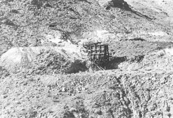
|
| Illustration 56. Ore bin and workings at Panamint Talc Mine. Photo by Linda W. Greene, 1978. |
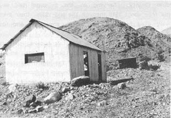
|
| Illustration 57. Modern buildings east of Panamint Talc Mine. Photo by Linda W. Greene, 1978. |
c) Evaluation and Recommendations
The ore bin, ore chute, and tramway ruins of the Panamint Talc Group are of recent (1950s) vintage. Neither they nor the two ruined buildings near the Warm Spring Road junction are historically significant.
7. Warm Spring Canyon Talc Mines
a) Growth of Talc Mining in the Region
Most modern large-scale mining activity in the Death Valley region has centered around borate and talc, the latter operations being conducted mainly in the southeastern Panamint Range where large deposits of commercial-grade ore have been found. The first major talc bodies to be opened in the region were developed in the Mojave Desert area in the early 1900s; these became the Talc City Mine near Darwin, the Western Mine in southern Inyo County, and the Silver Lake Mine in northern San Bernardino County. Serving as the principal talc sources in California from about 1916 through the mid-1930s, their product was extensively used for paint extenders, cosmetics, and insulators.
From 1933 to 1943 talc became important in the making of wall tile: A higher-grade talc, steatite, also became a major ingredient in the manufacture of the high-frequency electrical insulators used in some types of electronic equipment, and because of threatened shortages, became a critically-needed material for several months during World War II, with rigid restrictions placed on its use for non-strategic purposes. Wartime uses and the expansion of industry and population on the Pacific Coast were spurs to the greater production of talc, which was mainly acquired now from mines in the southern Death Valley-Kingston Range belt. After the war the Talc City, Western, and Silver Lake mines continued as primary domestic sources of talc, while other mines concurrently underwent further development, including the Death Valley, Grantham, Monarch, and Superior mines in the Death Valley region. The postwar building construction boom and resultant higher demands for paint and wall tile imposed a great strain on the talc reserves in California. As some became depleted or as it became too costly to operate small underground mines, fewer companies stayed in production, and more dependence was put on the Death Valley mines for the talc that was now being used in a variety of products: cosmetics, insecticides, roofing, rubber, asphalt filler, paper, and textiles. Preliminary data for California talc production in 1975 indicates that over 90% of the total statewide production that year came from Galena and Warm Spring canyons. [249]
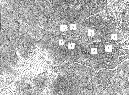
|
| Illustration 58. Site map, Warm Spring Canyon talc mines. |
b) Growth of Talc Mining in Death Valley
The talc deposits in Warm Spring Canyon, together with those located in Galena Canyon to the north, are the most westerly group of talc claims within Death Valley National Monument. These deposits are located on the east slope of the southernmost part of the Panamint Range along the steep sides of mountain ranges trending northwest-southeast. Warm Spring Canyon connects with Butte Valley on the west and the Death Valley basin to the east. The mines here are reached via a well-graded gravel access road that is constantly traveled by large ore-bearing trucks heading from the mines to mills at Dunn Siding, Los Angeles, and Victorville, California. The Warm Spring road leads west off of the West Side Road about five miles north of the latter's junction with the Badwater Road just north of the Ashford Mill site.
These Warm Spring Canyon talc deposits are located on the west end of a belt that stretches for approximately seventy to seventy-five miles from the southeast slope of the Panamints across southern Death Valley eastward into the Ibex Spring and Kingston Range region. The part of the belt included in Inyo County contains four talc properties yielding more than a few hundred tons (Warm Spring Group in Warm Spring Canyon; Ibex-Monarch Group in the Ibex Hills; Western Mine in the Alexander Hills; Excelsior Mine in the eastern Kingston Range) but only one of these (Warm Spring) has been worked continuously since the 1940s. [250]
c) Sites
(1) Grantham, Warm Springs, Warm Springs West, Warm Springs Nos. 2 and 3, and White Point Mines
(a) History
The original eleven claims filed on the most obvious ore exposures that now are covered by the main mine workings in Warm Spring Canyon were located from 1931 to 1935 by Louise Grantham and Ernest Huhn. Seven of these claims (Big Talc, Warm Spring No. 5, High Grade, Warm Spring, and Warm Spring Nos. 2 to 4) extend from east to west for about two miles along the south wall of Warm Spring Canyon; across the road on the north canyon wall are found the Warm Spring Nos. 6 to 9. The Warm Springs Talc property now consists of fourteen unpatented lode claims: Warm Springs Talc, High Grade Talc, Warm Springs Talc #7-8; G.M. #2, 24-30, 43; and G.M. Fraction No. 2, all located during the period from 1932 to 1955. The Warm Springs Talc Claim was located on 22 April 1932, prior to establishment of Death Valley National Monument, whereas the others in the claim group were located after the proclamation, giving the federal government the right to regulate surface disturbance.
Three of the early properties--the Big Talc, Warm Spring Talc No. 5, and Gold Hill Mill Site, located on 9 June 1932, 24 August 1932, and 5 (or 11) February 1933, respectively--were located prior to establishment of the national monument but during a period when the area was closed to mineral entry by temporary withdrawal. These claims were amended on 28 June, 29 June, and 3 July 1974, respectively. In 1938 the Warm Springs Canyon Talc Deposit was said to consist of five claims on the south side of the canyon owned by Miss Louise Grantham of Los Angeles. Development work was reported as slight, consisting only of two tunnels and several open cuts. The deposits seemed large and of good quality, but activity was only sporadic. The first development of the Warm Springs Talc underground deposit possibly began in the late 1930s, the workings consisting of a forty-foot shaft and an eighty-foot drift. In the 1950s work stopped when Louise Grantham acquired all the Warm Spring Canyon claims. From 1942 on, the Big Talc Mine was worked, yielding about 310,000 tons of commercial talc through 1959, producing more of the substance than any other mine in the western United States. [251]
The product of the Warm Spring mines became increasingly important during World War II, as evidenced by a letter in the monument files from Kennedy Minerals Co., Inc., to then Regional Director O.A. Tomlinson requesting him to investigate conditions of the road leading west from the state highway in the south end of Death Valley into Warm Springs Canyon. The road was so rutted that it was difficult to drive trucks over it, making it almost impossible to operate his mine. Kennedy states in this communication that the talc from his Warm Spring property on the south side of the canyon had been approved by the Maritime Commission for use in paint; as a result the War Production Board had asked the company to increase their production. [252]
Another letter, this time from the vice-president of Sierra Talc Company, repeated this complaint on the road, and stated that his company held a Navy contract to supply all the talc used by the Navy paint factory at Mare Island in the manufacture of paint for all naval vessels built and reconditioned In that yard. It also indirectly supplied the Maritime Commission through major paint manufacturers on the Pacific Coast. The material it supplied blended the products of three of its mines, including the one in Warm Spring Canyon, in order to meet rigid Navy specifications. A monthly production rate of 600 tons was needed from the Warm Spring mine, and they could not approach this unless the roads were in better condition for hauling. [253]
Another question in regard to roads arose in 1968 when a newspaper article announced that Grantham Mines and United Sierra Division of Cyprus Mining Corporation in Warm Spring Canyon were desirous of changing the current truck route they used for shipping their product to market by obtaining Park Service permission to improve and use the existing road through Butte Valley and Goler Wash into and across Panamint Valley via Manly Pass to Trona. This would result in shortening their trip to the railway from the current 142 miles (to the Union Pacific RR at Dunn, Ca.) to a much shorter 37 miles west (to the Trona RR). Considering not only the amount of industrial traffic this would have brought into another area of the monument, but also the encouragement it would provide to residents of Trona, China Lake, and Ridgecrest to use this new access to cut their mileage to Shoshone, Death Valley's superintendent, John Stratton, must have shuddered at the idea. Wisely refraining from giving any encouragement to the request, he reiterated the Park Service policy of preserving the monument grounds in as primitive a state as possible. [254]
Johns-Manville Corporation acquired all of Miss Grantham's Warm Spring Canyon claims in 1973 and undertook heading and pillar operations in the Big Talc and No. 5 and in the nearby Warm Springs Mine properties. Development work in the Big Talc was unable to keep ahead of the extraction rate, and only a few headings were made in commercial-grade talc. These were considered uneconomical to process because of the long hauling distances involved in reaching market, the stiff ventilation requirements that were being enforced, and an uncertain ore zone. Operations in the Big Talc were continued until July 1973 when the California Division of Industrial Safety shut down the lower Big Talc for lack of an adequate ventilation system. In December 1973 underground mining was completely stopped, after which time ventilation surveys were conducted.
In order to keep the company's mills going after the shutdown of the lower Big Talc, a program was started to open pit No. 3, but this proved unsatisfactory when the talc became stained and contaminated by dozer scraping. More satisfactory in September 1973 was open-pit mining of the Warm Springs Talc Deposit, although customers soon objected to the poorer quality of open-pit talc compared to that of underground material. Open pit mining continued for twenty-one months, or until June 1975, to a depth of eighty feet and stopped there because of the steepness of the deposit and the low quality of the talc. The Warm Springs stockpile supplied Johns-Manville's market until July 1976 when the Big Talc Mine was reentered to rob pillars for high-quality talc to blend with the stockpiled talc in order to maintain an acceptable product. Poor methods employed in this contract underground mining job, however, resulted in a lower quality material.
Another blow was dealt when Johns-Manville's environmental control group decreed that since the talc in this deposit contained tremolite it had to be packed in sacks marked as hazardous, which definitely influenced customer attitudes and buying habits. Business was further jeopardized when the company's Canadian asbestos dust control team surveyed the mills and shut the operation down because it felt the plants could not economically comply with new proposed asbestos (tremolite) standards. When a new president took over Johns-Manville, the mills and mine were shut down in August 1976. Prior to the shutdown, mine production had reached 60,000 tons per year. [255] At this point, the company decided to sell its talc properties in Warm Spring Canyon.
In August 1976 the company offered all its properties in the monument for sale, plus its grinding plant in Dunn, California. Johns-Manville considered donating its talc claims to the National Park Service in the summer of 1976, but on 1 September 1977, Desert Minerals, Inc., a Kentucky-based company, purchased them. Before operations began, in May 1978, the claims and the company plants in Dunn and Los Angeles were acquired by Continental Minerals Corporation of Las Vegas, Nevada, by lease and option sales agreements. The new owners expressed their intention to resume production at the Big Talc, and hoped to supply talc competitively by late 1978. Mining beyond the near future depends on implementing major exploration and development. In addition to supplying the developing Japanese market for Second Layer talc, which is used as a paper filler, Continental is also attempting to reassert its mines' former position in the domestic market. [256]
The Warm Spring Canyon mine complex now consists of about eight-seven contiguous unpatented mining claims (eighty-four lode and three millsites) controlled by Continental Minerals Corporation and located between about 1,800 and 2,400 feet in elevation along the south canyon walls in Warm Spring Canyon. The Big Talc property consists of fifteen of the lode claims and two of the millsites (located at Warm Springs Camp) of the Continental Minerals claim group: The Big Talc, Warm Springs Talc No. 5, G.M. Nos. 20 to 23, G.M. Nos. 200 to 201, L.G. Nos. 302 to 308, Gold Hill Mill Site, and Gold Hill Mill Site #2. The Big Talc and Warm Springs Talc No. 5 are interconnecting works and the most easterly of the mines within the larger claim group. Warm Spring, on the west end of the chain of claims, is also owned by Grantham Mines and, besides providing water, serves as a camp and equipment storage area for the nearby mines. [257] It will be discussed later in a separate section.
The Grantham Mine (Big Talc-No. 5) workings are the most easterly in the canyon and the most extensive, consisting of a complex system of drifts, winzes, stopes, and levels driven off the main haulageways. Most work has been concentrated in the lower of three talc layers where the zone is of uniform thickness and composition. "Room-and-pillar" mining methods in a checkerboard pattern have been used because the caving characteristics of the talc zone here make ground support a major problem. Although initially this makes for less talc recovery, in the end the pillars can be removed and reduced also, and the percentage of recovery thus increased. Originally mucking machines loaded the ore into mine cars, which were then hoisted up the winzes and trammed to the surface. Fifteen-ton-capacity, rubber-tired diesel haulers and diesel, rubber-tired, four-ton-bucket-capacity front-end loaders maneuver on inclined haulageways, and have been used since the mid-1950s. The full extent of the deposits here are unknown, but reserves are known to be high. Total production up to June 1978 has been 830,000 tons. [258]
Before 1974 all mining in Warm Spring Canyon was done underground, principally in the Big Talc-No. 5 workings. The Warm Springs Mine, about 4,000 feet west, also supported some underground activity, as previously stated, but since January 1974 surface mining has been carried on in an open pit on the site, about 80 feet deep, 400 feet wide, and 800 feet long. The total area disturbed by the pit, waste dump, equipment storage area, and flood control dike is twenty-four acres on the Warm Springs Talc and High Grade Talc claims. Production here was discontinued because of excessive overburden and contamination of the talc beds. Continental Minerals proposes to remove the existing 13,000-ton stockpile, accumulated between 1973 and 1975, to points outside the monument within eighteen months after their Plan of Operations is approved. The Warm Spring West deposit, located between the Warm Spring and the 442 deposit, has not been fully explored, but there appear to be resources underground. It will be developed by the room-and-pillar method. The Warm Spring Nos. 2 and 3 workings west of the Big Talc-No 5 are small bodies that have been exposed through recent dozing exploration and will be developed by open pits, at least initially. Measureable reserves are present. The westernmost talc exposures in this canyon, found in the No. 4 or White Point area, about 9,200 feet west of the main workings, have evidently had no production but have been explored and show rich deposits of commercial value. [259]
The Plan of Operations for the Big Talc-No. 5 workings, submitted in February 1978 and supplemented in December to include Second Layer talc mining, involves three separate phases:
Removing 3,000 tons of ore stockpiled underground
Developing new areas beyond the present mine faces, adding possibly another 379,000 tons to reserves
Mining pillars by drilling and blasting. (These measured reserves are estimated, at 1.3 million tons.) This involves development in both the First and Second talc layers.
According to the plans, ore would be crushed at the surface in a 20" x 36" jaw crusher capable of a 50- to 90-ton per hour capacity. Crushed ore would then be sent by conveyor belt to a steel 250-ton ore bin for loading onto 25-ton-capacity gondola trucks that would haul six loads a day seven days a week to plants at Dunn Siding or Los Angeles. Production of 36,000 tons a year was anticipated by the middle or latter part of 1978. Attaining the previous production level of 60,000 tons per year depended on recapturing lost markets. Mine life is estimated at ten to fifteen years, but additional reserves will probably be found. Reclamation will follow closing of the mine, consisting of removing manmade structures and debris, masking of dumps with dark gravel, and blocking portals with waste rock. [260]
(b) Present Status
Much of Warm Spring Canyon's primitive character has been obscured due to the impact of environmental disruptions resulting from the last fifty years or so of mining activity. Currently there are two open pits, a huge underground complex at the Big Talc, and camp development at Warm Spring, with threats of increased usage hanging over the latter area. The reclamation encompassed in the various Plans of Operation can be only cosmetic at best.
On first entering Warm Spring Canyon, an old adit is visible about one mile east of the Big Talc Mine and on the north side of the road. The adit is timbered, but the framing has fallen over partially on its side and now resembles an A-frame. About one-half mile further west, on the south side of the road, is another old timbered adit whose entrance timbers have been shored up with loosely-piled rocks. The history of these particular exploratory efforts is unknown.
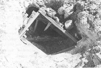
|
| Illustration 59. Timbered adit (#1 on site map) north of Warm Spring Canyon Road. Photo by Linda W. Greene, 1978. |
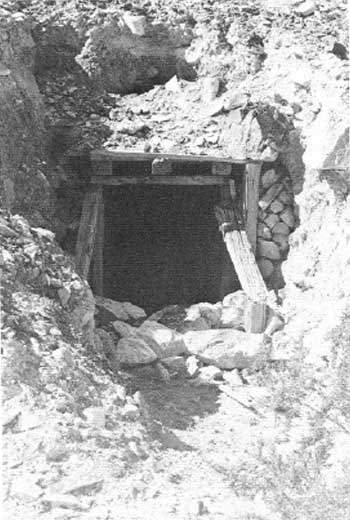
|
| Illustration 60. Timbered adit (#2 on site map) south of Warm Spring Canyon Road. Photo by Linda W. Greene, 1978. |
Approximately three-quarters of a mile further west, on the south side of the road, is a large metal ore bin and conveyor-belt system marking the site of the Grantham (Big Talc-No. 5) Mine. An extensive system of access, turnaround, and loading roads has been added. The entire complex consists of two 500-gallon diesel tanks, three 750-gallon and one 3,000-gallon diesel tanks, two diesel electric plants, two diesel air compressors, a jaw crusher, two ore bins and conveyors, a 500-gallon water tank, and a sump and drainage system. [261] Terraced cuts and levels have completely scarred the areas along the hillside in the vicinity of the main portals; no historical structures are visible.
Across the road from this operation is the site of the Warm Springs No. 6 Mine--older works consisting of a wooden one-chute ore bin serving two timbered adits, one of which has caved in. Remains of a tramway are still visible entering the second tunnel.
Approximately one and one-half miles further west on the main road, and alongside it on the south, is a timbered adit closed off with a framework X, located at the foot of a huge waste dump. This is the site of the Warm Spring Mine. On top of this great mound of earth is the large open pit that was begun in 1974.
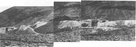
|
| Illustration 61. Grantham Mine (Big Talc-No. 5) south of Warm Spring Canyon Road. Big Talc Portal to left, Riley Portal in center, and #5 Portal to right. |
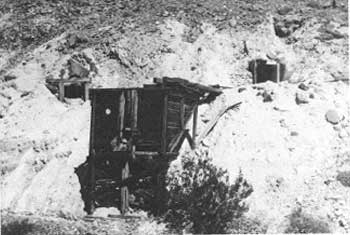
|
| Illustration 62. Warm Spring No. 6 Mine (#4 on site map) across road from Grantham Mine. Photo by Linda W. Greene, 1978. |
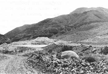
|
| Illustration 63. Warm Spring Mine (#5 on site map), view from west. Photo by Linda W. Greene, 1978. |
Proceeding west again, much terracing and scraping is visible south of the road a distance off along the hillside. This activity surrounds the operations of the Warm Spring West and No. 2 and No. 3 mines.
At the curve about one mile east of the Warm Spring camp, and south of the road, is a mine operation with two entrances and associated dumps. The area is posted NO TRESPASSING, and both tunnels are closed off. This is the site of the No. 4 and White Point workings.
Between this site and the Warm Spring community is another mine on the hillside, south of the road. Its workings consist of an adit with a generator at its mouth, some tram rails descending into the tunnel, and an old car frame used as a winch. Some chute remains are also present. This may be the site of either the Old Quartz Millsite Claim or the Old Mill Stream Mining Claim. [262]
(c) Evaluation and Recommendations
The hillsides in Warm Spring Canyon have been so completely scarred and defaced by the formation of large open pits and by dozing and scraping and waste dump operations that, although there might have been some earlier gold and silver prospecting activity here contemporaneous with mining in the Butte Valley-Gold Hill areas, any evidence of it has probably been completely obliterated. No documentary data on any early gold or silver discoveries in this area has been found.
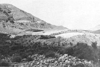
|
| Illustration 64. Activity around Warm Spring West and No. 2 and No. 3 Mines (#6 on site map) south of Warm Spring Canyon Road. Photo by Linda W. Greene, 1978. |
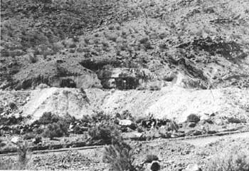
|
| Illustration 65. Site of No. 4 and White Point workings (#7 on site map) along curve of road just east of Warm Spring (Indian Ranch). Photo by Linda W. Greene, 1978. |
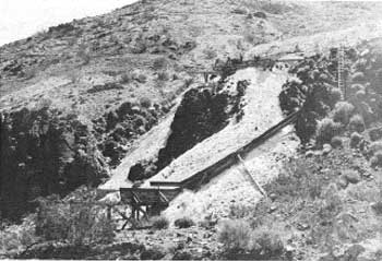
|
| Illustration 66. Claim immediately east of Warm Spring Camp in Warm Spring Canyon (#8 on site map). Possibly Old Quartz Millsite Claim or Old Mill Stream Claim? Photo by Linda W. Greene, 1978. |
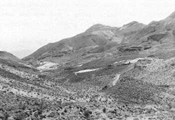
|
| Illustration 67. View east down Warm Spring Canyon of talc-mining activity. Photo by Linda W. Greene, 1978. |
The Grantham Mine (Big Talc-No. 5) in Warm Spring Canyon is considered eligible for inclusion on the National Register as being of regional significance. Since the location of its first claims in the early 1930s, it has developed into probably the most extensive underground talc-mining operation in the state and from 1942 to 1959 produced more commercial talc than any other mine in the western United States. It is considered of exceptional importance in modern Death Valley mining history.
NOTE: Since approval of the Plan of operations for the Big Talc, mineral examinations of the fifteen mining claims and two millsites of the property have found only two of the claims, the Big Talc and No. 5, and one millsite, the Gold Hill, to be valid. The rest are being contested. Of the fourteen Warm Springs Talc Group claims, only the Warm Springs Talc Deposit has been determined valid. [263]
8. Warm Spring Camp (Gold Hill Mill Site)
a) History
In the early 1930s when the Gold Hill Mine was under lease to Louise Grantham, it was rumored that she intended to build a mill at Warm Spring, about four airline miles southwest of Gold Hill. [264] This was not the first attempt at utilizing the waters of this desert oasis for mining purposes. A Notice of Appropriation of Water, recorded 27 May 1889 stated the intention of the claimants (Frank Winters and Stephen Arnold) to take water from the spring, develop it by ditches, pipes, and flumes, and use it for mining and milling purposes connected with their claims in the Butte Valley Mining District. [265] By at least the 1880s and 1890s the spring area, with its dependable water supply and lush vegetation, was undoubtedly considered a comfortable home base from which to conduct mining exploration in the surrounding hills. The Gold Hill Mill Site was located on 5 February 1933, immediately prior to establishment of Death Valley National Monument. The Gold Hill Mill itself was evidently built in the late 1930s, although no information has been located on the structure or the machinery that was put to work processing the gold ore brought down from nearby Gold Hill. By the time the mill was a going concern, Mrs. Grantham was becoming involved in talc mining in the vicinity.
As a result, she proceeded to establish a camp on the Gold Hill Mill Site Claim to serve her Grantham Mine. It is included within the boundaries of what appears on the USGS Wingate Wash quadrangle map as Indian Ranch (Bob Thompson Indian Allotment). The superintendent of Death Valley National Monument reported in 1955 that
Mrs. Grantham has undoubtedly the finest mining camp of any in the Monument. Her residence, the mess hail, shop, and generator building are all of substantial cement block construction and there are four frame buildings including a dormitory and two small houses. There are eight employees at present and this number may be increased to twelve or fifteen. The buildings are equipped with flush toilets, estimated at six, and shower baths. There is a community mess. . . . [266]
One confusing remark in this letter states that
Mrs. Grantham does not have a mill at present but it is understood that she plans to install a small mill for processing gold ore on the millsite across the road from the camp At present she is mining only talc. [Underlining added] [267]
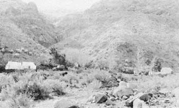
|
| Illustration 68. CCC spike camp at Warm Spring, 1934. Photo courtesy of DEVA NM. |
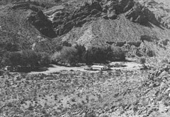
|
| Illustration 69. Grantham mining camp at Warm Spring, view to south. Photo by Linda W. Greene, 1978. |
b) Present Status
The profuse waters of Warm Spring have created a very pleasant environment in Warm Spring Canyon. For a number of years an irrigation system has fostered the growth of wild grape, giant reeds, oleander bushes, and fig trees planted just above the camp. There is also plenty of water for domestic purposes and for leisure activities such as swimming. The mining camp located today on the Gold Hill Mill Site consists of two houses, a mess hall and office, and a powder house and garage across the entrance road. Further north are the gold-processing mill ruins. The Gold Hill Mill Site No. 2, contiguous to the No. 1 on the south and incorporating the spring site, also supports a water entrapment system serving the mining camp and the mines. [268]
A plastic pipeline transports the spring water to the mines where it aids in dust control and will be used for drilling purposes as outlined in the proposed Plan of Operations. The only residents of the Warm Spring camp at this time are a watchman and his family. Under current proposals the majority of miners employed at the Big Talc would live at Shoshone or in other areas outside the monument; only two watchmen and their families would actually reside at Warm Spring. The millsites will continue to house the mine office and provide facilities for vehicle storage and maintenance. [269]
The old mill ruins are located adjacent to the Warm Spring Canyon road on the south side as it continues west toward the Montgomery (Panamint) Mine. A date imprinted in a cement slab at the mill site would seem to indicate that the complex, or at least part of it, was built in November 1939.
The mill setup contains a power-driven arrastra; an oil-burning hot-shot engine that drove an elaborate arrangement of flywheels, a belt and pulley system, and drive shafts that operated the mill machinery; a Blake jaw crusher; a cone crusher; bumping and concentrating tables; a cylindrical ball mill; an ore bin and chute; an unloading platform; a conveyor system; and other related mining paraphernalia. Immediately west of the mill are the concrete foundations of a mill house.
c) Evaluation and Recommendations
This mill and arrastra supposedly served the Gold Hill Mine from the mid- or late 1930s on, although neither its exact construction date nor the duration of its activity is known. The proposed Plan of Operations for the Big Talc Mine states that within six months after termination of mining operations the company "will remove all man-made structures from THE (GOLD HILL MILL SITE) and GOLD HILL NO. 2 MILL SITE Claims . . . . la Later in that report, however, it was pointed out that historical studies had not yet been completed and that the Plan of Operations could not be approved or cultural clearance granted before this was accomplished. [270] It is strongly recommended by the writer that Recommendation No. 21 as set forth in the "Environmental Review and Analysis, Big Talc Mine" be adopted, namely
That the stone arrastre and other remnant [sic] of the old mill located on THE (GOLD HILL MILL SITE) claim be specifically excepted from the requirement for removal of structures under the approved plan, and its physical integrity preserved until a determination of its historical value is made by the National Park Service. [271]
The mill ruin is considered to be of regional significance and warrants nomination to the National Register of Historic Places. It is important because of the combination of old and newer technological processes displayed, and is a prime example of an early ore-processing plant. As such it possesses both historical and technological significance. Although specimens of individual components of the unit may be found in other areas of the National Park System, so far as is known this is the only complete example of a large-scale gold-processing operation.
None of the other structures on the Warm Spring campsite are historically significant.
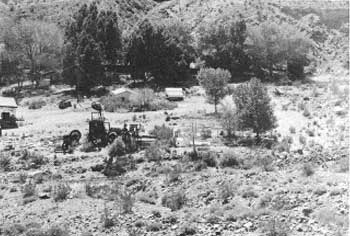
|
| Illustration 70. Warm Spring Canyon mine camp. Note gold ore-processing mill in foreground. Mill house foundations are seen to right of machinery. Photo by Linda W. Greene, 1978. |
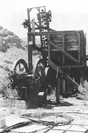
|
| Illustration 71. Hot-shot diesel engine and ore bin, Gold Hill Mill site. Photo by Linda W. Greene, 1978. |
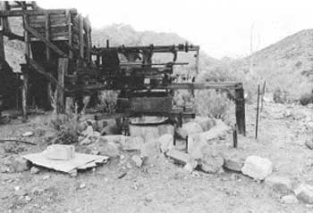
|
| Illustration 72. View west of arrastra, Gold Hill Mill site, Warm Spring Canyon. Photo by John A. Latschar, 1978. |
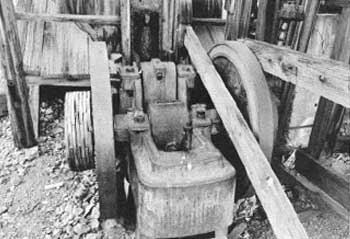
|
| Illustration 73. Blake jaw crusher, Gold Hill Mill site. Photo by John A. Latschar, 1978. |
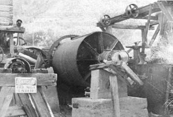
|
| Illustration 74. Cylindrical ball-mill, Gold Hill Mill site. Photo by Linda W. Greene, 1978. |
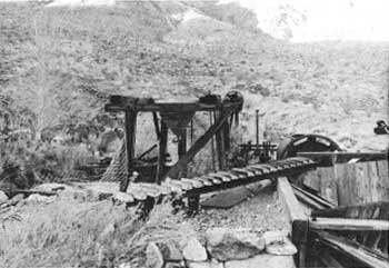
|
| Illustration 75. Cone crusher, Gold Hill Mill site. Photo by John A. Latschar, 1978. |
9. Pink Elephant Fluorite Claim
a) History
Fluorite, a mineral used as a flux and in the manufacture of opalescent and opaque glasses, has been found in association with lead and silver deposits in several mining districts in the area west of Death Valley National Monument. The deposit in Warm Spring Canyon is the only outcropping of this mineral that has been worked in the Panamint Range, but the site is so isolated and the ore bodies so scanty and irregular that mining here has not been economically profitable. [272]
The Pink Elephant claims are contiguous to the Indian Allotment, Survey No. 330 (Indian Ranch at Warm Spring). The Pink Elephant Nos. 1 and 2 were located on 25 August 1937, and the Pink Elephant No. 3 on 28 June 1937; the Pink Elephant Nos. 4, 5, and 6 on 19 June 1939; and the Teena Lode on 24 April 1942. No notice of location was found for the Pink Elephant Millsite Claim, but it was located sometime before March 1946 when all these claims were patented, in the South Park Mining District, by General Chemical Company. [273] No records appear to exist of any fluorite production during the years since.
b) Present Status
This claim group today consists of five patented lode mining claims--the Pink Elephant Nos. 1 to 3, Pink Elephant No. 5, and the Teena Lode, although as of March 1978 the Inyo County assessor's office carried all the original eight claims on their tax rolls. These claims were assessed at $950, according to information from the tax office in October 1974, but they had not been re-appraised since 1967. [274] The claims cover 101.180 acres and are owned by the General Chemical Division of Allied Chemical Corporation of Morristown, New Jersey.
The principal adits are located on a steep hillside about one-half mile north of the northeast corner of the Indian Allotment (Warm Spring). Evidence exists of a mine road that once led north from the Warm Spring Canyon road to the lower level of the mine workings this can be followed on foot today, but is too washed out for anything but four-wheel-drive vehicular passage. The workings cover an area of about 300 feet down the hillside and are just east of a gully at an elevation of approximately 2,700 feet. On the lowest level (there are three) of the workings is a timbered adit with a roughly-made work table outside; several yards south of the entrance and around the ridge is the foundation of a compressor building. [275] The concrete half of the platform is framed with heavy wooden timbers; timbers are also inset in the cement, possibly as a base for machinery. Another section of the building, delineated by boards to the north of this concrete platform, is dirt floored, about ten feet square, and also framed with buried timbers. A triangular-shaped, wooden cable-tramway support, with cable extant, stands just east of the concrete foundation.
On the second level of workings are two more adits, one above the other, and evidently connected. These are slightly north of the adits on the first and third levels. On the ground in front of the openings are the remains of another wooden cable support, indicating that the system probably extended over to this area. A large, wood-framed, screened sieve (?), measuring six feet by two feet, lies half buried in the ground in front of the adits. Remains of a rail tramway are visible leading out of the uppermost adit on the third level. Ore was trammed from the tunnel several yards south around the ridge to the cableway (another wooden cable support, with cable, stands on this level) and then sent down to the bottom of the hill. Ties and rail fragments from the mine railway are scattered all over the upper hillside.
The adits comprising these workings were purely exploratory in nature; hence their erratic turns and twists. According to the mineral appraisal of the property performed in 1978, the lower adit makes ten changes in direction during its 700-foot length. No stoping of the tunnels, which total about 1,005 linear feet, was found, indicating little serious mining activity or production. [276]
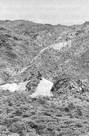
|
| Illustration 76. Pink Elephant Mine on north slope of Warm Spring Canyon. Photo by Linda W. Greene, 1978. |
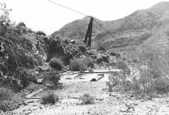
|
| Illustration 77. Compressor house foundations, cable tramway in background, Pink Elephant Mine. Photo by Linda W. Greene, 1978. |
c) Evaluation and Recommendations
The Pink Elephant Group has been considered uneconomic to mine due to the high cost of labor, the low selling price of fluorite, and the sparse occurrence of the mineral at this particular site. [277] The only physical evidence of activity remaining on site are the compressor house foundation, the aerial tramway supports with attached cable, some tramway rails in the upper adit, and miscellaneous debris scattered over the site.
The Pink Elephant Claim is not historically significant, is of recent age and not of exceptional importance in the history of Death Valley mining, and contains no notable structures on site. Interest lies only in its being the single fluorite deposit mined within the monument lands. Attempts should be made to salvage a number of good examples of mining-related artifacts (cable support, wooden sieve, etc.) that might prove useful in interpretive programs. These should be documented on site, collected, catalogued, and stored in the monument collections.
10. Other Mineral Deposits in Warm Spring Canyon
a) Barite
A Warm Springs Canyon Barite Deposit, comprising six claims on the eastern Panamint slope in Warm Spring Canyon, is listed as being active in 1938. The deposit was located at an elevation of 3,000 feet and was owned by Harry P. Gower and Owen Montgomery of Death Valley Junction. This discovery had been made in 1937 and was being developed by three men by means of open cuts along the surface. [278]
b) Fluorite
A Warm Springs Canyon Deposit of four claims in Warm Spring Canyon, owned by Owen Montgomery, was idle except for assessment work in 1938. Open cuts along the surface had traced the deposit, and about 100 feet of tunnel work had been done. This probably refers to the Pink Elephant Group. [279]
c) Wollastonite Feldspar and Mercury
Four claims located for these minerals along Warm Spring Canyon are held by Ralph Harris of the Victor Material Co. of Victorville, California. They are the Contact #l and #2 (wollastonite), the Spar #1 (feldspar), and the Louricha (mercury). No economic showing has been evidenced on any of these claims.
11. Montgomery (Panamint) Mine
a) History
This one-half-mile-square mining area is located about sixteen miles west of West Side Road and about 4.3 miles northwest of Warm Spring (Indian Ranch). The two main sets of workings lie between about 3,700 and 4,450 feet in elevation and are reached via an access road trending for about two miles uphill north from the Butte Valley intersection. The works cover the ridge between the Warm Spring and Galena canyon drainages and are the most westerly of the talc sites within Death Valley National Monument. The Galena and Warm Spring canyon areas have been the source of all talc produced from the monument since 1974. The fourteen claims comprising the first discoveries here were filed by Owen Montgomery and Harrison P. Gower around 1940. The Sierra Talc Company later leased the property, which is now owned by Cyprus Industrial Minerals Company and consists of nineteen contiguous unpatented lode mining claims: Amargosa #1-2, Amargosa No. 3, Amargosa #4, Amargosa Nos. 5-10, Sunrise, Sunrise Nos. 1-3, Panamint, Panamint No. 2, Frances Nos. 1-2, and Snow Flake. Location of these claims spanned a period of thirty-eight years, from March 1936 to September 1974.
In the three years during World War II when high-quality talc, was restricted to use in electrical insulators, the mine was worked steadily because its product could be used as a substitute for steatite-grade talc in non-strategic areas. This has been the only period of sustained underground production. After 1946 operations were intermittent and mainly assessment oriented in nature. Through 1959 only about 6,000 tons of commercial talc had been produced. Production now is estimated to average 25,000 tons per year, meaning a total production of 175,000 tons since pit mining was initiated. The deposit is considered to be nearly half mined out at this time. [280]
Because of the instability of the talc-containing bodies in the area, work underground proved extremely inefficient, requiring extensive timbering and resulting in only a small recovery rate. In 1971, therefore, a decision was made to turn to surface mining, which seemed warranted by indications of heavy reserves found through exploratory drilling. Since 1972 Cyprus Industrial Minerals Company, a division of Cyprus Mines Corporation, has been developing a pit with a projected depth of 300 feet on its southeast side and measuring 850 feet square in perimeter. Access will be at the northwest end. The total area disrupted so far by mining operations totals about 64.5 acres.
The Panamint Mine today is active and producing about 2,000 tons per month. Because it was in full production before passage of the 28 September 1976 act repealing the mineral entry provision for certain National Park Service areas, the present operators have been authorized to continue operations temporarily pending approval of their proposed Plan of Operations. The proposal is to continue open-pit mining until mid-1985 when the remaining 200,000 tons of recoverable ore will be mined out. [281]
b) Present Status
The older section of workings (Montgomery Mine), about 200 feet square in area, probably dates from the early 1940s. Visible from the entrance are one adit trending south and an inclined shaft to the east. The underground workings consist of an east-trending 250-foot-long drift connected to the surface at its west end by a south-trending adit and also joined to a 150-foot-long crosscut and winze east of this adit. Most of the salable talc is thought to have been removed from these areas, although the entire extent of the deposit is uncertain. The tendency of the ground to fracture and the resultant hazardous underground working conditions have precluded further work here. [282]
Remnants of a tramway remain leading southwest around the ridge from this early mine to a four-chute wooden ore bin with metal flashing still in place. Immediately north of this bin on the hillside is some wooden debris--possibly the ruins of an earlier tramway and chute system. A front-dumping swivel ore car was found overturned near the chute remains. The more recent open-pit work with large terrace cuts visible on top of the ridge east of the Montgomery works, at an altitude of about 4,400 feet, involves blasting work and benching into the ridge. Currently the pit measures about 700 feet by 800 feet. Downslope and southwest of the chute remains and west of the pit in a saddle of the same ridge is the stockpile area for talc removed from the latter operation. The ore is transported by truck to mills at Los Angeles ,and Keeler, or to Dunn Siding, California, for shipment to mills in Grand Island, Nebraska, and Mexico City, Mexico. [283]
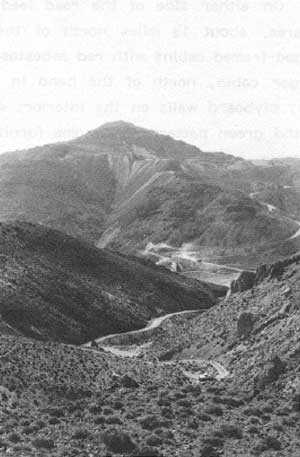
|
| Illustration 78. View east toward Montgomery (Panamint) Mine from burro trail heading west toward Panamint Treasure Mine on Gold Hill. Photo by Linda W. Greene, 1978. |
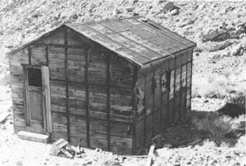
|
| Illustration 79. Early talc miner's shack on road to Montgomery (Panamint) Mine. Note small broken table in front fashioned from dynamite box. Photo by Linda W. Greene, 1978. |
On either side of the road leading up to the Panamint mining area, about 1-1/4 miles north of the Butte Valley cutoff, are two wood-framed cabins with red asbestos-covered gable roofing. The larger cabin, north of the bend in the road, has six-paned windows; plyboard walls on the interior; a linoleum floor in a red, black, and green pattern; and some furniture consisting of bedsprings, a table, benches, built-in shelves, and a small table on legs fashioned from an Atlas powder box. The smaller shack has unfinished walls and ceiling. Dumps up the hillside north of these cabins indicate that there may have been more such structures in the vicinity at some time--it was probably a residential area for men working the Montgomery Mine during World War II.
c) Evaluation and Recommendations
The older Montgomery Mine does not meet the criteria of evaluation for the National Register. Because it is surrounded by active strip mining, the site retains little historical integrity; none of the newer pit workings has any historical significance. The ore car near the old chute could be utilized by the park museum in interpretive programs. The shacks down the road toward Warm Spring probably date from the World War II period and are not outstanding type specimens. They were undoubtedly contemporaneous with settlements at Goldbelt and Ibex springs, which are better examples of talc-mining communities of that era because they contain more residences and related structures on site. The small Atlas powder box stool found in the northernmost of the two cabins should be acquired for use in park interpretive programs as typifying the sort of homemade furniture found at a remote desert mine.
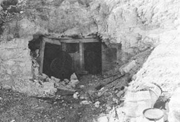
|
| Illustration 80. Earliest openings at Montgomery (Panamint) Mine. Photo by John A. Latschar, 1978. |
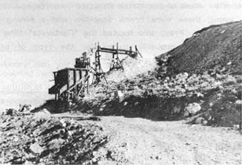
|
| Illustration 81. Ore bin probably associated with the above adits. Photo by John A. Latschar, 1978. |
12. Carbonate (Carbonite) and Queen of Sheba Mines
a) History
(1) Clarence E Eddy Locates Original Outcrop
The Carbonate Mine is situated on an east-trending ridge of the Panamint Range on the west side of Death Valley at an elevation of about 1,200 feet. Its workings are about 1/4 of a mile north of the Queen of Sheba Lead Mine tunnel and mill ruins. The area, about thirty-two miles south of Furnace Creek Ranch and thirty-seven miles west of Shoshone, is reached via a four-mile-long dirt road veering off southwest from Salt Well about 1/8 mile south of the Galena Canyon-West Side Road intersection. The track is now seldom used and extremely rutted from water and wind erosion.
The Carbonate Mine is the earlier of the two discoveries on this site. In the summer of 1907, when Clarence E. Eddy was exploring the southwest slopes of Death Valley, he and some associates began to develop a certain large galena outcrop about one mile from what later became the townsite of Carbonite. News of the strike attracted other prospectors to the scene; among these were Frank Stockton and a mining engineer named Chester A. Pray, who located the "Carbonite" Mine in 1908. The property was probably named for the type of ore found there--lead carbonate with silver. [284]
(2) Jack Salsberry Tackles a Multitude of Problems
The town and camp of Carbonite sprang up as a result of the interest manifested in the Carbonite Mine by Ed Chafey and Jack Salsberry (variously spelled Salisbury, Saisbury, Salisberry, and Salsburry), who formed the Carbonate Lead Mines Company of Death Valley with general offices in Manhattan, Nevada. [285] The problem that had hindered development of the area in the early 1900s--lack of transportation to a railhead--was immediately approached and just as quickly solved by the enterprising Salsberry. The mine was located about forty miles from the Tonopah and Tidewater Railroad station at Zabriskie, so Salsberry proceeded to build a wagon road from Salt Well, four miles east of the mine, over the Black Mountains to the railroad, enabling the ore to be hauled by freight teams about thirty miles across Death Valley to the Amargosa Range where a gasoline tractor hauled it the last sixteen miles to town. (This is the same route followed by today's Salsbury Pass road.)
Salsberry's company next negotiated for 150 head of stock to transport the ore to the spot where it could be taken over by the tractor. It was anticipated that with this system ten carloads of ore a week could be sent to Salt Lake City smelters. [286] Forty to fifty head of horses and mules were acquired at first, working as four ten-animal teams, with plans made to utilize 200 more, each animal hauling half a ton. The capacity of the tractor was about ten tons, which would be increased as the road improved and was packed down with use. Intense heat was a serious problem for the mine workers, the thermometer often reaching 130°F. in the shade and at least once as high as 164°F. To protect themselves, the men lived and slept in the mine tunnels, which also contained the kitchen and boarding house.
By late fall of 1913 only two carloads of ore from the mine had left the Zabriskie station, but further development work was to be carried on throughout the winter months by an increased force of men. Because the ore body appeared extensive and rich in minerals, a loading chute for the large amount of ore expected to arrive soon from the mine was erected at Zabriskie by the Tonopah and Tidewater Railroad. [287] By 1914 the camp was being referred to as the "latest sensation of the western mining world." [288] and the presence of extensive nearby deposits of lead, silver, gold, and copper seemed to promise another desert bonanza. The Carbonite Mine had now been developed to a depth of 300 feet, with lead and silver ore values reputedly running as high as two million dollars. The transportation force now comprised sixty mules and a twenty- or twenty-five-ton traction engine. (It was rumored at this time in the newspapers that the Southern Pacific Railroad was in the process of constructing a branch within fifteen miles of the town. Such a project never materialized.) The nearby camp was said to be "a typical desert metropolis, constructed with tents, rocks, tincans, dry goods boxes, whiskey bottles and anything that comes handy." [289] Water for domestic use was hauled in from Zabriskie.
As was the case with most desert boom towns of the time there were those who urged restraint and moderation in the assessment of future production:
A pretty story about the starting [of] a boom town in the heart of Death Valley is going the rounds. Diamondfield Jack Davis is mentioned as hiking to the new Eldorado, and it is not difficult to trace his fine Italian hand in the invention which has so much foundation as the beautiful mirages that are found in that section of the universe . . . . The truth about Carbonate Camp is good enough, but it will require time before the properties of that section are on a highly profitable basis. The question of transportation remains to be solved, and nothing short of the construction of a railroad can answer the purpose of hauling the ores to market. The traction engine that was supposed to work such wonders has not delivered the tonnage which was relied upon to make the investment more than fairly profitable and no substitute has yet been found for the humble horse and mule in negotiating the sands of the desert. A proposition to build a railroad is under contemplation by a combination of salt interests and the men behind Carbonate and, until this line is constructed, there will be no rush to Death Valley. [290]
Evidently the failure of the traction engine to transport a satisfactory amount of ore resulted in the addition of two motor trucks to the route. [291]
Four months later Salsberry's transportation fleet had been increased to sixteen large trucks that carried ore daily from the Carbonate Mine to Zabriskie, which, incidentally, was now teeming with activity occasioned by incoming men and freight and outgoing ore shipments. Fifteen mines were operating in the vicinity and utilizing the little railroad station as their supply point. Currently shipping one carload of ore per day, the Carbonate Mine was considered profitable since lead was bringing from $57.50 to $75.00 per ton. Salsberry had even constructed a small hotel for his workmen at a midpoint between his mine and Zabriskie (its exact location could not be determined by the writer), where two cooks were required to serve just the sixty truckers employed by the company. Twelve more trucks were being ordered around this time. [292]
(3) Progress of the Carbonate Lead Mines Company
In August another in a continuing series of reports on the progress of the Carbonate Lead Mines Company appeared. Only three miners were required to keep full the ten trucks, of 6-1/2-ton capacity each, that were currently hauling from the property. Ore from the mine, which had now undergone about 900 feet of development work and which showed a vein from 2-1/2 to 15 feet wide, was averaging about 37% lead, 20 ozs. in silver, and $5 in gold, resulting in a value of about $40 per ton of ore. Since transportation averaged only about $12 per ton, the company was realizing a nice profit from this mine. [293]
In 1917 the workings at the Carbonate Mine were described by the California state mineralogist: development consisted of three tunnels (upper, 100 feet long, 60 feet below apex; second, 150 feet long, 30 feet below first; lower [main], 300 feet long, 100 feet below second); the ore recovered was dumped into a bin outside the lower tunnel, from which it was loaded into four-ton motor trucks. Because these shipments were now costing about $15 a ton, the trucks were being replaced by caterpillar-type tractors--a move that would hopefully lower transportation costs. About forty tons of ore a week, averaging 35 percent to 40 percent lead, were being shipped to the U.S. Smelting and Refining Company in Salt Lake City. Only four men were employed by the mining company, whose home office was now evidently in San Francisco. [294]
From 1915 to 1918 the Carbonate Mine produced about 11,000 tons of ore averaging 15 percent lead and S oz. of silver per ton. [295] By 1920 the operation was reported to be idle, although one reference during this time period mentions the "caterpilar" road to the Carbonate Mine as being a good one, which tends to indicate that the mine was active sporadically. The Carbonate Mine was again mentioned in 1923, with the implication that it was still producing. [296]
(4) New Sutherland Divide Mining Company Takes Over
In that year notices were appearing on the transfer of ownership of several mining locations in the general area of the Carbonate Mine. On 1 June a quitclaim deed was granted by R.(oger) H. Downer, A. I. D'Arcy, and Nettie H. D'Arcy of Goldfield to the New Sutherland Divide Mining Company, the Nevada corporation that superseded the Carbonate Lead Mines Company in ownership of the Carbonate property, for the July 1, 2, and 3 lode mining claims "situated 10 miles south of Bennett Hole, on the east slope of the Panamint Mountains, in an unknown mining district; also July 4, 5, 6 and 7 lode mining claims, situated 4 miles west of Salisbury Wells, on the east slope of Panamint Mountains, in an unknown mining district." [297]
In November 1923 an M. (?) H. Downer of Goldfield deeded to the New Sutherland Divide Mining Company the Ajax Nos. 1-3 lode mining claims five miles southwest of "Salisbury's Well." [298] The following month the U.S. Smelting, Refining. & Mining Company contracted with the New Sutherland Divide Mining Company to take over operation of their lead mine, the smelting company realizing 51% of the profits. The wartime production of the mine had been 1,950 tons of lead and 97,000 ozs. of silver, and a profitable amount of ore still existed on its dumps. [299]
It appears that the Queen of Sheba workings, about 1,500 feet southwest of the Carbonate Mine, were a further extension of exploratory work on the latter and were in the same ore zone, so that the two actually comprised one extensive mining operation. When exactly this later lode was opened up is uncertain, but definite mention of it by name appears in 1924, describing it as consisting of nine claims owned by the New "Southerland" Divide Mining Company of San Francisco, but recently leased to the U.S. Smelting, Refining & Mining Company of Boston. The ore on these claims was said to be rich: 6,500 tons of sorted ore that had been shipped to the Salt Lake City smelter averaged 40% lead and 20 ozs. silver per ton. At the prices later reached for lead in 1926, this amount of ore could have grossed over $500,000. [300]
U. S. Smelting and Refining originally planned on spending a vast amount of money to develop the Queen of Sheba, which was regarded as the largest body of proved commercial-grade ore in the Death Valley region; when its connection with the mine began to be used for stock-jobbing purposes, however, the company surrendered its lease. [301] By 1925 D'Arcy and his Victory Divide Mining Company had reached an agreement with the Sutherland Company and initiated a twenty-five-year lease beginning 27 August 1924 on the Carbonate-Queen of Sheba. By this agreement Victory Divide would undertake exploration, mining, development, and treatment of the ore and the owners would receive royalties of 12-1/2% of the ore value after a deduction for smelting costs. From 1917 to 1925 the mine produced about 200 tons of crude ore. [302]
In 1926 the Victory Divide Company was concentrating on the Queen of Sheba group of claims, which, it had recently been determined, were not in the main ore body, although twenty-two feet of mill-grade ore had been found. The primary vein was determined to be in a tunnel on up the mountainside, which the company hoped to intersect by pushing forward in the main Queen of Sheba tunnel. Lead was now selling at the highest peacetime price ever, which was expected to soon equal that for copper. Because silver was found in conjunction with the lead ore at the Queen of Sheba, the company expected to realize large profits after erection of a mill. [303]
In March 1926 the Victory Divide Company was concentrating on the twenty-two-foot-wide vein of ore struck earlier, which by this time had been proven to extend at least several thousand feet and which measured from twenty to twenty-five feet wide. Thirty to fifty thousand tons of ore were expected from the vein, which was assaying 15% lead and 10 ozs. silver (worth about $35 a ton)--an excellent showing and better than that ore being mined in the principal camps of Utah and Idaho, whose best ore averaged about $15 a ton. R. H. Downer, the well-known mining engineer from Goldfield, who was also a director and consulting engineer for the Victory Divide Company, was instructed to make intensive studies of the company's development operations and of the surface and underground geology of the mine in order to ascertain the areas of ore occurrence and thus facilitate the development work. His studies were expected to show that the Queen of Sheba silver-lead deposit was one of the most extensive in the United States:
The work to date has demonstrated [sic] the orebody to be about 25 feet in width, proved at numerous places along the course of the vein, both by surface and underground workings, for a length of between 1,500 and 2,000 feet. This undoubtedly constitutes one of the most continuous bodies of highgrade silver-lead ore in the west, and in view of the favorable conditions in connection with the occurrence, it only remains for the management to open up the mine in an aggressive way to enable it to commence production on a large scale. [304]
Downer's findings seemed to support the opinion voiced by the company and the newspapers that the Carbonate-Queen of $heba Mine was "destined to be one of the biggest silver-lead producers of the United States." The reserves already blocked out were estimated at between 1 and 1-1/2 million dollars in value. [305] A month later lead-silver ore assaying $30 to $90 a ton in lead and silver and containing appreciable amounts of gold was uncovered in the Queen of Sheba south drift--"the greatest lead discovery made in recent years in the Southwest." [306] This strike encompassed the Ajax Claim southwest of the Queen of Sheba tunnel where work was still continuing in an effort to intersect the rich orebody showing on the surface. The situation in the Queen tunnel seemed to be constantly improving:
In one place in the tunnel the ore body has been found to be twenty-two feet in width. A drift on the ore to the north for a distance of seventy feet showed average values of from $15 to $20 to the ton; while to the south twelve feet of ore is said to have been uncovered assaying $35 to the ton. Six feet further on, according to the mine superintendent, the face measured eighteen feet, the ore returning assay values of $88 per ton, with improvements being noted as work progresses.
The company has under consideration the construction of a large concentrating plant, as water is easily available [Salt Well]. [307]
Although work was now focusing primarily on the Queen of Sheba, in June samples were taken from an old 100-foot tunnel on the Carbonate Claim. It was found the ore averaged better than 8% lead and 4 ozs. silver for the entire length of the tunnel. [308] In its main workings at this time the company reported it had 50,000 tons of ore blocked out, averaging 15% lead and 7 to 10 ozs. in silver, assaying $30 to $35 a ton. The vein had been followed at least 3,000 feet and the main tunnel was still being advanced. Victory Divide Mining Company shares were listed on the exchange and its stock continued active. [309]
The state mineralogist reported in the fall of 1926 that six men were pushing development work at the Carbonate Mine, now known as the Queen of Sheba Group of Mines, in three tunnels that had been driven on the ore body, and that another lower excavation was still being advanced to intersect ore bodies worked in the upper tunnels. [310] By December, in an attempt to garner enough funds to carry on development work until a milling plant could be financed, the Victory Divide Company issued Assessment No. 6 of one cent per share to its stockholders (proceeds from Assessment No. 5 had supported the mine for over a year). [311] From 1930 to 1931 around 3,300 tons of ore were mined from the Carbonate, but from 1932 to 1935 production dropped significantly to less than 1,000 tons. [312]
(5) Waning Years
In 1932 the Carbonate, or Queen of Sheba, was again described as having only three tunnels: the upper, 60 feet below the outcrop, was 100 feet long; 30 feet below that was the second, 300 feet long. Although the report said that the lower tunnel intended to tap the ore bodies worked in the upper tunnels was the fourth one, it was probably only the third tunnel. Operations had been suspended by this time. [313] By 1936 the Queen of Sheba Group was listed as the only important property at "Carbonate," and was said to have been sporadically active since 1918, with a total production of about $200,000. [314]
In 1938 the Carbonate Mine was still owned by the New Sutherland Divide Mining Company, but was now under lease to a John P. Madison and H. L. Hellwig, who had evidently been shipping from there for the last seven years. In May their equipment consisted of trucks, a compressor, air drills, and cars; ten men were employed. The ore was still hauled by truck to Zabriskie for shipment to the Salt Lake City smelters. Development on the Carbonate Claim consisted of a series of stoped tunnels to a vertical depth of 150 feet and a long crosscut tunnel below which no ore had been encountered. The Queen of Sheba had a tunnel 1,000 feet long with a few crosscuts--no ore had been developed here. By October Madison had crosscut west about 40 feet 200 feet above the old tunnel and had stoped some ore from 2 to 8 feet wide in drifts from the crosscut. The ore now being found was generally of a higher grade than in the past. The property was being only sporadically worked, however. [315]
The next few years are scanty in information on the mine, which remained mostly inactive. A letter from the Death Valley National Monument superintendent to a Mr. D. C. Wray of Las Vegas concerning the possibilities of improvement of the road into the Carbonate Mine indicates that some mining activity was continuing here during World War II. [316] The New Sutherland Divide Company resumed work in 1944, and after extensive sampling, the mine was reopened by means of three 100-foot crosscut adits with many drifts; rises totaling 2,500 feet were driven at 50-foot vertical intervals. [317] A year later the Mining Journal reported that the New Sutherland Divide Company had suspended operations for the summer, but that about sixty tons of ore had been shipped daily from the Queen of Sheba prior to that, the material being trucked to Manix, California, for rail shipment to the smelter. [318]
In 1948 the Queen of Sheba ore assayed 7% lead and 5 to 10 ozs. of silver per ton, but shipments were small. The Carbonate Mine was reopened in 1948 and ore concentrates assayed 35 to 40% lead. [319] During 1947-48 a long-awaited flotation mill was built, intended to treat 100 tons of ore a day. The plant included a 10- by 20-inch jaw crusher, a 5- by 7-1/2-foot Marcy ball mill, a Bendelari jig, a classifier, agitators, flotation cells, concentrating tables, and a disc-type filter. A 250-kw GE, diesel-powered generator supplied power. Water was pumped from Salt Well, four miles east, against an 1,150-foot hydraulic head. Construction of this plant resulted in a short flurry of activity, but although several hundred tons of ore were mined and milled by the New Sutherland Company from 1948 to 1949, mining operations finally ceased in mid-1949. [320] In 1950 the interest of the New Sutherland Company was relinquished to Mr. William Friml of Hollywood. The property was then leased to the Goldfield Consolidated Mining Company from 1952 to 1953, and some drilling was done, but no new ore bodies were found. In 1961 a Mr. Ray Bennett of Westminster, California, leased the property.
Total production of the Queen of Sheba has reportedly been 16,000 tons of crude ore yielding 5,000,000 lbs. of lead, 100,000 ozs. of silver, 1,500 ozs. of gold, and 146,000 lbs. of copper. Ore from the mine has averaged 15.5% lead, .5% copper, 6.3 ozs. of silver, and .09 oz. of gold per ton. [321]
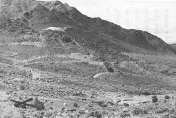
|
| Illustration 82. Carbonate Mine workings on hillside northeast of Queen of Sheba Lead Mine. Photo by Park Ranger Warren H. Hill, courtesy of DEVA NM. |
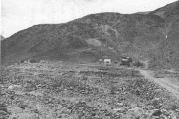
|
| Illustration 83. Queen of Sheba Mine and Mill site, 1962. Photo by Linda W. Greene, 1978. |
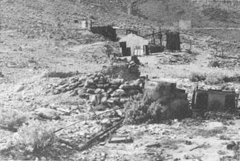
|
| Illustration 84. View north showing stone ruins, appliances strewn about, and flotation mill ruins. Photo by Linda W. Greene, 1978. |
b) Present Status
The site designated "Queen of Sheba Mine" on the USGS Wingate Wash quadrangle map consists of two separate mine operations. The earlier Carbonate Claim, comprising three adits and about 1,600 feet of horizontal development on four levels, is on the south slope of an east-trending ridge northeast of the Queen of Sheba Mine, whose workings extend higher up on a hillside on an east slope of the Panamints about 1,300 to 1,500 feet southwest of the Carbonate. These latter workings comprise four adits driven southwest into the ridge where four levels provide access to 1,900 feet of level workings. [322] As of 1976 the Roy Group of fifteen lode claims, located during 1971 and 1972, incorporate the old Queen of Sheba and Carbonate Mine workings. (The Roy Millsite claim covers Salt Well Tanks.) [323]
The structures on the mine site as of 1 April 1978 included two wooden shacks, a loading dock, some stone foundations (possibly dugouts or crude smelters), a large and more recent corrugated-metal industrial building, and the ruins of the flotation mill, above which an adit is visible on the hillside. [324] The two wooden cabins south of the mill ruin probably functioned as residences; appliance parts are strewn on the ground outside. Inside the two rock and mortar foundation ruins are pieces of charred timber. The ruins appear round, though slightly irregular, in outline.
The mill structure is quite imposing due to the presence of four levels of cement floor foundations, a great deal of the wooden framework, and various machinery items still on site. The metal shed and flotation mill ruin probably both date from the 1940s. All that remains of the structure below the ore bin shown in a 1962 view (Illus. 76) as having high wooden timbered walls is a cracked clay floor about two feet high and twenty to twenty-five feet in diameter through which water or some other liquid was routed. A rotating apparatus of some sort that once stood up in the center of this structure has fallen over. Water from Salt Well, although it could not be used for drinking purposes, was used to power the mill at the Queen of Sheba. The water had to be pumped in two stages against an 1,150 to 1,200-foot head.
North of the Queen of Sheba workings are those connected with the Carbonate Mine. These consist of three tunnels with a reserve bin below the lower tunnel from which ore was loaded onto trucks and hauled to Zabriskie.
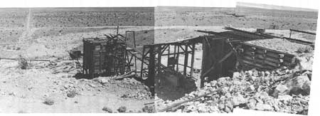
|
| Illustration 85. View easterly of Queen of Sheba ore bin and mill ruins. Road in left background leads to Salt Well. Photo by Linda W. Greene, 1978. |
c) Evaluation and Recommendations
Ward C. Smith, in a report on mineral resources within the monument, points out that several major lead, silver, and zinc producers exist- in Inyo County within a belt extending across the monument lands from the old deposits at Cerro Gordo on the west to Tecopa, southeast of Shoshone, outside the monument's eastern boundary. Within Death Valley three large lead deposits exist--the Queen of Sheba Mine and the Ubehebe and Lippincott mines near Ubehebe Peak--of which the first has been the most productive, yielding approximately $300,000 worth of ore prior to 1944 and about 16,000 tons of crude ore (five million pounds of lead) during its lifetime. Second in productivity is the Ubehebe Mine, which has furnished approximately 3,500 total tons of ore (two million pounds of lead), and trailing is the Lippincott Mine, whose total tonnage production is unknown but whose output has been valued at around $80,000. [325] The Queen of Sheba (Carbonate) Mine has had a long and varied history dating from the early 1900s through the 1970s. Its importance in Death Valley mining history relates to its status as the most productive lead mine in the monument, both in amount of ore produced and in its total value. For this reason it is being nominated to the National Register as being of local significance.
The mill-associated buildings that remain standing at the Queen of Sheba site (shacks, metal shed, mill ruins) date primarily from the 1940s, although their exact date of construction could be as early as the late 1930s. In the early 1900s a rude mining camp of undetermined size existed in the vicinity, but no traces of it were found. Whether the two stone dugout foundations date from this period is unknown, because no artifacts were found in association that might be used to date the structures. Several items of old mining machinery lie in various stages of disrepair on the site and should be examined by someone knowledgeable in early mining techniques and equipment. Some of these pieces might be useful for interpretive efforts or for research purposes.
The writer suggests that this property be used to interpret the lead-silver phase of mining activity in Death Valley. One of the monument's unique attributes is the wide variety of minerals that have been sought after and exploited here, and these should be indicated to the visiting public, who should also be made aware of the diverse types of milling operations used to process the many metallic and nonmetallic elements. The only other lead mines in the monument are in the Ubehebe District and, inaccessible to most tourists. In addition, neither of them supported as large or as enterprising a reduction plant. It is also recommended that some type of interpretive marker be erected, possibly at the junction of the mine's access road with the West Side Road, identifying the site and briefly highlighting portions of its history. Because the rough condition of the road to the mine tends to discourage visitation, emphasis should be laid on interpreting the site in more detail at the monument visitor center.
13. Galena Canyon Talc Mines
a) Sites
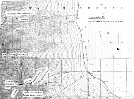
|
| Illustration 86. Map of Galena Canyon mining area. |
(1) Bonny Mine
(a) History
The three adjacent claims comprising the Bonny Mine are located at the mouth of Galena Canyon on the south side of the road, their waste dumps glaringly visible from anywhere below Badwater. The claims were originally owned by Southern California Minerals Company of Los Angeles, whose only mining operations here occurred during 1954 to 1955, yielding approximately 2,300 tons of talc. The area was mined by dozer cuts on the surface and through adits and drifts underground. [326] The Bonny and Bonny #2 lode mining claims were subsequently patented by Pfizer, Inc., on 2 February 1976, and the Bonny #1 claim was acquired by them on 14 February 1966, but is not patented. The Bonny Millsites Nos. 1 and 2 were located on 3 November 1975. [327]
Since 1970 these pit and stripping operations have produced about 30,000 tons of talc from the mine, for a total value of over $1,600,000. Although there is no record of ore production for 1975, the site was being worked by dozers in 1977 and 1978. [328] In January of the latter year Pfizer began implementing its Proposed Plan of Operations by removing waste rock overburden in order to expose additional talc. The mine is currently an open-pit operation that is estimated to produce 9,000 tons annually. Underground development (room and pillar) is proposed to begin near the time of completion of the pit operations (projected at 1981). Twenty-five-ton trucks will be used to haul the ore to the company stockpile and mill at Victorville, California. [329]
(b) Present Status
Dozers at the Bonny Mine site today are continuing pit operations and are carving out terraced benches on the ridge at the mouth of Galena Canyon. This work is scheduled to continue until the depth of the ore bodies becomes excessive, necessitating mining by underground methods.
(c) Evaluation and Recommendations
The Bonny Mine is not eligible for nomination to the National Register. It has no outstanding importance in Death Valley mining history, nor does it contain any, significant structures on site. An early prehistoric cave site was found west of the entrance to Galena Canyon, and two other small caves, one of which may have been inhabited by prospectors, were found on the north side of the mouth of Galena Canyon, but these would not appear to be affected by current mining activity. [330]
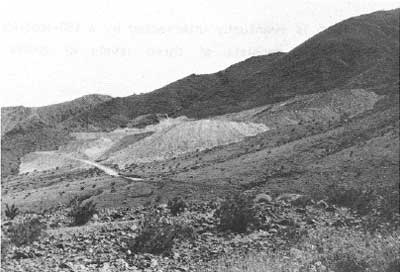
|
| Illustration 87. Bonny talc Mine at mouth of Galena Canyon. Photo by Linda W. Greene, 1978. |
(2) Mongolian Mine
(a) History
The Mongolian Mine Group, consisting of six contiguous claims, is located on the south side of Galena Canyon about one mile west from its mouth at an elevation of 1,800 feet. The claim group consists of the Mongolian lode mining claim (located 12 April 1928; patented 9 July 1963), the unpatented Mongolian No. 2, and Nos. 3 and 4 lode mining claims (located 10 and 30 October 1973), and the unpatented Mongolian Millsite Nos. 1-2 (located 13 March and 16 July 1976). [331]
The original claim was located in 1928, but not until the 1960s was a cut opened and the ore determined to be of sufficient quality and quantity to warrant a patent. Little progress in development and lack yet of a strong market for the talc impeded production for the next decade. Pfizer, Inc., began exploratory drilling operations in 1973 and a downdip stripping operation in 1974. This later phase had to be enlarged in late fall and early winter of 1975 because the more easily mined surface talc of the surrounding Galena Canyon mines had played out. The multiple-bench open-pit operation seen today is the result of an accelerated stripping program that was begun and completed before the moratorium period decreed by Public Law 94-429 had been instituted. [332]
So far, twenty-one acres of hillside have been disturbed by mining activity related to the Mongolian Mine. The Plan of Operations submitted for NPS approval proposes a five-phase program by which the waste rock overburden stripped from one section of the deposit would be used to backfill a previously-mined area. The entire program is contemplated to last through 1980, with reclamation beginning within six months of the end of activity. It would be judged complete after all benches were obliterated, the walls of the pit were sloped, the tops of the dumps were rounded off, and all areas were masked to match as much as possible the surrounding natural environment. This procedure is estimated to take one and one-half years. [333]
(b) Present Status
As seen from the Galena Canyon Road, this group consists of dumps and a terraced open pit.
(c) Evaluation and Recommendations
The site has no historical importance and contains no significant structures.
(3) Mammoth Mine
(a) History
The Mammoth Claim Group, located 1-1/2 to 2 miles west from the mouth of Galena Canyon at an elevation of 1,400 feet, consists of the Mammoth and Mammoth No. 1 lode claims, patented 9 July 1963. The first underground exploratory activity here took place in the late 1950s, but actual underground mining operations were not undertaken until ten years later when Kennedy Minerals Company and C. K. Williams and Company initiated development of over 1,600 feet of underground workings. In addition, metal ore bins and other necessary facilities were erected and access roads built.
The new underground workings consisted of a main adit with associated raises connecting sublevels, opening the way for future room-and-pillar mining. A lower adit was projected below the main one in hopes of intersecting the ore body, but it failed to locate any talc. A few other smaller exploratory openings were also made, with total production during the 1960s reaching about 5,000 tons. From 1970 to 1974 the mine was idle, and then, in mid-1975 and early 1976 Pfizer, Inc., which had gained control of the property, sporadically activated the mine by mining and shipping small test loads procured in the vicinity of the old main adit by means of an open cut or pit. About 200 tons of ore have been produced since, with a resulting total surface disturbance to the entire area of 3.75 acres.
The proposed production schedule for the Mammoth Mine called for reopening the area early in 1978 with a force of two to four men. During the first three months of preliminary work necessary before commencing underground open room-and-pillar operations, it was expected that only a minimal production level could be maintained. By mid-1978, however, a production rate of 10,000 to 12,000 tons per year would be anticipated from the six to eight miners employed five days a week. Twenty-five-ton trucks, hauling two loads a day, would transfer the ore to the company's grinding plant at Victorville, California. The production rate of the mine, whose projected life span is at least fourteen years (longer if added reserves are found), is estimated to reach 20,000 tons a year. Reclamation will follow the termination of operations and will involve the rounding off of road cut crests and dumps, the reduction of high retaining banks, and removal of man-made structures. [334]
(b) Present Status
The Mammoth Mine workings today consist of active open-pit and underground operations. Man-made structures on the access road include two talc bins, consisting of two metal tanks with a wooden framework for a tramway trestle on top, and a small wooden shelter that once housed a compressor. Both structures probably date from the 1960s. An older adit, the second one dug in the 1960s in hopes of intersecting the talc body, with an associated waste dump, is visible east of the metal talc bins and lower in elevation.
(c) Evaluation and Recommendations
The Mammoth Mine site is not historically important nor does it contain any significant structures.
(4) Death Valley Mine (White Eagle Claim)
(a) History
Galena Canyon is located immediately north of Warm Spring Canyon in the Panamint Range, and is reached via a gravel road leading west one-eighth of a mile north of Salt Well Tanks. The American-Italian Talc Company displayed initial interest in the talc deposits in the Panamint Range several years before the Warm Spring talc operations commenced, and laid claim to several areas in Galena Canyon. Incorporated with headquarters at Tonopah, Nevada, on 15 March 1927, the company boasted a capital stock of five million dollars, divided into five million shares with a par value of one dollar each. Beginning business with one thousand dollars in capital, the company proceeded to acquire claims in the Panamint Range and in the Black Mountains west of Tecopa. [335]
The first notice of the company's operations found in contemporary newspapers or journals was an article in the fall of 1929 stating that the American-Italian Talc Company was assembling a work crew and preparing to make shipments from its mine in Galena Canyon. The vice-president of the company stated that it had several orders to fill, one of them for 1,000 tons of ore. The exact production level reached by the Death Valley Mine at this time is unknown, but it was probably not more than a few hundred tons. [336] For the next few years operations were evidently suspended, during which time the American-Italian Company went defunct, emerging again in the summer of 1933 as the Death Valley Talc Company. The authorized capital stock was changed to $500,000 divided into 500,000 shares with a par value of $1 per share. S. D. Pipin, former president of the American-Italian Company, continued in this position in the new organization. [337]
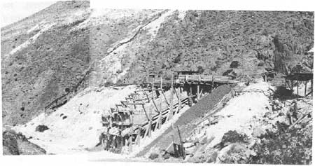
|
| Illustration 88. Death Valley talc Mine in Galena Canyon. Photo by Linda W. Greene, 1978. |
A 1933 letter from the vice-president of the new Death Valley Talc Company to Superintendent White at Sequoia National Park (Death Valley at this time being administered under a joint superintendency with Sequoia National Park) informed him of the company's takeover of the American-Italian Company assets and of the new company's intention to ship some ore to the east within a few days' time. A camp had been established in the vicinity of the mine consisting of "four frame buildings fully equipped with cooking utensils, beds, stoves, mattresses, outhouse, blacksmith shop, tools, storage cellar, loading platforms, etc." [338] The remote location of the deposits has always presented some problems for the owners. This was most serious during the earlier days when transportation facilities were not as advanced or dependable. This concern was voiced by Mr. Umbdenstock, who requested help in improving the road from the valley floor to the mines.
By 1938 the company's property in Galena Canyon included ten claims. Eight men ran a grinding plant where material ran through a "40-ton bin, steel chute about 100 ft. long, to hammer mill, elevator, to air separator where minus 200 product is taken out to two other air separators, products minus 400 and minus 700 mesh; oversize to 6 by 5 pebble mill, discharge back to air separation system. Products are sacked by hand. Sixty h.p. Venn-Severn oil engine supplies the power. Capacity 36 tons per day. [339]
About the year-to-year operations of the mine little could be found, so that only broad comments can be made on the subsequent progress of the company through the years. From 1937-to 1942 the mine yielded about 7,500 tons of talc, some of which was mined by the Pomona Tile Company which leased the property from 1940 to 1942. The mine was then either idle or only sporadically worked until 1953 when the eleven claims were sold to the Kennedy Minerals Company, which began active and continuous operation of the mine, producing another 55,500 tons of commercial talc by 1959. The total number of claims under their ownership had reached twenty-four by 1968, including mine workings and prospecting excavations. [340]
(b) Present Status
The five talc mines currently active in Galena Canyon--the Bonny, Mongolian, Mammoth, White Chief, and White Eagle--are owned by the Minerals, Pigments, and Metals Division of Pfizer, Inc., which also has controlling interest in talc claims in the Ibex Hills and Saratoga Springs areas. The Death Valley Mine is part of the underground workings of the White Eagle Mine, whose operations to the east involve downdip stripping operations in an open pit. These five operations are located on three adjacent fault blocks, with the White Eagle and White Chief mines being the two talc-bearing sites on the middle fault block. Deposits here have been mined mostly by downdip stripping. [341]
The northern segment of the talc zone in this middle fault block is the one containing the Death Valley Mine, including about thirty patented and unpatented claims. This site has yielded, by underground mining methods, practically all of the commercial talc produced on this claim before 1960. The earliest section of the mine, high up on the hillside, is known as the "Pomona workings," and consists of a 250-foot-long inclined shaft, which is eventually intersected by a 150-foot-long adit. The principal mine consists of three levels of drifts, adits, and winzes. [342]
The most imposing structure at the Death Valley Mine today is a large wooden two-section ore bin: one double bin with two to four chutes on the right and a smaller one-chute ore bin to the left. Also visible are at least four adits, a working platform area on top of the bins on which are located a storage dugout, a small office structure, two ore cars, a metal bunk, and ore scoops. Remains of a large-diameter pipe line advance down the hillside north of the main portal and over the dump pile. [343]
(c) Evaluation and Recommendations
The Death Valley Mine does not meet the criteria of evaluation for the National Register due to a lack of associative significance in the mining history of Death Valley. Dates of construction of the large ore bin are unknown, but a large grinding plant had been built somewhere in the area by 1938. No evidence of this building was found. Because the remaining structures at the mine are remnants of the oldest talc mining operation in Galena Canyon, with initial work dating from the 1920s, it is recommended they be accorded a treatment of benign neglect. Some interesting pieces of mining equipment on site (ore cars, forge, etc.) should be examined relative to possible interpretive use. This mine is part of an active talc operation and it is possible that Pfizer would donate some of these old items. [Note: Archeologists from the Western Archeological Center found remains of a mining camp with stone foundations near an ore chute thought to be on the White Eagle Claim. These have not been seen by this writer, but reportedly appeared to be relatively recent in origin (1950s). According to survey maps seen by this writer, the site is located between the Mammoth and Death Valley mines near the Kennedy Minerals camp.]
The Kennedy Minerals camp, one-quarter to one-half mile east of the Death Valley Mine, is a small community of white frame and corrugated-metal residences built in the 1930s. It is undoubtedly the camp referred to in 1933 as being used by the Death Valley Talc Company and located near their steatite deposit (Death Valley Mine). This complex is not historically significant. It has lost much of its structural integrity and is currently in a state of decay. Other type specimens of early talc camps exist within the monument in a better state of preservation.
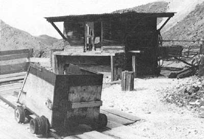
|
| Illustration 89. Ore car and workshop on platform area, Death Valley talc Mine, Galena Canyon. Photo by Linda W. Greene, 1978. |
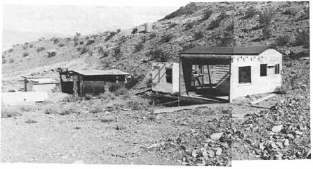
|
| Illustration 90. Kennedy Minerals Camp, Galena Canyon. Photo by Linda W. Greene, 1978. |
14. Hungry Bill's Ranch
a) History of Indian Ranching In and Near Death Valley
Indian existence in Death Valley from precontact times through the 1920s was of necessity a transitory lifestyle with settlements and camp locations determined by the seasons. In the winter the Indians retreated toward the valley floor to escape the severe snow and cold of the mountain ranges; in the summer the excessive heat and low water levels forced them once again up into the higher elevations.
The three Shoshone families whose main headquarters from at least the 1880s well into the twentieth century were at Hungry Bill's Ranch, at about 5,000 feet elevation up Johnson Canyon, lived during the winter about fifteen miles south of Furnace Creek in the general vicinity of Eagle Borax Works and Bennetts Well. These families might also have inhabited Butte Valley in earlier days before moving into the mountains in the fall to gather pinyon nuts. [344]
The occurrence of Indians (not always Shoshones) living on small ranches in the Death Valley region and indulging in serious farming activity was noted in several instances in early years. Travelers heading for the goldfields of Lida, Nevada, and Gold Mountain in 1873, and crossing north of Death Valley, found
a little enclosure of less than an acre, near a small spring of water . . . . No house or dwelling of any kind is seen, although this little farm is under a high state of cultivation. The proprietor is always to be seen dilligently [sic] at work upon his property. He is an aged and remarkable sedate-looking old Piute, who is known as "Billy Rogers" . . . . Billy is proud of his success as a farmist, having year sold his surplus (one sack) in Lida for $6. [345]
When Lieutenant Birnie participated in the Wheeler Survey of 1876 he and his companions took the trail leading from Panamint City across the Panamint Range east to Johnson Canyon:
The first portion of the descent to Death Valley by trail was very steep. In the canon through which we passed grass and a short running stream were found, also a small cultivated piece of ground where vegetables were raised with facility by irrigation. [346]
This description must refer to the Hungry Bill Indian camp area. A "Johnson's Ranch" is shown on the Wheeler Atlas Sheet 65D (1875).
In 1891 Frederick Vernon Coville made the following observations while acting as botanist for the Death Valley Expedition. During the trip he had seen about twenty-five Panamint Indians, all living on the west side of the valley:
At the mouth of Hall canon, near Hot springs, at the west foot of the Panamint mountains, and in Johnson canon, on the eastern or Death Valley slope of the same range, the Indians have under crude irrigation and cultivation two or three acres of ground. The crops commonly raised are corn, potatoes, squashes, and watermelons. Of the last they are especially fond, fully as much so as the African, and the desert climate is admirably suited to their growth.
The cultivation of plants, however, furnishes them neither a sure nor an adequate food supply. They occasionally purchase from miners and prospectors bacon and flour. . . . [347]
Peaches and grapes were also reported to have been raised here. [348]
In 1896 two "garden" areas within Death Valley were noted. The first described was in Johnson Canyon:
just over the summit, and southeast of Panamint, was "Johnson's garden" in the flush days of the rise and before the fall of Panamint. Here Indians Pete and George [Hansen?] are cultivating four or five acres of land. With immense labor they have cleared away the surface rocks, building huge walls for fences, and irrigating ditches from the large springs. March 31st alfalfa was four to six inches high: The grapevines hanging over a framework of poles, showed formed grapes in the verdure and the peaches appeared half formed. In their larder was found fine varieties of beans, wheat and corn. On the hillside George has graded away a large space, and has material on hand for a regular house. [349]
The second ranch was at Panamint Tom's place in Anvil Canyon, "where a copious spring of lukewarm water makes a small oasis in the wash, and right among the mineralized mountains. [350]
Panamint Tom's place is mentioned in more detail in an 1897 newspaper article describing the visit of a W. J. Langdon to the Panamint Range, a trip that happened to coincide with a severe thunderstorm:
It struck the ranch of the notorious Indian, Panamint Tom, about 9 o'clock in the morning, and swept everything before it. Tom's orchard of 150 trees was torn up, his garden entirely destroyed, the camp tepees swept away and the ranch wrecked generally. At the time of the occurrence there were eleven Indians on the ranch, but aside from a good drenching they sustained no injuries. The stock was on high ground and escaped the force of the water. [351]
During this same time it was reported that "Panamint George [Hansen] has a fine ranch, supplies the miners with fruit and melons and raises large crops of alfalfa." [352] George's ranch was on the west side of the Panamints at the mouth of Hall Canyon north of Warm Sulphur Springs. He was probably supplying miners and prospectors in the new camp of Ballarat further south as well as those working in the surrounding canyons. Another Indian supplying Ballarat was Indian Joe, who had lived on Peterson Creek in the Argus Mountains before being pushed off the land by John Searles, of Searles Lake borax fame, who started a garden there in 1873, planting fig, apple, and other trees, and grapevines, and building a terraced spot for his gardens. As soon as he left the area, Indian Joe returned and began harvesting the produce himself, ultimately supplying his wares to a Ballarat storeowner, Harry Robinson, for sale to miners. [353]
In 1910 two men, F. J. Busch and Pat Burke, made a trip into southern Inyo County:
From Skibo [near Lee, Ca.] we visited the Furnace Creek ranch, and it is certainly a garden spot at this time of the year. We traveled as far south as Bennett's wells in Death Valley and were escorted from Furnace Creek to what is known as Hungry Bill's ranch by Indian Bob Thompson. Hungry Bill being an Indian, and one that does not understand English, impressed me in several ways; one in particular was the energy he possesses. His place might well be called the western base of Telescope Peak, and here he and his family have lived for perhaps thirty years. He has about fifty fruit trees that bear splendid fruit in July. He raises grapes, potatoes, corn, peas and beans, and the ranch is not of ordinary Indian type. It shows evidence of being kept up. [354]
b) Hungry Bill and His Family
The Bureau of Indian Affairs, the 30 June 1927 census of the Paiute, Shoshone, Monache, and Washoe Indians of Bishop Agency, and various applications for enrollment with the Indians of the State of California all provide differing information on names, birth dates, and interrelationships of the various members of Hungry Bill's immediate family. According to the Bureau of Indian Affairs, Hungry Bill was born around 1839, a full-blood Shoshone and son of Pee-pu-wine (mother) who was residing in Inyo County by 1 June 1852. He married a full-blood Shoshone woman, Ce-un-ba-hobe, who was evidently about the same age. According to the BIA Hungry Bill died in 1919 of the flu and his wife passed away three years later. However, their children, on their individual enrollment applications, listed their father as dying in 1918, at age seventy, which would move his birth date back to 1848. Most did not remember the year of their mother's death, although one estimated it at about 1915. [355]
Hungry Bill and his wife had two sons: Tim Billson (aka Tim Hanneberry, Hendeberry, and Handeberry) was variously listed as being born in 1885, on 24 October 1891, or in 1901. He was listed on the 1927 census as living in Ryan, and according to the BIA was still residing in Death Valley in 1940. Little is known about the other son, Johnnie Billson, who reportedly died in 1916. [356]
Two daughters were born to Hungry Bill. Susie's date of birth was either 1880, 1890, or on 28 October 1895. She reputedly married Tom Wilson, also a Shoshone Indian, and was living at Furnace Creek in 1940. According to information Susie provided on her enrollment application, Tom was born 28 October 1872 and was one-half Shoshone. On the 1927 census a Tom Wilson is listed as living in Death Valley, born in 1872, and having a wife, Susie Button, born in 1890, and two daughters, Edna and Edith, both born in 1909. [357]
More confusing are the details on Mabel Billson, Hungry Bill's other daughter. According to the BIA she was born before Susie. Her enrollment application states her birth date as 25 October 1884, although the census gives it as 1894. The BIA records that she went to work at Scotty's Ranch in northern Death Valley, and, on becoming ill there, moved to Beatty, Nevada, where she died in 1934. Never married, she bore three full-blood daughters: Mattie Billson (born 1923); Maggie Billson (born 1924); and Musie Billson (born 1927). Mabel herself, however, stated that she had two children, Mary Bill (born 15 March 1924) and Musey Bill (born 25 October 1926) by Tom Wilson, a full-blood Shoshone Indian, to whom she was never married. A third child, Maggie Bill, she presented as her granddaughter (born 25 October 1922), the illegitimate child of a deceased daughter who was never named and who died around 1925. The grandchild's father was unknown. Maggie had lived with Mabel almost all her life. The census lists Mabel as having a daughter born in 1914. [358]
At the time Steward wrote his treatise on the Basin-Plateau peoples, seventeen Indians were reportedly congregating at Hungry Bill's Ranch in the summertime. These included Panamint Tom, regarded as the "chief," his wife, two sons, and four daughters; Tom's brother Hungry John (Bill), his wife, two sons, and two daughters; Tom's sister, her husband, and one son. [359]
In 1937 T. R. Goodwin, first official superintendent of Death Valley, wrote an article on the Indians of the region, and in so doing attempted to delineate some of the relationships. He stated that nearly all the Death Valley Indians were members of various branches of the Shoshone tribe, with Hungry Bill having been the acknowledged leader for several years. Panamint Tom, Hungry Bill's brother, was also an important power in the tribe. Indian George (1841-1945) of Panamint Valley married a sister of Hungry Bill. He had been born at Surveyor's Well in Death Valley and was buried at his Warm (Sulphur) Spring Ranch in the Panamint Valley. Robert Tomson (Thompson), to whom the allotment at Warm Spring in Death Valley was given, was the son of Panamint Tom. Tom Wilson, who married one of Hungry Bill's daughters, was not full-blood, according to Goodwin, but was born in Darwin in 1872 of a Mexican father and Shoshone mother. Until young manhood he lived with his mother and uncle in Bruce Canyon in the Argus Range. After working in his younger years in the mines around Darwin, he married late in life, moving to Hungry Bill's Ranch, from which he and his family migrated to the Eagle Borax area in the winter. Because he spoke English fluently and was quite familiar with the ways of the whites, he became a sort of liaison between them and the local Indian population, consulting with and advising the latter informally on important matters.
On his 1928 enrollment application, Tom Wilson stated that he was fifty-six years of age, born 28 October 1872. He was of one-half Indian blood, having been born to Manwella Wilson, a full-blood Shoshone born in the Panamint Valley, and her Mexican husband whose name Wilson did not know. Although born at Darwin, Wilson was now living in Death Valley near Death Valley Junction. His first wife, a full-blood named Susie Button, had died in 1918; his second wife, Susie Wilson, was the mother of his son Seeley, born 12 May 1929 at Furnace Creek. Wilson listed his occupation as cowboy. [360]
c) Hungry Bill and Death Valley Mining
In general the Shoshone Indians seemed to enjoy a good reputation among the white population, being considered "invaluable as guides, message carriers, packers, and wood choppers, and nearly all talk plain United States language." [361] Another miner around the same time opined that the Shoshone Indians were "as a general rule . . . good workers, thrifty, industrious and good livers . . . . The Indians all know of valuable mines, and when they find one will cover it up. If a white man will use a little diplomacy and get on the good side of them he can learn where the mines are." [362]
Many if not most of the Death Valley Shoshone would have been privy to the locations of ore outcroppings primarily because of their seasonal migrations. A few such instances of this knowledge were found by this writer, one indicating that an Indian was first responsible for pointing out the Gold Hill mines, and another telling of Panamint Tom's guiding a certain Julius Goldsmith to a rich mine in Pleasant Canyon. [363] it was said that Hungry Bill, as well as other native inhabitants, found gold and silver near Panamint City long before the whites did, and evidently did not have very civil relations with the resulting white influx. [364]
d) Mining in Johnson Canyon
Johnson Canyon was not only productive as far as ranching was concerned, but also was rich in mineral resources. How many mines were located in the general area before 1900 is not known. This writer found mention of only one, the Nellie Mine, located on 4 March 1897 by T. H. Henbery, probably Tim Billson, Hungry Bill's son, and located on the west slope of the Panamints 1-1/2 miles north from the Indian Ranch in Johnson Canyon. [365] it was not until the early 1900s that serious mining activity by whites occurred, for by then the fabulous discoveries at Skidoo promoted interest again in the Panamint Range, which up to this time had been undergoing only desultory mining exploration. In the summer of 1907 Clarence E. Eddy, "The Poet-Prospector" who had been doing some work in the Panamints in Johnson Canyon, led a party of newspaper men into the area to view his Fairview Group of fourteen free-milling gold, silver, and copper claims, whose ore was assaying from $28 to $31 per ton. He and the Salt Lake City newspaper men who had grubstaked him, headed by Frank I. Sefrit, manager of the Salt Lake Tribune had also secured the water rights to an adjacent stream and spring. Eddy, as the initial discoverer in the area, was completely optimistic about the whole situation, though he was not above acknowledging that sometimes these strikes did not pan out:
I am not certain that I have made a rich discovery--there is often a slip between the cup and the lip--but the prospects look better than anything I have ever yet found . . . . If there is any depth in the discoveries, and every indication is favorable, we have another Greenwater and Skidoo camp over there in the Panamints. [366]
The discovery was said to be located on the opposite side of the mountain from old Panamint at an altitude of 5,000 feet below the east slope of Telescope Peak, and could be reached by wagon road from Rhyolite via Lee or Daylight Springs to Bennetts Well and then by trail up Johnson Canyon for about fifteen miles. This latter part of the route could best be negotiated on horseback, and with more difficulty by wagons. It was encouragingly reported that the country had plenty of water and fuel, with good grazing land available for pack horses and mules; it did not appear to have been worked earlier by whites. In contemplating formation of a new townsite in the area, the name "Shadow Mountain" was decided on, because of a dark area on Telescope Peak's east slope visible in the distance. The claims already located reflected the strong influence of newspaper men in the initial discoveries: Lead, Add, Pick-up, Freak, Thirty, Composing Stick, Linotype, Galley, Proof, Imposing Stone, Chase, Shooting Stick, Mallet, Devil, Press, Bullfrog Miner, and Rhyolite Herald.
That Indians were living in the vicinity is evidenced by the statement that
Eddy left his brother on guard while he was in Rhyolite on the last trip for fear that the Indians in that portion of the country who are inclined to dispute the rights of the white man might destroy his monuments. He will remain in the camp the remainder of the summer. [367]
It was also noted that
The Indians have come to believe that the sentimental mining man is afraid of them. They have small gardens near the springs and frequently visit the poet-prospector's camp and besiege him for bacon, trinkets and "fire water." The prospector in attempting to meet all of their requests is a great portion of the time short on some of the necessaries of life. . . . [underlining added]
In reality they are more dangerous than the average prospector would think at first glance, for the average prospector does not know what fear is. But these Indians have been living over there, many of them, from their childhood, and with the isolation from public highways and nothing but Death Valley as an outlet they have seen but few white men. They have come to think that the few prospectors who have braved the wilds of that section comprise the greater population of the United States. They still have the idea that they might rise up and conquer the world. If they should make this attempt while there is [sic] only one or two unarmed prospectors in the neighborhood, of course, it would be hazardous to them.
They have firearms and other things in their possession that there is a bare possibility that they may have taken from victims in the past. They may have committed some of the murders charged to the privations of Death Valley. They are not too good to do it. They look about as low as any savages I ever saw. But so far as fearing them is concerned, Simpson and I never thought of it. [368]
The exploratory work accomplished by Eddy and his newspaper party encouraged their backers so much that they were completely reoutfitted and sent back into the mountains, in the belief that "the new discoveries in the Panamints will prove the sensation of the summer and . . . that this heretofore unexplored region will develop rich deposits in gold, silver, copper and lead." [369] Parties were also arriving from Greenwater, and it was predicted that "there is work for 100 parties in that field this summer. They have, the utmost faith in it becoming one of the biggest camps in the country, not even excepting the Bullfrog in the course of time." [370]
It was reported that the Indians in the vicinity were actually responsible for the arrival of Greenwater people. Angered by the encroachments of Eddy and his associates, a few Indians went to Greenwater, brought back some white men they knew, and pointed out to them a 20-foot-wide lode supposedly assaying 10,000 ozs. in silver to the ton (later assayed at slightly less!) and located within 100 feet of Eddy's gold- and silver-producing Red Mammoth Claim. The Greenwater people were so enthused they stayed day and night extracting and shipping the ore, which was practically in a natural state, having been crudely "blasted" out by Indians years ago. [371] (This property, known hereafter as the "Indian strike," was later expected to be bonded for $100,000.) Another version of this story is that one member of the tribe was dispatched to Greenwater to get help in legally holding their ground. A Judge L. O. Ray, president of the Rhyolite Mining and Brokerage Company, who was then in town, accompanied the Indian back, along with a Henry Brown and a George Fairbanks, in return for one-fourth interest in the claims. [372]
Within half a mile of Eddy's main discovery some earlier crude mine workings were found on the side of a canyon, consisting of implements, a shallow tunnel, and an old furnace or retort. "They called upon Indians who live in the neighborhood and inquired about the workings and the Indians remarked that they had 'Ketch urn some gold and some silver." [373] On the basis of this promising information, no doubt grudgingly given, the newspaper folk located five more claims--the Lost Inca, Montezuma, Cliff Dweller, Aztec, and Cortes--which assayed $30 to the ton in gold with a small percentage of silver. [374]
By the middle of July 1907 plans, including a post office, were proceeding ahead full steam for the development of the new mining camp, which was being renamed "Panamint." Over 100 claims had now been staked, with prospectors still swarming over the area. Salt Lake interests were the principal backers of the camp, intending to organize two companies, each with a capital of 1-1/2 million dollars; two more companies were due to organize within another month. Businessmen were commencing at once to sell stock, but would wait until fall to begin actual development work:
the numerous ledges of gold discovered . . have given all a full faith in the camp. They maintain that Greenwater, Skidoo and Lee, with all of their indications, are not ahead of the new Panamint. It is also believed that the famous Breyfogle was found and lost in this section, and that the new discovery is within a few miles of "Scotty's" famous mines.
In short, the prospectors and persons interested in the new discoveries are confident that the Panamints will witness the next excitement in Nevada-California mining. [375]
Also in this month a newspaper syndicate purchased the Fairview Group of eight claims, originally discovered by Eddy, but evidently now owned by a Mrs. Nellie Currier and Edward G. Gould, for $10,000 in cash and stock. This was in addition to thirty-seven other claims and water rights purchased for the group by Eddy. The two main mines of the area were reportedly the Greenwater "Indian silver lead strike," showing returns of $30 in gold and silver, and the Lost Inca, operated by the Rhyolite newspaper syndicate, showing much free gold and reportedly "the richest surface showing . . . yet observed in the Panamint country. [376]
Among the main parties heading for the new area to join the Rhyolite Mining Company people, the newspaper men, and the Salt Lake City capitalists, was C. A. Perry, a mining man from Denver and manager of the Golden Chief Mining and Milling Company operating in the South Bullfrog District. [377] A week later the first note of pessimism was creeping into accounts of the district. According to newspaper reports, Paul De Laney, an assistant district attorney at Rhyolite and one of the representatives of the Rhyolite newspaper syndicate, had been sent to the area to scout it, and
Regarding the strike, . . . does not exhibit any marked degree of enthusiasm. He says the early statements about it are somewhat at variance with the facts. [378]
This may be why, when "Slim" Young and James Kane joined the rush to the Panamints, they passed by Eddy's camps and went seven miles further west to the site of old Panamint where they located six claims. This area seemed to promise more good discoveries and Young mentioned that the former mill operators there still owned sixteen patented claims in the vicinity. Bolstering De Laney's opinion about the new Panamint was the Inyo Independent's terse comment: "The strike was a fizzle." It further quotes De Laney as reporting:
The Lost Inca . . . is a fake, pure and simple[.] I do not know whether Eddy knew any better, but he certainly should have known what he was talking about before spread [sic] the wild stories. We sent two men, Le Compte and Simpson, to look after our interests there, and they were evidently carried away by the stories of Eddy and the appearance of the country. There was nothing but lime, but the lime was of different ages, and the various discolorations gave it the appearance of a contact. [379]
The last accounts found concerning the new Panamint mining area mention Eddy as being still involved in prospect work there. He evidently still represented, or thought he did, the Salt Lake interests who owned twenty-seven claims in Johnson Canyon in the name of the Panamint Mining Company.
Eddy, obviously in an attempt to draw attention away from his fiasco in Johnson Canyon, was now gradually turning his thoughts and hopefully those of his detractors to the possibility of locating gold on the floor of Death Valley. In pursuit of this dream he located four claims in the foothills between Johnson Canyon and Wingate Pass--the Leadora and Death Valley Queen groups located on parallel veins a few hundred feet apart. Development consisted of a fifteen-foot shaft on the Leadora, which had exposed ore giving only decent returns. It was expected that the Panamint Mining Company would take over these properties also. [380]
At the same time then that Eddy was pursuing work on the Panamint Mining Company's claims in Johnson Canyon, he was busy advocating his theory that rich gold deposits lay just under the Death Valley floor, brought to. the surface from the bowels of the earth by the action of bubbling thermal springs, and could be easily developed by dredging and placer mining. Eddy and his brother, again backed by Salt Lake capitalists, now became involved in competition with a former partner of Eddy's, E. G. Gould, who was in the employ of certain California parties of dubious reputation, to corroborate this theory
that Death Valley is a huge treasure vat, into which, during the thousands of years gone by, the hot waters from below and the cloudbursts from above have connived to pour the precious minerals, which have gradually settled to layers of hard pan, few or many feet beneath the surface of that uninviting sink. [381]
e) Hungry Bill's Homestead
Probably in an effort to protect his land against further white encroachment, in 1907 Hungry Bill applied for a homestead in Johnson Canyon, which application was processed and subsequently approved by the United States Land Office at Independence on 10 October 1907. According to records of the Bureau of Indian Affairs, however, doubt soon arose over the propriety of placing an Indian on a homestead on unsurveyed public domain lands. The case was therefore referred to the Bureau, which processed the application papers through the superintendent of the Carson School in Stewart, Nevada, to allot 160 acres to Hungry Bill under provisions of the General Allotment Act of 1887. He was selected for Allotment No 122 on 1 May 1908. The next step was to have the land surveyed so a patent could be issued; although the survey was made, Hungry Bill died before a trust patent could be given. Nevertheless, it was issued on 14 July 1927 in the name of Panamint Bill for the NE1/4 of Section 20, T21S, R46E, MDM, California, and then on 28 June 1940 an order was issued showing the heirs of the estate, valued at $1,480, to be his living children and grandchildren. [382] It has been stated by some writers that Hungry Bill received the ranch site for his services as a scout during the Modoc War, but this could not be substantiated by the writer. [383]
It is unclear why the homestead later reverted to the BIA, but in 1953 Hungry Bill's Ranch was purchased by Fred and Leah Rosser from that agency, evidently without NPS knowledge. On learning of the transaction, the Park Service began negotiations for a land exchange with the Rossers, who were agreeable to the idea of selecting some comparable land outside the monument. Hungry Bill's Ranch became Park Service property on 16 August 1954. [384]
f) Present Status of Hungry Bill's Ranch Site
The area designated as Hungry Bill's Ranch on the USGS Telescope Peak quadrangle comprises a series of stone walls, corrals, wooden fences, and building sites stretching for about 1-1/2 miles along either side of a stream flowing down the North Fork of Johnson Canyon. The canyon alternates between very narrow stretches, choked with a dense undergrowth that forces hikers to take to the hillsides, and valley areas varying from one-third to one-half mile in width.
The road into the North Fork of Johnson Canyon ends at a spring about 9-1/2 miles west of the West Side Road. This area also shows signs of habitation and use. Stone walls have been erected alongside the stream, baling wire fencing has been added nearby, and pipes have been laid from the spring to the stream. A burro enclosure stands near the spring, and scattered about are tires, fencing, and tin can debris. On the hillside northwest of the spring area is a reservoir dug out of the earth, measuring twelve by twenty-five feet. It was once enclosed by a fence.
Arrastra pit #1 is located on the south side of the stream a few yards west of the spring area. This particular structure was not found during the 1975 LCS survey. It is small but in good shape, measuring about five feet in diameter. No dragstones remain. Arrastra pit #2, the first one located in 1975, is about one-half mile west of the spring beyond a box canyon entering from the north. It measures about four feet across and contains two dragstones. The holes in them are plainly visible and wire is still wrapped around the smaller stone. The rocks around the edge of the arrastre are well worn, indicating heavy use. In association with this arrastra is a stone-lined flume descending from the hillside above, with its funnel-shaped mouth opening east of the arrastra and measuring about nine feet across. The flume itself is about 1-1/2 feet wide and the walls of the trough opening into the stream are about 3 feet high. Perhaps the water was at one time rechanneled through this ditch. [385] Pieces of metal and wood fragments with holes in them are scattered about the area. Above the arrastra on terraces are two levels of dry masonry walls of local stone, averaging seven feet wide. The lower is two feet high and the upper about 3-1/2 feet high.
Arrastra pit *3 is located about one-half mile further west beyond a serpentine-shaped stone drift fence about seventy-five yards long on the south side of the stream. On either side of the canyon, short stone walls (twenty to fifty feet long) can be seen either shoring up trails or controlling animal movement. These walls tend to divide the canyon into pastures, but are not always continuous stonework, often incorporating natural obstacles in the canyon walls as part of the barrier. The third arrastra is located in a wash on a terraced ledge whose sustaining wall is about three feet high. A gear and miscellaneous metal parts are strewn around, and some timbers (one charred) are present. Pieces of metal were once attached to these timbers, which were hewn out in places to accommodate them. At least one dragstone is present. Fence posts stretch east in a line from the arrastra platform area, while a fence of poles and stovepipes also leads west.
Just west beyond this last arrastra the canyon opens out and holds a stone corral with an adjacent building site on the east. The corral appears to have entrances on the south side. The walls vary from three feet to six feet in height, with periodic dips in them on the south side. The south wall is 75 to 100 feet long, the east side about 25 feet in length, and the north side abuts the canyon wall. Three fig trees have been planted on the north side of the corral. East of here is a level platform area showing evidence of habitation. Metal and glass debris abounds. This may be the location in which Hungry Bill and his kin lived. The writer's feeling is that they divided their time between here and the larger orchard area further west where the canyon opens out again into a wide area originally known as "Swiss Ranch" and built during the Panamint City mining boom.
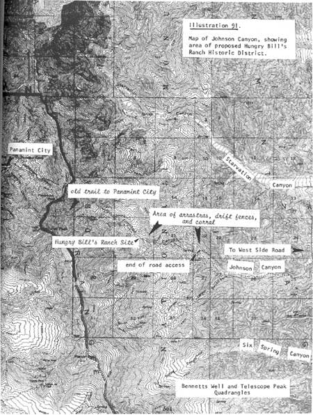
|
| Illustration 91. Map of Johnson Canyon, showing area of proposed Hungry Bill's Ranch Historic District. |
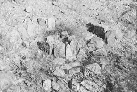
|
| Illustration 92. First arrastra in Johnson Canyon heading west towards Hungry Bill's Ranch. Photo by Linda W. Greene, 1978. |
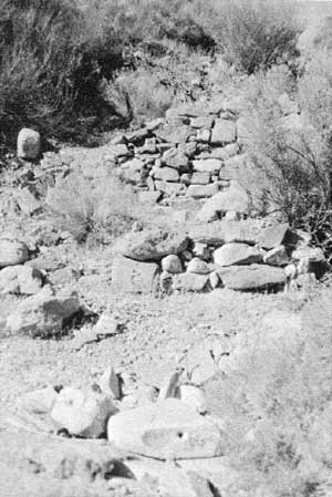
|
| Illustration 93. Second arrastra found in canyon. Note stone retaining walls visible above dragstone. Stone-lined flume descends hilt to left, outside picture. Photo by Linda W. Greene, 1978. |
This is a large field of perhaps ten acres enclosed by stone walls about five feet high. Here is the most extensive fencing, about 1,000 feet of walls three feet thick and six feet tall, built of masonry filled with gravel and cobblestones. At the northeast end, part of the wall is circular, about twenty-five to thirty feet in diameter, with walls about five to seven feet high (stone corral?). A wooden gate on the east provides access to the orchard. Just inside the field a tree and a forked branch support a pole from which various houseware items (pots, pans, kettles) once hung. They might have belonged to. some later miner or squatter here, but have long since disappeared. Some metal cable and a gear were found at the east end of the field. Among the trees at the west end much metal debris has been found: an old canteen and a frypan, a wheelbarrow, wagon jack, gears, and white murky glass, thick and bubbly. Apple, pear, fig, and American black walnut trees abound and bear delicious fruit. There is also a grape arbor. Wooden fencing extends further west beyond the arbor and more corral structures. West and north of the stream are more fences (stone and wood) and corrals. The LCS crew found a cellar hole in a grove of dead cottonwood trees near the west end of the field containing small segments of masonry, and leveled building sites to the southwest of the orchard back among the hills, but these were not observed during this writer's field trip.
Southeast of the orchard area is another building site, higher on the hillside. The first structure east of the orchard here is a stone, chevron-shaped windbreak whose wall is four to five feet high and about fifty feet long. It shelters what was probably a small house. All that remains of the latter are two parallel stone walls three feet high and fifteen feet long on either side of a dug-out area containing stove parts. Further southeast about fifty yards are at least three more building levels with stone retaining walls, each about 21 feet high and 25 feet long, barren except for debris. Wire fencing is found here as are glass, metal, and plumbing pipe remains. [386]
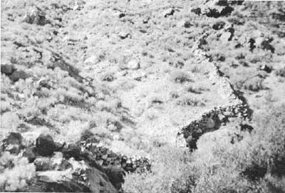
|
| Illustration 94. Drift fence, south wall of Johnson Canyon east of Hungry Bill's Ranch. Photo by Linda W. Greene, 1978. |
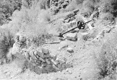
|
| Illustration 95. Ruins of third arrastra on north wall of Johnson Canyon east of ranch. Photo by Linda W. Greene, 1978 |
g) Evaluation and Recommendations
The masonry walls and building sites in the upper valley of the north fork of Johnson Canyon once comprised a farming enterprise known as "Swiss Ranch," a fruit and nut orchard ten miles from old Panamint City attributed to some Swiss settlers attempting to fill the need for vegetables in that thriving mining camp. Horses and pack animals might also have been boarded here. [387] From information supplied by visitors to the area in 1896 and 1910, however, the writer feels it safe to assume that Hungry Bill and his family also lived and farmed in this area, perhaps erecting some of the simpler fencing found here. Whether or not the Indians actually constructed any of the huge stone walls or irrigation ditches, or whether these were already in existence and simply reused, is conjectural. According to the 1896 report, Indians did build the walls and Indian George was even planning to erect a "regular" house on a cleared space on a nearby hillside. [388]
The smaller valley further east has been referred to as the historic Indian camp of Hungry Bill. In the 1960s when William J. Wallace investigated this site, a large, circular, roofless shelter or windbreak about eight feet high was still standing in perfect condition and full of discarded belongings, such as bundles of basketry, withes, and toys. A large collection of these miscellaneous objects was taken to the visitor center in 1963. [389] The structure was not seen by this writer, so it is possible it has since fallen down.
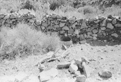
|
| Illustration 96. Stone wall of corral east of Hungry Bill's Ranch. Photo by Linda W. Greene, 1978. |
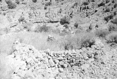
|
| Illustration 97. Circular stone pen on northeast corner of orchard complex, Hungry Bill's Ranch. Photo by Linda W. Greene, 1978. |
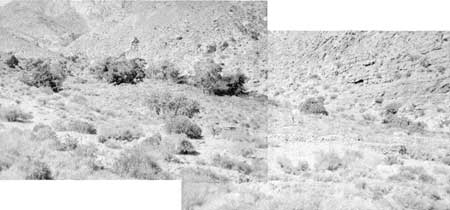
|
| Illustration. 98. Hungry Bill's Ranch site, view to northwest. Photo by Linda W. Greene, 1978. |
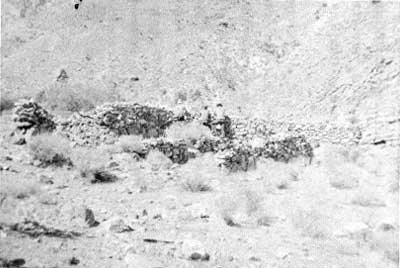
|
| Illustration. 99. Stone windbreak, Hungry Bill's just east of Ranch site. Photo by Linda W. Greene, 1978. |
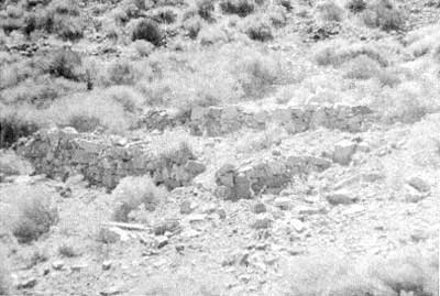
|
| Illustration. 100. Building site windbreak. Photo by Linda W. Greene, 1978. |
In addition to significance in the area of early 1870s farming enterprises and its long history as seasonal home to a group of historical Panamint Indians, Johnson Canyon also was the scene of several mining operations. It provided a direct route from Death Valley to Panamint City via Panamint Pass and Frenchmans Canyon, a trail used by miners going between the western and eastern Panamint slopes as well as by the "truck farmers" to transport their goods to Panamint City. Rich mineral strikes made by Clarence Eddy brought many miners and prospectors into the area, which for a while underwent a flurry of mining activity. It is doubtful, however, that the new town of "Panamint" ever prospered.
The entire stretch of ruins in Johnson Canyon is eligible for inclusion on the National Register as being of local significance, and will be incorporated into the Hungry Bill's Ranch Historic District nomination. An interpretive sign should be erected in the vicinity of the ruins providing a history of the area. Information on the ranch should also be provided at the visitor center. The network of stone walls is in good shape at the present time, but their condition should be monitored periodically since this is an important resource. No stabilization or restoration measures are proposed at this time.
Archeological study should be an essential part of further research into this canyon's history. More intensive perusal of the historical literature, notably in newspapers dealing with the Panamint City boom, might turn up more information on the exact nature of the "Swiss Ranch" enterprise and the individuals involved. Study of Hungry Bill's Ranch site and of the artifacts in the visitor center museum should help provide a picture of the lifestyle of these Panamint Indians who were seemingly able to tread the line between retention of their familiar customs and assimilation of white practices. Other remnants of Indian culture have been found in the area: pictographs in black and red of animal and human figures on the walls of a shelter (presumed to have been drawn by historic Indians on their way to Hungry Bill's); and three house sites or walled shelters on the north side of the canyon against the cliff. [390] This writer also noticed some petroglyphs on a rock wall just south of and across the stream from Arrastra pit #3.
15. Hanaupah Canyon Mines
a) History
The early history of the Hanaupah Canyon area is sketchy at best. As early as 1889 a Mr. W. C. Morton discovered silver ore on the northeast slope of Telescope Peak in a well-timbered canyon down which flowed a strong mountain spring. Mr. Morton stated that access to and from Death Valley was possible by wagon. [391] The pure water of the Panamint Range was well known by the 1900s and coveted for milling and domestic uses. "Hunopa" Canyon was one place mentioned as having sufficient quantities of water for power purposes. [392]
In 1905 a strike was reported in "Honupi" Canyon on a forty-foot--wide vein of free-milling ore assaying over $40 a ton. Again the abundance of wood and water in this particular area were seen as distinct advantages to its future prosperity. [393] About 1907 a promising copper discovery was made in the foothills at the west edge of Death Valley east of Telescope Peak. The most important deposits were located in Chuckwalla Canyon, immediately north of Hanaupah Canyon, but the mineralized district was thought to extend over several miles. It was predicted that although the area had seen little prospecting activity so far, the new discovery, whose "copper values and . . . showings generally . . . equals and in many cases surpasses anything in the Greenwater district," would cause an influx of prospectors and location activity. Two specific claim groups are mentioned: the Copper Contacts and the Chuckawalla Coppers, owned by H. M. Thurman, F. C. Kennedy, and associates. [394]
The only other mention of mining possibly in this area was a report that in September 1907 Frank Kennedy was mining silver ore on a property near Chuckwalla Canyon. The ledge was producing 400 to 500 ozs. of silver bromide, and shipping was expected to commence if the values held as development progressed. [395] This probably is a reference to Kennedy's activity in the Wildrose area, however. The next several years are devoid of mention of mining in Hanaupah Canyon. Some work was evidently going on in the early 1920s, as evidenced by an application for a permit to appropriate "one cubic foot [of water] per second from two unnamed springs in Hannapah Canyon, in Inyo County, for mining purposes," filed by a William P. O'Meara of Los Angeles. [396]

|
| Illustration 101. Map of Hanaupah Canyon mining area. |
In the spring of 1922 two lode mining claims, located about nine to nine and one-half miles west of the Eagle Borax Works and referred to as the Big Horn and Big Horn Extension, were filed on. [397] That distance would place them in the area of the South Fork of Hanaupah Canyon. In the late 1920s mining activity in the "Chuckwalla. Mountain region of Inyo County, on the west side of Death Valley" is mentioned, but it is thought by the writer that this data refers not to Chuckwalla Canyon but instead to a new mining district further north in the Ubehebe region; it will be discussed later as the "Skookum Mining District."
Sometime during the 1920s an ex-World War I U. S. Cavalry soldier named Alexander "Shorty" Borden, who had seen service on the Mexican border, came to Death Valley to indulge in some prospecting work, during which time he ranged over vast sections of the park, concentrating mainly in the Panamint, Emigrant, and Goldbelt Spring regions. On one of his expeditions he discovered what appeared to be rich silver-lead outcroppings in the South Fork of Hanaupah Canyon. Because assays of the find seemed encouraging, Shorty decided to try and develop the area. In September 1932 he began construction of the present nine-mile-long road leading west from the Death Valley floor to his mine at Hanaupah Spring. His only resources a pick, crowbar, shovel, a small amount of dynamite, and burro power, Shorty finished his access road six months later, supposedly at the age of sixty-five! At the same time he dug the well that bears his name at the junction of the West Side and Hanaupah Canyon roads. Sometime during this process Borden talked a Bill Price into partnership with him on the mine. The enterprise seems to have fizzled, however, when it turned out that shipping the ore to a smelter cost more than its assay value. [398]
The only other mine operated in Hanaupah Canyon of which mention has been found is the Peon Mine, owned by the Peon Mining Company (Dale Penner and associates) and leased to the Hanaupah Mining Corporation. No details of this operation or its dates of existence were found. [399]
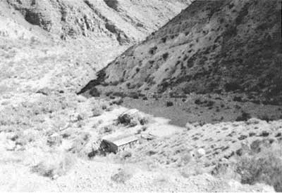
|
| Illustration 102. Mine camp, South Fork of Hanaupah Canyon near the spring. Note adit on far hillside. View to east. Photo by Linda W. Greene, 1978. |
b) Present Status
About two miles north of Eagle Borax Spring, at Shortys Well, a rough dirt road veers left up the alluvial fan into Hanaupah Canyon. About 8-1/2 miles from the road junction the gravel road ends at Hanaupah Spring, the site of a pleasant stream and spring and of an abandoned mine camp. The road forks here, the southern trail leading eventually to "a series of cascades and pools; the northern to a twenty-five-foot waterfall." [400] This southern draw might contain other remnants of mining activity, since the 1889 reference to a silver strike in this area mentions "three large natural tanks, which the elements have worn in the rocks, full of pure cold water, and . . . a stream carrying over 150 inches of water gushes down the canyon a few hundred feet from his discovery." [401] The writer followed this southern trail for about 1/4 of a mile along the hillside, but not on over the westernmost ridge. The areas closely examined included the mining camp and adits adjacent to Hanaupah Spring and another mine site on the north side of the canyon about 1/2 mile north of the main spring.
The abandoned claim at the spring consists of a prospector's residence and two adits. The main three-room house contains only a stove, sink, and table, and has been badly vandalized. One surprising feature is a flagstone terrace in front of the house's east entrance. A small porch or added room on the west end has fallen in. Northeast of the main structure is a shower house, containing a toilet and shower stall.. Both of these buildings are plywood. East of the housing area is a road running along the side of the ridge. Metal spikes and wooden boards on the hillside facing the buildings, and tramway section remains in front of the main house, indicate that at one time probably access to the adits was directly up the hill from the residential area. No structures (ore bin, chutes, or ladders) exist now. The first, main adit appears to have been used as both a workshop and sleeping area. A wooden-timbered entrance wall has been erected to protect a metal cot and workbench inside the tunnel from the elements. The tunnel goes back several hundred feet into the mountainside and then branches. The second adit on the road, south of the first, has either caved in or else was discontinued. The mining road leading south and then west up the hillside from the house leads on west over the ridge to a mine site on the north side of the canyon. From a distance only a waste dump and adit could be seen.
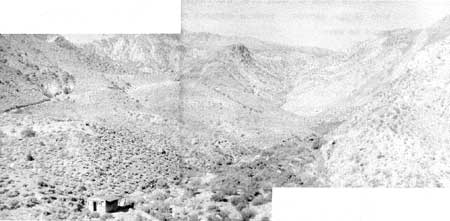
|
| Illustration 103. View to west up Hanaupah Canyon. Note mine road along hill to left. Another adit is located on one of the hillsides to the right. Photo by Linda W. Greene, 1978. |
c) Evaluation and Recommendations
None of the mine sites visited, and examined by this writer in Hanaupah Canyon possess historical significance. The only individual associated with mining activities here is Shorty Borden, but not enough is known about the extent of his operations, their importance, or their exact location to warrant a National Register nomination. The cabins around Hanaupah Spring are lacking in integrity and are in a decrepit state due to vandalism. According to Belden, Borden had seen some deserted Indian shacks grouped around the spring in the 1920s, which had been occupied by Indian draft dodgers during World War I. [402] No evidence of these remains. As far as could be ascertained from the vantage point of an opposite ridge, the site marked "Mine" on the USGS Telescope Peak quadrangle map contains no structures. It is possible that evidence of other mining activity exists in the area, although none is indicated here or in the Middle or North Fork of Hanaupah Canyon by the USGS. Some Indian rock alignments have been found on the Hanaupah Canyon fan southwest of Tule Spring. [403]
16. Trail Canyon Mines
a) History
(1) Death Valley Wonder Mining & Milling Company
The earliest mining activity in Trail Canyon was contemporaneous with the gold discoveries in the Harrisburg and Skidoo areas, taking place during the period from about 1906 to 1907. No information was found describing day-to-day operations in the area, but enough data emerged to establish that at least three mining companies conducted business in the canyon during this period.
On 5 March 1906 Articles of Incorporation were filed for the Death Valley Wonder Mining & Milling Company in Maricopa County in Arizona Territory by Stoddard Incorporating Company of Phoenix. The incorporators were J. P. Branley and James A. Joyce. Phoenix was to be the principal place of business in Arizona, and Oakland, California, the outside base. Capitalized at one million dollars, divided into one million shares of $1 each, the company began newspaper advertising later that month. Its properties included seven full claims of 140 acres, assaying from $2 to $85.73 per ton in gold and silver. Plenty of timber and water on hand ensured easy mining operations. A final attempt to snare the investor was this reminder:
Remember our property is upon a ledge from which ore assaying over $800.00 per ton has been taken. Who knows but a few more blasts may uncover same results for us. Secure at once what stock you can for it is much better to have a few thousand shares at this price than wish you had. [404]
Not much data was found on the fortunes of the Death Valley Wonder Mine. During the fall of 1906 five men were employed, and development results were considered encouraging. Company stock was projected to rise from its current price of five cents a share to ten or fifteen cents by the first of November. By January 1907 the company stock was being listed on the San Francisco Stock & Exchange Board. Company assets included the Annie M. six-claim group and the Branley in the Wild Rose District. By March 1907 the Death Valley Wonder's crosscut tunnel was in 140 feet. The final mention found of the mine was later in 1907 while a force of men was still working there and the mine was continuing to show good surface values. Mr. Branley was even contemplating the establishment of a company office at Skidoo. [405]
(2) Wild Rose Mining Company
A second corporation transacting business in Trail Canyon was the Wild Rose Mining Company, which owned property about seven miles from Skidoo. E. H. Goodpaster was the company agent in the area, and work started on the claims, which included the Wild Rose Annex and Rush Group, around October 1906. [406] This latter group of claims, located near a Wild Rose Mine, was first discovered by Goodpaster in September 1905 in association with John W. Seller, (a prominent mining man of Goldfield connected with the Bonanza Mountain and Black Spar companies in Rhyolite) and A. V. Carpenter. By the spring of 1907 an eighty-foot tunnel had been excavated with a crosscut running through the ledge and exposing ore assaying as high as $100 in gold and $25 in silver. In April 1907 it was reported that the extensively developed Wild Rose Group had just been sold to a Boston . syndicate for about $300,000. The Wild Rose Annex property was also making a good showing at this time. [407] Goodpaster was evidently dividing his time between Trail Canyon and the Skidoo area, because earlier in 1907 a notice appeared that he had established a camp on the Skidoo Contact property and was starting development of the Doctor Claim there. He had discovered the Gold Ledge Nos. 1-4 and the Doctor claims of the Skidoo Contact Group and the Granite Contact properties himself and had then sold them to the Skidoo Contact Mining Company, of which he became general manager, for $15,000. [408]
(3) Trail Canyon Mining Company
A third mining venture in Trail Canyon was the Trail Canyon Mining Company, incorporated in the state of South Dakota by three Tonopah, Nevada, and two Pierre, South Dakota, businessmen. The principal place of business was to be Pierre, with a business office closer to the property at Tonopah. Capitalized at one million dollars, divided into one million shares of $1 each par value, the company was incorporated on 10 November 1906. On 8 December 1906 it was registered as a foreign incorporation in the state of Nevada, designating Tasker L. Oddie as its resident agent. [409] In the spring of 1907 Charles M. Schwab, Oddie, and F. J Leutjens expanded the assets of the company by purchasing five promising claims in Trail Canyon whose assays were running from $50 to $3,000 per ton. [410]
What seemed to be a promising future for the company did not materialize, however, due to the collapse of the New York stock market in March of that year, followed by similar crises in Hamburg, Amsterdam, and Montreal. The financial panic spread to the west, causing two Goldfield banks to close. Tasker Oddie, who had invested and speculated heavily and rather recklessly in various mining claims and property and mining-related enterprises in Tonopah and the Bullfrog Mining District, was ruined by the economic collapse. Five flimsily-subsidized mining companies of which he was president, including the Trail Canyon Mining Company, failed when Oddie was unable to make good his obligations to the stockholders or to the Tonopah Banking Corporation, which had invested in his development work. [411]
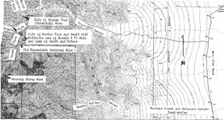
|
| Illustration 104. Map of Trail Canyon mining area. |
(4) Old Dependable Antimony Mine
The next phase of activity in Trail Canyon centered around antimony mining. The monument contains two such deposits: the Wildrose Mine, about one mile southeast of the Wildrose Ranger Station, which will be covered in a later section, and the Old Dependable Mine in the South Fork of Trail Canyon fifteen miles southwest of Furnace Creek Ranch. These two areas produced a total of about 2,060,000 pounds of antimony: 2,000,000 during World War I and the rest during World War II.
From 1939 to 1941 the Old Dependable was operated by Brinn W. Belyea, who invested approximately $50,000 in construction of a road, camp facilities, and mine development. The site yielded around seventy tons of ore showing eighteen to sixty percent antimony. In 1940 an H. E. Olund was in charge of the mine for Belyea Truck Company, and eighteen men were employed in building a modern camp. Operations were discontinued when the war came and Belyea donated the use of his time and the facilities of his trucking, crane, and construction companies to the war effort. Mr. Belyea died in the latter part of 1946; in 1948 sixteen claims were relocated as the Old Dependable Group by his wife, Isabelle Belyea, and were bonded and leased to J. W. E. McCulley of Darwin in January 1949. Drags, picks, and shovels were used in an attempt to rebuild and repair the access road, permitting mining to commence from an open cut in April. However, due to the smallness of the ore body, its remote location, and unfavorable market, conditions during peacetime, the two cars of ore removed from the cut were never shipped, and the property became idle. In 1951 the workings consisted of the open cut, which had produced one eleven-ton pod assaying 60% antimony, and two adits. [412]
(5) Tungsten Mines
A second mineral commodity sought during World War II was tungsten. As early as 1937 the world demand for this product was increasing substantially, due mainly to business recovery and expanded uses for the metal, and the advancing prices occasioned by higher production costs were promoting development in the United States of hundreds of mines and prospects. Estimates were made that in 1937 the world production of tungsten would equal the 35,000 tons produced during World War 1. [413] Small tungsten deposits within the monument have been found at the Sheepshead-Victory Group in Trail Canyon, near Goldbelt Spring at the Shorty Harris Prospect, and in various locations east of Skidoo. Much of this work was done in the 1950s, domestic tungsten mining having, been encouraged by the U.S. Government as late as 1958. [414] The Sheepshead and Victory tungsten groups are situated at about 4,000 feet elevation in the middle fork of Trail Canyon. In 1951 they were owned by Milton L. Knapp of Palm Springs, California, and Floyd R. Bekins, of Los Angeles. Several prospect pits were opened and one ton of high-grade ore shipped in 1943. Poor road conditions precluded further exploration on the property, which was idle by 1951. [415]
Only brief mentions of other tungsten mining endeavors in Trail Canyon were found in the monument files. These included the Morning Glory Group of four claims in the South Fork of Trail Canyon, owned by Morning Glory Mines, Inc., of Albuquerque, N.M., Abram H. Kreider, president; Ronald A Claims of Jack Smith and John Polson, in the Middle Fork of Trail Canyon, which had been the scene of several mining attempts over the years, but which soon reached a static state due to lack of investment capital and of any appreciable quantity of high-grade ore. This operation involved five people in residence; All Mine and Lucky Find Claims and Millsites #1-2 of a Mr. Dotson and Page G. Brady in the South Fork of Trail Canyon. These millsites were a relocation of the old Morning Glory Mine camp. Evidently these claims involved only promotional work, with no very active mining. Products obtained were silica and ornamental rock; AA Placer Claims composed of 137 160-acre group placer claims filed by Al Anderson and worked in 1958 over a total of 21,920 acres; Blackwater Mine of several hundred claims, worked in 1959, containing low-grade tungsten; and the Tarantula Mine (old Nichols Mine and Millsite) in the North and Middle Forks of Trail Canyon, worked in 1958. According to notes in the monument mining office this was probably the only profitable tungsten operation in Death Valley during the 1950s boom era, and was responsible for attracting others to the Trail Canyon area. This region evidently soon resembled the land around Skidoo, with hundreds of claims being filed on and a vast network of roads scarring the hillsides. (The operator of the Tarantula Mine built the road stretching from Trail Canyon, to Aguereberry Point--now only a rough jeep trail.) Quite a lot of false stock promotion was also prevalent. At the height of the craze some of the miners tried to drum up Washington's support for a bill to abolish Death Valley National Monument!
The Nichols Mine and Millsite were later relocated as the Broken Pick Mine and Millsite. The Small Hill Millsite was a conflicting relocation of the old Nichols Millsite filed in the same year as the Broken Pick Millsite relocation. Information was also found that a certain Joseph Harris of Yuma, Arizona, who had been involved in various mining activities in Death Valley since the 1930s, in addition to leasing the Skidoo Mine from 1938 to 1939 and operating the Keane Wonder Extension from 1949 to 1955, had run a tungsten mine in Trail Canyon in 1960. [416] As late as as 1971 some tungsten mining was being undertaken in the South Fork of Trail Canyon as evidenced by a request from the claimants for permission to use dynamite on their remote scheelite mine. [417]
b) Present Status
Because the road up Trail Canyon from West Side Road has been washed out and at best is considered a difficult four-wheel drive road that should be navigated only by experienced personnel, the writer did not visit these sites. The current status of the road from Aguereberry Point into Trail Canyon is unknown, although about fourteen years ago it was a steep, one-way downhill grade from the Point, and was also subject to washout problems. About nine miles west into the canyon from West Side Road, the trail branches, one arm continuing west into the Middle Fork for about 1-12 miles and ending near an abandoned mine camp. Monument photographs taken by a ranger in 1962 indicate that at least two small mine camps remained in the Middle Fork at that time: the Broken Pick and Small Hilt Millsites (two conflicting relocations of the old Nichols Millsite), and the Ronald "A" Mine and camp of Smith and Poison. These both consisted of corrugated-metal and wood frame buildings in the residential and work areas, and wooden chute remains at the workings themselves.
The South Fork road ends after about 2-1/2 miles at a cableway leading to the Morning Glory Mine, whose associated camp was relocated as the Lucky Find Millsite #1 and #2. The Old Dependable Antimony Mine lies along the South Fork Canyon road also, at about 4,800 feet elevation, a site marked in the early 1960s by a large open pit on the east side of the road. This may be the camp designated by the row of buildings on the USGS Emigrant Canyon quad. According to Park Ranger Warren H. Hill, the North Fork of Trail Canyon contained the Broken Pick Mine, the relocation of the old Nichols, or Tarantula, Mine, whose workings consisted of a wooden one-chute ore bin, several adits, and other miscellaneous mining debris.
c) Evaluation and Recommendations
The writer is unwilling to present any recommendations for preservation, restoration, or reclamation in regard to Trail Canyon resources because the area was not personally visited. It is not known whether any remains of the Skidoo-period operations can still be found. Most of the mining activity evident dates from the tungsten craze of the 1950s, although the Old Dependable Antimony Mine ruins would date from the late 1930s and early 1940s. It was the later of the two antimony concerns in the Monument, produced fairly low-grade ore except for occasional rich pockets, and produced less total yield than the Wildrose Mine. It does not possess the qualities of significance necessary for inclusion on the National Register. None of the later Trail Canyon mines had a production rate or associative significance that made them important in the monument's history, and the only pictures found of mining activity in this area do not reveal any structures of apparent historical or architectural interest.
Because Trail Canyon was not explored during the 1975 LCS Survey or by this present project, and therefore no recent pictures of it have been taken nor a reconnaissance of remaining cultural resources made, it is imperative that further examination and evaluation be made before any sites or individual buildings are destroyed. The Morning Glory Mine tramway ruin should be followed, photographed, and mapped--its present condition is uncertain. The entire extent of archeological resources in the Trail Canyon area is also unknown, although at least one cave site with a smoke-blackened ceiling was found at the head of Trail Canyon over fifteen years ago. Because this canyon provided passage for Indians between the lower valley and higher mountain ranges, there should be vestiges of their occupation and peregrinations remaining. [418]
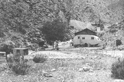
|
| Illustration 105. Ronald "A" *1 mine and camp of Smith and Poison. In middle fork of Trail Canyon, 1962. Photo by Park Ranger Warren H. Hill, courtesy of DEVA NM. |
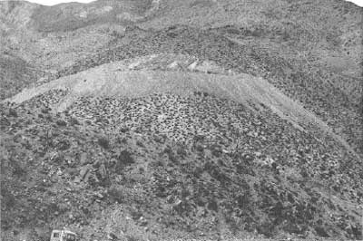
|
| Illustration 106. Scar of mining exploration for tungsten, now Ronald "A" 14 mine of Smith and Poison. In middle fork of Trail Canyon, 1962. Photo by Park Ranger Warren H. Hill, courtesy of DEVA NM. |
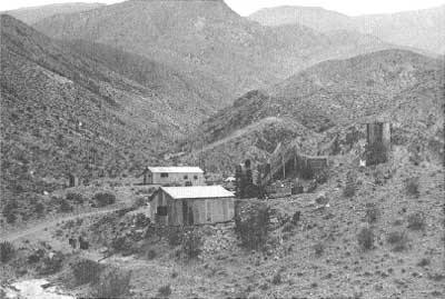
|
| Illustration 107. Broken Pick Millsite and Small Hill Millsite in middle fork of Trail Canyon, 1962. Photo by Park Ranger Warren H. Hill, courtesy of DEVA NM. |
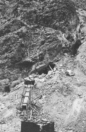
|
| Illustration 108. Broken Pick Mine, north fork of Trail Canyon, 1962. Photo by Park Ranger Warren H. Hill, courtesy of DEVA NM. |
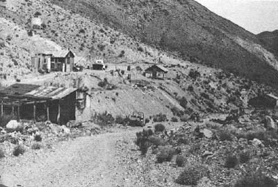
|
| Illustration 109. Lucky Find Millsites #1 and #2, relocation of old Morning Glory Mine camp, South Fork of Trail Canyon, 1962. Photo by Park Ranger Warren H. Hill, courtesy of DEVA NM. |
| <<< Previous | <<< Contents >>> | Next >>> |
deva/hrs/section3a.htm
Last Updated: 22-Dec-2003