|
Death Valley
Historic Resource Study A History of Mining |

|
SECTION III:
INVENTORY OF HISTORICAL RESOURCES THE WEST SIDE
B. Emigrant Wash and Wildrose Canyon
1. Thorndike Camp
a) History
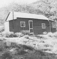
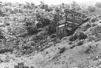
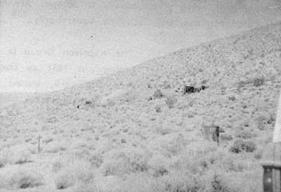
Thorndike Camp, located between the Charcoal Kilns and Mahogany Flat, in the Wildrose section of the Panamints, was once part of a 160-acre homestead filed on by John Thorndike (Thorndyke), a well-known Owens Valley miner, in order to provide a pleasantly-cool summer retreat for his wife Mary, an area schoolteacher. Thorndike came to the Death Valley region in 1903 from Maine, where he was born and had attended college. Working first as an assayer at the Ward Mine in the White Mountains, he later moved to mines in the Coso area and around Darwin. During these years he is mentioned in connection with the Modock Mine, which he superintended, [1] and the Custer Mine, near Darwin, which he co-owned and managed. In 1920 he married a Darwin schoolteacher, Mary K. Stewart. [2]
Thorndike's next move was to Ballarat, where his name was linked to the rich Gibraltar silver-lead mine in South Park Canyon, which he supervised, [3] and to the Big Horn lead-silver property eight miles southeast of the town that was one of four claims comprising the Honolulu Mine, worked intermittently from 1907 on, producing mainly during World War II. Thorndike was superintending the latter property in the 1920s over a force of fifteen miners who were building a five-mile auto/truck road to connect with the Ballarat-Trona road to be used for heavy ore shipments to the smelters. It has been said that this was the first mine to ship ore from the Panamints by truck. Thorndike's contribution to the area's development must have been considered substantial, for South Park Canyon has also been known as Thorndike Canyon. [4] In the late twenties Thorndike also held half interests in the Sunrise, Pine Ridge, and Panorama Nos. 1 to 5 mining claims, mining district unknown. [5]
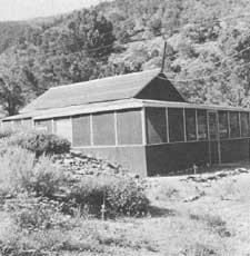
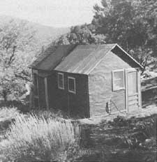
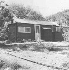
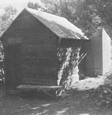
Around the mid-1930s Thorndike filed on a 160-acre homestead in the Panamints at the eastern end of Wildrose Canyon, the property extending from the bottom of the canyon up as far as Mahogany Flat and climbing about 600 feet in elevation. Six structures were erected by the couple in the approximate center of their holdings, including:
living quarters, a two-room frame building with an attached screened porch;
a cabin, a two-room frame building;
a kitchen/dining room, a two-room structure;
a laundry/shower room, a frame building with access to hot and cold water;
a sleeping cabin, a two-room frame unit with an attached screened porch; and
a garage/shop, a two-room, dirt-floored frame structure housing the complex's electrical plant. [6]
|
|
|
|
Although originally the Thorndikes presumably planned to occupy this property only a few months each summer, because of the number of buildings erected it is possible that they later envisioned developing the area for commercial purposes. This seems to be substantiated by a 1939 newspaper article reporting the unbelievable story that a Trona, California, man had been given permission to build a ski lift above the Charcoal Kilns near Telescope Peak; in connection with the skiing operation, it was mentioned that guests visiting the lift will find comfortable accommodations at Thorndike's camp." [7] The Thorndikes lived intermittently on the property until 1954; in 1955 the entire 160-acre homestead was bought by the U.S. Government and integrated into Death Valley National Monument.
b) Present Status
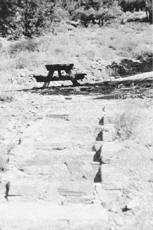
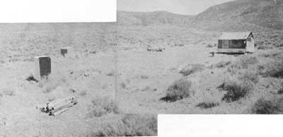
Thorndike Camp is located about 3/4 of a mile beyond the Charcoal Kilns, and is reached via a steep, low-gear road that continues on through the campground to Mahogany Flat. No buildings are standing on the site, although some concrete slab foundations are visible, as well as the remains of a small fish pond, a stone stairway, and some stone retaining walls.
c) Evaluation and Recommendations
The Death Valley Shoshone were attracted to the Wildrose area of the Panamints as soon as the summer heat began to force its way into the lower elevations of the valley. The area around the present Thorndike Campground was especially inviting as a summer campsite because of the presence of several springs in the area as well as the pleasant coolness of the surroundings due to the narrowness of the canyon and its relatively high elevation. These were undoubtedly also the attractions that led John Thorndike to homestead there. [8]
|
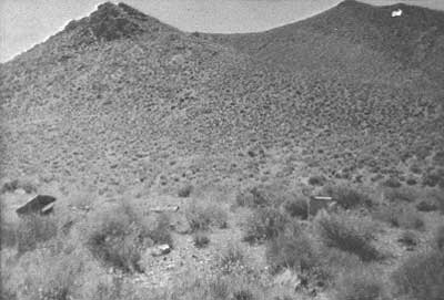
| Illustration 119. Thorndike Homestead. From Hopper, "Appraisal of Thorndike Property," 1954. |
|
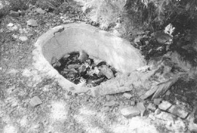
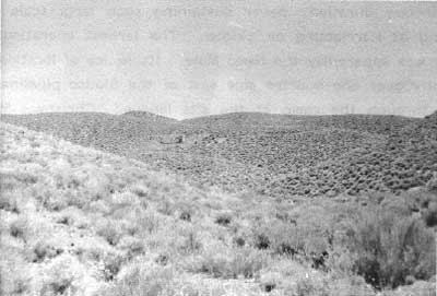
| Illustration 120. Goldfish pond (?) at Thorndike Camp site. Photo by Linda W. Greene, 1978. |
|
| Illustration 121. Stone steps and wall in background are all that remain of Thorndike homestead. Photo by Linda W. Greene, 1978. |
No significant remains of the Thorndike homestead are found in the campground. Despite its earlier association with a well-known Death Valley region prospector, the site no longer possesses historical integrity or significance.
2. Wild Rose Mining District
a) Early Activity
Referred to from about 1873 to the spring of 1888 as "Rose Springs District, the area loosely bordered by the Panamint Mining District on the south, Townsend Pass on the north, Panamint Valley on the west, and Death Valley on the east, was first opened to easy access from the Panamints by W. L. Hunter and J.L. Porter, who had located some promising claims in the vicinity. [9]
By March 1876 the district was seeing a vast amount of activity. The Inyo Mining Company had bought seven well-defined ledges in the area and had set up headquarters at the North Star Mine (formerly owned by the Nassano Company). The start of operations there and at the Garabaldi (Garibaldi) was only awaiting the arrival of Remi Nadeau's freighting teams bringing needed tools and stores. A townsite was being laid out to house the many miners entering the district over the improved wagon road from Warren Springs in search of work and property:
There are other valuable ledges in the district, and ample room for other companies to invest; and, as spring advances, we will, no doubt, have quite an influx of capital, as there are several parties of prospectors who have been in here at times for a year or more, and who hold ledges of considerable merit, from whom capitalists can purchase a set, or even several sets or groups of. ledges, numbering from three to 10 or 12, and which now lie undeveloped, together with mill sites with sufficient water for milling their ores. The records show that about 165 ledges have been located, and the necessary amount of work performed on the most of them to hold them for the year. [10]
b) First Locations
By 1882 the area was being referred to variously as the "Wild Rose District", and "Rose Spring Mining District," although the former designation was not official until several years later, It was rumored that a silver mill was soon to be erected because of the profitable and immense ledges being struck, and indeed a notice of location was filed on Wild Rose Spring itself for "conducting and carrying on a General Milling and Reduction Works." [11] Property filed on during this period included the Inyo Silver Mine, 113 miles North from Rose Spring and adjoins SE quarter of Virgin Mine"; Blizzard Mine "5-1/2 miles East from Emigrant Spring on right-hand side of trail leading from Mohawk Mine to Blue Bell Mine and is about 8 miles air line north of Telescope Peak"; Valley View Mine "6 miles East of Emigrant Spring on Mineral Hill & lies on right-hand side of trail leading from Springs to Blue Bell Mine & is ca. 2 miles SW of latter"; Argonaut Mine (Nellie Grant), "situated about four and 1 miles South, from the Mouth of Emigrant Canon at what is known as Hunter & Porters rock house near Emigrant Spring & is immediately South of the Jeannetta [Juniata?] Mine and is a relocation of the Uncle Sam Mine"; and the Jeanetta Mine "on the West side of Emigrant Canon about 4-1/2 miles above . . . near Emigrant Spring and is a relocation of the Nellie Grant Mine." [12]
In July 1884 the Mohawk (earlier known as North Star), Blue Bell (aka Garibaldi), and Argonaut (aka Nellie Grant) mines shipped about ten tons of ore to the smelter that yielded over 3,000 oz. of silver bullion. Due to the lack of milling facilities in the Wild Rose area, it was necessary to ship the ore across the Panamint Valley to the ten-stamp plant of the Argus Range Mill and Mining Company in Snow Canyon. This tedious trip was undertaken by the owner of one of these properties who
is a strong believer in this district . . . . The milling test was very satisfactory, coming up to 85 and 90 per cent of the assay value by the most ordinary process, and bullion 75 and 80 fine, carrying a light per cent of copper. This district shows a large amount of high grade ore. Some of the most promising ledges have been considerably developed, giving encouragement that they will make mines of great and permanent value. Natural and good roads lead to these properties and to the wood and water, which are both found ample for mining and milling purposes and are contiguous to the mines. There are hundreds, and I may say thousands of tons of this fine milling ore out and in sight, and no milling facilities near at hand to work it profitably, and the owners, mostly miners, are unable to undertake the erection of reduction works. The climate is very healthy and the finest in the world for continuous mining. [13]
By this time other producing mines in the area are mentioned: the Juniata (possibly the Jeanetta mentioned earlier), contiguous to the Argonaut, and the Virgin six miles south of these and near the Blizzard. Because of the encouraging results at the Snow Canyon Mill, the owners of the latter two were endeavoring to find capital to finance construction of a ten-stamp mill in the area of the mines. [14]
c) Formation of District and Establishment of Boundaries
On 4 April 1888 a formal meeting of local miners was held at Rose Springs for the purpose of organizing a new mining district in light of the fact that all the books and records of the previous district had been lost and no recorder had been active for the last two years. The new entity was to be known as the "Wild Rose Mining District": "The north boundary line shall be Townsends Pass in the Panamint range of Mountains. The western boundry [sic] line shall be Panamint Valley. The Southern boundry line shall be the North line of Panamint District. The Eastern boundry line shall be Death Valley." [15] A later description of the Wild Rose District, whose boundaries were possibly expanded after the strike at Harrisburg, reads:
Beginning at Williams canon to the center of Panamint Valley, thence north to a line running east and west through Cottonwood canon to Surveyors' Wells, thence to Salt Creek, south to Bennett's Wells, and west to place of beginning. The district is adjacent on the south and west to the recently organized South Bullfrog district. [16]
More mines were recorded during this time: the Weehawken (Weehawker?) Mine "about 2-1/2 miles from Coal Kilns in northerly direction and about 7 miles in westerly direction from Death Valley"; Antimony Mine "2-1/2 miles from Rose Springs on south side of road leading to coal kilns and 1/2 mile from summit of mountains leading to Fever [?] Canon"; Consolidation Mine "1-1/2 miles south from North Star Mine and formerly known as Consolidated." [17]
d) Mining Companies and Further Locations
By 1906 several mining companies held interests in the Wild Rose District: the Telescope Peak Mines Syndicate was an Arizona incorporation with a treasury stock of 600,000 shares, owning seven gold and copper claims covering about 140 acres in the Wild Rose District. Offices were maintained in Colorado Springs, Colorado, and Phoenix, Arizona; [18] the Panamint Mountain Mines Syndicate, another Arizona incorporation under the same management as the Telescope Peak Company, with a treasury stock also of 600,000 shares, owning sixteen full gold claims covering 320 acres each in the Wild Rose District; [19] the Wild Rose Mining Company, whose interests were represented by W.B. Gray, Dr. U.V. Withee, and W.H. Sanders, and which owned gold, silver, copper, and lead properties with surface values ranging from $9 to $716 (by 1924 the company's property above Wild Rose was proving to be one of the big gold and silver mines in the district under the management of Charles Grundy. Nineteen thousand tons of ore assaying $29 per ton were ready to be mined, and by March the ore was assaying $300 to $500 a ton in silver, with gold and lead present, too); the Rush Company, owning prospects near the Wild Rose, and involved in building a road into the canyon; the Death Valley Gold Mining Company recently incorporated by California capitalists; and the Kawich-Bullfrog Company. The Wild Rose, Rush, Kawich-Bullfrog, and Death Valley Gold Mining Company properties were all stated to be approximately two miles from Harrisburg. [20]
Other mines mentioned at this time, but on which no further information was found, are the Last Hike, Venus and Mars groups of claims located by Tom Knight in the Wild Rose District. [21]
e) Heliograph Dispatches
An interesting technological development related to mining during this time involved the initiation by the Rhyolite Herald of the heliograph method of communication in an attempt to facilitate transmission of the latest news from the surrounding mining districts to its readers:
The latest move is to receive heliograph dispatches from the Funeral and Grapevine ranges, which will be flashed to us from the mountains twenty-five to fifty miles away. Death Valley will signal from the top of Chloride Cliff in the Funeral range, while the California Bullfrog, Doris Montgomery and Breyfogle will flash their news from the Doris camp. Wild Rose district will span Death Valley with a ray of light to the Doris camp and that station will repeat the messages to us.
Who knows but that this wireless telegraph will be the means of saving life? . . . The instruments are now being constructed and as soon as completed and other necessary arrangements made, the signaling will begin. [22]
f) Settlement of Emigrant Spring Brings Need for Road to Keeler
By the summer of 1906 Emigrant Spring(s) was the site of what was projected to be a great mining camp with good ore showings in the surrounding properties that were attracting much investment capital. Thirty men were employed in the area, and there was talk of erecting a twenty-stamp mill. The biggest project under contemplation at this time was construction of a road from Keeler to Emigrant to replace the over-100-mile-long Johannesburg-Emigrant supply route that was costing shippers 4-1/2¢ per pound. The new route would not only reduce this distance by about 45 miles, correspondingly reducing production costs and speeding development, but would also open up a remunerative Owens Valley-Emigrant trade in agricultural products. [23]
A letter from Ballarat in late summer of 1906 declared that results from strikes near Emigrant Spring were still more than satisfactory. Freight teams from Johannesburg were arriving everyday, a pipeline was being built at Skidoo, and there was an influx of mining men from Goldfield and Bullfrog. The two disadvantages seen for the area were its distance from a railroad and the bad reputation the country held for heat and difficulties in mining. [24] By this time the Cashier Mine at Harrisburg, the Sheep Mountain strike, and the Golden Eagle at Skidoo were all in the throes of new development work. [25] By the fall of 1906 the wagon road from Keeler to Emigrant was still not an established fact, although it was being strongly pushed by miners in that section. Darwin Wash was considered to be the most feasible route for the trail, being both cheaper and more direct. [26]
Individual narratives on Harrisburg and Skidoo will follow in later sections. Suffice to say at this point that both were extremely busy at this time, thus ensuring some longevity for the Emigrant (Wild Rose) District. A six-horse stage was running twice a week between Ballarat and Emigrant Spring, where there was a saloon, grocery store, corral, and restaurant. Plans were underway to complete connections on a road from Skidoo to Daylight Springs and then on to Rhyolite. It was justifiably feared by those advocating the Keeler-Emigrant Road that all the potential revenue to be gained in the district could easily be siphoned off to Nevada, and Owens River Valley farmers and merchants would lose out completely:
Get together! Build the wagon road! This means work for Inyo's ranchers and their teams, and when completed will open a market for their produce, where they will not have to submit to extortionate railroad charges. The cost of this road would be trifling compared to the immense advantage to be derived therefrom. The Emigrant-Skidoo-Harrisburg country has arrived and it remains for Inyo's people to profit thereby.
Inyo is now in the limelight from a mining standpoint and it, remains for our County officials and the taxpayers to offer every facility in the shape of good roads and provisions to the host of men who are delving in the mountains and developing the resources of these vast store houses of golden treasures. This will be for the good of the County as a whole. Let no narrow feeling of sectionalism retard the work. [27]
Conditions of life were not easy in the Wild Rose area as shown by an item in December 1906 stating that all work at Skidoo, Harrisburg, and the surrounding country was temporarily stopped because of a heavy snowstorm that had deposited three to four feet of the white stuff in the area. Due to lack of fuel and adequate housing, the only option available to the miners in the section was to leave for lower elevations. In contrast, in August 1908, three or four miles of the Emigrant Wash Road were completely obliterated by a cloudburst, the road being five feet deep in water carrying 50- and 100-pound boulders. [28]
g) More Properties Located Throughout 1940s
By 1907 a few more properties were being recorded: the Combination-Goldfield and Nevada-Tonopah owned by J.H. Allen, Geo. Raycroft, and A.D. Myers; Wild Rose Annex #1, "one mile east from Harrisburg and Joins Wild Rose Group on East," located 1 March 1907 by Weyle and Clewell; Oro Blanco Mine about 3-1/2 miles south of Harrisburg," located 25 March 1907 by Nat Levi, H.L. Culvert, and O.E. Hart; Taylor Mining Claim "2 miles south of Harrisburg and one mile east of narrows on Ballarat Wagon road. Claim is on south side Wood Canyon and joins with Good Dope [Hope?] Mining Claim #2 on west," located 13 April 1907 by 0. Ewing and Wm. Taylor. [29]
Due to the expansion of mining activity and the consequent desperate need for a body of men to adjust and settle the disputes constantly arising over conflicting interests in mining claims and town lots, some important resolutions relative to the location of mining claims in the Wild Rose District were adopted at a meeting of the miners of the Wild Rose District held at Skidoo on 15 April 1907. Besides setting up procedures for marking and recording claims and performing the necessary location work, a motion was adopted to elect a ten-man Arbitration Committee to settle local disputes in the mining community arising over ownership. [30]
In late May 1907 a proposal was mentioned for a turnpike leading from Greenwater via the old Daggett borax road to Furnace Creek Ranch, then to Surveyor's Wells, over Emigrant Pass to Darwin, and connecting there with the road to Independence. The following February roadwork was being pushed between Keeler and Emigrant, with a connection soon to be made to the Wild Rose road. Ten men with two teams were working in the Darwin Wash area. [31] The exact population of the Wild Rose District in the early 1900s is not known. Registration for primaries in 1914 revealed forty-one persons registered in the Emigrant precinct, thirty-nine men and two women. By 1916 there were only twenty-three voters registered there. [32]
In 1923 development and prospecting work were still being carried out in the area, a number of new properties mentioned as being active in the Wild Rose District between 1909 and 1938. Because nothing further is known of them and because rarely is their exact location clear, only brief mention of them will be made:
1. Two Friends Nos. 1, 2, and 3.
2. Silver Star Nos. 1, 2, and 3 and Old Spanish Mine
3. White House and White House Nos. 1, 2, and 3.
4. Snowfall and Snowfall Nos. 1-11 approximately 240 acres, owned by the Golden Glow Mines Corporation of Utah.
5. Veta Grande de Plata Nos. 1-6 at Emigrant Spring.
6. Chesamac Mine six lead and silver claims eighteen miles northeast of Ballarat, development in 1926 consisting of shallow tunnels and open cuts worked by two men.
7. Mother Lode three miles east of Emigrant Spring.
8. Yellow Horse Mine
9. Western Mine Western No. 2, adjoining the Moonlight Mining Company property (in Nemo Canyon?).
10. Extension No. 1 Mine
11. Big King Mine
12. Edna Nos. 1-3.
13. Treasure Hill Mine twelve claims comprising 488 feet of shafts and tunnels in 1938. [33]
One of the more substantial mining companies formed in the district in the late 1920s was the Emigrant Springs Mining and Milling Company started by H.W. Eichbaum and associates in 1929. (More details on this company will be presented in the Skidoo section of this report.) In the 1940s the Skidoo District underwent a revival of mining activity. Both the Skidoo Mine and the nearby Del Norte Group were being actively developed as was the Gold King Mine one mile east of Journigan's Mill. Other mines functioning from this period on were the: Emigrant Mine three lead and silver claims active in the 1940s; Rose Mine four tungsten claims comprising an unsightly deserted camp along the charcoal kilns road, registering no production or mining activity since the mid-1950s; and the Wildrose Mine four silver claims last worked in the late 1950s. [34] Also during the fifties sporadic tungsten exploration was carried out in the vicinity of Skidoo.
h) Historic Wildrose Spring Stage Station
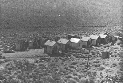
At least one historical resource of the Wild Rose area met its demise in the early 1970s. This was Wildrose Station, once located about mile below Wildrose Spring on the main road through Wildrose Canyon. Its service to the public began as a shady oasis providing a water spot and resting place for prospectors and mule teams, possibly as early as 1878; it then functioned as a stage station on the Ballarat-Skidoo route from about 1908 to 1917. The site consisted then of a wooden station, a corral, and blacksmith shop. After World War I the site saw only intermittent occupancy, but by the early 1930s offered cabins, a small curio shop/store, eating facilities, and gas to tourists. Composed of structures reputedly moved on site from abandoned mining camps about 1932, the camp was deemed unsuitable for modern tourism, and it was recommended that all the buildings except for the nineteenth-century forge site be destroyed. The concessionaires were forced to vacate the premises, which soon fell prey to vandalism and finally destruction. Today only foundations remain, topped by a few picnic tables and a comfort station. According to one author, this was the location of the miners' meeting in 1873 that organized the "Rose Springs Mining District." [35] If true, it may also have hosted the 1888 meeting that created the Wild Rose Mining District.
|
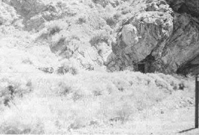
| Illustration 122. Emigrant Spring in Emigrant Canyon, no date. Photo courtesy of DEVA NM. |
|
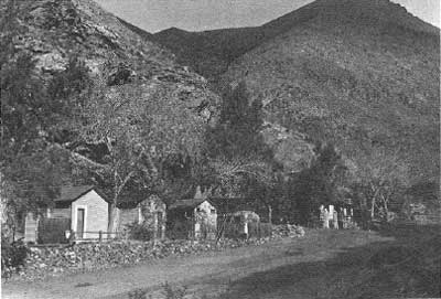
| Illustration 123. Wildrose Station in Wildrose Canyon. These cabins are atop the site of an old stage station serving the Ballarat-Skidoo run. Photo by W.F. Steenbergh, 1964, courtesy of DEVA NM. |
|
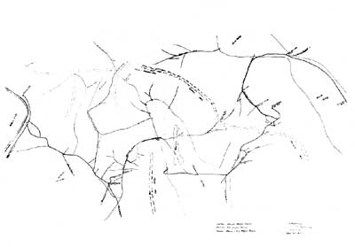
| Illustration 124. Wagon roads in western Death and Panamint valleys. Plotted by A.M. Strong, county surveyor, July 1907. Note Wildrose Station, where John Callaway (Calloway) operated a cafe at this stage stop between Skidoo and Ballarat. Note also the Indian Ranch on Cottonwood Creek just to the left of Lost Valley (upper arm of Death Valley). This feature will be discussed later in the section on Hunter Ranch. Courtesy of Inyo Co. Recorder, Independence, Ca. |
i) Sites
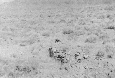
(1) Wildrose Canyon Antimony Mine
(a) History
i) Possible Site of Earliest Mine Location in Monument
It has been suggested that the Wildrose Canyon antimony deposit in the Panamint Range was found in 1860. An early discovery date would seem to be supported by a letter from Rose Springs appearing in the Panamint News in 1875 listing mines in the general vicinity: . . . and last, but by no means least, the Old Combination Company's ledges, situated about three miles southeast of here, and discovered by Dr. George some twelve years since, and now placed under the management of A.A. Ringold, who is also one of the pioneers of this and Slate Range District of twelve years ago.
The mines of this company have quite an interesting history. Shortly after their discovery a company was formed and men put on to prospect the ledges; the men were driven out by Indians in the Spring of 1863, and four of the party killed; since then their ledges until now have remained idle. [36]
Chalfant, in speaking of the discovery of the Telescope District in 1860, states that "W.T. Henderson was named as superintendent of the Combination mines." [37] Later in this article he remarks that "the antimony deposit near Wild Rose spring, in the Panamints, was found during this period, if we accept the evidence of a chiseled 'July 4, 1860,' in its tunnel." [38] Wheat, however, states that on Christmas Day, 1860, the party [George expedition of 1860] crossed over into Wild Rose Canyon near the site of the present Death Valley National Monument Summer Headquarters, and on that day discovered a deposit of antimony ore which was appropriately named the "Christmas Gift Lode." This was the first mining claim to be located in the Panamint Range . . . ." [39]
According to information acquired by Richard Lingenfelter, at the University of California at San Diego, a Combination Gold and Silver Mining Company was incorporated on 26 July 1861, controlling over 9,900 feet of claims worth approximately $990,000 in the Telescope District. Dr. George was president of the company, which in 1862 owned the Christmas Gift and other nearby mines.
The first official documented evidence of what might be this mine found by the writer was a notice of location recorded on 8 August 1882 by Frank Beltic and filed on the "Original Antimony Mine in Rose Spg. Mng. Dist. 2-1/2 miles SE of Rose Spg. AKA Inyo Antimony Mine." [40] Also found was a location notice for the Inyo Antimony Mine, giving the same location as above, and filed the same day by Chris Crohn, Paul Pefferle [sic] Frank Betti, and S.D. Woods. [41]
ii) Antimony Mining in the Region
The antimony industry in the United States was still in its nascent stages in the 1880s and was centered completely in the western states. Extensive reduction of antimony ores was taking place in Utah by 1884, and deposits also existed in Nevada. Up to 1892 most of the entire small output of antimonial ore produced in the United States came from California mines. Occurrence in the Death Valley region encompassed southern Esmerelda County, eastern and southeastern Inyo County, and northern San Bernardino County, with the Panamint deposits situated approximately in the middle of this belt. [42] None of the attempts to work these western deposits had so far proved successful.
Throughout the next few years the Wildrose antimony deposit underwent very little active development work, even though by 1887 this metal was quoted at $150 per ton in London. [43] Obviously the site's remote location and the lack of investment capital, coupled with a still undeveloped market, precluded any serious mining operations here. In January 1889 mines in this same general area were relocated and filed on by a William Hannagan (Hannigan or Harrigan) and a Joe Donalson (Danielson). [44]
The extent of mining accomplished by these men is unknown, but that the mines were regarded as potentially lucrative is evidenced by the fact that a year later they were bonded for $3,000 to G.A. Smith, a real estate dealer and mining speculator of Los Angeles, who intended to work the property and possibly build a reduction plant in the vicinity. [45]
Smith's optimism about the mine's future was based in large part on his assumption that a railroad would soon be extended from Salt Lake City to Los Angeles, putting the valuable mineral deposits of the Panamint country within easy reach of cheap transportation. But until that longed-for and necessary event took place, he declined to expend money on mine development. [46]
By 1891 antimony mining was showing signs of increased activity and of becoming an established industry. Over near Austin, Nevada, in Lander County, antimony mining was becoming highly profitable by that year. An English syndicate was working some mines in the area and making regular shipments to Liverpool, England, for reduction. The ore was averaging over sixty-five percent antimony per ton, and at the production rate of nearly 100 tons of ore a month from the mines the company was able to declare two dividends. Still, most of the antimony ore needed in the United States came from foreign producers, such as Borneo, the European states, Algeria, Australia, and New South Wales. The major use of antimony during this period was as an ingredient in certain alloys, providing hardness and stiffness, and a lesser use was in medicinal salts. Because of its somewhat restricted applications, the market for the metal was still limited. [47]
By 1893 reduction works for antimony ores had been established in San Francisco and were treating ore from California and Nevada, the latter state having eclipsed the former in production of this metal. That year the total output of antimony was 200 tons, estimated in value at $36,000. Four hundred tons of ore had produced this amount of antimony, of which California supplied fifty. The Wild Rose Mine, comprising eleven claims, was evidently furnishing slight amounts of ore at this time, although lack of capital was still preventing its full development. The deposit on the north side of Wild Rose Canyon was also opened at this time. [48]
iii) Development of the Monarch Combination and Monopoly Mines and the Kennedy Claim
In January 1896 three notices of location were filed by Frank C. Kennedy: one for the Monopoly Mine, two miles from Wild Rose Spring and composed of the former Hillside and Intrinsic mines; a second for the Monarch Mine, 1-1/2 miles from Wild Rose Spring and comprising the former Antimony and Smokeless Powder mines; a third for the Combination Mine, joining the Monarch, about 1-3/4 miles from Wild Rose Spring, and composed of the former Jersey Bell, Lotta, and Helen G. The Kennedy Claim was first located on 1 January 1897. [49]
In 1900 Frank Kennedy's antimony mines in Wild Rose Canyon were bonded to George Montgomery and E.M. Dineen, two Los Angeles men who later, in association with a C.B. Fleming, bought them in anticipation of building a wagon road to Darwin and of erecting a twenty-five ton smelter nearby, enabling production on a large scale. A contract was immediately let to haul the ore, which could be shipped to San Francisco and New York. [50] The first carload of antimony ore shipped by the new owners left Johannesburg in September 1900, with expectations high of a good return and the incentive thus provided to actively push further work. The success of this initial shipment was either not reported or the statement simply not located by this writer, but by the next year, Inyo County was leading in the California production of lead, soda, and antimony ($700 worth). [51]
By November 1901 the four mines of the Wildrose Group were being developed by an eighty-foot-long open cut and four tunnels, all producing-ore reportedly averaging fifty percent antimony. [52] The pattern of ownership of the Wildrose claims is difficult to follow during the early 1900s. In 1902 a forfeiture notice appeared in the Inyo Independent issued by A.W. Eibeshutz and directed toward C.B. Fleming, J.S. Stotler, and E. M. Dineen, referred to as co-owners of the Monarch, Combination, Monopoly, and Kennedy mines in the Wild Rose Mining District. In 1903 the only reference found to the mines suggested that work had been stopped, evidently due to the lack of good transportation facilities. [53] Frank Kennedy is again mentioned in connection with ownership of some Wildrose antimony claims several years later, in partnership with a Jeff Grundy, J.T. Hall, and Miles Sargent. A gold, silver, and lead strike was reported on their antimony property in 1907, causing some mild excitement in the area. Whether this encompassed the subject claims is uncertain, because several mineral properties had by now been filed on in the area by various individuals. [54]
By June 1909 Frank C. Kennedy was understood to be the owner of the "large and entirely undeveloped deposit of valuable antimony ore . . . in Wild Rose Canyon . . . between Keeler and Skidoo. . . ." [55] By this time Kennedy, J.S. Stotler, and A.W. Eibeshutz had already secured a patent on the property, having held the ground through the years by annual assessment work. According to other records found, however, the Monarch, Combination, and Monopoly claims, referred to as the Monopoly Antimonium Group and comprising forty-two acres, were patented on 11 October 1909, in the name of George Montgomery et al (Mineral Patent No. 83128). [56]
The Inyo Register reported in 1914 that J.E. (?) Eibeshutz and Frank Kennedy sold the antimony mines at Wildrose to some capitalists envincing an interest, as earlier parties had, in erecting a smelter and possibly a furnace to process the silver-lead ores found in association with the antimony. [57] Apparently by late fall of 1914 construction of reverberatory, oxidizing, and blast furnaces had finally started in Wildrose Canyon, with a force of fifteen men expected to begin operations by December.: Probably the new operators felt that the impending war would have a healthy effect on the metal market and make the concentration of low-grade deposits practicable. The current owner of the antimony property was L.C. Mott of San Francisco, whose interest in the reduction plant at this time was purely on an experimental basis, to determine if the antimonial matte could be refined to a pure enough state to make the plant economically worthwhile. By January 1915 twenty-two men were working in thirty openings on the property. [58]
By April 1915 from five to ten trucks, each averaging three tons of ore per day, were making daily trips to the railroad depot at Trona. From there ore was shipped to the Merchants' Finance Company smelter near Los Angeles. A six-ton reverberatory furnace about two miles from the mine was still treating the sulphide ore, which was being found in promising quantities and of a commercial grade. [59] The antimony mines shut down temporarily in the fall of 1915, for reasons not disclosed. By May of that year title to the property had been transferred from Mott to the Western Metals Company of Los Angeles. During Mott's ownership hundred of tons of high-grade ore had been shipped, running about fifty to seventy percent antimony. Because prices for the ore were fairly high (49¢/lb.) during that time, some profit accrued. Probably the mine was shut down either because of the wretched condition of the roads over which the trucks had to haul the ore to Trona or because the price of antimony soon dropped to under 30¢/lb. In December, however, the property was again shipping--six tons of ore a day--using Mexican contract labor. Despite its last slowdown, the Wildrose Mine was hailed as the largest individual producer of antimony ore in Inyo County for the year 1915. [60]
In 1917 a description of the Wildrose Mine reported that many of the early open cuts and drift tunnels had either been filled or had caved in, so the extent of workings was almost impossible to estimate. Currently thirty Mexican laborers were hand drilling and picking the open cuts and sorting ore from old dumps on the property. Five 2-1/2-ton auto trucks were hauling the ore, averaging around thirty-five percent antimony, the forty-five miles to Trona for shipment to the company smelter at San Pedro, California. [61] Greatest production from the property seems to have occurred during the years of World War I, during which time Western Metals Company reportedly mined about 4,000 tons of ore containing thirty-five to forty-two percent antimony. Recovery from the nearby smelter was low, however, and actual production was probably less than 1,000 tons. [62] From 1918 to about 1936, activity on the Wildrose Mine property, consisting of the four patented claims plus several held by location, was sporadic. [63]
By 1938 small-scale operations were occasionally attempted at the mine. An E.B. and Margaret Spitzer of Trona screened ore on the Monarch dump and also attempted some mining on the Kennedy Claim. Their Denver Mine (exact location unknown to the writer) in Wild Rose Canyon produced a small amount of antimony ore that was treated at the nearby mill. The property owners, A.C. MacClure (McLure) and A.G. Barnes of Los Angeles, were pondering whether or not to treat the low-grade ore and that on the dumps, while a T. F. Pierson and Associates of Los Angeles were busy locating eleven other claims in the area. [64]
In 1951 the four patented claims (Monarch, Combination, Monopoly, and Kennedy) were owned by James C. Davis of Los Angeles, the Andrew G. Barnes Estate, the A.C. McLure Estate, and Ruth F. Bastanchury. In 1972 when the Monarch, Combination, and Monopoly claims were appraised by mining engineers, Mrs. Bastanchury (then Mrs. Boeckerman) held an undivided 3/4 interest in the property, while Carl D. Dresselhaus and Lawrence J. Rink shared the remaining 1/4 interest, acquired by a tax deed. The property had been briefly leased for a period in 1970. [65]
(b) Present Status
The Monarch, Combination, and Monopoly patented claims, along with several unpatented ones, are located in the Wildrose Mining District on the south side of Wildrose Canyon in the Panamint Mountain Range about 2-1/2 miles southeast of the Wildrose Ranger Station. They are located on and near Antimony Ridge, extending over the ridge into Tuber Canyon, at elevations ranging from 5,500 feet to 6,400 feet. These three claims form an L-shaped parcel of 42.33 acres reached by an unimproved jeep road veering south for roughly a mile off the graveled road that leads west to the ranger station.
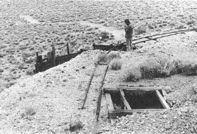
When Western Metals Company was working the Wildrose Mine during World War I, the mine workings consisted of several open cuts and narrow tunnels. According to pictures taken at the time, the ore mined high up on the slopes of Antimony Ridge was hauled by burro train to a long ore chute descending down the hillside to a bin. The nearby mining camp consisted of a combination of frame structures and large tents. [66]
The Monarch workings today consist of open cuts, small adits and stopes, and inclined shafts; the Combination Claim contains an adit and open cuts; and the Monopoly shows an open cut and rat holes. The road to the property ends at the main open cut on the Monarch Claim, and from there trails must be taken to the other workings. A dump area nearby contains purple glass fragments and bottles, indicating early activity. There are no structures on the property.
The Kennedy veins, formerly known as the Wildrose Mine, are reached by jeep road on the north side of Wildrose Canyon, about two miles north of the Monarch deposit, and about 1-1/2 miles northeast of the Wildrose Ranger Station. They are located on a small ridge at an elevation of about 5,100 feet. Workings consist of open cuts and small adits. No structures exist here either. [67]
(c) Evaluation and Recommendations
Antimony development in the western states was mildly successful, first in Utah and Nevada and then in California. The Wildrose deposits in Death Valley are in a poorly defined district that saw only sporadic activity through the years, full commercial development of the deposits here being hampered by their remoteness, the consequent lack of good transportation facilities, their small size, and an unsteady market. Their highest production level was reached during World War I--about 1,000 tons--while the other antimony deposit within the monument, the Old Dependable in Trail Canyon, produced mostly during 1939 to 1941, but only about 70 tons worth. Several antimony mines have operated in California. In 1915 when the Wildrose Mine was the largest individual producer, there was one other operation in Inyo County (near Bishop), five in Kern County, and one in San Bernardino County. [68] Other deposits in Inyo County were later found in Trail Canyon in the Panamint Range and on the west slope of the Argus Range.
|
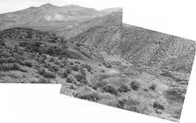
| Illustration 125. View of prospects and working area looking northeast, Wildrose Antimonium Group of Mines. Photo by John A. Latschar, 1978. |
|
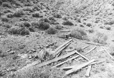
| Illustration 126. Wooden platform site, Wildrose Antimonium Group of Mines. Photo by John A. Latschar, 1978. |
Although new uses had been found for antimony during the war years, such as in matchheads and in the smear on matchboxes, the market continued unsteady and the prices paid for ore subject to considerable fluctuation, making only high-grade deposits economically feasible to mine. The threat of overproduction and a consequent lowering of prices prohibited much development of lower-grade deposits such as the Wildrose ones, which contained only a few high-grade pods and pockets. Because the deposits are widely scattered and no single one is large enough to be mined profitably, because low-cost methods of treating such low-grade ore are necessary, and because of the high cost of transportation, the ruggedness of the area, and the lack of a large water supply nearby, the deposits could never be profitably mined at the prevailing market prices, except for small tonnages of high-grade ore that could be handsorted. During the war years, 1915 to 1918, the average price for metallic antimony was 22.06¢/lb., and from 1919 to 1938 it was 9.97¢/lb. Mines in the Wildrose area could only be economically viable if prices ranged between 16-2/3¢ and 33-1/3¢/lb. [69]
The concrete foundations about one-half mile south of the junction of the gravel Wildrose Canyon Road and the dirt road to the mines, which were tentatively proposed by the LCS crew as the remains of the reduction plant built about 1915, were identified by the Wildrose ranger as the ruins of a communications relay building instead, probably of the relay station shown on the USGS 1972 topographic map of Death Valley. Field crews from the Western Archeological Center have located two sets of ruins in Wildrose Canyon not inspected by this writer. One of them sounds as if it might be the ruins of the reduction furnace.
The Wildrose Antimonium Group of Mines consists of four patented properties--the Monarch, Combination, and Monopoly claims on the south side of Wildrose Canyon, and the Kennedy Quartz Claim on the north side. In addition, there are several individual deposits and prospects located near the first group. The Monarch deposit, referred to as the Wildrose antimony Mine, appears to have been the site of the most concentrated mining efforts in the area and contains the most extensive workings. The precise discovery date of the Wildrose Canyon antimony mines is unknown, but on the basis of information acquired during this study, it is the writer's opinion that the first claim formally staked within the boundaries of the present national monument was in the vicinity of the present Wildrose Canyon Antimony Mine. Because of its early discovery date and its association with Dr. S.C. George, who played an instrumental part in the -early exploration and mining history of the Death Valley region during the 1800s, and because it was the more productive of the two areas mined for antimony within the monument, the site is considered eligible for nomination to the National Register as being of local significance.
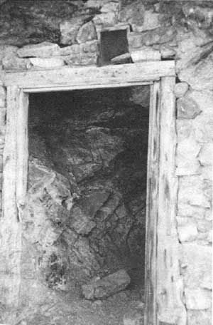
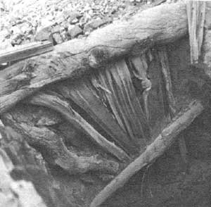
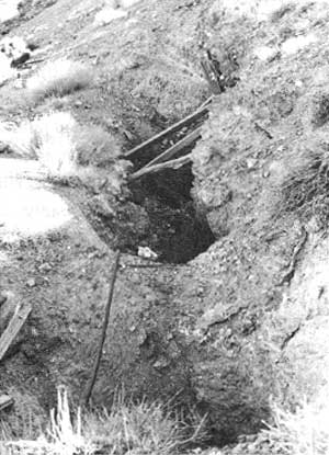
(2) Wildrose Spring Cave House
(a) History
Wildrose Spring, located on the Wild rose Canyon Road about 1 miles south of its junction with the turnoff to the Wildrose Ranger Station, was long a popular campsite and meeting place for the Death Valley Shoshone, who traveled seasonally in search of pinyon nuts from the floor of Death Valley to the upper Wildrose area via Death Valley Canyon on the east' slope of the Panamint Range. [70] It may be safely assumed that roving travelers and prospectors camped at the spring from the time of earliest mineral explorations in the region. When the Wildrose charcoal kilns were producing for the Modoc Mine, Wildrose Spring would have been a natural rest stop for the burro teams hauling the charcoal west. Pete Aguereberry, Shorty Harris, and others frequently camped there in travels between Harrisburg and Ballarat in the early 1900s. While Skidoo's mining operations flourished between 1906 and 1917, the Wildrose stage stop existed less than one-quarter mile further south, consisting of a station, corral, blacksmith shop, and other outbuildings.
Dates of occupation for the Wildrose Spring cave house could not be definitely ascertained. Allusions to similar structures in the area were found, however: a 1904 water location for "Lower Emigrant Spring" mentioned that the spring was situated "on down canyon about half mile from cave house in Wild Rose Mining District on road to Death Valley"; [71] Burr Belden, in relating the experiences of Shorty Borden in Death Valley, recounts that he "arrived in Death Valley early in the 1920's and put blankets down in an Emigrant Canyon cave which he enlarged, fitting the opening with a door and window." [72] Both these references, however, appear descriptive of a structure or structures further north in upper Emigrant Canyon.
Frederick Clark, who drove a stage between Ballarat and Skidoo in 1910, said that he changed horses at Wildrose Stage Station, "which was located about a quarter of a mile down the canyon from the old Kennedy-Grundy place, now removed from the present highway." [73] The distance given here corresponds perfectly to the location of the cave house and a nearby platform site. The two men mentioned were associated with antimony mines in the Wildrose area during this time period and certainly might have had some sort of shelter or home here. In 1915 Wildrose Spring was described as a "much-used camping place on the road to Death Valley by way of Emigrant Springs. The water is very good and the supply is plentiful." [74]
Edna Perkins, during her journey through Death Valley in the 1920s, met a small group of cowboys driving cattle to a feeding ground in Wildrose Canyon. The impression she gives is that they were heading for a spring near the charcoal kilns, but upon reaching Wildrose she and her companions found the cattle and also a two-room stone shack with an iron roof near "the spring at Wild Rose." [75]
(b) Present Status
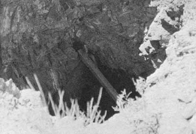
The Wildrose Spring cave house is hewn out of the cliff on the east side of the Wildrose Canyon Road on the edge of the wash near the spring. Its timber-framed door is shored up and strengthened by a surrounding masonry wall. The room itself measures about six by fifteen feet and is spanned by timbers. A small screen vent has been placed above the doorway. About 200 feet north of the cave entrance and also along the edge of the wash is a level platform site supported by a stone retaining wall. The possibility exists that this was associated with the cave in some way. [76]
|
| Illustration 127. Closeup of entrance to Wildrose Spring cave house, showing interior wall. Photo by Linda W. Greene, 1978. |
|
| Illustration 128. Wildrose Spring cave house entrance. Note possible leveled building site on hillside to left of cave. Photo by Linda W. Greene, 1978. |
(c) Evaluation and Recommendations
Too little data has been found on the Wildrose Spring cave house to either determine its purpose or imbue it with any historical significance. It is possible that it dates to at least the early 1900s when this route between the Panamint Valley and the Emigrant section was heavily utilized by stage and foot travel. Whether it was originally, designed as a cool and protected temporary home or camping spot, or whether it served as a cold-storage vault or spring house for a residence or store of some kind on the nearby platform site is unknown. Nonetheless, the cave is an interesting resource and a policy of benign neglect is recommended.
(3) A Canyon Mine
(a) History
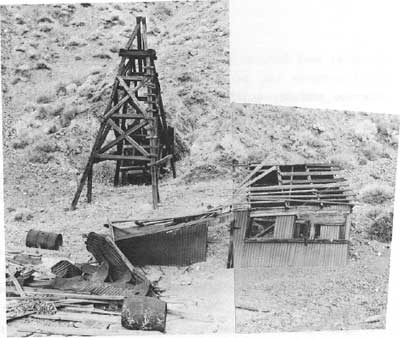
This site was not visited by the writer in 1978, but was inspected by Bill Tweed and Ken Keane in connection with the LCS survey in 1975. The area was once accessible either via a 2-1/4-mile-long unimproved dirt road leading east down A Canyon from the Emigrant Canyon Road and eventually turning into a foot trail necessitating a 1-1/4-mile-long hike to the mine workings, or by following about a one-mile-long dirt road leading north from the Wildrose Canyon Road about 2-3/4 mites east of Wildrose Ranger Station. This latter route led to a corrugated-metal structure undoubtedly connected with the mine workings, which are one-half mile further north on the ridge along a foot trail. In later years a bulldozer road was pushed north up the ridge from Wildrose Canyon over to the mine and on over the ridge down into the head of A Canyon. All these routes were heavily washed during flash floods in September 1975, making the site accessible only by foot.
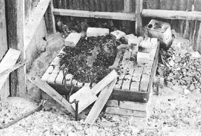
The mine workings themselves consisted of a solid wooden headframe standing over a wood-lined shaft. A collapsed wood frame tool shed and blacksmith shop, roofed with corrugated metal and built on the dump near the shaft, had partially collapsed by 1975. A good-sized brick forge was still located inside the building. Bulldozer prospecting was evident in the general vicinity of the mine.
The only mention found of early activity in the area is a notation mentioning the discovery by Reno men of high-grade silver ore in A Canyon reputedly running up to 2,500 ozs. in silver. [77]
(b) Present Status
The current appearance of the site is unknown.
|
| Illustration 129. Headframe and tool shed, A Canyon Mine. Photo courtesy of William Tweed, 1975. |
|
| Illustration 130. Forge inside tool shed, A Canyon Mine. Photo courtesy of William Tweed, 1975. |
(c) Evaluation and Recommendations
The LCS crew determined that this site was probably a 1920s to 1930s operation. The only structures on site of any particular interest were the headframe and the timbered inclined shaft, both being solidly reinforced and in relatively good condition. On the basis of current data, this site has no significance in the history of mining in Death Valley. Benign neglect is recommended.
(4) Nemo Canyon Mines
(a) History
Mining activity in the Nemo Canyon area was contemporary with mineral development at Skidoo and Harrisburg. The only claims in this area of which specific mention was found are the Eureka Nos. 1, 2, and 3, located 10 April 1908 by Judge Frank G. Thisse of Skidoo and situated in Nemo Canyon about 1,500 feet east of the Skidoo pipeline. [78] Judge Thisse returned to Skidoo in April 1908 to have samples of his ore assayed; the results were so encouraging that a small rush ensued to the discovery site. James Arnold, general manager of the Skidoo Trading Company, was in partnership with Thisse, and proceeded with a wagonload of supplies to the area with intentions of setting up a camp. Because of its proximity to the pipeline and its location within one-half mile of the wagon road, it was assumed that the mine would be easy and cheap to work and profitable to develop. With visions of the birth of a new bonanza camp, many people descended on the area within a short time from Harrisburg and other surrounding communities. The extent of development activity at other mines in the canyon is unknown, although there were notices of more strikes in the ensuing months. [79]
Frank Thisse's original find evidently later became known as the Nemo Mine and was referred to in August 1908 as a profitable gold- and silver-producing venture whose silver samples were assaying over 2,000 ozs. of silver and 1 oz. of gold per ton. Although still owned by Thisse and associates of Skidoo, the property was under lease to S.E. Ball and partners (later connected with the Tucki Mine) who were extracting and shipping ore averaging around $300 per ton. [80] Another large strike was reported in Nemo Canyon during the winter of 1908, with assays yielding over $200 in gold and 86 ozs. of silver per ton. The area was at this time evidently judged to have some promising production potential, because word was soon being spread by none other than Shorty Harris that a ten-stamp mill was to be erected. [81]
The eleven claims comprising the Nemo Mine were leased by George Cook and Joe Wosnieck about three weeks later, and ore was soon uncovered assaying up to $3,300 a ton in silver. The site was being touted as "one of the very best silver properties in the county. [82] Prospective purchasers Wingfield and Scott, of Goldfield fame, and Bob Montgomery of Skidoo, had examined the claims, whose purchase price was set at $50,000 by Thisse and J.R. Mason, the co-owners. In addition Cook and Wosnieck were demanding $20,000 for their interests, making a total of $70,000, a sum not considered exorbitant for a property on which there was indication of a deeper, richer, and more permanent ore body yet to be developed. [83] At this time the site consisted of both surface and underground workings.
The Goldfield capitalists evidently decided not to invest in the promising mine, possibly deciding the asking price was a bit steep. Whatever the reason, Cook and Wosnieck continued to operate their lease, happily discovering that the ore body grew larger with depth, and by January 1909 they had assembled 300 tons of silver for shipment to the Four Metals Company smelter in Keeler. An experimental consignment of three tons was sent there by wagon in February, with values ranging from $600 to $700 a ton. Because the smelter could not assure treatment before two or three weeks, the ore was then shipped to Hazen, Nevada, for processing. [84]
Another strike in Nemo Canyon was announced in March 1909 by a brother of Bob Montgomery (owner of the Skidoo Mine) who reportedly found silver ore assaying 2,800 ozs. in silver and 4 ozs. in gold per ton. Meanwhile the Cook lease on the Nemo Mine was still yielding a great quantity of high-grade ore, worth over $300 per ton. Five outfits were now operating in Nemo Canyon and in Wood Canyon immediately to the north, most being company ventures, with some leasing activity. [85]
From 1909 to 1920 there is a noticeable dearth of information about mines in Nemo Canyon, indicating that despite its spectacular early production record during the short period from the spring of 1908 to the spring of 1909, the area never attracted much investment capital. In January 1920 notice appeared that a certain J.J. King was leaving Independence for Nemo Canyon to check up on some mining claims he owned there. S.E. Ball, who had held a lease on the Nemo Mine property in 1908, was still working a silver claim in Nemo Canyon in 1922, and had reportedly removed ore worth $10,000 from the mine through the years. [86] This might refer to the Grey Eagle lode mining claim in Nemo Canyon, one-third interest in which was transferred by Ball and Ed Attaway to Maude E. Attaway in 1924. [87]
During the mid-1930s Walter M. Hoover and a man named Starr were mining in the area and processing the ore in a small cyanide plant north of Journigan's Mill. In 1938 the Journal of Mines and Geology listed a Nemo Canyon Antimony Mine, comprising six claims at an elevation of 5,000 to 6,000 feet. Owned by a Death Valley Junction resident, the mine's limited development involved only open cuts and some shallow shafts. [88] The names of two claims in the Nemo Canyon area were found in the monument files. The Nemo Gold Claims, thirteen in number, were the result of fraudulent promotions by the Blue Chip Mining Company. The Nemo Chief, two gold claims with no production record, served only as the home of an itinerant miner. By 1971 Omar L. Heironimus, owner of the Nemo Silver Corporation of Beatty, Nevada, acquired the water rights to a spring near the Journigan Mill site, and was leasing the property with the intention of cyaniding the tailings dump there. By this means it was hoped to acquire enough capital to mine Heironimus's gold and silver properties in Nemo Canyon. [89]
|
| Illustration 131. Building site in foreground and prospecting activity along hillside in back, Moonlight claims. Photo by Linda W. Greene, 1978. |
|
| Illustration 132. Nemo #1 Mine, later relocated as Christmas Mine. Photo by Linda W. Greene, 1978. |
(b) Present Status
Adjacent to the road to the Christmas Mine, on the south side and about one mile east of the Wildrose Canyon road, is a site marked by a Mine Hazard Area" sign. No structures remain, but it is assumed from the burned boards and assorted metal refuse on the ground that at least one wooden building once stood here. Purple glass has been found in the area. In the hills immediately to the south are some adits and prospect holes that were not visited by the writer--mining activity appeared to be minimal.
(c) Evaluation and Recommendations
Mineral development in Nemo Canyon, beginning' about 1908, appears to have been of relatively short and discontinuous duration, never sustaining such large-scale activity as found at Harrisburg or Skidoo. The largest operation in the vicinity was apparently the Nemo Mine. Its notice of location placed it slightly over one-quarter mile east of the Skidoo pipeline, which passed through the camp at the site labelled "Christmas Mine" on the USGS Emigrant 'Canyon quadrangle map and continued south. It therefore seems plausible that the Nemo Mine, referred to in the 1930s as the Nemo Canyon Antimony Mine, was the earliest location of what later became the Nemo #1 Mine operated by Omar Heironimus and a man named Mondell. This property, on a hillside south of the "Christmas Mine" at about 6,000 feet elevation, was relocated by Ralph Pray in 1974 as the Christmas Mine. It will be discussed in the following section. The site located a mile east of the Wildrose Canyon Road and designated by three adits on the USGS Emigrant Canyon quad contains the Moonlight claims, owned. originally by Heironimus and later also relocated by Pray. (A 15 April 1927 article in the Mining Journal, p. 29, mentions the Moonlight Group of seven claims in the Wild Rose Mining District, recently acquired by Long Beach, California, investors for $755,000.) None of the mining sites in Nemo Canyon meets the criteria of evaluation for associative significance necessary for nomination to the National Register.
End of Volume I, Part 1
Beginning of Volume I, Part 2
(5) Christmas (Gift) Mine
(a) History
A Christmas (or Christmas Gift) Mine antimony lode was reportedly discovered by Dr. S.G. George on Christmas Day 1860, during George's unsuccessful second attempt to locate the lost Gunsight lead. [90] Earlier that year he had headed a contingent that joined forces with the New World Mining and Exploration Company from San Francisco, headed by Col. H.P. Russ, and together they had entered Owens Valley. George and a detachment had separated from the main body here and headed east, discovering promising ledges in the rugged Panamints and organizing the Telescope Mining District. Returning to San Francisco, some unscrupulous people involved in these discoveries managed to secure investment capital there that would, they assured, be sunk into development of the Telescope District mines. Instead, most of these con artists left town with the monies; none of the original discoveries were actually placed on the market, nor were any of the companies formed to work. the Telescope mines legitimate.
Late in 1860 the George party made another trip out from Visalia, California, into the Death Valley country, resulting in discovery of a Christmas Gift Mine on December 25. Not having the necessary equipment to work the mine, and because winter was at hand and snow was already falling, the expedition started home. The following year W.T. Henderson and three others began work on a 150-foot tunnel to tap the Christmas ledge, but they were eventually driven out by unfriendly Indians. [91]
It is the writer's opinion, due to personal research findings and discussions with others familiar with mining activity in this section, that the so-called Christmas lode discovered by Dr. George is not the Christmas Mine found on the USGS Emigrant Canyon quad, but is instead what is today known as the Wildrose Canyon Antimony Mine southeast of the Wildrose Ranger Station. On the basis of data procured it appears that the workings found at what is presently labelled the Christmas Mine were first excavated in connection with work in Nemo Canyon in the early 1900s. As mentioned in the Nemo Canyon section, one of the present Christmas Mine sites is a relocation of the Nemo #1 Mine. In 1906 labor was performed in this area by the Christmas Mining Company under E.F. Schooley. Notice was found in 1908 that a Dan McLeod held a two-year lease on the Christmas Gift in the Panamint Range, "probably the oldest known mine in the county," on which he intended to install a twenty-horsepower gasoline hoist. The most recent owner of this property has been the Keystone Canyon Mining Company of Pasadena, California, Ralph E. Pray, president. [92]
In researching the Christmas Mine it is easy to become confused initially by references to the productive and more developed Christmas Gift Mine that was part of the Mackenzie Group (including the Pluto and Lucky Jim) four miles north of Darwin. This was a silver-lead mine being worked at least by 1890 and through 1948. [93]
(b) Present Status
The area designated Christmas Mine on the USGS Emigrant Canyon quad consists of two sites and is reached via dirt road leading east from the Emigrant Canyon Road about 4-1/4 miles south of Emigrant Pass. The mine camp is about 1-3/4 miles east of the Emigrant Canyon Road; the only extant building there is a small wood and corrugated-metal shack. The cabin is posted "Property of Christmas Mining Co." and contains only some bedsprings and chairs. Also on-site are a tin-sided pit toilet and two building sites southwest of the cabin. Nothing remains on them now but piled lumber and an old refrigerator. The burned ruins of a dugout can be found, consisting of a shallow hole filled with metal scraps. Northwest of the privy is a stone masonry support that once carried a portion of the Skidoo pipeline across a wash. The support is fifteen feet long, four feet wide, and two feet high. The pipeline scar is visible continuing on up over the hills to the southwest. Continuing east from the residential area on a four-wheel-drive road one arrives after one-half mile at the scene of some prospecting activity. Not much is left on site. Near the road is the ruin of a collapsed dugout or timbered adit, with beams visible protruding from the rubble. On west, around the top of the hill, are a caved-in stope and the remains of a timbered shaft. Much metal refuse lies around, but there are no building remains.
|
| Illustration 133. Christmas Mine residential area, view to east-northeast. Photo by Linda W. Greene, 1978. |
|
| Illustration 134. Caved-in shaft at prospect site due east of residential area. Photo by Linda W. Greene, 1978. |
|
| Illustration 135. Masonry support for Skidoo pipeline, near Christmas Mine camp. Photo by Linda W. Greene, 1978. |
A dirt road south from the residential area leads to a more complex mining operation, the Nemo #1 Mine that was relocated as the Christmas Mine by Ralph Pray in 1974. Remains on site consist of an ore bin, rails, trestle bents, and several small shafts, one of which was framed and timbered with pinyon pine logs, testifying to the longevity of mining operations here. Three of the shafts appeared to have been operated by means of hand winches. In 1975 some prospecting work was still being carried out in the tunnels. [94]
(c) Evaluation and Recommendations
A history of mining activities within Nemo Canyon may. be found in an earlier section. Although the spot labelled Christmas Mine on the USGS Emigrant Canyon quad map has been thought of as the site of the first claim staked within the present monument boundaries, it is fairly certain that George's early discovery was actually made further south. Sporadic attempts to work this Christmas Mine all the way up through the 1970s have been made, with its largest production during World War I. Exact output figures have not been found, however. [95]
The remains at both this site and at the. Christmas Mine immediately south are a strong mixture of old and new, and it is difficult to determine which workings were the result of the earliest mining activity. The discovery of rounded pinyon pine log framing in the shaft at the second site indicates that this operation was underway early, with the ore bin and rail system being later additions. This site is not eligible for National Register status due to a lack of importance in Death Valley mining history. Purple glass on the residential site further north suggests an earlier occupancy than indicated by the miner's shack standing there today. Dating the workings at the Christmas Mine prospect site near the cabin is almost impossible because of the lack of physical evidence. These last two sites are not deemed eligible for nomination to the National Register due to a lack of integrity and associative significance. The Skidoo pipeline support near the mine camp will be included within the route of the pipeline on the revised Skidoo Historic District National Register form.
|
| Illustration 136. Shaft lined with pinyon pine logs, Christmas Mine (formerly Nemo #1). Photo courtesy of William Tweed, 1975. |
|
| Illustration 137. Open stope at Christmas Mine (formerly Nemo #1). Photo courtesy of William Tweed, 1975. |
(6) Bald Peak Mine
(a) History
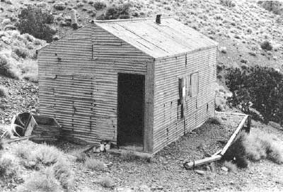
This site, located about 1-1/2 miles northwest of Bald Peak, was not visited by this writer, both because of its inaccessibility and because it had been inspected by two members of the LCS survey crew, Bill Tweed and Ken Keane, in December 1975. The area is reached via a dirt road leading east for 2-1/2 miles from the Emigrant Canyon Road about 1-1/2 miles south of Emigrant Pass. This access was reportedly badly damaged by heavy rains in the fall of 1975.
The site appeared to Tweed and Keane to be a talc operation, dating from perhaps the 1940s or 1950s. On-site was a wooden-framed building with corrugated-metal walls and roof standing on a level platform area that was supported by a corrugated-metal retaining wall. A short distance further southeast up the canyon was a good-sized one-chute ore bin; the mine workings were located on top of the steep slope behind. [96]
|
| Illustration 138. Corrugated-metal cabin at mine 1-1/2 miles northwest of Bald Peak. Photo courtesy of William Tweed, 1975. |
|
| Illustration 139. Ore bin at Bald Peak mine. Photo courtesy of William Tweed, 1975. |
(b) Present Status
The present condition of the mine structures is unknown.
(c) Evaluation and Recommendations
This site, probably a post-Depression Era talc operation, lacks National Register eligibility. The scarcity of data on the mine suggests little production and associative connection with any of the more important miners or mining companies that operated in Death Valley.
(7) Argenta Mine
(a) History
The earliest reference to an Argenta Mine, albeit an ambiguous one, was an 1875 notice that "Argenta" was the new name being given to the Jupiter Mine owned by the Parker company, evidently located somewhere in the Panamint region. [97] It is highly unlikely, however, that the Argenta Mine near Harrisburg was ever worked this early.
As far as can be determined, this latter mine was first located in 1924, was operated by the Rainbow Mining Company in 1925, and then by the Southwestern Lead Corporation from 1927 to 1928. In 1927 notice of the mine appeared in the Inyo Independent when the Argenta Nos. 1-12 mining claims in the Wild Rose District were deeded first from Ed L. and Hazel Wright of Los Angeles to Charles W. Stanley, and then by him and his wife, Lulu G., also of Los Angeles, to the Southwestern Lead Corporation of Delaware. At the same time an Alonzo and Martha E. Stewart of Los Angeles deeded the Argenta Group (Argenta, Leadfield, and Woodside mining claims) for $5,000 to Southwestern Lead Corporation. A bit confusing is a later notice of the transfer of deeds to the Argenta, Leadfield, and Woodside mining claims for $2,000 from a D.M. Driscoll of Los Angeles to the same Alonzo Stewart. Theoretically, this should have preceded Stewart's transfer of ownership to Southwestern Lead. [98]
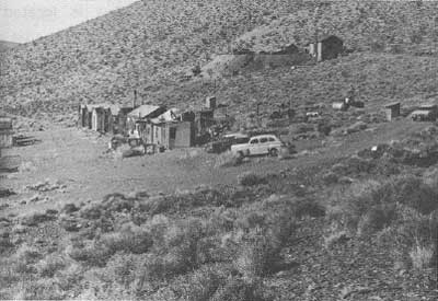
Around 1930 George G. Greist, evidently an employee of the lead company, filed suit against C.W. Stanley and the Southwestern Lead Corporation in lieu of unpaid wages. A Decree of Foreclosure and Order of Sale were instituted against the company in May of that year for $3,699.85, and the Argenta, Leadfield, Woodside, Thanksgiving, and Argenta Nos. 1-12 mining claims were offered for sale. [99] The litigation resulted in Greist becoming the new owner, relocating the property as nine silver-lead claims. This gentleman, referred to as a one-time sheriff of the Panamints, was indicated as living at the mine in 1933 and being a neighbor of Pete Aguereberry. [100]
|
| Illustration 140. Argenta Mine. View to southwest of main street of mine camp, February 1969. Photo by Chief Ranger Homer Leach, courtesy of DEVA NM. |
|
| Illustration 141. Argenta Mine camp, view to west-northwest showing bunkhouses and upper mining level, February 1969. Photo by Chief Ranger Homer Leach, courtesy of DEVA NM. |
In 1943 the property was owned by Greist and an Ed L. Wright and was under lease to H.T. Kaplin and Sam Nastor of Los Angeles, with Greist superintending the operation. Development at this time consisted of a 30-foot shaft on top of the ridge and a 630-foot adit with lateral workings and a crosscut. Ore assaying 17% zinc had also been found in an open cut south, of the shaft. The average grade of ore shipped contained 12% zinc, 5% lead, 2.80 ozs. silver, and .08 oz. gold. Seventy tons of lead ore shipped assayed 27% lead and $8 per ton in gold and silver. Equipment on-site included a machine shop, an electric-light plant with a Fairbanks-Morse gas engine, an Ingersoll-Rand portable compressor, an assay office, and assorted boarding- and bunkhouses. By 1950 only George Griest was named as owner, employing two men in prospecting work at the north end of the adit.
Two other properties mentioned in Wood Canyon were the Combination Group, owned by Wilson and associates and worked in the early 1900s, and the Arnold Plunket claims to the south. [101]
(b) Present Status
The Argenta Mine is located in the Wildrose Mining District along a ridge on the north side of Wood Canyon at an elevation of about 5,500 feet. The site is about 1-1/4 miles east of the Emigrant Canyon Road via a dirt cutoff just before the canyon road crosses Emigrant Pass. The owner, George Griest, never made much of an attempt to mine here, living off public charity until the early 1960s when he became eligible for a California State old-age pension. [102]
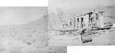
The mine area consists of two levels of workings. Lower on the hill is the "main street," once lined on both sides with about twenty assorted small, one-room boarding and bunkhouses and with other camp necessities such as a chicken coop. All buildings are presently in a shocking state of decay due to weathering and vandalism. Most of the structures, which were built of wood, plasterboard, and corrugated metal, have completely fallen in or been pulled down. The only items of any interest are on the north side of the street, in the form of remains of a stone dugout with a wooden false front, and, just southwest of this, a round, concrete cistern built underground, appearing to have a capacity for several thousand gallons of water. In the photographs of the camp site taken in 1969 the stone dugout appears to have been located behind a large building in the center of the community that probably functioned as the cookhouse. The dugout was probably the root cellar and the cistern nearby stored the camp drinking water.
Higher and further north on the hillside is a timbered adit and the ruins of at least two other buildings, one having been a two-story frame structure on the edge of the dump, and the other a smaller one-story frame building, possibly the assay office. Only the flooring and basement level framing of the larger building remain somewhat intact; the other structure is completely destroyed.
An incredible amount of refuse is evident everywhere on the site, ranging from modern garbage to old machinery parts to vintage 1940s and 1950s car bodies, the entire site resembling a tremendous junkyard.
(c) Evaluation and Recommendations
The Argenta. Mine never yielded a profitable output nor do any structures of historical significance remain on the property. The site was not an important Death Valley mining operation and is not eligible for inclusion on the National Register.
|
| Illustration 142. Argenta Mine. View to west-northwest down main street of mine camp showing almost total destruction of buildings. Photo by Linda W. Greene, 1978. |
|
| Illustration 143. Argenta Mine. View to northwest of mining area showing remains of two-story building. Photo by Linda W. Greene, 1978 |
(8) Napoleon Mine
(a) History
The Napoleon and Napoleon Nos. 1-2 quartz claims, situated one-half mile south of Harrisburg, were located by Pete Aguereberry on 1 January 1911 and recorded on 24 January. The location date of the Napoleon No. 3 was not found in the record books, but it was probably several years later, since it was not filed for record until 14 September 1935. [103] The Napoleon No. 1 is east of the Napoleon Claim and the No. 2 is south of it. The No. 3 joined the Napoleon No. 2, but on which side is unknown. The only reference to these claims in the literature was found in Pipkin, who was evidently told by Pete that after he had done some development work on the Napoleon he leased the claim to two men who reportedly removed $35,000 in gold ore from the mine within a six-month period and then abandoned it, leaving it ruined by improper timbering and gopher holing. [104] This large a sum seems open to. question. In 1946, when Pete's estate was settled, ownership of the Napoleon Nos. 1-4 was divided among the heirs, Ambroise Aguereberry receiving an undivided one-half interest, and the other half being given equally to Joseph, Arnand [Arnaud], James Peter, Mariane, and Catherine Aguereberry. [105]
The Napoleon Group is mentioned in the Journal of Mines and Geology in 1951 as comprising four unpatented claims, the Napoleon Nos. 1-4, owned by Ambroise Aguereberry of Trona, California. Development consisted of an 80-foot-deep inclined shaft and several adits, all within an 8O0-foot radius. Most of the ore mined has been removed from three adits southwest of the shaft. During sporadic operations from 1937 to 1939 lessees had shipped fifty-five tons of gold- and silver-bearing ore to custom mills, but the operation was currently idle. [106]
|
| Illustration 144. Shaft, tram rails, and ore chute at Napoleon Mine. Photo courtesy of William Tweed, 1975. |
|
| Illustration 145. Ore bin and collapsed chute southwest of main adit, Napoleon Mine. Photo courtesy of William Tweed, 1975. |
(b) Present Status
The Napoleon Mine is situated on the north side of a ridge about one mile south-southwest of the Cashier Mine workings. The site consists of two working levels--the lower containing a main adit and an ore chute, with a timbered vertical shaft between, some dry-stone retaining walls, and the remains of a mine tramway. Uphill about one-quarter mile southwest of this first complex are a second ore bin with a collapsed chute and several adit entrances. Purple glass has been found on this site.
(c) Evaluation and Recommendations
The Napoleon Mine has no significance except for its association with Pete Aguereberry, which is minimal. The writer does not recommend that it be included within the boundaries of the proposed Harrisburg Historic District. The site does not offer potential for further research or historical archeology.
(9) Harrisburg
(a) History
i) Shorty Harris and Pete Aguereberry Strike Ore on Providence Ridge
As is the case with most important events when two or more strong-minded participants are involved, the details surrounding the discovery of the first strike at Harrisburg Flats are open to controversy. The find was made by two of Death Valley's most noted mining personalities--Pete Aguereberry and Shorty Harris. The former's version of the tale is that around the first of July 1905 the two men met at Furnace Creek Ranch, by chance, and decided because of the heat of the valley to pull out for the Panamints together and do some prospecting, although Shorty was actually more interested in getting to the 4th of July celebration at Ballarat. After negotiating the old "dry trail" through Blackwater Wash, they arrived on the open plateau now known as Harrisburg Flats, about nine miles northeast of Wildrose Spring.
Shorty, being on horseback and driving his mules harder, was some distance ahead of Aguereberry, who at this point saw a promising-looking ledge on the north side of a low long hill. Chipping off a piece, he found it contained free gold. Hurriedly catching up with his companion, Pete showed him the ore sample, and the two excitedly made plans to continue on to Wildrose Spring to replenish their water and then return and stake out claims. During this time of further prospecting and exploratory work, the two divided up the outcroppings, Aguereberry staking claims on the north side of the hill, which later became known as "Providence Ridge" or "Providence Hill," including the Eureka Nos. 1-4, while Shorty took claims on the south side, which later incorporated the Providence Group. These finds were located at the extreme northeast end of an east-west ridge that rises about 200 feet from the mesa. The initial name agreed on for the camp was Harrisberry, in the hopes that a strong association with Shorty Harris would attract prospective investors.
The "partners" split up at this point, both eventually heading for Ballarat, Shorty to spread the word of his new find and Pete to pick up a grubstake that was being sent there by money order. By the time Aguereberry returned to his hill within the next few days, the rush was on, with gold-seekers from Ballarat swarming all over the strike area, necessitating that Aguereberry reestablish his original ground by both persuasion and force. Harris's version of all this is slightly different, suggesting that he found the first evidence of riches and was forced to share the discovery with Pete. According to one newspaper, "Pete and Shorty have not flipped coins to determine who is actually responsible for the strike, but the credit is generally given to Shorty, perhaps from previous achievements." [107] The real facts may never be known, but however it happened, another Death Valley boom camp had been born. [108]
ii) The Area Fills Up Rapidly
Word of the strike spread quickly, and by August 1905 at least twenty parties were locating monuments in the surrounding hills within a three-mile radius of the original discovery, about fifty locations being made immediately. The new area was included in the Wild Rose Mining District, and Frank C. Kennedy, a prominent mining man of the region, was appointed Deputy County Recorder. Samples from the immense quartz ledge, which, it would turn out, stretched north to the future Skidoo and Emigrant Spring mining areas, were assaying from $90 to $200 per ton in free-milling gold, with some rumored to have values as high as $500. It was reported that 300 men and some women were settled in the new camp, which was already organizing a townsite company, somewhat depopulating Ballarat and Darwin and also attracting many from Rhyolite, who tramped the approximately sixty-eight miles via the watering spots at Daylight Spring, Hole-in-the-Rock, Furnace Creek Ranch, and Blackwater Wash. [109]
As with every large strike in the Panamint Range, the call went up for Inyo County residents to rally and implement plans to assist the mining district by providing teaming services, agricultural supplies, and restaurant, hotel, and merchandising facilities to incoming miners. Ballarat was the main supply point. By September, 200 claims had been recorded in the area; with the advent of cooler weather, the camp's population was expected to triple with new arrivals from Nevada. [110] Timber and water, essentials to a new mining community, were near at hand, the latter available either at Emigrant Spring, seven miles northwest; at Blackwater Spring, about seven miles to the northeast; or at Wild Rose Spring, about nine miles southwest. At Emigrant Spring a new pipeline was being shipped in to funnel water from the spring to the roadside where it would be more accessible. [111]
iii) Cashier Gold Mining Company Is Formed
Four more claims mentioned in the Harrisburg area, adjoining Aguereberry's property, were the Wild Horse, Slow Elk, Modoc, and Monarch, owned by J.W. Sellers, l.T. Davis, Bill Pollard, Ray Robinson, and W.T. Voorhees. [112]
The intense involvement of "outsiders" in the Harrisbury discoveries and their desire to get in on the ground floor manifested itself in the immediate bonding of Shorty Harris's strikes to several millionaires from Tonopah and of Aguereberry's claims to Goldfield capitalists. A few days earlier Harris had gone to San Francisco where he succeeded in persuading some investors to visit his property in anticipation of financing development work. [113] The result of this visit was the formation of the Cashier Mining Company, headed by O.L. Ingalls and associates (including E.S. Shanklin, who was heavily invested in the Bullfrog National Bank Mine, and W.A. Jacobs) and owner of nine claims. A survey of the property was to be made and a company assayer moved in. More important to the residents of the area, probably, was the news that saloon supplies were on their way! A deal involving $100,000 was rumored to be pending for the Aguereberry mine. [114]
The survey of the Harrisburg townsite and of the Cashier Gold Mining Company's claims was undertaken by J.H. Wilson of Cripple Creek, Colorado, who had formerly been an engineer in Goldfield. He established residence in the area and proceeded to open an engineering office (touted to be the first such business opened in the Panamint Range). The company assay work was to be done by a D.E. Blake of Denver, Colorado, who established the first assay office in the new camp. A William O'Brien, of Bullfrog, was put in charge of the six men at work sinking three shafts on the property, and work was to be initiated by driving a tunnel at the foot of the hill to hit the vein as low as possible. [115]
By late October of Harrisburg's first year of existence, the land had been surveyed for a townsite and tents were constantly springing up in the business section. The Cashier Gold Mining Company now kept twenty-three men busy, at $3.50 a day, round-the-clock, sinking two shafts, one in $90 and the other in $700 ore, and running a tunnel. Twenty-seven tons of high-grade ore had already been mined to be shipped to Keeler. The vast number. of prospectors swarming the hills created a shortage of vegetables, fruit, ham, bacon, hay, and grain, as a consequence of which all sold for exorbitant prices. Rumors still persisted of a deal pending in Goldfield either for the Eureka Group or the Cashier Group (now said to include fourteen claims), or for both, the amount in question stated to be $160,000. In February it was reported that owners of the Eureka Group had sold a half interest in the property to San Francisco investors who paid $15,000 down and intended to build a mill. [116]
iv) A Multitude of Claims are Located in the Area
In December 1905 a big strike was made on the six claims of the Exjunction Group about two miles northeast of Harris's Providence Group and owned by U.V. Withee, W.B. Gray, and W.H. Sanders. Quartz averaging $259 in gold, silver, copper, and lead was being exposed. Stretching for five miles along this same ledge were forty other claims: beginning at the north were the Victoria Group of four claims, owned by Will Goodpasture, Dr. Kerns, and John Sellers; the Exjunction or Sanders Group of six claims owned by Withee, Gray, and Sanders; the Exjunction Extension Group of four claims owned by Goodpasture; the B & B Group of six claims owned by Brin and Blumlein; the Check Book Group of three claims owned by the Oakland Mining Company; three claims owned by the Kawich-Bullfrog Company; the Red Cross Group of seven claims owned by Tasker Oddie, Luetjens, and Webb; the Annis M. Group of six claims and the Branley, owned also by the Oakland Mining Company; the Carrie Nation and Little Hatchet owned by Charles Nations; and the Bunker Hill owned by Andrew Deck. [117] The Sanders strike had so far shown the best results among all these promising operations, and the Exjunction property of six claims was the core around which the Wild Rose Mining Company would soon be incorporated. Two timber claims and a millsite with water rights would be included in the company holdings. [118]
A synopsis of the mining situation at Harrisburg appeared in the Herald in late December 1905, the result of observations made by some individuals owning claims there:
We found quite a stir both in the new Wild Rose (gold) district and the old Panamint (silver) district. And this activity is being made principally by Rhyolite, Goldfield and Tonopah people, with whom outside parties are in some cases associated. We stopped at the Shorty Harris strike, now being worked by the Cashier Mining company, and found that a good proposition is being opened up. The ledge has been cross-cut in a tunnel, and there is about eight feet of ore carrying rich milling ore, with some shipping values of which we were not advised. Drifting is now being done on the ore. The day we were there the San Francisco people, who are intereste, [sic] came and looked over the property. The Sanders strike, which the Herald reported last week, is bona fide, as far as I was able to judge, the ore looking very good. We examined and sampled the five claims owned by Mann, Gorrill, Clemens and myself. Mr. Gorrill had not seen the ground before, and he was much pleased. These claims [on Silver Mountain] are old chloriding silver propositions, which were worked many years ago when the price of silver made profitable the mining of the ore, which had to be packed a half mile down the hill on animals, hauled in wagons 70 miles to Keeler and shipped over the C. and C. narrow gauge, a high tariff line, to Selby's smelter in Frisco. It was profitable work in those days, and with the better facilities for mining and cheaper transportation, these properties should be profitable now . . . . Johannesburg, 80 miles distant on the Santa Fe, is the shipping point for the Wild Rose district. . . [119]
About forty men were now working in and near the camp.
By spring and summer of the next year, discoveries hastening the advent of Skidoo were being made about two miles from Emigrant Spring, attracting miners from throughout the region. The Panamints were rapidly filling up, despite continuing transportation problems:
Ballarat is reached by stage from Darwin, and by the line from Randsburg. From Ballarat to Emigrant and Harrisburg transportation is effected by any sort of locomotion at command of the individual prospector or mining tourist, there being no established line of communication. Nor is there as yet any regular means of travel from the east--from Beatty or Bullfrog. . . . [120]
By April 1906 the Wild Rose Mining Company had been incorporated, with W.B. Gray as president, W.H. Sanders as vice-president, and Dr. U.V. Withee as secretary-treasurer. Principal place of business was at Beatty, and the seven main holdings of the company, situated about 1-1/2 miles from Harrisburg, included the Sanders strike on the Exjunction gold, silver, copper, and lead claim. [121]
Shorty Harris was continuing to extoll the virtues of "his" town in the Panamints whenever he journeyed to Rhyolite or other nearby camps. In May 1906 he boasted that there were twenty tents in residence and that he was planning to try to sink for water shortly, thus negating the need to haul this precious commodity from Emigrant Spring. Not putting all his marbles in one bag, however, he had proceeded also to locate two groups of claims near the Emigrant Spring Gold Eagle strike--the Gold Links and the Gold Eagle's Tail. [122] The Cashier Mining Company was still having success with the Providence Claim, which seemed to harbor steady reserves. The Ingalls interest in the company was purchased in the fall of 1906 by T. E. Crawford of Helena, Montana, making him co-partner with Shorty Harris. These two planned to immediately employ fifteen men on sinking a new shaft. Crawford was also planning to install, a five-stamp mill on the property that could draw water from the Skidoo pipeline to Telescope Peak. [123]
By November the Emigrant Spring area was fairly bursting with mining activity. Reputedly there were 150 miners in the area, a third of whom at least were working at the Skidoo Mine and on the projected Telescope Peak pipeline. The new townsite was rapidly filling up and was the terminus of a twice-weekly stage run from Ballarat. Owners of the Denver and Tramps properties in Rhyolite were still negotiating for the purchase of some Harrisburg property for a reputed $160,000. Meanwhile the Panamint Greenwater Gold & Copper Company, organized and financed by Denver capitalists, had purchased the Sweeney Group of four claims a mile east of Harrisburg. [124]
Silver Mountain, between Harrisburg and Skidoo, was still the scene of several good silver strikes at this time, which, because of the current high price for that commodity, seemed assured of a reasonably productive future. As mentioned earlier, rumor held that the outcrops here had been worked by Mexicans in years past, with the ore being carried on mule or horseback down from the mountains and then to Keeler for shipping on the Carson and Colorado Railroad to San Francisco smelters. It was presumed now that with better transportation facilities and a higher price for silver, these old workings could be operated even more profitably. Although the wagon road from Rhyolite to Stovepipe Wells was finished, work was still continuing on the last section to Skidoo. [125]
Some idea of the atmosphere at Harrisburg can be gleaned from the following account of its New Year's Eve party of 1907:
There were no invitations issued, there was no one asked to go. No one cared whether any one else went but themselves. No one cared to see any one else there. Whoever wished to go, went. Many were so inclined. Most of those who did go reaped a rich reward. No one attended for the enjoyment of the affair. It was a New Year's party under cover of midnight, held in the great big outdoors. Desirable mining property was the prize and there were many prizes. So great was the desire for claims that had been neglected and allowed to expire, that the re-locators met in numbers of ten and fifteen, in several instances, at some lone monument, just as the hour of midnight heralded the birth of the new year. Of course, in such instances, the names of all present were place on the location certificate and many who expected to secure two or three full claims, considered themselves fortunate in having been figured in for a tenth interest in one . . . . The re-located property is now in the hands of energetic men and development will be done. . . . [126]
Another large purchase in the Harrisburg area was consummated in the spring of 1907 when San Francisco and Michigan capitalists and John Stukey and his associates Kennedy, Gray, and Thurman closed two important mining deals, one involving the Ross E. (Rossie) Group of nine claims to the north of the original Harrisburg strike, purchased for $12,000, and the other the Providential Group of six claims on the south side, bought for $10,000. Another purchase mentioned was that of the Combination Group near Harrisburg by the California, Illinois & Wisconsin Gold Mining Company. [127]
The Cashier property was still undergoing active development at this time. A 165-foot tunnel had intersected a four-foot ledge of quartz showing values of from $70 to $100 in gold. Although just the high-grade ore was deemed sufficient to make the property a big mine, all the ore exposed was thought to be millable on the ground at a profit, which would make it an immense producer. A mill was being planned by the company, and in connection with that project they were contemplating use of the pipeline from Telescope Peak to provide the water supply. The Eureka Mine was still showing rich ledges, and ten tons of high-grade ore were ready for shipment, averaging $150 a ton. Notice appears at this time of some litigation between Shorty Harris and Crawford, owners of the Cashier, and J.P. Aguereberry and F. Flytin, representing the Panamint Midas property, over the Eureka Claim, with two of the properties finally being consolidated. Work was to be pushed with a force of fifteen or twenty men; later word suggested that the Cashier-Midas property had been bonded to a Chicago syndicate. [128]
Meanwhile W.B. Gray was still steadily developing the Wild Rose Mining Company's property two miles from Harrisburg and had driven a 150-foot adit, exposing a ledge carrying good values its entire distance. The three principal directors of the company, Edward E. Babb, W.W. Curtis, and. U.V. Withee, accompanied by a mining engineer, visited the property in the fall of 1907 to formulate plans for its future development. [129]
The names of a few more mines in the Harrisburg vicinity now come to light: the Blue Jay Group, near the Cashier; the Jockey Club Group; adjoining the Cashier claims; and the Rosalind S., Hearst Junior, Hearst Second, and Wilson lodes in the vicinity of the Green Monster Group. These names reflect the interests of William Randolph Hearst and his father-in-law G.W. Wilson. These latter lodes were about the last to be recorded in that district, which now contained forty-three unsurveyed claims in an area of 1-1/2 square miles. Eight men working on the Cashier Mine were sinking a shaft, and three rich gold veins had been found crossing the property. It was hoped that a 140-foot tunnel would intersect them in about seventy more feet. [130]
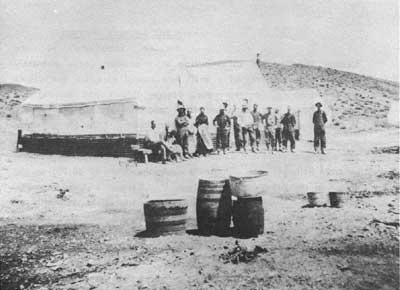
|
| Illustration 147. Supposedly a view of Harrisburg Camp, taken on Death Valley Expedition by Yeager and Woodward, May 1908. Tent flap, however, identifies spot as "Emigrant Springs." Photo courtesy of DEVA NM. |
|
| Illustration 148. Pete Aguereberry, date unknown. Photo courtesy of DEVA NM. |
v) A Mill Appears Imminent
Because conditions at the Cashier Mine seemed so promising at this point, with ultimately thirteen men working on a shaft and tunnel in which ore values were increasing, entrepreneur George Brown was moving his rooming house and restaurant from Emigrant Spring to Harrisburg to accommodate the increasing population. The only other storekeeper in the area whose name is known is Sam Adams, who ran a general store and saloon in a large tent with supplies brought in from Ballarat. He supposedly cleared a profit of $6,000 on the saloon in his first six months there. [131] Because of good showings in tunnel and shaft, the Cashier Company was still toying with the idea of erecting a ten-stamp cyanide lixiviation mill. To get the required water to run the operation, Crawford purchased from Ballarat people their water rights in Jail Canyon, amounting to eight miners' inches flow of water. This would pass through the Skidoo pipeline to Harrisburg. The addition of fifteen more stamps to the Skidoo mill was also being contemplated, as well as construction of a ten-stamp mill in Nemo Canyon to the south and another five-stamp custom mill for Skidoo below the large mill. These custom milling plants would enable small owners to obtain money for further development, for it was now considered unprofitable to ship out less than $100 ore. [132]
vi) Litigation Over Aguereberry's Eureka Mine
By March 1909 the Harrisburg mill was on its way from San Francisco, and over 100 tons of ore were waiting on the dump. Part of the delay in acquisition of the mill evidently concerned a dispute that had been evolving around Pete Aguereberry's claim to the adjoining Eureka Mine. Ownership of this property had originally been divided among Pete and his original grubstakers, Flynn and Kavanagh. When the three decided to sell as soon as possible, Flynn was put in charge of handling the sale. The result of his dealings with some dishonest mining promoters was that they--a Captain Fleece (appropriately named), his brother, and two other partners--acquired a one-third interest in the Eureka property but failed to come through with their promised down payment. When in November 1906 a bona-fide investor from Rhyolite named Sherwood Aldrich examined the claims, he became quite excited and offered to buy them for $180,000 cash if a clear title could be produced.
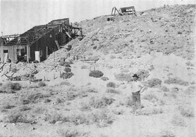
|
| Illustration 149. Cashier Mill ruin and Pete Aguereberry, 1916. From Dane Coolidge Collection, courtesy of Arizona Historical Foundation. |
This turned out to be impossible, for Fleece and his associates blocked the sale by so hopelessly tying up the property in litigation that the future seemed bleak indeed for its sale to anyone except Fleece, who had of course offered to buy the other two interests at a ridiculously low price. Flynn and Kavanagh became so fed up with the whole situation and discouraged at their inability to resolve it, that they drew up papers in which they relinquished all their interest in the claims to Aguereberry. The Eureka property, therefore, was lying idle while the Cashier Mining Company was producing rich dividends from Shorty Harris's original claims. Luckily for Aguereberry he still had thirty or more properties in the surrounding area that he could sell or lease, and so he managed to survive the period. Despite several trips to Los Angeles during which he tried to reach an agreement with Fleece about starting operations on the Eureka, no headway was made, Fleece being occupied now with a leased claim at Skidoo. It was not until the financial panic of 1907 hit that a way out for Pete seemed to offer itself.
After having kept up the assessment work on the mine for three years, Aguereberry let it lapse when Fleece and his brother discontinued their mining operations at Skidoo and left that part of the country. Aguereberry arranged with a friend to relocate the claims and then sell them back to him, thus establishing himself as sole owner by the spring of 1909. He immediately commenced driving a tunnel in pursuit of the gold vein and continued working the mine for the rest of his days. [133]
vii) Cashier Mill Opens for Business
To pass the time until final installation of the Cashier Company mill, its employees were kept busy blocking out ore and constructing a seven-mile pipeline in connection with the mill's operation. Although little more could be done on the Harris property until erection of the mill that would process the large reserves already on hand, Aguereberry was by now steadily developing the Eureka Claim and drawing out large quantities of ore for shipment to the Skidoo mill for processing. By the middle of July the Cashier amalgamation and concentration mill was almost finished, with production expected to begin almost immediately. It was hoped that proceeds from concentrating the generous amount of high-grade ore here, running $50 per ton, would enable construction of a larger plant later. By early August the Cashier Mine had made its first clean-up and sent out the first shipment of gold bullion. After about two weeks of operation the mill had yielded around $2,000. It was hoped' that a better percentage of recovery could be realized from the high-grade Cashier ore, and it was expected that the five-stamp mill would soon produce from $10,000 to $12,000 per month. [134]
A couple of weeks later the ore being treated at the mill was averaging better than $60 a ton, mainly in gold. The plant was working about 3-1/2 tons of ore per day, meaning a daily gross output of about $200, or $6,000 a month by using only one shift. Cyanide tanks had not yet been built. Ore for the mill was coming from the new tunnel above the old workings, rather than from the 100-foot shaft. [135] By September the plant was judged so successful an operation that the company intended to install an additional five 1,000-pound stamps within the next month, increasing the daily output from the current six tons to about twenty. [136]
A couple of months later a W.C. Price accompanied by a mining engineer traveled to Harrisburg to view Crawford's mine in anticipation of purchasing it. The exact condition of the mill at this time is unknown, but in January 1911 the Cashier was shipping its $50 a ton ore to the Randsburg mill and Aguereberry was shipping $60 rock there. [137] In February 1911 controlling interest in the Cashier Group was acquired by Sam Godby of Pioche, T.G. Crawford having retired. A force of men sent in to explore the property by the new owner discovered more areas of ore and definitely proved extensions of the vein and shoots. This decided Godby to immediately put a ten-stamp mill into operation, suggesting that one had not been in use up to this time. [138]
In the fall of 1911 two persons named Crowell and Lindley were slated to assume charge of the Cashier Mine, probably for the incoming owner W.C. Price, their intention being to move the hoisting plant from the Midas Mine onto the Cashier property. By late October W.C. Price had taken over direction of the Cashier Mine, and had levied an assessment of 5¢ per share on the company stock to speed up development. The twenty-five horsepower gasoline hoisting rig from the Midas was soon added to the Cashier property to facilitate ore retrieval, and machinery and supplies were being freighted to Harrisburg in preparation for the start of development work. It was rumored that the company intended to purchase the Eclipse Development Company mill and move it to the Cashier. In December it was reported that the Cashier Mine was producing so well that a mill was imperative. What happened to the earlier one, or whether it was just insufficient for the workload, is unclear. By early 1912, after development work at the mine had been carried on steadily for over two years, it was being said that the ore body was now sufficiently proven to justify erection of a (another?) mill. Possibly for this purpose, assessment no. 6 of 1-1/2 cents per share was levied on the corporation's stock. [139]
The pipeline froze up during the winter of 1912-13, necessitating extensive repair work. In the summer of 1913 six leasers were reported to be working at Harrisburg and Skidoo in addition to Aguereberry, who had mined ten carloads of high-grade ore for shipment. Requests were still circulating for a custom mill for the area, indicating that any existing plants were already overloaded. By June 1914 Price had ten or twelve men installing machinery for concentrating and working his ore; twenty-one tons of equipment were either ready for shipment to Harrisburg, on the way, or on the ground. [140] Then in September mention is again made of a five-stamp mill running at Harrisburg. By March 1915 the Cashier Mine reportedly had a ten-stamp mill with a cyanide plant projected for installation. Around 1916 the Cashier Mine was said to have produced 15,000 tons of ore averaging $20 per ton, all taken from the first mine level and above since the ore body pinched out below 140 feet in the shaft. The ore was being treated in a five-stamp Joshua Hendy mill and the pulp run over amalgamation plates and the tailings cyanided. Capacity of the mill was twenty tons per twenty-four hours, with water supplied from the Skidoo pipeline two miles away and power furnished by a distillate engine. The property was under lease to P.R. Turner and Robert Weir, who were stoping on the 100-foot level and intending to run fifty tons through the mill expired in before their lease expired in October 1916. [141]
viii) Waning Years
From 1917 to 1938 Aguereberry's Eureka Mine (both the Eureka and Cashier properties were referred to now as the Harrisburg Mine) was listed as active. In 1917 it was said to show development consisting of a forty-foot crosscut tunnel and several shallow pits. Ten tons of ore treated at the Cashier mill had yielded $50 per ton. In 1926 it was listed as idle, as was the Cashier Mine, still owned by the Cashier Mining Company of Los Angeles. On this latter property a 400-foot inclined shaft with four levels, at 100, 200, 300, and 400 feet, produced free-milling gold quartz ore assayed at $20 per ton. [142] The Cashier was possibly being operated by Roy Journigan, who also was working the Skidoo Mine, in 1938; at least he was treating the ore in his twenty-ton cyanide plant 5 miles northwest of Harrisburg in which he employed fifteen men. In this year the Cashier property comprised seven claims and was owned by J.P. Aguereberry. (A brief history of the mine written at this time said that it had been worked from 1906 to 1910 by the original owners, was bought by the Cashier Mining Company of Los Angeles, which operated it until 1914, and then was relocated by Aguereberry. Three thousand tons of ore were estimated to be on the dump, carrying $15 in gold per ton. Recent ore mined from the tunnel had been hauled to the Journigan Mining and Milling Company plant at Emigrant Spring for treatment, with production estimated at $150,000.) [143]
In 1951 the Independent (Cashier) Mine property of seven gold claims was owned by Ambroise Aguereberry. The workings consisted of a complex arrangement of shafts, adits, drifts, stopes, crosscuts, and winzes. Ore assaying $7 to $12 per ton in gold and silver had been found. Several prospect shafts and tunnels existed northwest of the main shaft near the ridge. Although an adit had been added 250 feet north of the main shaft, the property was idle. [144]
ix) Mines in the Harrisburg Vicinity
Many claims were located in the general vicinity of Harrisburg about which only a brief mention could be found: a company owned by one William Taylor operated the Delaware Claim; Pete Aguereberry located several claims in the area in addition to the Eureka, namely the Black Hill Mine, one-half mile east of Harrisburg, located on 1 January 1911; the Black Hill No. 1, one-half mile east from Harrisburg and joining the Black Hill Mine on the north, also located 1 January 1911; the Eagle Nos. 1 and 2 silver mines, two miles southeast of Harrisburg, located 19 May 1916; and the Jupiter Quartz Claim, situated 1-3/4 miles east of Harrisburg on the Blackwater Trail, located 10 January 1917. [145]
More detailed information is available on the Napoleon, Independence, and Independent mines located by Aguereberry. (The Napoleon Mine was discussed in the previous section.) The mining group consisting of the South Independence, South Independence No. 1, East Independence, Independence No. 1, Independent, and Independent Nos. 2 and 3 is unpatented and covers about 140 acres. The Independent location incorporates the old Cashier lode. The Independence Mine, later amended and renamed the Independence No. 1, was originally discovered by Martin Etcheverry in 1909. This was a relocation of the Eureka No. 1 and was joined on the south by the Providence No. 1; It was later quitclaimed to Pete Aguereberry in 1938. The East Independence, near the mouth of the Cashier Gold Mining Company tunnel and joining the east side line of the Independence Mine, was located by Martin Etcheverry in 1910 and quitclaimed to Aguereberry in 1938; the South independence (abandoned mining claim known as the Providence No. 1 owned by the Cashier Gold Mining Company; had two shafts on the south side of the hill and one tunnel on the east side near the north end line and was bounded on the north end line by the Independence Mine) and the South Independence No. 1 (abandoned claim known as Providence No. 2 owned by Cashier Gold Mining Company; joined on east by South Independence Mine and on north was bounded by Independence No. 1) were both located by Pete Aguereberry in 1921; the independent (bound on the south by the Providence No. 2 and joined on the east by the Independence Mine) and the Independent No. 2 (bound on the south by the Horn Toad No. 3 and joined on the east by the Independent No. 1) were both located by Martin Etcheverry in 1910 and quitclaimed to Aguereberry in 1938; the Independent No.. 3 had been located by Etcheverry in 1910 and was relocated by Aguereberry in 1935. The Independent No. 1 (bound on the south by the Providence No. 3 and joining the Independent Mine on the east) was located in 1910 by Martin Etcheverry; as were the Independent No. 3 (bound on the south by the Horn Toad No. 4 and joining the Independent No. 2 on the east) and the Independent No. 4 (bound on the east by the Independent No. 3.) The South Independent No. 3 was located by Aguereberry and filed on in 1935.
Upon Aguereberry's death in 1945, his property descended to his heirs--Ambroise, Joseph, Arnand (Arnaud), James Peter, Mariane, and Catherine Aguereberry. Not all the heirs contributed assessment work on the claims, however, so that by the fall of 1958 only Joseph and Ambroise retained Pete's old claims, including the Napoleon. [146] By 1960 the Independent Mine was being used mainly as a weekend retreat by Joe Aguereberry. Although it had produced a small amount of ore as recently as 1958, the last profitable shipment was around 1910. Assessment work in the past few years had consisted only of camp rehabilitation. [147]
(b) Present Status
Harrisburg is located about 1-3/4 miles east of the Emigrant Canyon Road on the way to Aguereberry Point. The first structures noticed at the site are the three houses composing Pete Aguereberry's old mining camp. The westernmost structure appears to be Pete's original two-room cabin, built about 1907, with a lean-to shed attached to the south side. The cabin still contains appliances, personal clothing, and assorted kitchen utensils. The middle cabin of the three, a guest house, was built by 1941 and contains three fully furnished bedrooms and a bathroom. The cabin on the east, a furnished two-room structure, was not standing when Aguereberry's estate was settled in 1946 and was evidently built by his nephew Joseph who became administrator of the property. All the buildings, are white with green trim. Scattered elsewhere over the site are tool remnants, stone foundations, a metal water tank, another small one-room shack, and a caved-in dugout, that once consisted of a corrugated-metal roof over a wood frame.
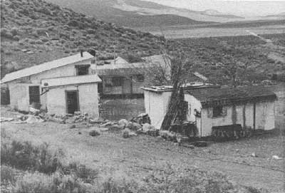
|
| Illustration 150. Aguereberry Camp at Harrisburg, view to west. Photo by Linda W. Greene, 1978. |
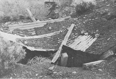
|
| Illustration 151. Collapsed dugout by road, Aguereberry Camp. Photo by Linda W. Greene, 1978. |
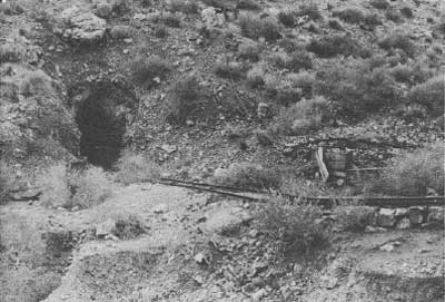
|
| Illustration 152. Eureka Mine, site of blacksmith shop to right. Photo by Linda W. Greene, 1978. |
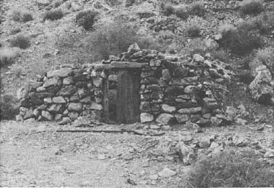
|
| Illustration 153. Stone dugout between Eureka Mine and Cashier Mill ruin. Photo by Linda W. Greene, 1978. |
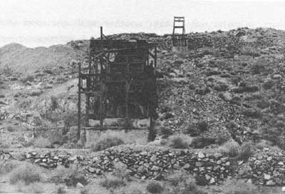
|
| Illustration 154. Cashier Mill ruin on east end of Harrisburg hill. Photo by Linda W. Greene, 1978. |
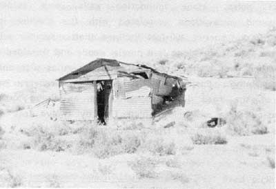
|
| Illustration 155. Dugout on opposite side of ridge from Aguereberry Camp. Photo by Linda W. Greene, 1978. |
Continuing eastward along the slope of the hill one comes to two metal-lined chutes serving an adit. On around the point of the ridge are another caved-in dugout ruin consisting of wood debris, corrugated-metal roof remains, and a door section; a tunnel possibly used as living quarters containing a stoped area, a wooden table, some stove remains, and a wooden frame doorway inside dividing the space into two rooms. A stove stands outside the entrance; a stone dugout with standing walls and a wooden door, reputedly lived in once by either Shorty or Pete in the early days; the ruins of Aguereberry's Eureka Mine and the remains of his blacksmith shop and compressor buildings; and the three-level ruins of the Cashier Mine and Mill, consisting of large cement foundations and an impressive one-chute ore bin.
All over the hillside and ridge are prospect holes, stone foundation' walls, and evidence of underground excavations associated with the Cashier lode, in addition to a timbered 400-foot inclined shaft. further around on the south side of the ridge is a partial wood- and tin-sided dugout, and further west another, one completely in ruins with only stone walls 'remaining. East along the road to Aguereberry Point and south of the road is a tunnel used as living quarters--a hollowed-out area measuring about five by twelve feet--with the remains of stone walls out front. Across the gully from it are some waste dumps.
(c) Evaluation and Recommendations
The Harrisburg site is eligible for the National Register of Historic Places as a historic district. This nomination can be justified on several counts. First is its association with two well-known Death Valley figures--Jean Pierre Aguereberry and Shorty Harris. Aguereberry was a Basque, born in 1874, who emigrated to the United States at the age of sixteen. He worked at many different jobs in his new home, including sheepherding, stagecoach driving, haying, mining, delivering milk, etc., until short times spent in Tonopah in 1901 and Goldfield in 1902 convinced him that prospecting and mining were to be his future. When labor trouble started in the latter town, Pete pulled out, grubstaked by Frank Flynn, a rancher, and Tom Kavanagh, a restauranteur in Goldfield. Aware of the strikes that had been made in Death Valley at Bullfrog, Greenwater, the Keane Wonder, and near Ballarat, Pete decided to prospect toward Rhyolite and Ballarat, eventually winding up at Greenland (Furnace Creek) Ranch where he met Shorty Harris and began the historic journey that resulted in the discovery of Harrisburg.
Aguereberry lived on his Eureka Claim at Harrisburg for the remainder of his life, working the mine mostly by himself and reportedly recovering $175,000 in gold. At various times he took odd jobs in the area such as stage driving, working on cattle roundups, performing road work for the county, or mining for others, simply for the sake of diversion, but he always returned to his own place when he tired of that. He often took tourists through his mine and also delighted in showing them the view over Death Valley from Aguereberry Point to which he had driven a 4-1/2-mile-long road by pick, shovel, barrow, and blasting powder. [148]
At the time of Pete's death he left to his heirs in the way of personal property: one Ingersol-Rand compressor, one jackhammer, one stoper, a 1931 Ford pickup, two shacks, one toilet, one shower, four beds, one stove, and two dining tables with cooking utensils. 149 When this writer visited the site in 1978 the cabins were still completely furnished, complete with made-up beds, furniture, and provisions. The Eureka Mine supported Aguereberry from the time of its initial discovery up until his death in the 1940s. Connected with this one-man operation were a compressor building and blacksmith shop.
The Cashier lode claim, originally belonging to Shorty Harris, is distinctive because of the large mill ruin associated with it. It also at one time had a connected powder house and blacksmith shop built out of $100-a-ton ore. [150] Although it was worked from about 1906 off, and on until the late 1930s, the mine's exact production record is uncertain, ranging from a whopping $300,000 in 1916 to $250,000 in 1936, $150,000 in 1938, down to a reported total of only $70,000 in gold and silver in 1957. [151]
In addition to its association with Aguereberry and Harris, the townsite' is an outstanding historical resource because of the variety of early mining lifestyles and technological processes displayed here. Although the short-lived camp was composed mostly of tents, several other modes of shelter were used over the years, as evidenced by the presence of structures ranging from Aguereberry's neat homestead to several small caved-in dugouts, a larger dugout with stone walls and a brush and pebble roof (especially valuable for its information on construction techniques), exploratory tunnels or adits enlarged and used as shelters, to frame and metal dugout/shacks on the south side of the ridge. Mining technology from the early 1900s on is well illustrated by a large multi-level mill ruin, a well-timbered shaft, extensive underground excavations with stone retaining walls, and adits. Not only are these interesting in and of themselves but also because of the contrast between the two mining operations involved--the Cashier Group run by large-scale commercial interests, and the adjoining Eureka Mine that was basically a one-man operation for forty years.
(10) Jordan Mine
No information on this site was found, although Benjamin Levy locates it in the Wildrose Mining District south of the Star of the West Mine. [152]
(11) Star of the West Mine
(a) History
This property was one of the group of silver mines located by the Nossano brothers about 1874 in the nascent Rose Springs Mining District. Not to be confused with it was a mine of the same name situated on the west side of Woodpecker Canyon in the Panamint City area in 1874. [153] Appearing to be a good-sized operation in 1875, the Star of the West No. 1 was producing ore assaying at $845.13; the No. 2 was assaying at $1,099.61, and the No. 3 at $1,189.13. [154] Included with the properties purchased by the Inyo Mining Company in 1876, the mine had no notable production thereafter. [155]
(b) Present Status
The location of the Star of the West Mine was not pinpointed by this writer, although Levy places it south of the North Star Mine. [156]
(c) Evaluation and Recommendations
Due to the paucity of documentary data on the Star of the West Mine, it was probably not a significant part of Death Valley mining history.
(12) North Star Mine
(a) History
The North Star Mine is especially difficult to research because this was a fairly common name for mines of that period. This particular claim was another one of the group of silver mines located by the Nossano brothers toward the end of 1874, and was reportedly located three to five miles south of the Garibaldi. One press report noted
That the valuable mines in the Panamint range are not confined to those located in the Panamint District alone is certain from what I have learned in the last few days, and know from ore received here from the Rose Spring District, twenty-five miles north of Panamint, in the same range of mountains. The ore in good part is of the same character as that of Panamint. Assays made by J. L. Porter of Cerro Gordo . . . give the very good return of $300 to $1,000 per ton in silver. These mines are the Star of the West, the North Star, owned by Mr. J. Morsano [Nossano]. [157]
One can easily be misled by numerous descriptions of activity on a North Star ledge "about 2-1/2 miles in a Northwest direction from the town of Panamint," about which information surfaced with some frequency. [158] Because of certain vagaries in the boundary descriptions this may or may not be the North Star Mine in the Panamint Mining District "On which the Company are running a cut or level from the head of Marvel Canyon." [159] In April 1875 assays were obtained on the Nossano Brothers' newly-discovered silver ledges in the Rose Springs District, the North Star among those sampled. In this particular instance the ore ran $1,363.23 a ton, although the correspondent adds that assays from that mine had occasionally reached as high as $1,700 per ton. [160]
The North Star was one of the properties purchased by agents for the Inyo Mining Company in 1876, [161] and was chosen as the headquarters site for the company's projected extensive operations in the area. In March the company superintendent was
only awaiting the arrival of [Remi] Nadeau's teams, with a full supply of mining tools, stores, etc., to commence active operations on their several mines. Their prospects are indeed flattering, and it is the prediction of all who have seen the property that they have purchased, that theirs will prove the most prosperous of any mining enterprise on this side of the Sierras. They secured seven well defined ledges, showing, probably, the richest average croppings of silver ore ever found outside of Virginia City, and much surprise is often expressed that they could have purchased it at so low a figure. [162]
Two travelers to the Rose Springs District in April were given a tour of the North Star Mine, "which is considered one of the best owned by this company [Inyo Consolidated Silver Mining Co.]." [163] Development consisted of a forty-foot tunnel run in on one vein and a shaft sunk on a second one. High-grade ore was being extracted, some of it assaying over $2,000 and generally expected to mill over $200 per ton. [164] By June a shaft had also been sunk at the mouth of the tunnel and was producing ore assaying $301 in silver per ton. [165]
The North Star was probably abandoned about the same time as the Garibaldi, around 1877, when papers show the Inyo Silver Mining Company was being assessed for 3,000 feet at $2 a foot in the North Star Mine. [166] Six years later the North Star Mine was relocated by Medbury and Hunter as the Mohawk, and its location was given as seven miles southeast of Emigrant Spring and seven airline miles north of Telescope Peak. [167] N. J. Medbury, W. K. Miller, and J. M. Keeler soon became partners in the Mohawk, Blue Bell (aka Garibaldi), and Argonaut (aka Nellie Grant) mines, and in 1884, interested in testing their ore's milling potential, Miller hauled 10-1/2 tons of the material from these mines thirty miles across the Panamint Valley to a mill in Snow Canyon. Four bars of bullion, weighing 3,400 ozs. were produced, [168] proving that the material was of good milling quality.
For several reasons these mines should have had bright and profitable futures: the ledges were being well and continuously developed (the Mohawk supported at least a tunnel and shaft by this time), roads throughout the area were relatively functional, and wood and water could be found within a reasonable distance. What prevented all these small operations from reaching their full potential was the lack of nearby milling facilities enabling the ore to be worked profitably. Compounding the problem over the long run was the fact that although small operators could initially open the mines, turning them into paying propositions required the involvement of practical mining men with sound judgement and backed by solid investment capital. [169] As it turned out, most, of these small mines passed into oblivion, and although the North Star was still mentioned in 1889, the extent of its life beyond that date is uncertain. [170]
Several later miscellaneous references were found that might pertain to this property. In 1896 Charles Anthony of Darwin filed a location notice on a Morning Star Mine in the Panamint Mountains about 1-1/2 miles north of the Consolidated or Consolidation Mine, a property formerly known as the North Star Mine. In 1903 notice of a land transaction involving the North Star and Valley View mines in the Panamint Range was found. There was a Valley View Mine operating in the Wild Rose District around 1884 in the vicinity of the Blue Bell, Argonaut, Mohawk, Blizzard, and Jeanette mines. Its 1883 location notice specifies it as being six miles east of Emigrant Spring on Mineral Hill on the right-hand side of the trail leading from the spring to the Blue Bell Mine. It seems to have been operating during the Skidoo period also. The transaction mentioned might, however, refer to the Valley View Mine discovered about 1896 east of Post Office Spring on the west side of the Panamints, and if so, the North Star property mentioned is probably one of those in the vicinity of Panamint City. [171] This latter seems the most probable since the 1903 article suggests that much development work had been done on the Valley View; the mine by that name located within the monument probably could not boast much progress until after 1907. Open to question is a location notice for the North Star Nos. 1-6, situated one mile east of "Kennedy's Springs Wild Rose Canyon, located in April 1907. [172]
(b) Present Status
The exact location of the North Star Mine was not found by this writer. The property seems to have undergone no intensive mining since its early days, at least not under its original name, and it is entirely possible that no recognizable remains exist. Or, more recent mining operations may have completely obliterated the original workings.
(c) Evaluation and Recommendations
The lack of information found on the property is probably indicative of its lack of historical significance.
(13) Journigan's Mill
(a) History
The early history of activities on, and ownership of, this site, located in the Panamint Range two miles south of Emigrant Spring on the west side of the Emigrant Canyon Road, is a rather confusing chronicle of the juggling of titles to water rights to any or all of the six springs located near the mill site. These springs and the mill site were involved in intermittent mining and milling operations from at least the early 1920s through the early 1970s. According to a monument memo a one-stamp mill was processing Skidoo ore here around 1909, but this allegation was not substantiated by data found during the course of this study. Carl R. Suksdorf and Frank (Shorty) Harris purportedly ran a ball mill here in 1918 while performing custom work for miners in the vicinity. Suksdorf, at least, was still in control of the property in April 1923 when he filed for the water rights to the six nearby springs (Green, Canyon, Burro, Malapi, Burns, and Willow) for use at his five-acre Gold Dollar Millsite and camp where he was presumably processing ore from his Gold Dollar Mine about one mile northwest of Skidoo. This application was revoked in February 1926 for failure to develop the water source and use it beneficially. In 1924 Shorty Borden and Harris are said to have run a five-stamp mill on the site to process ore from Skidoo and the Poppy Mine. [173]
A Dr. Archibald owned the property in 1926 and a Mr. Hoover was milling there until 1932. Beginning in 1934, prompted by passage of the Gold Reserve Act, gold mining activity in the United States began to accelerate with the increase in the price of gold to $35 per ounce. In March of that year Roy Journigan, E. L. Journigan, and L. E. Steinberger located the five-acre Gold Bottom Mill Site Claim. (No chain of title exists between Suksdorf and Journigan, the latter not relocating the Gold Dollar Millsite, but merely locating in the same general area.) Roy Journigan acquired the interests of his partners in the mill site sometime prior to April 1939 and possibly as early as May 1937 when he applied for the water rights to Green, Burro, Willow, and Burns springs for use at the Gold Bottom Mill Site, which at present was receiving an insufficient supply from just one spring in the area. On 20 December 1937 the Journigan Mining and Milling Company requested a permit to construct a small pipeline to divert these waters to the mill across monument property. This group of springs evidently supplied Journigan's Mill up until World War II.
Many formerly productive gold mines in the Death Valley and surrounding regions opened up again during these prewar years, given impetus by the presence of a custom mill in the area. As a result, Journigan and Judge Gray, operator of the Skidoo Mine, entered into a business arrangement for the reduction of the latter's ores at the former's custom mill, which was also processing ore hauled by truck from the Cashier Mine at Harrisburg. [174]
In January 1937 Roy Journigan secured a lease on the Skidoo Mine, about 2-1/2 airline miles northeast of his mill, from the Gray and Worcester Mining Company, which had operated the mine for the last two years and used Journigan's Mill to process the ore. Journigan employed five men to work the old stopes on the property, and old dump tailings were also being hauled to Journigan's amalgamation and cyanide plant for treatment. Machinery at the plant consisted now of a twenty-five-ton ore bin, a 6 in. by 8 in. Blake crusher, a twenty-five-ton fire ore bin, a 3 x 4 ft. Straub cone-type ball mill, seven 14 x 5-ft. cyanide tanks, 4 x 8-foot amalgamation plates, and four-compartment zinc boxes, the entire operation being powered by a fifteen h.p. Fairbanks-Morse gasoline engine. Four men were employed working the Skidoo ore and performing custom work for other mines in the area. The plant's capacity was twenty-five tons per day. [175]
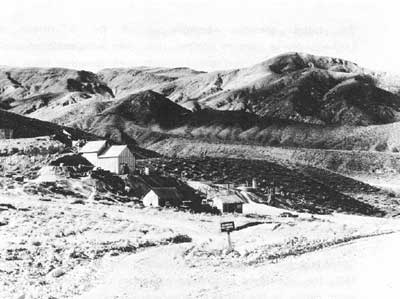
|
| Illustration 156. Journigan Mining and Milling Co., 1935. Note stamp mill to right of lower entrance road. Photo by George Grant, courtesy of DEVA NM. |
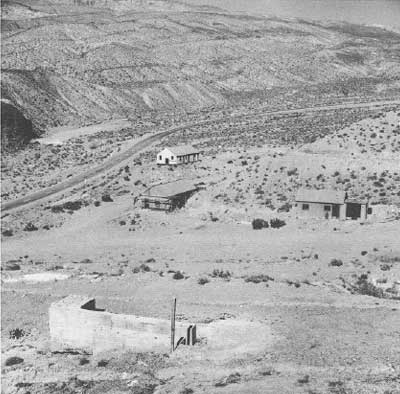
|
| Illustration 157. Buildings on mill site south of plant, 1962. Photo by Matt Ryan, courtesy of DEVA NM. |
On 14 April 1939 Roy Journigan and his wife Mary agreed to sell the Gold Bottom Mill Site to J. E. O'Donnell, who assigned the agreement to C. O. Mittendorf, who, on 12 February 1940 proceeded to assign his interest in the 14 April agreements to the Del Norte Mining Company, a Nevada corporation. The Del Norte Group of mines, just north of the Skidoo Mine operation, had been the site of an important low-grade gold ore discovery in 1936, and a short while later were being actively developed, the ore being trucked to the Keeler Gold Company's mill for treatment. During World War II, on 20 May 1943, the Journigans quitclaimed all interest in the mill site and the water rights to the Del Norte Company, [176] whose owners were John M. Rogers, Joe Stivers, and Roy C. Troeger. According to the Journal Stivers and Rogers used the water from the springs acquired in their purchase to operate the mill at Skidoo.
On 1 March 1951 the Del Norte Corporation quitclaimed a 45/100 undivided interest in the mill site and its other property to Joe W. Stivers and a 55/100 undivided interest to Roy C. Troeger. These two, in turn, leased the Gold Bottom Mill Site Claim on a year-to-year basis to James H. Bennett and Max Barginski, who proceeded to locate three other mill sites--the B & B, B & B #1, and B & B #2--contiguous to each other and to the Gold Bottom Mill Site and located up the Burro Canyon branch off Emigrant Canyon toward the mill water sources. The B & B Group was later quitclaimed to Art Detloff. [177]
On 28 November 1953 the Gold Bottom Mill Site and other properties were quitclaimed to Art Detloff and Donald A. Dobbins, who by the next year were busy rebuilding the mill site, which by now consisted of only a few tanks and buildings. A crew of married men and their families were constructing houses and erecting concrete foundations and piers for the cyanide solution plant. The mill was expected to be in operation in three to four months and producing 100 tons per day. The milling process involved sending Skidoo ore through a 16 x 24-inch Wheeling crusher to two 36-inch Allis-Chalmers rolls that would reduce the rock to 1/4-inch size. From there it would go to a large Harding ball mill and be ground to a hundred mesh, then on to agitation in a cyanide solution tank. It would then be pumped in sequence to three Dorr thickeners, two of them sixty feet in diameter and twelve feet high. The recovered gold, in solution, would then be pumped from the tanks through an automatic Denver gold precipitation unit in a locked room. The gold would then be retorted into bullion bricks and shipped to the mint. Tailings would go to the Oliver filters and be conveyed by belt to the dump. The Skidoo ore was being mined by the Golden Queen Mining Company of Mojave, who had extensively sampled the Skidoo ore bodies and found them ranging in value from $14 to $28 per ton. Already 250,000 tons of the ore were ready for breaking and to be hauled to the mill, hauling and milling expenses totalling about $7.50 per ton with gold recovery running about 90%. The profit on a 100-ton-per-day schedule was expected to be $7 per ton. [178] Detloff also filed on another mill site, called the "Detloff," adjoining the Journigan site and northeast of it in November 1953. The camp buildings were located on this later claim.
Meanwhile, on 9 March 1954, Joe Stivers and his wife quitclaimed to Roy C. Troeger all their rights in the mill site and other property. [179] By 1959, because Detloff and Dobbins defaulted in the payment of royalties and in other particulars, their Gold Bottom lease was terminated and they quitclaimed all their interests in the mill site to Troeger in February. [180] In September of that year the machinery at Journigan's Mill was purchased by the Argentum Mining Company and was dismantled and moved to Columbia Flats, Nevada, southwest of Mina. Only the two water tanks were left. By 1960 the "Detloff Mill," owned by Roy Troeger, was considered an eyesore, largely due to the ramshackle condition of the remaining buildings.
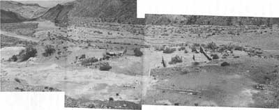
|
| Illustration 158. Journigan's Mil' ruins. California State Route 8 in background. Photo by Linda W. Greene, 1978. |
From 1962 to 1964 a contractor, Carl Dresselhaus, and his crew, who were performing annual assessment work on the Del Norte and Skidoo claims, held water rights to Burro Spring, but no milling activity was taking place here. On 1 May 1967 Roy Troeger deeded to David E. and Elisabeth Hinckle an undivided 25% interest in the mill site and his mining claims. (Troeger held the remaining 75% undivided interest until his death in 1973.) [181] Also in 1967 Troeger entered into a use agreement on the Gold Bottom Mill Site with the unregistered Nemo Silver Corporation, O. L. Heironimus, president. This company, which in the lease obtained water rights to one of the nearby springs, intended to install pipelines from the springs to connect to the remaining cyanide tanks. Heironimus and his partner Bill Stapleton then would attempt to cyanide the tailings dump, and hopefully the gold and silver recovered would provide them with enough capital to mine their gold and silver claims in Nemo Canyon. At that time the property supported a frame building, two 25,000-gallon water tanks, and eight old concrete cyanide tanks. [182] This appears to have been the last spate of activity on the site.
(b) Present Status
The only building remaining on the site today is a large white plywood building covered with tarpaper and with a composition-paper roof. Originally it appears to have been divided into three rooms. Inside are a mattress, bedsprings, and an old icebox. Southeast of this structure are wooden foundations of another building, identified in one photograph found by the writer as a CCC building. Northwest of the first building are two cement foundations for other structures (see Illus. 157). Further northwest and around the point of a ridge are the ruin of a collapsed residence and some old car wreckage.
The mill site itself consists of two steel water tanks, an extensive layout of concrete foundations and machinery pillars, and seven concrete cyanide tanks. The concrete ruins are in stable condition.
(c) Evaluation and Recommendations
The Journigan's Mill ruins are considered eligible for inclusion on the National Register of Historic Places as being of local significance. The site has been used sporadically for milling purposes from the first decade of the twentieth century up until the early 1970s--the longest continuous usage of a site for milling-related activities within the monument. In addition to its early association with such Death Valley luminaries as Frank Harris and Shorty Borden, it is especially significant because as the largest and best-equipped custom mill in the Wildrose area, its presence in the 1930s stimulated gold-mining activity around Emigrant Spring and provided impetus and encouragement to the reopening of mines in the Skidoo/Harrisburg areas by cutting down markedly on their production costs. Journigan's Mill is the largest ruin of an amalgamation and cyanide plant of the 1930s-1950s period left within the monument boundaries.
The concrete ruins are in good shape and do not require stabilization work. The erection date of the frame building on the site is uncertain, though it appears in a 1954 picture. It might have been one of the structures erected during the Dobbins-Detloff period of ownership in the early 1950s, An interpretive sign on this site presenting a capsulized account of the mill's operation and perhaps an early picture would be of great value, since visitors passing by now have little idea of the type of structure that once stood here.
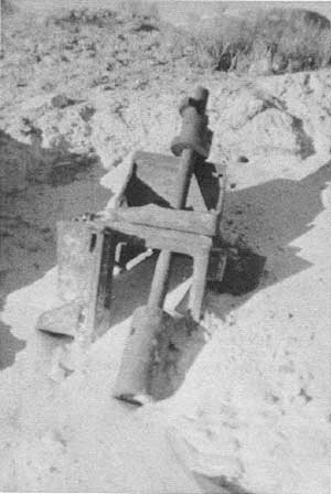
|
| Illustration 159. View south down California State Route 8 of Journigan's Mill cyanide tanks. Foundations in preceding photo are up hill to right. Photo by Linda W. Greene, 1978. |
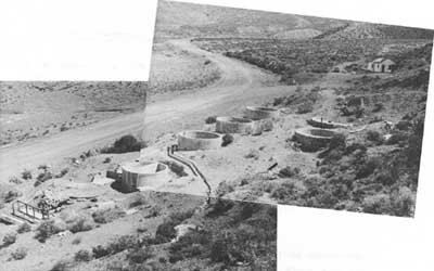
|
| Illustration 160. Stamp lying on bank by side of road below cyanide tanks. Photo by Linda W. Greene, 1978. |
(14) Mill Site North of Journigan's Mill
(a) History
This small mill site alongside the Wild rose- Emigrant Canyon Road was operated during the mid-1930s. Walter M. Hoover, who has owned several pieces of Death Valley mining property, and a man named Starr ran the small cyanide plant here on ore hauled from Nemo Canyon about 1935. After the partners split up, Starr continued to operate the mill until sometime in the fall when he left California. The area was subsequently cleaned up by monument personnel and a small amount of pipes and fittings removed. [183]
(b) Present Status
The mill straddles a rocky outcropping on the west side of the Emigrant Canyon Road about one mile north of Journigan's Mill. Four cement-lined masonry tanks connected with the cyanide process' are still present, one being at least twenty feet in diameter and still containing remains of the wooden grid that once covered the bottom. Stone dry-wall foundations and concrete machinery pilings are also in evidence. Southwest of the mill and along the, edge of the ridge are what appear to be small adits or holes of some kind in the rock face. Some low stone walls are associated with them.
(c) Evaluation and Recommendations
This site is not historically significant. The mill operated for only a short period during the 1930s, but the ruins are interesting and have interpretive value. No stabilization work is thought necessary. The" remaining foundations should be left to benign neglect and an interpretive marker erected identifying the area as the site of a 1930s cyanide milling operation. The purpose of the low walls southwest along the hillside is unknown, the writer having been unable to examine them closely. They and the nearby, caves (?) should be examined for archeological significance.
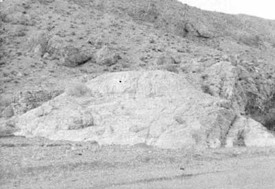
|
| Illustration 161. Cyanide mill ruins on west side of Emigrant Canyon Road 1 to 1-1/2 miles north of Journigan's Mill. Photo by Linda W. Greene, 1978. |
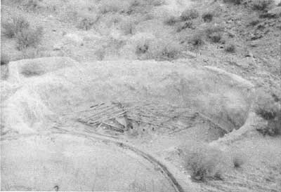
|
| Illustration 162. Cyanide tank on mill site. Note wooden slats remaining. Photo by Linda W. Greene, 1978. |
(15) Gold King Mine
(a) History
The original location of the Gold King lode was made on 29 August 1936 by C. O. Mittendorf, who, along with a fellow Los Angelan, P. H. Greer, bought the property formerly leased by Walter M. Hoover of Lone Pine. [184] Serious mining activity on the site apparently began in 1938, after 200 tons of ore from the mine, whose showings were said to be unusually. good, had been found to run $25.50 per ton at the mill. This encouraging discovery spurred development and resulted in the opening of an extensive ore body by early 1939. As a result the owners decided to send a test run of one thousand tons of extracted ore to the Golden Queen Mill south of Mojave, over 150 miles away, in order to determine the type of milling most suited to this particular ore. Seven ore trucks were needed for the long haul to Lone Pine and then south. This circuitous route was necessitated by the distressing condition of the shorter road south through Emigrant Canyon and the Panamint Valley that made it unfit for use as a mine-to-market road. [185] During this time the Gold King was extensively developed and ore was being produced for shipment on a regular basis. On completion of loading and hauling the 1,000-ton test shipment, mine workers were given a well-deserved vacation, five men finally resuming development work again toward the end of June. [186]
In late summer the mill of the Del Norte Mining Company, which was operating near Skidoo, was anticipating the arrival of ore for treatment not only from the Del Norte Mine, but also a minimum of 300 tons a month from the nearby Gold King, [187] which, indeed, supplied most of the mill's custom work--1,300 tons of ore--until the arrival of winter forced a cessation of all mining and milling activity. [188] Shipments resumed again in April, when it was also reported that a contract had been let for sinking a new shaft at the mine. [189] The Gold King lode was patented in March 1944, but no data was found about any further mining activity over the next thirty years. A lease/option agreement was executed in 1975 between W. M. Hoover and a Mr. Crowe, with the former again acquiring leasing privileges over the site. [190] In April of this year the Gold King Extension lode was located by Hoover joining the east end of the Gold King.
(b) Present Status
The Gold King patented lode mining claim is located about one mile east of Journigan's Mill in Emigrant Canyon in the hills southwest of Skidoo, and is reached by a rough trail leading east about 6-1/2 miles south of the Emigrant Canyon Road intersection with California State Highway 190. Due to recent washing activity, the trail's merger with the Emigrant Canyon Road is difficult to detect. According to a plat of the property dated 29 May 1942 (Mineral Survey No. 6289), underground workings consisted of a discovery shaft, three short adits, and three inclined shafts, each intersected by short crosscuts, comprising an estimated total footage of 640 linear feet. Although this 1942 plat also lists such improvements as a blacksmith shop, bunkhouse, cookhouse, and office, they are not now extant. In 1975-the remains of a cabin site, a collapsed dugout, and a small powder house were found.
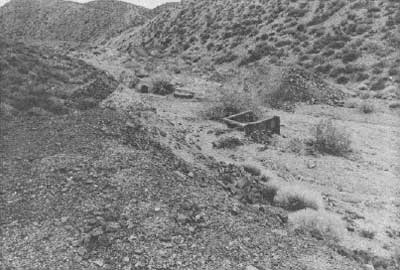
|
| Illustration 163. View southeast of shaft and dump in wash, Gold King Mine. Photo by John A. Latschar, 1978. |
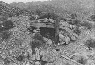
|
| Illustration 164. Collapsed dugout on edge of wash, Gold King Mine. Photo by John A. Latschar, 1978. |
(c) Evaluation and Recommendations
The Gold King Mine site has no historical significance. Early 1900 references to a Gold King Mine were found to refer to one by that name in the Bullfrog District. [191] The subject property was not developed until the 1930s, and during that time supported a small mining camp for its employees. Because the underground workings are located in a wash, they have been filled in through the years with sand, gravel, and silt, making the site fairly safe for monument visitors, probably few of whom, however, are aware of its existence. The small powder house and dugout ruin, if still on site, do not appear to pose safety hazards.
(16) Tiny and Sunset Mines
(a) History
A Sunset silver mine was mentioned in the Panamint District as early as 1873, in the vicinity of a Blue Belle Mine; it is fairly certain, however, that this refers to a location near Panamint City. [192] The only other early citation to a mine of that name found by this writer is a location notice for a Sunset Silver Mine in the Rose Spring Mining District 3 miles northeast from Rose Spring Garden and about 1-1/2 mile north of the Virgin Mine. [193] According to the LCS crew who visited the mill ruin site miles south of Skidoo in 1975, that area had been referred to in the past as the Sunset Mine. No data was found conclusively supporting this designation, although an article in the Mining Journal does mention a gentleman from Barstow, California, who "has been carrying on gold production on a small scale at his Sunset mine in the Panamint district of California for the past six years. His equipment includes a five-ton Straub ball mill, Economy concentrator and amalgamation plates. [194] The monument mining office had no information on this mine, or on who had worked it, although activity evidently took place here as, late as the 1940s--a claim marker for a "Tiny Mine" was found by this writer on the site, dated 11 October 1945.
A bona-fide Sunset Mine is located on the south side of the gravel Skidoo Road about three miles east of the Wildrose-Emigrant Canyon Road. Last worked about 1940, its four claims produced about 100 tons of ore averaging $20 worth of gold per ton for custom mills. Small amounts of silver were also recovered. [195]
(b) Present Status
Approximately 1-1/4 miles east of the Skidoo-Emigrant Canyon road junction a dirt track leads north for about 1-3/4 miles to the Tiny (Sunset?) Mine site. A trail continues north beyond the mine turnoff across the ridge to Skidoo. The area of mining activity covers the south slope of this ridge, facing Harrisburg Flats, and comprises two sites. About 1/4 mile east of the mill site and adjacent to the road continuing on to Skidoo are the remains of a collapsed wooden shack. Of some interest is the road leading from here to the mill site, whose edges and curves have been shorn up and reinforced by a tremendous amount of dry-wall masonry. Basically three levels of mine workings exist, the access road entering on the second level alongside an adit that has been closed off with a tin door. On the lower level below this adit are the ruins of a milling operation, with cement machinery pilings, dry-wall masonry foundations, and a portion of a wooden ore bin still extant. Built into the hillside a few yards northwest of the mill is a cistern with a cement floor and plastered masonry walls on three sides, the hillside forming the north end. A pipe leads from this reservoir to the mill, probably once supplying the power to run it. The upper level of workings above the access road consists mainly of caved-in stopes, some containing rotted timbers. Ruins of a small tool shed or blacksmith shop are also found on this upper level. A series of stone walls advancing down the hillside suggest that some type of chute arrangement once descended toward the mill. Below the mill ruins is a dry-stone silt dam.
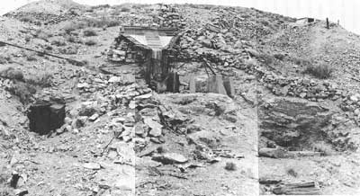
|
| Illustration 165. Mill ruin at Tiny Mine, one mile south of Skidoo. Photo courtesy of William Tweed, 1978. |
The Sunset Mine about 2-1/2 miles southeast of this site consists only of a timbered vertical shaft with drifts run on three levels. Downhill (northwest) from the mine and across the Skidoo road is a house possibly associated with the mining operation that appears to be of 1930s or 1940s vintage.
(c) Evaluation and Recommendations
Insufficient data exists on the Tiny Mine site either to provide associative significance or to properly place it in the context of Death Valley mining history. During the LCS survey of the site, purple glass was found on a dump in the area along with hand-finished bottle necks, suggesting an occupancy period from the 1880s up to approximately 1920. The site's proximity to Skidoo and location adjacent to the Skidoo-Harrisburg road suggest that the site might have been prospected in the early 1900s during Skidoo's heyday. At least one set of claims during that period--the Rag Time Group--was reported as lying about two miles south of Skidoo. [196]
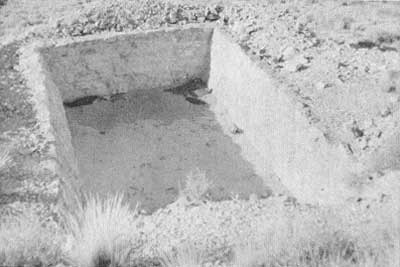
|
| Illustration 166. Masonry-walled reservoir northwest of mill ruins, Tiny Mine. Photo by Linda W. Greene, 1978. |
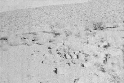
|
| Illustration 167. Building site along road to Tiny Mine. Photo by Linda W. Greene, 1978. |
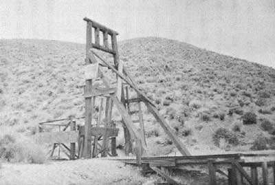
|
| Illustration 168. Sunset Mine headframe on road to Skidoo. Photo by Linda W. Greene, 1978. |
In the spring of 1909 it was announced that the Skidoo Mines Company planned erection of an additional mill on its property to treat ore from the Wilkinson lease, situated on the north side of Skidoo hill. This lease location was too far from the Skidoo mill to afford hauling of ore from that point, so the company was considering locating a new plant about a mile from the present mill (in which direction was not stated). Water used in the present plant would be conserved and used again at the new structure. The Wilkinson lease, however, was a near neighbor of the Granite Contact property, which was located north of town, so it is doubtful that the new mill would have been built even further south. [197]
The other possibility is that the mill is of a later construction date and associated with the 1930s era of mining activity in the monument. The present southern boundary of the Skidoo Historic District passes through the middle of this site. Since these mill ruins have interpretive value, it is recommended that the site be left in a state of benign neglect and that the southern boundary of the Skidoo Historic District be expanded slightly to include the ruins and the impressive stonework retaining walls.
(17) Cabin 1-1/2 Miles Southeast of Skidoo
This site is reached via a 1-1/4-mile-long track, now almost indistinguishable, leading north from the gravel Skidoo road about 1-3/4 miles east of its junction with the paved Emigrant Canyon Road. The area was visited by members of the LCS survey crew in 1975. The only extant structure was a rude miner's cabin of tarpaper and corrugated metal probably built during the 1930s or possibly associated with the 1950s tungsten activity in the area. Miscellaneous debris littered the site. Adjacent to the shack a portion of the Skidoo pipeline scar was visible.
The cabin is not historically significant, but the Skidoo pipeline route scar will be included on the revised Skidoo Historic District National Register form.
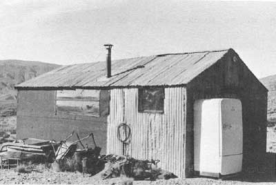
|
| Illustration 169. Cabin 1-1/2 miles southeast of Skidoo. Photo courtesy of William Tweed, 1975. |
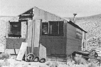
|
| Illustration 170. Cabin 1-1/2 miles southeast of Skidoo. Photo courtesy of William Tweed, 1975. |
(18) Blue Bell (Garibaldi) Mine
(a) History
Historical records and early newspaper accounts provide only fragmentary data on this site. Around 1874-75, shortly after the discovery of Panamint City, a party of Italians--Joe and Zeff Nossano, Joe Lanji, and Charles Andrietta--discovered a group of eight silver mines in the new Wild Rose Spring District in the vicinity of present-day Harrisburg. [198] These new properties included the North Star, Star of the West, Maria, and Polar Star mines, all located in the northeast portion of the district, five miles east of Emigrant Spring, and overlooking Death Valley:
Among them is the 'Garibaldi' mine, a very large lode, showing on the surface hundreds of tons of rich ore. An average sample of the ores of this mine, assayed by J. L. Porter, of Cerro Gordo, yielded $238.18 per ton in silver.
This remarkable discovery has been visited by a number of mining men from Panamint, Cerro Gordo and elsewhere, all of whom pronounce it as showing on the surface a larger amount of rich ore than they have ever seen before. [199]
Two months later a correspondent of the Panamint News visited the Nossano brothers' property, which he said included about twenty mines, and wrote that
Their principal mine, the Garibaldi, has an outcrop of an average width of sixty feet; with metalic ore assaying from $400 to $1,800 per ton, the greater portion of which is free milling ore; a large percentage of the ore can be sorted and worked by smelting. [200]
Because it was still a relatively new location, excavations in the area only penetrated about eight feet. An interesting sidelight to the Garibaldi's history is that Dr. S. G. George, early pioneer into the Wild Rose area and discoverer of the Christmas lode in 1860, was working with another gentleman from Visalia, E. M. (F. M.?) Bently (or Bentley), on the eastern portion of the Garibaldi--referred to as the Lady Ethel--during this time. [201]
Reportedly during the seventies ore from the Garibaldi and probably from some neighboring properties was sent by muletrain over a Walker's Pass to the railroad several hundred miles away. By the spring of 1875 the Garibaldi was still upholding its reputation as "the most promising location in the district, if not in the entire county," [202] even though little development work had been done. Ore from here was generally averaging $628 to $1,600 per ton. [203] It was no surprise, therefore, when the Garibaldi, North Star, Polar Star, Star of the West, and Maria mines were sold by the Nossano brothers to a San Francisco syndicate for $70,000. Incorporated under the name of the Garibaldi Mining Company, the group's board of directors included A. J. Bowie, Jr.; Arch. Borlands, William M. Lent; N. B. Stone; and John F. Boyd. They evidently only acted as agents for the Inyo Mining Company, because the latter's superintendent, a William Irwin, immediately took over development of the Garibaldi, spending about $30,000 on the project. [204] The future not only of this mine but of the entire Rose Springs district seemed extremely promising now:
Since the Inyo mining company made the purchase of the Nassano [sic] company's mines, the camp has changed its appearance, and, instead of being the resort of a few prospectors, is shaping itself into a busy mining camp. A town site has already been laid out, a station erected for the accommodation of those visiting the district, the wagon road from Warren springs improved, and work on the Garabaldi and North Star mines commenced. [205]
Although from the meager information presented here it is difficult to determine the exact location of this main camp, presumably the focal point for prospecting activities in the Rose Spring District, it is known that the Inyo Mining Company headquarters were established at the North Star Mine, three to five miles south of the Garibaldi. [206]
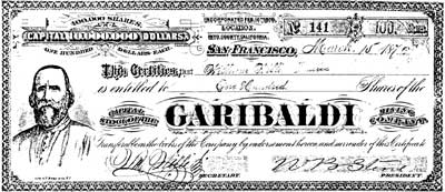
|
| Illustration 171. Stock certificate, Garabaldi Mining Company. Courtesy of Richard E. Lingenfelter, Univ. of Calif. at San Diego.. |
By April 1876 the Garibaldi Mine workings consisted of a 100-foot incline run down on the hanging wall and an 18-foot tunnel that had been started to tap the rich ledge. Superintendent Irwin was now contemplating erection of a mill on the site, to be powered possibly by water piped over from the vicinity of Furnace Creek, fifteen to twenty miles east. [207] In June the vein was struck at the bottom of the shaft and ore recovered assaying $600 a ton. Twelve men were employed in drifting, crosscutting, and other development work. [208] Despite the impression that work was progressing well here, before long Irwin decided the ledge had petered out. According to Milo Page, Irwin, who had previously mined in Oregon, simply did not know how to mine under California's geological conditions; others said he miscalculated and, veering away from the ledge by mistake, concluded that the ore had run out. Whatever the reason, the mine was abandoned, Irwin leaving for Bodie to work on the Standard Mine. Several sacks of high-grade ore were left behind on the dump. [209]
Later in 1877 it appears that W. L. Hunter picked up this mine, along with the Argonaut, Junietta, Blizzard, and Virgin, later selling interests in them to W. K. Miller and E. N. Medburg (N. J. Medbury) of Lone Pine, these three then proceeding on development work together. [210] No further mention was found of the Garibaldi Mine until a formal notice of location for the Blue Bell Mine was filed in 1883 by N. J. Medbury and W. L. Hunter, "8 miles East from Emigrant Spring on south side of canon emptying into Death Valley. Is about opposite to Mouth of Furnace Ck. and about 10 miles air line north of Telescope Peak and is relocation of Exchequer or Garabali [sic] Mine." [211] According to the U.S. Mint several high-grade silver mines were being operated in the Wild Rose District in that year, some of which had been discovered ten years or so before during the height of the Panamint City excitement. These included the Virgin, Peru, Kuler, Silver Star, Mohawk (aka North Star), Valley View, Umpire, Argonaut (aka Nellie Grant), Genette (Junietta?), and Empire State. Ore was also being recovered from the old workings on the Garibaldi; 150 tons of material on the dump had assayed $100 per ton on the average and were being shipped to San Francisco for treatment. Development work was being financed solely by proceeds from the ore shipments. [212]
By the time another year had passed several thousand dollars had been expended on development of the Argonaut, Junietta, Blue Bell, Blizzard, and Virgin mines by Hunter, Miller, and Medbury. The Blue Bell reportedly contained a well-defined twenty-foot ledge showing ore averaging $80 per ton, with over 100 tons of ore lying on the dump. Over $1,000 had been spent on development of this property alone. In the late summer of 1884 10-1/2 tons of ore from the Mohawk, Blue Bell, and Argonaut mines were sent to the Snow Canyon mill for treatment in order to determine the ore's milling quality; about 3,400 ozs. of silver bullion were produced. [213]
In November 1884 Medbury and Miller sold a J. M. Keeler one-half interest in the Blue Bell, Mohawk, Valley View, Blizzard, Argonaut, and Jeanette (sic) mines for $1,600. [214] Evidently the mine underwent yet another name change, because two years later a notice of location for the Silver Queen Mine was filed, located in Rose Springs Mining District and "formerly known as the Blue Bell Mine or Garibaldia." The property in question had been located 2 April 1886 by M. M. Beaty (probably Beatty) and Joseph Danielson. Again on 1 January 1888 a Silver Queen Mine on the east side of the Panamint Range and about twelve miles northwest of Coleman's borax works in Death Valley, "formerly known as the Blue Bell or Garabaldia mine" was located by Paul Pfefferle and Joseph Danielson. [215] In 1902 the Garibaldi Mine, now including an 80-foot shaft and 150-foot tunnel, was linked to Charles Anthony of Darwin. [216] It is more uncertain whether a 1906 discovery of a Blue Bell No. 1 and No. 2 claim took place at this site. Their location is given as "between the Casa Diablo Company's mines and the old Wild Rose property. . . ." and "are about four miles south of the old Wild Rose. . . ." [217] Because of the vague description of boundaries it would be difficult to determine the area involved without further research into the Casa Diablo Company and its holdings. It is the writer's opinion, however, that this refers to claims further south and west, possibly outside the present national monument.
In 1906 the old Garibaldi Mine near Skidoo, possessing numerous long tunnels and shafts, was owned by Kennedy (probably F. C.) and Gray, who had performed limited development work. It was during this year that the first reference was found to "stone mill buildings" on the property. [218] Kennedy received an offer for the mine at this time, a sale that might have been consummated, since in 1911, Mr. Ball was working the "Girabaldi" and had several tons of ore ready for shipment. [219] Before long the mine was again abandoned, and no record of any mill or smelter returns for the next several years has been found. One memo in the mining office file lists the Garibaldi as being worked in 1953 for gold. A later list shows W. M. Hoover as owner of the Garibaldi and E. H. McGlothlin and Earl Enger as owners of the Blue Bell. [220] According to McGlothlin, who by 1974 was one of four claimants of the Blue Bell Millsite and the Blue Bell #1 lode claim (encompassing the old Garibaldi Mine), a lessee of the property shipped about 150 tons of selected material from the site in 1967, and he himself had shipped nine to ten tons to Barstow a year later. No documented production for the mine has been found. [221]
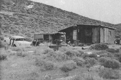
|
| Illustration 172. Cabin on Blue Bell mining claim. Photo by Linda W. Greene, 1978. |
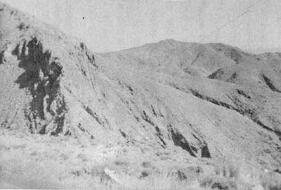
|
| Illustration 174. Tramway support, Hanging Cliff Millsite. Photo by Linda W. Greene, 1978. |
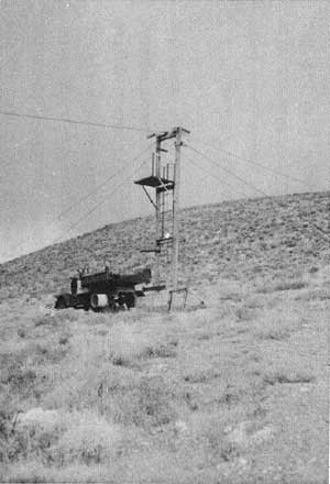
|
| Illustration 173. Cable heading north across gulch toward Hanging Cliff Millsite. Light area on far cliff is mine dump. Photo by Linda W. Greene, 1978. |
(b) Present Status
The Blue Bell Group, comprising one twenty-acre unpatented lode claim (Blue Bell #1) and one five-acre unpatented mill site (Blue Bell Millsite), is about three miles east of Skidoo and reached via the gravel Skidoo Road. The turnoff to the mine is about five miles east and north from the junction of the Skidoo and Emigrant Canyon roads; from there the Blue Bell Millsite lies about one-half mile down the slope. Here claimants have erected their tin shack headquarters, still furnished, and identified on its side as "Hidden Wash, McFarlin and Durham Mining." Probably built in the 1950s or 1960s, the cabin and surrounding ground resemble all mine camps of that period within the monument--assorted debris and trash, old appliances, and a dilapidated vehicle litter the ground.
From here a road trends southeasterly toward the Hanging Cliff Millsite, which, located at the crest of a hill, is distinguished by a large metal support for a cable tramway that crosses a small, though deep, canyon toward the Hanging Cliff Claim, appropriately named for its precarious location on the side of a very steep rock wall. Further east and at the bottom of a precipitous jeep road is the Blue Bell Claim (Garibaldi Mine). Its situation is best described, though slightly exaggerated, by a visitor in 1876 who remarked that
the descent from the mine to the valley is so abrupt that a stone can be thrown with ease into the valley below, although the mine lies several thousand feet above it. [222]
No mine structures are extant; indeed, the main shaft itself is barely discernible to the untrained eye because of the efforts made to fill it in. Of greater interest are the remains of several rock houses or dugouts visible in the canyon a short distance below. Two others are built against a hillside near the road between the Hanging Cliff Millsite and the Blue Bell Claim.
(c) Evaluation and Recommendations
The Blue Bell (Garibaldi) Mine is determined to be of local significance and eligible for inclusion on the National Register. It is one of a group of very early silver mines in the Wild Rose area, all discovered during the rash of exploratory activity prompted by the excitement over Panamint City's unfolding riches, and all worked intermittently over the next several years. Making it somewhat unique is the fact that it evidently proved profitable enough to mine, or at least periodically explore, over the next almost forty years so that its location is still known today.
What makes the site especially significant, of course, are the associated stone ruins, which in the early 1900s were identified as mill buildings; no specific date for their construction was mentioned, however. They should be researched further and in closer detail by historical archeologists. Due to time limitations the writer was only able to examine the two more accessible dugouts near the Garibaldi Mine road: one is about eleven feet square in dimension and is surrounded on three sides by a five-foot-high wall with two entrances; the other was circular in shape with about twelve feet of five-foot-high curved wall remaining. The structures lower on the canyon floor appear to be ten to fifteen feet in diameter.
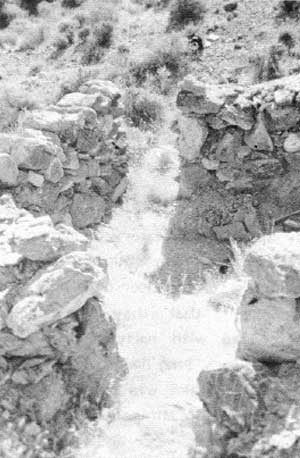
|
| Illustration 175. Stone dugout to north of road between Blue Bell and Garibaldi mines. Photos by Linda W. Greene, 1978. |
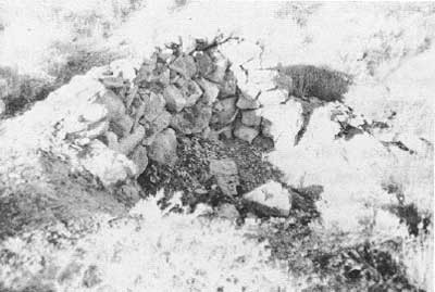
|
| Illustration 176. Stone dugout to north of road between Blue Bell and Garibaldi mines. Photos by Linda W. Greene, 1978. |
It has been hypothesized that these ruins date from early Spanish exploratory or mining activities in the region; reportedly an old trail can still be seen leading from the vicinity of these structures to the floor of Death Valley. It is this writer's feeling, however, that they are probably of later construction and associated with early mining endeavors at the Garibaldi during the 1870s. The limited historical data available seem to agree that the Garibaldi was one of the more prominent mines in the early Rose Spring Mining District for several years. The 1875 Inyo Independent newspaper article quoted earlier in this section suggests that the Garibaldi ore warranted smelting works of some kind, and these might have been built by the Nossano brothers. When the Inyo Silver Mining Company took over the property and initiated extensive development procedures, such stone structures might have been erected to house employees as well as milling operations.
Further conjecture about the ruins is not only time-consuming but also meaningless until the site is investigated further by historians and historical archeologists; hopefully the discovery of artifacts in association with the structures will enable their more precise dating. Because of the presence of several ruins, of varying shapes and sizes, possibilities exist here for comparative study of, early Death Valley stone structures, some of which might have been connected with early milling operations. Such an opportunity should not be overlooked.
|
| Illustration 177. Adit associated with Garibaldi Mine Claim. Photo by Linda W. Greene, 1978. |
|
| Illustration 178. Ruins of stone mill buildings in valley below Garibaldi Mine. Death Valley salt pan seen in distance. Photo by Linda W. Greene, 1978 |
On the road near the Garibaldi Mine is an old rubber-wheeled, wooden-sided ore wagon, probably dating from the early 1900s, and possessing interpretive value. A tag on the vehicle provides full information on its maker, model number, etc.
The Blue Bell Millsite and Hanging Cliff Millsite and Claim possess no demonstrable historical significance.
(19) Skidoo
(a) History
i) Ramsey and Thompson's Great Discovery
Right here on the border line between California and Nevada, just a few miles from arid within speaking distance of Nevada's big, bonanza gold camps of Goldfield, Rhyolite, Tonopah, California promises to give birth to the most wonderful gold mines America has yet produced . . . . Here the golden goddess is again singing her siren song of enchantment and California is again beckoning to the world with a finger of gold: and the world is listening, and looking, and coming--TO SKIDOO! [223]
By 1907 when this enticingly optimistic editorial appeared, Skidoo was a thriving year-old mining camp. Her cramped townsite, dizzyingly nestled on top of the Panamint Range, already proudly possessed over thirty tents, several frame buildings, and many of the amenities of civilization, including restaurants, hotels, and a newspaper. It was a far cry from the desolate and lonely conditions existing here in January 1906 as two wandering desert prospectors, John Ramsey and John ("One Eye") Thompson, wended their slow way up Emigrant Canyon toward the newly-discovered gold strike at Harrisburg.
Although the Panamint Range for almost its entire length had been known since the early 1850s to contain gold-. and silver-bearing veins, early mining efforts had centered mostly around silver and lead, the gold veins being largely overlooked and unprospected. Only now, in the early 1900s, was this precious metal becoming a highly-prized and sought-after commodity. Both Skidoo and Harrisburg, discovered about six months earlier and located about 5-1/2 miles further south, were the direct offshoots of the big Nevada bonanzas of Tonopah, Goldfield, and Rhyolite. Excited and encouraged by the seemingly quick riches exposed in these areas, the desert mining community became hungry for more, and prospectors began gravitating westward across Death Valley in search of rumored treasures in the Panamints.
The long trek of Ramsey and Thompson toward Harrisburg was suddenly interrupted by a rare freak of nature in the Death Valley region--a blinding fog. Quickly becoming disoriented in the murky light, and afraid of getting lost in one of the many surrounding canyons, the two decided to encamp near Emigrant Spring and proceed on their way in the morning. By the next day the fog had lifted, enabling a view of some nearby ledges whose color appeared promising. A true desert prospector always had time for even a brief survey of such formations. What Ramsey and Thompson found completely dismissed all thought of a further journey, and precipitated their prompt location of several claims in the vicinity. Comprising the Gold Eagle Group, this series of rich ledges appeared to stretch north-south for a distance of about 1-1/2 miles, varying from two to twelve feet wide, and showing $82 in gold per ton.
Somehow managing to keep their new discoveries secret until their claims had been properly monumented and recorded (luckily they did not run into Shorty Harris here!), it was not until a couple of months later that news of the strike began to spread. Immediately realizing that these veins were probably located in the same mineral belt that had been the source of riches for Panamint City over thirty years earlier and that was now proving so productive in the Harrisburg vicinity, hordes of miners turned their burros toward Emigrant Spring, hoping to be early enough to cash in on the bonanza. Though located in California, the camp soon fell almost completely into the hands of Nevada capital and enterprise. As soon as word of the strike reached the ears of the pioneers of the Bullfrog District, the area's future was assured, for it was their intervention and investment that made Skidoo one of the longest-lived and most successful Death Valley mining camps.
ii) E. A. Montgomery Acquires the Property
The Nevada mogul most responsible for Skidoo's success was E. A. (Bob) Montgomery, who immediately purchased the original Gold Eagle Group of claims from Ramsey and Thompson. As was not at all unusual on the desert mining frontier, where the thrilling prospect of untold wealth often precipitated fast and loose business deals, some hint of scandal did revolve around the negotiations for the property. One version of the transactions states that a representative of Captain DeLamar, a well-known mining magnate of the region, being one of the first on the scene with money enough to act, promptly secured an option for a one-half interest in the property for $100,000. Following on his heels came E. Oscar (Bob) Hart, a Goldfield pioneer, mine owner, and New York promoter, who subsequently secured the former's option and bonded the property for $20,000.
From this point on the facts are hazy, probably deliberately so. According to some, Montgomery eventually intercepted Hart and for his option offered him a sum he couldn't refuse--$100,000 extra--and then proposed to the discoverers another large sum for their remaining interest. Upon the latter's acceptance of same he was put in sole ownership of this phenomenal discovery. Some doubt is cast on this tale of completely orthodox business proceedings by a second account to the effect that Hart made the original deal with Ramsey and Thompson to bond the claims for $23,000, after which, forking over the option money and rightly assuming he had an ironclad contract, he returned to the East to attempt to interest Schwab's bankers in the property, leaving matters for the most part in the hands of his business associate George M. Ottis. This was his first mistake, for Ottis, not above playing both sides of the fence, apparently turned around and struck up a partnership with Montgomery (or so he claimed in a lawsuit two years later), betraying Hart's option for the claims in return for a one-eighth interest in the mine and any ensuing profits. Montgomery was thus enabled to pick up Hart's option before his time expired, gladly paying a bonus therefor. [224]
However it happened, by May 1906 the Schwab crowd and Bob Montgomery and his associates had gained undisputed control over the original twenty-odd claims of Ramsey and Thompson, and Matt Hoveck, Montgomery's competent former manager of the Montgomery-Shoshone Mine, was put in charge of development. Nevada capital was now pouring into the district from such investors as Senator Nixon and George Wingfield of Tonopah, who bought the Green Monster Group of fifteen claims adjoining the Gold Eagle, and Hudson Goodpasture, John W. Seller (one of the original locators of Bonanza Mountain and an investor in several big enterprises in the Bullfrog District), and A. V. Carpenter, who secured the Contact Group of seven claims in these early days, believed by some to be next in importance to the original strike. [225]
It was the news of Montgomery's entrance into the new field, however, and of his initiation of development, that practically emptied Harrisburg and provided the impetus for a mass location of new claims, everyone vying to acquire a site as close to his works as possible and within the prosperous mineral zone that was now estimated to measure about six miles wide by fifteen miles long. Considered part of the Wild Rose Mining District, the new Emigrant section was immediately provided with a deputy district recorder to handle the expected increased work load; a voting precinct was also established here.
An astute and competent businessman, E. A. Montgomery intended to waste no time in the development of his Skidoo interests, future plans for the site involving installation by 1 January 1907 of a quartz mill (variously projected as holding thirty, forty, or sixty stamps) to be run by water and hopefully later by electric power. Although sufficient water for domestic purposes could be acquired from Emigrant Spring, approximately five miles away by trail and seven by wagon, a more abundant water supply would be needed to provide the hydraulic force necessary to run the milling plant. Accordingly, water rights to the springs near Telescope Peak, at an elevation of about 7,400 feet, were acquired from a Fred Gray of Ballarat, enabling the release of about forty miner's inches from Birch Spring at the head of Jail Canyon, and north of Telescope Peak, to be conveyed by gravity pressure to the mill and townsite in a long pipeline ranging in diameter from six to eight and ten inches, estimated to cost about $150,000 and intended with a fall of 1,800 feet to provide enough force to generate about sixty horsepower for mining and milling purposes. The water was harnessed at the springs in a four-by-eight sandbox. Pressure would be reduced somewhat along the line, there being places where the water would drop lower than Skidoo's elevation. The high-pressure quality pipeline would be strung along the route in twenty-foot lengths. It weighed 650 pounds to the length, with eighteen miles worth weighing 1,544-2/5 tons. It was expected that because of this water supply all ore running above $4 a ton could be treated at a profit in the mill. Water from the line would be free for domestic purposes. [226]
A negotiable road from Emigrant Spring was also needed to facilitate the importation of construction supplies, and for this task Montgomery employed 20 men, expecting to increase this force soon to 75 and later to 250 when the mill was in operation. The promoter and backer of all this initial development work was the Skidoo Mines Company, an unincorporated and closed association operating on a partnership basis. No stock offerings were ever made, the individual members contributing all necessary monies. A capitalization of $250,000 would hopefully cover all initial costs.
By the Fourth of July 1906 a real spirit of optimism pervaded the camp, its over-abundance of energy and enthusiasm finding an outlet in the discharge of guns and the explosion of gunpowder in front of buildings gaily decorated with bunting and flags. Such optimism seemed duly warranted, for arrangements were already being made for an auto line into the district from Beatty, a stage line seemed assured, a post office had been applied for, mine options were being taken up right and left, and several companies expected to start production soon. The high altitude of Skidoo (5,600 feet) and its relatively protected position in a saddle on the southwest slope of Tucki Mountain meant that prospecting and development work could continue all summer.
On Montgomery's property, now rechristened the Eagle Mine, a spate of construction activity was currently underway, resulting in erection of several matched lumber buildings, including a bunkhouse (eighteen by eighty feet), a cookhouse, a boarding house (twenty by forty feet) with a twenty by thirty-foot kitchen, an office, and a blacksmith shop, in the company camp located on the hilltop above (south of) the mine workings where thirty men were busily employed in development work and in laying the foundations of the stamp mill. Communications with Ballarat had been substantially improved by the initiation of a tri-weekly stage line, but in order for the new camp to reach its full potential it was concluded that a communication and transportation line with Rhyolite was needed, necessitating much work on the road crossing Death Valley that at this point was so sandy it could not support loaded wagons. [227] A telephone line to the Bullfrog District was also considered essential to keep mining men in Skidoo apprised of the rise and fall of shares.
iii) Granite Contact Mines Company
Touted as the Emigrant Spring section's first stock offering, the Granite Contact Mines Company, one-half mile north of town and still considered second in anticipated wealth to the Skidoo Mine, with an almost comparable surface showing, was incorporated under the laws of South Dakota in the summer of 1906 and was offering stock at 15¢ a share by August. Capitalized at $1,250,000 with 500,000 shares in the treasury for development purposes, the company was backed by a string of solid Bullfrog businessmen: John W. Seller, president; Clay Taliman, a prominent Rhyolite attorney, vice-president;. J. J. Fagan, pioneer broker and real estate man of the Bullfrog District, secretary; and treasurer G. B. Keenan, cashier of the Bullfrog Bank and Trust Company of Rhyolite. [228]
Prospective purchasers were completely assured by the company of the systematic development campaign that would be undertaken on its seven claims (adjoining the Skidoo Mine on the north, the Blue Jay Mining Company on the east, and the Skidoo Contact Mining Company grounds on the south and west) in what was
Without question . . . destined to be one of the best high grade and leasing camps on the desert gold fields; situated as it is at an altitude of 6500 [56001 feet, with a delightful climate, with an abundance of water for mining and milling purposes, with a plentiful supply of timber for fuel and lumber, with ideal free milling ores and with precipitous mountains particularly adapted to mining by tunnel, mining operations can be conducted by the most economical methods known to mining. [229]
Many people evidently were won over by the eye-catching and flamboyant ads appearing in the Bullfrog Miner and Rhyolite Herald for the demand for stock was far greater than anticipated, no doubt prompted in great part by the already heavy and continuing investments in the area by prominent Nevada operators.
iv) A Townsite is Established
From its very beginning Skidoo displayed a definite tendency toward an organized and systematic development pattern that no doubt played a great part in helping sustain it through the rough years ahead. The rapid influx of mining men to the vicinity, some with families, made the establishment of a townsite and the dispersement of residential and business lots the next natural step in the area's growth. By the end of August 1906 a townsite, variously designated as Montgomery and later Hoveck, was platted just east of the Skidoo Mine, which was functioning as the center of milling operations. Neither "Montgomery" nor "Hoveck" captured the imagination of the townspeople, however, nor did either of those two solid citizens particularly desire to be so memorialized. The details of the debate resulting in the colorful designation of "Skidoo" have been lost to history and open to conjecture for years, the linking of the then popular slang term "23 Skidoo" with the townsite having been variously attributed to: 1) the length of the Skidoo pipeline; 2) a total of twenty-three claims in the original discovery group, coincident with twenty-three surveyed blocks in the new townsite (this seems the most likely suggestion, though newspaper reports mention twenty-four claims), prompting Mrs. Montgomery to suggest the appellation; 3) the location of the original mineral discoveries on the twenty-third of the month; 4) the twenty-three men who supposedly founded the town; etc. Whichever fact prompted the suggestion, the new name was wholeheartedly approved by all.
Lots on Skidoo Street went almost in a day. The coming of winter would delay new construction, but by spring large and substantial frame buildings would be rising. An important drawing card for the area was its relative accessibility compared to the inconveniences experienced by earlier and smaller mining ventures in this region. Emigrant Spring(s) rapidly became the distributing point for Skidoo and Harrisburg, boasting now a general store and three saloons for those who needed to slake their thirst before attempting the last few miles to either of those places. The rate of fare to Johannesburg from Los Angeles was only $6 and the stage rate to Ballarat, on the threshhold of the Wildrose and Emigrant districts, only $8. The ride from Ballarat to Skidoo was another $6, the stage leaving every Tuesday and Saturday. Freight to Skidoo cost about 3-1/2 cents per pound and entered the region from the railroad terminus via Barstow and Johannesburg, hauled by ten-, twelve-, and fourteen-horse teams. Other assets of the region were free-milling ores, extremely rich formations, and the ability afforded by the high mountains to utilize tunneling methods rather than expensive shaft work. [230]
v) A Communications Link to Rhyolite Needed
The arguments put forth earlier in favor of establishing a communications link with Rhyolite--a move now considered even more logical because it would put Skidoo about forty-five miles closer to a railhead--were revived, and in the course of the discussion it was pointed out that a decent automobile road already existed to Stovepipe Springs (Wells), twenty-eight miles northeast. If a good dependable water supply and a waystation could be developed there, travelers and freight supplies should be able to negotiate the burning desert sands in relative comfort. While plans for this project were being hashed and rehashed, a new gold strike in the fall of 1906 on the north end of Sheep Mountain added to the mining excitement. (This area later proved to also contain sizeable quantities of copper ore.) [231]
Meanwhile work on the Skidoo pipeline was progressing. Grading was finished and the laying would commence as soon as the eighteen freight outfits engaged in transporting the material could deliver it. The first consignment of pipe arrived from Johannesburg in the middle of September. Seventy-five men were at work on the water system and at the mine where the main shaft, already down sixty feet, was exposing magnificent ore filled with free gold. [232]
Further discussion on the Skidoo-Rhyolite road had resulted in the decision to commence work almost immediately on the proposed route. Matt Hoveck, manager of the Skidoo Mine, committed the company to construction of the road up to the sand dunes, a project estimated to entail an expenditure of several thousand dollars, if Rhyolite businessmen would build from the east to that point. J. R. Clark, brother of the Las Vegas and Tonopah Railroad head, was appointed to supervise this second construction phase, selling subscriptions in Rhyolite to finance the work. (This scheme was not completely foolproof, for expenditures always outweighed contributions. The total amount donated was $1,045, while expenditures for picks, shovels, rakes, wages, teams, and lumber for culverts were $1,525.90. In addition, some further work became necessary and was expected to result in a final deficit of $750.90.) Hopes were also high at this time that Borax Smith's railroad would be extended westward from his Lila C borax mine, past his Furnace Creek properties, on north to Cow Creek, and if the Emigrant Spring ore continued to show promise, on to Skidoo. [233]
Meanwhile slow but steady work continued at the Skidoo Mines Company site where two shafts and as many tunnels were producing high-grade ore with values ranging from $100 to $1200 per ton, precipitating the receipt by Hoveck of at least twenty-five lease applications from Goldfield and Tonopah people. Because it seemed inevitable that the number of ore deposits would far outstrip the capacity of the company mill to handle them, it was already assumed that a second mill of fifty stamps would have to be established at the lower end of the property, utilizing the same water after it had performed its duty above, the fall between the two mills being about 1,000 feet. [234]
vi) The Skidoo News Arrives
One of the more important events in Skidoo's early days, and one ensuring the dissemination of her virtues far and wide, was the arrival in November of a four-horse load of printing material, transported to the isolated town by James G. Sterrett and Edwin S. Drury of Encampment, Wyoming--the Skidoo News was born! During the ensuing months other businesses mushroomed in the vicinity, all owing their existence to the Skidoo Mine: an engineering and assay office was opened in that town by two mining engineers, John H. Wilson of Rhyolite (formerly of Greenwater?) and R. H. Earle of New York; Lawrence Kimball of the Kimball Bros. stage line began canvassing the wagon road between Rhyolite and Skidoo preparatory to the establishment of regular stage and express service; a water station was established at Stovepipe Wells and an eating house and feed stable were projected; John Calloway began running a six-horse bi-weekly stage from Ballarat; and Jack Hartigan further developed his Emigrant Spring facilities and was liberally dispensing spirits, general merchandise, and stock feed.
vii) Conditions Continue Promising
Actually, mining conditions throughout Inyo County as a whole were healthy during the closing months of 1906, with 150 miners reportedly working the Emigrant District, where investment capital seemed always available. Harrisburg was taking on a new lease of life due to all the activity in the surrounding region, and Ballarat was thriving as the distribution point for supplies for a vast mining section including not only the Wild Rose District but also the revitalized camps in the Darwin, Modoc, and Coso districts. To the north numerous valuable copper properties in the Ubehebe and Saline Valley regions were drawing much attention at this time, and to the east Greenwater, the site of a bonanza copper strike, was attracting investors from all over the country. [235]
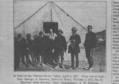
|
| Illustration 179. Office of Skidoo News 1907. Note Matt Hoveck and Bob Montgomery in picture. From Rhyolite Herald, 19 April 1907. |
Over the next few months slow but steady progress took place in the efforts to improve conditions at the new camp. Although five miles of pipeline had been laid by the end of November 1906, the early days of December brought heavy snows, sometimes as deep as three feet around Skidoo and Harrisburg. The unbearable cold, lack of fuel, and poor housing accelerated an exodus from the Emigrant Spring area. The Skidoo News even froze up, and work on the mines and pipeline had to be temporarily interrupted. Toward the end of December weather conditions had improved to the extent that twenty-seven laborers could resume work on the pipeline, while a forty-horsepower hoist was installed on the main shaft of the Skidoo Mine, now down 120 feet and exposing ore running from $60 to $200 per ton. By early January the first power hoisting plant to be installed in camp, a new eighteen-horsepower one hauled by fourteen-mule team from the railroad, was installed at the mine. An iron-clad engine house was erected at the No. 1 shaft and the hoist was working steadily. Although large surface showings were present on the Granite Contact, permanent work had not yet been started. The need for a mill and treating machinery on the property was already being hinted at, however.
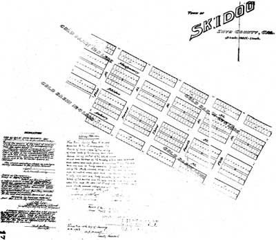
|
| Illustration 180. Plat of the town of Skidoo, Inyo Co., Ca., filed 10 January 1907. Courtesy of Inyo Co. Clerk and Recorder, Independence, Ca. |
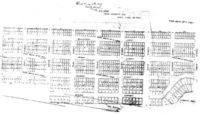
|
| Illustration 181. Plat of the town of Skidoo, Inyo Co., Ca., filed 6 May 1907. Courtesy of Inyo Co. Clerk and Recorder, Independence, Ca. |
J. R. Clark had by now also taken charge of the road work on the Skidoo end of the line being constructed between Rhyolite and the new town, which, now boasting thirty-three tents, several frame buildings, a big general mercantile store, a lodging house, a restaurant, a newspaper, and several saloons, was eagerly anticipating increased trade from the new association. By the middle of January men were working at four places along the road, which had been finished so far only over the Funeral Range to Stovepipe Wells. Here, nearly two miles out of a necessary five of the road had been corduroyed with mesquite. [236] Although the road still needed some finishing touches, it was negotiable by motorcycle, stage, or auto. Crossing of the sand dunes took a good two hours, however, and from Stovepipe to Emigrant, a distance of twenty-one miles, about seven hours. The route from Skidoo to the railroad via Ballarat was badly deteriorating and rapidly becoming impassable for teams with heavy loads, causing Superintendent Hoveck to contemplate bringing the rest of the pipeline in over the new road from the north. Work on the project had been delayed already for six weeks during the end of December and first of January because of the inability to transport supplies over the road now being used.
The Kimball Bros. stage line lost no time in initiating a five-day round-trip service from Rhyolite to Skidoo via Stovepipe and Emigrant Spring, with a one-night stopover at the former. A one-way fare cost $20, and the express rate was 5¢ per pound. During this same time a telephone line from Rhyolite was nearing completion to Stovepipe Wells. The connection had reached there by March 1907 and was already extending nearly five miles up the Panamint slope toward Skidoo. Completion of this communication link would do much toward ending some lingering feelings of isolation at the townsite.
viii) Leases Opened on the Skidoo Mines Company Property
To return briefly to mining operations at Skidoo, a new and extremely profitable phase of activity began with the opening of leasing opportunities on the Skidoo Mines Company property to interested parties. According to Hoveck the company would eventually lease everything except for the three big ledges on the Skidoo and the three on the Cocopah that the company was working. (The Cocopah Group of fifteen claims was not included in the Skidoo Mines Company organization, but did have the same directorate. It was later consolidated with the Skidoo Mine.) The awarding of these leases offered the possibility of quick fortunes for many, because rich values could easily be drawn from the surface without tedious preliminary development work. Royalites agreed on were 10% on $25 ore or. less with a graduate scale up to 25% on $100 or better.
On the Skidoo itself, the No. 2 shaft was now a double compartment sixty feet deep another forty-horsepower gas hoist was soon to be erected over it to increase production capacity. In February 1907 a new venture, the Skidoo Contact Mining Company., was organized under the laws of South Dakota with a capitalization of $1,000,000. Comprising five claims-(Gold Ledge #1-4 and Doctor) 1-1/2 miles north of Skidoo, the Skidoo Contact Group lay adjacent to the Golden Eagle Group (Skidoo Mine) and the Granite Contact, and was considered third in importance to these two. President of the company was O. O. Kincaid, cashier of the John S. Cook & Co. Bank of Rhyolite; vice-president was John W. Seller. [237]
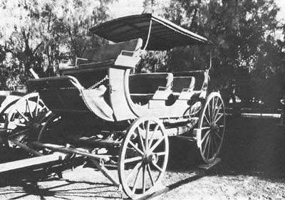
|
| Illustration 182. Rhyolite-Skidoo stage, on exhibit at Borax Museum, Furnace Creek Ranch. Photo courtesy of G. William Fiero, UNLV. |
It was anticipated that the first shipment of gold bullion from the Skidoo Mine would be made before the end of July, test samples of ore having been shipped to Taylor & Company milling machinery house in St. Louis and to Denver in an attempt to determine the best method of treatment. According to Hoveck, an eighty-stamp mill operating by the summer would reserve ten of its stamps for custom work, entailing at least three years of steady use for the other seventy stamps. Hoping to facilitate operations elsewhere, the company offered to furnish water and electric power to any surrounding properties desiring it. Ore was to be purchased from leasers or operators, all ore running above $5 per ton to be bought and paid for at the mill. By March leasing offers for Skidoo ground were withdrawn, the Skidoo Mines Company undergoing a formal incorporation encompassing all twenty-three Cocopah and Gold Eagle locations in one organization. [238]
ix) The Townsite Expands
Skidoo townsite was thriving now, and a great morale boost was provided when the U.S. Government withdrew its aesthetic objections and officially recognized the appellation Skidoo. In March the Skidoo Bank and Trust Company, with a paid-up capitalization of $25,000, took up temporary quarters in the general store. Due to numerous delays, however, it was not until May that the renamed Bank of Southern California opened its doors for business. The first day's transactions carried deposits up to almost $10,000. The future looked so rosy that stone masons imported from Los Angeles were already quarrying the native white stone for use in a new two-story-high building costing $12,000, with lodge rooms on the second floor for Masons and with a 60 by 100-foot ground floor to house a large store and several business offices in addition to the bank. In February the Panamint Artificial Ice Company had been formed by Salt Lake parties who intended to divert water from the Telescope Peak pipeline to their $5,000 ice plant situated on four town lots. Two men already managing large businesses at Tonopah and Greenwater were planning the establishment of the Skidoo Lumber Company, intending to supply this commodity from Rhyolite via big freighting outfits at from $15 to $25 cheaper than the prices now being paid of $130 per thousand board feet.
Investments in mining properties and real estate were the order of the day, the latter transactions being ably conducted by Capt. W. R. Wharton, a Pennsylvania capitalist and stockholder in the Skidoo Mines Company, who bought the Skidoo townsite in March 1907 from Matt Floveck who had acquired the original one from James Arnold, the locator. Wharton proceeded to plat a new residential addition east of the original townsite, where he himself erected two portable houses, and sell business lots as well as oversee development work on those promising claims embraced within the townsite. It was expected that such development work would soon open up an extension of the Gold Eagle ledges within the city limits. The Skidoo Townsite & Mining Company, with a capital stock of 1,000,000 shares, was organized, with Montgomery as president; Matt Hoveck, vice-president; and Wharton as secretary-treasurer. It owned eight full claims and one fraction adjoining the Skidoo Mines Company property and, in addition, sold townsites ranging in price-from $100 to $1,000 each, depending on location.
Skidoo's population had reached 400 to 500 citizens, who were being served by L. E. Thompson's large general merchandise store, supplying everything from mining necessities to hardware, clothing, drygoods, and groceries, four saloons, a meat market, laundry, bakery, newspaper, and lumber yard, lodging houses, three restaurants, assayers, surveyors, a physician, lawyers, brokers, and more. Social activities were held in the Skidoo Club, measuring twenty by fifty feet and costing about $3,000, and in the more elite Panamint Club, which demanded an initiation fee of $100. By April the town contained altogether about 130 residences and business houses of frame, wood, and iron.
Because the Telescope Peak pipeline was not yet finished, water continued to be hauled in wagons from Emigrant Spring by ten-horse team and was sold for $4 a barrel or three to ten cents a gallon or higher to the townspeople. It was hauled to the Skidoo Mine in an iron tank on wheels. Groceries, supplies, and the cost of living were about equal to Rhyolite. Mail was being hauled on the Kimball Bros. stage from that town, while fresh meat and vegetables arrived by the same means and were then peddled. A Death Valley Forwarding Company had been established in. Rhyolite to forward freight to Skidoo. Emigrant Spring now was a small camp of framed tents with traveler accommodations in the form of a store, a saloon, a lodging house, and restaurant. Water was piped from the spring to a point in front of the main building. Several prospectors called this place home, as did Frank C. Kennedy, the district mining recorder. [239]
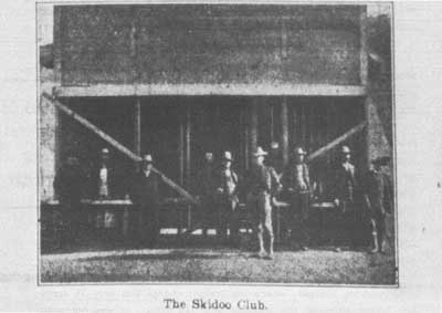
|
| Illustration 183. Proud cardholders of the Skidoo Club, 1907. From Rhyolite Herald 19 April 1907. |
x) Transportation Problems Arise
Skidoo and the surrounding Emigrant District were now accessible by stage both from Ballarat (four-horse, tri-weekly service arriving on Tuesdays, Thursdays, and Saturdays) and Rhyolite (now on a four-horse, three-day round-trip schedule), and it was being rumored that a stage company in Johannesburg was planning a line to Skidoo, making the 110-mile trip in two days, a stage going each way daily. This would mean three regular stages into the town as well s several private cars, such as J. W. Calloway's sixty-horsepower auto with a capacity for ten passengers. [240]
The recently-completed Rhyolite-Skidoo road was proving a boon in many ways, but unforeseen problems soon arose that for a while were seriously detrimental to the freighting business. The trouble was first perceived when J. R. Clark, who had been hauling pipe, telephone poles, and other miscellaneous freight for Montgomery and Hoveck was warned by freighters doing business between Rhyolite and Skidoo not to haul any more freight for less than 3-1/2 cents per pound, even though the distance was less than fifty miles. This action justifiably angered the Skidoo Mines Company, which had just initiated a shipment of 500 tons, or ten carloads, of pipe, lumber, hay, and grain from Los Angeles to Skidoo via Rhyolite. Upon learning that hauling the supplies from the latter place to Skidoo would cost $3.50 per hundred, the shipment was stopped and ordered to go via Johannesburg instead, where the freight charge was only 2-1/2 cents per pound although the distance was 120 miles. It was not until the following October that arrangements were made among the local Rhyolite freighters to allow open competition for the Skidoo business and to do away with the prohibitory tariffs. This would ensure the rerouting of freight for the Skidoo Mine (especially the lucrative mill shipments) back through Rhyolite and necessitated the laying off of many of the freight handlers and railroad men who had been involved in the Death Valley business at Johannesburg. [241]
An important milestone in the town's history was reached in early spring 1907 when Skidoo became connected to Rhyolite by phone, one of the first messages relayed concerning a new strike on the Granite Contact. According to the Skidoo News
The telephone from Rhyolite has reached Skidoo and a flood of business between the Bullfrog metropolis and this place is keeping the wires busy. The first message flashed across the wires from here last Monday announcing that communication was, opened and that conversation could now be carried on with the Panamint camp. [242]
The line, built by the Skidoo Mines Company, again under Clark's supervision, had a halfway phone station at Stovepipe. The cost of talking with Skidoo was a mere dollar. By the end of April a similar 7-1/2-mile-long line was about to be completed to the Keane Wonder northeast across the valley that would connect with the Rhyolite-Skidoo line, thus making a second phone office in the valley. [243]
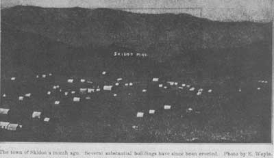
|
|
"Away up at the top of the Panamints where the western wall of Death
Valley fades off into thin air; that's where Skidoo is . . . the little
strip of country in Inyo county, California, where the geography shows
blank." From Inyo Register, 17 January 1907. Illustration 184. Townsite of Skidoo, 1907. From Rhyolite Herald, 19 April 1907. |
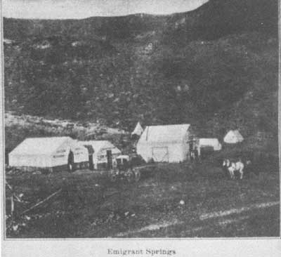
|
| Illustration 185. Community of Emigrant Spring(s), 1907. From Rhyolite Herald, 19 April 1907. |
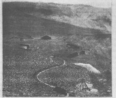
|
| Illustration 186. Skidoo Mines Company camp, 1907. From Rhyolite Herald 19 April 1907. |
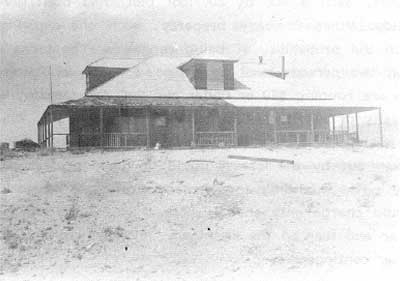
|
| Illustration 187. Skidoo Mines Company headquarters building, 1943. Photo courtesy of DEVA NM. |
xi) Continuing Activity by the Skidoo Mines Company
All this thriving progress by the town of Skidoo was, of course, directly attributable to a surge of profitable and systematically-planned development at the great Skidoo Mine. The parent mining company was still carrying out its plans with its own money, offering no stock on the market except for 20,000 shares that were sold to friends as a favor for $30,000. Like Goldfield, Skidoo was fast becoming famous for her leases (of which she now had five), the most famous of which were the Shackett and Hoyt ones. Next to the Skidoo and Granite Contact mines, these were most important in proving the richness of the district. Figures vary considerably as to the number of men actually employed by the Skidoo Mines Company at any one time, ranging from forty to seventy for the month of April alone. By spring, several thousand dollars had been expended on the mine camp, where the company headquarters were now housed in a fine building containing a large main office, a private office for the superintendent, a parlor, bathroom, and several private bedrooms for employees. The structure was surrounded by a large porch and finished throughout in excellent style. Workers were boarded and lodged for $1 each per day. Other recent improvements at the camp site consisted of a twenty by ninety-foot boarding house, a bunkhouse and another building, an eighteen by twenty-four-foot reading room, an officers' dining room, and a lady cooks' room. [244]
The Skidoo mill was to be built near the mouth of Tunnel No. 3. Here the ore's free-milling character made it easy to treat, and by stoping and tramming directly to the mill and not using wagons, the ore could be cheaply mined also. The No. 1 shaft was driven to a 200-foot depth and was equipped with a twenty-five-horsepower gasoline hoist, while the double-compartment shaft, in April, was still awaiting its forty-horsepower hoist. At this time the Skidoo Mines Company completed its formal organization. Still a closed corporation, it had a capitalization of $5,000,000, with the capital stock divided among the incorporators. Montgomery was president; Capt. W. R. Wharton, vice-president; and Matt Hoveck, treasurer and general manager. Ten claims were included in the mine holdings, and it was fully understood by the men involved that close to half a million dollars would probably be expended on the installation of water, an electric plant, the mill, etc., before any return on the investment would be realized. The Cocopah Mines Company was organized by the same people and financed in the same manner. This company controlled fourteen of the Gold Eagle locations, including the extremely rich 22 and 23 claims. It intended installation of a twenty-stamp mill to handle customers, but this project as well as further development would be delayed until the Skidoo Mine enterprise was in full swing.
By the middle of April eight leases, each a 400 by 600-foot plot, had been given out on the Skidoo Mines Company property, each one expiring 1 April 1908 with the probability of being renewed. The terms of lease stated that two persons must be employed twenty shifts each per month. On ore running $20 or under per ton, the company would receive a royalty of 10%; from $20 to $30, 15%; above $30, 20%. In addition, it was promised that when the Skidoo mill was finally installed, ore taken out by the lessees would be given preference over company ore. Not intending to make any profit on the work, the company would charge only enough more than the milling cost to allow for wear and tear on the machinery, interest on their investment, and other contingencies. [245]
xii) Skidoo Continues Systematic Development
Mining speculators, investors, and owners from all over the country were clearly visualizing the immense profits to be made at Skidoo. Among the camp's visitors during the spring of 1907 was a representative of Lindblom, Linderberg & Co., multimillionaire mine owners of Alaska, who steadfastly announced their intention of becoming involved in the section's mining activity. An important aspect of Skidoo's dynamic mining community and the one that was probably responsible for attracting so many people to her properties was that her business elite were well and widely known for their conservative judgement and legitimate, businesslike mining methods,
men who investigate thoroughly and then support their opinion with capital as strong as the Bank of England; this is the class of men who are making of Skidoo the most wonderful gold camp ever known . . . . Skidoo is not alone great through its gold; it is great in the possession of financial backing which mine and produce that gold. [246]
This is the feature that gave Skidoo her truly unique standing in Death Valley mining history. A short tally of some of the "greats" associated with Skidoo produces the following impressive list:
1. E. A. (Bob) Montgomery, Nevada mining king
2. Matt Hoveck
3. Capt. W. R. Wharton, closely associated with Charles M. Schwab and his enterprises
4. Capt. John L. Armit of Colorado Springs, actively engaged in mining throughout the West
5. John W. Seller(s), Goldfield operator
6. various officials of the John S. Cook & Co. Bank of Rhyolite
7. Sherwood Aldrich of Colorado Springs, involved in the Bullfrog Tramp Consolidated
8. Patsy Clark, the copper king involved in Greenwater mining
9. Poulson & Weaver, Salt Lake City capitalists
10. Busch brothers, founders and promoters of Rhyolite
Countless others were also involved in various Skidoo operations. [247]
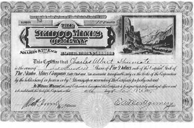
|
| Illustration 188. Skidoo Mines Company stock certificate. From Historical Mining Certificates folder issued by The Book Club of California, 1971, edited by Albert Shumate and printed by Ward Ritchie Press. |
By early May 1907 the citizens of Skidoo, in accordance with their already proven desire to create a law-abiding and orderly camp, petitioned the county for the appointment of peace officers. A brief visit by the county district attorney and sheriff confirmed the need, and a deputy sheriff and justice of the peace were duly appointed.. Another tie with the county seat was suggested in the form of a Skidoo-Keeler road, providing another railroad outlet for the growing community. A second attraction of the proposed project would be a consequent drop in the local cost of hay, grain, and vegetables due to the new access to Owens Valley, products. [248]
The establishment of a Skidoo board of trade was another innovation. With Matt Hoveck as president, the organization not only monitored sanitary conditions in the camp, but also created a set of rules by which Skidoovians were expected to abide:
That all citizens pledge themselves to assist the officers of the law in maintaining law, order and decency in this camp, especially in the following particulars:
The prevention of shooting firearms within the boundaries of the townsite.
To discourage the carrying of concealed weapons therein.
The orderly conduct of all persons upon the streets of the town.
Preventing the use of vulgar and indecent language in places likely to be within the hearing of ladies and children.
The prevention of women and minors from entering barrooms. [249]
The first of summer saw frustrating problems on the Skidoo pipeline. The heat and scarcity of water across Death Valley were preventing the hauling of heavy freight from Rhyolite, necessitating utilization of the longer route through Johannesburg and Ballarat. One hundred sixty horses were on the road hauling pipe' in the first week of June, and the wagon trains hauling supplies for the construction gang were increased to speed up work. Numerous delays had plagued the project, the result of railroad tie-ups, of the inabilities of factories to make prompt shipments of material, and of numerous other factors over which the Skidoo Mines Company had no control. Material for the line filled forty railroad cars; after its arrival at the depot it had to be freighted by wagon over 100 miles and packed on burro trains up mountain trails where it was laid in solid rock in almost inaccessible places. Despite the holdups and obstacles, five miles of the line had been completed, over the hardest piece of country through which the line would pass, and water was now running into Tuber Canyon. A Mr. Maren, who had previously laid pipe for Standard Oil Company, was in charge of the work and intended to have his crew of thirty men lay not less than one-quarter of a mile per day from now on. It was not until the first week of September, however, that the line was completed to Harrisburg, and by the end of November the pipeline was still two miles and one hill away from Skidoo. [250]
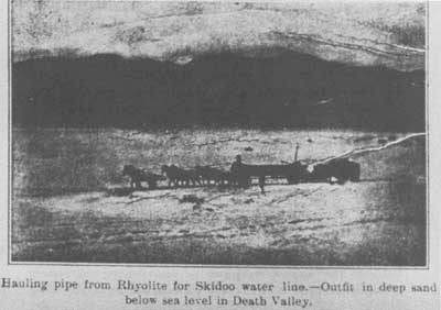
|
| Illustration 189. Team hauling water line pipe from Rhyolite to Skidoo, 1907. From Rhyolite Herald 19 April 1907. |
One proof of Skidoo's durability was the fact that it was not experiencing the usual "hot weather slump that so often invaded mining camps in Death Valley during the summer quiet season and that many times presaged the end of less stable communities. Here, however, the mines were increasing their forces, new buildings were going up, and autos filled with speculators and sightseers arrived every day. To handle the increased activity, the Kimball Bros. stage now left Rhyolite six times a week, leaving there every day but Sunday at 5:30 P.M. and leaving Skidoo every day but Monday at the same hour. During the hot summer months, nighttime was the only period in which to travel.
Most interesting, though, is the realization that a great depression had been sweeping the country for the past several weeks. With the exception of Skidoo, where there was no cessation or lessening of activity through the summer, there had already been a general closing of mines in practically every camp on the desert. Not more than half the mines were working now in Goldfield, Tonopah, Manhattan, and other northern Nevada camps, and those that were able to keep going had greatly reduced work forces. These dull times would continue for most of the large mining camps in Arizona, California, and Nevada into the fall. The lively town in the Panamints had experienced only a slight reduction in population, now holding probably less than 300 people, of whom 100 were employed at various properties. An estimate at this time arrived at nearly 2,000 claims in the district. The fact that the Skidoo Mines Company expended three months time and $4,000 on grading a new road around the big Skidoo hill, long a terror to freighters and visitors, was testimony to its continued commitment to the area. [251]
A change of policy occurred in Skidoo during the fall when the camp, heretofore a non-union one, elected to organize a local branch of the Western Federation of Miners:
The name of Skidoo camp has been as a challenge to I.W.W. men for a good while, it having been the policy of owners there to limit the stay of agitators to the length of time from the stage on which they arrived to the next one going out. [252]
The thirty-five charter members next proceeded to formulate a policy of liberal, non-coercive elements that were truly unique in labor history and that greatly enhanced the WFM image, at least in this section of the Panamints. These instructions to the membership included:
1. no attempt to dictate policy to mine owners
2. acceptance of no one as a member unless he was a practical miner (that is, actively engaged in mining work)
3. encourage and bring in to the district good miners who were already union members
4. cease reports that had been circulated through union channels detrimental to Skidoo. [253]
This action by Skidoo miners greatly augmented the high esteem in which the area was held by important individuals whose support meant so much to the town. J. J. Taylor, a well-known mining engineer in the firm of Voorhees & Taylor of Rhyolite, voiced the widely-held opinion that
Skidoo has a better reputation, from a mining standpoint, than any other new camp in the country, and from what I. have seen in the few days here, I consider that the reputation is fully justified, and merited. The camp has the mineral, beyond question. But aside from that all important fact, it has been thus far entirely free from any wildcat or stock jobbing promotions which have given black eyes to every other mining district on the desert. Up to the present time Skidoo mining has all been on a clean, legitimate basis. The biggest mine in the camp, the Skidoo, is under the management of one of the most thorough mining men of the country, Matt Hoveck, and honest work is every where in evidence. [254]
The desire of Skidoovians to keep this statement accurate extended to the calling of a miner's meeting in November to frame new district laws and select an arbitration committee of ten to settle any disputes arising over mining claims. [255]
xiii) The Skidoo Pipeline is Finally a Reality
"Yes, the streets of Skidoo are running full of water, enough for swimming pools or skating rinks." [256] Thus did Bob Montgomery announce the long-awaited event as water piped from Telescope Peak was turned into a big reservoir above town, from which it ran freely through the unpiped city streets. The line awaited continuance to the town, mine, and mill until the latter was further advanced. The twenty-two-mile-long line of six-inch pipe, with eight- and ten-inch mains in the draws, was said to have cost around $250,000.
Other sources said the total bill for wagon haulage from the railroad at Johannesburg to the road nearest the pipeline was $75,000, and the line itself cost nearly $300,000. Montgomery's elaborate plans of development had of necessity to undergo some modifications and retrenching of policy because of the 1907 financial panic, and as a result a substitution was made in the pipeline of a number of miles of steel spiral pipe for the heavy eight-inch steel screw pipe used throughout most of the length. A big electric station had to be cut out as well as private lines to other springs. So far five teams of the Tonopah Lumber Company had transported 100,000 feet of lumber to Skidoo for the mill, material for which was coming from Los Angeles, and grading for a sixty-stamp mill, that being the determined capacity upon completion (reduced from the last-mentioned eighty because of financial conditions), had been finished. [257] Construction work was being rushed, but the heavy mill timbers could not be set until the concrete beds had hardened sufficiently to support them. A steel cable strung across the gulch would be used to hoist the heavy machinery. A dam in the gulch below the millsite formed a pool where tailings would be saved until the cyanide process was installed.
Financial problems had started to affect the camp now, and the depression that led to a reduction in the projected sire of the Skidoo mill also was the excuse for the holding of a "Hard Times Frolic," a newspaper account of which gives some indication of the town's erstwhile optimism and general spirit of good humor that accompanied the patient wait for a return of solid business conditions. Invitations to the party read:
WHEREAS, In a burst of defiance against the solemn depression thrust upon our beloved Death valley region by the heartlessness of Wall street and high finance generally, we, the free and independent citizens of Skidoo have resolved to hold a "hard times frolic" in the Eschwig grand opera house . . . . To this you are heartily invited that you may join in the good cheer, good drinkables and eatables provided. And enjoy the greatest terpsichorean, literary, musical and freakish exhibition ever devised by man on the ragged edge of Death valley. [258]
The arrival of the new year in Skidoo saw the continuance of positive and improving conditions. Immediate need was seen for a school district, census returns of which in June showed a healthy attendance of thirty-nine white children, twenty boys and nineteen girls. Work progressed on the Keeler-Skidoo or "Zinc Hill Road," as eight men and two teams struggled to blast a 3-1/2-mile section out of solid rock and cement through Darwin Wash by means of mules, scrapers, jack-hammers, and blasting powder. Efforts at the Skidoo Mine were directed toward getting the ore in shape for stoping and toward exploring new bodies that could be conveniently transmitted to the mill; much good miffing ore was present on the dumps and a ready water supply was at hand. The main problem was that all available cash had been used, and more capital was necessary. [259]
xiv) The Hanging of Joe Simpson
Because of this charged atmosphere, when tempers possibly were temporarily strained by more doubts about the future than were usually entertained, and in light of the town's reputation for decency and law-abiding behavior, it was less than prudent for Joe "Hooch" Simpson, a gambler hailing from Reno, though a resident of Skidoo for some time, with a reputation for a surly character and drinking to excess, to enter the store of James Arnold, one of the town's founding fathers and one of the best-liked men around, and proceed to deliberately shoot him to death. The motivation for this action is not completely clear, but it was evidently on account of some fancied wrong that Simpson felt had been done him by the victim. He was immediately arrested, and upon Arnold's death a few hours later, it was only by some of the greatest diplomacy that law officers were able to avert an immediate lynching.
As it was, only a temporary stay of execution had been granted, for on 22 April Simpson was dragged from confinement and efficiently and unceremoniously attached by the neck to a telephone pole. Word of the deed spread quickly. When newsmen arrived from other parts wanting pictures of the event, Simpson was rehanged with pleasure, and the photo taken that appears in practically every volume on Death Valley. As would be expected in this town, the entire project was undertaken in an organized fashion, and when the misdeed had been avenged, normal conditions rapidly resumed. [260] An official investigation of the affair determined that Joe Simpson, one-time consort of "Skidoo Babe" and regarded as really nothing more than an ordinary pimp, had met death "by strangulation at the hands of unknown parties, [261] while "the opinion of the Skidoo people appears to be that the lynchers did a justifiable piece of business." [262]
xv) The Skidoo Miff Supports the Town
Late spring of 1908 brought the commencement of teaming between Owens Valley and Skidoo along a route vastly improved but still marred by a few steep grades and curves where top-heavy loads found the going particularly harrowing. This section of road from Darwin Wash connected with the old Nadeau freight road into Panamint Valley and with the Wild Rose road constructed by the Modoc Company when it was hauling ore from the charcoal kilns in Wildrose Canyon to its mining property. May also saw the first stamps fall on high-grade rock at the Skidoo mill. The attachment of a Pelton water wheel would soon enable the addition of five more stamps. In early June the first gold brick from the Skidoo Mine, representing the cleanup for the first few days of operation and estimated to be worth $4,000, was transported to Rhyolite and then shipped to the mint by Wells Fargo express. Ten stamps were now in operation and the full process at the mill encompassed crushing, amalgamation, and concentration, with cyanide still to be added. The second brick from May production was valued at $7,000. By the end of June the mill was treating around thirty-five tons daily with an increase to twenty stamps planned when the demands of the mine justified the additional expenditure. [263]
It was considered unprofitable to ship less than $100 ore from the area, prompting the frequent voicing of the need in Skidoo for a small custom mill, which could secure water by contract from the Skidoo Company and thereby enable more lessees to start work. This was deemed especially essential when in July the Skidoo Mines Company decided to throw open more than half its estate for leasing purposes, wisely realizing that it would be years before it could work all its territory. The lessees' ore would be treated by the company at a maximum rate of $3.50 per ton, including cyaniding, or at only $3 per ton if the run was made with water power. Leasing royalties were raised only slightly: ore under $20 a ton, 10%; ore over $20, 15%; ore over $30, 20%; ore over $50, 25%. The company's action here was expected to have a tremendous influence on the prosperity of the camp. Numerous advantages would revert to the company, the expired leases already handed over to them having greatly enhanced the value of the property; when the new leases expired, the Skidoo Mine would be in control of a tremendous output that would keep the mill running steadily. The great factor sustaining the mine's value was that ore bodies were increasing and their average value was remaining, steady. The mine's future was dependent on the fact that the ore bodies would persist with depth and that enough large-capacity reduction plants could be installed to handle large reserves of milling ore at a profit to offset high operating costs. The June cleanup resulted in a $13,000 brick. [264]
A Presidential year is usually fairly lean for business, and coupled with this particular one was the unfortunate fact that effects of the past financial panic could still be felt during the traditionally quiet midsummer time. Having been without adequate water for eighteen months and for so long without a reduction plant, and crippled now by the failure of its bank, the withdrawal of the Nevada stage line, and the closing down of the Skidoo News (all due primarily to the stringency of the money market), it was truly amazing that the camp of 150 people was still able to function. It was supported singlehandedly by the Skidoo Mines Company, which was amazingly still able to increase its output, put a cyanide plant in operation, and keep fifty men employed on its own business while twenty-five or so others worked on leases. [265] It was agreed by all that "lack of a sufficient water supply and power to work her ores is the only the sole reason why Skidoo is not one of the foremost producers on the Pacific coast. [266]
Although Montgomery had once hoped that the Nevada-California Power Company would extend electrical service into Skidoo and into other sections in the district south of Rhyolite, thereby furnishing power for his mill and enabling the present water line to be freed for use by other mills in the area, this never came to pass. The cost estimated by the power company for the project was approximately $1,000 or more per mile, and most of that would have had to be paid by the Skidoo Mines Company itself. [267]
Due to the lack of mills in the vicinity, little mining activity was being conducted in Skidoo in the fall of 1908. Their mine's great production rate ($20,000 a month) prevented the Skidoo Company from donating more than three months time to reduction of the ore worked by its lessees, a11 of whom had been mining for more than a year with no opportunity to extract the gold. Renewed isolation of the town meant that mining timbers were costing $400 per thousand running feet, potatoes sold for eight cents a pound, and hay for $100 per ton. [268]
By October 1908, in an attempt to alleviate somewhat the problems caused by a lack of reduction plants, E. M. Tracey, assayer for the Skidoo Mines Company, was promoting the erection of a five-stamp custom mill in the gulch below the main Skidoo mill in a location enabling it to utilize the latter's waste water, which, with a fall of 800 feet or more, could generate enough power for further ore reduction. This mill, powered by a twenty-five-horsepower oil engine, would be for use on the ore of Skidoo Mine lessees only. After four months the company would take over the plant, paying the cost price less 6%. [269]
Thus gradually the Skidoo Mines will augment their reduction works on a very economical basis, and eventually achieve the ambition of Bob Montgomery of having a big mine operated at a very low cost, although isolated in an expensive section of difficult access. [270]
At the same time work was proceeding on this project, grading was being done to enable an increase in the Skidoo mill from ten to twenty-five stamps. The cyanide plant was functioning extremely well, with a total savings now being secured of almost 95%. The water necessary to run the larger mill was being obtained by increasing the head of the present supply at the spring near Telescope Peak. [271]
By January 1909 the route from Stovepipe station to Skidoo had been shortened by fifteen miles by completion of a light road up Telephone Wash, making the. Rhyolite-Skidoo trip only about forty miles long; despite this, the freight, mail, and stage route had reverted to the long and expensive Johannesburg road, over 100 miles long. Carloads of pipe were still being delivered to the Skidoo Mine as efforts were being made to furnish power for additional machinery, electric lights, etc. The total cost of all these improvements--the additional pipe, additional water and machinery, financing of leases, construction of transportation tunnels, etc.--had to this date exceeded production. By March a second, lower mill of five stamps was in operation, as were six concentrators and fifteen cyanide tanks. Around seventy men were employed at the mine, where a healthy state of affairs seemed to exist. Despite the town's drop in population and generally quiet atmosphere, holidays were still important, and Washington's birthday was celebrated with a literary program and grand ball lasting far into the night.
According to current estimates, in the months since the Skidoo plant started operation, about 5,000 tons of ore had been milled. There were estimated to be 49,320 tons in sight averaging nearly $20 a ton with a large tonnage running below $10. The bullion output for the six months of the previous year reached $110,000. The total cost per ton produced was $8.69, but it was anticipated that this would soon be reduced to $5.10. (By January 1910 the total cost of mining and milling ores was under $8 a ton.) Ore reserves were placed at between $812,500 and $1,000,000. [272]
The Skidoo Mine operation, encompassing twenty-three claims and fractions, consisted now of the mill, a laboratory, office, lodging and boarding houses, an approximately fifty-mile-long telegraph line, machine shop, large ore bins, tramway, etc. Underground workings ran 5,000 feet, largely confined to about sixty of the company's 240 acres. Enough ore was in sight to keep the mill running full capacity for the next three years. Shipments from Harrisburg were also being processed here. No renewal of leases was being extended. In July the Los Angeles Mining Review reported that in the last three months the net profits from mines operating in the Skidoo region had been from $15,417.46 to $17,981.57, with gross extraction averaging $24,859.41 a month. This made the Skidoo Mine second only to the Keane Wonder in production in California in 1909. The net profit for the last three months was $49,019.96, or an average of $26,339.98 a month, or $196,079.84 per year. All indebtedness of the Skidoo Mines Company was cleared away by this time, and the first dividend, aggregating $50,000, was being paid in July at the rate of five cents a share.
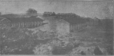
|
| Illustration 190. Skidoo Mines Company camp, 1909. From Rhyolite Herald Pictorial Supplement, March 1909. |
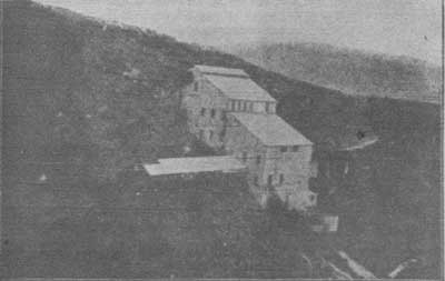
|
| Illustration 191. Skidoo Mines Company mill, 1909. From Rhyolite Herald Pictorial Supplement, March 1909. |
This success was corresponding with the return to the limelight of several southwest Nevada districts, which were only now recovering from the setback dealt their development by irresponsible promoters and poorly-managed mining operations in earlier days. The Montgomery-Shoshone, for instance, was in the process of paying off its indebtedness and the Keane Wonder had just opened up a promising lode. [273]
xvi) A Fire and Litigation Bring an End to Mining Activity
Despite the ongoing and successful development at the Skidoo Mine, however, it was obvious that the town itself was becoming more and more depleted, the supervisors' proceedings of 20 September 1909 ruling that "it appearing to the Board that the attendance of pupils in the Skidoo School District for the past year has been below the required number for maintaining a school, motion was made and carried that the District be declared lapsed. [274]
When Frank Montgomery, nephew of E. A., took over management of the Skidoo Mine in the winter of 1909-10, a new era of productivity arrived. More aggressive than his uncle, he put half the workforce on development and the other half he charged with supplying ore to the mill. It was not. long before the most extensive and richest ore body yet was located. Better returns were the result, acquired in spite of some pipeline troubles due to expansion and contraction and sometimes even freezing that temporarily lessened the hydraulic power supply for the mill during extreme seasons of the year. Although the mine was, able to keep up production for several years yet, monthly net profits seemed to suddenly start a downhill slide, broken only temporarily by an occasional banner year:
| September 1909 -- | $10,000 |
| October 1909 -- | $11,507.22 |
| November 1909 -- | $ 6,508.82 |
| March 1910 -- | $ 8,116.66 |
| April 1910 -- | $ 6,878.78 |
| July 1910 -- | $ 7,798.41 |
| October 1910 -- | $ 5,212.73 |
| November 1910 -- | $13,280.03 [275] |
A second dividend of five cents a share ($50,000 total) was paid by the company on 1 July 1910.
A report on the Skidoo Mine appeared in the Mining and Scientific Press in August 1910 and presented the following brief summary of its operations: work was being pursued on four veins, with two tunnels and two shafts having attained a maximum depth of 300 feet. Ore averaging $15 a ton was recovered and treated by amalgamation, concentration, and cyanidation in a fifty-ton mill, with about 65% of the gold recovered on the plates. The concentrate was shipped to the Midvale, Utah, plant of the United States Smelting, Refining & Milling Company. Cyanidation of the tailings recovered 90% of the gold. Forty men were employed at the mine and mill, and a power plant consisting of several gasoline engines was on hand in case of severe trouble with the pipeline. The company's statement of operations from June 1909 to June 1910 inclusive showed profits of $92,617, with the total cost of mining and milling at $6.88 per ton. [276]
At the start of 1911 there were three producing companies and five producing lessees operating on the Skidoo Mines Company property, shipping to outside smelters at Salt Lake City, Needles, and Keeler, and to Johannesburg, Rhyolite, Beatty, and Skidoo mills. January and February of 1911 each netted only about $8,000 from the Skidoo, but the last year's production had totalled $108,000. [277] July recorded the largest run in the life of the mine--$18,000.
Another five-cent dividend was paid by the company in October 1911, and again in May 1912, by which time it was reported that the company was maintaining an approximate production of $14,400 a month and earning net profits of about $4,800. [278] A blow to production fell in January 1913 when the pipeline froze and burst in several places, necessitating the shutdown of the mill and consequent discharge of forty miners. (The cyanide plant had already been closed for the winter.) Because future operations appeared in doubt, most men left camp, leaving only a few lessees on the property. Undaunted, the company began the slow process of hauling in wagonloads of material to repair the pipeline, but when half the repairs had been accomplished, a more serious calamity befell the operation when most of the mill structure was destroyed by a fire of unknown origin on 2 June 1913. The loss, was reported at a staggering $50,000, with only one battery of five stamps being saved. Although parts of the old structure could be reused, a large amount of new material was necessary to modernize the mill. By October 1913 a new ten-stamp mill was in commission and a heavy winter yield was expected. Company ore would be processed the first month and then the mill would turn to steady processing of lessees' ore until all stockpiled material was cleaned up. [279]
Production progressed well enough that by July. 1914 another dividend could be declared, proving the fantastic resiliency of the company and the resources of its mine. Another one-cent dividend in October 1914 brought the total dividends to a reported $365,000. [280] Thirty-five men were again on the company payroll involved in exploration and development work. Plans were being perfected for adding another five stamps and increasing production by fifty per cent, for the Skidoo property seemed destined to continue operations for many years to come. J. H. Cooper, who took over management of the mine in 1914, said that during more than half of this year the best sections of the mine were in the hands of lessees who were profiting highly at the expense of the company. Also during this year pending litigation prevented work on two known ore bodies of excellent grade. Still the company remained free of debt with substantial reserves in the treasury. [281] In April 1915 five 1,250-pound stamps were added to the ten-stamp mill, along with two Deister concentrators. In December the cyanide plant was housed and insulated with paper, and an oil-fired boiler was installed to heat the cyanide solution. Leases were not being renewed, the owners determined to run the mine themselves.
The town of Skidoo still supported a small population, although several lots were being offered for sale. It was still reached by a horse stage from Ballarat costing $34 per person. Upon completion of the Trona Railroad it was possible to go directly from there to Skidoo, bypassing Ballarat completely. Freight from Johannesburg was costing $50 to $70 a ton, although parcel post would bring it for $21 a ton. Accordingly coal, barley, canned goods, and every other type of freight imaginable that could be compressed into fifty-pound lots was being sent by mail! [282]
Skidoo's days were numbered, however, and in September 1917 it was reported that the Skidoo's rich vein had pinched out and the mine had closed down permanently, coincident with the demise of Rhyolite and Greenwater about this time. Current prices for iron and steel remnants made the prospect of salvaging them attractive, so that by October Trona was gearing up for bustling railroad activity after receiving word that the contract for dismantling and shipping the mill, machinery, and pipe from Skidoo would soon be awarded. It was estimated that 160 cars would be needed for the pipe alone, sold to Standard Oil Company, which along with other scrap metal would be hauled to Trona by teams and motor trucks. [283] (Short sections of the pipe left on the ground were later taken out by CCC labor and used for various purposes.)
xvii) Revival of Mining in the Area in the Later 1900s
When Edna Perkins visited the site of Skidoo in 1922 on her trip through the Mojave Desert, several buildings were still standing along one wide street and a mass of stoves, broken chairs, and cooking utensils were strewn around. A neatly-piled wait of bottles, five feet high and several feet wide, still stood behind the saloon. "Old Tom Adams," an old desert prospector, was the sole inhabitant of the area, guarding his mine and Skidoo. [284] The peacefully slow decaying process of the site was only slightly interrupted in 1923 by the Eric Von Stroheim Company from Goldwyn Studio in Hollywood, headquartered at Lone Pine, which began location work in Darwin, Skidoo, and Death Valley generally for final scenes of "Greed," an adaptation of Frank Norris's book "McTeague."
In January 1926 the Skidoo mines were to be reopened under the management of Ogden, Utah, men who bought control from Judge William B. Gray of Beatty, a justice of the peace who had earlier acquired the property when he sued Montgomery in U.S. District Court, claiming, ownership of ten fractional claims that had been operated as a part of the Skidoo Mine. Rather than pay a $00,000 judgement, Montgomery had given the mines to the judge, who later operated them throughout the 1930s. The new company would function under the name of Golden Glow Mines Corporation. In October the workings consisted of an inclined shaft 300 feet deep and a 300-foot-deep vertical shaft. The ten-stamp mill and cyanide plant were still on site. Three years later H.W. Eichbaum, controlling the Emigrant Springs Mining and Milling Company, tried to revive the Skidoo mines, but with little success. [285]
The Skidoo Mine enjoyed a revival of production, and the nearby Del Norte Mine at the northern end of the Skidoo gold mining district most of its activity and production, following passage of the 1934 Gold Act. Whereas prior to that, from about 1837 to 1934, the price of gold had been restricted to a little over $20 an ounce, it now jumped to $35. Judge Gray, in the spring of 1936, began employing sixteen men in the mine and mill of Skidoo in removing ore averaging $30 a ton in gold at the rate of ten tons per day; by summer some thirty other men were employed on various surrounding' properties. In July a strike was made on the Del Norte Group of claims two miles north of the old Skidoo Mine, and Gray entered into an agreement with the U.S. Smelting and Refining Company of Salt Lake City to sample the two mines. The Del Norte was subsequently taken under option by Roy Troeger, whose cyanide mill at the Keeler gold mine could process the ore. Two years later the group of six claims was still under bond to the Panamint Milling Company, of which Troeger was secretary and manager. They had been developed to the extent of ten shafts from ten to fifty feet deep and many long trenches. Six men were employed. In 1939 a Morris Albertoli and John Rogers of Mojave leased the mine, employing ten to twelve men and producing twenty to twenty-five tons of gold ore daily. Later that year Rogers and Joe Stivers, also of Mojave, purchased Albertoli's one-third interest and formed the Del Norte Mining Company, operating the property until 1942. The $30-a-ton ore they mined was treated at the Skidoo mill. It was hauled by truck to the fifty-ton ore bin, crushed to 1/4-inch size by two jaw crushers,, reduced to 16-mesh by stamps, and the coarse gold concentrated and removed. The pulp was then thickened, the slimes going to waste and the sands leached. [286]
Back in June 1937, according to one newspaper account, a lease with an option to purchase the Skidoo Mine had been given to some eastern interests by the Gray and Worcester Mining Company, which for the previous eighteen months had been making regular shipments of a good-grade milling ore to Journigan's Mill in Emigrant Canyon. A memo found in the monument files stated the sale was to Colorado parties. Whoever it was, their projected plan of operations included relaying the Telescope Peak pipeline with a four- or five-inch-diameter pipe, in the old ditch, at an estimated cost of $100,000, in order to economically treat the large bodies of milling ore still available in the Skidoo Mine and some recently developed on the Inyo and Del Norte groups of claims. According to the Journal of Mines and Geology Roy Journigan leased the Skidoo Mine in January 1937 and with a crew of five removed a small amount of ore from the old stopes, which he treated at his plant in Emigrant Canyon. Meanwhile Roy Troeger, who held interests in the Del Norte claims, continued efforts to push through reconstruction of the pipeline, hoping to attract Mojave capital to his Golden Queen and Inyo claims. The pipe would have two terminuses--one at the old Skidoo mill and the other at a new 300-ton mill to be located near the Del Norte Mine, which would be worked by an open-pit method. [287]
In March 1938 it was announced that the Golden Queen Mining Company of Mojave, a subsidiary of Goldfields Consolidated, a British mining firm, and owners also of American Potash and Chemical Company, had taken over 60% ownership of the Inyo Group of claims at Skidoo owned by Roy Troeger.288 With permission supposedly granted by the Department of Interior for construction of the pipeline, the Golden Queen imported twenty-five miners and placed them on the job of development, intending to prove the ore bodies before beginning a major construction program. Materials for camp buildings were ordered from the Lone Pine Lumber and Supply Company, and the first truck shipments were made immediately. New York interests also joined in the venture.
By 1940 there was a renewal of mining activity in the Argus Range and in the Skidoo District in Inyo County. The Del Norte was being actively developed and the Del Norte Mining Company was preparing to operate its mill on ore from the mine, including its own plus lessees' ore, and a minimum of 300 tons monthly from the nearby Gold King Mine. The Skidoo Mine was still being worked by lessees and ore treated at the Journigan Mining and Milling Company plant in Emigrant Canyon. All operations shut down in December for the winter months, with about $90,000 having been taken off the Skidoo property since the last May. The Del Norte Mining Company mill at Mojave had processed in the last eight months approximately 7,000 tons of ore from the Del Norte, Gold King, and other mines in the district. [289]
From 1942 to 1969 the Del Norte property as a whole was essentially inactive. In the early 1950s the Del Norte Group of six claims was only sporadically worked, Troeger still owning and maintaining the Del Norte and Inyo groups of mining claims with their large deposits of low-grade gold ore. Prior to World War II these could be profitably mined, but the War Production Board had caused a cessation of gold mining during the war and since that time the government had held down the price of gold to such a degree, while other prices had gone up, that it was unprofitable to mine. Troeger, who also owned the Skidoo mill and appurtenances that he had purchased from Gray, was holding on to the property hoping the price of gold would rise or the price of commodities fall. The twelve claims of the Skidoo Mine were still owned by W. Howard Gray. [290]
Also in the early 1950s (1949-56) a tungsten boom hit the Skidoo area. There were large deposits of low-grade ore but no material of commercial quality. Although several hundred claims were located, and in the process many scars left on the hillsides, the flurry was mainly promotion-oriented with little or no output. The last measurable production from the Skidoo Mine took place about 1941, while the Del Norte lasted until about 1954. In the early 1970s when gold was at $38 an ounce and low-cost open-pit operations afforded the best opportunity of producing gold profitably, Mineral Associates of Battle Mountain, Nevada, obtained a lease/purchase option on the old Skidoo gold mining property, and Amberson Construction Company of Nevada conducted drilling operations. In 1970 the Del Norte Group was leased by Carl Dresselhaus and Mrs. Virgina Troeger to Bell Mountain Silver Mines, Inc., of New York, who undertook an extensive sampling program of the low-grade gold deposits on the property and then proposed to mine and crush the ore, recovering gold by cyanide heap leaching in an open pit, but this was not successful. The work resulted in thirty shafts and seven open cuts sampled over a four-acre area. [291]
(b) Present Status
The old Skidoo townsite and mill are reached via an unimproved dirt road leading east off the Emigrant Canyon Road at the north edge of Harrisburg Flats, approximately 9-1/2 miles south of the intersection of that road and California State Highway 190. In the course of the next seven miles this eastward-trending road turns north and then westerly before ascending to the high plateau housing the deserted townsite. Time, weather, vandals, and modern mining activity have all taken their toll of the area, which is marked by an interpretive sign. Open shafts, adits, and stopes dot the hillsides and ridges, posing a grave threat to careless sightseers. Only a very few structural remnants remain, in the form of collapsed ore bins and stone building or tent foundations. Liberal quantities of the usual junk cars and assorted metal debris can also be spotted.
Only one structure of determined significance remains--the Skidoo Mines Company quartz stamp mill. The attractively-verandahed company office building that stood on the hilltop above the mill burned a few years ago. Still sitting on the Del Norte Mine site, on the next ridge north, are the vats and the large pit utilized in its short-lived leaching operation.
The present Skidoo-Del Norte Group of mining claims consists of thirty-one unpatented, contiguous, and often overlapping lode claims. Located during the mid-1920s and 1930s they overlie the historical, early 1900 workings and are included within the boundaries of the Skidoo Historic District. The group covers approximately 600 acres of land, and, stretching diagonally across the ridges from the northwest to the southeast, encompasses the old Skidoo mill and part of the townsite. The Skidoo-Del Norte Group was closed to further mineral entry in 1976, and the claims are being contested by the Department of the Interior. One mile north of the townsite near the head of a wash are the nine patented Contact and Gold Bird claims.
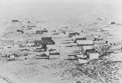
|
| Illustration 192. Skidoo townsite. Date unknown, but post-March 1907. Photo courtesy of G. William Fiero, UNLV. |
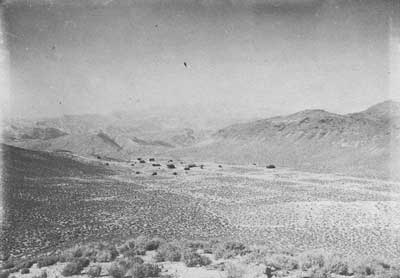
|
| Illustration 193. Skidoo townsite, 1916. From Dane Coolidge Collection, courtesy of Arizona Historical Foundation. |
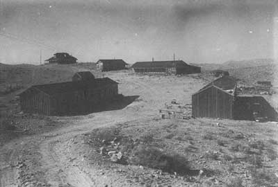
|
| Illustration 194. Skidoo Mines Company camp, 1916? From Dane Coolidge Collection, courtesy of Arizona Historical Foundation. |
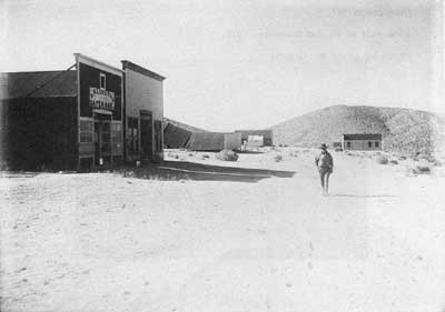
|
| Illustration 195. Skidoo main street, 1916? From Dane Coolidge Collection, courtesy of Arizona Historical Foundation. |
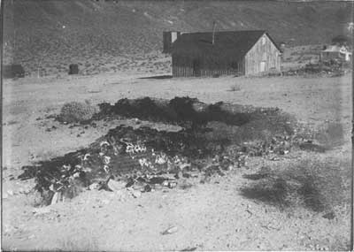
|
| Illustration 196. Skidoo townsite, 1916? From Dane Coolidge Collection, courtesy of Arizona Historical Foundation. |
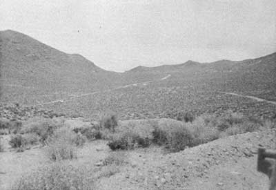
|
| Illustration 197. View east of Skidoo townsite, 1978. Photo by Linda W. Greene. |
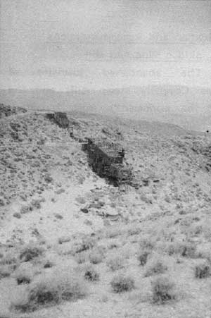
|
| Illustration 198. Ruins of Skidoo mill. Photo by Linda W. Greene, 1978. |
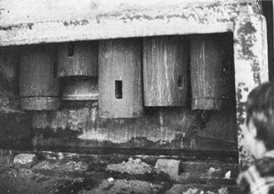
|
| Illustration 199. Stamps in Skidoo mill. Photo courtesy of G. William Fiero, UNLV, 1972. |
(c) Evaluation and Recommendations
i) Skidoo Mine and Mill
The abandoned townsite of Skidoo, the nearby Skidoo Mines Company stamp mill, and the surrounding ruins are some of the monument's most important historical resources. Located in 1906 and flourishing for the next ten years, Skidoo owed its existence primarily to one mining concern--that run by E. A. Montgomery and the Skidoo Mines Company. This one man financed the entire operation, initially expending over $500,000 on the property. The money came from his purchase of 400,000 shares of treasury stock at $1 per share and an additional loan of $150,000. The ore produced from the Skidoo Mine came from two fairly narrow vein systems ranging from eighteen to twenty-four inches in width and sometimes up to four feet, and averaging anywhere from one-third to one-half an ounce of gold per ton.
The ore was mined by overhand stoping, with timber used only sparingly. By May 1908 the Skidoo stamp mill was in operation, powered by water delivered to the site from springs near Telescope Peak about twenty miles south via a gravity-pressure pipeline built at enormous cost, hardship, and frustration. The ore was collected on the tunnel levels and trammed in trains of mine cars by mules directly to ore bins in the upper part of the mill. A description of the mill operation in 1911 states that the water pressure upon reaching the Pelton wheel in the plant was about 300 pounds per square inch due to its being reduced at two or three points enroute. This wheel, assisted by one or two gas engines (40 h.p. and 18 h.p.), ran the mine and mill machinery, the latter consisting of two Blake jaw crushers, two five-stamp batteries of 1,050-pound stamps, built by Hendy, and one five-stamp battery of 1,300-pound stamps built by the Union Iron Works. This latter set was the one bought and erected by company lessees about a year after the other two batteries started, and which was then sold to the Skidoo Mines Company. Below the apron plates of the mill, were three Deister tables that during the month collected a limited tonnage of sulphide concentrate worth about $450 per ton. The tailings went directly to dewatering and percolation tanks. The earlier tailing, held in ponds, was sporadically elevated and run through extra cyanide tanks. The mill, including its cyanide annex and concentrators, cost about $60,000, while the twenty-mile-or-so long pipeline cost from $250,000 to $300,000.
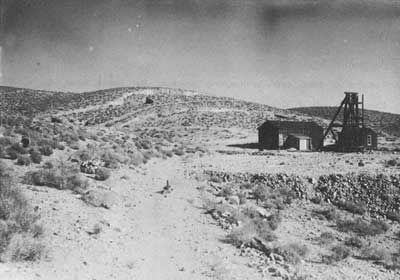
|
| Illustration 200. Kennedy Mine near Skidoo, 1916? From Dane Coolidge Collection, courtesy of Arizona Historical Foundation. |
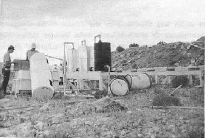
|
| Illustration 201. Remains of heap cyanide leaching process, Del Norte Mine site. Photo by Linda W. Greene, 1978. |
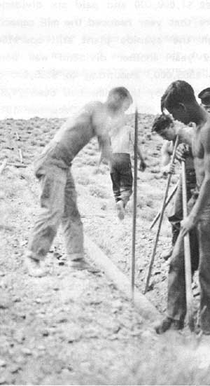
|
| Illustration 202. Digging up Skidoo pipeline south of Wood Canyon, probably by CCC crew. Photo by T. J. Williams, courtesy of DEVA NM. |
By 1911 a total production of over $500,000 had enabled the repayment of the original $150,000 loan and the. payment of two $50,000 dividends. By January 1913 the mine had produced almost $1,000,000 and paid six dividends aggregating $325,000. The fire that year reduced the mill capacity to only ten stamps, although the cyanide plant still operated. Despite the problems of this year another dividend was paid, bringing the total to date to $365,000, amounting to $385,000 by January 1915. The total ore milled by that time had been 74,380 tons with a gross return of about $1,250,000. In December 1917, about the time the mine was shut down and the mill dismantled, the state mineralogist listed the mill equipment as ten 850-pound stamps and five 1,150-pound stamps plus amalgamation tables. These last five stamps (possibly 1,250 pounds instead) were said to have been added around the spring of 1915.
From 1908 until its shutdown in 1917 the Skidoo Mine produced a total of 92,479.5 tons of ore ($1,344,500), with returns averaging $14.54 a ton and 90% recovery in the mill. According to the mine manager the mine had not been worked out by 1917 but had to close due to litigation, disputes with lessees, and bad management. The mine was then inactive until about 1935 or 1936 when it was reopened and worked for five years as the Silver Bell Mine. The period from 1940 to 1947 was relatively quiet, and production from 1948 to the mid-1950s was sporadic. During 1940 to 1942 when the Del Norte Mining Company mined about 3,000 tons of ore from the Skidoo Mine, it was treated at the Skidoo mill, which had been acquired by surface easement.
The State Division of Mines's estimate of $1,500,000 as the value of Skidoo ore produced through 1916 approximates that given by the USDI Regional Bureau of Mines. The latter states that the actual value of all gold and silver reported to them as coming from this mine during 1908 to 1917 was about $1,600,000. Applying present-day values for gold and silver this would mean a total output of $2.5 million.
ii) Del Norte Group
The Del Norte Group, not worked, as far as can be ascertained, during the early 1900s, was mined by means of an open pit during 1937-38 with no economic success. Between 1971 and 1975 Bell Mountain Silver Mines, Inc., proposed installation of a heap cyanide leaching process. The site was graded and a neoprene apron laid in anticipation of mining a proposed 10,000 tons of rock, crushing it, and piling it on a prepared pad lined with plastic sheeting. A cyanide solution would then be sprayed on the heap to dissolve the gold, which would then be collected as it drained off the pad. The solution would then be passed through specially-treated charcoal filter cylinders to extract the dissolved gold, which would then be sent for refinement. Only 5,000 tons of quartzite were ever placed on the pad, and the project came to naught because of troubles in crushing the rock to the desired size.
iii) Skidoo Historic District
Although Skidoo's meteoric rise to prominence was contemporary with that of Greenwater, far more has been written about the latter, because it was a bona fide boom town. Characterized as having few parallels in its "sudden rise, great outlays, small returns and quick decline," it played out its life in sharp contrast to its sister city on the western edge of the Panamints. More law-abiding and attracting a more conservative element than Greenwater, Skidoo's only black mark in the annals of history was her refusal to forgive Joe Simpson for his rash act one pleasant spring day. Unfortunately, because this sort of "shoot-'em-up" action with its final inevitable result has always held more romantic appeal than quiet and honest hard work, this one deed has been publicized more than Skidoo's lucrative gold production.
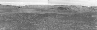
|
| Illustration 203. Scar of Skidoo pipeline route, across Harrisburg Flats can be seen best in distance heading north toward Skidoo. Photo courtesy of William Tweed, 1975. |
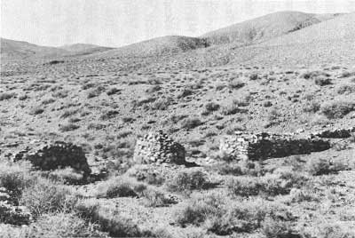
|
| Illustration 204. Masonry support for Skidoo pipeline, 112 miles southeast of town. Photo courtesy of William Tweed, 1975. |
Two unique items are associated with Skidoo's mining heyday. First, the town possessed the only milling plant in the desert operated almost completely by water power, making it one of the most economical operations around. Its cost of mining and milling reached a miraculous $7 a ton, below that of any of its neighbors. Today the mill's basic structure remains in place cascading down the hillside just west of the townsite. Most of the machinery has either been removed by salvage operations or has succumbed to weathering and decay. The ten-stamp battery still remains and is of much interpretive value. The structure is, however, dangerous for inquisitive visitors, the timbers appearing shaky and infirm. Secondly, the construction of the pipeline was a phenomenal engineering feat; its scar can still be seen crossing from Skidoo over Harrisburg Flats and Wood, Nemo, and Wildrose canyons to the Telescope Peak area. Some interesting remnants of the line remain, such as masonry troughs, at least one round pillar that supported the pipe as it passed over washes, and broken iron clamps. Although the line was frequently susceptible to breakage during periods of expansion and contraction, and totally useless when the water supply from the mountains was low, these problems were overcome by the dauntless tenacity of its builders and a little auxiliary help from gas engines.
The townsite of Skidoo was entered on the National Register of Historic Places in April 1974 as being of local significance, its inclusion based on its importance as a representative example of the last gold mining towns in Death Valley flourishing during the early twentieth century, and as one of the few mining towns in the region that produced significant amounts of gold ore, primarily by undertaking the uncommon large-scale mining of narrow ore veins. The stamp mill on the edge of the townsite, built by the Skidoo Mines Company, is a comparatively-rare surviving example of an early twentieth-century stamp mill and is the only gold-mining mill of this size located in a National Park Service area. Its stamp batteries and much of its other equipment are still in place. Skidoo is now considered to be of regional significance because of its production record, the presence of the mill structure, and the innovative manner in which a water supply was brought to the area to serve the town and run the mill. The Skidoo National Register form will be revised to include the pipeline route, the Saddle Rock and Tiny mines, and the Telephone Spring arrastra site.
The frame stamp mill structure, with its concrete base, was constructed against a steep hillside so that, although it is equal in height to a five-story building, no part is actually more than three stories high. Of the four levels of construction, the upper two appear to be structurally sound while the lower ones are in poor condition. Exterior sheathing and roofing are of corrugated metal. The plank floor of the structure is decaying, the wooden floor girders are loose and cracked, and the heavy wood columns supporting the structure are deteriorated, with several pulled out of alignment. The mill framework has been weakened through the years by the action of the stamps, age, deterioration, and the removal of machinery for scrap by literally dragging it out through the walls.
Due to the growing realization of the importance of mining history within areas administered by the National Park Service, and in an attempt to provide a better theme balance in the interpretation and preservation of historical sites, it is recommended that the first task at Skidoo be to resolve the ownership question on the mill property and, if it can be acquired, the second task should be to accomplish emergency stabilization with eventual limited restoration. A Historic Structure Report, especially an Architectural Data Section, should be funded for the mill, although it is doubtful if much more historical data can be found than has been included in this study. Blueprints of the mill plant would be an invaluable research and interpretive aid if they could be located. Opportunities in this area for on-site interpretation of more modern mining methods and of ore-processing techniques using a gravity feed system should be exploited. Skidoo's distance from the visitor center makes management of the site a problem, especially from the aspects of protection of resources and visitor safety. The area's importance, however, demands that an attempt be made to not only successfully fulfill these obligations but also accurately and completely interpret the town, mill site, and pipeline ruins.
(20) Saddle Rock (Saddlerock) Mine
(a) History
The famous Gold Eagle strike in January 1906 that precipitated the rush to Skidoo resulted from the discovery of free gold on the Saddlerock Claim by John L. Ramsey and John A. Thompson. By 23 February the Palma lode claim had been discovered and at various dates throughout that year the claims included in the Saddle Rock Consolidated Mine--the Saddle Rock, Chespeake Fraction, Pima, and K. K.--were located. [292] Because Ramsey and Thompson kept the news of their new discoveries to themselves for the next two months or so until they, had finished staking all the claims they wanted, and were therefore the only prospectors in that particular area for awhile, it is probable that they were the original owners of the property.
At the end of 1906, or in early 1907, the Saddlerock Group, reportedly including only three claims and bordering the famous Skidoo Mine on the west, was purchased by Sherwood Aldrich of Colorado Springs and Hector Mckenzie and Russell F. Sutherland of Rhyolite for $25,000 cash. At this time the property's principal ledge, varying from three to five feet in width, was giving returns of $41 to the ton. [293] By June 1907 Aldrich's company, the Skidoo Saddle Rock Mining Company, a South Dakota incorporation, was developing the property by means of three tunnels (two being dug under contract) and two shafts. The company-worked tunnel was now in over fifty feet and the other two extended for about thirty-five feet. The thirty-foot main shaft was disclosing ore similar to that on the Skidoo Claim, "and it is. the opinion of all who know the property that the Saddle Rock will develop a mine second only to the Skidoo." [294] Unnamed Nevada mine promoters were backing the company, but keeping their future plans for the operation cloaked in secrecy. Encouraged by the ore showings so far, they were attempting to get the most work done in the fastest possible manner, and therefore were paying miners wages far above the ordinary scale. The only building on the property so far was a blacksmith shop. [295]
By the middle of the summer the Saddlerock shaft extended down sixty feet, and sixty tons of ore lay on the dump. The shaft was sinking in solid ore its entire width, but assay returns from the ledge, which could be traced along the surface of the claim for nearly a mile, were still being kept secret. Two more shafts were being sunk on other ledges, and three tunnels were attempting to open up the ore shoots at depth. A camp had been established, and arrangements were being made with E.A. Montgomery for water, hopefully enabling erection of a mill later in the fall. [296]
When the Palma and Saddle Rock Combination were surveyed in 1907, the former had a cut and tunnel and the latter was developed by several cuts, tunnels, and shafts. [297] By April 1909 the Saddlerock still had excellent ore showings but had not been worked since the first of the year. [298] In August the Skidoo Saddle Rock Mining Company applied for a patent on the K. K., Pima, Thespeake Fraction, Saddle Rock, and Palma gold- and silver-bearing lodes, veins, and deposits. [299]
From 1910 on up to the present day, information pertaining to the Saddlerock Group is very piecemeal. The next reference to the property is a notification in 1928 that the State of California had deeded to the Sterling Bros. the Palms (Palma) lode claim and the Saddle Rock, Chesapeake [sic] Fraction, Prima (Pima), and K.K. claims. [300] In an attempt to revitalize mining activity in the Skidoo region by successfully working the rich deposits of gold known to exist on this particular site, H.W. Eichbaum and associates (William Corcoran, Bourke Lee, and Jess Hession) in 1929 organized the Emigrant Springs Mining and Milling Company, incorporated for $100,000 and including the Pima, Emigrant Fraction (Palma?), Saddle Rock, Chesepeak [sic] Fraction, and K.M. [K.K.] mines near Emigrant Spring. The company had $25,000 available for immediate use toward construction of a new mill, purchase of machinery, etc. Reportedly over thirty old-time prospectors, including Shorty Harris, arduously constructed a road during the heat of the summer to the mouth of Eichbaum's Emigrant Springs Mine tunnel, blasting it out of solid rock from the bottom of Emigrant Canyon 1 miles up the steep slope to the property. The strike here reportedly yielded ore assaying up to $10,000 per ton. Ultimately machinery was transported on burros to the mine site, where one tunnel had already reached the main ore body. Stoping was soon to commence, with initiation of the milling process projected for 1 January 1930. [301]
In 1938 the Emigrant Springs (Saddle Rock) Mine consisted of four patented claims and twelve held by location, and was owned by the Emigrant Springs Mining Company, H.W. Eichbaum, president, and Mrs. Eichbaum, secretary. Gold values ranging from $4 to $6 a ton were being found on the property, which was being developed by three tunnels and five shallow shafts. The mine was thought to have good potential as a large, low-grade gold deposit, but was idle at this particular time. [302] William C. Thompson of San Fernando, California, purchased the Saddle Rock property from a Helene West in 1945. Five patented claims were involved, producing ore assaying $30 a ton in gold. Earlier in the year Thompson had bought Shorty Harris's gold and tungsten property in the Goldbelt area further north. [303] Records in the monument mining office files show that in 1959 the Saddle Rock Mine consisted of sixteen gold claims, four of which were patented. By 1962 the four patented claims were included in the Harry Hamlin estate and had seen no production within the last twenty-five years. The current owner, David L. Dotson, purchased the property from the Hamlin family in 1967 for a reported consideration of $1,000. [304]
(b) Present Status
Located on the eastern slope of Emigrant Canyon in the Panamint Range, about 1-1/4 miles east of Emigrant Spring and at an altitude of 4,800 to 5,400 feet, the Saddle Rock Group today consists of two adjacent, irregularly shaped parcels of land. They are reached by a 1-1/2-mile-long unimproved jeep trail leading easterly from the paved Emigrant Canyon Road. An attempt to locate the site was made by the co-author of this study. He is uncertain, however, whether or not he actually reached the subject claims. The area had recently undergone heavy washing and as. a consequence the claim boundaries were difficult to ascertain. Only one adit was spotted. During a survey of the site in 1972 the only extant building was an outhouse on the Pima Claim, although nearby were the scattered remains of several collapsed wooden frame buildings. Some shafts and an adit were also visible. [305]
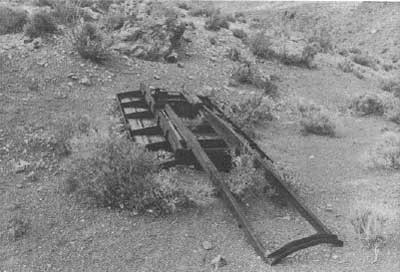
|
| Illustration 205. Remains of mining activity on Saddle Rock property. Photo by John A. Latschar, 1978. |
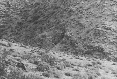
|
| Illustration 206. Adit, Saddle Rock mining claim. Photo by John A. Latschar, 1978. |
A second site examination in 1972 disclosed two 75-foot-deep shafts in fair condition for the first 25 or 30 feet but appearing extremely dangerous below that point. Two 50- to 150-foot adits and some open cuts had been driven on the K.K. and Pima claims, and the latter site also contained a 60-foot adit. The leveled remains of the old mine camp were seen near the center of the property. [306]
(c) Evaluation and Recommendations
The significance of the Saddle Rock Group today lies in its being the site of the initial gold strike responsible for the creation of Skidoo and the evolution of the surrounding mining district Although passing through the hands of several owners, some of whom spent a considerable sum on development work, from the early 1900s on up to the 1960s the mine itself has had no production record and seems to consist only of exploratory workings. The site is considered locally significant and eligible for inclusion within the revised boundaries of the Skidoo Historic District.
(21) Nellie Grant and Uncle Sam Mines
Little information has been found on these mines, permitting only a brief survey of what were some of the very earliest mines in the Wild Rose area. The Nellie Grant and Uncle Sam mines, in the vicinity of Emigrant Spring, were located by W.L. Hunter, whose early presence in the area is attested to by a newspaper statement to the effect that Rose Springs District was
the same where Messrs. Hunter & Porter have been operating for a long time past, and where we are satisfied from all accounts there are numerous silver ledges as promising as any in the whole country. Among them are the Nellie Grant, belonging to Hunter & Porter. . . . [307]
Hunter & Company were working the Nellie Grant Nos. 1-3 in 1874, as well as the Uncle Sam Nos. 1 and 2, North Corner Nos. 1 and 2, the Theodore Wibbeth, and the Silver Bluff. Several men were at work, with development being subsidized by proceeds from the ore. According to the Inyo Independent
The following assays, made by Mr. J.L. Porter and F.F. Thomas, will satisfy any judge of ores as to value: Nellie Grant No. 1, four assays, respectively, $459 62, $659 57, $754 and $479 11; No. 2, $274 81. North Corner, three assays, $212 05, $150 82 and $403 69. Silver Bluff, $180 84. Wibbeth, three assays, $801 33, $493 58 and $95 81, silver per ton. The ore was sold to M.W. Belshaw and Co.'s furnace on the 24th instant. The amount sold was fourteen mule loads, the product of three men for two days, and was from the different mines as follows: Nellie Grant, five parts; Uncle Sam, one part; North Corner, one part; Silver Bluff, two parts. The whole crushed and sampled as one lot yielded $323.54 per ton, silver. Mr. Porter has been at these mines for the last ten days, and he says as far as developed they are the best average prospect that he has ever seen. All are free milling ores, and the country is of such a nature as to admit of large teams going to the mines without any road making. [308]
Mining was facilitated by a plentiful supply of water, but wood had to be hauled about twelve miles from Telescope Peak. [309]
It has been a common occurrence and a prevailing frustration throughout this study that just when this writer feels some progress has been made toward sorting out the many disparate references to a mine, further information turns up that completely invalidates the conclusions. A Nellie Grant Mine appears on the 1877 Wheeler Survey Map Sheet 65D. An 1883 location notice states that an Argonaut Mine was "situated about four and one-half miles South, from the Mouth of Emigrant Canon at what is known as Hunter & Porters rock house near Emigrant Spring & is immediately South of the Jeannetta Mine and is a relocation of the Uncle Sam Mine." That same year a notice of location far the Jeanetta Mine was filed noting "This location is on the West side of Emigrant Canon . . . the same is near Emigrant Spring and is a relocation of the Nellie Grant Mine." [310] By 1884 a local newspaper was referring to the. "Mohawk, Blue Bell and Argonaut mines, formerly known as the North Star, Garibaldi, and Nellie Grant." [311] The Nellie Grant was described here as one of the properties owned by W.K. Miller, J.M. Keeler, and N.J. Medbury. According to Palmer, in Place Names the Nellie Grant was located south of Emigrant Spring. However, a notice of location for the Susan B. Anthony Mine, located on 1 April 1886 by M.M. Beatty and Jos. Danielson, describes it as being north of Emigrant Spring and formerly known as the Nellie Grant. Then on 1 January 1888 Paul Pfefferle and Jos. Danielson filed a notice of location for the Maud S. Mine, "on a line with Emigrant Springs in Emigrant Canon and was formerly known as Susan B. Anthony or better known as Nellie Grant. [312]
An 1889 article on mining mentions the Nellie Grant, "with its big body of free ores" and a nearby spring that furnished enough water for a large mill. [313] In 1896 a Nellie Grant Mine "situated in Emigrant Springs Canon in Wild Rose Mng. Dist. Formerly Known as Emigrant Springs Mine" was relocated by Charles Anthony. [314] In 1906 a proof of labor was filed on an Argonaut Mine owned by W.L. Skinner, but whether this has any relation to the Nellie Grant is conjectural. [315] Further records on the mine were not pursued by this writer.
(22) Junietta Blizzard and Virgin Mines
These properties in the Wild Rose District were also located by W.L. Hunter of Lone Pine around 1877. [316] Interests in them were acquired by W.K. Miller and N.J. Medbury, and the three pursued a course of strenuous development work:
The Junietta has a six-foot ledge which gives an average assay of $50 per ton. There are 100 tons of assorted ore now on the dump that will yield $100 per ton. The Argonaut [Uncle Sam?] joins the Junietta on the south. . . The Blue Belle [Garibaldi] is situated about six miles distant from the two former mines. The Blizzard and Virgin are close to the Blue Belle. The former claim has a four-foot ledge of fine horn silver ore. [317]
The 1884 Report of the Director of the Mint mentions the Virgin as carrying high-grade ores, and states that the Genette [sic], "the best developed of the group, has a shaft 100 feet deep, with a 4-foot vein of free-milling chloride of silver ore . . . and assays from 50 to 100 ounces per ton of silver." [318] In this year Medbury and Miller transferred to J.M. Keeler a one-half interest in the Blizzard and Jeanette mines. [319] No more information was found on these properties, primarily because there was no time for a strenuous search of county records pertaining to them. It can be assumed, however, that Milo Page's assessment of their lives is accurate:
At Emigrant Springs there was also a group of silver mines, yielding ore of high grade, owned by Wm. L. Hunter and J.L. Porter, of Cerro Gordo fame. These, like the Garibaldi claims, received the usual amount, or scarcity, of "development." [320]
(23) Tucki Mine
(a) History
Record books of the Wild Rose Mining District contain a Notice of Location for a Tucki No. 1 Mine, "located about 3 miles NE of Skidoo," dated 12 April 1909, and filed by Henry W. Britt (or Birtt; writing illegible). By the location given it would appear that this is the same property later located by John Millett, Samuel E. Ball, and Charles G. Walker in September 1927 encompassing a group of claims about 2-1/2 miles southwest of Tucki Wash and 4 airline miles north-northeast of Skidoo. If so, the area's early activity must have been sporadic and inconsequential, for no information on it has been found. By October 1927 an Edward R. Attaway was deeded a one-fourth interest in the Tucki and Tucki Nos. 2, 3, and 4 mining claims. [321]
Specific details even on these more modern mining operations at the site are negligible until the 1930s, when a few newspaper articles appear recounting progress there. In 1937 Ed Attaway and Sam Ball, at least, were working the gold mine and trucking their ore to Death Valley Junction for shipment to the smelter. By 1938 ore from the Tucki Mine was being treated by Roy Troeger in the fifty-ton cyanide plant of Keeler Gold Mines, Inc. [322] Four months later, in August, Attaway and Ball gave a lease/bond agreement on the property, referred to as the Tuck-I Mine, to the Lane Development Company of Hollywood for a total consideration of $25,000. According to the newspaper article on the transaction, the two lessees had been working the property for the past fourteen years and shipping ore running $100 to $700 per ton. Roy Journigan became part owner of the mine, along with Ball and Attaway, by April 1939, and these three proceeded to lease the property to a Felix Castro, Fred Bunting, and Fred Mastagan. [323]
A year later the Tucki, still owned by Attaway, Journigan, and the Sam Ball estate, was handed over in another lease/bond agreement to Warnken, Potter, and associates. Working six men, Potter began securing a return of about $846 in gold every two weeks. By 1951 the Tucki Mine included four unpatented lode claims owned by Journigan and Attaway. Workings comprised an inclined shaft and several drifts. The earliest openings on the property were the two adits northwest of the shaft. Total gold, production to that date is unknown, but from August 1940 to April 1941 lessees had sold $5,200 worth of ore averaging $20 per ton, with a gold content ranging from $12 to $60 per ton. Immediately prior to 1940 ore recovered at the mine had been sent to Journigan's Mill in Emigrant Canyon for processing; after that year it was treated in a small cyanide plant on the property. The Tucki was idle in the early 1950s and continued that way for the next several years, Journigan evidently deciding to keep the property in abeyance while waiting for an increase in the price of gold. [324] Activity continued in suspension throughout the 1960s, with only occasional visits to the site by Journigan each year.
Early in 1974 Russ Journigan relinquished the Tucki No. 4 and 44 mining claims adjacent to the Tucki Mine, retaining only the Tucki, Tucki No. 2, and Tucki No. 3 property originally located in 1927. At this time he and his wife held complete title to each of the three claims on which most of the development and production work had been done through the years. In 1975 the Journigans and the Barnetts, affiliated as the Tucki Mining Company, decided to, reopen the mine and begin construction of a gold recovery plant to leach oversized material from the old tailing dumps and process it by the carbon filtration method. The process was a complicated one: material from the source dump below the plant was fed via a chute into a 10-1/2-inch jaw crusher and then into an 18-inch cone; from there the crushed ore was conveyed by dump truck to the vat storage bin. A solution of the old tailing material would be circulated through activated charcoal cartridges, there being one cartridge for each of the four concrete leach vats. A sand/gravel bed in the floor of each vat was to filter the pregnant solution. Counter-circulation of sodium hydroxide would strip the gold from the cartridges, and it would then be precipitated. The two-man operation required 1,000 gallons of water per day, and this had to be transported by truck from Panamint. Springs, thirty-four miles to the west. The water and solution were stored at the site in 12,000- and 18,000-gallon swimming pools. A front-end loader emptied the vats by removing their steel end gates, a single one being unloaded and reloaded in less than a day. Allowing a percolation rate of eight days, production was projected at twenty-five tons a day. [325]
Although this operation was expected to take four years, only a few dozen ounces of gold were actually recovered. The crusher and other miscellaneous equipment were finally removed in March 1976. By May Journigan was leasing the mine to Barnett and a partner for a percentage of the gross; these latter two contemplated continuing the leaching process using zinc instead of carbon in the refining of the ore. They were also hopeful that by driving a new adit to intersect the main inclined shaft they could open the lower workings and stope the upper ones and still make the operation pay. By the summer of 1978 Journigan had evidently acquired new financial backing and anticipated continuing mine operations, but work was suspended during the monument moratorium on mining.
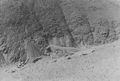
|
| Illustration 207. Tucki Mine, 1975, showing leaching operation and mine camp. Photo courtesy of DEVA NM. |
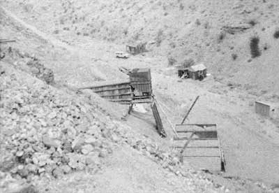
|
| Illustration 208. Tucki Mine, 1978. Cabins in ramshackle condition and much debris on site. Photo by Linda W. Greene, 1978. |
(b) Present Status
The Tucki Mine is located on Tucki Mountain and is reached by an unimproved 10-mile-long dirt road from Emigrant Wash. It has been basically an underground operation that has produced some ore from shallow stopes. The last recorded production was in December 1971. Although no figures for total production have been found, mine receipts from gold bullion delivered in 1941 amounted to almost $18,000. [326]
Today the site contains cabins, concrete pads, and sheds ranged along the east side of a narrow gully, and assorted mine workings covering the west hillside. The residences still contain furniture and household goods and the sheds and workshops are full of small supplies used in the leaching process. The workings themselves include a fairly modern large ore bin, four fifty-ton leach tanks, measuring nine feet by twenty feet by six feet, and further south against the hill the ruins of a chute and a concrete platform that once held a building connected with the crushing operations. Sprawled over the hillside are the remains of older diggings--adits, an inclined timbered shaft, and an old ore chute.
(c) Evaluation and Recommendations
The Tucki Mine is not considered eligible for inclusion on the National Register, possessing no associative significance and no buildings, structures, or objects of historical importance.
(24) Telephone Spring
(a) History
Telephone Spring is located toward the north end of Telephone Canyon in the northern Panamint Range, about four miles northwest of Skidoo and slightly over three miles directly north of Emigrant Spring, on the southwest slope of Tucki Mountain. The canyon, actually more of a wash, derives its name from the Rhyolite-Skidoo telephone line, constructed in March 1907, that passed through here on its way to the telephone station that had been established at Stovepipe Springs (old Stovepipe Wells). By 1909 this wash had been graded to accommodate a light freight road between Rhyolite and Skidoo that shortened the trip to about forty miles, twelve to fifteen miles less than by the old route via Emigrant Spring. [327]
Although entrance to Telephone Canyon is now possible via a washed-out and barely discernible road entering the Emigrant Canyon Road about 1-1/2 miles south of its junction with California State Highway 190, during the Skidoo era the trait undoubtedly led from the canyon directly onto the flats toward the sand dunes and Stovepipe Wells. In 1910 Telephone Canyon was suggested as one segment of "Alkali Bill" Brong's proposed auto service between Rhyolite and Skidoo. Under this plan, two men would be kept busy at Stovepipe cutting mesquite with which to surface the road so that autos could, pass. The Skidoo Mines Company would then, under contract, construct the auto road through the canyon, a modicum of safety being afforded by its accessibility to the phone line in case of trouble. Two men and two cars were expected to make the trip, in eight hours, each carrying three tons of perishable supplies daily in both directions. The service could also include mail and passengers. Whether this service was ever, actually implemented is unknown. [328] Trails leading off the Telephone Canyon road ended at various small mining operations along the slopes of Tucki Mountain, [329] while a well-defined branch road leads off in a southeasterly direction toward the Tucki Mine about nine miles further up the road.
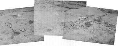
|
| Illustration 209. View east toward wash of mill ruin at Telephone Spring. Note arrastra and diversion channel to right leading muddy mixture of crushed ore and water to pond disposal area behind embankment in lower left corner. Note also masonry water tank support in center and other stone foundations to left of picture. Photo by Linda W. Greene, 1978. |
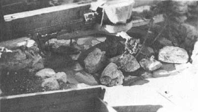
|
| Illustration 210. Arrastra gold mill at Telephone Spring, 1934, "still in use." Photo by A.E. Borell, courtesy of DEVA NM. |
(b) Present Status
The Telephone Spring area at one time supported a small mining operation, possibly during the Skidoo era, but more probably during the revival of mining activity in this region during the 1930s. Strangely, no mention of who built the large arrastra whose ruins are found here, or when, has been found by this writer. According to the caption on a monument photo of the structure, it was definitely operating in 1934.
The mill lies on the edge of the wash, and therefore is quite susceptible to erosion. Nevertheless, the site, embracing a large arrastra basin with a flume or drainage channel leading off toward three tailing dams, a shallow cement trough for holding a water tank, some leveled terraces overlooking the arrastra, and several machinery pilings and stone foundation walls, appears in remarkably good condition. Farther upstream (south), on the west side of the wash, are some stone tent foundation levels and a crude shelter set against the wall and fashioned from F.W. Woolworth packing crates. Purple glass and fragments of insulator from the telephone system have been found on various parts of the site, indicative of activity prior to 1920.
(c) Evaluation and Recommendations
It is conceivable that the packing crate shelter and stone foundations in Telephone Canyon are indicative of limited settlement in the area, dating from the pre-1917 period of activity at Skidoo when the route through here served as an important link in the Skidoo-Rhyolite transportation and communication system. It is the writer's opinion, however, that the mill was probably a later addition of the 1930s, a conjecture based on several factors: the surprisingly undamaged condition of the dams and stone walls; the fact that the operation was machine driven and fairly extensive in size; plus the later date on the monument photo of the arrastra. The lack of information available on the mill is its most puzzling aspect.
The Telephone Canyon ruins contain another good example of a machine-driven arrastra used within the Panamint Range in the 1930s. It is difficult to determine whether the site was as complex an operation as the one at Warm Spring since all its machinery, has long since been removed. The mill's location within Telephone Canyon, which has interpretive significance itself as the route of a freight road and phone line between Skidoo and Rhyolite--the latter project being one of the more interesting engineering feats of Skidoo's heyday and one on which little has been written--justifies the recommendation that this stretch of the canyon containing the mill and tent foundation levels be left to benign neglect.
(25) McLean Spring
A brief mention should be made of the McLean Spring site, slightly over seven miles east of the Stovepipe Wells Hotel and adjacent to Burned Wagons Point. According to one writer who visited the scene, a faint trail could be discerned passing south of the spring, and also in the vicinity were three wooden footbridges, indicating semi-permanent occupation or at the very least fairly heavy travel through the area. This same source states without hesitation that a "trading post" existed here in the early 1900s to cater to prospectors, presumably crossing over into the Panamint Range or merely passing between the northern and southern sections of the main valley. [330] Wooden bridges would certainly be necessary if people were attempting to carry on business over any extended period of time on this sandy plain that can become quite sticky and intractable, especially during rainstorms. Burr Belden also asserts that historically a trail led south from old Stovepipe Wells to Salt Creek and McLean's Well, and from there a path ascended the Panamints via Blackwater Canyon. [331] No mining camp paper or other source found by this writer mentions a supply point at McLean Spring, but some operation of more than temporary status appears to have existed here as evidenced by the wooden bridge remains. They should be left to benign neglect.
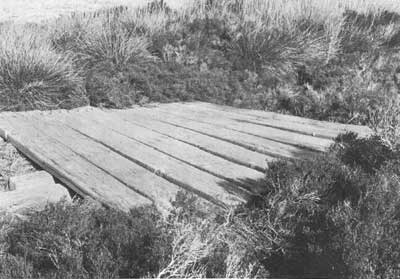
|
| Illustration 211. Bridge to trading post (?) standing at McLean Spring around 1902. Photo courtesy of G. William Fiero, UNLV. |
(26) Lemoigne Mine and Junction Camp
(a) History
i) John Lemoigne Arrives in Death Valley
The stark, simple beauty of Death Valley has often captured the imagination and the hearts of unwary visitors and held them in its spell for their lifetime. Such an unwitting victim of this desert magic was Jean Francois de Lamoignon, born in February 1857 at Lamoignon, France, and educated in England, Paris, and Germany as a mining engineer. [332] As seems to be the case with all Death Valley folk heroes, controversy and irreconcilable discrepancies surround every aspect of his life in the region. Initial disagreement arises over the date of the tall, white-bearded, genial Frenchman's arrival in the Death Valley region and the impetus behind his long journey. While some sources suggest that he served as a sailor before coming to America to work in the mines around Darwin in the early 1870s, it has been most commonly assumed that he arrived here around 1882 to 1884 at the behest of Isadore Daunet, who, hearing about the young mining student through mutual friends, suggested that he take over supervision of the new borax works in the southern part of the valley. [333]
By the time Lemoigne arrived in this country, however, Daunet had taken his own life, depressed by the failure of both his business venture and his recent marriage. [334]
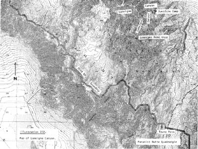
|
| Illustration 212. Map of Lemoigne Canyon. |
Once in this country, and possibly forced to stay by a lack of money, Lemoigne quickly became Americanized and acculturated, dropping his aristocratic name and donning the garb and life-style of a Death Valley prospector, although never completely losing his distinctive aura of education and intellect. Reportedly meeting some Indians in the Cottonwood area of the Panamint Range and learning from them the location of a silver-lead mine at which they fashioned bullets for their muzzle-loaders, he filed on this property, known as the Bullet Mine, about 1882, although one source stated it was not located until 1887. [335]
Lemoigne covered a lot of territory in his peregrinations throughout the California and Nevada mining districts, prospecting from Barstow, California, east toward Virginia City and Ely, Nevada, and west toward the high Sierra Nevadas. He seems to have had fairly good luck, for his name is connected with several claims in the Death Valley region alone: the Uncle Sam Lode in the Panamint Mining District, located 11 April 1880 (which, as mentioned, would seem to imply that Lemoigne did arrive prior to Daunet's ill-fated borax venture); the Independence, located on 14 January 1884, and the Alaska, discovered on 24 January 1884, both in the Union Mining District; the Washington, Robespierre, and Lafayette, located 28 April 1885, in the Deep Spring Mining District; and the Egle and Union mines, two relocations on 3 January 1887, and the Bullion, Stare, Hop, and Ouray, discovered 4 February 1889 in the Furnace Creek Mining District. [336] In early 1890 Lemoigne and Richard Decker were involved together in a chloriding operation at the Hemlock Mine near old Panamint City, though five years later he was working his lead mine and talking some of erecting a smelter for his ore near Keeler. By 1896 he had filed location notices for three quartz claims in Cottonwood Canyon. [337]
ii) Lemoigne Properties
It is rather difficult because of the variety of locations given to determine the exact extent of Lemoigne's holdings. His lead mine, which remained active through the 1950s, was located in present-day Lemoigne Canyon. According to Crampton, Lemoigne's silver prospect, complete with shack, was located north of Skidoo, and it was this property that actually supported him and paid his bills and grubstakes. [338] This is at variance with Southworth's assertion that "He [Lemoigne] was known to depend entirely upon his highgrade silver property in Lemoigne Canyon whenever ready funds ran low." [339] George Pipkin states that Lemoigne opened the "LeMoigne Silver Mine at the extreme north end of the Panamint Mountains in Cottonwood Canyon," and also discovered lead "in what is known today as LeMoigne Canyon northwest of Emigrant Springs. LeMoigne's silver mine could have been the 'Lost Gunsight Lode'. . ." [340] The 1896 location notices indicate that he did have property in Cottonwood Canyon, and, indeed, evidence of mining activity was found here in 1899 where
the ruins of an old log cabin stand near to where considerable work has been done in former years by some prospectors. A large pile of lead ore lies upon the dump. Cuts have been run and shafts sunk. [341]
In 1897 Lemoigne's property was mentioned as one incentive for construction of a transcontinental route from Kramer Station on the Santa Fe and Pacific line to Randsburg and on to Salt Lake City that would tap the untouched mineral resources in the Panamint Valley area. It would, it was argued, facilitate shipping from the Kennedy Antimony Mine at Wild Rose, the Ubehebe copper mines, and would put within reach "the apparently inexhaustible 'low-grade'--worth $50 per ton, with lead accounted at 54 per lb and silver at 70 per oz.--argentiferous galena ores of Cottonwood, known as the Lemoigne mines." [342]
In 1899 Lemoigne found a large body of high-grade lead ore on his property, but was still hindered by transportation problems and hoping for completion of a railroad into the area so that large quantities could be shipped at a profit. The lead mine was producing so well in 1904 that it was reported that Lemoigne had gone to San Francisco to negotiate its sale: "This property is said by experts to be the biggest body of lead ore ever uncovered on the coast." [343] Reportedly any grade of lead, up as high as 75% even, could be obtained by handsorting, the silver content varying from 15 to 83 ozs. and gold from $5 to $20. [344] The sale was not consummated, however, and perhaps this was the basis for the oft-repeated tale of how old John, reasserting his often-voiced contempt for negotiable paper, turned down several thousand dollars for his mine because he was offered a check instead of cold hard cash.
Lemoigne was reputedly a very simple, honest man with no particular need or desire for life's luxuries. Money was relatively unimportant and only necessary to finance his long prospecting trips or to grubstake one or another of his friends. Since it appeared that he would be returning periodically to his lead mine, Lemoigne proceeded to erect a stone cabin there. Frank Crampton recalls:
Often I stopped at the lead prospect, almost as often as at the silver prospect Old John worked, alternately with the lead [the mine near Skidoo). In the old stone cabin (house I presume might be better) he passed some of his time particularly when the weather was cold. He had built the stone house soon after he discovered the lead outcrops and realized they were good possibilities of ore. It was winter he told me when the stone house was built and water could be had from a creek bed that flowed some water. In the spring when the water either was insufficient, [sic] after his first winter at the lead prospect he went up the canyon and built himself a shack. In the shack was the shelf of classics, French, German, English, which he dusted every day and often when I remained a few days with him he would read one of them, as I did also. [345]
iii) Lemoigne Castle at Garlic Spring
In addition to the monetary sustenance afforded him by his mine, Old John also thrived on the goodwill of a host of fellow miners in the surrounding desert region, who considered him a gentleman and true friend. Their ready offers of food and friendship were reciprocated by John's grubstaking offers. Sometimes this generosity brought amazing and unwelcome results.
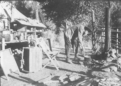
|
| Illustration 213. John Lemoigne, about 1915. From Dane Coolidge Collection, courtesy of Arizona Historical Foundation. |
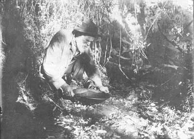
|
| Illustration 214. John Lemoigne, about 1915. From Dane Coolidge Collection, courtesy of Arizona Historical Foundation. |
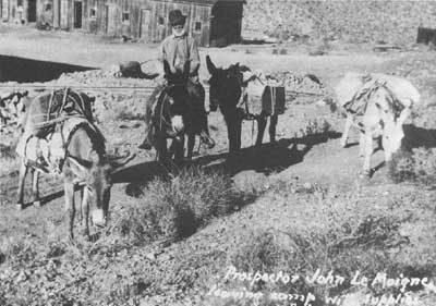
|
| Illustration 215. John Lemoigne, no date. Photo courtesy of DEVA NM. |
One of the stranger stories connected with John Lemoigne and that sounds as if it might have enjoyed some slight embellishment at the hands of Frank Crampton, who first reported it, concerns a construction project at Garlic Spring on the old road between Barstow and Death Valley, where Lemoigne was camped around 1914. Two men whom he had grubstaked brought him a contract to sign, having not only located a mine but also attracted a buyer. Firm persuasion was required to secure Lemoigne's reluctant signature on the necessary instruments, and his worst fears were soon realized when to his acute embarrassment a steady flow of grubstake profits began pouring in. Because of his strong distrust of banking institutions, Old John persuaded the local storekeeper to take charge of these funds, but that individual soon became nervous because of the large sums he was being entrusted with and the proximity of Barstow and its rough-neck railroad men and other strangers who might be tempted to avail themselves of these riches in an ungentlemanly manner.
To remedy the situation the storekeeper's wife suggested that she be allowed to construct and furnish a large house for John in the area and thereby utilize the money. Consent was reluctantly given the lady, who proceeded to supervise the erection of "Old John's Castle," a monstrosity that daily grew more unwieldly and unattractive. What she lacked in expertise in architectural design and construction, she compensated for in flamboyance and general bad taste. The large, two-story square building soon sported turrets, a spire, dormer windows, gables, and a multitude of chimneys. A covered porch surrounded the bright red structure on four sides, and the whole was accented by green-trimmed windows with blue shutters. Dozens of mail order catalogs were perused, resulting in acquisition of heavy oak furniture, a completely furnished library, a huge kitchen with hot and cold water, wallpaper, and fine carpeting. Pre-dating Scotty's Castle, this structure reportedly displayed none of the latter's fine attributes, and was considered nothing more than a white elephant by its owner. The only way to forget such a structure is to blow it off the face of the earth, and that is precisely what Old John did one night with the aid of several boxes of dynamite. [346]
iv) Controversy Surrounding Lemoigne's Death
That incident, if true, was about the only undignified moment in Lemoigne's life, which came to an end tragically in 1919. In death as in life Lemoigne has been the subject of considerable controversy. Many cannot even agree on the date of his demise, while, as Southworth writes, the number of people who claimed to have found and buried John Lemoigne reads like a Who's Who of the desert region. Why Old John was heading toward Furnace Creek Ranch, or away from it, is not definitely known, although reportedly he had not been feeling well for some time and was journeying there to seek medical advice. Whatever the reason, he never reached his destination. According to Crampton he and Shorty Harris found the body lying under a mesquite bush about nine miles northwest of Furnace Creek Ranch near Salt Well. Apparently overcome by the heat or a sudden heart attack, Lemoigne had been unable to untie his burros, who perished with him. Proving his personal involvement in the event, Crampton says, are pictures he took of Old John and one of his burros as they lay when found. Reporting the incident at Furnace Creek Ranch, Crampton and Harris returned with Harry Gower, Oscar Denton, Tom Wilson, and a couple of other Indians for the burial, with Gower carving a grave marker. [347]
According to Harry Gower, however, it was Death Valley Scotty who found Lemoigne eleven miles north of Furnace Creek and returned to the ranch to report it. Upon receiving the message at Ryan, Gower contacted the coroner at Independence and was told to go ahead and bury the body. Arriving at the scene with an Indian companion, Gower found the body partially eaten by coyotes and John's gold watch hanging in a mesquite bush. Because of the hardness of the ground and the intense heat, the grave was only dug about two feet deep and was quite narrow. Lemoigne was wrapped in a blanket and lowered into the grave, over which a mound was erected and marked with stones and a board. Gower later sent the coroner the watch and a bill for $40 to cover costs of the burial detail. Gower states he was told later that Scotty felt he should have gotten the money, but no words ever passed between the two on the subject. Cower evidently did have some strong feelings about Crampton's declared part in the whole affair:
The guy who is going to have a tough time getting squared with me is the alleged author who claims to have been associated with Le Moigne, and buried him on the desert. If he gains a bit of notoriety by his statement I have no objection as I got paid for my work. I'm sore because I doubt if he ever had the guts to dig a hole two feet deep in Death Valley in August. [348]
Adding further confusion is Scotty's version:
In June 1918, I found him [Lemoigne} stretched out dead. He must have been on his way to Furnace Creek with his burros. I dug a hole and buried him right there by a clump of mesquite. Then I went on to Furnace Creek to give the notice. Cost me twenty dollars for feed for my string of mules. Gower got the ten-dollar fee for burying old John when the work was already done. I got nothing! [349]
In 1922 when Sarah Perkins traveled through Death Valley, she by chance stumbled upon a sun-bleached board set in the sand. Written on it in pencil, she said, were the words "John Lemoign, Died Aug. 1919." Nearby were the skeletons of two burros and a coffeepot beside a fireplace. This supports Gower's contention that he buried John in August 1919, and pretty conclusively disputes Southworth's romantic statement that "in deference to Old John, who always believed his burros were human, each body was buried in a separate grave." [350] At the time of his death John Lemoigne's estate was valued at about $10.00 after all expenses were paid. [351]
v) Later History of the Lemoigne Mine
Because no heirs were known to exist, Beveridge Hunter and Bill Corcoran relocated Lemoigne's eight mining claims, soon, disposing of the property to a W.J. Loring and associates. Because of the area's remote location, Hunter and Corcoran realized they would either have to sell the mine outright or enlist the cooperation of someone with the investment capital necessary to turn the property into a paying concern. A Brandon & Co. of Boston had an option on the group, but Brandon was killed before a sale could be consummated. Corcoran and Hunter then managed to interest Harry C. Stemler and Associates of Tonopah, who were in some way connected with the Loring interests, in the property, but they insisted on visiting the mine before making a firm decision. Despite a harrowing experience during the return from the mine, during which Stemler and Corcoran almost died from thirst and exhaustion, the former decided to take a bond on the property. The claims deeded to him in Lemoigne Canyon were the Blossom, Captain, Captain No. 2, Captain No. 3, Hunter, Atlantic, Pacific, and Sunshine. [352]
In August, despite the heat, Corcoran was told to take charge of development work and intended despite the 132-degree temperature to begin a force immediately at three places on the ledge; ore would be hauled to Beatty by tractor across the floor of Death Valley. Incentive to begin operations was provided by an engineer for the Loring interests who declared that the ore in the mine would average 61-1/2% lead for the full length of the three claims, and who also estimated that there was $2,500,000 worth of ore in sight. Development work already consisted of a twenty-five-foot tunnel previously excavated by Hunter and Corcoran and a twenty-five-foot-deep shaft, plus several cuts made to keep track of the vein's course and of the consistency of its values. [353]
The eight claims acquired by Stimler were later quitclaimed to the Interstate Silver Lead Mines Corporation of Nevada, but by 1923 a W. R. McCrea of Reno and a John J. Reilly, who once leased on the Florence Mine at Goldfield, were developing the property, on which they held a lease with option to buy, and were driving a crosscut tunnel to intersect the rich ledge. [354] In May 1924 it was thought that the main lode was discovered when a rich strike, "bigger than anything before encountered in any of the workings at the mine," was made on the Birthday Claim west of the old workings. [355]
By June Corcoran had purchased more machinery for the mine and, in addition, all the buildings and pipelines belonging to Carl Suksdorf at Emigrant Spring, with plans underway to make this one of the biggest lead-producing mines in the western United States. A year later John Reilly had organized the Buckhorn Humboldt Mining Company and had purchased the Lemoigne Mine from Corcoran and Hunter for a substantial amount of cash and stock. McCrea became the company's manager and principal owner and, later, president, after Reilly's death in March 1925. Immediate plans were made to construct an eight-mile auto truck route to the Trona-Beatty Road in order to facilitate shipping to the smelters. Four leasers were also working on ground near the company property, though by April the number had increased to ten, forcing two trucks to leave every day loaded with shipping ore. Property of the Lemoigne South Extension Mining Company (composed of Messrs. Turner, Burke, McDonald, Clark, and Smith) adjoined the Lemoigne Mine proper and was uncovering ore running up to 80% lead. [356]
Development was still being steadily pushed by the Buckhorn Humboldt people in the spring of 1926 to uncover the large amount of high-grade ore in sight as well as the vast quantities of low-grade milling ore that seemed to be present. Several lessees were at work, notably on the Miller Lease and the Dollar Bill Matthews ground. By May only four sets of leasers were operating, and the number was evidently reduced to three by June. [357] In 1926 the California Journal of Mines and Geology described the mine as located in the LeMoigne District and still owned by the Buckhorn Humboldt Mining Company. It was under lease to L.P. (?) McCrea, M. L. Miller, and associates of Beatty, Nevada. A twenty-five-foot tunnel had been driven west in the canyon north of the main camp and was intersecting an ore lens from which 150 tons of ore had been shipped running 50% lead and three to five ounces of silver per ton. South of these workings on a ridge above Lemoigne Canyon a 165-foot tunnel had developed a lens from which 100 tons of ore had been shipped averaging 50% lead with five ounces of silver per ton. The ore was being hauled by truck to Beatty at a cost of $18 per ton. Two men were employed at the mine. [358] The property must still have been active in 1928, because in May of that year Margaret Long mentions a road that was washed out and would have to be regraded by the next truck through to Lemoign." [359]
McCrae and the Buckhorn Humboldt Mining Company continued to hold the Lemoigne Mine from 1937 through 1948, although by 1938 the twelve claims were reported as idle. [360] Bev Hunter later refiled on the property, subsequently leasing it to W. V. Skinner of Lone Pine, who produced a little ore in 1953. By 1962 Roy Hunter was evidently attempting some sporadic mining activity at the old mine. Total production from the property was said to have a gross value of approximately $38,000, realized from the shipment of over 600 tons of ore containing 30% lead, 7% zinc, and 4 ozs. of silver per ton. During its active lifetime up to 1963, the Lemoigne Mine was developed by about 600 feet of workings taking place on three levels and one sublevel, which were connected by a vertical shaft, and by three stopes. The shaft on the property had been extended to about eighty feet in depth. [361] Again in 1974 mining activity resumed on the site, and by December 1975 a Harold Pischel was working on a previously unexplored hillside looking for sulfide ore. Material reportedly carrying 14 ozs. of silver per ton was being stockpiled at the adit entrance. [362]
(b) Present Status
The Lemoigne Mine is located in Lemoigne Canyon, the southernmost canyon of the Cottonwood Mountains, which form the northerly extension of the Panamint Range. The claims, ranging in elevation from 4,950 to 5,700 feet, are reached via a jeep trail, crossing an alluvial fan, that is often subject to severe washing and that trends north off of California State Highway 190 approximately three miles east of the Emigrant Ranger Station. The claim area is reached after about 9-1/2 miles of very rough 4-wheel driving. This writer was unable to personally view the mine because the road into Lemoigne Wash was barely visible following a series of heavy downpours in the area during the early fall of 1978. The site was visited by. the LCS crew in 1975 and the following account of structures found is based on their data and on that collected during an archeological reconnaissance of the area. [363]
Near the junction of the North and South forks of Lemoigne Canyon are the remains of a campsite appearing to date from the 1930s. Only a leveled tent site and assorted debris were found. On up the road at the entrance to the Lemoigne claim the trail forks again into two short smaller canyons, both showing evidence of occupation by man. The southern or left one contains a relatively new corrugated-metal structure with a nearby pit toilet, a metal trailer, and the only structure of real historic significance in the area--the rock cabin built by John Lemoigne in the 1880s. This latter is a partial dugout, carved into the bedrock and lined with wooden cribbing. The front is part stone and part wood, with flattened five-gallon metal cans being used for paneling in some areas. Shelves are built into some of the walls, which tends to verify this as Old John's home:
When Jean arrived in America, he had with him volumes of the classics in French, English, and German, which he kept on shelves in the stone cabin he built below his lead prospect in a canyon west of Emigrant wash . . . . [364]
The cabin structure itself is intact but filled with garbage and debris. Crampton states that when he visited Lemoigne's lead property around December 1919 the cabin had already been rifled of everything of value. [365] Beyond these buildings the road leads to an active mine adit surrounded by some five other small adits dating from an earlier period.
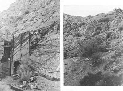
|
| Illustration 216. View showing tramway, mine dumps, and ore bin in fork of Lemoigne Canyon. Photo courtesy of William Tweed, 1975. |
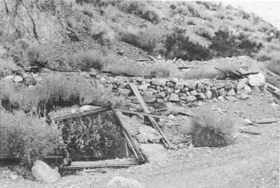
|
| Illustration 217. Foundations of building and debris at site below ore bin in picture above. Photo courtesy of William Tweed, 1975. |
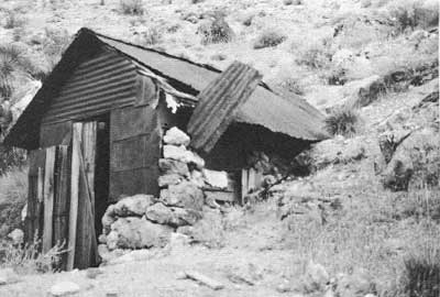
|
| Illustration 218. Stone dugout of John Lemoigne in Lemoigne Canyon. Photo courtesy of William Tweed, 1975. |
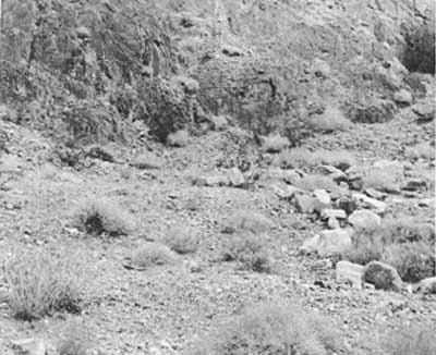
|
| Illustration 219. Leveled site at Lemoigne Canyon junction camp. Photo courtesy of William Tweed, 1975. |
The northern canyon fork leads up past the site of at least four leveled habitation sites, about eight feet square, either for tent houses or wooden buildings, set against a cliff and about one-tenth of a mile below a one-chute ore bin. Wooden boards, stove parts, and old bedsprings were found scattered through the area. The ore bin is in a narrow box canyon and at the foot of a rail tramway descending on a very steep incline from a mine tunnel on the ridge above. The tramway was controlled by a gasoline-powered winch still in place at the entrance to the tunnel.
(c) Evaluation and Recommendations
The Lemoigne silver-lead-zinc Mine was probably first worked in the late 1880s, though the exact location date was not found by this writer. The mine was only sporadically worked by Lemoigne, who spent most of his forty years in the Death Valley region searching for minerals and performing assessment work for fellow miners. A newspaper article in 1923, in fact, mentioned that Lemoigne had confined his development of the area to shallow surface holes. [366] According to a recent study of the claims, they have been developed through the years by about 1,300 feet of workings. Most ore removed was high-grade, the many low- and medium-grade pockets being considered economically infeasible to mine during the 1920s when the mine saw its highest production rate. According to a 1976 report, the total value of all metals recovered at the Lemoigne Mine, based on January 1976 prices, would be about $116,000. [367]
The historical significance of this site is not based on the volume of ore produced at the mine or on its monetary value. Its importance lies in its early discovery date and especially in its associations with John Lemoigne, considered by many to be the dean of Death Valley prospectors. It is not that Old John is completely forgotten--his lead mine is shown on the USGS Panamint Butte quad at the end of a canyon that also bears his name. His gravesite is marked on the Chloride Cliff quad just south of the Salt Springs jeep trail. (Attempts to locate the site by this writer were unsuccessful, though the wooden cross was still in place in February 1973.) It is simply that he is often overshadowed by the braggadocio of such highly-publicized wanderers of the desert as Death Valley Scotty and Shorty Harris. Leomoigne was a completely different breed, more attune in tastes and life-style to Pete Aguereberry, the other transplanted Frenchman in the valley who, like Old John, stayed to pursue a quiet and uneventful life in the desert they both loved so well.
Lemoigne's biographer, Frank Crampton, expressed his appraisal of the man this way:
Old John typified the breed of prospectors and old-timers and the Desert Rats who centered on Death Valley. Few, if any, did any prospecting of any consequence in the valley, they were not looking for non-metallics but for gold, silver, lead, copper or one of the other of the lesser metals. Death Valley was not the place where metals were found in paying quantities and the breed knew it . . . . Old John was the best of them all. He had the knowledge of a highly educated man, and the fortitude to accept the fate that had befallen him when he arrived at Death Valley and learned that Daunet was dead. But the greatest of all attributes was that he loved the desert, and Death Valley best of all, and without effort adapted himself to it. Old John Lamoigne [sic] deserves imortality [sic] He was the epitome of them all and represents the best of a breed of men who are no longer. [368]
Because the Lemoigne Mine was the scene of some of the earliest mining activity within the monument and the home of John Lemoigne until his death in 1919, the mine area and the stone cabin that Lemoigne built are considered to be locally significant and eligible for inclusion on the National Register. The leveled tent or house sites and ore bin in the box canyon probably date from the 1920s era of mining activity when the mine was being developed and was shipping ore. Some sort of camp had to have been situated here to house the Buckhorn Humboldt Mining Company employees and the various lessees. Based on the 1975 LCS research notes, these structures are not considered significant.
An interpretive marker near the stone cabin identifying the site would be appropriate. The tent foundations and old ore bin should be mentioned as probable vestiges of early twentieth-century activity in the area. An exhibit at the visitor center might dwell further on Lemoigne's life, emphasizing his long tenure in the valley, his knowledge of the classics, and his degrees as a mining engineer--traits which set him apart from his desert comrades.
Attempts were made by this writer to determine the extent of mining enterprises in Cottonwood Canyon further north where Lemoigne had filed on some quartz claims in the late 1880s. An arduous all-day hiking trip failed to turn up any signs of such activity. A monument employee, however, stated that about 1976 the remains of two buildings were found at Cottonwood Springs. One corrugated-steel and tin shack contained a wood-burning stove and a set of bedsprings. No evidence of mining was seen in the immediate area, and no prospect sites are shown on the USGS Marble Canyon quad.
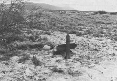
|
| Illustration 220. Grave of John Lemoigne near Salt Springs road. Photo courtesy of G. William Fiero, UNLV, 1973. |
| <<< Previous | <<< Contents >>> | Next >>> |
deva/hrs/section3b.htm
Last Updated: 22-Dec-2003