|
MANZANAR
Historic Resource Study/Special History Study |

|
CHAPTER SIX:
SITE SELECTION FOR MANZANAR WAR RELOCATION CENTER — HISTORICAL BACKGROUND OF OWENS VALLEY AND MANZANAR VICINITY
In March 1942, a site in Owens Valley, approximately five miles south of Independence, California, was selected by the U. S. Army for establishment of a reception or assembly center for persons of Japanese descent who were to be evacuated from the west coast. Located on lands that had been settled by a fruit-growing community known as Manzanar during the early 20th century, this site would become known as the Manzanar War Relocation Center. Although this site's historical significance is based primarily on the events that occurred here during World War II, the historical development of the Manzanar vicinity and Owens Valley provide insights into the settlement and growth of a little-known chapter in eastern California history.
SITE SELECTION
Two principal sources provide explanations for the military's decision to locate a reception or relocation center in the Owens Valley in March 1942. The first is the Project Director's Report, prepared in February 1946 by two men who would play influential roles in the development and operation of Manzanar. The two men were Robert L. Brown, who became reports officer at Manzanar on March 15, 1942, and later served as assistant project director at the relocation center from January 1943 to February 1946, and Ralph P Merritt, who served as project director at Manzanar from November 24, 1942, until the center closed on November 21, 1945. [1] The second source is a report written in early April 1942 by Milton E. Silverman, a feature writer for the San Francisco Chronicle, who was given a 60-day assignment by the Western Defense Command to investigate the relocation center operations of the Wartime Civil Control Commission. [2] Although the two reports offer some conflicting viewpoints on the events surrounding the Manzanar site selection, they corroborate each other in the essential details of the decision.
The Brown and Merritt report noted that the Manzanar site was located in Inyo County in the Owens River Valley, approximately 230 miles north of Los Angeles. A "long, narrow, semi-arid valley bounded on the west by the towering Sierra Nevada mountains and on the east by the colorful, but not quite-so-high Inyo mountains," Owens Valley had "a colorful history having been the scene of one of the great 'water-wars' of the West."
In the early years of the 20th century, the City of Los Angeles "in its quest for water turned to the steams flowing down the eastern slopes of the Sierra" in Owens Valley and "conceived and built a 230 mile aqueduct to carry these waters to its rapidly expanding boundaries." During the next two decades, Los Angeles, through its Department of Water and Power (LADWP), purchased "most of the land in the Owens Valley to protect this source of water [i.e., the water rights], and, as a consequence. forced most of the land to revert back to semi-arid desert land." "A few cattle and sheep men were given grazing leases, the farmers moved away, and the towns shrank to semi-ghost towns."
In the 1930s, "with the advent of better roads and increased population in Southern California," however, Owens Valley "began to be visited by vacationists looking for recreation spots during the summer months)." This "early trickle" of tourists "kept the towns from complete annihilation, and pumped new hope into the veins of the merchants who had refused to leave." "New leadership," according to Brown and Merritt, "began to focus the spotlight of national publicity on the injustices perpetrated by the City of Los Angeles." During the late 1930s, a "great wave of interest in Inyo and the Valley swept California" as tourists "flocked to the high mountains, the towns prospered, Los Angeles sold back some of the town property, and leased some ranches for farming." Owens Valley was again in the public eye and on the 'uphill' grade."
One of the supporters of the "new development" of Owens Valley was Manchester Boddy, influential publisher of the Los Angeles Daily News. Boddy was also a friend "of the Roosevelt Administration," and as such "his advice was often sought by the Administration on matters of national importance affecting the Pacific Coast." It was "by no strange coincidence," according to Brown and Merritt, that "when the publisher was asked for help and advice by the Administration on the handling of projected evacuation of citizen and alien Japanese," he "was the first to suggest their evacuation to the Owens Valley." Aware of the "plans outlined by a citizen group in the Valley aimed at developing a stronger economic position for the residents," Boddy also "knew the Japanese and shared none of the fears of the 'Yellow Peril' decried so loudly in front page banners" by the Hearst newspapers. Knowing "the temper of the California 'public,'" Boddy agreed "to aid the Administration in laying the groundwork for an orderly evacuation of the Japanese by the Army, and an orderly reception of them where they were sent)."
On February 21, 1942, two days after President Roosevelt signed Executive Order 9066, Glenn Desmond, the public relations director of the Los Angeles Department of Water and Power, called Brown, executive secretary and public relations director of the Inyo-Mono Associates (today known simply as Inyo Associates) organization that was promoting the valley's economic development through tourism, requesting that he travel to Los Angeles "for an off-the-record talk" with Boddy "on a matter of great importance." On February 26 Boddy told Brown and Desmond "that the Army had already decided on the Owens Valley as one place of 'detention' for as many perhaps, as 50,000 Japanese." He asked for suggestions on "handling the delicate relationship between the Army, the Department of Justice, the City of Los Angeles and the people of the Owens Valley." At the request of Attorney General Biddle, Boddy introduced the two public relations men to Thomas C. Clark, who had just been named by General DeWitt as Alien Control Coordinator and head of the civilian staff of the WCCA with responsibility for working out the preliminary organization of the evacuation. Evidently on Brown's advice, Clark chose to work with a citizens' committee that Brown would select. [3]
Following the meeting Brown returned to Owens Valley, enlisting the aid of some of its leading citizens. Among the individuals that agreed to aid in the endeavor were Merritt, a "rancher" near Independence and chairman of the committee on relations with the City of Los Angeles who was representing the people of Owens Valley in their discussions with the city "over land and Water." Merritt, who would serve as project director of the Manzanar War Relocation Center from November 1942 until its closure in November 1945, was a gifted agricultural organizer with a lengthy career in business, politics, and agricultural development. Since Merritt would play a significant role in pre-World War II Owens Valley history as well as the development and operation of the war relocation center at Manzanar, it is appropriate that his career, especially his relationship with the Japanese government, be examined.
Merritt was born in 1883 on a cattle ranch along the Sacramento River in Rio Vista, California. After growing up in Oakland, Merritt entered the University of California, Berkeley, in 1902. He dropped out of school after his freshman year to work as a cowpuncher for Miller and Lux, a large livestock concern with extensive landholdings in California, Nevada, and Oregon. Merritt reentered the University of California in 1904, becoming student body president in 1906 and graduating from the College of Agriculture in 1907. After graduation he served as secretary to the president of the university for several years, and in 1909 he was elected graduate manager of athletics. During 1911-13 Merritt served as vice president and general manager for Miller and Lux. By that time the company had acquired approximately 10,000,000 acres of land on which it raised some 600,000 cattle and more than 1,000,000 sheep. It owned a number of meat packing plants and was the largest distributor of meat and meat products in northern California. Merritt served as the University of California's first comptroller from 1912-17, organizing its business operations and properties and overseeing building expansion on the Berkeley campus. In 1917 he was appointed adjutant general of California, becoming chairman of the first civilian draft board in the state to oversee the draft during World War I. That same year Herbert C. Hoover, federal food administrator, appointed Merritt as food administrator for California, and in that capacity he was responsible for the state agricultural program and development of food supplies needed by the government. Merritt became a close friend of Hoover, working with him in the widely-heralded operation of Belgian relief. In 1919 Merritt returned to the University of California as its comptroller and served on the administrative board of the institution. In 1920 Merritt left the university to campaign for Hoover's presidential campaign After Warren G. Harding was elected President of the United States in 1920, Merritt opened a consulting and property management business in San Francisco. He purchased 1,200 acres near Wasco in Kern County to develop a commercial cotton-growing demonstration project. During the early 1920s, Merritt continued to be associated with the University of California, serving as its chairman of endowments and as its acting chairman of the Grounds and Buildings Committee. In the latter capacity, he supervised the first construction on the campus of the University of California, Los Angeles. In 1919 he became the director of the California Development Board, which would later become the California State Chamber of Commerce in 1929, and from 1925-28 he served as director of the U.S. Chamber of Commerce. During the 1920s, Merritt also served as chairman of the first statewide water committee, playing a leading role in the Central Valley Project that developed a dependable water supply for the San Joaquin and Sacramento valleys. Other responsibilities of his during the 1920s included taking an active part in the campaign to reapportion the state legislature and serving as a member of the Bay Bridge Committee in San Francisco. In this latter capacity, he worked with Secretary of Commerce Hoover to lay the groundwork for the construction of the San Francisco-Oakland Bay Bridge. Appointed to a federal agricultural committee by President Calvin Coolidge in the early 1920s, he worked with the War Finance Corporation to alleviate the crisis in sheep prices and with banking institutions to solve problems associated with marketing farm products. He became a leader in the field of cooperative marketing of agricultural products, helping to establish the California Rice Growers' Association and serving as its president during 1922-23.
In the latter year Merritt became president of the Sun Maid Raisin Growers' Association, a Fresno-based farm cooperative that stirred controversy in the San Joaquin Valley. He soon faced charges of violating anti-trust laws, but, as a result of his contacts with Harding administration officials, the indictment was dropped. He was with the Harding party during the president's last illness and death in San Francisco and helped with arrangements for removal of the president's body to Washington for funeral services. In 1924 Merritt and his wife went to the Orient to open markets for Sun Maid raisins in China, Japan, and the Philippines. During his visit the Japanese government proposed to award him with a medal and other honors "for having saved Japan at the time of its rice riots because the advent of the California rice into the Japanese market had quieted the rice riots and returned the people to a feeling that their kind of rice would be forthcoming." Although he declined the honors, Merritt developed significant relationships with Japanese government officials on the trip. While visiting Tokyo, word was received that the U.S. Congress had passed the Immigration Act of 1924 barring further Japanese immigration to the United States. In the wake of this announcement, violent anti-American demonstrations broke out as angry Japanese took to the streets. Merritt spoke to the crowds, promising to attempt changing the legislation if they would stop the demonstrations. Merritt would later say that this incident "began my interest in the Japanese people and my interest in trying to get this Exclusion Law and the [California] Anti-Alien land law stricken from our statutes. It finally led me to my part in the War Relocation Authority and being Director of Manzanar in World War II, the Presidency of the Japan America Society in Los Angeles in 1951, and my friendship with Crown Prince Akahito."
During the mid-1920s, Merritt purchased a vineyard outside Fresno to demonstrate his belief that vineyards should be removed and replaced by other crops to reduce the surplus of grapes and thus raise their "price" in domestic and foreign markets. The Sun Maid Raisin Growers' Association went bankrupt in 1928 and was taken over by its creditor banks. Following the financial collapse of Sun Maid, he went to Europe, broken in health, spirit, and finances. After his return, he worked with grape growers for a period, but soon suffered a severe attack of pneumonia. Merritt had relatives in eastern California, and had maintained a long-time close friendship with descendents of John Shepherd who in 1864 had homesteaded the land that would later form a portion of the Manzanar War Relocation Center site. Thus, Merritt retreated to Death Valley to recuperate under doctor's care in the early 1930s, later buying a ranch and establishing his home near Big Pine in Owens Valley. A long-time friend of Horace M. Albright who served as Director of the National Park Service from 1929-33, Merritt played a pivotal role in the effort to have President Hoover issue an executive order establishing Death Valley National Monument on February 11, 1933. Merritt began to speculate in silver and lead mining ventures in the Death Valley area and purchased additional ranch lands in the vicinity of Yerington in western Nevada. In 1937 he helped to found the Inyo-Mono Associates. [4]
Other persons in addition to Merritt that Brown contacted included George W. Savage, a resident of Independence and owner of the Chalfant Press which published the three major Owens Valley newspapers; Douglas Joseph, a Bishop merchant and president of Inyo-Mono Associates; R. R. Henderson, a lumber company owner in Lone Pine and chairman of the Inyo County Evacuation Committee; Inyo County Superior Court Judge William Dehy, one of the county's most respected citizens and a leader in the valley's resistance to the Los Angeles aqueduct during the 1920s; Dr. Howard Dueker, a medical doctor in Lone Pine, president of the Lone Pine Lions Club, and spokesman for medical aid and sanitation in Inyo County; and George Francis, a resident of Independence and District Attorney for Inyo County. These men, according to the Brown and Merritt report, "all saw the [Japanese relocation] program as a beneficial one to the area, but all of them also saw the difficulties ahead in handling public reaction." [5]
This "ad hoc" committee with Merritt as chairman was "asked unofficially" by Clark "to draw up a program for the Japanese which would be beneficial to the Valley" He also requested that they "aid the military in selecting a site" and "give advice to the military and to his office on the best and most timely way of informing the people of the Valley of the coming influx of people."
On February 27 Merritt and Brown, along with an Inyo County supervisor, accompanied "officers from the U. S. [Corps of] Engineers on a detailed tour of the Valley" during which several sites, including locations near Olancha and Bishop and one on the east side of the valley, were inspected. According to Brown and Merritt, the engineers selected a site on the west side of the valley between the towns of Independence and Lone Pine, primarily because of its relatively level ground and the water available from several streams which ran down from the Sierra Nevada. The location selected was the site of John Shepherd's 1864 homestead and of an early 20th century "irrigation colony" known as Manzanar, where portions of the drainage system and concrete conduits George Chaffey constructed were still in place. [6] In his report, Silverman stated that the military selected the site "because of its distance from any vital defense project (except the Los Angeles aqueduct), its relative inaccessibility, the ease with which it could be policed, and its general geography" The following day a first draft of a detailed plan "for the use of the Japanese and methods of handling public relations" was presented to Clark. [7]
A preliminary report on the Manzanar site was prepared on February 28 by Colonel Bendetsen and Lieutenant Colonel I.K. Evans but was not made public. [8] Confusion and controversy developed on February 28 when personnel of the Corps of Engineers "without consulting Clark on any method of approach on the delicate matter of public reaction, called on [H. A. Van Norman] the Chief Engineer of the Department of Water and Power." To "his utter consternation," according to Brown and Merritt, the military officials "demanded a lease on Department of Water and Power land in the Owens Valley amounting to 8,000 acres, for a 'prison camp' for 'Japs'!" Refusing the request, the chief engineer "started immediately to use his own influence in Washington to counteract any idea of the Army to use City-owned lands to house evacuated 'Japs'." Instead, he attempted to convince the Army that a site near Parker, Arizona, should be selected for a relocation center, and he tried to interest federal government officials, including the FBI, in the Japanese consulate's inquiry into the construction and operational details of the Los Angeles municipal water system in 1934, implying that the inquiry and subsequent hiring of 12 Japanese civil service employees by the Los Angeles Department of Water and Power was part of a conspiracy by the Japanese government to sabotage the system. [9]
According to Brown and Merritt, this lack of coordination in handling the situation in Owens Valley prevented the "carefully worked out plan by all parties in the Clark agreement" from being presented.
Rumors began to spread through political circles in Los Angeles as well as the communities in Owens Valley, causing anxiety, fear, and anger. Anxious to get rid of its Japanese residents, Los Angeles officials nevertheless bitterly protested the choice of the Manzanar site. The vital aqueduct that carried water to Los Angeles originated in the Owens Valley and had been sabotaged in the past, and they feared that the Japanese would present a physical or sanitation threat, or both, to their water supply. Leading the attack against the Manzanar site was Los Angeles Mayor Fletcher Bowron and Congressmen Thomas F. Ford of Los Angeles, both of whom had consistently called for the evacuation and internment of persons of Japanese ancestry living on the west coast. Ford noted:
In my mind, I can see Tokio grinning with joy because of the opportunity this action will afford to sabotage the water supply of 1,500,000 people. I cannot penetrate the mind of the General [DeWitt]. He may have reasons for his action that are satisfactory to him, but I most vigorously protest this action as in my judgment as [an] inexcusable piece of stupidity. I sincerely hope that his military superiors in Washington will stop this move until a more thorough examination of the dangers inherent in the situation are investigated. [10]
Mayor Bowron, while reiterating his support for evacuation and internment, trembled to think of placing the Japanese in Owens Valley. Nevertheless, he added that if the Army really won't take anything but the Owens Valley" we "certainly can't stop them." [11]
Meanwhile, the residents of Owens Valley were also becoming embroiled in the heated controversy On March 3, for instance, the situation in Owens Valley was aggravated when a private contractor told a local garage owner that he had come to look over the area where the Army was going to build "16 miles of prison camps" for those "damn Japs."
To restore order Clark on March 5 asked Los Angeles Mayor Fletcher Bowron to call together members of the Los Angeles Board of Water and Power Commission, the chief engineer of the Department of Water and Power, publishers of the four Los Angeles daily newspapers, and the president of the Los Angeles Chamber of Commerce. At the meeting, according to Brown and Merritt, Clark "brought order out of the chaos by masterful handling of the situation and forceful presentation of the will of the government." Among other things, Clark emphasized that the Western Defense Command had determined that an area "of some 6,000 acres situated between Lone Pine and Independence was absolutely essential to the Japanese evacuation program." Press releases were agreed upon by all present that would be published in each of the major dailies the next day. In addition, Savage produced extra editions for his three valley newspapers that were published on March 6. [12]
Highlights of the press releases included the story that the former Manzanar site had been selected by the Army for a "processing station" or reception center to house 10,000 to 15,000 persons of Japanese ancestry. Bids for the contract to construct the center, however, had been opened the previous day. The public was assured that the military was in complete control of the project "for the time being at least." All rights of the county and towns in the valley would be fully protected. Clark was quoted to the effect that the center would be "a boon not a burden to the community." In his editorial comments on March 6, Savage pointed to all the good that could come to the valley from such a project, praised the federal government for its ability to work quickly, and complemented the City of Los Angeles for its cooperativeness.
While the publication of the press release helped to inform the local residents of the contemplated moves by the government, it did not allay the fears of many people nor did it stop the "growing crop of rumors." One local resident, for instance, became so excited over current rumors that he attempted to form a "vigilante" committee that mapped out a plan of defense for the town of Independence, some five miles north of the site of the proposed relocation center. The plan, according to Brown and Merritt, contained "all the old methods of 'Indian Fighting,' including a 'delaying action' from rock to rock as the band of 'defenders' were to fall back when being pressed by 'superior forces.'" [13]
On March 7 General DeWitt sent a letter to the Los Angeles Department of Water and Power, formally informing it that the Army had selected the Manzanar site as a reception or relocation center site. He stated:
. . . . In order adequately to provide the means for orderly and rapid accomplishment of these [evacuation program] objectives, the immediate establishment of necessary facilities to care for persons excluded is necessary With the assistance of Federal, State, and local agencies a careful reconnaissance has been undertaken of possible sites for this purpose. Although many areas were suggested as immediately available, actual surveys on the ground revealed only two sites possessing all the features necessary and desirable for the intended use. Both of these sites are absolutely essential to the program. One of these sites lies in the area known as Owens Valley within Inyo County, California, the ownership of which is in the City of Los Angeles.
In view of the urgency of the situation, I have initiated construction of necessary facilities in Owens Valley near Manzanar upon property owned by the City of Los Angeles and within the jurisdiction of the Bureau of Water Works and Supply thereof Use of this property will be for so long as the present emergency requires, following which possession will be relinquished. Incident to the use of the said property, water in the watershed in which the said property lies will be appropriated in such quantities and for such specific purposes as may be necessary, fully bearing in mind, however, the needs of the City of Los Angeles for such water.
DeWitt "assured that adequate provision will be made and continued for protection of the Los Angeles Municipal Water Aqueduct and works appurtenant thereto against any injury or pollution by reason of the project." The general stated further:
I therefore advise you in the name of the United States Government that, effective immediately, temporary possession of the said property described . . . will be taken by duly authorized officials and agents of the United States Government for such uses as may be necessary
DeWitt closed the letter by stating that he Was acting under the broad powers of the Tucker Act under which the Army could take property necessary for national defense. Although not mentioned in the letter, DeWitt promised city officials during private conversations that the Manzanar site would be patrolled by military police. [14] On March 9 the Los Angeles City Council debated the question of the military's acquisition of the Manzanar site, determining to postpone a vote of endorsement pending further study. More than a year later on April 15, 1943, the city council, after acrimonious discussion, would resolve that the city's "agricultural lands and water in the Owens Valley may be made available to the Federal Government, conditioned upon the same being placed under agriculture and tilled by the internees at Manzanar, and the vegetables produced therefrom be made available to the armed forces of the United States or sold in the open market at prevailing prices to the residents of the City of Los Angeles." [15]
Although the military was taking physical possession of the land for the Manzanar relocation center, the legal issues involved had not been settled. The federal government filed a civil complaint for condemnation of the land "under the power of eminent domain" on June 27, 1942, based on authority given to the Executive Branch by the Second War Powers Act of 1942. [16] The US. District Court for the Southern District of California, Northern Division, granted to the United States immediate possession under a leasehold interest expiring June 30, 1943, for 6,020 acres. The order included all water wells and pumping installations in addition to the land. [17] The Western Defense Command and the City of Los Angeles disagreed on the annual payment that should be made for the use of the land, with the military claiming $12,000 and the city $25,000. The court decided in favor of Los Angeles and a "Declaration of Taking" was issued, granting the Western Defense Command the legal right to occupy and use the land "for a term of years ending June 30, 1944, extendable for yearly periods during the national emergency" and six month periods thereafter. [18]
Under the pressure of persistent rumors that continued to spread throughout Owens Valley, the "ad hoc" committee arranged for a series of public meetings to be held in the Lone Pine, Independence, and Bishop, the three principal towns in Owens Valley. Representatives of the Justice Department, the Army and the WCCA spoke at the meetings, outlining the government evacuation program, according to Brown and Merritt, "in such a manner that there was no possible chance of misunderstanding on the part of the residents." Acceptance of the program by the majority of valley residents, however, was another matter, as "racial intolerance" "made itself manifest." The Inyo County Board of Supervisors was antagonistic, in part because they had not been consulted by federal authorities. According to Brown and Merritt, most "of the residents of the county (population 7,000) having known each other on a first-name basis for a long time, infused personalities into the program from the beginning." Members of the "ad hoc" committee were accused of making "deals" with the government for personal gain, and the charge of "Jap lovers" was hurled in the town meetings in the valley. [19]
Following release of the first newspaper stories on the project on March 6, Merritt reconvened the "ad hoc" committee. An amended program of suggestions, with local problems and suggested means of solution, was adopted. The recommendations were taken by Brown and Savage to Clark at WCCA headquarters in San Francisco. Clark supported the committee's recommendations, and felt that the use of a local committee during the "first hectic days and weeks of this project and others like it soon to come was ne answer to helpful community relations in those communities where other camps were to be located." Thus, Clark formalized his appointment of the members of the "ad hoc" committee to the Owens Valley Citizens Committee with Merritt as chairman, thus giving that group "dignity and status in the community." [20] At the same time Clark urged Brown to leave his public relations work for the Inyo-Mono Associates and take over public relations work for the government at Manzanar.
He assumed his new position on March 15, the day after the first truckloads of lumber arrived at the relocation center site and the day when workmen began land-clearing operations for construction of the center.
In his report Silverman observed that local residents in Owens Valley "wanted no prison camps, it wanted no Japanese, and particularly it wanted no deal wherein any part of the City of Los Angeles was concerned." It took "nearly two weeks for the valley people to cool down, to realize this was a war and the acceptance of the so-called "prison camp" was necessary wartime sacrifice." A key change of heart in the valley occurred when George Savage had shifted his alarmism to the highroad of patriotism. In an editorial published in the Inyo Independent and his other valley newspapers on March 20, Savage now saw "History in the Making":
These changes were not of our asking, but the military necessities of war brought war to our own doorstep in an unexpected manner. Thus we see that the people of Inyo County have a definite part to play in the American wartime effort. Let's do the job so that the eyes of the nation and the world will be focused on the citizens of this county and outsiders will say that 'there's a group of people who are tackling a most strategic international problem and doing a great job of it." [21]
Furthermore, Silverman noted that "public opinion" was modified after "a group of leading valley citizens" received "tentative approval from the Wartime Civilian Control Authority (or so the citizens understood) for a series of public works projects which the Japanese could undertake for the permanent benefit of the valley." [22] Based on this understanding Merritt's committee met on March 30 and developed a set of proposals that were forwarded to Clark on April l. These included use of the Japanese internees at Manzanar for: (1) agricultural development; (2) broad gauging the railroad between Lone Pine and Mina, Nevada; (3) construction of mine to market roads for development of strategic materials and metals; (4) improvement of roads under a plan already worked out by the state Division of Highways; (5) development of small industries to be taken over by veterans after the war; (6) national forest and national park development and protection; (7) development of facilities for veteran rehabilitation; (8) development of wildlife conservation; and (9) other long range projects that may arise or have been planned by federal, state, and City of Los Angeles agencies. [23] Despite the initial support that the proposals received, however, they would never be implemented as a result of conflicts between WCCA and WRA and opposition by western state officials.
THE MANZANAR SITE IN MARCH 1942
When DeWitt formally announced the selection of the Manzanar site on March 7, 1942, the 6,020-acre parcel was described as a largely arid and barren patch of sand-swept desert. According to Silverman, there was "nothing left at Manzanar but a frowzy, dilapidated orchard of old apple trees surrounded by spotty stands of sagebrush, rabbit brush, and mesquite." Where a fruit packing house had once stood, "there was nothing but a stick or two of timber." [24] Although the property was desolate and barren, the vestiges of an apple orchard and mention of a packing shed indicate that the area had once been settled and farmed.
GEOGRAPHY AND HISTORY OF OWENS VALLEY
Natural Setting
The Owens Valley is the westernmost of the more than 150 desert basins which, together with the more than 160 discontinuous subparallel mountain ranges that separate them, form the Great Basin section of the Basin and Range Province of the western United States. Owens Valley is commonly defined as the narrow northwest/southeast trending trough bounded by the towering Sierra Nevada on the west, the White-Inyo Range on the east and extending northward from the Coso Range south of Owens Lake for more than 100 miles to the great bend in the Owens River northwest of Laws, California. The average elevation of the valley floor is approximately 3,700 feet. The valley includes the area drained by Owens River and its tributaries, and it contains two smaller topographic depressions, Long and Round Valleys. [25]
Geologic History
Throughout the Paleozoic Era the area of the present western United States was submerged beneath the ocean. It was exposed only at the shores of ancient Cascadia somewhere in the eastern part of the Pacific Basin. Erosion from the bordering lands and subsequent sediment deposition on the ocean floor, combined with the additional weight of volcanics from eruptions triggered by the growing stress of the deposits, led to the depression of a geosyncline at the western margin of the submerged region sometime in the early Mesozoic era, probably during the Triassic period. In the late Jurassic or early Cretaceous, this trough yielded to the tension. High temperatures and pressure caused the sedimentary rocks and volcanics to melt, and resulted in the recrystallization and granitization and emplacement of the Sierran batholith one mile or two beneath the surface (Nevadan orogeny) with aureoles of contact metamorphic rocks. These processes were followed by a rising of the trough. Erosion of the uplifted rocks exposed the granites with erosion continuing through and after the cessation of vertical movement into the early Tertiary. This period of relative quiescence was succeeded in the Eocene by a gradual up-arching of the eroded plain, probably along an axis through the area of the present Sierra-Cascade system. Some geologists tentatively place the movement along Owens Valley faults into this period. In the late Miocene and/or early Pliocene, the arch fractured into a number of segments. The Sierran black, remaining intact, continued to rise, tilting to the west. The eastern flank broke into a series of eastward tilted basin and range blocks, the westernmost of which was downdropped as the wedge-shaped graben that now forms the Owens Valley. Some geologists have suggested that the valleys to the east may merely represent alluviated areas on the lower ends of eastward tilted blocks, implying uplift without subsidence in this region. The downfaulting of Long Valley and Mono Basin is suggested to have occurred during this period as well, resulting from volcanic eruptions causing low pressure zones in these areas of local tension which in turn are attributed to the southward movement of the Sierra Nevada relative to the western Great Basin, including Owens Valley.
As a result of its geologic history, portions of Owens Valley, particularly the Manzanar-George Creek area, came to possess an isolated but magnificent natural environment. The formation of artesian springs and high water tables, together with fertile soil, resulted in this vicinity becoming one of the only areas in the southern Owens Valley to be suitable for agriculture. [26]
History
Exploration. Most historians believe that the first non-aboriginal people [27] to enter the Owens Valley area were American and English fur trappers and mountain men. Although early Spanish explorers may have discovered the area, no records of any such journeys have been uncovered. The Paiutes, however, probably had contact with travelers, judging from their rudimentary knowledge of Spanish. [28] Most evidence points to Jedediah Strong Smith as the first non-Indian to enter the region east of the Sierras in present California. [29]
After his exploratory journey across the Great Basin to southern California, Smith. who stands out as the epitome of the American combination of mountain man and explorer, came into contact with Mexican authorities who then laid claim to the present American Southwest. Disobeying his deportation orders, Smith travelled up the San Joaquin Valley. Faced with the need to return to a trappers' rendezvous at Great Salt Lake, Smith made the first crossing of the Sierra Nevada by a Euro-American during the late spring of 1827. The record of Smith's exact route remains unclear. However, most historians now believe that Smith crossed Ebbets Pass and either traversed the Antelope Valley or followed the Carson River northward, bypassing the Owens Valley vicinity entirely Nevertheless, his exploits encouraged later mountain men and explorers to journey into both the eastern and western Sierra Nevada of present California. [30]
The next Euro-American explorer to traverse present Inyo and Mono counties, according to several noted historians, was the British trapper Peter Skene Ogden. An agent of the Hudson's Bay Company based in the Northwest, Ogden has generally been remembered for his expeditions in the Great Basin from 1824 to 1830. Although his geographical descriptions are sketchy, some historians believe that his last trapping expedition in 1829-30 from the Columbia River to the Colorado River traversed Owens Valley and present eastern Mono County. [31]
Joseph Reddeford Walker, one of the most persistent explorers of the Sierra Nevada and Owens Valley, led three expeditions into eastern California. During the first expedition in 1833-34, Walker left the Great Salt Lake area, crossed the Great Basin, and travelled into the eastern Sierra in the first successful Euro-American effort to cross from east to west, While his exact route is not definitely known, most students of his travels suggest that he followed the east fork of the Walker River, perhaps traveled up Virginia Canyon, and crossed the Sierra somewhere in the vicinity of present Tioga Pass. After wintering on the California coast, Walker returned in 1834, some Indians guiding him over the pass across the southern Sierra that today bears his name. He then moved north through the Owens Valley, hugging the foothills of the Sierra. After passing through the valley, his party camped at Benton Hot Springs before turning eastward into Nevada. [32]
The Walker party's reaction to the eastern Sierra exemplified an attitude toward the land and the environment that would be echoed by subsequent generations of Euro-Americans. The expedition entered Owens Valley in late April 1834 and found the country not much to their liking. Zenas Leonard, a member of the party, described the region:
The country on this side is much inferior to that on the opposite side — the soil being thin and rather sandy, producing but little grass, which was very discouraging to our stock. . . . On the opposite side vegetation had been growing for several weeks — on this side it has not started yet. . . . The country we found to be very poor, and almost destitute of grass. [33]
The lack of pasturage and the harsh climate made the journey through Owens Valley slow for men anxious to get home, and probably affected their reaction to the valley. Significantly for its later history, numerous other exploratory and immigrant parties, most of whom traversed the arid Owens Valley during the harsher seasons, echoed Leonard's unfavorable reaction to the valley. Their negative comments, however, may have reflected, in part, an implicit comparison with western California and a lack of interest in lands that appeared to be a barrier to their final destinations.
Although westward moving Americans did not initially wish to settle on the barren lands east of the Sierra, they had to pass through them on their way to the mines and farmlands of western California. As a result the region began to be visited by passing wagon trains. In 1841 the first emigrant party to cross the Great Basin made its way into California. Sixty-four members of the Bidwell-Bartleson party left Missouri for California in spring. Internal dissensions divided the party, and half turned off on to a better known trail to Oregon in August. The others struggled toward the Humboldt River, still rife with conflict. They entered California passing through Antelope Valley, near present-day Coleville, in October, before following the West Walker River into the mountains and passing the crest of the Sierra in the late autumn somewhere in the vicinity of Sonora Pass. [34]
Joseph Chiles, a member of this successful crossing, returned to Missouri in 1842 and organized another group of emigrants. Hoping to avoid the hardships of the earlier group, he hired Joseph R. Walker to guide his party to California. Although Chiles later split off to find a northerly path, Walker led the bulk of the party through a portion of the Mono Basin, down the eastern shore of the Owens River, and over Walker Pass in 1843. The emigrants hauled their wagons, the first ever brought into California by overland homeseekers, and equipment all the way to Owens Valley, but to save their hard-pressed livestock they were forced to abandon much of their equipment near Owens Lake. After this journey Owens Valley became an occasionally used emigrant trail, providing a route into California that avoided crossing the High Sierra. [35]
John C. Fremont, a noted naturalist-explorer-scientist who became known as the "Great Pathfinder," ]ed a party through the Bridgeport and Antelope valleys on his "second expedition" in late 1843-44 during an unsuccessful effort to cross the Sierra in winter. Following this somewhat foolhardy adventure, he led a party into the Sierra during the late fall of 1845 on his third and final western expedition. While Fremont took a small band over the Sierra near Truckee, a larger party headed south under Joseph R. Walker, Edward M. Kern, and Theodore Talbot. The group passed east of Mono Lake through the Adobe Hills, striking the Owens River on December 16, 1845. Short on rations, the party hastened down the valley, leaving Owens Lake on December 21. The men crossed Walker Pass around Christmas and moved into the San Joaquin Valley to rendezvous with Fremont's group. [36]
Like the members of Walker's earlier party, this group also reacted negatively to the Owens Valley area. Edward Kern wrote in his journal that the area was "a sandy waste," lacked sufficient water, and provided poor grass for livestock. Kern noted a significant number of "wild-fowl," and was impressed by the "fine, bold stream," now known as the Owens River, but the "strong, disagreeable, salty, nauseous taste" of Owens Lake disappointed him. Kern spotted "numerous," "badly disposed" hidden Indians which caused apprehension for the party. [37] Needless to say, comments such as those of Kern and Leonard, did little to enhance the reputation of Owens Valley and Mono Basin. During this trip through the valley, Walker's third and last, the deep trough between the Sierra and the Inyo-White ranges received its name. Most sources argue that Fremont named the river, lake, and valley after reuniting with Kern, Walker, and Talbot. The namesake was Richard Owens, who like Fremont had never seen the valley One of Fremont's captains on his third western expedition, Owens was rewarded with this appellation. However, two historians, Philip J. Wilke and Harry W. Lawton, dispute this interpretation. Noting that Kern's daily journal mentioned "Owen's River" during the trek down the valley, and believing that the journal was written during the trip and not afterward, Wilke and Lawton have attributed the naming of the valley to Kern. Later, Fremont claimed credit for naming the river, lake, and valley in his Memoirs, published in 1887, during his only mention of the incident. In any case, the valley first appeared on a map under its present name in 1848. [38]
From the time of Walker's last journey to the late 1850s, many travelers passed through Owens Valley and Mono Basin. Most were on their way to western California, and likely viewed the arid lands east of the Sierra as the last obstacles in their journey. Various sources note the occasional presence of travelers in the area. In 1849, for instance, several groups of Midwesterners journeyed near Owens Lake during their crossing of eastern California, having suffered greatly while passing through Death Valley Other emigrant trains, using various passes through the Sierra to reach coastal and central California, continued to pass through the area on their way to the mines and new settlements springing up throughout western California. [30]
After California was admitted to statehood in 1850, the new state government became interested in the area east of the Sierra. In 1855 the state Surveyor of Public Lands commissioned A. W. Von Schmidt to survey lands east of the Sierra and south of Mono Lake. During 1855-56, Von Schmidt's team worked the area from Mono Lake to Owens Lake. The observations of Von Schmidt, like those of Kern and Leonard, probably served to discourage interest in settling the area. Like his predecessors, Von Schmidt found the region inhospitable. With the exception of Round and Long Valleys, he declared the "land entirely worthless. . . . On a general average the country forming Owens Valley is worthless to the white man, both in soil and climate." He noted the scarcity of game and observed that the valley "contains about 1000 Indians of the Mono tribe, and they are a fine looking set of men. They live principally on pine nuts, fish, and hares, which are very plenty." [40]
Although they had done nothing to whites settling in California, the Indians east of the Sierra were under constant surveillance by the U.S. Army and the Office of Indian Affairs after the late 1850s. In February 1859, 22,300 acres near Independence in southern Owens Valley were withdrawn from settlement pending a decision about establishing a reserve. That year both the Army and the Office of Indian Affairs made excursions into Owens Valley, thus affording whites a better knowledge of the area. During the year, Indian agent Frederick Dodge of the Utah Superintendency travelled through the valley, exploring the region and preparing a map as he went. [41]
That same year Captain John W. Davidson led an exploratory expedition through the region. After heavy civilian livestock losses were reported in the Fort Tejon, southern San Joaquin Valley, and Los Angeles areas, Lieutenant Colonel Benjamin L. Beall, officer in charge of Fort Tejon. ordered Davidson to lead a group of soldiers into Owens Valley to search for the stolen horses. Davidson, as well as many whites, had long suspected the Paiute of eastern California, but upon observing the natives of the region he concluded that such suspicions were incorrect. Finding few horses in the valley, he concentrated on observing the tribes and exploring the area, motivated in part by the prospect of establishing an Indian reservation on the withdrawn land in the valley as he had been instructed by Beall. Davidson observed that the Indians "are not only not horsethieves, but . . . their character is that of an interesting, peaceful, industrious people, deserving the protection and watchful care of the government." [42]
During July, Davidson's route took his group up the west side of Owens Valley to a point just north of Round Valley. Unlike most of his predecessors, Davidson was favorably impressed with the climate and much of the land. He found the climate "delightful." The soil, where "touched by water," was fertile and "well suited to the growth of weath [sic], barly [sic], oats, rye, and various fruits, the apple, pear, &cc." Grasses were "of luxuriant growth." In particular, Davidson found Round Valley to be "one of the finest parts of the state." To the farmer, it offered "every advantage but a market; to the Indian, nature, unaided by Cultivation, kindly bears on her bosom the means of his subsistence." He found "building timber enough for all the uses of a population commensurate with the agricultural resources of the valley." He noted an abundance of water in the region and suggested that much of the land could be irrigated from the many streams flowing down from the Sierra. Owens Valley and the Mono Basin were in his opinion "the finest watered portion of the lower half of the state." Davidson concluded that Owens Valley was an ideal location for an Indian reservation — the "country is large enough, & fruitful enough, not only for them, but for all the Indians of the Southern part of California." "Properly managed," a reservation "should cost nothing to the Government but the first outfit." After the first harvest, it "should be self-sustaining, for the means are here and nothing is lacking but their proper application." Despite Davidson's favorable report, however, the February 1859 order withdrawing acreage for a reservation was revoked by the government in 1864. [43]
The final state-sponsored exploration of Owens Valley during the 1860s was conducted by a Whitney survey team in 1864. Commissioned by state geologist Josiah Dwight Whitney, William H. Brewer led survey teams over uncharted areas of California during the early and mid-1860s. After surveying the Mono Basin area during the summer of 1863, Brewer's men reconnoitered Owens Valley during late July and early August 1864. The party traveled from Visalia over Kearsarge Pass, down Independence Creek to Owens River and Owens Lake, back upstream past Camp Independence, a military outpost established in Owens Valley in 1862, past the headwaters of the Owens River, and back over the Sierra. Brewer described the valley during his travels:
It lies four thousand to five thousand feet above the sea and is entirely closed in by mountains. On the west the Sierra Nevada rises to over fourteen thousand feet; on the east the Inyo Mountains to twelve thousand or thirteen thousand feet. The Owens River is fed by streams from the Sierra Nevada, runs through a crooked channel through this valley, and empties into Owens Lake. This lake is the color of coffee, has no outlet, and is a nearly saturated solution of salt and alkali. The Sierra Nevada catches all the rains and clouds from the west — to the east are deserts — so, of course, this valley sees but little rain, but where streams come down from the Sierra they spread out and great meadows of green grass occur. [44]
Throughout the trip in Owens Valley, which took place during a widespread drought in the state, Brewer and his party were uncomfortable in the dust and heat that frequently exceeded 100 degrees. Brewer noted:
It [the heat) almost made us sick. There was some wind, but with that temperature it felt as if it came from a furnace. It came from behind us and blew the fine alkaline dust into our nostrils, making it still worse.
Brewer failed to find any wood or other fuel. The cattle in the valley were "starving, because all but ten percent of the land, according to Brewer, was desert Mosquitoes were a nuisance, preventing sleep. Brewer's party was happy to depart the valley, taking with it an unfavorable impression of the area that would contribute to its reputation as an inhospitable area for settlement. [45]
Despite these impressions, however, Euro-American pioneers had begun settling in Owens Valley by the time of Brewer's survey. His mention of cattle and settlements in the region demonstrated the extent to which white settlement had encroached upon the valley lands that had hitherto been the domain of Indians. With the commencement of Indian-white hostilities in 1861, the federal government made its first imprint on the area with establishment of Camp Independence the following year. To get to the valley Brewer had relied on well-traveled prospectors' trails through the rugged Sierra. His reliance on those trails indicated the extent to which prospecting and mining was drawing Euro-Americans to the valley.
Mining. By the late 1850s mining strikes and production in the goldfields of western California and the Sierra were declining, leaving many prospectors unemployed and searching for new beds of ore. The mining industry itself had been reorganized with the realization that successful extraction required the discipline, money, and organization that capitalist methods could bring to the mother lode. As a result, the means of production became increasingly concentrated in the hands of a few, and many miners had to face the prospect of working for mining firms. Although this reorganization probably provided more security and success than the earlier individualistic and haphazard methods associated with independent entrepreneurial prospecting, some men sought to retain the independence they had envisioned in the west. Largely excluded from new strikes in the eastern Sierra, these hardy independents turned to the area east of the Sierra in the hope of independently striking it rich. [46]
The region of present Inyo and Mono counties appeared forbidding at first. Transportation and communication was difficult in the desolate and isolated region, the ores first extracted were not very high grade, and a lack of capital limited early development. Nevertheless, miners made their way to the inhospitable area, thus constituting the earliest Euro-American population in the area. [47]
During this period a series of gold and silver strikes drew attention to the semi-arid lands of the western Great Basin. The discovery of the Comstock Lode in western Nevada in 1859 stimulated great interest in the region. Yet Mono and Inyo attracted their own settlers, some prospectors arriving from western California and some traveling from Los Angeles. The Mono County area, in particular, was first populated by the overflow from the California gold rush in the late 1850s. [48]
Early mining strikes in present Mono County included Dogtown in 1857 and Monoville or Mono Diggings in 1859. Other strikes in the Mono County area included the discovery of gold at what would later become famous as Bodie in 1859 and discovery of silver east of present-day Benton in the early 1860s. These findings, however, were dwarfed by the larger, more fruitful strikes at Aurora on the Esmeralda Lode in Nevada in 1860. [49]
To the south, mining in Owens Valley began slightly after the establishment of Dogtown and Monoville. The greatest stimulation to mining activity in the valley resulted from nearby strikes, including not only those around Mono Lake but also those east of the valley. Prospectors from Los Angeles and from the western Sierra crossed the mountains to get to the valley. In 1860 Dr. Darwin French and his prospecting party discovered the rich Coso Ledges southeast of Owens Lake. That same year prospectors located the first claims in the valley in Mazourka Canyon, but did not develop them, and the New World Mining and Exploration Company, a San Francisco firm, explored the valley and staked claims southeast of present-day Independence. By July, nearly one hundred men were reportedly prospecting in the valley.
Enthusiasm for mining in eastern California soared during the early 1860s. In late 1861 the Mining and Scientific Press announced the success of mining east of the Sierra, declaring that its gold, and especially its silver, deposits would eventually provide "riches beyond computation." Although such enthusiasm would eventually have some merit, development of mining in the area proceeded slowly during the first few years as a result of hostilities between whites and Indians. After the Army was called in to quell the difficulties in 1862 and 1863, however, mining operations increased. Some of the cavalrymen found gold in the foothills of the White Mountains. In 1862, the San Francisco-based San Carlos Mining and Exploration Company, assured of military protection, established a camp between the Owens River and the mountains to the east. [50]
Virtually all of the first mining camps in Owens Valley were founded on the east bank of the Owens River. Owensville was established in the northern part of the valley in 1862 or 1863, some 50 homesteader claims being filed before 1864 when mining activity declined. By 1871 the last resident had departed, and the buildings were dismantled and the lumber floated downstream to Independence, Lone Pine, and Big Pine. [51]
Further south along the Owens River, three other mining settlements were established in the 1860s. each of them having a shortlived tenure. These communities included San Carlos, near the mouth of Oak Creek at the site of a soldier's gold discovery, Chrysopolis, and Bend City. The latter was a town that at its height included 60 houses, mostly adobe, two hotels, five stores, several saloons, a library, "stock exchange," and vigilante committee. [52]
Like the early strikes in Mono County, the first mining endeavors in Owens Valley amounted to little. Activity in the area remained slower than that taking place elsewhere in eastern California or western Nevada. Nevertheless, as miners entered the valley, the land was opened up to more permanent types of settlers. Visitors to the region noticed that the area could be used for agriculture and ranching, and the influx of miners and mining-related endeavors provided a market for dairy and beef products, farm produce, and the services of craftsmen and entrepreneurs. [53]
Settlement. The first recorded occurrence of Euro-American settlement in the Owens Valley region and its adjacent valleys took place in the Antelope Valley in autumn 1859, when Rod Raymond drove a herd of cattle to feed there. The following year George W. Parker homesteaded in Adobe Valley near the trail that connected southern California and Aurora. During the summer of 1861, the first white settlers entered Owens Valley. A cattle-driving party, including A. Van Fleet and Henry Vansickle, moved into the valley from the north in August, scouted the land as far south as the present site of Lone Pine, and returned to the northern edge of the valley to build the first white dwelling, composed of sod and stone, near the site of present-day Laws. About the same time, Charles Putnam built a stone cabin on Independence Creek, at the present site of Independence, as a trading post to tap the increasing traffic of prospectors through the valley. Samuel A. Bishop drove a herd of 500 to 600 cattle from Fort Tejon into Owens Valley and built a ranch southwest of the town that today bears his name. In late November 1861 Barton and Alney McGee herded some cattle into the Lone Pine area from the San Joaquin Valley and built a residence. [54]
After the first year of white settlement in the Owens Valley, three of the valley's four major town sites had been selected. Independence, known for a short while as "Putnam's" and "Little Pine," grew slowly, aided by the establishment of Camp Independence in 1862.
Thomas Edwards and his family, traveling with a large cattle herd, moved into the valley in 1863, purchased Putnam's trading post and stone cabin, and laid out the valley's first official town at Independence. Lone Pine prospered with the influx of miners, quickly attracting a multi-ethnic population. In 1862 several cattlemen from Visalia in the central valley settled on George Creek to form the nucleus of a community that would later become the orchard town of Manzanar. [55]
These nascent communities formed the loci for settlement expansion in Owens Valley. Yet the influx of settlers, and especially of ranchers and farmers, was not large. When the Army established its fort near Independence in 1862, there were few sources of food for the soldiers. Only in the next several years did sufficient settlers enter the valley to support a non-agrarian population. Thus, the driving force of permanence in the valley. and the bedrock on which valley development would be based during the next 40 years, was the settlement by ranchers and farmers that began populating the valley during the early and mid-1860s. [56]
One of the primary impulses for the rapid increase of farmers and stockmen in eastern California during these years was the drought that afflicted western California grazing and agricultural lands from 1862 to 1864. Searching for adequate pasturage for their stock, sheep and cattle raisers from the Central Valley drove their herds over Walker Pass into Owens Valley and northward into the Mono Basin. Later, while developing a route that remains in use today, herders pushed their stock over Sierra passes in Mono County into the northern part of the Central Valley, thus completing a circle of travel for summer pasturage. Some of these stockmen made their permanent homes east of the Sierra, while others continued making the summer journey annually, thus providing a steady stream of traffic through the region. [57]
Cattle and sheep proved to be the staples of agricultural production on the remote and semi-arid lands of eastern California. Expansion of farming operations in the area was hampered by lack of a reliable nearby market for produce. Nevertheless, the growing number of settlers had to provide for themselves, and they found a temporary, although unstable, market in miners and prospectors. While beef continued to be a staple for most diets, the expanding population in the region developed taste for a mixed diet of meat, dairy products, and vegetables. Thus, despite the primitive state of the region's economy, agricultural production expanded, and by 1867 some 2,000 acres had been enclosed with fences in Inyo County and 6,000 in Mono County Barley became the principal crop, but other foodstuffs were also raised for human and animal consumption. [58]
As mining and settlement increased in eastern California, governmental bodies were established. The early prospectors established mining districts with defined boundaries and drew up rules and procedures for staking claims and resolving disputes. Owens Valley and the Mono Basin fell within the jurisdiction of several established California counties, including Tulare, Mariposa, and Fresno, but the distance from those centers of government was so great and the means of transportation so difficult that the miners felt they needed their own governments. [59]
On April 24, 1861, the California legislature established Mono County as the first mining county east of the Sierra. Formed from parts of Fresno and Mariposa counties primarily, the county represented an attempt to bring governmental order to an area rapidly filling up with prospectors and mining operations. [60]
Residents south of Mono petitioned the California legislature to form Coso County in 1864 but the motion was not acted upon. Two years later, on March 22, 1866, the petitioners succeeded in establishing Inyo County out of portions of Tulare and Mono counties. At that time the southern boundary of Mono was moved up to Big Pine Creek, and four years later Inyo purchased for $12,000 another portion of Mono County, including the present town of Bishop, making the county's borders approximately what they are today. Competition developed between Kearsarge, a mining town high on the eastern slope of the Sierra, and Independence, near the U. S. Army post, for the honor of serving as the seat of Inyo County, but the latter was selected by county residents. After weathering dissension within the county that threatened to have its northern portion returned to Mono in the early 1870s, Inyo went on to become the second largest county in California. [61]
Hostilities Between Indians and Euro-Americans. The growing number of Euro-American settlers in eastern California led to tensions and conflicts with the Indians as the whites superimposed their settlements on lands that had long been inhabited by the native Paiutes. These bands of hunters and gatherers that belonged to the family of Great Basin Indians had suffered some of the problems of survival in that arid climate of eastern California but had also enjoyed the benefits of the river valley as their habitat. Until the late 1850s these people had lived largely secluded from the white man. Upon the arrival of growing numbers of Euro-American miners and settlers, however, the Owens Valley Paiute faced a severe and penetrating challenge to their centuries-old culture. [62]
In 1859, during his aforementioned expedition, Davidson had characterized the Owens Valley Indians as "an interesting, peaceful, industrious people, deserving the protection and watchful care of the government." Davidson went on to credit the Indians' indigenous agricultural practices:
They have already some idea of tilling the ground, as the ascequias [irrigation ditches] which they have made with the labor of their rude hands for miles in extent, and the care they bestow upon their fields of grass-nuts, abundantly show. Wherever the water touches this soil of disintegrated granite, it acts like the wand of an Enchanter, and it may with truth be said that these Indians have made some portions of their Country, which otherwise were Desert, to bloom and blossom as the rose. [63]
Davidson's observations were later shared by Colonel James H. Carleton of the First Infantry, California Volunteers, who described the tribe as both "inoffensive and "gentle". The supposition that these agrarian and food gathering people would not have the weapons and the hunting technology to make them dangerous to the encroaching white civilization would later surprise military officials when war broke out in the early 1860s. [64]
In 1859 Davidson not only recommended that Owens Valley be set aside as a reservation, but he also promised the Indians that their valley would be reserved, precluding whites from settling there. Provided that the Paiutes allowed free travel through the valley and that they "maintained honest and peaceful habits," Davidson was willing to protect them. It is likely that this plan had been approved, or perhaps suggested, by military and governmental officials far removed from the valley. [65]
Promises made by Davidson were reiterated by other agents of the Office of Indian Affairs. Warren Wasson, an agent with the Nevada Superintendency, reported in 1862 that the Indians had been promised security, material goods, and land by "officers of the government," presumably including both military and Indian agents. [66] In the Owens Valley, as in other areas east of the Sierra, the government had spoken too freely. Nevada's territorial governor, James B. Nye, reported in 1861, "the Indians have been promised too much, and led to expect more from their government than it would be possible to perform." [67] In the case of the Owens Valley Paiute, Nye's commentary proved prophetic. Once valuable minerals, grazing lands, and agricultural plots had been discovered in the area, the flow of white settlement could not be restrained by government promises to the Indians, and armed conflict resulted.
Tensions between Euro-American settlers and the Paiutes began to mount as miners and stockmen invaded Indian lands in Owens Valley, By 1863, the valley had become "a great thoroughfare. White cattlemen and herdsmen, hoping to feed their stock or sell it to miners in Esmeralda, Mono, and Inyo counties, drove their herds through the valley, undoubtedly the most passable route in the region. The sheep and cattle devoured the seed plants that the Paiutes relied upon for winter food, and the increase of lumbering in the eastern Sierra, as an adjunct to mining development and settlement, depleted the supply of pinyon trees, and thus pine nuts, a staple of the Paiute diet. Game, another staple of the Paiute diet, was depicted by the influx of miners and settlers. Not only did the Paiute lack an adequate food supply, but they also lost much of the surplus which they used to barter with Indians west of the Sierra for other goods. [68]
As tensions mounted in the early 1860s, word of the conflict began to spread. Neighboring Indian tribes and whites became acutely aware of the forthcoming hostilities. Colonel Carleton understood the problem rather clearly, observing that
the poor Indians are doubtless at a loss to know how to live, having their field turned into pastures whether they are willing or not willing. It is very possible, therefore, that the whites are to blame, and it is also probable that in strict justice they should be compelled to move away and leave the valley to its rightful owners. [69]
They rejected Paiute demands for tribute and appeals to move off their cultivated and gathering lands. Thus, the rift between the two peoples grew larger, pushing both sides beyond compromise or reconciliation.
The breaking point was finally reached during the winter of 1861-62. By felling pinyon pines for fuel, destroying seed plants and meadow lands with their stock, and depleting game, whites drastically reduced the natives' supply of food for the winter. Because of the particularly harsh conditions that season, the Paiutes virtually had no place where they could turn for food. When they began raiding the herds of cattle in the valley to replace depleted game, ironically capturing the very animals that had destroyed their seed plants, whites retaliated by shooting the Paiutes. Hostilities soon escalated. By joining forces under several leaders, most prominent among them Captain George from southern Owens Valley and Joaquin Jim from the north (a Yokuts), the Indians, by superior numbers, were in undisputed control of the valley by early 1862. The damage caused by the Indian raids was never made clear. It is possible that Indians may have been blamed for the thefts of other whites, as well as their own, because some whites probably suffered with the Indians that winter. In any case, the Indians that Captain Davidson had found peaceful in 1859 became hostile and feared by whites by 1862. [70]
Although most settlers, miners, and soldiers in the area hoped to put the Indians down forcibly, agents of the Office of Indian Affairs continued to work for peaceful resolution of the difficulties. During the spring of 1862, while early skirmishes were occurring around Bishop Creek, Indian agent Warren Wasson met Colonel Evans, who was leading the California Volunteers in the struggle to subdue the Indians. Wasson complained that his peace-making mission had been squeezed out by the military. His complaints were reiterated the following year by John P.H. Wentworth, Indian agent for the Southern District of California. After being turned down by Congress when requesting a $30,000 appropriation to subsidize and pacify the Paiutes, Wentworth lamented:
By heeding the reports of its agents, who are upon the ground and ought to know the wants of the Indians far better than those who are so remote from them, oftentimes formidable and expensive wars will be averted, and the condition of the Indians vastly improved. [71]
The military first appeared in Owens Valley during early 1862 after it received reports of troubles between the Indians and white settlers. A troop of California Volunteers arrived as the Indians laid Putnam's to siege in the vicinity of present-day Independence. Led by Evans, the troops drove away the natives and proceeded to Bishop Creek where a larger battle was underway. Following some skirmishing, Evans determined that a military post should be established in the valley to protect the growing numbers of white settlers. [72]
After a trip to Los Angeles to resupply his outfit, Evans returned to Owens Valley in June 1862 and established Camp Independence near the present-day county seat on July 4. Soon thereafter a short-lived treaty was signed with the Indians at the Indian agent's instigation, and the level of hostilities receded. As the supplies of both the Indians and the soldiers began to run out, however, warfare was renewed, especially after the soldiers and Indian agents could not provide the Indians with the material goods they had promised as part of the treaty. [73]
Armed conflict between the Paiutes and the whites extended into 1863, the military using increasingly brutal tactics to subdue the Indians. As Indian attacks increased during the early months of the year, choking off white traffic through the valley, soldiers and civilians responded harshly, killing and imprisoning the natives and destroying their homes and food supplies. Some white soldiers began taking advantage of Indian women, and the Indian women in turn looked to the whites for food and protection when their own tribesmen were deprived of the ability to provide for and defend them. Squaws began to stay around Camp Independence as early as 1862, angering the Indian men who had been undercut by white intrusions in the valley. Generally, the Indians fought on an "informal" basis, although during much of early 1863 they roamed the area in a band consisting of 150 to 300 warriors. A group of 41 Indians was exterminated on the shores of Owens Lake, just east of where the river flows into it, as revenge for the Indians' killing the wife and son of a civilian. Other pitched battles occurred on Owens Lake at the mouth of Cottonwood Creek, and in the Black Rocks area near Bishop. [74]
In the spring of 1863 Captain Moses A. McLaughlin replaced Colonel Evans as commander at Camp Independence. After ruthless pursuit of the Indians and decimating many of their homes and much of their food supply through a "scorched earth" policy, McLaughlin managed to subdue the Paiutes. Hungry and beaten, the Indians trickled and then poured into Camp Independence during the late spring and early summer until approximately 1,000, or slightly less than one-half of the estimated native population of the valley before the coming of the whites, had surrendered. Anxious to dispose of the beaten and troublesome Indians and to dismantle Camp Independence, McLaughlin, heeding the advice of local Indian agents, herded the Indians to San Sebastian Reservation in the southern San Joaquin Valley and Tehachapi Mountains near Fort Tejon, a military post that had been established in 1854 to suppress stock rustling and protect San Joaquin Valley Indians. Of the approximately 1,000 Indians who began the forced march, only about 850 finished it, those not finishing either dying along the way or escaping back to the valley that was their home. The escapees would be followed during the next few years by a large number of those who made the journey to the San Sebastian Reservation as the reservation and fort were ill-equipped to hold and provide for the people. These Indians gradually sifted back into the economy of the Owens Valley, living in rude and rocky camps along the fringes of white settlement and dependent largely for employment and sustenance upon the whites who had dislodged them from their homeland. The Indians, their former way of life largely decimated, began working for whites as farm and ranch hands and performing other menial jobs in the expanding white-controlled mining, ranching, and farming operations, while attempting to supplement their subsistence with some natural products. [75]
Although many of the displaced Indians returned to Owens Valley, their tribal ways were severely disrupted and their former social and familial structures all but destroyed. In 1870 a census counted 1,150 Indians an the valley, but by 1877 there were only 776, or about one-third of the estimated native population before the coming of the whites. [76]
When McLaughlin removed the Indians to Fort Tejon., whites assumed that the valley would be safer for their mining and agricultural pursuits. The development of these activities, which had been slowed considerably by the hostilities, accelerated. Nevertheless, some hostile Indians, who had not submitted to the soldiers, continued sporadic attacks against the white settlers. Camp Independence., which had been dismantled when McLaughlin returned to Fort Tejon in 1864, was reestablished to protect white settlers as well as travelers through the valley and remained in operation until 1877. With the reopening of the camp, most of the Indian attacks ceased. [77]
History
Development: 1860-1890s. With the conquest of the Paiute, the lands of the eastern Sierra opened up to rapid settlement and development by white Americans. During the last thirty five years of the 19th century, Owens Valley underwent substantial development that would shape its future and determine to a large extent its present character. Two prominent mining booms took place in the area — the strikes at Cerro Gordo and Bodie — that would dominate the history of the region. Before reviewing these mining booms, however, it is important to understand their historic context and their relationship to ongoing settlement and agricultural development. [78]
While the mining rushes had profound effects on the development of the Owens Valley region, they were primarily short-lived affairs. Agriculturalists began settlements that had a more permanent character, although even farms were but temporary features upon the landscape in some parts of eastern California. Initially, agriculture relied upon the market that miners provided, as did other industries that supplied lumber, transportation, and water. Despite this dependence, however, farmers and ranchers lent an air of stability to the lands east of the Sierras. The hard economic times that set in after each boom reduced agricultural interests but could not eliminate them as they did mining. The slumps in the region after 1880 attest to the difficulties in the economic sector that supported miners, but the persistence of farmers and stockmen attests to the steady character of livelihoods tied to renewable wealth of the land. [79]
Although farm operations got off to a slow start in Owens Valley, they expanded rapidly during "the late 1860s. By 1867 farmers were cultivating approximately 2,000 acres. Barley was the principal crop. Two years later, 250 tons of grain were harvested from 5,000 acres of cultivated land in the valley, thus indicating a rapid expansion in farm operations. By 1886, a variety of fruits and vegetables were being raised in the valley, bringing good prices to growers. [80]
A promotional pamphlet published in 1886 optimistically advertised the agricultural possibilities in Inyo County and Owens Valley. The publication reported that more than 82,000 acres were still available for cultivation, and two-thirds of Round Valley, which contained much of the region's most fertile land, remained open for settlement. This estimate, however, was likely too optimistic. Cattlemen and sheep raisers dominated most of the choice "open" land in the region, and probably would have resisted extensive settlements by newcomers. Despite the promoters' claims, the best usable land was beginning to fill, leading to disputes and fights between potential settlers and those who had already established themselves on the land. [81]
Despite expanding settlement and farm and ranch operations, Owens Valley remained largely isolated from the outside world during the late 19th century. Although it generally grew faster than the settlements of Mono County to the north, it still developed slowly, particularly after the decline of Cerro Gordo in the mid-1870s. By the 1870s the valley had become a base camp for climbers heading into the High Sierra, and the route up Mount Whitney had its beginning, as it does today, at Lone Pine. Prominent visitors to the valley, who climbed Mount Whitney during the early and mid-1870s, included John Muir, the noted naturalist, explorer, and writer, and Clarence King, a prominent government surveyor in the West. [82] But visitors to the valley in the late 19th century were comparatively rare. Besides Muir and King, the most famous visitors to the valley in the late 19th century were members of the Wheeler Expedition, an Army Corps of Engineers scientific survey team assigned to explore the Great Basin. The expedition based some of its activities at Camp Independence from 1870 until the camp's abandonment in 1877. [83]
Selection of Owens Valley as the expedition's base camp symbolized the character of the valley in the late 19th century. Located on the fringes of the Great Basin, it epitomized the features of the region's semi-arid geography Yet it also lay on the eastern perimeter of California, adjacent to the rapidly developing settlements in the western and central parts of the state but separated from them by the wall of the Sierra Nevada. This location as a Sort of isolated backwater, lying between the turbulent mining-related prosperity of western California and western Nevada as well as the advancing modernization of California and the dry undeveloped stretches of the Great Basin, lent to Owens Valley a somewhat motley and unstable character. The population of Lone Pine in 1873, for instance, was a mixture of Mexicans, Americans, Indians, French, Swiss, and Chileans. Mining strikes, such as Cerro Gordo, created an opening for Asian workers as well. That ethnic groups could mix so easily suggests that no one element controlled the valley during these early years. Due in part to its geographical location and to its largely undeveloped character, society in Owens Valley would remain impermanent and unstable throughout the late 19th century. [84]
Yet some families found this backwater of civilization appealing, and some agriculturalists strove to establish permanent institutions east of the Sierra. Elements of these efforts were visible largely in the small towns that dotted the landscape of the valley. Bishop Creek, a town of approximately 600, brought the first "religious society" to the eastern Sierra region in 1869 with establishment of a Baptist Church. By 1886, the town featured two churches, three hotels, and a public school. The first Inyo County newspaper, the Inyo Independent, was established at Independence in 1870, and the first telegraph between that town and Camp Independence was installed in 1876. The first elements of an irrigation system crucial to agricultural development in the valley were begun during these years. [85]
Camp Independence, although a temporary military post, provided an aura of stability to Owens Valley Through the 1860s it aided white settlement in the valley by serving as a base for fighting Indians, protecting travelers, and providing a market for local meat and farm produce. During the 1870s, the post helped to resolve some of the problems associated with accelerated settlement. The struggle between farmers and ranchers for land and water, and the violence and lawlessness associated with the nearby mining booms, required and received the soldiers' attention. In the mid-1870s, for instance, at the height of the Cerro Gordo boom, soldiers at Camp Independence settled feuds between cattlemen and sheepherders over rights to pasturage and water. By 1877, however, the Indian threat was gone and local government was well enough established to handle settlement problems. Thus, the camp was disbanded, and the buildings torn down or auctioned off. [86]
A devastating earthquake in the early morning of March 26, 1872, had a major impact on the growing settlements as well as the landscape of Owens Valley. One of the greatest tremors recorded in the history of California, it is estimated that the quake would have registered 8.3 on the Richter scale. Lone Pine, near the epicenter, suffered extensive damage. All of Lone Pine's adobe houses collapsed in the tremor, killing 29 and injuring more than 60 of the town's 300-400 residents. Of those killed in the quake, most of whom were Mexicans, 16 had no nearby relatives. They were buried in a common grave that remains extant on the northern outskirts of Lone Pine. The adobe structures at Camp Independence toppled, but no fatalities and only a few injuries were reported. Most of the buildings in Independence were built of wood, and thus there were no reported injuries to its population of 400 because the wood flexed with the quake and did not break. [87]
The earthquake also resulted in changes to the landscape of Owens Valley Scarps that reached 23 feet in height were formed along the eastern edge of the Alabama Hills, and in some places the ground moved horizontally by 20 feet. Some 28 miles north of Lone Pine, the bed of the Owens River sank, and as the river filled these new fissures the flow stopped to the south for several hours. About seven miles north of Lone Pine, the ground along the river banks sank, creating a new channel for the river. The faults and scarps of that dramatic event remain in the valley, and along with the grave of the earthquake victims, are reminders of the valley's geological history. [88]
Cerro Gordo and Bodie Mining Booms. Compared to the slow, steady development of agriculture and settlement in Inyo and Mono counties, the Cerro Gordo and Bodie mining booms shook and realigned the character of the region. In a sense, they put the lands of the eastern Sierra on the map by stimulating rapid demographic and economic growth and by linking the area, albeit tenuously, to the outside world. The mining booms typified the approach of most Americans to the region Unwilling to settle in the lowlands of the two counties, for the most part, many were willing to endure hardship and cultural deprivation at Bodie and Cerro Gordo for a few years to strike it rich. These miners planned to tap the mineral resources of the area, hoping to spend and consume its wealth elsewhere. Nonetheless, their frenzied existence in the region contributed substantially to the region's growth. [89]
The silver boom at Cerro Gordo, the richest strike in the history of Inyo County, exemplified these patterns of development. Discovered about 1865 and worked constantly for 12 years, the mines at Cerro Gordo generated travel and wealth in the valley, but as was common in many western mining strikes, the profits from the venture tended to flow away from the valley to large cities and distant capitalists. Nonetheless, the mine stimulated commercial growth, created new business opportunities in the valley, and connected the region with Los Angeles, the expanding metropolitan area to the south that would one day acquire much of the valley. [90]
By 1868 some 700 people had made their way to the peak high above Owens Lake, and Cerro Gordo became a full-fledged mining camp. Stage lines sprang up, connecting the mine with Owens Valley twice daily, Nevada twice weekly, San Francisco via Walker Pass three times weekly, and Los Angeles once weekly. By 1870 nearly 1,000 claims had been filed, and the town began to acquire the meager rudiments of civilization, featuring frame houses, hotels, dance halls, and unpaved roadways. [91]
Despite problems with crime and disorder, Cerro Gordo became one of California's richest mining strikes. Its total output was uncertain during its principal years of operation from 1865 to 1877, but estimates suggest that it produced about $17,000,000 in silver. At its peak in 1874, the three smelters that served the mine produced 5,300 tons of bullion valued at $2,000,000, or an average of 400 bars of silver per day. [92]
The success of Cerro Gordo was due largely to its business organization. Developed by big businessmen, their disciplined organization turned the venture into a profitable enterprise. Mortimer W. Belshaw, a mining engineer from San Francisco, was responsible for much of the success of Cerro Gordo. Arriving with the earliest prospectors, Belshaw, with his partners, quickly gained control of the refining processes and later the water and lumber resources as well as the roads to Cerro Gordo, thus monopolizing production there. A proven mastermind of mineral engineering, Belshaw invented a special type of smelting furnace, and by 1868 he had begun to produce bullion at the unheard-of rate of 120 bars per day, each bar weighing 85 pounds and costing $20-$35. [93]
Getting the bullion from Cerro Gordo to the California coast was one of the developers' biggest problems. Until 1873 the production of bullion outraced the abilities of mule teams to haul the silver to market. A steamboat transported the bars from the base of the range across Owens Lake, where mule teams picked them up and transported them to Los Angeles, a journey that took between three and four weeks. In another three days, the bars were shipped to San Francisco, where they were refined further and passed on to the United States mint. After attempting several operations, Belshaw helped to establish the Cerro Gordo Freighting Company, headed by Remi Nadeau, in 1873, thus stabilizing the patterns of shipment for the remainder of the Cerro Gordo boom. [94]
Thus, the silver at Cerro Gordo gave Owens Valley its first consistent link with the outside world, and at the same time it fueled the growth of Los Angeles, which would later dominate the valley. The rise of Cerro Gordo coincided with one of the first land booms in the Los Angeles area, as farmers flocked to southern California. Cerro Gordo provided a market for their crops, and Los Angeles provided an entrepot for the bullion of Cerro Gordo. The 500 or so mules that hauled cargo between Cerro Gordo and San Pedro harbor near Los Angeles consumed all of the city's surplus feed crop, and the population at Cerro Gordo consumed other supplies from the city's farmers and merchants. Thus, the two regions became closely linked in a pattern of commercial growth. This connection almost resulted in construction of an early railroad between the two regions, but when the backing of an independent railroad promoter fell through, the Southern Pacific took over the idea. The company extended the rail line to Mojave, thus requiring Owens Valley to wait another 35 years for a direct connection to the city to the south. [95]
The Southern Pacific's reluctance to incorporate Cerro Gordo into its rail system reflected the decline of mining on that rim of the Owens Valley. During the mid-1870s mining activities were declining, and by 1877 all known silver deposits in the area had been extracted. Lack of reliable water sources and destructive fires contributed to the declining mining operations, and by 1879 Cerro Gordo had gone into decline.
The demise of Cerro Gordo came at an inopportune time for the Owens Valley. The financial Panic of 1873, which had afflicted the economy of the nation and California, began to impact Inyo County in 1875. As Cerro Gordo and smaller mining operations in the region slumped, miners, teamsters, and merchants experienced declining prosperity. During early 1877 soldiers at Camp Independence were discharged in a continuous stream, and on July 10 of that year the post closed, thus ending not only a social center and a source of authority but also a market for the produce of farmers and the goods of merchants. Disbandment of the fort and closure of Cerro Gordo signified the end of the first period of economic prosperity in Owens Valley. [96]
To the north of Owens Valley, the rising mining camp of Bodie was able to absorb some of those dispossessed by the economic decline in Inyo, and in so doing bolstered the sluggish development of Mono County. Rich veins of gold were discovered at Bodie during the mid-1870s, and by 1880 some 6,000 people had arrived to participate in the boom. Mining activity in Bodie reached its peak during the years 1877-81, as the town experienced a peak population of nearly 16,000. Although mining operations would continue into the 20th century, production at the Bodie mines declined drastically after 1883. The mines at Bodie far outstripped those at Cerro Gordo, the total value of the generally high grade silver and gold ore amounting to some $21,000,000. During the peak years from 1877 to 1881, approximately $11,700,000 of that total was produced in gold, the Standard Mine yielding two-thirds of the entire gross output. [97]
Carson and Colorado Railroad. The Carson and Colorado Railroad was one of the byproducts of the Cerro Gordo and Bodie mining booms, and it outlived both. The line was originally proposed in the late 1870s, although mining east of the Sierra had already begun to decline. The railway builders desired to connect Carson City, Nevada, with the Colorado River in southern California. But in the early 1880s, when this narrow gauge railroad was commenced, mining activity in Mono and Inyo counties had diminished to such an extent that the tracks from Carson City were extended only to Keeler on the eastern shore of Owens Lake at the southern end of the Owens Valley The builders originally intended to profit from the trade of the mining strikes in the area that the railroad served, but when the railroad was completed in 1883 Cerro Gordo had been abandoned and mining operations at Bodie were declining. Nevertheless, the railroad replaced the teams of mules and burros that had been such a frequent sight through Owens Valley Because of the stagnant mining activity in western Nevada and eastern California, D. O. Mills, the owner of the railroad, was forced to sell out to the Southern Pacific in 1900 for $2,750,000. Shortly thereafter, strikes at Tonopah, Goldfield, and elsewhere in western Nevada made the line profitable, staving off its inevitable decline for several decades. [98]
Despite its relative lack of success, the Carson and Colorado Railroad influenced the development of Owens Valley The line was the valley's first modern transportation link to the outside world, connecting it with Reno and San Francisco. The function of a narrow gauge railroad in the American West was generally limited to local or regional businesses, such as livestock, lumbering, and mining. Because these industries were generally migratory and temporary, use of these railroads was generally limited, and only two narrow gauges — the Denver and Rio Grande and the Carson and Colorado — survived into the mid-20th century as did the White Pass and Yukon Route in Alaska. The purpose of the narrow tracks was to facilitate travel over and through mountain passes. The Carson and Colorado squeezed over the White Mountains near Benton, connecting western Nevada with eastern California. [99]
While the railroad stimulated the economy of the eastern Sierra by creating new markets for its agricultural produce in western Nevada, the principal interest of its builders was mining. As a result, the tracks travelled down the eastern side of the valley, bypassing each of the major settlements that had emerged on the west side of the Owens River, where the elements of irrigation were available for agriculture. Thus, each permanent settlement in the valley had to build a station on the east side of the river in order to be served by the narrow gauge. Bishop utilized the town of Laws, Big Pine the town of Alvord, Independence the station at Kearsarge (originally known as Citrus), and Lone Pine developed Mount Whitney Station. The railroad's tracks skirted the northeastern shore of Owens Lake, where in later years they would provide transportation for the non metallic minerals extracted from the lake bottom. [100]
Despite the comparatively long life of the Carson and Colorado (in later years renamed briefly the Nevada and California and for most of the 20th century known simply as the Southern Pacific Narrow Gauge), it was doomed to extinction from its earliest years. Mining activity in eastern California never improved sufficiently to warrant full-time service, and the strikes in western Nevada were transitory in nature. Towns such as Tonopah and Goldfield provided a market for farmers, but most of the business and the ore moved from Mono and Inyo counties toward Reno and San Francisco. Competition also impacted operations on the narrow gauge line. The Southern Pacific extended its standard gauge tracks from Mojave to Owenyo in 1910 to provide transport for the construction of the aqueduct that would carry water from Owens Valley to Los Angeles, and rail traffic began to enter the region from southern California over the Southern Pacific lines. Along with other American railroads, the Carson and Colorado faced increasing competition from increased use of automobiles and trucks on passable highways that connected Owens Valley with Los Angeles during the 1920s and 1930s. When Los Angeles completed its aqueduct in the 1920s, the railroad lost the business of the valley's farmers. Though it still made regular trips through the 1940s and 1950s, the railroad continued to decline, and made its last run in 1960, and within a year had been dismantled. [101]
Owens Valley at the Turn of the 20th Century. In 1900 the economy of Inyo County rested on an agricultural base. With a population of 4,377, the county had 424 farms and 141,059 acres of farmland. The annual value of its crops (ten-year average) was $394,846, while the annual value of its livestock was $574,229. [102] The Carson and Colorado Railroad provided a means of export for farm produce and a mode of import for other goods. The growing season supported more crop production than Mono County, its neighbor to the north, but, like Mono, the Owens Valley largely depended on livestock. Owens Valley residents produced some fruits and vegetables, but they concentrated on feed crops such as alfalfa. [103]
Earlier in 1893 the federal government had become a fixture in Inyo County when the Sierra Forest Reserve was established, protecting more than 4,000,000 acres of forest lands in five California counties. In 1907, when "timber reserves" were redesignated "national forests," parts of Inyo and Mono counties became the Inyo and Toiyabe national forests. As a result of this new land designation, sheep grazing was somewhat curtailed as restrictions on land usage in the national forests limited the number of animals that moved through the area. [104]
At the turn of the 20th century, the population of Owens Valley was linked together in a chain of towns that ran the length of the valley, each sharing the river and the railroad as common communication channels. Foremost among the towns in the area was Bishop, located at the north end of the valley. After building a bank, public high school, and utility company in 1902, the town was incorporated in 1903. By 1909 its population numbered about 1,200, and it had acquired electric power, a town water supply system, a post office, telephones, and a telegraph The town boasted six churches and four schools. [105]
Lone Pine exemplified another aspect of the growth of Owens Valley at the turn of the 20th century. Although whites had dominated the valley's non-aboriginal population, a strong Mexican community sprang up in Lone Pine. The Mexicans had arrived in the settlement during the mining rushes in the region, and a deeply rooted community remained there. Mary Austin, a noted author whose own tragic life in the valley was part of the story of Independence during this period, depicted the foreign community sensitively in her The Land of Little Rain in 1903. [106]
Northeast of Lone Pine, another community, known as Owenyo, was established by Quakers in the early 1900s. Located on the Carson and Colorado narrow gauge, Owenyo became the center for a 13,000-acre settlement project by the William Penn Colonial Association of California. Incorporated on June 9, 1900, the association, whose officers were headquartered in Whittier and Los Angeles, was capitalized at $200,000. The association attempted to sell land for $25 per acre, and it planned to construct electric power, light, and heating plants and erect a sugar beet processing factory. Liquor, gambling, and "houses of ill repute" were banned from the colony. The Quakers dug some 42 miles of irrigation canals ranging in width from 18 to 50 feet, but it soon became apparent that the settlers, most of whom were from the East, were unprepared to work the arid lands of Owens Valley. Thus, the Quakers were among the first to sell their lands to Los Angeles in 1905 when the city began to purchase land for its aqueduct. [107]
The Basques were another European group present in Owens Valley at the turn of the 20th century. Since they came and left as transient sheepherders, little was ever recorded about them. Many of those labeled as Basque were in actuality French, Spanish, Mexican, and Portuguese. These European herders had come to North America as early as the 1850s, working primarily in western California, but some Basques had apparently reached Owens Valley and Mono Basin by the mid-1860s. However, they did not arrive in large numbers until the setting for Basque herding began to shift from central and western California to the Great Basin during the closing decade of the 19th century. In 1896-97 all but two of the 34 licenses in Inyo County went to Basque or French herders. Establishment of a hotel catering to Basque and French herders in Bishop provides evidence that these people kept to themselves in order to maintain their cultural ties and perhaps to protect themselves against discrimination by the dominant white society. [108]
For permanent settlers in Owens Valley survival depended on the building of irrigation systems. The Paiutes had constructed an extensive network of ditches which allowed them to irrigate "nearly all the arable land in that section of the country." [109] When Euro-American settlers moved into the area, whites had to construct watercourses to channel water to their mining and agricultural endeavors. Early white settlers in the Owens Valley moved on to the lands formerly cultivated by the Paiutes along the rivers and streams, taking over the ditches the Indians had dug and using them to irrigate farmlands just as the Paiute had. As the number of settlers increased in the valley, conflicts erupted over the limited water supply, as farmers and ranchers both attempted to employ it for their own interests. [110]
As the prime lands along the streams of the valley were settled, new arrivals began to choose lands that lay farther away. To avoid the conflicts that had permeated valley life since white settlement began, and to prosper as farmers and ranchers, residents began digging their own canals. The first sizable white irrigation projects were undertaken in 1878, when the McNally Ditch near Laws, Bishop Creek Ditch, Big Pine Canal, and Lone Pine Ditch were planned. Work began on the Owens River Canal and the Inyo Canal in 1887. Most of these canals tended to run parallel to the river, and many were located north of Bishop. By 1906 nineteen canals were in operation in Owens Valley, and by 1910 artesian wells near Independence had been dug successfully and used to provide water for irrigation. The combination of plentiful water and increasingly prosperous agricultural activities helped Owens Valley to overcome its economic doldrums in the wake of the decline of the Cerro Gordo mining boom and seemed to portend a bright future for the Owens Valley. [111]
The continual increase of agricultural production in the valley during the early 1900s supported the promising expectations for the valley's economy. In 1910 an agricultural census of the valley showed that there were 43,000 sheep, 5,000 horses, 20,000 cows and cattle, 5,800 colonies of bees, 20,000 apple trees, and 40,000 grapevines. Farm production included 58,000 bushels of corn, 51,000 bushels of wheat, 53,000 bushels of potatoes, 174,000 pounds of butter, 37,000 tons of alfalfa, 100 tons of honey, and 150 tons of grapes.
One horticultural specialist, however, was less than enthusiastic about the agricultural prospects of Owens Valley during this period. J. S. Cotton, in his Agricultural Conditions in Inyo County, observed that of the 500,000 acres of land in the Owens Valley, about 200,000 acres were held under patent, and one-fifth of that was under cultivation. He noted that the "great majority of farmers in the Valley are very lax in their methods." Irrigation of unleveled land by flooding led to over-irrigation and increased alkalinity of the soil in many areas. Furthermore, valley farmers were "badly handicapped" by inadequate facilities to market their produce. The Carson and Colorado Railroad connecting Keeler with points in Nevada ran along the east side of the valley, far from the agricultural districts on the West. The railroad was poorly managed and freight charges were high. Much of the feasibility of any new project in the valley depended "on the future value of the land, which in turn may depend on the transportation facilities." [112]
Despite this negative assessment of Owens Valley agriculture, however, the combined ranching and farming industries in the valley were beginning to reach their peak by the early 1910s. Nevertheless, a water controversy with the City of Los Angeles loomed on the horizon that would shatter the valley's agricultural-based economy and have drastic impacts on the region's development.
Los Angeles, the Aqueduct, and Water Controversy. By the turn of the 20th century, Los Angeles had experienced what seemed like a perpetual boom since the heyday of Cerro Gordo, and the continual influx of people demanded more and more resources. As the city became accustomed to growth and the profits to be made from expansion, its leaders, who were committed to the "ethic of growth," began to plan for expansion. Long before the city needed actual resources, men were planning how to bring them to the rapidly expanding metropolis to insure continued prosperity and growth in the future. This was especially true in the case of water. [113]
The Los Angeles Basin comprises approximately 6 percent of California's habitable land, but enjoys only 0.6 percent of the natural stream flow of the state. This small portion seemed adequate until the turn of the 20th century. At that time the city had a population of about 100,000, but its phenomenal growth rate suggested that it would soon double in size. A dry weather cycle that stretched from the early 1890s until 1904 convinced city leaders that future growth of their city depended upon obtaining a large water supply from elsewhere. [114]
In 1902, three years before Los Angeles civic leaders became overtly involved in the aqueduct project, the U.S. Reclamation Service began studying Owens Valley in preparation for extending irrigation throughout the basin. Largely because of the efforts of Joseph Barlow Lippincott, who was employed by both the chief engineer of the Reclamation Service and the City of Los Angeles, the federal project was dropped when the city began to show interest in the valley's water. Los Angeles began moving into the area, purchasing lands adjacent to the Owens River as well as other streams and canals, thus acquiring most of the riparian rights to the water in the southern half of the valley. Although their methods were not illegal, the buyers for the city, under the leadership of the superintendent of the Los Angeles City Water Department, William Mulholland, and former Los Angeles mayor Fred Eaton, owner of a 440-acre poultry ranch near Big Pine that was reportedly the largest such operation in the state [115], sometimes employed unscrupulous methods. Posing as ranchers and agents of the Reclamation Service, buyers purchased valley lands for Los Angeles throughout the middle years of the first decade of the 20th century. By falsely representing themselves, the city's agents were attempting to avoid sudden speculation by local landholders, but many valley residents later came to resent these tactics, feeling that they had been misled into selling their land. [116]
The City of Los Angeles received assistance from the federal government in its quest to obtain land in the Owens Valley. The first two decades of the 20th century witnessed the rise of the progressive movement in American politics during which time many leaders became strong supporters of urbanization, urban reform, regional incorporation, bureaucratic management, and municipal ownership of city services. In addition, the progressives promised a solution to local underdevelopment through scientific conservation, reclamation, organizational efficiency and economic centralization. [117] Theodore Roosevelt, a progressive who served as President of the United States from 1901 to 1909, was sympathetic to the proposed water project , and as a result his administration aided the efforts of the city by protecting much of the unsettled portions of Owens Valley from further settlement. This objective was accomplished in 1908 when Gifford Pinchot, Chief Forester of the fledgling U.S. Forest Service, extended the borders of the Sierra National Forest to include 275,000 acres of valley land, despite the fact that the protected acreage was virtually treeless. This action, along with the Reclamation Service's earlier decision to drop its irrigation plans in favor of the Los Angeles plans to construct an aqueduct, would later lead many to conclude that the federal government was an accomplice in "the rape of Owens Valley" and encouraged distrust of the federal government in the valley. [118]
By 1908 the voters of Los Angeles had approved bond issues that funded the project, and construction of the aqueduct was begun. As construction got underway, a promotional pamphlet issued by the Owens Valley Chamber of Commerce optimistically stated:
It has been reported that Los Angeles owns the greater part of the irrigating waters of Owens Valley; not only is this not the fact, but it is true that the city of Los Angeles owns only a small minority of such waters, depending principally for its supply on the surplus flow of Owens river. . .
The water rights of Owens Valley are secure; the continued appropriation and use for many years has given vested rights, which are as near perfect as water rights can be. The exceptionally few law suits over water rights are a part of the history of Inyo county. [119]
At its completion in 1913, the 230-mile aqueduct, largely the brainchild of William Mulholland, stood as one of the engineering triumphs of the early 20th century. To complete the project the Southern Pacific, at the behest of the city, built a rail line from Mojave that connected with the narrow gauge at Owenyo. Initially, it supplied the construction, already underway, of the Los Angeles Aqueduct, and later provided an outlet, albeit roundabout and costly, for Owens Valley farmers. To provide the builders with electricity, the city constructed power plants which were later converted for use by valley residents. The aqueduct intake was built at Aberdeen, where the Owens River entered a channel that pulled the water by gravity through a string of reservoirs, pipes, tunnels, and canals to Los Angeles. During the years immediately after completion of the aqueduct, the city did not need much of the water for domestic or industrial use, thus diverting much of the flow to irrigate farmlands in the expanding San Fernando Valley just north of Los Angeles.
Although concerned about the actions of Los Angeles, Owens Valley residents remained generally optimistic about the future of their homes and livelihoods until the 1920s. The aqueduct extended only to Aberdeen, leaving untouched most of the irrigated lands and riparian rights in the more cultivated northern half of the valley During the early years of that decade, one promotional tract, for instance, contended that there was plenty of irrigation water left for new settlers and that "the filings of the city in no way jeopardize existing water rights in the valley." [120]
Another promotional pamphlet circulated during the early 1920s optimistically stated that agriculture in Owens Valley was "still in its infancy." There were some 75,000 acres under cultivation, of which "at least 98 per cent" was irrigated under gravity flow of water." "In the last few years," however, a "new awakening" in agricultural development had occurred in the valley that would "lead us to a development four times as large as our present cultivated area, with 30 and 40-acre holdings, and a class of people more contented than in any other section in California." [121]
Despite this optimism, however, two sets of circumstances combined during the 1920s to shatter the confident illusions of Owens Valley residents. First, a number of factors prevented the construction of a dam and reservoir at the lower end of Long Valley that would have helped to regulate the inconsistent flow of the Owens River and store for later use excess water from wet years. When it became clear that this dam would not be constructed, the stage was set, according to several historians, for misunderstandings and violence. [122]
A second set of circumstances provided the more immediate cause for the battles that erupted in Owens Valley during the mid-1920s. A severe drought that afflicted southern California in the early 1920s, combined with the explosive growth that continued in the Los Angeles area, demonstrated the need for the city to expand its holdings in Owens Valley Initially the farms and ranches of the northern half of the valley had been ]eft with enough water to operate easily. During the dry years of the early 1920s, however, these residents consumed most or all of the river water before it reached the aqueduct intake. While Los Angeles had earlier planned to take only the "surplus" water from the Owens River, the drought and continued growth of the city forced it to change its goals. Thus, the City launched a new land acquisition program in the Bishop and Big Pine areas, hoping to close off the ditches and canals so that all of the Owens River water would flow into the city's aqueduct. The city's new campaign led to vigorous arguments over the monetary value of the valley lands and reparation demands by valley residents for the damage the aqueduct had done and was expected to do to business and prosperity in the valley. When the two sides were unable to reach a compromise, valley residents became increasingly angry over the "rape" of their valley by the powerful and wealthy metropolis to the south and turned to bombings and violence as a last resort. Their most notable act of sabotage occurred in November 1924, when a group forcibly opened the Alabama Gates four miles north of Lone Pine, diverting water from the aqueduct and sending it down a spillway to the abandoned river bed over a five-day period.
An additional development that added to the frustrations of Owens Valley residents was the inability of the area's farmers, ranchers, and townspeople to reach a consensus on how to deal with their more numerous, powerful, and wealthy rivals in Los Angeles. Those who were willing to accept the city's terms sold out and then either moved away or stayed in the valley as tenants of Los Angeles. They were viewed as traitors by some valley residents, who sought either to hold out for high prices or to resist the Los Angeles land acquisition program entirely. Those who did not want to sell at any price often resented other opponents of Los Angeles who were merely trying to get more money for their properties. As a result of these differing opinions, many suspicions, feuds, and community disruptions occurred in the valley during the 1920s, thus shattering the former camaraderie that had characterized its small communities. This legacy of suspicion and distrust would linger for decades. [123]
The heightened conflict between the City of Los Angeles and the residents of Owens Valley ended abruptly in 1927. Opponents of Los Angeles had organized behind the leadership of Wilfred W. and Mark Q. Watterson to resist the aqueduct until they received their price. The Watterson brothers operated the only banks in the valley, and represented the only source of loans to valley farmers and ranchers. In August 1927 the Watterson banks were suddenly audited and closed, and the brothers were convicted of embezzlement and sentenced to San Quentin prison. The collapse of the banks destroyed all effective opposition, as the valley lost not only its strongest leaders but also the money necessary for resisting Los Angeles. Ironically, many valley residents who had sold out to the city had deposited their windfalls in the Watterson banks, causing them to suffer also from the collapse. [124]
During the next few years the city and the valley worked to reconcile their differences. The ability to compromise on prices and issues, which had eluded both parties for so long, suddenly made itself apparent. Both parties consented to some arbitration and price adjustments, and Los Angeles proceeded to acquire all the essential land and water rights in Owens Valley. By 1933 the city owned 95 percent of all farmland. In lieu of paying damages to townspeople who lost business as a result of the aqueduct, the city also purchased some 85 percent of all town property in the valley. [125]
The impact of the water controversy upon the people and lands of Owens Valley was tremendous. The local economy slumped as people streamed out of the valley — an event that was aided in part by the onset of the Great Depression in 1929. The population of Inyo County declined from 7,031 in 1920 to 6,555 in 1930, and Bishop, its largest town, suffered a drop in population from 1,304 to 850 during the same period. [126] Land use also changed drastically as Los Angeles acquired virtually all privately owned farm lands and the federal government withdrew from homestead entry much of the public land to protect Los Angeles water rights. The city leased a small fraction of its 278,055 acres to farmers and ranchers, allowing a semblance of agriculture to persist in the valley. Nevertheless, over 500 modest farmers in 1920 were replaced by 80 cattle ranchers in 1930 who managed, on average, 5,000-acre ranches of city-owned land valued at over $1,000,000 each. [127] Despite the on-going agricultural activities, however, the city was given priority for water from the Owens River, so no farmer or rancher could be assured of a steady and certain supply to irrigate his lands. Farming declined as a result of this uncertainty. Because the livestock industry required less water, it remained in the valley, and some feed crops were also grown. But for the most part, agriculture would never again be the dominant way of life in the valley as it had been before the coming of the Los Angeles aqueduct. [128]
Owens Valley During the 1930s. During the late 1930s, a paved highway was completed from Los Angeles to Owens Valley, and with improvements in automobiles, Owens Valley and eastern California became increasingly popular tourist destinations for the expanding population of southern California. To some extent the promotional activities of some leading local residents were instrumental in developing tourism. While at the nadir of economic life in Inyo and Mono counties during the Great Depression, concerned residents joined to restore the economy of the area. Under the leadership of Ralph Merritt and Father John J. Crowley, pastor of the Santa Rosa Parish headquartered in Lone Pine, [129] the aforementioned Inyo-Mono Associates was organized in 1937 to publicize the scenic beauty and recreational and investment opportunities of the two counties. By 1940 the organization had a membership of 30, including representatives from Olancha, Death Valley, Panamint, Darwin, Keeler, Bishop, Lone Pine, Big Pine, and Independence.
Among the group's most prominent members were George Savage, owner of the Chalfant Press which published the three major Owens Valley newspapers; W. A. Chalfant, editor of the Inyo Register at Bishop for more than 50 years; Roy Boothe, supervisor of Inyo National Forest; S. W. Lowden, division engineer of the State Division of Highways; and Theodore R. Goodwin, superintendent of Death Valley National Monument. The organization sought to restore the Owens Valley economy through a program of cooperation with the City of Los Angeles, and Merritt was appointed chairman of the committee on relations with the city. To attain its goal, the Inyo-Mono Associates posited that Owens Valley "was but a part of the whole area — called by them 'America's Range of Recreation' — and that by bringing prosperity to the area they would inevitably bring prosperity to the valley itself, not alone through the revival of agriculture but through the scenic beauties and more tourists." [130] Serving largely as a regional chamber of commerce, the organization helped to pump life and confidence into the area's decimated economy, although its initial enterprise was clouded by Merritt's reputation for "sharp practice" and rumors that Merritt and Crowley had been closely associated in Fresno during the 1920s when Merritt's Sun Maid raisin growers' association had gone bankrupt. Nevertheless, by encouraging local businessmen to subscribe funds to the advertising and public relations activities of the Inyo-Mono Associates, Merritt and Crowley were able to raise an annual budget of $20,000 by 1942. Crowley and Merritt recruited Robert Brown, a former English teacher at Big Pine High School with a journalism background, to head the Inyo-Mono Associates as its chief of publicity. Brown was successful in his attempts to get the major Los Angeles newspapers, particularly the Los Angeles Times, to carry articles in their sports sections about the abundance of fish and game in Inyo and Mono counties. [131]
The most important achievement of the association and its supporters occurred when they convinced the Los Angeles Department of Water and Power to co-operate in efforts to make the region a tourist haven. Such an idea had been proposed before, even by planners in Los Angeles who felt that recreational use would enhance the city's efforts to protect the watershed that drained into the aqueduct, but the city had resisted any further development of the valley. During the late 1930s the Department of Water and Power began to change its mind and commenced working with the Inyo-Mono Associates to promote tourism and recreation in eastern California. Its main contribution to this cause during the pre-World War II years was the release of some city lands in Owens Valley. Some property was leased or sold back to town businessmen, and some city land was allocated for recreational purposes. With the valley's largest landowner participating, efforts to promote tourism and recreation showed marked success. In 1940 it was estimated that approximately 1,000,000 tourists visited Owens Valley. [132] ) These efforts seemed assured of continued success on the eve of World War II and would later contribute to the postwar economic development of the valley economy. [133]
EARLY HISTORY OF MANZANAR
The earliest Euro-Americans to settle in the vicinity of what would later become the site of the Manzanar War Relocation Center arrived at George Creek, approximately three miles south of the site, in 1862 in search of feed for their cattle. They arrived during the height of the hostilities then occurring between the Indians and whites as the Owens Valley Paiutes attempted to defend their traditional homeland against the encroaching white settlements. Among the settlers was John Shepherd, a cattleman from Visalia in the Central Valley of California who had been born in Illinois in 1833. Attracted by the ranching possibilities of the vicinity, Shepherd built a small cabin near George Creek. [134] John's two brothers, James and George, also settled at George Creek at the same time. Shepherd had come to California in 1852 with his brothers, sailing from their home in North Carolina around the Horn to California. After living in Stockton for a short period, John spent several years in Los Angeles engaging in freighting between that growing city and San Pedro before settling on a cattle ranch near Visalia with his two brothers. [135]
When the settlers arrived, they found a Paiute village of approximately 100 inhabitants. The Paiutes practiced a form of irrigated agriculture supplemented by hunting and pine-nut gathering. [136] The Paiute leader, known to the settlers as Chief George (for whom the creek was named), would later earn the respect of both Indians and whites as a leader and mediator in the efforts to achieve peace between the two groups of people. According to one source, when Dr. S. G. George was prospecting in the area in 1860, a Paiute leader whose camp was on the creek acted as his guide and took the name Chief George. [137]
In 1863 John Shepherd returned to Visalia to move his wife and two small children to his small cabin on George Creek. The following year he homesteaded 160 acres on Shepherd Creek, three miles north of George Creek, on the future site of the relocation center. Shepherd built a small adobe brick home, the bricks being of white plaster made from the alkali found on the east side of Owens Valley. He began a cattle ranching operation and grew alfalfa and grain for feed as well as for sale to the mining camps on the east side of Owens Valley. While George Shepherd would soon leave the valley, James continued to ranch with John at Shepherd Creek. [138]
In 1873 Shepherd built a large nine-room ranch house near Shepherd Creek for his growing family which would soon include eight children. The two-story house featured a balcony and was constructed of redwood brought by wagon from San Pedro, and its elaborate white gabled exterior became a landmark in the valley. The new house was connected to the original adobe brick home, which was used as a kitchen, dining room, and extra bedroom, by a grape arbor. The house resembled a southern Victorian mansion and featured running water in the kitchen. It was surrounded by a grove that included apple, cottonwood, black walnut, willow, and poplar trees, and marble statues and fountains and two basins graced the grounds. Beside the creek was a flume that led to a quaint waterwheel. Shepherd quickly rose to prominence in the area's political and social circles, being elected an officer of the recently established Masonic lodge in Independence in "1873 and a county supervisor in 1874. As a result, his home became a center of social life for area residents and a stopover spot for travelers and teamsters who were housed in the original adobe structure. [139]
An Indian camp and an associated burial ground developed to the west of Shepherd's home above the irrigated portion of the ranch. The camp consisted of tents and shelters made from tule reeds, which housed an unspecified number of Paiutes, most of whom were employed and given land for shelter by Shepherd following their return to the Owens Valley from the forced removal to the San Sebastion Reservation in 1863. [140] There is evidence that Shepherd was sympathetic to the plight of the returning Indians, because he attributed the Indian-white clashes of the early 1860s to white mistreatment, observing that "white people were not treating the Indians right and the Indians finally got tired of it. [141]
By June 1874 Shepherd employed more than 30 Indian women on his ranch, paying them 75 cents a day. [142] The women winnowed grain and performed domestic tasks on the ranch. Meanwhile the Indian men, many of whom were knowledgeable in irrigation techniques, performed irrigation work on the ranch and in 1874-75 helped Shepherd build a toll road from Keeler in Owens Valley to Darwin in Panamint Valley for transporting livestock and farm products to the east. One contemporary source noted:
John Shepherd has completed the toll road from the foot of the lake, via Darwin to the new survey, through the foot of Panamint Canyon, and it is now said to be a splendid road for any kind of teams. Shepherd did most of the work with his Indians under the command of Captain George, and we are told that the way the captain and his men slashed sage brush, and made rocks and dirt move, could not be surpassed by any equal number of white men that ever made road for wages. [143]
As was the custom in the valley, many of the Paiutes at the ranch took the Anglo surname of their employer. This was a sign of respect on the part of the Indians and an indication of the paternalistic relationship which developed as the Paiutes became an indispensable part of the labor force and contributed to the success of the farms and ranches with their knowledge of irrigated agriculture. Additionally, there are many accounts that attest to the respect that the Indians had for Shepherd. [144]
In November 1877, after Camp Independence had been abandoned by the military, leaders of the Paiutes from Bishop Creek, Deep Springs, Big Pine, Fish Springs, and Independence gathered at George Creek. The Indians invited local whites to the meeting and John and James Shepherd and John Kispert attended — as well as a representative from the Inyo Independent. Speaking for the Indians were Captain Joe Bowers and Captain George. They encouraged the other Indian leaders to recognize the folly of "entertaining thoughts of hostility to the whites," and they sought an agreement between the Indians and the whites as to how troubles between them might be adjudicated. If an Indian killed an Indian, he would be dealt with by the Indians. If an Indian harmed or killed a white, he would be turned over to the whites for justice. If a white killed an Indian he would be dealt with by the whites as if the Indian he killed had been white. The newspaper representative noted:
Captain Joe's proposition, given at the outset, was cordially endorsed by all present, and now, it only remains for us to add, that they all most respectfully ask the whites not to get excited or alarmed at the act of any individual mischief maker, to act with moderation in any event, all will be well. [145]
Thus, a truce — or an accommodation — was agreed upon between the Indians and the whites, and peaceful relations developed in Owens Valley.
A fire on the "prosperous" Shepherd farm was reported on July 19, 1879. The fire was attributed to the carelessness of one of Shepherd's Indian laborers. A newspaper article noted:
At about 2 o'clock P.M. Thursday last a fire started near some outhouses and bid fair to sweep all the stacked hay, granaries, stables, etc. At the same moment a Petaluma hay press was aflame, and cinders were flying in every direction; yet by the almost superhuman exertions of Mr. Jas. Shepherd, members of the household and some Indians, the press and all the stacks were saved. The fire originated from some coals and ashes carelessly thrown out by an Indian employed about the place. [146]
Following reported disagreements over water rights With neighboring ranchers, John and James Shepherd eventually acquired many of their properties. By 1881 the two Shepherd brothers owned 1,040 acres having an assessed value of $6310. Improvements on the property had a value of $3,800. Their personal property had an assessed value of $3,925, including four wagons, six work horses, 40 halfbreed horses, 3 mixed blood cows, 15 stock cattle, four dozen poultry, one jack, three mules, 40 hogs, 25 bee hives, and 200 tons of hay. Among other items for which the brothers were taxed included three watches, furniture, firearms, musical instruments, a sewing machine, farming utensils, machinery, and harnesses. The total value of their property was $14,035 on which they paid a tax of $491.22. [147]
By the late 1800s the Shepherd lands were all in John's name, and his landholdings had grown to some 1,300 acres, including a large portion of the future relocation center site, and two-thirds of the Water rights on Shepherd Creek. Shepherd raised cattle, horses, mules, grass, hay, and grain and hauled ore from the Inyo mines to San Pedro, bringing back supplies to Owens Valley. Many of his horses were sold to ranchers in southern California, notably the Bixby family which owned extensive acreage in the Long Beach area.
By 1893 the George Creek and Shepherd Creek settlements included some 28 families, some of whom had mined at Cerro Gordo and other mining strikes. [148] The sizes of the ranches, which featured fertile land and lush pastures, ranged between 160 and 1,700 acres. Most of the settlers of the area had small herds of cattle and bands of sheep as well as vegetable gardens and orchards. Among the fruit raised were apples, pears, peaches, apricots, nectarines, and plums, and cherry trees were beginning to be planted. Corn and wheat were raised, and the average annual yield of the latter was 40-55 bushels. Surplus agricultural produce was sold to the surrounding mining camps or traded at stores in Lone Pine or Independence for staples. The 15-mile-long Stevens ditch had recently been completed from Owens River above Independence to the southern part of the settlement, thus providing additional water for irrigation. [149]
In September 1905, George Chaffey, after visiting Owens Valley during the spring of that year, filed an application for water rights and the right to construct a reservoir on Cottonwood Creek in the southern end of the Owens Valley, intending to use the water for establishment of a hydroelectric project to power an electric railroad to Los Angeles. In October of the following year, Chaffey established Sierra Securities Inc., a firm connected with his extensive banking interests in Los Angeles, to provide financing for the projects he envisioned in Owens Valley. During the next two years, he and his associates transferred to the company all their landholdings and water rights acquired during 1905-06. [150]
Chaffey, a member of a prominent Southern California family that had emigrated from Ontario, Canada, was one of the foremost water developers of his generation and a prime example of the successful engineer as private entrepreneur. In his early years, he and his brother, William Benjamin Chaffey, founded the irrigation colonies of Etiwanda and Ontario in southern California, where they introduced a system for the mutual ownership of water resources which was later widely adopted to open large sections of southern California for settlement. Among other accomplishments, the Chaffeys constructed the first hydroelectric power plant and electric house lighting west of the Rocky Mountains at Etiwanda in 1881 as well as the first western street lights in downtown Los Angeles in 1882. At the request of the Australian government, George, along with several members of his family, established the first two irrigation colonies at Renmark and Mildura. Returning to California around the turn of the 20th century, George and his family established several irrigation colonies in the desert wastes of Imperial Valley, developing these communities by constructing an extensive irrigation system to carry Colorado River water north from Mexico. In 1902, George bought a small water company in east Whittier near Los Angeles and expanded the company's operations to supply water to east Whitter, La Habra, and Brea, thus enabling those communities to become large citrus and avocado producers. During 1901-02, George and his oldest son, Andrew, pioneered banks in Ontario and the Imperial Valley and subsequently in Los Angeles, and as a result he became a major economic force in the real estate boom of the rapidly-expanding Los Angeles area.
Thus, George Chaffey came to the Owens Valley in 1905 to establish his last irrigation project. His interest in the valley coincided with the early announcement of the Los Angeles Aqueduct project and with efforts taken by the City of Los Angeles to secure the right-of-way to large amounts of federally-protected land as long-term protection for its water rights in Owens Valley Nearly 20 years of contentious litigation between Chaffey and the City of Los Angeles would ensue as each sought to implement plans for the area. [151]
Earlier in July 1905, George Chaffey sent his youngest brother, Charles Francis, to Shepherd Creek to purchase the Shepherd Ranch, which by that time totaled more than 1,300 acres, to secure both the land and the water rights to the nearby streams for his envisioned colony. In ill health. Shepherd sold his landholdings to Chaffey for $25,000 and moved to San Francisco where he died on May 14, 1908, at the home of his daughter. Charles Francis moved his wife and six children into the former Shepherd ranch home in September and, after transferring the Shepherd Ranch to his brother in November, he became the first on-site manager of George's extensive landholdings in the vicinity. The family lived in the former Shepherd home until 1907, when Charles moved to a fruit ranch he had purchased near Vancouver, British Columbia. Thereafter, a succession of company farm superintendents took over management of the Chaffey properties in the area and occupied the house. Upon hearing of Chaffey's purchase of the Shepherd property, William Mulholland, who would oversee construction of the Los Angeles Aqueduct, reportedly told a prospective rancher in the valley that if "Chaffey purchased that ranch," we [Los Angeles] will certainly turn that back to sagebrush." [152]
On May 6, 1910, the Chaffeys and their partners established the Owens Valley Improvement Company to operate their proposed irrigation settlement project. The company, headquartered in Upland, California, had a capital stock of $500,000 divided into 5,000 shares valued at $100 each. [153] Other adjacent properties, as well as ranch lands in the vicinity of Independence, had been acquired by the Chaffeys and their associates since 1905 for a total, including the former Shepherd holdings, of more than 3,000 acres. About this time, a concrete pipe and drain tile manufacturing operation owned by V. C. Lutzow was begun, probably West of the former Shepherd house. [154]
In August 1910 the Owens Valley Improvement Company's Subdivision No. 1, consisting of approximately 1,000 acres, was laid out. A townsite was platted near the center of the subdivided tract (see a copy of townsite plat on page 173), and the initial elements of a system of concrete and steel gravity flow irrigation pipes were installed to bring water to the land parcels from Shepherd and Bairs creeks. The subdivided tract and the townsite were named the Manzanar Irrigated Farms and Manzanar, respectively, since "Manzanar was the Spanish name for apple grove and apples were the most logical crop for the area because of its climate. The tract was advertised by agents in San Francisco and Los Angeles and promoted via brochures that touted the possibilities for success and wealth at the new colony because of its fine soil, abundant water, favorable climate, and proximity to markets. Parcels of 10, 20, and 40 acres were offered for sale at $150 and up [some sources refer to parcels of 16 and 25 acres] and included ownership of one share per acre in the Manzanar Water Corporation, incorporated on September 4, 1915, [155] and the services of a zanjero or water distributor. Where settlers were located on land served by the gravity flow irrigation system, water under pressure was delivered for which a small monthly charge was made. Beyond the irrigation distribution area, domestic wells were sunk, water being obtainable at from 15 to 30 feet below ground level. The Owens Valley Improvement Company's general plan was to develop and expand the valley's apple production, and the firm offered to plant apple trees and care for them for absentee landowners or to sell trees directly to residents. [156]
Subsequent to the summer of 1910, some roads in the Manzanar townsite vicinity were graded, and purchases of the town lots began. [157] A community began to take shape as a two-room schoolhouse, community hall, cannery, garage, lumber yard, blacksmith shop, and store, which also served as the town post office and held the town's only telephone, were built. The nucleus of the Manzanar community was located near a "straight, broad highway," which would later become a part of present-day California State Highway 395, that had been laid out from Independence to Manzanar by 1912. Like the streets of the townsite, the highway was bordered with trees. Later, an ice cream and soft drink stand, known as the "Wickiup," was established along the highway. [158]
Farmers and ranchers, some with little or no previous agricultural experience, arrived at Manzanar from points as distant as Missouri and Indiana, although many came from southern California and western Nevada as well as from the nearby communities of Independence and Lone Pine. While most purchased the property they farmed, some farmed lands for absentee landlords, including an English nobleman Primary agricultural products raised at Manzanar included fruit such as apples (Winesaps, Spitzen, Burgs, Roman Beauties, Delicious, and New Town Pippens), pears, peaches, berries, and grapes; crops, such as alfalfa, corn, and wheat; and vegetables, principally onions and potatoes. Cattle, poultry, and pigs were raised for meat, eggs, and dairy products. Beehives were tended for honey production. [159]
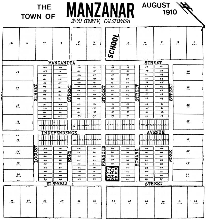
|
|
Figure 18: The Town of Manzanar, August 1910 Townsite Plot, Eastern
California Museum. (click on image for an enlargement) |
By 1912, approximately 20,000 apple trees had been planted at Manzanar. The town boasted a Manzanar Commercial Club to attract property purchasers. The club's president was Ira L. Hatfield, the second man to purchase land in the new development in October 1910. He planted 20 acres of apples, and in April 1911 he constructed the store in town, handling everything from groceries and dry goods to hardware and farm implements. He also "secured the postoffice," which had been located at Thebe since 1896, and opened the new post office in his store on May 30, 1911. At that date Manzanar had a population of 50, but the post office was organized to serve a population of 150, including the residents of the George Creek settlement. The secretary of the commercial club was W. B. Engle, who had purchased land and planted 25 acres of apples at Manzanar in 1911. Aside from ranching, he served as an agent of the Union Central Life Insurance Company of Cincinnati. [160]
Manzanar was Owens Valley's first coordinated attempt at water conservation. In contrast to the methods of irrigation that were employed elsewhere in the valley, the new irrigation system at Manzanar consisted of miles of concrete and tile pipe to prevent seepage and improve drainage. Intake dams were constructed on Shepherd and Bairs creeks. Water was distributed throughout Manzanar via an underground steel and cement system to the high corner of the individual lots. Generally, water to which each stockholder was entitled was accumulated and delivered in large heads every 15 to 30 days. Plans were developed and carried out after 1917 to expand the system of inverted concrete tile drainage ditches. [161]
Initially, markets for the agricultural produce of the Manzanar farming enterprises were the neighboring towns and mining areas in the Owens Valley region. As the mines declined, however, more of the products were transported by railroad, either through Tonopah and Goldfield to northern markets, or southward to Mojave and Los Angeles. The trip south was made in unrefrigerated rail cars and required costly reloading from the narrow to the broad gauge line at Owenyo or hauling to Lone Pine to pick up the broad gauge directly. The Manzanar railroad station — a boxcar — was located at Francis (later the name was changed to Manzanar), four miles east of town. In the early days, a wagon and team of mules made round trips between the settlement and the railroad station for freight and passengers. By the mid-1910s the orchards that had been planted during the early 1910s began to produce fruit harvests. The Manzanar Fruit and Canners Association was incorporated on July 24, 1918, to "conduct and carry on in all its branches the business of canning, preserving, drying, packing and otherwise handling, disposing of and selling all kinds of deciduous and other fruits, and all kinds of vegetables." [162] This association was reorganized as the Manzanar Fruit & Canning Company in April 1919, affording it the right to "acquire, use, sell, or otherwise dispose of letters patent of the United States of America, or any foreign country, and any patent rights, licenses and privileges, inventions, improvements, processes, trade-marks, and trade names, labels and designs relating to or useful in connection with any business of the Corporation." [163] The focus of social life for the new community of Manzanar centered at the community hall. Farm bureau meetings — often attended by residents of Independence — followed by potluck suppers and dancing to live music provided by local musicians were held at the hall. The building was also the scene of weddings, funerals, anniversaries, Christmas celebrations, Ladies Aid Society meetings, and Sunday School and church services led at first by the Methodist Episcopal Mission and later by the Manzanar Methodist Episcopal Church which was formally established in June 1921. In addition, the hall housed the offices of the Owens Valley Improvement Company, a branch of the Inyo County library, and living quarters for farm and company personnel. After the establishment of extensive orchards at Manzanar, part of the building was converted for use as a packing house. During the mid-1920s a roller skating rink was constructed in the building. [164]
Social activities at Manzanar included summer picnics held in a grove south of town. Other recreational pursuits of Manzanar residents included camping in George Creek Canyon and along Shepherd Creek. The town fielded a baseball team that played teams from neighboring towns in Owens Valley. Fishing in nearby streams flowing from the mountains and hunting for wild geese, ducks, doves, pheasants, quail, rabbits, and deer were favorite pastimes for many men and boys. An annual fall farm festival was sponsored by the Farm Bureau. [165]
In 1912 the Manzanar School District was established, and on July 19 the Owens Valley Improvement Company conveyed a lot in the townsite to the district for construction of a school. A two-room school was built, with one teacher in the elementary school and another added later. High school students were bussed to Independence. By 1916, 29 pupils were enrolled at the Manzanar school, and by the early 1920s enrollment was in excess of 50 students as the population of Manzanar reached its peak and several students were gained following closure of the George Creek school. [166]
The Fourteenth Census taken in 1920 showed a total Inyo County population of 7,031 residents and a population of the Manzanar and Owenyo townships, which included George Creek, of 203. Of the 57 households at Manzanar that were surveyed, 42 lived on their own property and 15 were renters or operators for absentee owners. Nine Indians were living on 30 acres that had been set aside as U. S. Government land, while the rest of the population was white, with predominately northern European origins. Most residents, with the exception of the two teachers and the town's only merchant, R. J. Bandhauer, gave farming as their occupation. [167]
In 1924 the City of Los Angeles, having determined the need to increase its delivery of water to the city from Owens Valley, began taking options on the agricultural lands at Manzanar held by individual farmers and the Owens Valley Improvement Company in order to secure stream and groundwater rights. By this time the Manzanar development included Subdivisions Nos. 1, 2, and 3 plus the townsite for a total of approximately 3,000 acres. Property owners at Manzanar had lived with the possibility of this action for months, and reactions to it ranged from relief and eagerness to sell to anger and a feeling that they had been betrayed by both Los Angeles and their neighbors. [168]
Contrary to the glowing promises outlined by the Owens Valley Improvement Company, the Manzanar community had not prospered as expected. While the quality of Manzanar fruit was well-known throughout California, and the quantity in good years exceeded expectations, late frosts and untimely strong winds prevented the farmers from realizing consistent profits over the years. In addition, the problem of markets persisted as freight costs increased and competition from farmers in the Imperial and San Joaquin valleys resulted in lower profits for Manzanar fruit growers. Thus, while many of the farmers at Manzanar were eager to sell to Los Angeles and some even joined together to ask Los Angeles to accept their own terms of sale, others held out as long as possible before selling. Many residents later argued that the city had engaged in "checkerboard" buying and had pitted neighbor against neighbor, leaving a legacy of bitterness that lingered for years. According to most oral and written reminiscences by former Manzanar residents, those who finally left the area under whatever circumstances felt profoundly uprooted from a close-knit community. [169]
Several articles in the Inyo Independent during 1924 describe the purchase of Manzanar lands by the City of Los Angeles and the impact of the purchases on the Manzanar community. In March 1924, for instance, an article noted:
Word was received the first of the week that the options offered to Los Angeles by a combination of Manzanar and Georges Creek interests were not accepted by the City It is presumed that the value fixed for the water was more than the City desired to pay. While some of the ranch owners in the section mentioned were undoubtedly disappointed, yet other property owners who went into the deal, so we have been told, to conserve their interests, were not displeased with the outcome of the negotiations.
Later that year another article stated:
It would seem too bad for all the beautiful apple and other fruit orchards of Manzanar to be lost for lack of water; but no passing traveler is justified in saying what should be done or what should not. Try farming first, then try marketing what you raised; if you are not an experienced farmer and excellent hard worker it is not necessary to consider the market problem. After you have tried the farming game in a country where water is none too plentiful your eyes may be equipped with the same spectacles the rancher looks through.
In August 1924 another notice in the newspaper stated that the Rotharmel, R. A. Wilder, and R. J. Bandhauer families, all Manzanar residents, had "gone to Southern California to look for home locations." [170]
City of Los Angeles land purchases at Manzanar began in August 1924. The sale of the Owens Valley Improvement Company's property the following month placed at least half the Manzanar area under the control of the city. It is likely that this early sale was a reflection of the opportunity Chaffey and his company saw and seized to reach a settlement with Los Angeles for both the contested Cottonwood Creek water rights and sale of the Owens Valley Improvement Company lands as it was becoming clear that the years of the Manzanar community were approaching an end given the city's intention to purchase all of the privately-owned ranches in the valley. By 1927 Subdivisions Nos. 1, 2, and 3, and the Manzanar Townsite, a total of 3,000 acres, were entirely owned by the city. Of those who sold out and left Manzanar, some moved to emerging agricultural communities in Whittier and Chino in southern California or northern California. Others gave up farming altogether and settled in Lone Pine or Independence, often to go to work for the Department of Water and Power. Several of the former landowners remained, leasing their properties back from the city and continuing their farming operations as before. [171]
By 1926-27 the City of Angeles had become owner and absentee landlord of most of the land at Manzanar. Cognizant of the fact that it was responsible for managing the lands and maintaining harmonious relations on its new properties, city leaders launched an effort to reshape the area in line with its goals. Los Angeles wanted to protect the watershed that drained into its aqueduct, and thus it supported some types of agricultural activity as it realized that it could not merely quarantine Owens Valley The city wanted to ensure the efficient handling of the available supply of water in the valley, a goal that included the judicious use of water for agriculture with its potential for long-term groundwater storage, and it wanted to repair its image with the valley residents. The value of the agricultural enterprise at Manzanar could not be discounted as a means of recouping some of the costs of the land purchases. Thus, the city continued to farm portions of its newly-acquired property at Manzanar and to operate the packing house in the town's community hall. [172] The Los Angeles Times Farm and Orchard Magazine reported on the city's agricultural activities on June 13, 1926:
The case of the city's Manzanar tract purchase is interesting as showing what Los Angeles has been called upon to do in maintaining improved lands pending leasing arrangements. Here, out of 3000 acres acquired with water rights, around 1200 acres had at one time or another been developed, a considerable portion to orchards. Of the developed area a great deal had, in an acute water shortage just prior to the city's purchase in August, 1924, sadly deteriorated. It was squarely up to the city to step in and farm the tract for awhile.
The Manzanar tract had been about half sold out to individual owners, the other half being farnfed [sic] in part by the Owens Valley Improvement Company, which had subdivided it, when the city stepped in. Victor M. Christopher, who had been managing the company's farming operations, was employed by the city to look after the maintenance and leasing of the whole tract. He started in by giving the orchards a severe pruning followed by good irrigations. He had to yank out eighty acres of pears on one place because of blight. Some owners, too, had neglected their orchards so there was no saving them. Three hundred acres of fruit, however, have been well cared for, pruned, sprayed and irrigated, and of this a third has been leased. Last year Mr. Christopher sold a fair apple crop from city-owned orchards.
Some of the alfalfa fields of the tract were in a deplorable condition when the city took them over. This spring work is going ahead on improved water distributing lines designed to make possible a rapid extension of the alfalfa acreage. The city itself is now farming about 200 acres each of alfalfa and orchards and good crops are in sight. Los Angeles expects to be in the market again this year with premium hay and big red apples and the combined crops grown by the city and its tenants at Manzanar are sure to bring quite a figure. [173]
The farming operations conducted at Manzanar by the City of Los Angeles were described at length in another article in the Los Angeles Times Farm and Orchard Magazine on November 30, 1927. The article noted that "Growing apples unexcelled in quality even by the best produced in Northern California, Oregon or the Ozark Mountain region and distributing them under its own brand to all parts of the Southwest is one of the little-known features of the City of Los Angeles's agricultural and horticultural operations in the Owens Valley." The city's fruit-raising activities in the valley were "confined principally to Manzanar. There were approximately 300 acres of orchard, the "major portion of which has not yet attained a full-production stage." Two-thirds of this acreage was directly cared for by the city itself under the supervision of Farm Superintendent Victor N. Christopher," the remainder being leased. According to the article,
the tenants get the full benefit of the farm superintendent's experience and ability and this has proved of substantial value to them, especially in the preparation of the fruit for market and the manner of disposal. The unusual distance from the nearest center brings up difficult problems of packing, storage, freighting and sales commissions. The group system solved these most easily, efficiently and profitably. A Los Angeles company [Klein Simpson Fruit Company] handled last year's entire output satisfactorily.
The fruit crop at Manzanar in 1926 amounted to 55 carloads, including six of peaches, 12 of Bartlett pears, and 37 of apples. The latter were mainly winesaps with some delicious and Arkansas blacks. The city's crop made 18,650 boxes and that of the tenants 7,350.
The apple harvest at Manzanar "generally was so abundant," according to the article, that there was "no disposition on the part of buyers to stock up." Consequently the maximum figure of 75 cents per box "was offered for large size, extra fancy, delivered at the city's Manzanar packing-house, the buyer to do the grading and packing and furnish all materials." Considering all grades and sizes, this meant "only a net average of 50 cents per box, a sum that "seemed ridiculously low in view of the fact that Owens Valley apples seem to remain in tip-top shape after those from some other sections go into a state of decay." Thus, arrangements had been made "at once for the city to pack and store its stock instead of sacrificing." Thus, the entire crop had not been sold until August 1927, eleven months after having been placed in storage.
Christopher, a horticulturist, had protected the farm tenants by bargaining with the fruit concern to handle their output on consignment, the company advancing $1 per box to cover picking, packing, and freight costs. A Los Angeles cold storage plant held the apples at the season rate of 25 cents per box up to June 15, 1927, storage payable at the time of sale. The packing season at Manzanar started about September 20, 1926, and lasted five to six weeks. More than 20 persons were employed for the packing.
In round numbers, Los Angeles took in $40,000 for its Manzanar fruits, while its expenses were $30,000, leaving a profit of $10,000. Other farm profits brought the profits from the Manzanar district to $14,134.47, excluding taxes and interest. Twenty tons of hay was sold "in the stack for $12 per ton and 235 tons, worth the same price, [were] furnished for consumption on the city's construction works at the Haiwee generating plant, the Tinemaha dam and elsewhere along the Aqueduct." Fruit was also supplied to "various city camps in season.
Production costs after delivery to the packing house amounted to $1 per box. This figure included 20 cents for a box, 6 cents for a label and wraps, 20 cents for grading and packing, 6 cents for trucking 13 miles to Lone Pine, 19 cents for railroad freight to Los Angeles, 26 cents for cold storage, 2 cents for equipment, and 1 cent for miscellaneous items.
Late spring frosts in 1927 destroyed much of the Manzanar and Owens Valley fruit crop, thus making "apparent its uncertainty as a fruit country." This uncertainty, according to the article, would "in all probability lead to the discontinuance of orchard planting and use of the lands along surer and constantly remunerative channels." Like the rest of the valley, Manzanar "with its prodigiously fertile soil," had "plenty of other and reliable resources, actual and potential, the former including alfalfa, corn, potatoes, poultry, honey and garden truck." At present the city was cutting "the summer's last stand of hay," using blacks and Indians to do the work. New farming enterprises in the Manzanar vicinity included onions, chicken ranches, and honey production.
Before Los Angeles had purchased its Manzanar landholdings more than 1,200 acres had been farmed in the area. This acreage had been reduced to 1,000, because the water supply was inadequate. During years of normal or more than normal snowfall, when water for irrigation was plentiful, Los Angeles planned to enlarge the acreage farmed. The Manzanar lands were watered from Shepherd Creek "through a ditch ten years old, yet as sound as the day it was completed." The mile-long waterway, having a capacity of at least 100 inches, was built of granite boulders set in cement. The cost of maintaining the waterway was "practically nil and it will stand for decades with little repairing to be done."
Having taken over the Manzanar "lands to obtain the water and being engaged in direct farming merely pending other and better arrangements," Los Angeles, according to the article, now desired "to retire from that sphere and lease all its Manzanar holdings to individuals." Thus, opportunities existed for ranchers "financially able to swing such propositions and seeking new fields of conquest." [174]
Although Los Angeles continued to conduct agricultural operations on some of its lands at Manzanar, significant portions of the once highly-acclaimed irrigation system were allowed to deteriorate. One writer who decried the "rape" of Owens Valley by the City of Los Angeles wrote a series of articles in the Sacramento Union during March 28 to April 2, 1927. The author observed that Owens Valley was a "Pitiful Story of an Agricultural Paradise, Created by California Pioneers, Condemned to Desert Waste by Water Looters."
Regarding the demise of many of the orchards at Manzanar, he noted:
Manzanar was once famous for its apples. The orchardists of Manzanar won first prizes at the State Fair in Sacramento and at the Watsonville apple show. A commodious packing plant was erected. The community was prosperous. It was growing rapidly. The village school had two teachers and there was talk of a new school building.
The Los Angeles water and power board came and bought every orchard and ranch that its agents could trick the owners into selling. The city immediately diverted the water from the ditches into the aqueduct. It dug wells and installed pumps to exhaust the underground water supply.
Today Manzanar is a ghastly place. The orchards have died. The city has sent tractors to pull up the apple trees. This should be a week of pink and white blossoms in "Apple Land," instead there is only desolation. Vigorous trees just coming into full bearing are prostrate in one field; across the road the blazing trail of the fire brand is visible. [175]
The Manzanar community declined after the mid-1920s. Many of the houses vacated by farmers who sold their property to Los Angeles were rented to Department of Water and Power employees, farm tenants, and other workers from Independence. Some farm buildings were torn down, their materials being salvaged by the Department of Water and Power for other use. Some structures were purchased and moved to Independence and Lone Pine, while some simply deteriorated or were destroyed by windstorms or fire. [176]
The decline of the Manzanar community resulted in closure of its post office on December 31, 1929. In 1932 the Manzanar Water Corporation was dissolved. Two years later, Los Angeles determined to stop irrigation entirely and increase groundwater pumping in the Manzanar area. Thus, the remaining orchards and farmlands were abandoned and allowed to dry up. Two families who remained at Manzanar in 1934 moved to Lone Pine and Independence, and in 1935, Clarence Butterfield, poultry farmer and last remaining resident, was asked by the Department of Water and Power to move. The following year the Manzanar school closed, and the Manzanar school district joined with Independence to form a unified district. On October 6, 1941, two months before the Japanese attack on Pearl Harbor, the Inyo County Board of Supervisors passed a resolution at the request of the City of Los Angeles that "all streets, alleys, lanes, etc. in the Town of Manzanar be abandoned. [177]
In March 1942, at the time the Army leased 6,020 acres from the Los Angeles Department of Water and Power for construction of the Manzanar War Relocation Center, two ranchers were leasing portions of the affected acreage. Archie Dean was leasing "dry brush grazing land" north and northeast from the former Manzanar townsite and the Manzanar airport, which had been surveyed in July 1941 and subsequently constructed by the United States Government, under a three-year lease at an annual fee of $110. His original lease had been modified to cover land which was included in the lease to Inyo County for the Manzanar "airport site. Peter Mairs had a lease which expired on March I, 1942, covering land irrigated from George Creek and other dry grazing land located on the east side of the highway and below the Los Angeles Aqueduct. Mairs paid an annual fee of $1,890 for the land on which he grazed cattle. [178]
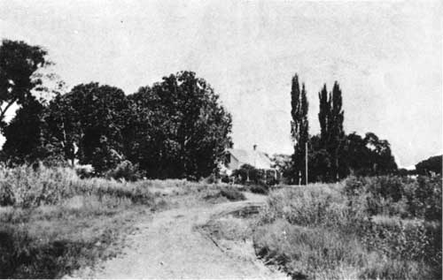
Photo 1: Shepherd House (built in 1872).
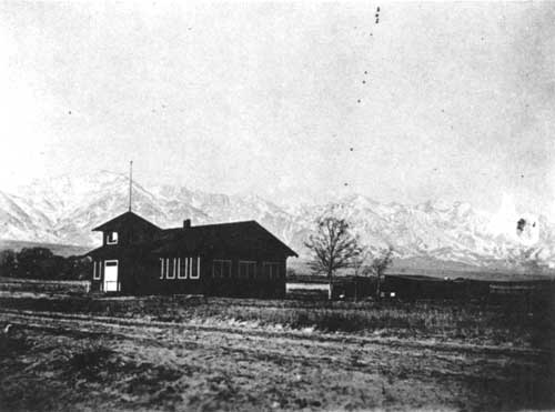
Photo 2: School, Manzanar.
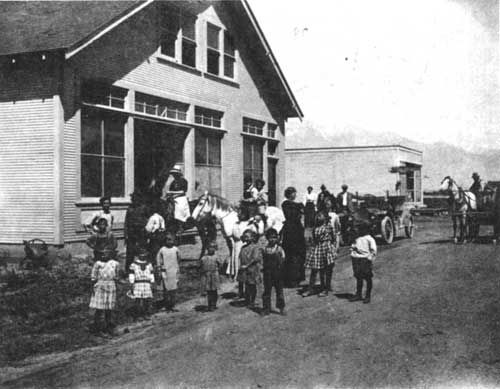
Photo 3: Manzanar Community Hall, ca. 1912. Building in back was
Hatfield's
(later Bandhauer's) General Store which housed the post
office.
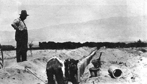
Photo 4: Van Lutzow (at left), laying cement pipe at Manzanar.
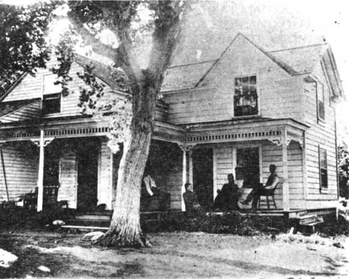
Photo 5: Kispert Ranch house on George Creek.
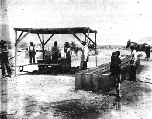
Photo 6: V. C. Lutzow at the construction site of Manzanar making cement
pipe for the Manzanar subdivisions.
| <<< Previous | <<< Contents >>> | Next >>> |
manz/hrs/chap6.htm
Last Updated: 01-Jan-2002