Mesa Verde
Administrative History
|

|
ILLUSTRATIONS
|
|
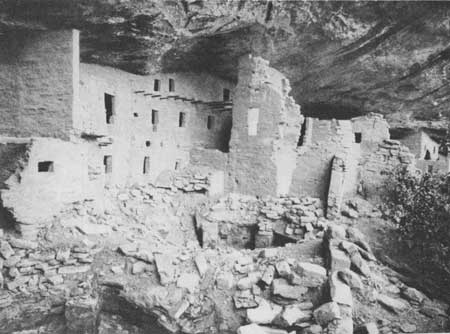
Plate 1. Spruce Tree House, Plaza D, before
restoration (Fewkes' Report, 1908).
|

|
|
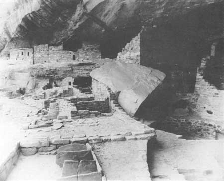
Plate 2. Spruce Tree House, Plaza D, after
restoration (Fewkes' Report, 1908). |
|
|
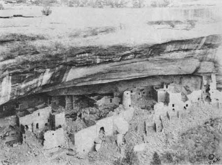
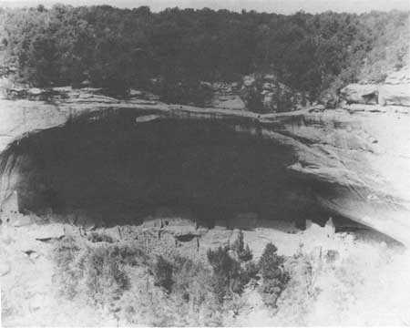
Plate 3. Cliff Palace from the north,
before restoration. (Fewkes' Report, 1909).
|
|
|
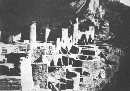
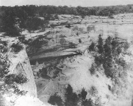
Plate 4. Cliff Palace from the north, after
restoration. (Fewkes' Report, 1909). |

|
|
Plate 5. Mug House before excavations of
the Wetherill Mesa Project (circa 1959 photo, HA Files). |
|
|
Plate 6. Mug House, looking north, after
excavations of the Wetherill Mesa Project (1963 photo, HA Files).
|
|
|
Plate 7. Long House, west side, before
excavations of the Wetherill Mesa Project (1958 photo, HA Files). |
|
|
Plate 8. Long House, east end, after
excavations of the Wetherill Mesa Project (1963 photo, HA Files).
|

|
|
Plate 9. The Knife Edge Road overlooks
the Montezuma Valley from an altitude of 8,572 feet (photograph by
Willard R. Culver, c. 1948, National Geographic Society). |

|
|
Plate 10. A narrow ledge and a fortified
tunnel was the only approach to Balcony House. Visitors today climb this
30-foot ladder to enter (Photograph by Williard R. Culver, c. 1948,
National Geographic Society). |
meve/adhi/illustrations.htm
Last Updated: 21-Aug-2004
|