|
National Park Service
Recreational Use of Land in the United States |

|
SECTION IV. PROGRAM FOR DEVELOPMENT OF THE NATION'S RECREATIONAL RESOURCES
1. THEORY OF DIVISION OF RESPONSIBILITY FOR RECREATION
In the field of recreation:
(1) What are the responsibilities of the local governments?
(2) What are the responsibilities of the State governments?
(3) What is the responsibility of the Federal Government?
If a certain responsibility for providing recreation falls logically and necessarily on the Federal Government, how should this responsibility be divided among the various branches of the Federal Government?
Because these old questions must be faced again in the relatively new field of recreational planning, they demand reexamination.
Local, State, and Federal Responsibilities
Supplying facilities for the day-by-day recreational needs of the people is primarily a local responsibility, whether met by municipalities of sufficient population and wealth to supply all the various types of recreation required, or by county or metropolitan park boards which, dealing with the needs of a group of urban and rural communities, make it possible for each of those communities to enjoy such facilities. Use by outside residents of facilities so supplied and maintained is incidental.
Every State has areas either of such high scenic value or of such high value for active recreation, or both, or possessing such interest from the scientific, archeological, or historical standpoint, that their use tends to be State-wide in character. Acquisition of such areas, and their development and operation, appear to be primarily a function of the State, though this should not preclude joint participation in acquisition, and possibly in development and operation, by the State and, by such community or communities as might receive a high proportion of the benefits flowing from their establishment.
Taking the Nation as a whole, there are, again, areas of such superlative quality, because of their primeval character or scenic excellence, or historical, archeological or scientific importance, or because of some combination of these factors, that they are objects of national significance. It is the responsibility o the Federal Government to acquire and administer these.
The Federal responsibility is particularly emphasized in the case of the primeval wildernesses. There are several reasons for this. Remaining areas of primeval condition are few. Those who live in the regions immediately adjacent to the wilderness are usually pioneers whose lives and thoughts are devoted to wilderness conquest. Hence the Federal eye rather than the local eye must be depended upon to recognize and protect what wildernesses remain. A wilderness reserve ordinarily must be of great size if it is to remain primeval, and the present value may seem insignificant, whereas the deferred value is very great. Take all these conditions and circumstances together, and it is apparent that the monumental task of saving the primeval must be very largely a Federal responsibility.
There is, in addition, another group of areas, the ocean and Great Lakes beaches, which as a group, are heavily freighted with national interest, and are extensively sought by persons living at a great distance from them. It is unlikely that these areas will be acquired by the States to a sufficient extent for the public, and it would appear reasonable to expect the Federal Government to acquire and administer a representative group of them.
Departments and Bureaus of the Federal Government
The division of responsibility among the several governments seems thus to be susceptible of fairly clear definition. Defining the division of responsibility as it concerns the several departments and bureaus of the Federal Government is more difficult. Several types of federally owned lands, such as national parks and monuments, national forests, Federal wildlife reservations, and Federal reclamation lands, provide recreation. Recreation is the primary objective of national parks and monuments and Federal game refuges, although in the latter areas the recreational value is usually realized elsewhere.
Recreation is a secondary objective of the other types of federally owned lands. The recommendations made at a later point in this report arise from certain principles which are stated as follows:
1. It is a Federal responsibility to develop to their highest usefulness the recreational values inherent not only in national parks and monuments, but in other Federal holdings as well, as long as they remain in Federal ownership.
2. In this development every effort should be made to avoid unnecessary duplication of "special purpose" organizations.
3. There should be constant and conscientious striving toward interbureau and interdepartmental cooperation.
4. Wildlife protection and administration must be coordinated on all holdings if the Federal Government is to be effective in its responsibility to conserve this recreational resource.
5. Commercial objectives should not be permitted to jeopardize the value of lands which are primarily of importance for recreational use.
2. LOCAL COMPONENTS
Municipalities1
It is estimated that land devoted to all municipal purposes amounts to about 10 million acres, which is about one-half of one percent of the total land area in the United States.2
1 Editor's note: The tables used in this section without individual citations were compiled from 1930 census Bureau figures, and information obtained by the National Recreation Association in a Nation-wide survey of municipal parks and recreation areas (1925—26).
2 Joint Committee on Bases of Sound Land Policy, What About the Year 2000? Harrisburg, Pa., McFarland, 1928, p. 48.
If the recreational use of land be considered from the viewpoint of concentration of population, and from the viewpoint of the necessity of frequency of use, it is evident that the focal point and the very foundation of a national plan for recreation is within the numerous municipalities of the United States and their immediate environs. Improved methods of transportation have made possible a distribution of the responsibility to other political units, such as counties, metropolitan districts, States, and the Federal Government, but the basic responsibility remains with the local municipalities.
What, therefore, is the extent of responsibility of the municipalities?
In attempting to answer this question, the 16,598 incorporated municipalities3 will be divided into two general classes, based upon the ability or lack of ability of these municipalities to provide not only the minimum types of land areas desirable for meeting the daily or very frequent recreational-use needs of its people, but also the necessary finances to support a recreation-administering agency on a year-round basis.
3 There are unincorporated communities in the United States as large in population as many that are incorporated. The number is unknown.
Municipalities under 8,000.—The experience of the National Recreation Association covering a period of over 25 years in organizing recreation systems has demonstrated quite conclusively that most municipalities under 8,000 population cannot provide the desirable necessary recreation areas and maintain a year-round recreation administrative organization. Practically all such municipalities may be expected to provide some kind of a maintenance organization.
Therefore, the first group of municipalities to be considered is comprised of all those having less than 8,000 inhabitants.
These four groups of municipalities comprise about 93 percent of all incorporated places in the United States, 22.7 percent of the total population of all incorporated places, and 14.5 percent of the population of the Nation.
TABLE XV.—Municipalities in the United States under 8,000 population showing numbers and total population1
| Municipal groups | Number in each group | Total population |
| 5,000 to 8,000 | 625 | 3,903,781 |
| 2,500 to 5,000 | 1,332 | 4,717,500 |
| 1,00010 2,500 | 3,087 | 4,820,707 |
| Under 1,000 | 10,346 | 4,362,746 |
| Total | 15,390 | 17,804,024 |
1 U. S. Bureau of the Census, Fifteenth Census of the United States: 1930, Population, vol. 1; Number and Distribution of inhabitants.
The strictly rural village, town, and small city, if present trends continue, will occupy a less and less important position in American life unless the widespread distribution of cheap electric power attracts industries to them from the larger centers of population.
Very little information is available as to what these small communities have provided for themselves in recreation areas; the most complete available statistics are from a study conducted by the National Recreation Association in cooperation with the American Institute of Park Executives in 1925—26. The following table is a summary of the findings of this study.
| Municipal groups | Number places | Number reported in study | Number having no parks | Number having parks | Total acres |
| 5,000 to 10,000 | 721 | 322 | 67 | 255 | 11,366.87 |
| 2,500 to 5,000 | 1,320 | 309 | 72 | 237 | 5,186.89 |
| Under 2,500 | 12,905 | 1,320 | 751 | 569 | 5,346.64 |
| Total | 14,946 | 1,951 | 890 | 1,061 | 21,900.40 |
1 Editor's note: These figures are from a Nation-wide study of municipal park and recreation areas and systems conducted by the National Recreation Association in 1925—26 at the request of the National Conference on Outdoor Recreation.
Of the 721 communities in this group (5,000 to 10,000) in 1920, reports as to park areas were secured from 322, or 44.6 percent of the total. Sixty-seven, or 20.8 percent of the total reporting, had no parks, while 255, or 79.2 percent of total reporting, had 11,366 87 acres, an average of nearly 45 acres per community. Twenty-eight of the communities reporting parks had a total park area of 3,238.69 acres; the ratio of park acreage to the total population in these 28 cities was 1 acre to every 58 inhabitants. The average number of parks per city was about 4.4
4 Weir, L. H., editor, Parks: a Manual of Municipal and County Parks. New York, Borneo, 1928, 2 vols.; vol. 1, pp. 76—77.
In the group with from 2,500 to 5,000 inhabitants, approximately 25 percent were reported. Seventy-two, or 23 percent of those reporting, had no parks, while 237, or 77 percent of those reporting, had 5,186.89 acres of park areas, an average of over 21 acres per community. These statistics of recreation areas did not include school sites, which in many communities were large enough to provide quite amply for the outdoor active recreation needs of the children and young people. Thirty-five of the 237 communities reporting parks had 2,529.89 acres, and the average ratio of park acreage to population was 1 acre to every 45 inhabitants. The number of park properties ranged from one to seven. Thirty-three of these communities reported a total of 298.91 acres of school sites and a total of 89 sites.5
5 Weir, L. H., editor, Parks; op. cit., vol. 1, pp. 71—75.
In the group under 2,500 population, reports were received from about 10 percent. More than half of the 1,320 communities reporting had no parks, while 569, or 43 percent of those reporting, had a total of 5,346.64 acres, an average of about 9.4 acres per community. Of the 569 communities reporting parks, 80 were selected as the most representative from the viewpoint, of either the size of their park acreage, or school ground area, or both.
These villages ranged in size from 86 to 2,484 inhabitants. The total park area owned by 69 of the 80 communities was 1,762.17 acres, or an average of slightly more than 25 acres per community. The ratio of park acreage to population was 1 acre to every 33 inhabitants. Seventy-five of the 80 communities reported a total of 594.99 acres of school grounds.
A summary of the average park acreage per community of all the communities reporting parks in the several population groups is presented in the following.
| Population groups | Number communities reporting | Average park communities acreage per community |
| 5,000 to 10,000 | 255 | 44.6 |
| 2,500 to 5,000 | 237 | 21.9 |
| Under 2,500 | 569 | 9.4 |
| Population groups | Number selected communities | Average park acreage per community | Ratio of acreage to population |
| 5,000 to 10,000 | 28 | 115 | 1:58 |
| 2,500 to 5,000 | 35 | 72 | 1:45 |
| Under 2,500 | 69 | 25 | 1:33 |
These two tables give a slight clue to what municipalities in the various population groups may be expected to provide for themselves in recreation areas, based on what some of them have actually done.
It is very difficult to fix a reasonable standard for the various groups of small municipalities to follow in providing their own recreational areas. On the basis of the very limited data of the most progressive communities in the various population groups as presented in the immediately preceding table, a reasonable average ratio of acreage to population in the population group is set forth in table XIX.
| Population groups | Standard |
| 5,000 to 8,000 | 1 acre to every 75 inhabitants. |
| 2,500 to 5,000 | 1 acre to every 60 inhabitants. |
| 1,000 to 2,500 | 1 acre to every 50 inhabitants. |
| Under 1,000 | 1 acre to every 40 inhabitants. |
| Population group (1930) | Number communities | Estimated total acreage each group | Estimated average park acreage per community |
| 5,000 to 8,000 | 625 | 52,050 | 83+ |
| 2,500 to 5,000 | 1,332 | 78,626 | 59+ |
| 1,000 to 2,500 | 3,087 | 96,414 | 31+ |
| Under 1,000 | 10,346 | 109,068 | 10+ |
| Total | 15,390 | 136,158 | --- |
It will be shown later than the total estimated recreational area desirable for 17,804,824 inhabitants of the 15,390 incorporated places under 8,000 population (1930) is approximately one-half of the total estimated desirable recreation space for the 60,333,452 inhabitants in the 1,208 cities of 8,000 population and above; this appears to be entirely out of proportion, considering the relative number of people in the two general groups of incorporated places.
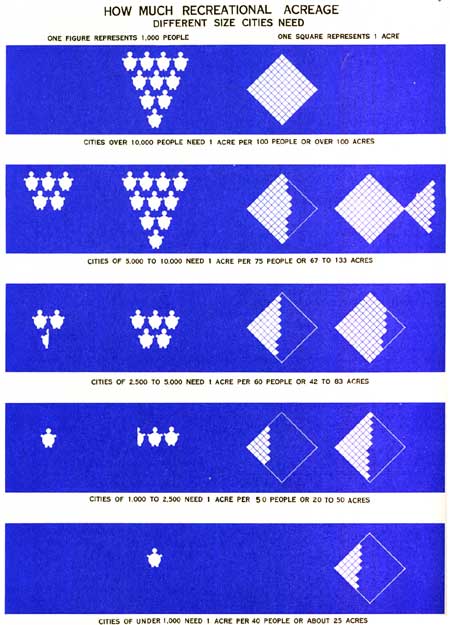
FIGURE 31.
The basic reason for this apparent lack of balance is that irrespective of the number of people to be served there is a minimum desirable number of types of recreation areas with a total gross acreage necessary in any corporate community if the outdoor recreational needs of the inhabitants are to be served. For example, a community of 1,500 people should have one combined playground and school site of not less than one block, or about 3 acres; one playfield of not less than 5 or more acres; one small park of at least a block, or about 3 acres, in the shopping center of the town; one picnic grove of 10 or more acres; one small natural swimming center if topographical conditions present the opportunity; a site for a public library and perhaps another for a community house. In short, the total desirable recreation area would be from 25 to 30 acres. This same amount of space in a large city, if divided into special types of areas, would serve satisfactorily a far larger number of people. If 25 acres, for example, were divided into tracts of 5 acres, each located in a residential district of 160 acres in a city having as low a density as 25 persons per acre, these playgrounds would serve adequately the outdoor play needs of the children of a population of approximately 20,000. At a the same time they would provide space for a school building on each with recreational opportunities for adults also. The recreation areas of villages, towns, and small cities are frequently used by the people living on the farms in the surrounding country so that they serve a far larger number of people than are actually enumerated as living in the small municipalities themselves.
For financial reasons all-year-round administrative recreational leadership cannot, as a rule, be provided by the 15,390 small municipal corporations comprising this general group of incorporated places. Reliance must be had for recreational administration, and perhaps for acquisition and development of some of the desirable types of properties, on a larger governmental unit. The county is perhaps the best existing governmental agency for handling this problem, not only for the numerous villages, towns, and small cities, but also for providing a recreation service under leadership for the population dwelling in the open country. In many instances also State-owned properties and outlying parks of the larger cities will be so located as to serve frequently the recreational needs of the people of many of the villages, towns, small cities, and strictly rural population in their vicinity.
Cities of 8,000 and up.—The second group of cities comprises all those of 8,000 population and above. The number of cities in this general group classified according to size is shown in the following table.
| Group | Number cities (1910) | Population | Percent total population of Nation |
| 1,000,000 or more | 5 | 15,064,555 | 12.3 |
| 500,000 to 1,000,000 | 6 | 5,763,987 | 4.7 |
| 250,000 to 500,000 | 24 | 7,956,228 | 6.5 |
| 100,000 to 250,000 | 56 | 7,540,966 | 6.1 |
| 50,000 to 100,000 | 98 | 6,491,448 | 5.3 |
| 25,000 to 50,000 | 185 | 6,425,693 | 5.2 |
| 10,000 to 25,000 | 606 | 9,097,200 | 7.4 |
| 8,000 to 10,000 | 226 | 1,993,175 | 1.6 |
| Total | 1208 | 60,333,452 | 49.1 |
1 Fifteenth Census of the United States, 1930, Population, vol. 1; op. cit.; see p. 14.
The above cities may be expected to provide not only the necessary recreational spaces within their borders, or very near their boundaries, for daily or frequent use of their populations, but also to maintain a year-round administrative recreational service.
Each of the cities in the above groups may reasonably be expected to provide at least 1 acre of recreational area for every hundred of its inhabitants. This ratio should be higher for all or part of the group comprising cities from 10,000 to 25,000, if these cities are to provide for themselves all the different desirable types of recreational areas. However, for purposes of calculation, the generally accepted standard of 1 acre for every hundred of the population will be used for all groups.
This standard, applied to the total population of all groups, would show that there should be reserved for recreational purposes for these 60,333,452 inhabitants a total of 603,333 acres now, without making allowance for future growth of population. The study of municipal recreation spaces conducted by the National Recreation Association, 1930, covering cities of 5,000 and above, and securing reports from 1,072 cities of a total of 1,833, showed a total of 308,804.87 acres now owned by 898 cities; 174 cities reporting as having no parks.6
6 U. S. Bureau of Labor Statistics, Park Recreation Areas in the United States, 1930; Bulletin no. 565, May 1932, 116 pp., tables; see p. 7, table 2.
This total recreation acreage, however, includes 89,196.3 acres lying outside the limits of the cities. Deducting this total from 308,804.87, there remains within the city limits of the 898 cities a total of 219,608.57 acres. The probabilities are that if complete records on recreational areas, including school sites owned by all the cities of 5,000 and above within their limits, had been available in 1930, they would show that about one-half of the desirable recreational areas had been acquired, although a rather surprisingly large number of the smaller cities was entirely lacking in park spaces.
Studies conducted by the Recreation Division of the National Resources Board, 1934, show 206,916.17 acres of recreational spaces in 440 cities of 5,000 population and above.
Taken as a whole, the cities of 10,000 inhabitants and above are still far from the goal of even so low a standard as 1 acre to every 100 of the population.
Balanced planning of lands for recreation within cities requires that the total acreage secured by application of the principle of 1 acre for every 100 of the population be divided into types of areas of varying sizes, each type performing a specific, primary recreational function. Among some of the most outstanding types of recreation areas are:
1. Children's Playgrounds.—Of the total recreation area secured through the application of the principle of 1 acre to every 100 inhabitants, not less than 12 percent should be allocated to children's playgrounds for children from 5 to 14 years of age, each playground ranging from 3 to 8 acres in extent with an average size of 5 acres.
From 3 to 5 percent of each 160 acres of residential area should be reserved for a children's playground.
These areas may also be sites for grade schools. In fact, the distribution of grade-school sites and community-playground sites will in general coincide, and in an ideally planned city the great majority of the children's playgrounds should be located adjacent to schools.
2. Neighborhood Playflelds or Playfleld-Parks.—From 15 to 18 percent of the gross area, under the principle of 1 recreation-acre to every 100 inhabitants, should be allocated to neighborhood playflelds or playfleld-parks. There should be one of these areas to each 640 acres of residential territory, and it should range in size from approximately 15 to 30 acres, or even more. In other words, it should contain from 2-1/2 to 5 percent of each 640 acres of residential territory. These areas may also be used as the sites for junior- and senior-high schools, or, conversely, large sites of such schools may be used as community playflelds and neighborhood parks.
3. Miscellaneous Recreational Areas.—These include athletic fields, stadia, golf courses, bathing beaches, areas devoted exclusively to tennis or some other special type of facilities. There is no special rule governing the amount of area which should be set aside for miscellaneous active-recreation areas. Requirements of the particular use determine more or less the amount of space required for each, as a minimum of 100 acres for an 18-hole golf course, 15 to 20 acres for a first-class athletic field or stadium, including the enclosed space and outside area for auxiliary fields and auto parking.
In a properly balanced system of recreational areas in a city, it is probably desirable to use for active recreation from 30 to 50 percent of the total recreational area, assuming 1 recreation-acre for every 100 inhabitants.
4. The acreage remaining after deducting areas for children's playgrounds, playflelds, or playfield-parks and miscellaneous active recreational areas may be distributed among areas characterized by landscaping and natural or designed topographical features. They are intended primarily for adornment of areas in cities wherever they are located; to preserve natural topographic features better adapted for general recreation than for any other purpose; to provide opportunities for relaxation in an environment of beauty; to make possible frequent contact of the people with the elements of nature; to promote the study of nature; and, in some instances, as in large parks or waterfront parks, to provide opportunities for forms of active recreation which the natural conditions readily permit, such as hiking, riding, picnicking, boating, swimming, nature study, presenting dramatic performances, concerts, play festivals, civic celebrations, and playing of games.
The following are among the most important types of landscaped areas:
(a) Neighborhood or in-town Parks.7—These are comparatively small areas located in residential districts, downtown sections, and even in parts of cities occupied by industry and transportation. There is no general rule as to the desirable total or individual acreage of this type of property. They should, however, be distributed over the city on the basis of about one for every square mile. They are sometimes combined with a playfield area, making a playfleld-park.
7 Editor's note: There is a class of very small properties, numerous in some cities, called ovals, triangles, circles, and parking strips, annually resulting from left-over areas in the street plan, or consciously introduced by real-estate subdividers, They are not neighborhood parks.
(b) Large Parks.—Large parks are areas ranging from a hundred or several hundred acres to several thousand acres, although in small cities areas from 40 to 100 acres perform for the inhabitants much the same functions as do the larger areas in large cities. Such areas are generally characterized by varied topographic features and an abundance of plant life arranged according to the principles and rules of landscape architecture, although very frequently they provide a variety of active recreational opportunities. There is no rule governing their numbers, size, or distribution. Natural topographic features in a city, availability and cheapness of land, and accessibility to large segments of the population are factors in their location. All small cities should have at least 1 area of this type, and in the larger cities it is desirable that they be distributed so that no citizen would be more than 1 to 3 miles from one.
(c) Educational-Recreational Areas.—These comprise areas for a zoological park or garden, botanical garden, arboretum, and special educational gardens. Among these types of areas, zoos are by far the most numerous.8 The park-recreation systems of American cities are notably deficient in special opportunities for the study of plant and animal life in their natural habitats.
8 Park Recreation Areas in the Unite States, 1930; Bulletin no, 565, op. cit. p. 21.
5. Other recreational areas not infrequently owned by cities, but which are excluded from the gross area assuming 1 acre to every hundred of the population, include organized camp sites, outlying forest parks, boulevards, and parkways. The first two are excluded because they lie outside the boundaries of the cities, and the second two, because they are parts of the general highway system of cities. Exception may be noted in the case of a parkway that has sufficient width and natural topographic conditions to render general recreation services somewhat similar to a large park.
After the requirements for children's playgrounds and playflelds and miscellaneous active recreation areas have been fulfilled in the recreational land-use plan of a city, it is often wise and good planning to forget the general rule of 1 acre for every hundred inhabitants in providing the different types of landscaped areas, including especially large parks. The preservation of natural topographic features, as water fronts, rugged terrain, and stream valleys, should be done on a generous scale even though the result may be that the total gross area of recreation space within the city may become as high as 1 acre to every 50 of its inhabitants. Not a few cities in the United States have already exceeded the ratio of 1 acre to every hundred inhabitants.
According to the standards of land planning for recreation which have been suggested for various groups of municipalities in the United States, the gross area devoted to recreational purposes in these municipalities should now be approximately 1,000,000 acres. This is only about 10 percent of the estimated total area of all lands devoted to municipal uses in the United States.
The exact amount of lands comprised in the park-recreation systems of the cities of the United States, plus the school sites and other publicly owned areas with an auxiliary recreational use, is not known. However, on the basis of statistics available for existing park acreage, partial statistics of existing school sites, and other publicly owned lands with an auxiliary recreational use, it is estimated that the gross acreage available for recreational use is somewhere between 400,000 and 500,000 acres. In other words, existing lands for recreational use within cities are approaching 50 percent of the gross area considered desirable.
Counties
The county is one of the oldest of Anglo-Saxon political units. In America, exclusive of New England, it has been and is still today one of the most important political subdivisions of States, although in recent years there has been a tendency toward the absorption of some of its ancient functions by the State. Such loss of function as the control of roads has been counterbalanced to some extent by an extension of its functions into fields not hitherto covered by counties, such as health, library service, agricultural extension service, and recreation.
It is the purpose here to examine the possibilities of the county as a governmental unit and agent in the acquisition, development, and operation of lands for recreational purposes and for the general maintenance of a recreation service.
One impressive fact about counties in America is the large number of them. As an administrative governmental unit the system of counties was laid out for the most part when transportation was slow and communication in general difficult. This condition chiefly accounts for the large number of counties in the older sections of the country and their comparatively small size. Modern methods of transportation and communication have outmoded the original layout of the county system.
Another impressive fact is the very large number of counties that decreased in population during the decade from 1920 to 1930.
There are 3,099 counties in the United States, but out of a total of 2,955 counties whose boundaries remained unchanged during the last decade (the boundaries of 144 counties were changed) 1,220, or 41.2 percent, had less population in 1930 than 1920. The combined population (22,099,508) of these de creasing counties constituted 18 percent of the total population of the country in 1930.9
9 President's Research Committee on Social Trends. Recent Social Trends in the United States. New York, McGraw-Hill, 1913. 2 vols., tables, diagrams. See vol. 1, p. 446.
The number of counties in each State grouped by geographic divisions and the number in each State which decreased in population in the decade 1920—30 are shown in the following table:
| Number of counties | Number of counties decreased in population | |
| NEW ENGLAND | ||
| Maine | 16 | 5 |
| New Hampshire | 10 | 1 |
| Vermont | 14 | 7 |
| Massachusetts | 14 | 0 |
| Rhode Island | 5 | 0 |
| Connecticut | 8 | 0 |
| Total | 67 | 13 |
| MIDDLE ATLANTIC | ||
| New York | 62 | 11 |
| New Jersey | 21 | 0 |
| Pennsylvania | 67 | 19 |
| Total | 150 | 30 |
| SOUTH ATLANTIC | ||
| Delaware | 3 | 0 |
| Maryland | 24 | 9 |
| Virginia | 100 | 37 |
| City counties | 24 | 3 |
| West Virginia | 55 | 19 |
| North Carolina | 100 | 5 |
| South Carolina | 46 | 24 |
| Georgia | 161 | 104 |
| Florida | 67 | 12 |
| Total | 580 | 213 |
| EAST SOUTH CENTRAL | ||
| Kentucky | 120 | 75 |
| Tennessee | 95 | 24 |
| Alabama | 67 | 16 |
| Mississippi | 82 | 21 |
| Total | 364 | 136 |
| WEST SOUTH CENTRAL | ||
| Arkansas | 75 | 44 |
| Louisiana | 64 | 18 |
| Oklahoma | 77 | 27 |
| Texas | 254 | 69 |
| Total | 470 | 158 |
| EAST NORTH CENTRAL | ||
| Ohio | 88 | 40 |
| Indiana | 92 | 58 |
| Illinois | 102 | 62 |
| Michigan | 83 | 46 |
| Wisconsin | 71 | 36 |
| Total | 436 | 242 |
| WEST NORTH CENTRAL | ||
| Minnesota | 87 | 38 |
| Iowa | 99 | 48 |
| Missouri | 115 | 83 |
| North Dakota | 53 | 18 |
| South Dakota | 69 | 18 |
| Nebraska | 93 | 43 |
| Kansas | 105 | 42 |
| Total | 621 | 290 |
| MOUNTAIN | ||
| Montana | 56 | 20 |
| Idaho | 44 | 25 |
| Wyoming | 23 | 6 |
| Colorado | 63 | 26 |
| New Mexico | 31 | 7 |
| Arizona | 14 | 3 |
| Utah | 29 | 12 |
| Nevada | 17 | 7 |
| Total | 277 | 106 |
| PACIFIC | ||
| Washington | 39 | 12 |
| Oregon | 36 | 10 |
| California | 58 | 6 |
| Total | 133 | 28 |
| Grand total | 3,098 | 1,216 |
| Geographic division |
Percentage of counties decreased |
| New England | 19.4 |
| Middle Atlantic | 20.0 |
| South Atlantic | 36.7 |
| East South Central | 37.3 |
| West South Central | 33.6 |
| East North Central | 55.5 |
| West North Central | 46.7 |
| Mountain | 38.2 |
| Pacific | 21.0 |
1 Fifteenth Census of the United States, 1930, Population, Vol. 1, op. cit.
This table shows that the highest percentage of counties decreasing in population are in those States which are primarily rural in character. In industrial New England and the Middle Atlantic States the counties which decreased in population were rural counties of the States. The largest percentage of counties decreasing in population were in the East North Central Division where a great industrial development, especially along the Great Lakes, tended to draw people from the rural sections.
A very significant fact in relation to the ability of the counties to act as effective agents in providing lands for recreation and in maintaining an organized recreational service is that comparatively few of the counties have a population of 100,000 and over. Of the 3,098 counties, only 167, or 5.3 percent, fall within this population classification, while only 7.2 percent of all the counties fall within the population classification of 50,000 to 100,000. On the other hand over 67 percent of all counties have a population under 25,000.
The following table shows the situation with respect to gross population classifications.
| Geographic divisions and States | Total number of counties | Number of counties with 100,000 or more population | Number of counties with 50,000 to 100,000 population | Number of counties with 25,000 to 50,000 population | Number of counties under 25,000 population |
| NEW ENGLAND | |||||
| Maine | 16 | 1 | 5 | 5 | 5 |
| New Hampshire | 10 | 1 | 2 | 3 | 4 |
| Vermont | 14 | 0 | 0 | 5 | 9 |
| Massachusetts | 14 | 9 | 1 | 2 | 2 |
| Rhode Island | 5 | 1 | 1 | 3 | 0 |
| Connecticut | 8 | 4 | 3 | 1 | 0 |
| Total | 67 | 16 | 12 | 19 | 20 |
| MIDDLE ATLANTIC | |||||
| New York | 62 | 20 | 13 | 22 | 7 |
| New Jersey | 21 | 11 | 4 | 6 | 0 |
| Pennsylvania | 67 | 22 | 17 | 16 | 12 |
| Total | 150 | 53 | 34 | 44 | 19 |
| SOUTH ATLANTIC | |||||
| Delaware | 3 | 1 | 0 | 2 | 0 |
| Maryland | 24 | 2 | 5 | 6 | 11 |
| Virginia | 100 | 0 | 2 | 20 | 78 |
| Virginia, city-counties | 24 | 2 | 1 | 3 | 18 |
| West Virginia | 55 | 1 | 11 | 8 | 35 |
| North Carolina | 100 | 3 | 13 | 32 | 52 |
| South Carolina | 46 | 3 | 5 | 22 | 16 |
| Georgia | 161 | 2 | 3 | 17 | 139 |
| Florida | 67 | 3 | 4 | 6 | 54 |
| Total | 580 | 7 | 19 | 96 | 242 |
| EAST SOUTH CENTRAL | |||||
| Kentucky | 120 | 1 | 5 | 17 | 97 |
| Tennessee | 95 | 4 | 2 | 23 | 66 |
| Alabama | 67 | 2 | 6 | 37 | 22 |
| Mississippi | 82 | 0 | 6 | 19 | 57 |
| Total | 364 | 7 | 19 | 96 | 242 |
| WEST SOUTH CENTRAL | |||||
| Arkansas | 75 | 1 | 4 | 21 | 49 |
| Louisiana | 64 | 2 | 4 | 19 | 39 |
| Oklahoma | 77 | 2 | 8 | 24 | 43 |
| Texas | 254 | 6 | 12 | 43 | 193 |
| Total | 470 | 11 | 28 | 107 | 324 |
| EAST NORTH CENTRAL | |||||
| Ohio | 88 | 11 | 13 | 33 | 31 |
| Indiana | 92 | 5 | 6 | 22 | 59 |
| Illinois | 102 | 9 | 12 | 26 | 55 |
| Michigan | 83 | 6 | 11 | 17 | 49 |
| Wisconsin | 71 | 2 | 13 | 22 | 34 |
| Total | 436 | 33 | 55 | 120 | 228 |
| WEST NORTH CENTRAL | |||||
| Minnesota | 87 | 3 | 2 | 14 | 68 |
| Iowa | 99 | 2 | 5 | 19 | 73 |
| Missouri | 115 | 3 | 3 | 19 | 90 |
| North Dakota | 53 | 0 | 0 | 4 | 49 |
| South Dakota | 69 | 0 | 1 | 0 | 68 |
| Nebraska | 93 | 2 | 0 | 9 | 82 |
| Kansas | 105 | 2 | 2 | 11 | 90 |
| Total | 621 | 12 | 13 | 76 | 520 |
| MOUNTAIN | |||||
| Montana | 56 | 0 | 1 | 1 | 54 |
| Idaho | 44 | 0 | 0 | 4 | 40 |
| Wyoming | 23 | 0 | 0 | 1 | 22 |
| Colorado | 63 | 1 | 2 | 5 | 55 |
| New Mexico | 31 | 0 | 0 | 2 | 29 |
| Arizona | 14 | 1 | 1 | 3 | 9 |
| Utah | 29 | 1 | 1 | 2 | 25 |
| Nevada | 17 | 0 | 0 | 1 | 16 |
| Total | 277 | 3 | 5 | 19 | 250 |
| PACIFIC | |||||
| Washington | 39 | 3 | 3 | 9 | 24 |
| Oregon | 36 | 1 | 2 | 5 | 28 |
| California | 58 | 10 | 11 | 8 | 29 |
| Total | 133 | 14 | 16 | 22 | 81 |
1 Fifteenth Census of the United States, 1930, Population, Vol. 1.
| Geographic divisions | Number of States | Number of counties | Number of counties with 100,000 or more population | Number of counties with 50,000 to 100,000 population | Number of counties with 25,000 to 50,000 population | Number of counties under 25,000 population |
| New England | 6 | 67 | 16 | 12 | 19 | 20 |
| Middle Atlantic | 3 | 150 | 53 | 34 | 44 | 19 |
| South Atlantic | 8 | 580 | 17 | 44 | 116 | 403 |
| East South Central | 4 | 364 | 7 | 19 | 96 | 242 |
| West South Central | 4 | 470 | 11 | 28 | 107 | 324 |
| East North Central | 5 | 436 | 33 | 55 | 120 | 228 |
| West North Central | 7 | 621 | 12 | 13 | 76 | 520 |
| Mountain | 8 | 277 | 3 | 5 | 19 | 250 |
| Pacific | 3 | 133 | 14 | 16 | 22 | 81 |
| Total | 48 | 3,008 | 166 | 226 | 619 | 2,087 |
In the 96 metropolitan districts, as defined by the United States Bureau of the Census in 1930, 247 counties are wholly or partially included, while in the metropolitan region as defined in this report (radius of 50 miles from the center of a central city or cities), there are, of course, many more.
It is within these counties, subject to urban influence, that the greatest growth of population has taken place during recent decades; while in the very large numbers of rural counties is found the large decrease in population during the last decade.
Of the total of 3,098 counties, 36 are city-counties, that is they are comprised wholly within the boundaries of cities and where the city exercises the joint functions of a city and county government.10
10 The city-counties are: Baltimore, Philadelphia, Washington (District of Columbia), New Orleans (Orleans Parish), Denver, San Francisco, St. Louis, New York City (5 counties), and 24 city-counties in Virginia.
Practically all of the 166 counties having each, in 1930, 100,000 inhabitants or over are "urban" counties. The same may be said of the 226 counties with a population from 50,000 to 100,000.
The counties of the United States may be divided, therefore, into two general classes:
(1) Those that fall within influence of metropolitan and districts and regions.
(2) Those that are primarily rural in character.
It is within the first of these classes that county action for the preservation and utilization of lands for 54 recreation has chiefly taken place.
Of the 3,063 counties remaining after deducting the 35 city-counties, record is had (1934) of 113 counties, or only 3.7 percent, having acquired lands for recreational purposes.11
11 U. S. Bureau of Labor Statistics, Park Recreation Areas in the United States, 1930, Bulletin No. 565, May 1932, 156 pp., tables. (See p. 43.)
The total area of recreational space owned by these 113 counties was 121,957.6 acres. The average area per county was approximately 1,079.3 acres.
The counties had thus provided recreational areas were distributed among 24 States. Such counties were most numerous in New Jersey, New York, Michigan, Wisconsin, Illinois, and California—States having heavy concentration of population and chiefly distinguished by urban growth.
Of the 73 counties reporting county-owned recreation areas in 1930, 44 were in 25 metropolitan districts. Fifteen others contained a central city with population ranging from about 15,000 to slightly over 55,000. Two others contained five and six small cities, respectively. Only 12 counties possessing recreation areas were more or less typically rural counties.
In 1930, 28 States were found to have enacted laws empowering counties to provide parks. No evidence of such laws was found in 20 States,12 although under general laws relating to the powers of counties the right to purchase lands for parks probably exists if the county authority desires to exercise it.
10 12 Playground and Recreation Association of America, County Parks, New York, 1930, 150 pp., illus., maps. (See pp. 16—48, 111—147)
| Geographic division | Number of States having County park laws | Number of States having no county park laws1 |
| New England | 0 | 6 |
| Middle Atlantic | 3 | 0 |
| South Atlantic | 5 | 3 |
| East South Central | 1 | 3 |
| West South Central | 3 | 1 |
| East North Central | 5 | 0 |
| West North Central | 5 | 2 |
| Mountain | 5 | 3 |
| Pacific | 1 | 2 |
| Total | 28 | 20 |
1 County Parks, op. cit., pp. 111—113.
Those States having no specific legislation concerning county parks included the 6 New England States (where the county government is feeble and very little utilized), 10 agricultural States, and 4 States where the predominating influence is urban. One of these States (Washington) has provided county parks, presumably under the general powers of the counties without specific legislation.13
13 Ibid, p. 111.
All the States in two of the most populous geographic divisions have provided the counties with the necessary legal authority to acquire and administer recreational areas (Middle Atlantic and East North Central divisions).
The total population of the States which have provided such legislative authority to counties is 95,805,491, and, if the State of Washington, where several counties have provided parks seemingly without specific authority, is included the total population in all States making provision for county parks is 97,368,887, or nearly 80 percent of the total population of the Nation. If the population of New England is eliminated, approximately 85 percent live in States which have made legal provision for county parks. New England is excluded for the reasons that the county is a weak governmental unit there, and the States, especially Massachusetts, Connecticut, and Rhode Island, have assumed the responsibility of providing the types of recreation areas usually found in the more highly developed county park system.
It is to be noted that, with the exception of New England, the States having provided legislation empowering counties to acquire parks are found in every geographic section of the United States.
The first county park-recreation system was established in 1895, in Essex County, N. J. In a period of 39 years only 112 additional counties have followed the example of Essex County. The growth of county recreational systems until 1925 was very slow, but in the 5-year period from 1925 to 1930 the number of counties having recreation spaces more than doubled, and the total acreage set aside for recreational purposes approximately doubled.14
14 Park Recreation Areas in the United States. 1930, Bulletin No. 565, op. cit., p. 37.
What of the future of the county as a local governmental agency for providing recreation areas and for maintaining a general recreation service?
Since the great majority of the population of the United States is now living in States which have provided for legal action by counties in acquiring, developing, and operating land and facilities for recreation, it would be well for the 20 States lacking such laws to enact the necessary legislation (except in New England), even though the percentage of people affected (15 percent) would be small.
Based on the trend of county recreational development during the past two decades, it is reasonable to expect combined action by counties in the metropolitan districts and regions of cities, wherever the metropolitan district recreational plan is not established, and where State action does not provide all the desirable recreational spaces.
There is no standard for the amount of recreational space which the counties of the "urban" type should provide. Westchester County, N. Y., has reserved approximately 5 percent of the total area of the county for recreational purposes. This is at the ratio of about 1 acre to every 30 of the population (1930). Union County, N. J., has already reserved nearly 7 percent of the total area of the county for recreational uses, and the ratio of recreational space is 1 acre to every 73 of the inhabitants.
Cook County, Ill., has set aside in its forest preserve system about 5.5 percent of the total area of the county. The ratio of acreage to population is approximately 1 acre to every 120 of the inhabitants.
Essex County, N. J., has reserved nearly 5 percent of the total area of the county, and the ratio of recreational space to population is approximately 1 acre to every 211 inhabitants.
The above are examples of county accomplishments in highly concentrated population centers.
Erie County, N. Y., has reserved in its county system of recreation spaces only about one-fifth of 1 percent of the total area of the county, and the ratio is 1 acre to about every 565 of the population. This system, however, is as yet incomplete.
These few examples are presented to show trends as to ratio of county recreational area to population and not as bases for a desirable standard. However, it is suggested that the ultimate standard ratio of recreational area to population in county recreational systems should and will likely be far higher than the basic standard of 1 acre to every 100 persons in city systems. The desirability of preserving a generous part of all outstanding natural topographic features, including forested areas, in counties, especially counties in the vicinity of cities, will require, as a general rule, a high ratio of recreational area to population, ranging anywhere from 1 acre to every 20 persons to 1 acre to every 100 persons.
As has been shown in the discussion of metropolitan districts and regions, the States already have assumed a considerable part of the responsibility of providing recreational areas in "urban" counties. It is reasonable to assume that they will continue to do so. However, the greater percentage of the "urban" counties have the population and financial resources to assume a large share of the responsibility of acquiring, developing, and administering lands for recreational purposes, and of carrying on a year-round recreational service. There is need, however, in all these counties for comprehensive planning, studies, and surveys, a fundamental procedure that has hitherto been almost wholly neglected except in those comparatively few counties that have already established extensive systems of recreational areas.
It is desirable that a county planning commission or board be established in all the more populous counties, working in harmony with regional, State, and metropolitan planning boards.
The rural counties of the Nation present a far different problem. There are many more rural than urban counties, and fully half of them are decreasing in population. Most of them are financially weak.
Land ownership for recreational purposes is not so vital in these counties as in the urban counties. The most important problem is recreational program leadership. This does not mean, however, that publicly owned recreation spaces and facilities for the use of the rural population of the Nation are not desirable and important. The providing of such spaces should be not only the direct responsibility of the county, but should also be the joint responsibility of the State, the consolidated rural school, the local incorporated and unincorporated village, and small city communities. There is no standard as to the desirable amount of recreational area which counties of this type should possess, and there are no data on which to base consideration of a standard, as so few of them actually possess recreational areas.
Inasmuch as financial weakness is the chief bar to the rural counties providing the desirable recreation spaces for themselves and of maintaining a year-round recreation service, it is suggested that the formation of larger taxing units through the consolidation of two or more counties would be desirable, or, failing this, the setting up of recreation-administration districts through the cooperative union of two or more counties. The Michigan county park laws provide for cooperation between two or more counties in purchasing recreational properties, as do also some of the laws of other States.
The experience of the American Library Association in attempting to establish libraries and library service in rural counties has been disappointing. This association is now strongly in favor of districts composed of two or more counties in order to secure a broader financial base. On the other hand, the growth of agricultural extension work in rural counties has been phenomenal. This is a cooperative service program in agricultural economics and adult education, fostered by the extension divisions of agricultural colleges aided by the Federal Government. Financial participation comes from the county, the State, and the Federal Government. In 1931, 77.2 percent of the counties had agricultural agents and 43 percent of the counties had home demonstration agents.15
15 Recent Social Trends in the United States, 1933, op. cit., p. 507.
In providing a recreational service program under leadership in rural counties the same procedure may be followed as in the agricultural extension and home demonstration service program, using practically the same governmental set-up with the addition of recreation directors or leaders on the staff of the State extension service and in the counties. The State should employ the general State recreation director, while the counties or combination of counties would be responsible for the local director.
The States of New York, Pennsylvania, Massachusetts, New Hampshire, Nebraska, Connecticut, Ohio, and Oregon have each provided a State recreation director on full time, while Oklahoma, Georgia, and South Carolina have such a director on part time.16
16 Information furnished by Mr. John Bradford, field secretary for rural counties, National Recreation Association, Sept. 5, 1934.
It is suggested that it would be desirable if there were employed on the staff of the extension division of each State agricultural college, or other State educational institution of higher learning dealing with rural regions, a State recreation director. It would be desirable, too, if in every county, or combination of two or more counties, there would be a county or district recreation director working under the general supervision of the State recreation director and in cooperation with the county agents and home demonstration agents, to the end that a recreational service program be developed and carried on among the rural population of the Nation.
Metropolitan Systems
In a national plan for the utilization of lands for recreation, the planning for the use of lands in the metropolitan regions of cities is next in importance to such planning in the cities themselves. Not only does it involve more or less frequent recreation service for the inhabitants of the principal cities of a kind which cannot effectively be supplied in them, but it must provide a service also for the inhabitants of a very large number of smaller municipalities and a considerable number of rural nonfarm and farm people.
The extent of the trend toward concentration of the population of the United States in metropolitan communities is not generally understood by the average citizen. The following table shows in general what has taken place during the past three decades.
| Year | Total population | 1/4 of population | 1/2 of population | 3/4 of population | |||
| Number of counties | Area (square miles) | Number of counties | Area (square miles) | Number of counties | Area (square miles) | ||
| 1910 | 91,972,266 | 39 | 23,243 | 312 | 887,829 | 264,868 | 1,068 |
| 1920 | 105,710,620 | 33 | 19,270 | 250 | 224,944 | 992 | 856,820 |
| 1930 | 122,775,046 | 27 | 14,431 | 189 | 170,517 | 862 | 767,403 |
1 Recent Social Trends in the United States, op. cit., p. 445.
This table shows an increasing geographical concentration each decade. In 1930, 75 percent of the total population was concentrated on about 25.8 percent of land area of the United States.
An interesting phase of this concentration movement is the trend toward the Atlantic Ocean, Gulf of Mexico, the Great Lakes, and the Pacific Ocean. The following table presents a summary of what has happened in this respect.
| Census year | Population within zone | Percent of total United States population in zone | Increase with in zone since preceding census | Percent of total of United States increase within zone |
| 1900 | 27,842,288 | 36.6 | 5,495,234 | 42.1 |
| 1910 | 35,633,796 | 38.7 | 7,791,508 | 48.8 |
| 1920 | 43,865,221 | 41.5 | 8,231,425 | 59.9 |
| 1930 | 55,413,567 | 45.1 | 11,548,346 | 67.7 |
1 Recent Social Trends, op. cit., p. 446.
In 1930 there were 93 cities of 100,000 population or more in the United States.17 The following table shows the concentration of population within this group of cities, and in the regions around them, within an arbitrary radius of 20 to 50 miles, the number of metropolitan regions being reduced to 63 by grouping cities close to each other.18
17 Fifteenth Census of the United states, 1930, Population, Vol. 1, p. 14, table 8.
18 Recent Social Trends, op. cit., p. 447.
| Year | Total population in metropolitan zones | Total population in United States | Percent which population in zones formed of total United States population |
Percent which increase in zones formed of total increase in United States since preceding census |
| 1900 | 75,994,575 | 28,044,698 | 36.9 | 46.4 |
| 1910 | 91,972,266 | 37,271,608 | 40 5 | 57.7 |
| 1920 | ,710,620 | 46,491,835 | 44.0 | 67.1 |
| 1930 | 122,775,046 | 59,118,595 | 48.2 | 74.0 |
About half of the population of the United States now lives within daily access of a city of 100,000 or more. This is 85 percent of the total population classed as urban.
The metropolitan districts comprise about 1.2 per cent of the total land area of the United States and have about 45 percent of the total population.19
19 U. S. Bureau of the Census, Metropolitan Districts, Population and Area (Fifteenth Census), Washington, D. C., Government Printing Office, 1932, pp. 6-7.
The density of population in the central cities was 8,380.4 per square mile, and in the outside territory 528.3 per square mile.20
20 Ibid.
These districts present some interesting population characteristics. Of all Negroes in the Northern States, 82.9 percent are in the metropolitan districts of those States. The corresponding figure for the Southern States is 16.9 percent. Of the foreign-born white population of the United States 74.9 percent is in metropolitan districts. The metropolitan districts have only 24 percent of the native white population.21
21 Metropolitan Districts, Population and Area (Fifteenth Census), op. cit., pp. 6-7.
Over 50 percent of the total population of the Nation between 25 and 44 years of age is in metropolitan districts, whereas only 29 percent of the children under 15 years and about the same percent of the persons 65 years of age and over are to be found in the metropolitan districts.
In the central cities, the females outnumber the males with but few exceptions. The reverse is true in the suburbs. "In nearly every metropolitan district the percentage of foreign-born white in the central city was higher than outside, which condition is also true of the Negroes. With but few exceptions the percentage of children under 15 years of age in the population is higher outside than in the central city."22
22 Ibid., p. 8.
The increase of population in the metropolitan districts from 1920 to 1930 was very much higher (27.2 percent) than for the country as a whole (16.11 percent).
During the decade 1920—30, there were added to the central cities 5,622,986 inhabitants and to the outside territory 4,362,930. While the numerical growth was greater in the central cities than outside, the rate of growth outside was approximately 29 percent as compared with about 20 percent in the central cities. This rapid rise of inhabitants in territory outside central cities23 will probably continue during the present decade (1930—40), indicating that emphasis on planning land use for recreation should be centered on territory outside central cities in order to prevent the recurrence of the conditions as to lack of open space for recreation prevailing in so many of the central cities, and at the same time to provide types of recreation areas which both the central city and the outlying cities cannot effectively provide for themselves.
23 Population and Area (Fifteenth Census), op. cit., p. 6.
A clear distinction should be made between a metropolitan region and a metropolitan district as defined by the United States Census Bureau. The average radius of the 96 metropolitan districts set up by the United States Census Bureau is about 11 miles. On the other hand, as far as the recreational use of land is concerned, a metropolitan region is based on accessibility for frequent use of areas set aside for recreation. Modern transportation makes possible the effective frequent use of recreational areas within a radius of at least 50 miles of a central city or cities. For planning purposes the central city is excluded, as are also the larger municipal corporations in the region, since provision for recreational areas within their borders, according to a minimum standard of 1 acre to every hundred inhabitants, is conceded to be a definite responsibility of the cities themselves.
Planning lands for recreational use in a metropolitan region, therefore, is concerned primarily with preserving lands desirable for recreation in the more open sections of the region where the density of population is relatively low. However, in such planning in a region around a central city it is desirable to establish zones based on varying distances from the central city.
The first zone might include the area outside the central city in the metropolitan district as defined by the United States Census Bureau. Special attention should be given to the reservation of lands for recreation purposes in this zone for the reason that the movement of population from the congested sections of the central city is into this zone. Unless liberal provision is made for open spaces for recreation in this zone in advance of growing congestion, a repetition of the lack of open spaces in the congested sections of the city will result, thereby defeating one of the primary purposes of the movement of the people from the central city or cities.
While naturalistic areas of considerable extent may be secured in the zones around most of the central cities, the recreational plan for such zones should take into account smaller areas of the type of large parks and neighborhood playfield parks, commonly found in cities.
In the second or outer zone planning should primarily be directed toward preserving large naturalistic areas of the forest type and the preservation of outstanding topographic features such as streams and stream valleys, water front areas along rivers, lakes, or ocean, and elevated areas presenting varied scenic attractions.
The planning, acquisition, development, and government of land for recreation in metropolitan districts or regions is, from an administrative viewpoint, a very complex problem. It involves several governmental agencies among which may be listed the following:
1. The Central City.—The responsibility of central cities in providing recreational areas within or very near their boundaries according to a minimum standard of planning (1 acre to every hundred population) has already been stated. Many cities, however, have also the legal right to have assumed responsibility for acquiring, developing, and administering recreational properties in their metropolitan districts and regions.
The Denver mountain park system is an outstanding example. Phoenix, Ariz., has such a metropolitan park of 14,640 acres. In 1930, record was had of 186 cities having 381 parks outside their boundaries with a total of nearly 90,000 acres.24 In 1925—26 there were only 109 cities owning such properties.25 The trend is evidently toward cities extending their recreation acreage into their outside metropolitan regions.
24 Park Recreation Areas in the United States, 1930, op. cit., pp. 11—13.
25 Park Recreation Areas in the United States, op. cit., p. 11.
2. Incorporated communities (villages, towns, and small cities) in the metropolitan district and region outside central cities. Standards for general planning of recreation areas within these have been hereinbefore stated as follows:
(a) Cities of 10,000 and above, 1 acre to every 100 inhabitants.
(b) Cities from 5,000 to 18,000, 1 acre to every 75 inhabitants.
(c) Towns (very small cities) from 2,500 to 5,000, 1 acre to every 60 inhabitants.
(d) Villages from 1,000 to 2,500, 1 acre to every 50 inhabitants.
(e) Villages under 1,000, 1 acre to every 40 in habitants.
These standards would apply also to unincorporated communities whose population would bring them under any of the classifications above. It should be noted, however, that certain types of areas which such small or large incorporated or unincorporated places would be expected to provide for themselves, if they were entirely outside of a metropolitan region, might be provided by the central city itself through an extension of its system of recreational areas into the outside metropolitan district or region or by other agencies, such as the counties, metropolitan park districts, or the State. This is especially true of the picnic, forest type of area.
3. Counties.—While it is clearly apparent that counties have made definite, constructive contributions to the solution of the problem of recreational planning and administration in metropolitan districts and regions, still, since both a metropolitan district and a metropolitan region usually comprise parts of or the whole of two or more counties, it is very difficult to secure uniformity of planning or administration in a metropolitan district or a metropolitan region on a county basis.
4. Special Park Districts.—These districts as set up in Tacoma, Washington; in Illinois, etc., have a peculiar status in that their jurisdiction extends over the recreational areas of the central city and usually a territory outside the central city to an extent determined by the courts and established by a popular vote. From time to time the boundaries of the districts may be extended by the same methods through which the original district was established. The districts usually have special taxing and bonding powers and legislative and police powers.
The special park district has proven a fairly effective planning and administrative agency for handling the planning and administration of recreational areas and facilities in a central city and in a comparatively narrow zone around the central city. It is probably better adapted for use in connection with cities under 200,000 population than the larger cities for the reason that the administrative problems of handling both varied and intensively used areas within the city, as well as in a zone around a central city, become too complex and burdensome for efficient government.
5. Metropolitan Park Districts.—These are similar to the special park districts except that existing metropolitan park districts do not have jurisdiction over the recreational areas within central cities, although they may own and administer recreation properties in central cities independent of the local system.
The Boston Metropolitan Park System and the Rhode Island Metropolitan Park System are in reality State systems. Ohio is the only State in the Union which has enacted legislation providing for special metropolitan park districts. The basic unit in any metropolitan park district created under this law is the county in which the principal or central city is located, but by vote of the people living in adjacent territory the boundary of the district can be indefinitely extended. The Cleveland Metropolitan District includes the whole of Cuyahoga County and parks of several other adjacent counties.
6. The State.—Many States own and administer recreation areas within the metropolitan regions of cities as the result of geographic, topographic, social, economic, political, or philanthropic factors or as a result of a combination of two or more of these factors. In Massachusetts, Connecticut, and Rhode Island there is not a single State recreation area which is not within the metropolitan region of one or more of the cities of those States and, in many instances, areas in one State are within the metropolitan regions of another State.
This is due primarily to the very small geographic areas of these States. The same situation exists in northern New Jersey. Not infrequently areas of outstanding topographic importance are within the metropolitan regions of cities and are of such magnitude and importance for recreation that the State is warranted in acquiring them, especially if such acquisition is beyond the financial power of local communities. Large cities pay a heavy percentage of taxes to the State. This economic factor leads to demands that the State locate some recreational areas within the frequent-use radius of the cities. Political considerations sometimes influence the location of State recreational areas. Gifts of lands to the State by philanthropists have been the origin of some State parks in metropolitan regions (e. g., Detroit). Whether by deliberate planning as the result of social-economic influences, or because of other factors, in the future the States will likely continue to play an important role in land utilization for recreation in metropolitan regions.
7. Federal Government.—What the Federal Government has done in providing recreational areas in metropolitan regions of cities has, up to the present time, been more the result of chance than of deliberate planning for the purpose of aiding cities to secure such benefits. However, if the plans are carried out for the purchase of submarginal lands in the metropolitan regions of cities, or near such regions and these are turned over to the States or some local governmental agency for administration, the role of the Federal Government in the planning and development of such areas may become a very important one. If there is ever developed a plan of Federal monetary aid to cities, counties, metropolitan park districts, or States in acquiring recreational areas in metropolitan regions, the role of the Federal Government will also be an exceedingly important one.
Among these several different governmental agencies which, up to this time, have actually provided recreational areas in metropolitan regions, standards of planning have been developed for the municipalities only. For the territory outside central cities, exclusive of municipal corporations within the metropolitan region, there are no standards as to the desirable number of recreational areas to be set aside. For the guidance of those governmental agencies, such as counties, metropolitan park districts, and States, which have provided such regional areas for recreation, there are no definite standards.
There is no plan or policy developed governing the division of responsibility among these several agencies. There is likewise no plan or policy developed concerning the desirable type of administrative unit for the planning, acquisition, development, and operation of regional areas for recreation.
Conclusions
In the absence of any standards in planning for recreation in a metropolitan region, exclusive of central cities and other municipalities in the region, the most that can be done is to present some general observations and suggestions concerning the problem.
First. Present-day transportation methods make possible the frequent use of recreation areas in any suitable location within a 50-mile radius of the central city (or cities), and this zone might be accepted as the metropolitan regional planning unit until such changes occur in transportation methods as to modify it.
Second. Insofar as practicable within the radius of 50 miles the recreational areas should be distributed in zones of varying distances from the central cities. Zone 1 should include all the areas from the boundary of the central city to 10, 20, or 30 miles, depending on the extent of the area that has now or is tending to become territory with a density of 100 persons per acre and upwards; zone 2 should comprise all the area beyond the more thickly populated zone.
In the inner zone the character of recreational areas will likely be somewhat different from that of areas in the outer zone. In many instances the inner zone areas will approximate the types of areas which are found in the central city itself, although the system of open space may include naturalistic areas characteristic of those desirable in the outer zone.
In the general planning of recreational areas in both zones of a metropolitan region, special and first attention should be given to preserving natural topographic features, such as streams and stream valleys with adjacent highlands; lakes and lake shores; lands along rivers; ocean fronts; areas of rugged topography presenting varied scenic attractions; swampy areas (especially in the outer zone) suitable as sanctuaries for certain species of wildlife; areas possessing especially fine stands of trees and shrubs and other forms of flora; and areas of special historic significance to the region.
Third. The responsibility for providing recreational areas in a metropolitan region logically and practicably should be assumed by several different public administrative agencies, chief of which are:
(a) The State.—The responsibility of the State may primarily include the preservation, planning, development, and administration of naturalistic recreational areas, chiefly of large acreage, in the outer zone (20 to 50 miles from the central city) of the metropolitan region.
(b) The Metropolitan Park District.—The metropolitan park district plan embodies a comparatively new form of governmental agency, not yet widely used. This plan has merits, however, which recommend its wide adoption as an effective method of securing comprehensive planning in any metropolitan district or any other section of the metropolitan region outside a central city and of securing a unity of financing and administration of recreational services in a logical unit. It cuts across boundaries of existing civil divisions, such as townships and counties, which generally bear no relation to the common problems of the people living in a metropolitan district or region.
The Ohio metropolitan park law providing a method of setting up metropolitan park districts and regions of the cities of that State, is perhaps the best example of legislation bearing on this plan, although the Boston metropolitan park law is worthy of careful consideration.
The function of a metropolitan park district is to assume major responsibility for the general planning, acquisition, development, and operation of recreational areas in the zone extending from near the boundaries of a central city to the limits of the territory that has already become suburban-urban in character or is tending that way, including also all areas of open country between the more developed sections, and perhaps somewhat beyond them. Such a zone might range in width from 5 to 30 miles, depending on the size of the central city or cities, the extent to which suburban development has progressed, and the rate at which it is expanding.
(c) The County.——The county may logically function as a metropolitan recreational-planning and administration agency in the zone as defined for the metropolitan park district, where no such metropolitan park agency exists. This will frequently involve action on the part of two or more counties in order to cover the same territory that a metropolitan park district would include. Unified comprehensive planning is difficult to secure under this condition.
Fourth. It is probable that central cities will continue to acquire and administer recreational areas in their metropolitan districts and regions. It is therefore, strongly recommended, as a general policy, that the cities give first attention to acquiring, developing, and operating areas within their own borders or very near their borders. Very few cities have at present more than 50 percent of the desirable number of types and acreage of recreation areas within their boundaries.
This lack is without question one of the primary causes of the rapid decline of population in the older and more congested parts of cities during the past decade. Property values are falling in these areas of declining population. The areas are becoming more and more a civic and social menace and burden, while at the same time public expenditures for their care and control are mounting. It is suggested that good city management could well include the expending of large sums of money for the purchase of many blocks in blighted areas and for their development as parks, playgrounds, and playflelds. This alone will make such areas desirable as living places again, raise and stabilize property values, bring in greater income in taxes and other types of revenues, decrease ill health and lawlessness, lessen the expense of health supervision and of maintaining law and order.
Fifth. There is urgent need of comprehensive planning for recreation in practically all the metropolitan districts, as defined by the United States Census Bureau (1930), and in metropolitan regions as defined in this report. Among few metropolitan regions having such plans at the present time are New York City, Philadelphia, Chicago, and St. Louis.
It is recommended that a metropolitan planning commission or board be set up at the earliest possible time in each metropolitan region, and that such board or commission include representatives of existing city and county boards and a representative of the State planning board, as well as outstanding citizens at large.
If legislation is lacking for the creation of such boards, appropriate bills should be drafted and presented to the legislatures of the several States having metropolitan districts and regions, and a determined effort made to secure their passage.
Recognizing that a movement for the study and planning of metropolitan districts and regions does not usually start automatically or spontaneously, it is further recommended that State planning boards assume leadership in fostering the formation of such metropolitan boards, in drafting and presenting appropriate legislation, and in the organization of metropolitan associations of citizens to aid in furthering the movement.
3. STATE COMPONENTS
State and Interstate Systems
Either through passage of some form of enabling legislation or through actual acquisition of lands all but two of the States have recognized that provision of facilities for recreation is a legitimate function of State government.
The responsibility of the State appears to be to acquire, develop, and maintain for public use and enjoyment such areas of land and water as will meet with reasonable adequacy such needs of its own people for inspiration, nature education, and active recreation, and other recreational needs as are not the responsibility of local political subdivisions or of the Government of the United States.
In advance of preparation of this section, a number of men and women, possessing either long experience in State park administration, or serious students of the whole broad subject of recreation, were consulted with respect to certain important problems related to State administration of lands and waters for recreational purposes. Most of the recommendations which follow arise more or less directly from the comments made by this group.
Classification of Holdings
The majority of those persons consulted were agreed that some form of classification of State recreational holdings was desirable, though the suggested classifications submitted by them varied widely in number and definition. Consideration of the subject on the basis of their replies and of first-hand knowledge of the existing situation appeared to indicate the desirability of comparatively few designations, with as clear cut distinction as possible between the various types, and with a nomenclature uncomplicated and most likely to be accepted fairly readily by the public.
As one means of assuring suitable administration practice with respect to each classification or type, and in order that the using public may have a reasonably definite concept of the character of the various types, it would be well for the several agencies of the States entrusted with administration of lands and waters set aside primarily or wholly for leisure time use, to give serious consideration to the following proposed classification of such properties:
State Parks.—State parks are those areas of considerable extent in which are combined either superlative scenic characteristics and a fairly varied opportunity for active recreation or distinctive scenic character and exceptional opportunity for active recreation.
Essential to the character of any State park is the preservation of the native landscape and of native fauna to the extent that provision and enjoyment of active recreation-use facilities shall not be permitted to destroy or materially to impair valuable landscape features or to injure wildlife or its natural habitat; and further that all of its natural resources shall be withheld from commercial utilization.
State Recreation Reserves.—State recreation reserves are those areas which, lacking scenic distinction, supply such opportunity for active recreation as entitles them to be considered a part of the State's responsibility.
State Monuments.—State monuments are those holdings established for public use wholly or dominantly because of their historic, archeological, or scientific interest on which even the simplest types of active recreation, if permitted at all, are subordinated to the primary purpose for which such monuments are established.
State Waysides.—State waysides are those small areas situated along or close to highways, administered by the highway department in cooperation with the park administrative agency. They are designed to provide the highway traveler with places where he may stop to rest and to picnic and are so located as to escape the annoyances of highway traffic. These should be distinguished from extensions of the highway right-of-way acquired to include and preserve natural features which contribute to the attractiveness of the highway, but which are not designed for use as stopping places. They should also be distinguished from highway stopping places or turn-outs designed primarily to provide locations where cars may be stopped off the highway while their occupants enjoy some distant view at their leisure.
State Parkways.—State parkways probably need no definition beyond calling attention to the fact that they embrace an elongated park with a road running through it—in contradistinction to a highway possessing a broad right-of-way. In the case of the parkway, access is wholly under control of the administrative agency; in the case of the highway, abutting property owners possess definite rights of access.
Principles of Acquisition and Development
State Recreation Surveys.—There is a general agreement among those consulted as to the necessity of some form of State-wide study or survey as the basis of a program of acquiring lands to be devoted to recreation. The method of conducting such surveys has varied greatly among the several States, ranging all the way from that undertaken for Wisconsin in 1908 by John Nolen, consultant in city planning, in which four sites were recommended for acquisition, to the Iowa conservation plan of 1932, which covered every form of conservation activity. The belief that surveys are worth undertaking, but that public mention of specific areas is undesirable, is indicated in the Connecticut survey of 1913, and in the statement of Richard Lieber, president of the National Conference on State Parks, to the effect that "such a survey should be the work of one or two men who can keep their mouths shut." Most of the published results of such surveys have in fact been fairly specific concerning areas to be acquired.
State surveys are a basic necessity in any effort to place and keep a State system of recreational areas free from inclusion of low-grade properties. Against the idea of complete secrecy regarding areas found worthy of inclusion is the argument that when the essential details of a program are publicly known and public support of it is based on intelligent knowledge, it is easier to defend it in case of attempts to break it down.
It is recommended that State park, recreation reserve, and monument acquisition programs be based on and proceed from a comprehensive survey of the State's actual and potential outdoor recreational resources. Such a survey should seek to determine, as far as possible, the needs of the people of the State for facilities for outdoor use of their leisure time with respect to the total amount of such needs, the kinds of facilities required to meet them, the ideal pattern of distribution of such facilities, the extent to which such needs are being satisfactorily met by existing facilities, and whether publicly or privately owned. The survey should also attempt to ascertain the location and the probable cost of acquisition, development, and operation of those areas which, if brought into State or other public ownership, could be made to meet those needs satisfactorily.
In the cases of all areas proposed for public acquisition such a survey requires a careful appraisal of their public values as against their values if left in private ownership. It should include careful consideration of the several public purposes—recreation, forest protection, stream control, and wildlife protection and production—to which they might be put. It should also determine as nearly as possible—taking into account the distribution of the population of adjacent States and the extent to which their leisure time needs are being met or are likely to be met—the amount of use which proposed recreational areas are apt to render to out-of-State visitors.
Bases of Selection.—It is recommended that in the selection of any areas for recreational use the following factors be considered:
1. "Where a site offers unusual or unique features, which are not duplicated or perhaps even approached elsewhere in the State, the strongest possible reason exists for including it in any proposed system, even in the face of serious obstacles."1
1 Evison, Herbert, editor, A State Park Anthology, Washington, D. C., National Conference on State Parks, 1930, see chapter Planning a System of State Parks for Connecticut, by Albert M. Turner, p. 78.
2. Its scenic quality, by comparison with that of other areas considered for inclusion in the system, as well as with those within easy reach in neighboring States either included or likely to be included in their systems.
3. The extent of desirable lands possible of acquisition and the probable adequacy of such lands to furnish the quantity and kind of recreation which the area would be designed to supply.
4. The actual or potential variety and quantity of active recreation procurable in it, outside of those portions where certain values indicate the wisdom of relatively complete preservation.
5. Its probable ability to yield all or a large part of its cost of operation through legitimately imposed and reasonable fees for special services, or certain forms—limited as to duration and extent—of exclusive occupancy.
6. Its location with respect to population which might be expected to use it and to competition of other areas offering similar facilities.
7. The significance of its historical, archeological, and scientific values, and their relation to other areas within the State which possess similar or related values.
The entire system should be based on careful studies of the future growth of the State and should be closely tied in with the complete plan for the State and region.
Gifts to State Recreation Systems.—As a corollary of the preceding suggestions, it is recommended that any proposed gift of lands, or lands and waters, for recreational purposes be subjected to most careful scrutiny to ascertain its adequacy or the possibility of so adding to it as to make it adequate; that it be accepted only if it fits satisfactorily into the pattern of holdings determined for the State as a whole; and that assurance be given that it is not hedged about by such reservations as enable the prospective donor to retain all values by which he sets any store, such as mineral or water-power rights—the ultimate use of which may injure or impair its recreational value while avoiding the necessity of paying taxes upon it. The State should in all cases possess complete title to its recreational properties.
Bases for Establishment of Boundaries.—It is recommended that the States, in acquiring State parks, monuments, and recreation reserves, bear particularly in mind both the kind and quantity of possible use, and that they exert special effort to obtain an adequate extent of territory to care for that use.
The principal factors in determining adequacy appear to be these:
1. Complete inclusion of such extraordinary scenic, historic, prehistoric, and scientific features as are proposed to be preserved in the area.
2. Inclusion of ample additional areas susceptible of development for such intensive and wearing public use as is likely to occur so that the features themselves may be cared for without destruction or impairment of their extraordinary values.
3. Inclusion, in the case of State parks, of sufficient area to provide extensive use amid unspoiled and relatively unmodified natural surroundings where a feeling of spaciousness and complete separation from manmade things and the ordinary daily preoccupations of men prevades.
4. Inclusion of sufficient buffer area between the boundary of the park, monument, or recreation reserve, and all points of concentrated use to discourage the establishment of "parasite" business undertakings.
5. Inclusion, wherever possible, of territory of such extent and character as will provide a reasonably satisfactory year-round habitat for the wildlife to be found within it.
It is recommended, as a corollary of the preceding, that whenever any State is under the unfortunate necessity of acquiring any area piecemeal, public use be prohibited, so far as possible, until such time as it may be permitted without the danger of adverse effects—from the standpoint of the State—on the values of such additional lands as are planned ultimately to be included within the park.
Elimination of Undesirable Holdings.—Since it appears that most States have included in their recreational systems certain areas which are either almost wholly of local value, or which yield (and will probably always yield) so small a recreational return that the State is not justified in continuing to operate them, it is suggested that State park agencies undertake a careful study of their holdings and an analysis of the amount and kind of their actual or potential recreational service, with the idea of eliminating from their systems those holdings that manifestly do not belong there.
Scenic Easements.—It is recommended that in the case of areas, such as certain monuments and recreation reserves, in which a relatively small extent of public ownership will supply sufficient space for all necessary or desirable public uses, the States supplement such public ownership with easements on adjoining property, by which use of such property for undesirable purposes may be prevented. Such easements are equally desirable in the case of State parks where it is impossible or unduly costly to obtain such protection by means of land purchase.
Limitations on Types of Public Use.—It is recommended that the types and extent of public use to be permitted on any State park, monument, or recreation reserve be carefully determined in order to prevent destruction of those values—scenic, historic, prehistoric, scientific, or active-recreational—by means of which the establishment of the area as a public property for public use was originally justified. This recommendation does not necessarily preclude any form of healthful recreation from these areas, but does involve a careful weighing of all values possessed by the area and of the relative value of all uses to which it may be put. It should be borne in mind that there are millions of acres of land on which golf, tennis, archery, and other active recreation may be enjoyed, but that areas of fine forest, or natural meadow, as well as streams, waterfalls, lakes, and ocean front of unmodified natural beauty are relatively rare. Particularly to be guarded against is the widespread tendency to place active recreational use on the State monument type of holding, which, more often than not, is wholly unsuited for it.
Limitation of Areas of Intensive Public Use.—In order to facilitate administration, it is recommended that the necessary modification of natural features be kept to a minimum, to avoid pollution of streams, and to reduce fire hazard, and that the number of locations to be devoted to intensive and wearing use in any State park be limited to one or to the smallest number possible.
Need of Nonpartisan Administration and Qualified Employees.—It is recommended that the States recognize the selection, planning, and administration of State recreational areas—parks, monuments, and recreation reserves—as a specialized field of governmental activity; that selection of members of boards or commissions and of administrative officials and employees should be wholly on a basis of ability and character, free from partisan political considerations. Every effort should be exerted to attain continuity of policy and permanence of employment of qualified personnel. The necessity of employing trained and experienced persons in selection of sites, in delimitation of suitable boundaries, in planning development, and in execution of development should be particularly stressed.
In view of the wide variety of park administration organizations to be found in the several States, and particularly in view of the fact that the successful administrative machine depends for its success more on the type of men who compose it than on the particular form or organization, it is difficult to be specific as to the type of administrative organization which most nearly approaches the ideal. It is believed, however, that in general the grouping of various conservation efforts in a single department under a commission proves the most satisfactory. Essential features of such an organization seem to be:
1. A nonpartisan board or commission, the terms of whose members are "staggered" in such a way that a majority of the membership will always have served at least 2 years. Such an arrangement encourages continuity of policy and makes it difficult for any governor during a single term of office to change completely the complexion of the board. The functions of such a board are those of establishing policies, deciding budgetary requirements, passing on major fiscal matters, and selecting the executive head of the department. Active participation in administration is not included in the functions of the board.
2. Selection of an executive head for the entire department, who should possess broad understanding of the whole field of conservation and of the proper relationships of its various parts.
3. Coordination of divisions within the department dealing with parks, forests, fish and game, and any other specific conservation functions.
Whatever the organization, it is felt to be particularly important that administration of parks and other purely recreational areas should not be subordinated to any other branch of conservation, either forestry or fish and game.
Legislative Provisions.—In addition to such provisions in law as are required to define and establish the agency which is to be entrusted with administration of State parks and areas of closely related character, any park act should contain the following provisions if it is to be reasonably adequate:
1. The governing board or commission, established in the act, would be empowered to acquire lands for State park, parkway, monument, and recreation re serve purposes, and to develop and administer such properties for the purposes for which they are established.
2. It would be specifically empowered to accept or reject lands, whether donated, devised, or bequeathed, for inclusion in the State's system of recreation areas, or funds to be utilized for acquisition, development, or operation of such lands.
3. It would be empowered not only to make direct purchases of lands but also to exercise the right of eminent domain.
4. It would be authorized to set aside, for park or other recreational purposes, such lands as are already in State ownership and not required for other purposes.
5. It would be authorized to undertake surveys and studies to determine the State's facilities for recreation, its needs, and such areas as might be acquired in order to meet those needs.
6. It would be empowered to employ such administrative and technical assistance as might be required in order properly to plan, develop, and maintain the areas which it is to administer, and to meet, with available funds, such costs of acquisition, development, and maintenance.
7. It would have the power to undertake such development of the areas it administers as would safeguard their scenic, scientific, historic, and wildlife values, and add to their usefulness for recreation and education.
8. It would have the power to make and enforce regulations relating to the protection, care, and use of the areas it administers, and violation of any such regulation should be made a misdemeanor. It would also be authorized to enforce and to delegate to others authority to enforce the laws of the State on the areas it administers.
9. It would be authorized to impose such fees as it might deem reasonable and proper for use of such facilities as might be provided in the areas it administers.
10. It would be authorized to enter into agreements with private parties for operation of services within the areas it administers. The act could well name a limit—perhaps "not to exceed a period of 5 years"—for the duration of any such concession agreement.
11. Because it is desirable from the standpoint of human safety, as well as wildlife conservation, any State park act should include a clause prohibiting hunting on any park, monument, or recreation reserve
Support of State Recreational Undertakings.—The recreation "plant" of the States is now worth approximately $170,000,000. It is still in many respect incomplete, even in those States which have gone ahead most soundly and with the most generous financial support. It is not, in the ordinary sense, a money-making plant; its earnings and its dividends are in forms which, for the most part, cannot be expressed adequately in dollars and cents. There can be no doubt that it needs protection; that public use of it could not very well be prevented even if it were desirable to do so; and that use should be regulated in such a way that it may be enjoyed safely and beneficially.
It is therefore recommended as desirable that the legislatures of the several States provide regular and adequate funds for the orderly acquisition, development, and maintenance of such areas as are found suitable for inclusion in their recreational systems.
Advisory Services.—It is recommended as sound and economical that those agencies entrusted with administration of parks, monuments, and recreation reserves be so equipped as to personnel and funds for the handling of recreation problems, that they may not only concern themselves with these problems as they arise in connection with parks, monuments, and recreation reserves, but may also supply consultant service in connection with recreational use of State forests and other State-owned open spaces.
The sound development, operation, and use of lands for recreation may require constantly or occasionally the services of the architect, the landscape architect, the civil engineer, the sanitary engineer, the forester, the plant pathologist, the biologist, the wildlife expert, the public health expert, the expert in soils, the erosion control engineer, and a wide variety of other technical services.
Fees.—Since use and enjoyment of State parks, monuments, and recreation reserves is not, and probably never will be, on such a completely equitable basis as to provide actual equality of opportunity for all the people, it is recommended that a part of all of their cost of operation be borne by those who use them, through payment of reasonable fees for any special service rendered, for the privilege of limited exclusive occupancy of any part of an area, or for individual use of any sports or other recreation equipment. This may include fees for use of supervised and protected parking spaces, for camping and picnicking, for fuel, for bathing, for rental of locker or dressing room, and for rental of boats and canoes. Such income should either be available, under proper restriction, for expenditure by the administrative authority or should be set up in a special fund in the State treasury for appropriation for park, monument, and recreation reserve purposes.
Exclusive-Use Occupancy.—In accordance with the practically unanimous opinion of leaders in the State recreation field, it is recommended that no form of long-term exclusive occupancy of any portion of any state park, monument, or recreation reserve such as leases for erection of summer homes be permitted. By "long-term" is meant for more than a single season, and such occupancy for as much as a single season should be subject to termination at any time.
Construction of Facilities.—Although certain facilities, such as hotels, housekeeping cottages, restaurants, and stores, are necessary to proper enjoyment of many State parks, it is recommended that structures to be utilized for these purposes be built by the State.
Operation of Facilities.—It is further recommended either that the State operate all such facilities directly, or that it provide for their operation by means of a concession contract awarded on the basis of the ability, financial reliability, and character of the park operator; never on competitive bidding. The latter arrangement is considered inimical to the public interest.
Highway Construction.—In a large number of cases, State parks have been opened up to extensive highway development, with consequent serious impairment of their natural characteristics; in other cases, they have been seized upon as adjuncts of State highways which have been routed through them primarily because of their State-park status.
Besides introducing an inharmonious element into the parks, the latter practice adds to the difficulties of administrative control. It is, therefore, urged upon the States that this problem be carefully studied and that, in general, roads be limited to those required to provide access to a central point, or central points, and those needed to make one or two fine scenic features relatively easy of access.
It is further earnestly recommended that the practice of building trunk highways, or any but purely park roads, through State parks be prevented wherever possible.
Although in a few States park roads are constructed by State highway departments or by county road authorities, final control of location and design should always rest with the authorities charged with park administration.
Preservation of Natural Conditions.—Because preservation of natural conditions is one of the primary objectives for which State parks, as herein defined, are established, and because that involves not only preservation of forests and plant life and prohibition of hunting, but, so far as possible, nondisturbance of plant and animal life and living conditions, it is urged:
1. That in every State park a liberal portion of its total area, where natural conditions are at their best, be left completely undisturbed without attempt at clean-up or improvement, free from roads, and with only a limited amount of trail.
2. That such areas be so bounded as to provide, if possible, satisfactory, year-round habitat for the non-migratory wildlife species to be found therein.
3. That wildlife conditions be made the subject of careful study in connection with any State park acquisition program, to the end that sanctuary areas of reasonably adequate extent may be provided wherever possible.
4. That all development plans for State parks be carefully checked to ascertain the probable effect of the proposed development on wildlife.
5. That any necessary introductions of animals and plants into State parks be limited to indigenous species already found in the area or that have in the past been native to it.
6. That hunting in State parks be prohibited as foreign to their character and purpose and dangerous to other users of the parks.
Probable Extent of State Park Lands Desirable for the United
States
Although the figure of 1 acre of park or playground area to each hundred inhabitants is generally accepted as a desirable minimum for the cities of more than 10,000 population, there is not, and probably never will be, any agreement as to a minimum ratio between State and national park acreage and population. Several variables are responsible for this situation.
In a great many States, use by nonresidents is an important factor to be considered. Maine, for instance, has a comparatively small population, but no sound planning for parks can be made upon that basis alone.
The coast, the hundreds of lakes, the forests, the mountains and streams of Maine offer such opportunities for outdoor recreation that any system that Maine might establish would be certain to have a very large degree of use by nonresidents—probably equal in a well selected system to that of residents of the State.
The same factor is important in New England, and in the Western States.
Another factor is the vast difference in active recreation capacity of various types of land. A comparatively small park fronting on or containing a body of water capable of use for bathing, fishing, and boating possesses high capacity for active recreation. At the other end of the scale, perhaps, is the desert, such as California has included in the Borego Desert Palm Canyon State Park—an extraordinarily fine possession because of its profusion of desert flora and fauna, its hidden groves of palms and the rugged mountains which hem it. The desert has a strong attraction for many people. Essential to maintenance of its character unmodified is control of an extensive unit of area. Its comparative lack of value for other uses makes such control possible at low cost. However, it is wholly unsuited for intensive recreation.
In addition, fairly complete inclusion of scenic features of outstanding quality in State parks frequently requires the taking of large acreage, by no means proportioned to expected amount of use. Mount San Jacinto State Park in California and the Greylock Reservation in Massachusetts are examples of this type of State park.
For the country as a whole, the authors of "What About the Year 2000?"2, published in 1929, estimated a probable ultimate need of between 5,000,000 and 10,000,000 acres for State parks. On the basis of State-by-State calculations, which attempt to take account of both the extent and variety of State parks in each State and the probable volume of use, this need is estimated to be 7,680,000. This figure does not contemplate any considerable increase in New York's State park properties. If all of the States, except New York, were to acquire approximately the acreage estimated as desirable, and New York carried out its complete purchase program in the Adirondacks and the Catskills—which would involve about 2,000,000 acres more—the estimated total would of course be subject to modification by that amount.
2 Joint Committee on Bases of Sound Policy, What About the Year 2000? Harrisburg, Pa., McFarland, 1928, 168 pp., maps, plans.
The State-by-State estimate is shown in table XXX.
| State | Present | Recommended future total |
| Alabama | 20,025 | 90,000— 125,000 |
| Arizona | 1,221 | 71,000— 100,000 |
| Arkansas | 29,172 | 71,000— 100,000 |
| California | 293,119 | 350,000— 400,000 |
| Colorado | None | 75,000— 100,000 |
| Connecticut | 11,274 | 30,000— 50,000 |
| Delaware | 5 | 15,000— 25,000 |
| Florida | 12,088 | 90,000— 125,000 |
| Georgia | 4,751 | 90,000— 120,000 |
| Idaho | 14,020 | 35,000 — 50,000 |
| Illinois | 9,981 | 110,000— 150,000 |
| Indiana | 13,845 | 75,000 — 100,000 |
| Iowa | 12,520 | 80,000— 100,000 |
| Kansas | 5,758 | 50,000— 70,000 |
| Kentucky | 5,029 | 75,000— 100,000 |
| Louisiana | 1,122 | 60,000— 75,000 |
| Maine | 6,201 | 100,000— 125,000 |
| Maryland | 1,333 | 40,000— 60,000 |
| Massachusetts | 25,431 | 60,000 — 80,000 |
| Michigan | 36,031 | 100,000— 120,000 |
| Minnesota | 43,329 | 125,000— 150,000 |
| Mississippi | 5,789 | 40,000— 60,000 |
| Missouri | 22,113 | 100,000— 125,000 |
| Montana | None | 10,000— 30,000 |
| Nebraska | 5,215 | 40,000— 70,000 |
| Nevada | 23,619 | 50,000— 75,000 |
| New Hampshire | 11,945 | 80,000— 100,000 |
| New Jersey | 13,922 | 30,000— 50,000 |
| New Mexico | 3,577 | 70,000— 100,000 |
| New York | 2,520,036 | 2,650,000— 2,710,000 |
| North Carolina | 26,545 | 100,000— 125,000 |
| North Dakota | 3,334 | 80,000— 125,000 |
| Ohio | 41,607 | 100,000— 110,000 |
| Oklahoma | 13,366 | 50,000— 60,000 |
| Oregon | 11,194 | 50,000— 75,000 |
| Pennsylvania | 23,728 | 250,000— 100,000 |
| Rhode Island | 4,172 | 10,000— 11,000 |
| South Carolina | 4,710 | 40,000— 70,000 |
| South Dakota | 116,752 | 140,000— 150,000 |
| Tennessee | 6,077 | 80,000— 100,000 |
| Texas | 309,7851 | 150,000— 225,000 |
| Utah | 15,350 | 40,000— 50,000 |
| Vermont | 3,848 | 80,000— 100,000 |
| Washington | 20,655 | 75,000— 100,000 |
| Virginia | 20,989 | 40,000— 00,000 |
| West Virginia | 23,907 | 65,000— 100,000 |
| Wisconsin | 10,956 | 100,000— 125,000 |
| Wyoming | 1,040 | 25,000— 60,00 |
| Total | 3,810,290 | 6,345,000— 7,680,000 |
1 225,000 acres included here are in Big Bend State Park, which will become a part of the proposed Big Bend National Park.
State Trails
City streets, the margins of modern highways, or the limited trails of public reservations of various types do not appear to have made adequate provision for the foot traveler, or for the encouragement of this healthful and inexpensive type of outdoor recreation.
It is earnestly recommended that the several States, through their State park authorities, give serious consideration to the Massachusetts plan of establishing, marking, and maintaining State trails, designed either solely for pedestrian use, or for the combined use of the man on foot and the man on horseback.
The several State and other highway authorities are urged to undertake programs looking toward ultimate provision of paths or trails paralleling public roads. They should be located at a safe distance from that portion of the right-of-way devoted to vehicular travel, taking all possible advantage of such natural features as lie within the right-of-way. Aside from contributing to outdoor recreation, they would provide safety for pedestrians.
State Forests
Extent of Recreational Use.—It is recommended that such recreational use of State forests be permitted and provided for as will supplement and complement the causes provided in areas established wholly for leisure time use—State parks, monuments, and recreation reserves. In general, such use, if it is to be a complementary, rather than a competitive one, will be limited to very simple types of recreation and will not require, to any great extent, a duplication of the administrative organization required for the park, monument group, and recreation reserves.
Delimitation of Areas Deserving Park, Monument, or Recreation Area Status.—It is further recommended that the State forests be carefully studied to determine what areas in them, if any, are of such character as entitles them to State park, monument, or recreation reserve status, and that appropriate status and administration be given the areas.
Exclusive-Use Occupancy.—Because of the limited extent of State forests; because of the tendency of holders of special use permits to maintain that they acquire through occupancy some degree of vested right in the areas leased to them; and because of the likelihood, sooner or later, of a conflict of the interests of the public and the lessee or permittee, it is recommended as a general policy that such special use occupancy as summer-home leases be denied on State forests. In the case a State is not disposed to accept this general policy, it is particularly urged that the most serious mistake of the past be avoided—that of devoting to the uses of a small group recreation resources which should be maintained for general public use.
Uniformity of Practice on Fee and Concession Practices.—Adoption of uniform practice in charging of fees is strongly recommended for forest and park authorities. Aside from the fact that such charges are equitable and just, such uniformity is desirable in order to avoid invidious comparison of the practices of either agency with those of the other. Uniformity as to concession practices is also strongly recommended.
Protection of Special Features.—While preservation of the (native) landscape, and of natural conditions generally is not an objective of such compelling force in State forests as in State parks, many State forest authorities have safeguarded resources of scenic, historic, prehistoric, and scientific interest which lie within the forests, and which do not justify separate administration. It would be well if all State forest authorities would do likewise insofar as this would be consistent with the primary objectives of State forests.
Fishing Easements on Streams
In order that public fishing rights may be safeguarded and open streams assured to the Waltonian, it is suggested that the fish and game authorities of the several States should keep themselves informed concerning the extent to which desirable fishing streams are closed to the public; that no opportunity to assert fishing rights—as in connection with stocking of streams by the State, and with dam-construction permits—should be over looked; and that authority to obtain public fishing easements on streams and lakes should be granted to State fish and game authorities for use if and when public necessity may arise.
State Recreation Maps
On the accompanying State maps, the State and national recreational areas are shown. A few cities are labeled, with a 75-mile radius from each indicated. Any parks within this radius may be easily reached on a week end outing, and it is possible to visit them on a day trip.
In color on each map is shown an indication of population density taken from a copyrighted population-density map of Rand, McNally & Co.
In addition to the State maps, there is, for each State, a graphic presentation of its total area compared with the area now given to recreational use and that recommended for such use. These graphs are on the same scale throughout the series, permitting a comparison of areas from State to State. Population is indicated by figures in the shape of men, each man representing 100,000 inhabitants.
The average distances which State-park users who were questioned said they normally travel on day outings and week-end outings is indicated for each State where information was available.
The six most densely populated States are so designated. Their need for provision of out-door recreation is particularly acute.
Web Edition Note: The State maps have been omitted from the online edition of this document.
4. FEDERAL COMPONENTS
The Federal System
It is thought that the preservation of such national resources as productive soil (in situ), water resources, wildlife—especially examples of the primeval—archeological, and outstanding historical sites is properly a responsibility of the Federal Government. Since the subjects of erosion, wildlife, and water are being treated by other sections of the National Resources Board, it is necessary in this report only to indicate that they are extremely important to the subject of recreation. Preservation of the primeval and of historical and archeological sites is a special problem of conservation which must be treated as a Federal responsibility.
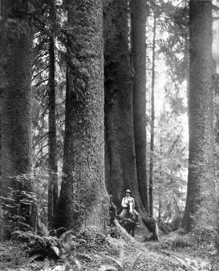
PHOTO 8.—Trees such as nature could not replace for us in ten generations.
Photo by Asahel Curtis.
Primeval Areas and Their Protection
Primeval America is represented today by a few scattered wildernesses. Their preservation unmodified and unspoiled for the benefit and enjoyment of Americans now and tomorrow is a challenge to our national pride.
The once prevalent idea that natural resources in the form of forests and wildlife were inexhaustible has long since been proved untrue. Man's interference may cause a complete disappearance of some of those living things which form raw materials and furnish man with the necessities of life. Furthermore, it has become evident that the artificial conditions which replace natural ones often prove less useful to man. Drainage of some marshes has proved so destructive of man's interests that restoration is now in order.
Unmodified nature is a distinct inspiration to mankind, and has left its impression upon the pioneer. Art and literature offer abundant proof of the great inspiration which has come from nature. It is no wonder, therefore, that the American people are discovering that some of the primeval must be saved from destructive civilization. The first move to this end was the act of 1872, creating Yellowstone National Park, which prescribed that its forests, minerals, and natural wonders should be preserved in their natural condition. This was assumed to mean all growing cover. The next practical move was the act of 1894 similarly protecting Yellowstone birds and animals. Acts creating succeeding national parks repeated these provisions. The National Park Service, upon its creation in 1916, accepted the ideals established relative total protection for primitive land and life forms, and administration of areas under its jurisdiction is in accord with this policy.
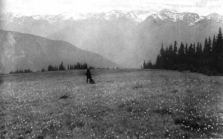
PHOTO 9.—Meadows that have been run over by big game for hundreds
of years without a scar left behind.
The United States Forest Service, recognizing the need, has set aside natural areas of old-growth timber in which human activities have never upset the normal processes of nature. As yet these are inadequate in size and fail to include many vegetative types. Other Government-owned areas administered by other bureaus have no designation indicating this type of use.
It should be noted that too often there is emphasis on the social use of a primeval area rather than upon its ecological status. Under such emphasis a cut-over area by being kept free from further human intervention and use might be considered a primeval area. If the ecological status of the area is used as a criterion, emphasis must lie on its unmodified condition.
The scientific organization which has most consistently urged primeval areas is the Ecological Society of America. It advocates "nature sanctuaries or nature reserves; areas of natural vegetation containing as nearly as possible all the animal species known to have occurred in the areas within historic times * * * surrounded by very slightly modified areas devoted to experiments, recreation, or game culture * * * These areas should be left alone without management and * * * only in the case of an emergency that might arise should control measures be undertaken and then only after most careful consideration and determination as to their practical necessity."1
1 Shelford, V. E., 1932, Nature Sanctuaries; Science, vol. 75, May 6, 1932, p. 481.
According to Robert Marshall, less than 20 wilderness areas of a million acres each remain as an American heritage.2 As people have come to an understanding of the inherent values of wilderness, attention has been directed to the desirability of protecting and increasing such areas. Special emphasis has been placed upon the need for finding areas which can be permanently dedicated to such public use as would furnish outdoor recreation requiring primitive means of sustenance and travel. If recreation is to be a complete change of occupation, then it is suggested that man should sometimes return to a more primitive type of living, in contrast with life in urban communities. It is urged that open spaces be provided where there are no permanent inhabitants, where no roads are allowed to penetrate, and where man is placed largely upon his own resources.
2 Marshall, Robert, 1930, The Problem of the Wilderness, Scientific Monthly, vol. 30, pp. 141—148. (See p. 142, 1933.) The Forest for Recreation, A National Plan for Forestry, S. Doc. No. 12, pp. 463—487.
The United States Forest Service defines wilderness areas as "regions which contain no permanent inhabitants, possess no means of mechanical conveyance, and are sufficiently spacious that a person may spend at least a week or two of travel in them without crossing his own tracks."3 The Forest Service definition of primeval areas is: "Tracts of virgin timber in which human activities have never upset the normal processes of nature."4 These are set aside to preserve virginal growth conditions which have existed for an inestimable period. Here we have emphasis on scientific values, but lest there be overemphasis on vegetation as against animal life, and to give it a general connotation, we should replace the term "tracts of virgin timber" with a broader term and should perhaps make the definition more positive in form, thus: Primeval areas are unmodified tracts of land, with accompanying plant and animal life, where normal processes of nature continue undisturbed by man and where all forms of life are given sanctuary. A shorter definition might be:
Primeval areas are areas in which the ecological processes of nature are not modified by artificial treatment. Consequently a cut-over area might be considered a wilderness but not a primeval area. A wilderness area is free from man-made roads and conveniences, but a primeval area contains unspoiled virgin fauna and flora. The one emphasizes kind of travel possible, the other the type and condition of cover. There is a place for both types of areas.
3 U. S. Forest Service, A National Plan for American Forestry, 73d Cong., 1st sess., S. Doc. No. 12, pp. 473—474.
4 Ibid, p. 471.
Opportunities for preserving the primeval are greatest on large Government reservations like the national forests, but in actual practice, because of emphasis on use, the areas thus far set aside often fail to meet the definition. Too often modification takes place through grazing of domestic stock, killing of predatory animals, or other encroachments which result from commercial pressure.
In the national parks primeval areas are less extensive but are subject to less human use of disturbing effect. The conservation of unspoiled areas is a prime duty of the National Park Service. At present, there is a difference between primeval areas set aside in national forests and those in national parks, because timber cutting and grazing under forestry principles are allowable in a national forest but not in a national park. Likewise, hunting and fishing, subject to existing laws, are allowable within a national forest, but only fishing is permitted inside a national park. In allowing fishing in national parks we have something which heightens recreational value but which modifies certain ecological relationships.
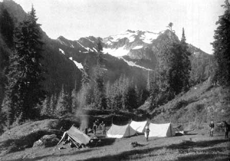
PHOTO 10.—Camping and riding that vanishes when the road grader
moves in.
Within national parks there are designated two special types of unmodified areas:
Sacred Areas.—Sacred areas are spaces set apart to safeguard unique features of national parks, no buildings or roads being permitted.
Research Reserves.—Research reserves are areas within national parks or monuments, unmodified in character, and administratively isolated from entrance, and undisturbed by man-made development. Their purpose is to preserve permanently, in as nearly an unmodified condition, and as free from external influence as possible, representative geologic phenomena and biotic communities, to the end that their characteristic forms shall continue to be available for purposes of scientific investigation and education.
Suitable primeval areas may still be left on Indian lands or on the public domain. Large private holdings should not be overlooked, since, through public purchase or acceptance as a gift, they might be reserved, but wherever located, administration should be governmental so as to obtain stability and assurance of perpetual protection.
Under the increasing pressure of motor travel, control of road building becomes an important factor in the preservation of primeval areas. However, only one motorist in hundreds ventures a mile from his car; the rest are amply content with the road and the museums, lectures, and pleasures of developed centers. For the few, the trail and the primeval; for the many, the points of concentration and comfort. By sacrifices of small areas sufficient to house, interest, and entertain the masses, vast areas are preserved to the student the scientist, and others who appreciate—for today and for generations to come. However elaborate our road systems to the parks and between them may become, the roads within need be only few. Thus is met the problem of preserving our national parks while we also use and enjoy them.5
5 Yard, Robert Sterling, unpublished mss.
There are at least two strong arguments in favor of the protection of primeval areas. First, it can easily be shown that an unmodified wilderness area is a national resource, having both aesthetic and economic values. Second, since the primeval in nature is nonreproducable, fairness to future generations demands that it be protected to assure its preservation for the use of the public of the future.
Man's success is largely determined by his knowledge and ability to make use of natural laws. The best places for scientists to learn first-hand of nature's laws are found where nature's laws still operate undisturbed by man. Many studies of the natural distribution of fauna and flora must be based on that which has been reserved in its natural state. There is need also for a check on rapidly growing artificial development and for the preservation of natural biota to serve as a basis of comparison with artificial growth. Unmodified conditions must be retained as a scientific control on all experimentation that deals with plant and animal life.6
6 Shelford, V. E., The Preservation of Wildlife, Science, vol 52, p. 464, Nov. 12, 1930.
Secondly, natural areas are of economic value be cause they act as a reservoir of natural resources which are saved up for future needs.7 It is reasonable to hope that reserved areas may eventually become a source of enormously important biological information. What man has secured from nature to meet his need is only a small part of what may be secured if biotic conditions be retained intact.8
7 Committee on Preservation of Natural Conditions of the Ecological Society of America, Naturalist's Guide to the Americas, William and Wilkins Co., Baltimore, 1926, 763 pp. (See Uses, Values, and Management of Natural Areas, pp. 7—53.)
8 Joint Committee on Recreational Survey of Lands, Report to the National Conference on Outdoor Recreation, Recreational Resources of Federal Lands, S. Doc. No. 158, 1928, 141 pp.
Still another economic consideration is that of recreation. To be able to turn to inviting woodland and inspiring scenery is a real human need, and the growing interest in virgin tracts of land is evidence of the fact.
We can afford to be careless with those things which are easily replaced, but those which can never be replaced must have special protection and care. When a virgin forest is completely cut, neither our generation nor future ones can expect to see exactly the same type of forest. When a particularly choice rock formation is removed for the building of a road, we can not conceive that it can ever be replaced to please the eye of the observer. Fairness to those who have similar rights to ours, but who will live 100 years from now, demands that we save intact some of primeval America.
Fortunately there is still opportunity afforded for its preservation, for not quite all of America has been despoiled. There are yet within the parks and forests certain areas through which no roads should be built, and direct effort should be made to retain them in their original primeval state.
Aesthetic and economic values recounted above make it a duty of the present generation to protect them. The retention of the primeval in nature is dependent usually upon a minimum of industrial use by the public and continuous protection from encroachment of artificialities.
In connection with the selection of primeval areas a number of problems arise as to size, location, and suitable protection.
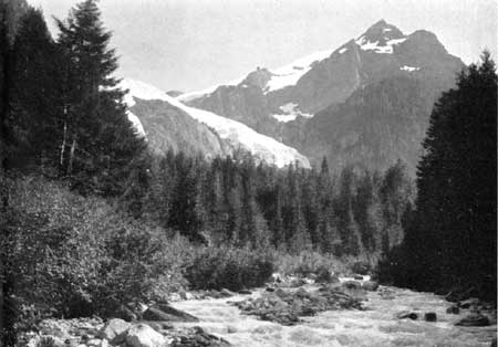
PHOTO 11.—Such country is worth more for direct human use than as
raw material for industry.
Experience has shown that to be retained as such they must be of considerable size so as to give continued protection to all forms of plant and animal life. Animals have seasonal migrations, and lands which are insufficient in size to care for animals at all seasons of the year cannot be retained in their truly natural state. Probably one-quarter million acres is about the smallest area which could be considered at all adequate. Some have indicated that areas of 5,000 acres, scarcely 8 square miles, might protect a timber type, but seldom would such a tract form a biotic unit.9 The larger the area, the more likelihood there is of meeting proper scientific standards. Of course, size will have to vary according to conditions.
9 Marshall, Robert, The Forest for Recreation and a Program for Forest Recreation. A National Plan for American Forestry, S. Doc. 12, 73 Cong., 1st sess., 1933. (See Discussion of Primeval and Wilderness Areas, pp. 471—476.)
Many factors come to bear when a selection is made. The nearby presence of human habitation or of human activities is a detriment. Even the nearness of road terminals must be considered. If an area can be surrounded by a zone in which even halfway protection is afforded, better safety is provided. The term "buffer area" has often been used and experience continues to show its value.
Though in general a hands-off policy will best care for a primeval area, a management policy to retain the primeval is necessary. It is still a question as to how far we may safely go in providing artificial protection against fire. Fire control nearly always demands additional trails, telephone lines, and lookout towers. The provision of this equipment furnishes a means of fire protection, but at the same time brings in man-made control as against natural control.
Conclusions
1. Inspirational and economic values support the view that primeval areas constitute a national resource deserving of protection and promotion.
2. The type of recreation furnished by natural unmodified areas provides physical and mental refreshment of an exceptionally virile and stimulating type.
3. The United States Forest Service, because of the size of areas administered, and the National Park Service, because of its basic laws and lack of commercial pressure as regards administration, are in a particularly favorable position to provide truly primeval areas suitable for the highest scientific use and such recreation as may be consistent with preservation of the primeval.
4. A vanishing resource of unique and irreplaceable value, primeval areas should be protected in a great national system, regardless of Bureau jurisdiction.
A National Program for Historic Sites.—In a broad conception of the national program, the ideal is the possession by the Federal Government of sites which are the finest and most representative of their kind for each successive phase of American development. From this point of view the ideal Federal system would contain, for example, the finest archeological remains of all known periods of prehistoric human habitation upon the continent, the most significant colonial survivals, the sites of the most critical events of the American Revolution, and so on. Typifying the different stages in the development of America, the national historic sites would provide resources of high cultural and educational significance.
Toward the realization of such a conception the National Park Service is now moving. Representative of the prehistoric phase of American development the Federal Government already possesses invaluable archeological survivals including pueblos, cliff dwellings, and mounds such as Yucca House, Mesa Verde, and Mound City. Though much is still to be done, a broad basis has been laid for protecting these areas and developing them for the public benefit.
Within the last 5 years, three important sites representative of American colonial life have been acquired by the Federal Government. These include, first, Colonial National Monument area, comprising the archeological remains of the earliest settlement at Jamestown, the battlefield of Yorktown which brought an end to the colonial period, and portions of colonial Williamsburg; second, the birthplace of George Washington, typical of the second frontier stage in Virginia life; and finally, Morristown, located on the economic and social frontier of the colonies struggling against England, but strategically central for military operations and protected and endowed naturally to support the main camps of the American Army during 2 years of the Revolutionary War. These areas are among the finest historical possessions of the American people.
Representative of the revolutionary origins of our Government, and commemorating the struggle which brought American independence, are several critical battlefields of the Revolution, such as Yorktown, already mentioned, King's Mountain, Cowpens, and Guilford Courthouse; and within the last 3 years has come the development of Morristown, to which reference has been made, and which is probably entitled to be called the military, political, and economic capital of America during a considerable period of the Revolution.
The period of sectional and national development is at present represented by relatively few areas under the Federal Government, considering the general extent of physical survivals from this epoch over the country as a whole. The westward movement is recalled in the story surrounding the Shenandoah and the Great Smoky Mountains National Parks, as well as the proposed Pioneer National Monument in Kentucky, and Scotts Bluff along the Oregon Trail in Nebraska. The story of the second war with Great Britain is told at Fort McHenry, the New Orleans battlefield (Chalmette), and the proposed Perry Victory Memorial National Monument on Lake Erie. Fortunately, too, private societies, municipalities, and States have preserved extensive physical survivals of this period. It is anticipated that some areas now under another form of control will eventually, because of their national importance, come under the Federal Government.
From the era of the Civil War, the Federal Government possesses the great battlefields from Antietam to Appomattox, as well as several survival forts such as Fort Pulaski and Castle Pinckney. These areas, distributed over the East and South, and historically related to much that happened before and after the major struggle, provide bases from which to interpret broad phases of American life. The development of these areas, greatly furthered by the emergency programs, is moving in the direction of this broadly interpretative use.
The recent period of American development is of general interest to all Americans, though not much has yet been done by the Federal Government in preservation and interpretation of sites associated with the history of our generation. An exception is the site where the first successful airplane flight took place at Kitty Hawk, N. C.
Sites commemorative of the Spanish-American and World Wars have been proposed. In addition, almost endless possibilities present themselves out of the multitude of economic, social, and political developments of our day. While representative sites from these significant phases of our national development will undoubtedly be included in the national system, it is perhaps as well that we do not move too rapidly in acquiring national areas in connection with recent history.
A list of archeological and historical sites now under the administration of the National Park Service, classified according to the principles enumerated above, is shown in appendix, page 273.
In building up the ideal program for places of national historical interest, it is of utmost importance to consider areas in every part of to the country and to evaluate them in terms of their availability for national use. Much material relative to this problem has already been brought together in surveys conducted by various Federal agencies in the past. Moreover, private individuals, as well as various State historical and archeological societies, have done much work in collecting information and evaluating it.
It is admitted that the full results of these surveys and other similar undertakings now in progress have not yet been completely assembled and analyzed, but certain principles applicable to problems of national planning are already clearly evident.
Statement of Principles.—The Government of the United States should interest itself directly in preserving under its own jurisdiction a relatively limited number of sites of historic nature. The majority of historic sites, like the majority of scenic and scientific areas, should be preserved through the various State and local governments, as well as through private and semi-public organizations. In this connection, more comprehensive legislation, both State and Federal, looking toward a better working program of conservation, is needed.
The determining factor in the preservation of a historic site by the Federal Government, as in the case of any areas of great scenic or scientific qualities, is that it possesses certain matchless or unique qualities which entitle it to a position of first rank among historic sites.
The quality of uniqueness exists—
(a) In such sites as are naturally the points or bases from which the broad aspects of prehistoric and historic American life can best be presented, and from which the student of the history of the United States can sketch the large patterns of the American story; which areas are significant because of their relationship to other areas, each contributing its part of the complete story of American history;
(b) In such sites as are associated with the life of some great American and which may not necessarily have any outstanding qualities other than that association; and
(c) In such sites as are associated with some sudden or dramatic incident in American history, which though possessing no great intrinsic qualities are unique and are symbolic of some great idea or ideal.
Survey of Historic Sites.—1. The Government of the United States should assume the fundamental responsibility of inventorying historic and archeological sites. This involves two purposes: first, the acquisition of invaluable data regarding irreplaceable historical and archeological remains; and, second, the use of such data to determine under the tests already suggested the qualities and possible rank of such areas and materials as well as proper legislation for their conservation. The importance of this work is indicated by the recommendation of the International Conference on the Conservation of Artistic and Historic Monuments, that "each country or the institutions created or recognized competent for this purpose publish an inventory of ancient monuments, with photographs and explanatory notes."
2. In order to know what resources of this type remain and in order that a better plan may be developed, it is believed that the Secretary of the Interior should provide that a survey be made by the regularly constituted historical agencies with the Department of the Interior; the results of the survey should be compiled and the sites classified as "Potential National" and "Nonpotential National" sites.
3. Following this survey and subsequent recommendations it is suggested that the Secretary of the Interior recommend to the Congress the passing of such legislation concerning historic and archeological sites as he may think appropriate in the national program.
Archeological Resources.—The Indians, real breakers of the new world wilderness, originated ways of life, means of travel, and systems of agriculture which, adopted by the first white settlers, have exercised potent influence upon our whole national career. The Indians wrote the first chapters of American history, but only by study of their archeological remains can we hope to read and to understand them. Ruins, mounds, and village sites thus constitute precious historical and archeological resources. Their preservation from idle destruction and their scientific study are obligations which the United States owes not only to its own intellectual and educational development, but also—in the sense that the past of any human race is the joint heritage of all mankind—to the world. Prehistoric Indian sites of outstanding archeological or historic importance should, therefore, if on private land, be acquired by public agencies. Those already on Government land should be protected by greatly improved enforcement of existing laws. Certain significant and carefully selected sites should be held inviolate for considerable periods of years to await investigation in the light of the more highly perfected research methods of the future, and study should be made of means employed in other countries for conservation and utilization of antiquities for the common good. Finally, attention should be given to the problem of possible adoption of the principle established by law in Sweden, Italy, Mexico, and elsewhere, that all archeological materials are the property of the Nation.
In accordance with the principles above stated, there follows a list of what are considered to be the most important of the known archeological sites in the United States, the preservation and, where necessary, the acquisition of which are recommended. These sites have been designated A, B, and C in accordance with their apparent scientific and historic importance.
The A sites have been selected because of their preeminent significance and the imminent destruction of some of them through unqualified excavation.
| State | A | A (s.d.) | B | B (s.d.) | C | C (s.d) | Unclassified | Total |
| Alabama | 10 | 1 | 2 | -- | 3 | -- | -- | 16 |
| Alaska | 16 | 8 | 8 | -- | 7 | -- | -- | 39 |
| Arizona | 31 | 54 | 19 | -- | 5 | -- | -- | 109 |
| Arkansas | 4 | -- | -- | 1 | -- | -- | -- | 5 |
| California | 10 | 1 | 11 | 5 | 3 | -- | 3 | 33 |
| Colorado | 1 | 1 | -- | -- | -- | -- | -- | 2 |
| Florida | 6 | 4 | 3 | -- | -- | -- | -- | 13 |
| Georgia | 9 | -- | 5 | 1 | 4 | 2 | -- | 21 |
| Illinois | 3 | -- | -- | -- | -- | -- | -- | 3 |
| Indiana | 3 | -- | -- | -- | -- | -- | -- | 3 |
| Iowa | 6 | -- | 6 | -- | 2 | -- | -- | 14 |
| Kentucky | 2 | -- | -- | -- | -- | -- | -- | 2 |
| Louisiana | 9 | 1 | 1 | -- | 1 | -- | -- | 12 |
| Maine | 1 | -- | -- | -- | -- | -- | -- | 1 |
| Massachusetts | -- | 1 | -- | -- | -- | -- | -- | 1 |
| Michigan | 1 | 5 | -- | 2 | -- | 2 | -- | 10 |
| Mississippi | 17 | 2 | 8 | -- | 5 | -- | -- | 32 |
| Missouri | 1 | -- | 1 | -- | -- | -- | -- | 2 |
| Nebraska | 9 | 3 | 15 | 1 | 2 | 2 | -- | 32 |
| Nevada | 1 | 1 | -- | 4 | -- | -- | -- | 6 |
| New Mexico | 6 | 17 | 6 | -- | 3 | -- | -- | 32 |
| New York | 7 | 1 | 5 | 2 | 8 | 2 | -- | 25 |
| North Carolina | 3 | -- | 1 | -- | 2 | -- | -- | 6 |
| North Dakota | 12 | -- | 6 | -- | -- | -- | -- | 18 |
| Ohio | 5 | 4 | 3 | 1 | 4 | -- | -- | 17 |
| Oklahoma | 5 | -- | 2 | -- | 2 | -- | -- | 9 |
| Oregon | 1 | -- | 2 | 1 | -- | 4 | -- | 8 |
| Pennsylvania | -- | 1 | -- | -- | -- | -- | -- | 1 |
| South Carolina | 9 | -- | 3 | -- | 21 | -- | -- | 33 |
| South Dakota | 10 | -- | 1 | 1 | 1 | -- | -- | 13 |
| Tennessee | 5 | -- | -- | -- | 2 | -- | 1 | 8 |
| Texas | 12 | 1 | 8 | 3 | 8 | -- | -- | 32 |
| Utah | 5 | 2 | 3 | -- | 1 | -- | -- | 11 |
| Washington | 1 | -- | -- | -- | -- | -- | -- | 1 |
| Wisconsin | 5 | -- | 4 | 1 | 3 | -- | -- | 13 |
| Wyoming | -- | -- | -- | -- | 2 | -- | -- | 2 |
| Total | 226 | 108 | 123 | 223 | 89 | 12 | 4 | 585 |
PHOTO 12.—Kinbiniyoli ruin (whirlwind Pueblo) is a well-preserved
ruin belonging to the Chaco Canyon culture. Near here the remains of
extensive irrigation works were discovered.
In connection with the above it is recommended—
That scientifically valuable archeological sites on Federal lands not at present within a national park or monument be designated as national monuments, and that Federal protection be given the sites so designated; that scientifically valuable archeological sites on other lands be acquired and added to the monuments; that all archeological sites which are administered by the Federal Government be classified and treated according to the system of archeological categories developed in table XXXI, namely, A, A (s. d.), B, B (s. d), C, C (s. d.); that all federally administered archeological sites which are reserved for excavation and study should not be publicly advertised or made accessible to the public, except at the discretion of the Secretary of the Interior and the Smithsonian Institution.
These sites specially designated (s. d.) are recommended for semipermanent preservation for two reasons:
1. Under present research conditions they would presumably yield only duplicate information, and
2. Because of the steady advance of archeological technique, they are almost certain to yield far more historical and scientific data in the future than they could at the present time. Experience in the past has amply demonstrated this fact, as witness many of the sites in the Southwest which were completely excavated prior to the recent discovery of the importance of tree rings in dating. Archeological sites already included on lands under Federal jurisdiction where so designated should be regarded as within the above classification.
The particular period at which any of these specially designated sites are to be excavated should be determined by the Smithsonian Institution.
The committee of the Recreation Division is profoundly impressed by the importance of preserving all of these sites because of their rapid destruction at the present time through undirected interests or mercenary exploitation.10 11 Nevertheless, it is firmly believed that unless adequate laws and, even more important, adequate enforcement of these laws, be provided, the mere setting aside of the above-mentioned archeological sites can have but little value. Experience with the National Antiquities Act of 1906 has shown that its potentialities are too limited. It has not been and apparently cannot be enforced. For this reason, it is urged that the National Resources Board, its successor, or any other duly authorized agency of Government, appoint and finance a committee consisting of one member of the Smithsonian Institution, one member of the National Research Council, one member of the Carnegie Institution, and one member each to be designated by the Departments of Justice, Interior, Agriculture, and War. It is recommended that this committee make a careful study of the existing antiquities laws of the various countries of the world in which such laws have proved effective in preserving the common archeological heritage of the people for the countries concerned.
10 Present Status of Archeology in the United States; by Neil M. Judd; American Anthropologist, vol. 31, No. 3, 1929. (See appendix, p. 589.)
11 Report on Illegal Excavations in Southwestern Ruins, by Neil M. Judd; American Anthropologist, vol. 26, no. 3, 1924. (See appendix, p. 590.)
In the light of this information and the experiences with the present Antiquities Law of 1906, the above-named committee should be authorized to draw up an antiquities act more comprehensive in its scope and actually capable of enforcement.
Method of Archeological Survey.—The Archeological Committee prepared a questionnaire indicating the data desired for each important archeological site. These questionnaires were sent to more than a hundred archeologists throughout the United States. Replies were received from about 95 of these collaborating archeologists, and about 550 data sheets were received, giving data regarding that number of sites. Photographs and diagrams were furnished when they were immediately available.
The Archeological Committee then assembled these data sheets by States and prepared maps showing the location of the sites reported upon in each State. The sites were classified by the committee and designated as A, B, and C, to indicate the relative importance of the sites. Sites, in each of these groups, that are recommended to be protected and not to be excavated for a period of years, were classed as specially designated sites, and were marked, for example, A (s. d.).
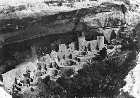
PHOTO 13.—Cliff Palace—Prehistoric communal dwelling
containing over 200 rooms for family living and 23 kivas or sacred
ceremonial rooms.—Mesa Verde National Park, Colo.
An example of the valuable data that were secured by the Archeological Committee is shown herewith:
DEPARTMENT OF THE INTERIOR, NATIONAL PARK SERVICE
ARCHEOLOGICAL SURVEY 1934—DESIGNATED_ _ _ _ _ _ _ _ _ A
Report submitted by (name) David L. DeJarnette, Curator, Alabama Museum of Natural History.
1. Name of site (if known). Mound Park.
2. Location (as accurate as possible). One mile north of Moundville, Ala.
3. Ownership (Federal, State, or private), State, in the care of the Alabama Museum. (If private, name and address of owner). Alabama Museum maintains full-time caretaker permanently.
4. if public ownership, is additional protection needed?
5. Area covered by site, 140 acres, _ _ _ _ _ square miles.
6. Nature of site. A group of 40 mounds with adjoining village site.
7. Surface indications. Mounds (40) and artificial lakes built by the aborigines.
8. Your reasons for recommending preservation of site. This site is one of the largest of its kind in the United States, and exceedingly interesting from an archaeological standpoint. Consequently, it attracts many visitors from outside the borders of the State.
9. Remarks: While there are hundreds of mounds scattered over the continent, the group at Moundville is certainly the finest in the South, and perhaps second only to the famous Cahokia group in Illinois (photos attached).
National Parks and Monuments
The objectives of the National Park Service include the protection of areas of Federal land having outstanding values of scenic, historic, prehistoric, or sites scientific character, and the use of these areas by the people, for inspiration, education, and recreation insofar as these uses are consistent with the preservation and protection of the areas.
The objectives of preservation for future generations and of present use are interwoven, but of two, the preservation is the more important and primary consideration. Areas may be reserved for protection, without present use, looking forward to such us in some future time. Present use that is destructive of the objects for which the reservation was made should not be permitted.
It is recognized that preservation and use may conflict. In such cases the public interest will govern, in an effort to secure a maximum of both objectives combined, without eliminating either objective.
Most of the areas administered by the National Park Service have been reserved from publicly owned lands; some have been gifts to the Government for public use.
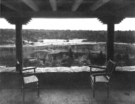
PHOTO 14.—Spruce Tree House as seen from the porch of the new
community house at Mesa Verde National Park, Colo.
Congress has heretofore followed the policy that it is not desirable for the Federal Government to purchase privately owned lands for use as national parks or monuments, but, when a suitable area is offered as a gift, it may properly be accepted and thereafter administered by the Federal Government for the benefit of the Nation. In a number of cases Congress has appropriated funds for the purchase of private lands in established national parks and monuments. It might become desirable for the Federal Government to purchase areas of outstanding national value, either in cooperation with the States or alone. It is obvious that if the Federal Government does enter on such a purchase program, effective restrictions will have to be provided to limit the areas purchased to those which are clearly of great national value.
Beneficial types of recreation appropriate to the areas should be developed and offered to visitors. Recreation, in its broader sense, is one of the major purposes of the National Park Service, but it is inherently combined with the preservation of the outstanding values for which the areas were set aside.
Whatever the number of national parks and monuments, they should be selected in accordance with existing policies as indicated by previous congressional and administrative action, in order that the areas should be those of outstanding national importance.
It is the responsibility of the National Park Service to evaluate these various proposed areas in comparison with the existing established areas. Areas of Federal lands of outstanding national value should be preserved before they pass into private ownership or before the exceptional features of the areas are destroyed. Areas of secondary importance, not truly of national value, should not be established as national parks or monuments, for inclusion of such areas would dilute the value of the system and open the way for additional sub-standard areas, so that, if not carefully guarded, the time would come when a national park or monument would lose its significance as indicating an area of outstanding national value. Any existing national parks monuments that do not meet standard requirements should be eliminated from the system.
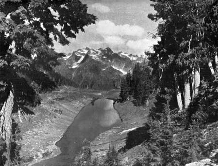
PHOTO 15.—Mount Seattle from the east.
Elimination, Extension, and Addition of National and Monuments.—The system of national parks and monuments is intended to comprise the outstanding areas of their respective types.
In order that the intention may be fulfilled, it is necessary—
1. To eliminate from the system areas not of outstanding national value.
2. To add to the system the areas of greatest national value.
The principal objective of General Grant National Park is to protect the giant Sequoias within its boundaries. This park is located not far from Sequoia National Park, the primary objective of which is also the protection of the Sequoias. It would seem desirable that these two areas should be combined under one national park designation and administered as a unit.
It is suggested that Zion and Bryce Canyon National Parks and Cedar Breaks National Monument be combined and administered as a single national park, consisting of three detached areas.
Grand Canyon National Monument should be added to Grand Canyon National Park, since it is adjacent to the larger reservation and is of similar type.
Death Valley National Monument is believed to be suitable for establishment as a national park.
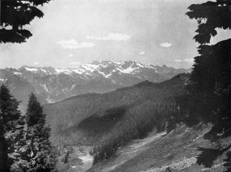
PHOTO 16.—The head of the Queets from the Queets-Quinault Divide.
Additions to Existing National Parks and Monuments.—In a program of enlarged and extended Federal activities in forestry, recreation, and wildlife administration, it will be desirable to enlarge greatly the national forests and also the national park system. The enlargement of the latter may be accomplished by increasing the area of some of the present reservations and by establishing new ones.
In a number of existing national parks and monuments, public usefulness would be increased by additions to them or revision of their present boundary lines. Boundary changes may be desirable for some of the following reasons;
1. To include additional important scenic features.
2. To provide a more nearly complete biological unit for the important types of wildlife in the area. Sometimes a park or monument includes the summer range, but not the winter range, of species that it is important to protect.
3. To provide a more suitable area for administrative purposes and for the accommodation of the public.
4. To provide a protective zone around the principal feature which the area is reserved to protect.
5. To permit the construction and maintenance of approach roads.
6. To facilitate administration by substituting topographic boundaries for land-line boundaries.
As a basis for determining the classification of areas as between national park and national forest categories, a comparative statement of the functions and objectives of national parks and national forests is included here:
National Forests.—The Department of Agriculture has defined the objectives and functions of national forests as follows:
The National Forests are primarily utilitarian in purpose. Their dominant function is to preserve and perpetuate the timber supply and to safeguard the watersheds of streams. Their resources are to be employed to meet the economic requirements of the Nation, to the fullest degree consistent with their adequate perpetuation. In pursuance of this principle, the cutting of timber, the utilization of forage, the storage of water for irrigation or power, the occupancy of lands for purposes of industry, commerce, or residence, and the exploitation of their mineral resources is permitted under proper regulation and control.
But the very existence of forests, streams, varied and abundant vegetative growths, fish, game animals, etc., in combination with a wide and varied range of topographic and climatic conditions operates to create within the national forests an integrated recreational resource, which, when properly coordinated with the industrial utilization of other resources, has a tremendous social and economic significance, that within limited areas may be of paramount importance and demand specialized and intensive development and management. The dedication of such areas to popular mass recreation is in no way inconsistent with the primary purposes for which the national forests were created but, to the contrary, is in complete accord with the principles of regulated use by which their administration is governed * * *
The definition of the objectives and functions of the national forests as given by the Department of Agriculture seems entirely acceptable in principle. The only place where differences of opinion might arise lies in the degree to which the Forest Service, in response to the demands of popular recreation, might depart from what is termed its primary economic function and set up a specialized and intensive development and management which would duplicate that already maintained by and pertinent to the National Park Service.
National Parks and Monuments.—National parks are the superlative natural areas, set aside and conserved unimpaired for the benefit and enjoyment of the people. Their development shall be conducive to the realization of the scientific and recreational values consistent with their inherent characteristics.
National monuments are the outstanding areas or objects of prehistoric, historic, or scientific value, set aside and conserved unimpaired because of their national interest.
(Other classified areas, such as national historical parks, national military parks, national cemeteries, etc., are administered by the National Park Service. Since, however, these types of areas are not at present involved in the problem of differentiating between national forests and national parks, they are not treated specifically in this statement.)
It is believed all areas of national park or monument quality—Kings Canyon, for example—should be included in the national park system and administered by the one agency of Government created to conserve them unimpaired for the benefit and enjoyment of the people. Areas of national park or monument character should not be jeopardized by concurrent commercial use.
National parkways, which are for recreational and not for commercial purposes, should be accorded similar protection and administration.
The act to establish a National Park Service states:
The Service thus established shall promote and regulate the use of the Federal areas known as national parks, monuments, and reservations hereinafter specified by such means and measures as conform to the fundamental purpose of the said parks, monuments, and reservations, which purpose is to conserve the scenery and the natural and historic objects and the wildlife therein and to provide for the enjoyment of the same in such manner and by such means as will leave them unimpaired for the enjoyment of future generations.
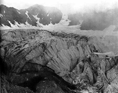
PHOTO 17.—The Blue glacier, showing deep crevasses.
Recreation.—It is assumed that recreation is that which re-creates the individual. This is broader than the physical activity, or playground concept of recreation. In its broader sense, recreation includes spiritual and mental stimulation and exercise as well as physical activity. It is believed that any more restricted definition of recreation is untenable.
If properly utilized, both national forests and national parks will provide recreation. To hold that either administrative service should not provide for the recreational use of these resources is futile. The types of recreation germane to the purposes of the areas that each service administers should be defined.
Since national parks are superlative natural areas, the type of recreation they provide must be consistent with their natural characteristics. To provide this type of recreation is the primary objective of national parks and there is no other competing objective. Preservation and interpretation of primeval nature and of the scientific, prehistoric, and historic objects is an integral part of the main objective.
Since the national forests are primarily utilitarian in purpose, the type of recreation which they provide is therefore incidental and must be consistent with all other uses of the forest and must be correlated with them.
If the recreational values of a superlative area to be realized, the area must be dedicated to that alone. Otherwise it will be impaired. You cannot conduct banking in a temple and keep it a place of worship. Neither can you graze sheep and cattle and cut trees in a superlative forest and keep the forest superlative.
All such areas, then, if they are to be conserved unimpaired for the benefit and enjoyment of the people, should be dedicated to that purpose alone. And it is submitted that such areas should be classified as national parks and monuments, to be administered according to the standards for such areas.
It is evident that administration of great scenic areas, for appropriate recreational use, under two departments of Government is an unwarranted duplication of expenditure and effort. Moreover, the administration of national parks and monuments by the Forest Service would be inconsistent with the purposes for which it was created; just as the administration of national forests by the National Park Service would be a similar inconsistency.
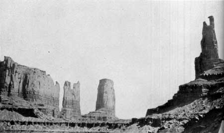
PHOTO 18.—Monument Valley on the Navajo Reservation, Ariz.
Boundary Adjustments.—The unit idea is the premise upon which boundary adjustments are advocated. That is, if a superlative natural area is to be preserved, it must be a unit capable of sustaining itself.
It would be futile to attempt to provide a city with pure water by controlling the area of the reservoir only. It is necessary to control the watershed above the reservoir to assure pure water within it. In like manner, it is futile to set aside a superlative area and attempt to preserve it unimpaired, without including the tributary areas which give rise to its outstanding character.
The unity of the area is particularly important to the psychological aspects of the problem. To take an obvious example: Cliff Palace in Mesa Verde National Park provides a superb and satisfying spectacle in the primitive setting of its secluded canyon. What would Cliff Palace be with an oil well stuck in front of it? It is necessary, then, in order to preserve the character of Cliff Palace to establish a suitable, protected area around it. Moreover, the archeological story of Cliff Palace adds to the pleasurable experience of the visitor. To preserve the primitive environment which made possible the life of the cliff dwellers on that arid mesa makes appreciation of the whole picture more vivid. Finally, there is the important matter of approach to the Cliff Palace area. This must be handled as part of the unit, for there are subtle values involved. These may seem to be intangible considerations but we acknowledge them frankly, and deal with them practically, in every city when we establish business and residential zones.
Perhaps in no instance is the unit character of an area more clearly exemplified than in the attempt to preserve its native biota. A park such as Yellowstone is established. Animal life and the vegetative cover are absolutely essential to the character of the area. But the winter game ranges are excluded. Civilization occupies them. The available range within the park is overgrazed; forest reproduction is consumed; the ground is laid bare and erosion occurs. The superlative features of the area are impaired because the foundations upon which they rest were not included.
Zion Canyon was set aside as a national park. The canyon itself is the superlative feature. But the watershed above the canyon is overgrazed. Run-off is violent. The wooded floor of Zion Canyon is washing away with repeated floods. Again, the unit character of the area has been ignored.
The development of a park is of vital importance in its utilization and preservation. Human utilization of such areas, in a manner consistent with their characteristics, imposes extremely complex problems. If the reserved area is too small or is improperly conceived and delineated, the necessary developments and accommodations must impinge more severely upon features which it was desired to save. This is particularly true of national monuments, such as Aztec Ruins, Casa Grande, Bandelier, Muir Woods, and Devils Tower, as well as of most of the national parks. Human and wildlife utilization of an area is of necessity more concentrated and destructive in a restricted area than in a spacious one. The development and utilization of a park are inescapable elements in the problem of its protection. They must be considered in delineating its boundaries.
Unless a park is treated as a unit it will be impaired. This applies equally to its spiritual aspects, its scientific, aesthetic, and historical values, its forests and wildlife, its development, human utilization, protection, and administration.
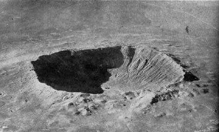
PHOTO 19.—Meteor Crater, Ariz. The pit caused by the impact of a
meteor with the earth. The crater is 570 feet deep and 4,000 feet in
diameter.
Commercial Considerations.—At times, there seems to be a tendency to assume that only areas of little or no commercial value should be set aside as national parks, or utilized for recreation. If this premise were generally accepted, there would be no superlative areas saved for there is not one such area which does not have potential economic value apart from its utilization for recreation. No one could deny that the coast redwoods of California and the virgin forests of the Olympic Peninsula would have economic value if cut for timber. But it is these merchantable trees which make the area superlative. This Nation can afford to reserve samples of its heritage for present and future enjoyment. And then, of course, there is the economic proposition that some of these same trees would be worth far more to look at than to chop down.
New Areas.—Aside from the Yellowstone, which was established when the area was in primeval condition, there never would have been another national park if the areas had been refused because of previous commercial exploitations. For instance, it was necessary to accept Grand Canyon, Zion, Bryce Canyon, Mesa Verde, Glacier, and others, with privately owned property and certain lifetime grazing permits in order to establish these parks at all. But the private holdings gradually are being eliminated and the grazing is decreasing as the permits expire.
Because civilization has moved into the choicest areas faster than they could be established as national parks, some parks now must be carved out of commercialized areas. To permit a previously established and temporary commercial venture to thwart the establishment of national parks now would mean the loss of almost all remaining areas of national park quality.
It is realized the attempt to preserve superlative areas is a highly specialized form of conservation, the benefits of which are not always apparent. It is a type of present use which will not limit the possibilities of future use. The Government is reserving certain archeological areas which will not be excavated for many years, with the belief that archeological knowledge and technique in the future will discover values which present methods of excavation would discard by the shovelful. In like manner, we should not "excavate." our great wilderness areas too heavily at present. For the health of man and of vigorous scientific inquiry, there is need of large superlative areas where nature can be enjoyed and studied as it was in the days of Audubon and Darwin. Thus, we try to leave the doors open to new social values and new scientific knowledge.
The following areas are among those previously under consideration, and it is recommended, in view of the proposed extension of Federal activities in both national forests and national parks, that these areas be studied again to determine how the public interest would be served best.
PHOTO 20.—Southeastern Utah. Cataract Canyon on the Colorado River
below the mouth of the Green River.
Additions involving lands now under the administration of the Forest Service:
1. Mount Olympus National Monument.—The present area of this national monument is approximately 300,000 acres, or about half of the original area set aside by proclamation of Theodore Roosevelt in 1909. The present boundaries should be revised in order to include the winter range of the Roosevelt elk and a large representative section of the finest forest west of Mount Olympus which is of a type not duplicated elsewhere in the United States. This exceptional forest is in an area of high rainfall, the total annual precipitation being 140 inches or more. These lands are now in the Olympic National Forest but, as indicated above, some of them were in the Olympic National Monument as originally established. The Olympic Mountains constitute one of the most primitive and untouched areas of beautiful mountain scenery in the United States.
2. Rocky Mountain National Park.—Inclusion of Arapaho Park country.
3. Yosemite National Park.—Inclusion of approximately 9,600 acres of superlative sugar pine forest near Carl Inn, on west boundary of the park (see also, p. 28, proposed Sierra Nevada Park).
4. Sequoia and General Grant National Parks.—(a) Kings River Canyon area.; (b) Redwood Mountain area (also involves private property); (c) Mineral King area; (d) land south of General Grant National Park (see also p. 28, proposed Sierra Nevada Park).
5. Crater Lake National Park.—Diamond Lake area and other boundary adjustments.
6. Yellowstone National Park.—Thoroughfare and upper Yellowstone country
7. Grand Teton National Park (legislation recently submitted to Congress).
8. Grand Canyon National Park.—Comparatively minor extensions of both north and south boundaries.
9. Carlsbad Caverns National Park.—Addition, perhaps as a detached unit, of a wilderness area now in the Lincoln National Forest.
10. Lassen Volcanic National Park.—Boundary changes, especially to the north, are recommended for study.
The following addition that has been proposed involves land now in the public domain.
11. Zion National Park.—Kolob Canyons, Utah.
The following additions that have been proposed involve land now in private ownership:
1. Carlsbad Caverns National Park.—Guadalupe Mountains in Texas.
2. Great Smoky Mountains National Park.—Extension to the Pigeon River, on the south, in order to provide a more complete biologic unit for wildlife; also an exchange of land between the Cherokee Indian Reservation and the park.
3. Hawaii National Park.—An extension of the southern portion of the park, including additional coast line. Some other areas are suitable for addition, if available.
Areas Suitable for National Parks and Monuments.— Areas believed to contain features that qualify them for designation as national parks or monuments, and should be further studied, include the following:
1. Areas in the Navajo Indian Reservation, Arizona and Utah, and in adjacent portions of the public domain in southeastern Utah. This region includes the present Canyon de Chelly National Monument, the Navajo National Monument, comprising three detached areas of archeological value, and the remarkable Rainbow Bridge National Monument. In addition to these established national monuments there is Monument Valley, a highly scenic area with great sandstone monoliths in a desertlike country of wilderness character, primitive in condition and of appealing interest. Navajo Mountain, the sacred mountain of the Navajos, is the highest point of elevation in the region. It is a prominent landmark, and offers an extensive view over an area of great scenic interest and variety. Coal Canyon and Blue Canyon are other scenic features of the region. In Utah the San Juan River flows through a country that is unusually scenic and but little known. The Goose Necks of the San Juan are one of several remarkable geologic features.
PHOTO 21.—In southeastern Utah. Goosenecks of the San Juan River.
Canyon de Chelly National Monument was established with the approval of the Navajo Indians and of the Indian Service. If it is found to be in the interest of the Indians to establish a national park in the Navajo Reservation, under an agreement that would be mutually satisfactory, then the scenic and archeological features of the area will entitle it to consideration.
2. Palm Canyon, Riverside County, Calif., near Palm Springs, is a part of the Agua Caliente Indian Reservation. It contains the finest groves of native palm (Washingtonia filifera) in the Southwest. The approval of the Indians and of the Indian Service would be a necessary preliminary to consideration of this area for a national monument.
3. Organ Pipe Cactus Area, Arizona.—The two most spectacular, species of cactus in the United States are the saguaro (Carnegiea gigantea) or giant cactus, and the organ pipe (Lemaireocereus thurberi) cactus. The former is larger and more widely distributed and is the chief feature of the Saguaro National Monuments, near Tucson. The organ pipe cactus consists of a clump of separate stems, each about 6 inches in diameter, rising to a height of some 10 or 12 feet, and is found in the United States only in a comparatively limited area of southern Arizona. The area that has been suggested for a national monument lies south of Ajo, immediately to the west of the Papago Indian Reservation and adjoining the boundary between Mexico and the United States. It is remote from centers of population, is of primitive wilderness character, and lacks any important commercial use. The land is principally unappropriated and unreserved public domain, with the usual State school sections. The area includes a good representation of organ pipe cactus, some saguaro and other species of cactus, and typical desert species of plants and animals.
PHOTO 22.—Organ Pipe Cactus Area, Ariz. Showing saguaro cactus,
organ pipe cactus, and ocotillo.
4. Wayne Wonderland, Utah.—This is located on the Fremont River in Wayne County. It is principally public domain with some State school sections and has very little commercial use. The establishment of a national park or monument in this region was proposed by the Associated Commercial Clubs of Southern Utah. The area contains spectacular scenery of red and white sandstone formation, narrow gorges, several natural bridges, some cliff dwellings of prehistoric Indian tribes, petrified trees, and other features of interest. It is in a region that is now visited by few people other than local residents. If a project for a highway across the Colorado River to improve accessibility between south-eastern Utah and the rest of the State should materialize, this area would be on a route connecting Mesa Verde National Park with Zion National Park and its accessibility would be greatly increased.
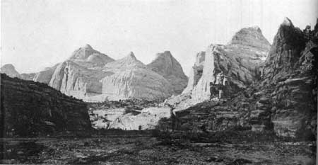
PHOTO 23.—Wayne Wonderland, Utah. Looking up at Fremont River from
the upper end of River Gorge. Domes and cliffs of white and red sandstone.
5. Yampa Canyon, Colo.—Located in northwestern Colorado, and extending to the western boundary of the State, this area includes the scenic canyons of the Yampa River, and also the Lodore Canyon of the Green River. The canyons are principally in sandstone strata and have many vertical cliffs. At the junction of the Yampa and the Green Rivers is Pats Hole, which was called Echo Park by Major Powell because of the remarkable echo which repeats six or seven words, spoken rapidly. The area is a primitive wilderness, now utilized only for rather scant grazing. The region has few inhabitants, is remote from traveled routes, and cannot be reached by automobile. The Lodore Canyon was first explored by William Ashley in 1824, and has been traversed by a few parties of scientists and adventurers. A number of the caves have been occupied by prehistoric Indians. There are no stone dwellings among the archeological remains, but there are numerous granaries, artifacts, pictographs, and other evidence. This area is on the northern border of the region previously occupied by the cliff dweller or cave dweller. The land is mostly public domain, with the usual State school sections and a few tracts of privately owned land.
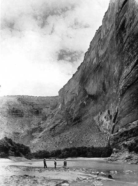
PHOTO 24.—Yampa Canyon, Colo. A typical rock wall in the Yampa Canyon.
6. Desert Plant Area, California.—One of the most picturesque and spectacular plants of the desert regions of the Southwest is the Joshua tree (Yucca brevifolia) or tree-yucca. The wood of this tree has some special uses, and it is also being cut for fuel because of the scarcity of other wood in its neighborhood. It is believed a representative stand of Joshua trees should be protected and held in public ownership. There is a suitable area in Riverside and San Bernardino Counties, Calif., southwest of Twenty-nine Palms and northeast of Palm Springs. The area has an interesting variety of desert plants and borders on both the Colorado and Mojave Deserts. There few native palms are found. Unlike much of the Joshua tree zone, it has scenic interest and variety. Readily accessible to the Los Angeles metropolitan district, the area will have extensive use and is correspondingly in need of protection. It is partly public domain and partly railroad land grant, with some State school sections and private land.
7. Kofa Mountains, Ariz.—There is only one area in Arizona where the native Washingtonia palm (Washingtonia filifera) is found and that is in the Kofa Mountains of Yuma County. The region is in a primeval condition and seldom visited. Its scientific value is probably greater than its recreational value at the present time. The land is mostly public domain. The area under consideration is about 36 square miles in extent. Signal Peak, the highest point of the Kofa Mountains, rises abruptly from the desert plain and has scenic value.
PHOTO 25.—Kofa Mountains, Ariz. Native Washingtonia palms; found
nowhere else in Arizona but in the Kofa Mountains.
8. Channel Islands, Calif.—There are eight islands in this group. The three largest and most desirable—Santa Catalina, Santa Cruz, and Santa Rosa—are privately owned. The other five—San Clemente, Santa Barbara, San Nicholas, Annacapa, and San Miguel—are Government land under the administration of the United States Bureau of Lighthouses. That Bureau has need for only a few lighthouse locations and would be willing to have the remainder of the islands used for other purposes. The Navy may have a use for one of the islands as an airplane field. A marine national park would be of much public interest and value. It would offer features of national interest that are not now represented in any of the present national parks. If some portion of the three larger islands were to be acquired for use as a base, the entire group could be used for a marine park offering excellent opportunities for the observation and study of marine life, as well as fishing, boating, swimming, and other sports. The islands have some rare plants, including the Torrey pine, some fossil remains of the imperial elephant, and extensive archeological remains of Indian villages. Geologic evidence clearly shows that at one time these islands were connected with the mainland and old beach lines, now high above the sea level, indicate that at another time the islands were more deeply submerged than at present.
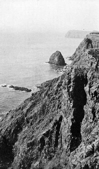
PHOTO 26.—Channel Islands, Calif. The south shore of Anacapa Island,
which is Federally owned. Numerous sea lions frequent the rocks.
9. Meteor Crater, Ariz.—This is the location of a great crater that has been formed by the impact of a meteor with the earth. One scientist has referred to it as "the most interesting spot on the earth's surface." The meteor probably fell several thousand years ago. The crater is some 500 feet deep and some 4,000 feet in diameter. A large mass, or many detached masses of meteoric iron ore, rich in nickel, are believed to be located under the southern rim of the crater at a depth of 1,300 feet. The presence of some meteoric iron has been verified by drilling. The crater is owned by a mining company which hopes to mine the nickel ore, but which, as yet, has been unable to overcome the difficulties encountered, one of which is that the meteor is below the plane of water level. Probably within a few years either the mineral values will have been removed or else the attempt will be abandoned. The area is suitable for a national monument whenever title to the land may be acquired by the Government.
10. Indian Mounds along the Mississippi River in Iowa, Minnesota, and Wisconsin.—Among the interesting archeological remains in the United States are the ruins of cliff dwellings and pueblos in the Southwest and the Indian mounds of the North Central States. Some of the most valuable of the mounds are those grouped along the upper Mississippi River. State officials and organizations interested in conservation have proposed the best of these mounds, most of which are now in private ownership, be acquired, placed in public ownership and designated as a national monument. These mounds or burial places, frequently located on top of the bluff overlooking the Mississippi River, are of three types—lineal, conical, and effigy; in some cases the bones have been transferred from other locations. The region is scenically attractive as well as of high archeological value.
11. Redwoods, California.—There are two types of Sequoia: The "Big Trees" (Sequoia gigantea) and the coastal redwoods (Sequoia sempervirens). Groves of the former are included in Sequoia, General Grant, and Yosemite National Parks, and other groves are in State parks and in national forests. A grove of the coastal redwood is included in the Muir Woods National Monument. Better groves are now in California State parks. The redwoods are found in a narrow and intermittent strip a short distance back from the coast. The northern end of this strip is near the California-Oregon boundary line and the southern extremity is near Monterey. Most of the redwoods are in private ownership. Much of the original stand has been logged, and the rate of present and future logging depends largely upon economic conditions of the lumber industry. These redwoods are the outstanding forests of the United States and the finest stands should be preserved for future generations. The State of California has made important progress in acquiring some of the groves. Additional redwood forests should be acquired for preservation in their original condition before it is too late. They are unquestionably eligible for status as a national park.
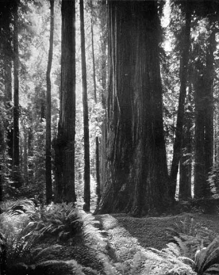
PHOTO 27.—Redwood Belt, Calif. In southern Humboldt County. Photo by Moulin.
12. Big Bend Country, Texas.—Most of this region is in a primitive wilderness condition. It is bounded on the south by the big bend of the Rio Grande, and is adjacent to the international boundary between the United States and Mexico. The Rio Grande, within this area, passes through three great canyons: The Santa Helena, the Mariscal, and the Boquillas. These gorges, from 1,200 to 1,500 feet deep, are highly spectacular. The scenic Chisos Mountains, an isolated group, are also within this area. Rising to a height of 6,000 feet above the Rio Grande, they offer remarkable views. This is one of the most southerly regions of the United States, and contains some unusual animals and many rare plants. Sections of the area are of desert character, but portions of the Chisos Mountains section are well wooded. This is believed to be the most scenic area in Texas and eligible for a national park, and its establishment as such is advocated by officials of the State. Most of the land is in private ownership, though of a low value per acre. The State owns some 200,000 of the million acres in the area under consideration. There is no public domain in Texas.
13. The Lake Region of Northern Minnesota.—This region contains innumerable lakes and a network of waterways that offer splendid canoeing, fishing, and camping facilities. Much of this area is believed to be of greater value for recreational purposes than for commercial utilization. It should be kept in its wilderness condition, without unnecessary roads or other development. Part of this area is now in the Superior National Forest.
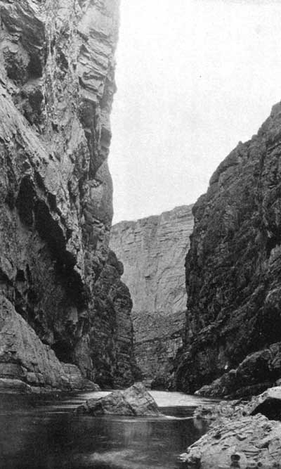
PHOTO 28.—Big Bend, Tex. Santa Helena Canyon, some 1,200 feet deep,
on the Rio Grande. The left cliff is in Mexico, the right cliff is in
the United States.
14. The White Mountains of New Hampshire and the Green Mountains of Vermont.—These mountains are among the most scenic portions of the Appalachian Range and it is believed that their recreational value outweighs the values that might be obtained by the commercial utilization of their resources. Within a comparatively short distance of heavily populated areas, they offer a recreational ground accessible to many. Parts of the area are now in the White Mountain National Forest and in the Green Mountain National Forest.
15. Luquillo Forest, P. R.—This forest is more tropical in character than any portion of the continental United States. It is in an isolated mountain mass at the eastern end of the island of Puerto Rico, known as the Sierra de Luquillo. The area is rugged and has numerous streams. The rainfall is high, varying from 130 to 150 inches annually. Every hill and gorge is clothed with a tropical rain forest, containing a combination of large hardwoods and tall mountain palms. In the lower reaches of the forest are many beautiful tree ferns. Most of this area is in the Luquillo National Forest. The greatest values of the Luquillo Forest will be secured by its utilization for public recreation, watershed protection and perpetual preservation as an unspoiled example of a high mountain tropical rain forest.
16. Okefenoke Swamp, Georgia and Florida.—This is believed to be one of the two swamp areas of the United States with such high scientific and scenic values that they should be in public ownership and retained in their primitive condition.
17. Dismal Swamp, Virginia and North Carolina.—Similar to Okefenoke Swamp already mentioned.
18. High Sierra Nevada country, California.—There is a strip of country along the crest of the Sierra Nevada of outstanding scenic value, which would link together Yosemite, General Grant, and Sequoia National Parks and the Kings River Canyon. This strip is now within national forests, but includes large areas that are above timberline, other areas of noncommercial timber, and still other areas where the recreational value is greater than the commercial value of both timber and grazing. This area is of such superlative scenic character that if it were not already in national forests it would be reserved as a national park, and since it is of greater value for recreation than for commercial use, it is believed it should be under the same jurisdiction as the adjacent national parks. Most of the area is of high elevation and remote from main roads. It would be desirable to include two extensions to lower elevations on the east face of the Sierra and in a few places lower areas would be included to furnish bases for accessible camp sites and other public facilities. In general this area would include regions of superb scenery of national importance, in which recreational values outweigh commercial values. It would link into one great national park what is now three established national parks, and the intervening area now under national forest administration.
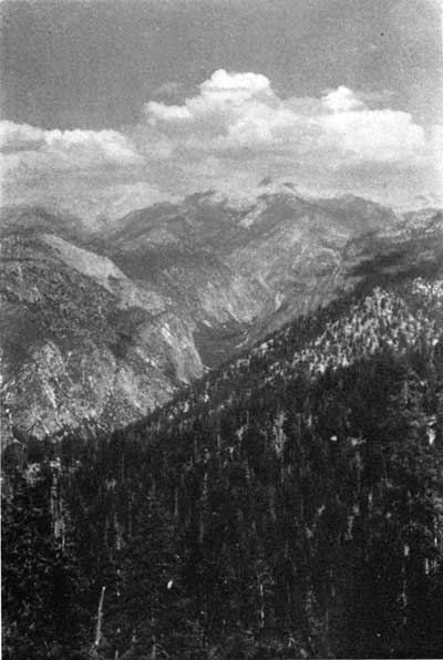
PHOTO 29.—High Sierra Country, Calif. Kings River Canyon.
19. The Cascade Range, Wash. and Oreg.—There are a number of spectacular volcanic cones, also a variety of superlative mountain scenery in the Cascade Range of Washington and Oregon. Mount Rainier, one of these peaks, is an established national park. The other principal peaks would be reserved as national parks if they were not already in national forests. The Forest Service has designated large tracts in the Cascade Range as recreational areas and it is generally recognized that their value for recreation exceeds their value for commercial utilization. Since they contain scenery of national value, and since their chief use is recreation, it would seem that they should be designated as national park lands. The area proposed would include Mount Rainier, Mount Baker, Mount St. Helens, Mount Adams, Glacier Peak, and other outstanding peaks in Washington; and Mount Hood, Mount Jefferson, Three Sisters, and other spectacular peaks in Oregon. The total area would reserve as a national park some of the finest and most spectacular scenery of the country, and would preserve areas whose best uses are for watershed control, game preservation, and education and recreation.
Mount St. Helens with an elevation of 9,671 feet is perpetually snowcapped. Most symmetrical of all the volcanic cones of the Cascades, it is considered by many to be the most beautiful.
Mount Adams is similar to Mount Rainier in grandeur of bulk, mass, and general rugged aspect. Its elevation is 12,307 feet. The surrounding country is especially wild, undeveloped, and unpopulated.
Mount Baker, elevation 10,750 feet, is designated as Mount Baker National Forest Park, in recognition of its scenic rather than commercial value. Mount Shuksan, elevation 9,038 feet, is also scenic, and both Mount Baker and Mount Shuksan have large glaciers and perpetual ice caps.
The Glacier Peak region is rough, inaccessible, and not frequently explored. Glacier Peak is 10,436 feet in elevation.
The peaks in Oregon, including Mount Hood, Mount Jefferson, and Three Sisters, are of the same general type and their recreational use is national in character.
All of these peaks are of national park quality and might be grouped as one great national park—or two parks might be established, one in Washington and one in Oregon. In some cases the peaks would be detached areas, and in other cases some of the peaks might be connected.
20. Colorado River, Utah and Ariz.—One of the great wilderness areas of the United States is in southeastern Utah and northern Arizona, on both sides of the Colorado River, from its junction with the Green River to Grand Canyon National Park. This section of the Colorado River contains many spectacular gorges. Some of them have been seen by only a few adventurous explorers. The area has scant grazing value, but very high scenic quality and great geologic interest. It seems desirable to reserve a liberal area in public ownership. The present use is so small there would be little conflict with commercial interests. The population of the area is considerably less than one person to a square mile. As an indication of the absence of travel in this region at present, it may be mentioned that there is no road across the Colorado River between Moab, Utah, and Lees Ferry Bridge, Arizona, a distance of about 170 miles. The present value of this area is small; its future recreational value will be great.
21. Green River, Utah and Colo.—The Green River, from Flaming Gorge, Utah, through the Canyon of Lodore, in Colorado, and back into Utah, through numerous gorges to Split Mountain, is highly scenic in character. Some of the people of Utah halve proposed a national park in this area. The area under consideration would include the Yampa Canyon, previously referred to, as well as the Dinosaur National Monument.
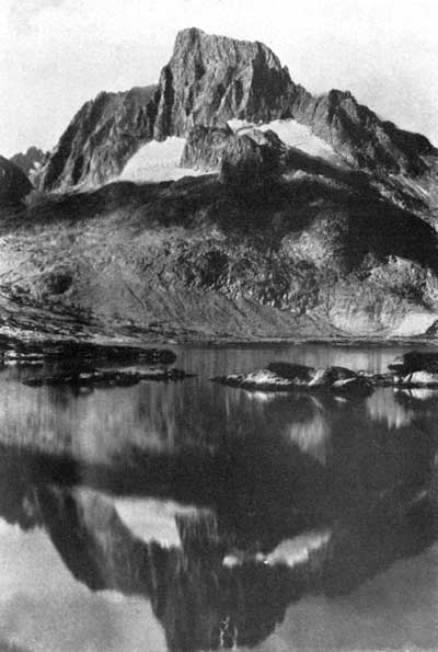
PHOTO 30.—High Sierra Country, Calif. Banner Peak.
There are on file some 138 proposals for additional national parks and monuments. Many of these have not been investigated. Presumably the greater part will be found to possess insufficient national interest to justify their establishment as Federal parks or monuments, but among the list it is believed there are some areas, in addition to those mentioned that should be reserved or acquired for national use.
These proposed areas may be classified approximately as follows, based on their chief feature of interest:
| Number of areas | |
| 1. Scenic: | |
| (a) Mountains | 22 |
| (b) Canyons | 10 |
| (c) Forests | 2 |
| (d) Lakes, lake shores, and islands | 4 |
| (e) Marine, ocean beaches and islands | 3 |
| (f) Caves | 3 |
| (g) Various | 11 |
| Total scenic areas | 55 |
| 2. Scientific: | |
| (a) Thermal | 1 |
| (b) Botanic | 6 |
| (c) Zoologic | 2 |
| (d) Geologic | 1 |
| (e) Paleontologic | 2 |
| (f) Ethnologic | 1 |
| Total scientific areas | 13 |
| 3. Prehistoric: | |
| (a) Cave dwellings and pueblos | 6 |
| (b) Pictographs | 6 |
| (c) Mounds | 2 |
| (d) Other | 2 |
| Total prehistoric | 16 |
| 4. Historic: | |
| (a) Exploration and discovery | 9 |
| (b) Migration and settlement | 7 |
| (c) Colonial period | 1 |
| (d) Military (forts and battlefields) | 17 |
| (e) Places associated with national characters | 15 |
| (f) Invention and industry | 2 |
| (g) Other | 3 |
| Total historic | 54 |
Reaches of the Ocean and Great Lakes.—In respect to one extraordinarily important resource for the enjoyment of a wide range of recreation, namely, ocean and Great Lakes shores, the publicly owned recreation facilities of the United States are seriously lacking. While there are numerous points of public access to beaches in many coastal States, those that are in private ownership, which cater to a far greater volume of use than all those publicly owned, are usually very limited. The maximum of use is usually concentrated upon them and they almost invariably are associated with a crowded, unplanned, and garish conglomeration of structures that frequently is little more than a beach slum.
Of the New England coast, only about 56 miles are in public ownership for recreational use, with approximately 35 miles of beach. Years of effort and clamor have not yet brought any of New Jersey's picturesque and valuable coast line into State ownership. The same is true of Delaware. Maryland, with a limited frontage on the open Atlantic and hundreds of miles on Chesapeake Bay, has not acquired an inch.
Virginia has, in actual ownership, 1,000 feet of frontage on salt water and this lies inside the Virginia capes. North Carolina owns a small amount of beach at Fort Macon; South Carolina has half a mile near Myrtle Beach; Georgia and Florida have none. Of the Gulf States, Texas is the only one owning any frontage on the Gulf (4.8 miles), and that is unsuitable for bathing. In the proposed Everglades National Park is a long coast line on the Gulf with a limited extent of excellent beach.
New York alone, of all the east and south, has had both the wealth and the will to provide any considerable extent of beach or other coastal frontage. Jones Beach, Orient Beach, Montauk Point, Hither Hills, Sunken Meadow, and other properties—10 in all—on the shores of Long Island comprise the most extensive and valuable holdings of this type in the possession of any State, with frontage totaling 55 miles, of which 34-1/2 miles are beach. Jones Beach carries the heaviest annual volume of use per acre of land of any State park in America. These properties serve the population of Greater New York and Long Island, but they are so difficult of access from more distant points as to be of comparatively slight interstate service.
The situation on the Pacific coast is somewhat better than that on the Atlantic. As part of her $12,000,000 park purchase program, California has acquired 52.5 miles of frontage, of which 29.79 miles are beach on the Pacific Ocean, its bays and inlets. Of this total, the bulk is in southern California. Several of these are properties described as "frontage on ocean, 6,000 feet; acres, 0," which indicates that for the most part they include little, if any, of the picturesque uplands that lend so much picturesqueness to her beaches.
"The State of California, and municipalities created by and holding from it, broadly speaking, now possess title, in trust for the people, to the entire coast of California between ordinary high tide and low tide, and to the submerged lands beyond so far as that ownership can be made effective."12 The actual use the beach is often controlled by the ownership of the abutting property. At high tide all of the strip owned by the State is submerged. Convenient access to the beach is essential to its full use by the public. Buildings for public use must be located on adjacent property. Therefore the beaches serve their full recreational use only when the State owns the property fronting on the coast.
12 Report of State Park Survey of California, prepared for the California State Park Commission by Frederick Law Olmsted, California State Printing Office, Sacramento, 1929.
Oregon's sole park water frontage is 23.6 miles in length, with 7.8 miles of beach. These properties are highly picturesque but limited largely to those sections of her coast where the mountains meet the sea, or to rugged shores where bathing is limited and somewhat hazardous. Four hundred and twenty miles of the State's 450-mile shore is owned by the State between high and low water, and has the legal status of a public highway. Washington's State-owned frontage resembles that of Oregon in picturesqueness and beauty. It lies on Puget Sound, Hood Canal, and the bays that open on the Strait of Juan de Fuca. It is a notable fact that of her 13 miles of salt water frontage, more than 11 are on properties obtained from the Federal Government without cost to the State.
For the entire United States, the States own 206.6 miles of frontage on salt water with 110.5 miles of beach. As previously stated, the United States Coast and Geodetic Survey reports that the total length of tidal shore line of continental United States, measured by a unit 1 mile long, is 21,862 miles. The total ownership of coastal property included in all of the State park systems is only 1 percent of the total tidal shore line of the United States. The possibilities for increased public recreational use of the seacoast are tremendous.
New York, Pennsylvania, Michigan, Indiana, Wisconsin, and Minnesota all possess parks fronting on the Great Lakes, though those of Wisconsin and Minnesota possess slight value for intensive recreation. Ohio, with its long frontage on Lake Erie, has not devoted a foot of it to recreation; neither has Illinois on her more limited Lake Michigan frontage. The total State-owned Great Lakes frontage is 63.9 miles with 26.4 miles of beach.
National Park Policy for Wildlife Administration.— One function of the national parks is to preserve the flora and fauna in their primitive state and to provide the maximum opportunity for their observation.
In the present state of knowledge, and until further investigations make revision advisable, it is believed that the following policies will best serve this dual objective as applied to the vertebrate land fauna.
Relative to areas and boundaries:
1. That each park shall contain within itself the year-round habitats of all important species belonging to native resident fauna.
2. That each park shall include sufficient areas in all these required habitats to maintain at least the minimum population of each species necessary to insure its perpetuation.
3. That park boundaries shall be drafted to follow natural faunal barriers, the limiting faunal zone, where possible.
4. That a complete report upon a new park project shall include a survey of the fauna as a critical factor in determining area and boundaries.
Relative to management:
5. That no management measure or other interference with biotic relationships shall be undertaken prior to a properly conducted investigation.
6. That every species shall be left to carry on its struggle for existence unaided, as being to its greatest ultimate good, unless there is real cause to believe it will perish if unassisted.
7. That, where artificial feeding, control of natural enemies, or other protective measures are necessary to save a species unable to cope with civilization's influences, every effort shall be made to place that species on a self-sustaining basis once more.
8. That the rare predators shall be considered special charges of the national parks in the proportion that they are persecuted everywhere else.
9. That no native predator shall be destroyed on account of its normal utilization of any other park animal, excepting if that animal is in immediate danger of extermination, and then only if the predator is not itself a vanishing form.
10. That species predatory upon fish shall be allowed to continue in normal numbers and to share normally in the benefits of fish culture.
11. That the numbers of native ungulates occupying a deteriorated range shall not be permitted to exceed its reduced carrying capacity and, preferably, shall be kept below the carrying capacity until the range can be brought back to original productiveness.
12. That any native species which has been exterminated from the park area shall be brought back if this can be done, but if said species has become extinct, no related form shall be considered as a candidate for reintroduction in its place.
13. That any exotic species which has already become established in a park shall be either eliminated or held to a minimum provided complete eradication is not feasible.
14. That the threatening invasion of the parks by other exotics shall be anticipated; and to this end, since it is more than a local problem, encouragement shall be given for national and State cooperation in the creation of a board which will regulate the transplanting of all wild species.
15. Presentation of animals. That presentation of the animal life of the parks to the public shall be a wholly natural one.
16. That no animal shall be encouraged to become dependent upon man for its support.
17. That problems of injury to persons or to their property or to the special interests of man in the park shall be solved by methods other than killing the animals or interfering with their normal relationships where this is at all practicable.
18. Relative to faunal investigations. That a complete faunal investigation, including the four steps of determining the primitive faunal picture, tracing the history of human influences, making a thorough biotic survey, and formulating a wildlife administrative plasm shall be made in each park at the earliest possible date.
19. That the local park museum in each case shall be repository for a complete skin collection of the area and for accumulated evidence attesting to original wildlife conditions.
20. That each park shall develop within the ranger department a personnel of one or more men trained in the handling of wildlife problems who will be assisted by the field staff appointed to carry out the faunal program of the Service.13
13 From Fauna of the National Parks of the United States, by George M. Wright, Joseph S. Dixon, and Ben H. Thompson; Government Printing Office, 1933.
National Capital Park System.—The National Capital Park system of the District of Columbia and its environs is administered by the National Park Service of the Interior Department. It comprises within the District 680 separate properties totaling approximately 5,334 acres, and in the adjoining States of Maryland and Virginia about 1,1266 acres. In the District of Columbia 3,053 acres or 57.2 percent are developed; 458 acres or 8.6 percent partially developed, and 1,823 acres or 34.2 percent undeveloped. Of the 1,166 acres in the States of Virginia and Maryland approximately 80 percent is undeveloped.14
14 Statistics from an unpublished statement of the National Capital Park Office entitled "National Capital Parks Reservation List", Revised to May 1, 1934.
An integral part of the regional recreational plan are the properties under the jurisdiction of the Maryland National Capital Park and Planning Commission in suburban Maryland.
In the District of Columbia there are also certain properties which functionally are a part of the recreational area system of the National Capital but not under the immediate jurisdiction of the National Park Service. These include several properties under the Playground Department of the District Government, school properties suitable for playground or playfield purposes under the Board of Education; the National Zoological Park under the Smithsonian Institution; the National Botanic Garden; the Capitol Grounds, and other areas under the Joint Library Committee of Congress; the Agricultural Department grounds and the National Arboretum under the jurisdiction of the Department of Agriculture.
The properties of the National Capital Park System may be classed as follows:
1. Circles, Ovals, Triangles, and Parklike Strips in Streets.—These are numerous but their total acreage is comparatively small. They are usually formally landscaped when developed. They serve as beauty spots, safety zones, and as sites for statues or other memorials.
2. Small In-town Parks or Squares.—These were for the most part set aside in the original plan of the city. They are formally landscaped when developed and serve as rest and relaxation places and as informal playgrounds for very young children.
3. Playgrounds and Playflelds.—These areas are of comparatively recent origin in the system and as yet are entirely too few in number and acreage to serve adequately the active adults of the city. Playgrounds are intended to provide convenient and properly equipped places for the play of the children of the city, while the playfleld or recreation center is designated to provide readily accessible opportunities for the sports and games of the youth and active adults.
4. Formal Landscaped Areas Which Provide Settings for Public Structures.—They serve also as rest and relaxation places and in some instances provide opportunities for active recreations. The Mall is a typical example of this kind of area.
5. Large Parks.—These are for the most part naturalistic or landscaped areas preserving the water front of the Potomac and Anacostia Rivers, the watersheds of various small streams in the District and the region, and areas of historic and scenic interest. Some of these properties are highly developed from the landscape viewpoint while others are kept in a naturalistic condition. Typical examples of large water front landscaped areas are East and West Potomac parks. These are developed chiefly for various kinds of active recreation, as is also true of the Anacostia River front and valley.
Typical examples of areas kept in a more or less naturalistic condition are Rock Creek Park, which reserves and protects the forested watershed of Rock Creek and some of its tributaries, the Glover-Archbold Park; the large area along the Potomac River comprised in the Mount Vernon Memorial Parkway, including Fort Hunt; Fort Dupont in the District; and other historic areas.
6. Parkways and Boulevards.—The parkways are chiefly parts of the water-front and stream-valley properties mentioned immediately above. The proposed Fort-to-Fort Drive will be a combination of both a parkway and a boulevard, forming a connecting loop through the suburban sections of the District and contacting nearly all the major park properties and many of the active-recreation areas.
The metropolitan character of the National Capital Park System is at once apparent from the foregoing statement of its present status, comprising areas both within the city and outside its boundaries.
There are several reasons which have inspired the extension of the park system into the region about the city and District and that make it desirable to continue this policy. Among these are the arbitrary and unnatural boundaries of the city, the expansion of the population and its overflow into the surrounding region, the great need for outdoor recreations of a working population so largely engaged in executive and of clerical pursuits, and the high per capita ownership of automobiles which enables a large percentage of the people to seek outdoor recreations beyond the boundaries of the city.
Unlike the park systems of other large cities of the United States, the National Capital park system is essentially national in character. While the system serves the recreational needs of the residents of the District and its environs it also provides recreational services to very large numbers of the people of the United States who are drawn to the city because it is the Capital of the Nation. The national character of the parks of Washington is clearly stated in the language of the act of September 27, 1890, providing for the establishment of Rock Creek Park: "that a tract land * * * shall be secured, as hereinafter set out, to be perpetually dedicated and set apart as a public park and pleasuring ground for the benefit and enjoyment of the people of the United States."15 Because Washington is the Nation's Capital and the District of Columbia a Federal district, the providing of open spaces for parks and recreation always has been dependent on legislative action of Congress. "Prior to the passage of the act of June 6, 1924 (43 Stat. L., 463), creating the National Capital Park Commission, all park areas except those shown on the plan of the original city and small areas outside the original city at street intersections, were created by special acts of Congress.16
15 The italics are the Editor's.
16 Schmeckebier, Laurence F., The District of Columbia; Its Government and Administration, Washington, D. C., Institute for Government Research, 1928, p. 662.
The creation of the National Capital Park Commission, the members of which are appointed by the President, except certain ex-officio members, marked a most important step in the history of park planning and development in the National Capital and its environs. The Commission was specifically charged under the act creating it "to acquire such lands as in its judgment shall be necessary and desirable in the District of Columbia and adjacent areas in Maryland and Virginia * * * for suitable development of the National Capital park, parkway, and playground system" (act of June 6, 1924—43 Stat. L., 463, sec. 2). By act of April 30, 1926 (44 Stats. 374) the powers of the Commission were enlarged and its name changed to the National Capital Park and Planning Commission. The object of this change was stated as being "to develop a comprehensive, consistent, and coordinated plan for the National Capital and its environs in the States of Maryland and Virginia, to preserve the flow of water in Rock Creek, to prevent pollution of Rock Creek and the Potomac and Anacostia Rivers, to preserve forests and natural scenery in and about Washington, and to provide for the comprehensive, systematic, and continuous development of park, parkway, and playground systems of the National Capital and its environs."
Acting under the authority of the congressional legislation of 1924 and 1926, together with subsequent legislation, the National Capital Park and Planning Commission prepared a comprehensive plan of parks, parkways, and playgrounds.
The plan comprised two general groups of properties.
First. A system of active-recreation areas, playgrounds, and recreational centers. This suggested system included 226 major recreational centers and approximately 130 playgrounds. The total area of this proposed system of playgrounds and recreational centers is 1,068 acres.17 The plan involved the use of suitable school sites, properties belonging to other public agencies where arrangements could be made for such use, and the direct purchase of additional sites or extension of existing sites by both the School Board and the National Capital Park and Planning Commission. Considerable progress has been made in the acquisition of sites under this plan and some progress made in development of sites but, in general, it may be said that the chief defect of the park-recreation system of the National Capital as it exists today is in the inadequacy of spaces for children's playgrounds and playfields. Juvenile delinquency among the children is very high in those sections of the city lacking playgrounds, and the rate of delinquency among the youth of the city is appalling.
17 Statistics from an unpublished statement or the National Capital Park and Planning commission dated Nov. 1, 1911.
It is urgently recommended that Congress make available the necessary funds for carrying forward as speedily as possible the plans of the National Capital Park and Planning Commission for playgrounds and playfields and, especially, for completing acquisition of and making usable those projects already begun.
Second. The second group of areas in the comprehensive plan comprises areas intended to preserve the forests and natural scenery and historic sites in and around Washington, to restore the purity of the waters of Rock Creek, the Potomac, and Anacostia Rivers, protect the watersheds of streams tributary to Rock Creek and the above-mentioned rivers, and to preserve water-front areas, and areas suitable for parkways and boulevards.
Of that part of the general plan comprising properties in the region, the acquisition and development of the water front of the Potomac River from the Memorial Bridge to Mount Vernon has been accomplished as the first unit in the George Washington Memorial Parkway; Fort Foote on the Maryland side of the river and Fort Hunt on the Virginia side have been transferred by the War Department; and certain key properties at Great Falls and control over certain places in the bed of the river have been obtained.
Within the District, through purchase, gift, transfer, or allocation, much progress has been made in securing properties along the Potomac River especially in the southern part of the city. Three-quarters of the lands for the Fort-to-Fort Drive have been secured, including practically all the historic fort sites.
In Maryland, the Maryland National Capital Park and Planning Commission has acquired, through funds loaned and contributed by the Federal Government, 7 miles of stream valley parks totaling 580 acres. These not only add further protection to the watershed of Rock Creek and to certain tributaries of Anacostia River but also provide many opportunities for active recreation.
Outstanding among the regional projects is the George Washington Memorial Parkway, or River Valley Park, extending along both sides of the Potomac River for approximately 30 miles, from Mount Vernon on the south to and including the Great Falls on the north, and also including the historic Chesapeake and Ohio Canal and the Potowmack Canal constructed by George Washington. To insure this and future generations against despoliation of the banks of the Potomac River by objectionable and undesirable commercial enterprises already taking place; to preserve the Chesapeake and Ohio Canal not only because of its great historic value but also because of its recreational potentialities; and to retain the Great Falls of the Potomac in their natural state it is urgently recommended that Congress, as rapidly as possible, make available the necessary funds for carrying forward this project.
It is further recommended that Congress, as soon as practicable make funds available for complete acquisition of projects already under way in the District. The Park and Planning Commission has 50 such projects in the District in various stages of acquisition in which more than $5,500,000 have been invested for land acquisition. The Commission estimates that will require $2,000,000 to complete two-thirds of these; $3,500,000 would complete all of them. These projects include a large number of the much-needed playgrounds and neighborhood recreation center areas.
It also is strongly recommended that Congress make funds available for the progressive development of areas already acquired so that people may have the benefit of their use at the earliest possible date. This recommendation has special reference to the development of areas for playgrounds and recreation centers.
The present and proposed future expansion of the park-recreation system in the District and its environs together with a constantly expanding program of recreational services raises the question as to the best form of administration of recreation in the District and the region. At the present time the administration of public recreation is divided among three principal agencies: the National Capital Park Office of the National Park Service, the Playground Department of the District Government, and the Community Center Department of the Board of Education. Some plan of unification and coordination is highly desirable in order to secure maximum service from funds appropriated and from properties and facilities now available and to be provided in the future.
Considering the metropolitan and national character of the park-recreation system of the District of Columbia and its environs; and considering also that most of the facilities for outdoor recreation are under the control of the National Capital Park Office of the Park Service and that this Office is well equipped to handle all problems in design, construction, and maintenance of areas and facilities and that its Recreation Division could readily be expanded into a program administering agency, it is recommended that public park-recreation administration be unified and coordinated through the National Capital Park Office and that it work in close cooperation with the Board of Education and other public agencies rendering recreational services in the District.
It is further recommended that an advisory park-recreation committee composed of certain ex-officio members and outstanding citizens of the community be appointed to advise with the executive park-recreation officials of the National Capital Park-Recreation Office concerning the development and administration of a comprehensive program of recreational service in the District and its environs.
Biological Reservations
Because wildlife cannot be adequately conserved, i. e., perpetuated and used, by the establishment of wildlife reservations alone and because wildlife is one of those recreational resources which permeate the entire country, it must be considered in all forms of land utilization and should be dealt with as a national resource.
One locality within one State may have a surplus of antelope, buffalo, or grizzly bear, whereas these same animals may be practically extirpated from the entire remaining area of our country. In such cases, it is hardly justifiable to permit the local viewpoint to deprive the Nation of a valuable and irreplaceable resource. In addition, therefore, to the establishment of numerous wildlife reservations, there should be a national coordination of wildlife conservation.
Such a program of conservation should include all types of wildlife utilization consistent with perpetuation of the resource and the realization of its various types of values. For example, referring to the definitions of different types of wildlife reservations given on page 4, all reservations should not be of the game preserve or game refuge types only, but should include all kinds of reservations in order to provide for all types of wildlife utilization, according to their function. But national coordination of wildlife conservation should rest in one agency.
A specific conservation measure of apparent merit is suggested by McAtee. It is as follows:
Sentiment has been aroused and action taken to preserve objects of outstanding natural interest other than birds. Among the national monuments, for instance, Muir Woods was established to save a noted redwood grove, and the Papago Saguaro to reserve characteristic desert flora, primarily the giant cactus, while among national parks the Sequoia is intended to insure the perpetuation of the big trees. We have national monuments even to protect petrified trees and fossil dinosaurs. Then let us do as much for threatened forms of wildlife lest they join the fossil world.
The sequoia and the redwood are wonderful native plants, the survivors of an evolutionary series known to have great antiquity. Their continued existence hangs by a slender thread, and we have done well to strengthen it. We may equally as well insure the preservation of such interesting birds as the road runner, the anhinga, and the pelican. The road runner is confined to the southwestern United States and northern Mexico and is absolutely unique; if we allow its extermination, it will be gone for ever, like the great auk and the passenger pigeon. The anhinga, snakebird or water turkey, is one of the very distinct family of birds of which there are only three or four species in the world; our bird is restricted chiefly to cypress swamps, and the number of breeding places available to it is constantly decreasing. There are only about six species of pelicans in all, of which two occur in the United States, and they are restricted in the breeding season to widely separated colonies, in most of which they have been terribly persecuted.
All of these stand alone among our birds, and their loss, whether from the standpoint of science or of popular natural history, would be irreparable. Birds of wonderful structure, the last remnants of their lines, and not only of national but of international interest and value, they are subjected to wanton raiding by small minorities for petty reasons. Classing them as vermin could be termed as childish, if it were not a monstrous absurdity. Rather than being dealt with so shamefully, they are just as much entitled to preservation as some of the objects that have national monuments devoted to them. Living pelicans or anhingas certainly equal, if they do not surpass, in interest, fossil dinosaurs, and road runners are just as characteristic and precious an element of desert life as the giant cactus. If we should carry out the logic of our own previous actions or should follow the enlightened example of Japan, we would in outstanding cases establish the birds themselves as national monuments. This step would all the more be warranted in the case of migratory birds, the pelicans, as protecting the breeding colonies alone is only of seasonal effectiveness.18
18 McAtee, W. L., A Little Essay on Vermin (in Bird Lore, vol. 66, pp. 381—384, December 1931).
National Forests
National forest lands are and should be widely used for recreation. Recreation might be considered as one of many forest crops which must be included in the sustained-yield policy. Where it is the primary forest product it should not be jeopardized by concurrent and competing commercial objectives. Lands that are chiefly valuable for recreation and which meet park standards should be established as such. Where recreation is concomitant with other forest objectives, it should be provided for by the forest administration.
The report to the National Conference on Outdoor Recreation contains the following summary of the present and future recreational use of national forests:
The national forests are rich in resources of very great value for other than purely material purposes. Recreational use is a public service compatible with the laws under which the forests are administered and with sound principles of land economy and public welfare. In the public and private forests of other countries, with long-established systems of forest management, public use for recreation is thoroughly recognized as an important form of land service. In this country, as population grows and economic and industrial needs become more intensive, there will be an increasing need for opportunities for refreshment of body and spirit which the out-of-doors alone can give and which the great national forests can supply in abundant measure. The use of forest highways, trails, and campgrounds by the recreation-seeking public will progressively increase. There will be appreciable increases in the numbers of outdoor camps maintained on national-forest lands by counties, municipalities, and other political units and by semiofficial or unofficial agencies. The number of summer homes maintained under special-use permits will mount progressively. Private capital and initiative engaged in supplying the outdoor recreational needs of the American public will turn to the national forest fields of operation and will encourage and develop many forms of outdoor sport under national forest conditions which are now of minor consequence. While intensive and mass forms of outdoor recreation will properly continue to be encouraged on the national forests, due recognition, it is hoped, will be given—and given now before it is too late—to the legitimate demand for opportunities to enjoy the simpler forms of wilderness outdoor life disassociated with highways and crowds.
It is clear that the social requirements of the future demand definite provision for recreation as a part of the planning necessary for the orderly development of national forest resources and the realization from them of the maximum public benefits.19
19 Joint Committee on Recreational Survey of Federal Lands, Recreation Resources of Federal Lands, Washington, D. C., National Conference on Outdoor Recreation, 1928, pp. 107—108.
Indian Reservations
In a few instances Indian reservations include areas of outstanding scenic, scientific, historic, or prehistoric value that would be eligible for consideration as national parks and monuments if they were on unappropriated public domain. In such cases it would seem proper for the Indian Service to decide whether or not the interest of the Indians could best be served by having such areas designated as national parks or monuments, and calling the National Park Service into cooperation in the administration of these specific areas.
The possible objects to be gained would include—
1. Beneficial contact between the Indians and an increased number of white visitors.
2. Increased opportunity for the sale of products of Indian craft.
3. Added employment for Indians in the development and operation of the area, such as employment on roads and other construction and maintenance work, employment in connection with furnishing food, accommodations, and supplies to visitors, and employment as guides.
If such national parks or monuments were established, they should be administered by the National Park Service, under an interdepartmental agreement which would outline the duties, responsibilities, and authority of the two bureaus. Canyon de Chelley National Monument is now operated on this basis.
Other recreational activities on Indian reservations, both for the use of Indians and for white visitors, would be under the administration of the Indian Service.
The report to the National Conference on Outdoor Recreation suggests that Indian lands are not public property, but are reserved for the benefit of the Indians and not for the general public. Some forms of public use, however, such as wilderness recreation, may be utilized by visitors with resultant benefit to the Indians.
The following extract is taken from the above mentioned report:
Many Indian reservations offer unusual opportunities for the development of wilderness recreation for general public enjoyment. This is a form of use that can not only become profitable to the Indians but one that is peculiarly appropriate to Indian genius and life. It is, too, a form of land utilization that can well be coordinated with the management of the forest, grazing, and wildlife resources of the reservations. The policy governing the administration of the Upper Mississippi River Wild Life and Fish Refuge under the administration of the Department of Agriculture may well be considered in this respect. It is to be hoped that the duplication of commercialized popular outdoor resorts, however enticing financially, will be wholly avoided. The spectacle of Indians selling "hot dogs" and fake trinkets cannot be viewed with complacency. The restricted application, however, of the wilderness policy of recreation, would seem wholly appropriate.20
20 Joint Committee on Recreational Survey of Federal Lands, Recreation Resources of Federal Lands, Washington, D. C., National Conference on Outdoor Recreation, 1928, p. 115.
Reclamation Projects
The Reclamation Service administers areas that have been reserved for the construction and operation of irrigation and drainage projects. These projects are usually of such magnitude as to be impracticable for development by private enterprise. The recreational features of these reclamation projects may include boating, bathing, fishing, and other forms of recreation associated with a large lake. These reclamation projects are usually unsuited for national parks or monuments.
In the case of the Boulder Dam, it has been suggested that the National Park Service might cooperate with the Reclamation Service in supervising recreational and educational activities which are not the primary objective of the Reclamation Service. The public takes a natural pride and interest in this project and some provision must be made for the handling of visitors to the dam. A need may arise to provide boat trips on the reservoir, to enjoy the scenery of the area, including the lower part of the Grand Canyon of the Colorado River, which has heretofore been accessible only to an adventurous few. Fishing may offer recreational possibilities. Accommodations for the public may be needed on Government land. The National Park Service might cooperate in some of these operations, but the project should remain primarily as a reclamation project and not be classified as a national park or monument. The administration should remain primarily with the Reclamation Service.
The Public Domain
The report on A National Plan for American Forestry makes the following recommendation regarding those parts of the public domain that are suitable for recreation:
Public domain lands that are chiefly valuable for recreation should be turned over to the national parks, national monuments, national forests, or State parks, according to which type of management is best adapted to administering them. Provision has been made in the Recreation Act of June 14, 1926, for turning over to the States or minor political units public domain lands of recreational value which seem better adapted to local than to Federal administration.21
21 U. S. Forest Service. A National Plan for American Forestry. U. S. Senate Document No. 12, 73d Congress, 1st Session, 1933. 2 vols., pp. 483.
Territories and Insular Possessions
Alaska.—National park development in territories is noteworthy, but few territorial parks exist, and administrative units for sufficient care and protection are lacking. Alaska has a national park, Mount McKinley, with 1,939,493 acres, and four national monuments. Katmai National Monument contains 2,697,590 acres and Glacier Bay National Monument contains 1,164,800 acres. The area of Sitka National Monument is negligible, being designed to protect totem poles. Old Kasaan, the fourth national monument in Alaska, is also small. There are extensive national forests in southeastern Alaska. The area of privately owned land is small and most of Alaska is public domain.
It is just as important to supplement such national activities in a Territory as in a State. Each Territory should have a territorial park commission and a system of parks to care for regional recreation and to protect significant scenic, historic, and scientific features.
Philippine Islands.—Insular possessions are as yet largely lacking in park and recreational development. The Philippine Islands, even though slated for independence, should not neglect longer the establishment of an insular park system.
Puerto Rico.—Puerto Rico's only extensive nationally owned area is the Luquillo National Forest. It is being developed almost wholly as a recreational area, though storage reservoirs and power sites are involved. The small plazas in each town constitute about the only public recreation areas with the exception of a sizable city park in San Juan, a few publicly owned beaches, and insular forests of importance. Among the most worthy projects suggested as insular parks are Luquillo Beach at the eastern end of the island, particularly well fitted as a bathing beach and also having historic associations, and Guajataca Gorge, the scenic 12-mile river gorge at the west end of the island. A third project on the south side of the island would be needed to furnish recreational opportunities to the large population of the southern slope of the island.
Study on the ground22 has shown that the two large fortresses of El Morro and San Cristobal are of such age and historic interest that they should eventually be added to the national monument system and utilized educationally rather than at present as quarters for troops. Furthermore, there are a number of scenic and scientific areas, some of which have been selected by the eminent scientist, Dr. N. L. Britton, which should he protected and utilized as insular parks.
22 Bryant, H. C. and Wright, Geo. 1934 Report of Inspection of Park Possibilities in Puerto Rico. Unpublished manuscript.
Three strong arguments for early development of an insular park system in Puerto Rico are—
1. The very dense population needing recreational facilities.
2. The need for protecting rapidly disappearing fauna and flora.
3. The need of publicly owned areas since practically the entire island is now privately owned.
Virgin Islands.—Similar recommendations to the above can be made regarding the Virgin Islands. An insular park system should be started through the public purchase of privately owned lands to provide protection for significant and disappearing plants, and for public use for recreation. Here also playfields and organized recreation for children are needed badly.
Hawaii.—The life story of volcanism may be told in Hawaii National Park, first, by the active volcanoes of Mauna Loa and Kilauea on the island of Hawaii; second, by the dormant crater of Haleakala on the island of Maui; and third, by a dead crater. It is desirable to add to the national park at least one of the following areas, which are also rich in scenic and biologic interest;
1. West Maui Mountains, including Eke Crater. This is a dead volcanic dome rising to an elevation of 5,700 feet, highly eroded cuts, deep valleys, and sharp ridges. Beautiful waterfalls, cascades, and mountain streams abound. There is a dense native forest on the windward side and but sparse vegetation on the leeward side.
2. Windward Molokai.
3. Kohala Mountains on Hawaii.
4. Mount Waialeale, including the Na Pali lee coast and Waimea Canyon on the island of Kauai.
These areas are geologically unique and are not duplicated in existing national parks. Their wild mountain character and intricately sculptured beauty can hardly be equalled.
Investigation has not been made as to the availability of these areas, nor whether they involve territorial or privately owned lands.
At the 1934 Territorial Conference of Social Workers the following resolution was passed:23
In the interest of the youth of the Territory the Conference urges that greatly increased appropriations be made for the Recreation Commission of Honolulu and agencies of similar character on the other islands, to be used in the employment of more trained recreational supervisors in order that the character values of recreation may be assured and conserved.
23 From a report transmitted by letter from Hon. J. B. Poindexter, Governor of Hawaii, Oct. 9, 1934.
The Recreation Commission of Honolulu makes the following recommendations:24
1. Continuance of recreational supervision by the Federal Emergency Relief Administration and of engineering projects which affect the creation or improvement of recreational facilities throughout the Territory.
2. Continuance of appropriations to Hawaii National Park, the islands of Maui and Hawaii.
3. The creation of a position of recreation executive by the Federal Government for the Territory of Hawaii, whose duties shall be to coordinate in the welfare and interest of all.
24 Report transmitted by letter from Hon. J. B. Poindexter op. cit.
5. CIRCULATION SYSTEMS
The automobile in the space of 30 years has evolved from an experimental curiosity into a vital element in our existence. Although there is today an elaborate system of highways and approximately 20 million automobiles to our 123 million Americans, approximately half of our families still do not own their own transportation. It has been but little more than a decade since a trip of 500 miles or more by automobile was an uncommon experience, and even today it is probable that comparatively few people have made more than a dozen trips of a thousand miles or more.
Such amazing expansion has meant rapid change and progress in the design of both automobile and highway. As a profession, the design of highways for motor vehicles has had difficulty in becoming what one might call a "stable science", because its problem has changed with the same rapidity as the change in automobile design.
In relatively few years normal touring speed of highway traffic jumped from 15 to 20 or 25 miles an hour, to 35 miles, to 45 miles, until one might be safe in saying that today's normal speed is 50 to 55 miles an hour. Each progressive acceleration in average speed has set up different requirements in highway design, as to grade, alinement (curvature), super-elevation or banking of curves, width of roadway, and type of surfacing material, and has caused vast increase in highway mileage.
In the face of constant economic change and inventive accomplishment, long range predictions as to future use and importance of the automobile in American life, even though based on the most careful study of past history and present trends, are almost certain to be inaccurate. Who can assert that in the span of a generation, the automobile may not show a decline in general use, or perhaps in special uses? The fact that we kill as many people by automobiles during a year as we lost soldiers during the year 1918 is ample and indicting evidence that mass use of the automobile is untested and unproved.
What will be the attitude of the average individual when he will have made a dozen motor trips of a thousand miles or more? What will be the outcome of a change in the economics of the several means of long distance travel? At present for one person, a transcontinental trip is less economical by automobile than by other transportation means; for two persons it is the reverse. Who can say with authority that this fact will long remain?
Whatever the unpredictable long range place of the automobile in American life, there are strong indications predicated on past record and current trend that at least the near future should certainly see the automobile used to a greater extent, the country with more automobiles per capita, and a continuing progress made in automotive design.
Present day statistics estimate that only 40 percent of all motor travel is for commercial and strictly transportation purposes. This indicates that 60 per cent of all motor travel is largely recreational. Eight thousand miles per year is the average use of each of the 20 million registered motor vehicles in the United States. This demonstrates the important place the automobile holds in our national recreation scheme. A large percentage of this travel is local, but while no exact figures are available to prove that long distance travel is increasing, figures covering out-of-State registrations are indicative of such increase.
City streets, no doubt, carry the largest percentage of private traffic, arterial routes in metropolitan areas are second in importance, and State highway systems third. The latter have been coordinated so that in the aggregate they tend to form a national highway system.
The city street has met the change from horse-drawn to motor traffic with little or no change in its design except for roadway surface and sporadic widening. Twenty-five years ago earth surface was the common type used on all city streets whereas today the paved surface is in general use. The city street has probably declined in its use for recreational traffic, and while it may carry a tremendous amount of traffic, it might be considered only as a means of access to and from one's residence rather than as a type of traffic artery for recreational use.
The arterial routes in metropolitan areas probably are the most used for recreational purposes since they provide routes of travel for trips of one day or less. This without doubt is the largest volume of present recreational traffic.
The State highway system provides the means for trips of one day or more. It handles traffic between points within the State, and for those taking extended trips provides the means for crossing a State. The principal arteries of a State highway system normally follow the most natural and direct route for the flow of traffic.
Streets and highways have been developed under a most liberal policy. Their legal status permits great freedom of use and there are practically no restrictions as to access. The advent and general use of the automobile and truck have necessitated some restriction. Certain residential streets prohibit truck traffic which has resulted in designation of truck routes through metropolitan areas. The State highway has provided practically no restrictions except those which might be considered in the cause of safety, or the restriction of types of vehicles which might destroy the highway surface. At the present time, taking the country at large, our general policy is in favor of unrestricted use of highways.
In metropolitan areas there has been some progress made in the direction of designing certain traffic arteries for a specific purpose. It is quite natural that this does not occur until the traffic over a given route for a particular distance becomes too great for one roadway. It then becomes logical to consider the design of a second or even third trafficway between two given points using each route for a particular purpose. Some cities distribute traffic on the basis of speed, others on the basis of use.
The parkway is a new type of traffic artery that has been developed in metropolitan areas because it is in these areas that traffic has first increased to such volume as to force the construction of more than one type of roadway. The parkway, as the name implies, is built for passenger car traffic and largely for recreational use. It is defined as a special type of trafficway based on the following principles:
1. A right-of-way of sufficient width to provide a shielding strip of land on both sides of a paved motorway, thereby excluding privately owned abutting property from direct contact with the traveled roadway.
2. The elimination of grade crossings at main intersecting highways.
3. Access roadways spaced at infrequent intervals to reduce friction between entering and departing vehicles and the main traffic streams.
To summarize, it is a roadway within an elongated park.
The wide right-of-way which permits the restrictions as to frontage and access is the fundamental principle behind the parkway idea. Legally, a highway cannot restrict frontage or access rights. A park area is the only type of public land which can legally provide restrictions as to use. The wide right-of-way provides means by which abutting property on the trafficway is made public land, with the only frontage rights. The procedure then is to construct the highway in an elongated park. The park land provides insulation for the highway, giving it restrictions as to frontage and access rights, or to express it another way, provides "publicly controlled access."
Since there is no abutting private frontage, access need be provided only at long intervals; cross traffic can be separated, and need for parking of cars along the curb is eliminated. The insulation provided by the flanking strips of park brings to the trafficway, from the traffic standpoint, much of that freedom from interference and from impedimen that is the advantage of the subway and the elevated, while from the recreation and aesthetic standpoint it provides unlimited opportunity for an attractive roadside that is denied to the subway and the elevated.
The parkway is essentially a traffic artery designed exclusively for passenger car use, largely recreational. It is the most recent type of travel route development for the motor vehicle. It has come into use in metropolitan areas where traffic between given points has necessitated more than one traffic artery. It provides an easy and pleasant access to and egress from congested metropolitan areas, as well as a pleasant route for recreational motor travel in and about a metropolitan district. Because of its recent inception both as trafficway and factor in recreation, the mileage of existing parkways is an exceedingly small percentage of our national highway system. It has, however, already justified and proved its use in metropolitan areas, and gives promise of an increasingly important place in our national highway system and our national recreational plan.
The State highway departments have to date been pressed to the limit of their capacity to build normal traffic routes. Because of this there has been practically no opportunity to build a parkway unit of the State highway system primarily for recreational purposes.
However, the highway systems within National parks and State parks are planned primarily for recreational use. The fact that they are built on park land gives the necessary roadside control. Since most National and State parks are happily not located on normal commercial traffic routes, highways and their commercial traffic are eliminated naturally from the parks largely because a use of the park roadways would lead commercial traffic out of its way.
The location of the National parks and State parks has frequently required that the State highway system provide approach roads to the parks from the main highway system. There are a few cases where parks are located on both sides of a principal highway artery, but in most instances the park areas are reached by spur roads from the main trafficway. The approach roads may then be considered the only roads that have been built by State highway departments primarily for recreational use. The roads within the parks have been built and financed by the park authorities. The approach roads have been largely a problem of the State highway departments, although there have been a few instances of Federal participation in the case of approach roads to national parks where the land is 90 percent federally owned for a distance of 60 miles from the park boundary. This has been done as a means of financing the approach roads to national parks in such States as have a large percentage of federally owned land and where traffic is largely national traffic enroute to a national park.
The parkway idea on a large scale might logically come as a development in the progress of the design of State highway systems. In the first place, both the parkway and the highway would naturally follow the normal route for the traffic between two given points. It would be unsound to build parkways of great length on State or National scale until the traffic warrants it.
There may be instances in certain sections where the nature of the country is scenic rather than agricultural or commercial, and the bulk of traffic over a given highway is of the recreational type. In such instances it might be necessary to acquire a roadside protection in order to maintain the scenic or recreational values of the route and still not restrict or prohibit commercial use, since the volume of traffic might not warrant a construction of two routes. As traffic increases over a given area it is quite natural to believe that the same development as began in the metropolitan areas might take place beyond the metropolitan area; that where the traffic is sufficient for two arteries, one might be planned for through and largely recreational traffic while the other would carry local and commercial traffic.
The economics, the purposes, and the objectives of a parkway and a highway are fundamentally different. The highway will come into use as a way between two points because of traffic demands, regardless of the availability of construction funds. It is graded, surfaced, and generally improved from time to time, to meet the requirements of traffic but with little or no attention to recreation standards. The parkway on the other hand is conceived, designed, and built for specific and limited purposes. While it may be considered for the relief of a crowded highway, at the same time it is set aside for the exclusive use of passenger traffic. It is considered as a completed project built to specific high standards at the outset, whereas the highway must accept the best available. The parkway will include a paved surface, permanent bridges, grade separations, and roadside planting, to make a completed project conforming with the highest standards of the art of the road builder. In contrast, the highway might reach this goal by gradual improvement, as it must be content with such economic support as it can get.
The parkway will be conceived on an aesthetic basis, whereas in the case of the highway, these qualities are incidental, or at least follow other considerations. Artistic opportunities are at once considered in the design of a parkway. It is considered and justified on the premise that it gives a pleasant and comfortable trip to the traveler, a premise that calls for the artistic and inspirational qualities of the art of road building. The parkway may depart from the most direct route in order to provide excellent scenery. It may reasonably seek more irregular topography to provide a more pleasant roadside. It will include architectural design as a necessary part of its bridges and other structures. It will include landscape design in the treatment of the roadside development.
The metropolitan parkway as above discussed may be chosen as a proved means of relieving an overcrowded highway, a preferable alternate to building a second highway.
The George Washington Memorial Highway from Washington to Mount Vernon is a development in the use of the parkway. Although it serves a metropolitan area, the name "Memorial Highway" distinguishes it. It was considered primarily for its inspirational and artistic qualities. It was built to lead to a national shrine. It was built for recreational purposes. The traffic over it was in a large measure developed because of itself. It was not built to relieve a crowded trafficway to Mount Vernon.
The Colonial National Monument Parkway is being constructed in Tidewater Virginia by the National Park Service through the Bureau of Public Roads to connect physically three important areas—Jamestown Island, the first permanent English settlement in America; Williamsburg, the Colonial capital of Virginia; and Yorktown Battlefield, which saw the final defeat of the British Army, and the beginning of our national life. This parkway is being built on a 500-foot right-of-way with structures and incidental construction in adaptations of the eighteenth century brick styles.
"Scenic parkways" built through areas of natural beauty solely for the purpose of the recreational and inspirational values of motoring over them, are being discussed as the next development in the use of the parkway. Such projects would seek to bring the recreational values of a road within a national park to an area of natural scenic beauty by applying the parkway right-of-way principle. Such parkways at the present time are without precedent.
The Federal Government in the emergency program has authorized as a Public Works project the construction of a parkway connecting the Shenandoah and Great Smoky Mountains National Parks. It has also provided for the survey of a parkway through the Green Mountains of Vermont and, as a third project, the Natchez Trace from Natchez, Miss., to Nashville, Tenn. These are the first attempts toward the design of a traffic artery on a large scale for which the first purpose is recreational type of traffic. These are in the main experimental projects, and are pioneering in a new field.
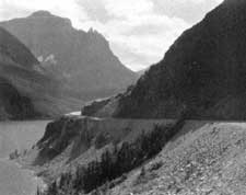 PHOTO 31.—Going-to-the-Sun Highway, a recreational road in Glacier National Park. Photo by George Grant. |
 PHOTO 32.—The Mount Vernon Memorial Boulevard, a parkway connecting the Capitol City with the Washington plantation. The generous right-of-way protects the roadway from undesirable views inland and affords some fine views of the Potomac River. |
Conclusions
From the foregoing general statement the following conclusions are presented:
The recreational use of the highway system of the United States plays a very large share in our national recreation scheme. Traffic over this system is now more than one-half recreational traffic. While some routes are primarily for commercial use these form a small percentage of our entire highway scheme. There are others that are primarily recreational in use and on which the commercial traffic is incidental. Between these extremes we have the larger share of the highway system which carries both recreational and commercial traffic. It is estimated that recreational use forms at least 60 percent of the total use of automobiles.
The motor vehicle as a means of mass transportation is relatively new and is making rapid strides in development. It is logical to assume that the use of the motor vehicle will be a changing thing for some time to come. The mechanical development of the automobile, developments in highway design, and developments in the attitude of the people toward its use, are all in the process of change.
Beginnings have been made in the design of highways as a specialized type primarily for recreational use.
(a) The parkway in metropolitan areas has proved itself and will no doubt come into more general use. It will always be justified by traffic before it is constructed and in most cases will be built as a relief to an existing congested traffic artery.
(b) The State highway systems are units within a national highway system, and may follow the same procedure. Traffic will be guaranteed by an existing congested route between two points before a parkway for passenger vehicles is constructed as a means of relieving this congestion.
(c) The Federal Government in the emergency program, through the National Park Service and the Bureau of Public Roads, is authorizing the construction of one parkway and a survey of two others—first as a means to relieve unemployment and second, as an experimental parkway to provide a recreational route through an area containing natural scenic qualities. Such parkways are being constructed with the expectancy that they will be a tourist attraction and by their own qualities develop the traffic to justify them. These are in contrast to the metropolitan parkway which is justified from a traffic viewpoint before it is constructed.
(d) Units in a State highway system that carry a larger percentage of passenger vehicle traffic offer an opportunity for the development of a type of trafficway somewhere between the parkway and the highway. The use of frontage and access restrictions might be introduced to a limited extent rather than to the complete degree with which they are applied to the parkway. The scenic easement and other restrictions of roadside development, such as zoning and architectural and landscape control of development in abutting property, might very profitably be used. The idea suggested in this section would apply to highways in thinly populated areas where the natural scenery is of such quality that it would attract visitors, and where the traffic over the highways is a mixture of commercial and recreational travel, the larger percentage being recreational—yet where the total is not sufficient to warrant the construction of two traffic arteries, one for commercial and the other for recreational traffic.
Since the automobile plays such an important part in the recreational scheme of the Nation, it is recommended:
1. That the Federal Government make a survey of the national highway system, to include, particularly, the development and design of highways and parkways that are expressly laid out for recreational use.
2. That this survey (the survey referred to here is a survey of conditions and is not to be confused with the word survey as used in highway construction) be maintained annually in order that there may be a permanent record of trends in the development of the recreational use of highways.
3. That the National Park Service be authorized to advise and assist other governmental agencies in their studies of the recreational use and design of parkways and highways.
4. That the existing provision for parkway surveys in the Appalachian Mountains be enlarged to include a survey of a parkway from Canada to the Gulf through the Appalachian Range. The question of the responsibility for construction of such a route, i. e., whether it should be State, Federal, or a combination of State and. Federal, need not be determined at present.
5. That the Federal Government go no further than said survey of the Appalachian route as a definite project until a reasonable amount of such parkway has been constructed and has proved its usefulness.
6. That the Bureau of Public Roads and the States, with the advice of the National Park Service, be authorized to consider parkways upon other sections of the country as additions to the Federal aid systems or parts of the State highway systems.
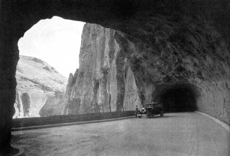
PHOTO 33.—The Zion-Mount Carmel highway pierces the cliffs,
offering from occasional galleries splendid views of the canyon
landscape of Zion National Park.
| <<< Previous | <<< Contents>>> | Next >>> |
recreational-use/sec4.htm
Last Updated: 20-May-2016