|
The Rise of Multiple-Use Management in the Intermountain West: A History of Region 4 of the Forest Service |
|
Chapter 9
An Era of Intensive Multiple-Use Management: 1960 to 1969
By the late 1950's, the Forest Service, led by Chief Richard E. McArdle, wanted a congressional mandate authorizing its de facto policy of multiple use and sustained yield. Resistance to such legislation came from the two ends of the spectrum—those who favored use for commodities like timber and range and those who favored preservation of forests for recreational activities and wilderness. As Congress began considering the Multiple Use-Sustained Yield Act, both the Sierra Club and the National Lumber Manufacturers Association expressed opposition. Sierra Club members believed the act placed wilderness in jeopardy; the lumbermen thought timber production and protection of water flows as authorized in the 1897 Organic Act should be given top priority. [1]
Some rural communities agreed with the lumber manufacturers. In a talk to a group of people in Vernal, Supervisor William D. Hurst said that the Forest Service was required to manage the national forests not just for timber, but also for watershed, grazing, recreation, and wildlife. "My audience," he said, "frowned on this. They thought the Forest Service was created to maintain a constant timber supply and maintain water yield." [2]
To diffuse opposition, the Forest Service undertook a successful lobbying campaign, and Congress passed the act on June 12, 1960. As passed, the act confirmed existing policy by authorizing the Service "to develop and administer the renewable surface resources of the national forests for multiple use and sustained yield of the several products and services obtained therefrom." [3]
With the passage of the act, officers in Region 4 could cite a congressional mandate for their policy of multiple-use management. Where, in the past, the Service had recognized various uses by regulation, the law specifically authorized the activities. Most important, it acknowledged recreation, wilderness, and wildlife as legitimate forest values, on par with the production of commercial commodities. This recognition dealt a lethal blow to the futile efforts of stockmen and lumbermen to have their interests acknowledged as preemptive. Most important, perhaps, the law recognized that the Service did not have to press for maximum commodity production, but rather could strive for the best combination of the diverse functions. [4]
Concerns over activities other than range and timber management emerged as major new challenges in the region. This expansion was particularly critical as the demand for recreational uses increased. Recreation emphasis intensified with the passage of the Wilderness Act in 1964, the Wild and Scenic Rivers Act in 1968, and the National Environmental Policy Act in 1970, all of which placed additional burdens on the Service's resource management capabilities. Wildlife received increased emphasis with the passage of the Endangered Species Preservation Act of 1966.
Implementing Multiple-Use Planning
The increase in forest use intensified a primary concern for the fragile lands of Region 4. [5] As Regional Forester Floyd Iverson put it in a statement on long-range objectives in 1961, the "major water resources, the bulk of the timber, a significant amount of summer forage for domestic livestock, much of the big game habitat and a large majority of the outdoor recreation attractions in the Intermountain area are situated within the boundaries of the national forests." Overgrazing and improperly planned logging roads had already revealed the need for multiple-use management. Increased recreational use made this need even more imperative.
Planning for multiple-use management did not proceed in a vacuum, since with 55 years of experience the Forest Service recognized the conflicting demands on national forest resources. As Neal M. Rahm of the Washington Office put it at a regional foresters and directors meeting in November 1960, forest officers began, like urban planners, with a recognition that conflicting demands would exist, but instead of zoning to prevent conflict, they tried where possible to design "coordinating requirements for different kinds of uses or services within a particular area, unit, or zone." The Service "adopted [exclusive use] only when multiple use is impossible or impractical." Nevertheless, while striving for properly balanced use, the Service recognized that particular values might dictate dominant use in certain areas. [6] As Richard McArdle emphasized in a speech before the Fifth World Forestry Congress in Seattle in 1960, in planning for multiple-use, Forest Service officials were concerned particularly with limitations placed in planning for the proper use of resources by the diversion of national forest lands from potential multiple-use to nonforest purposes such as superhighways, transmission lines, and dams. [7]
Basic to all such multiple-use management considerations was concern for the land and thus for watershed management. In recognition of watershed condition as the limiting factor in all land use planning, the Service realigned its divisions, creating a Division of Watershed and Multiple-Use Management in each region and the Washington Office in 1960 to ensure watershed protection and coordinate multiple-use management. Initially headed by Leon R. Thomas, Region 4's division was directed by Gordon L. Watts in the mid-1960's. [8] In 1969, the region assigned P. Max Ross as Regional Planner-Coordinator, to facilitate cooperative efforts between line officers and study teams assigned to plan for activities in complex situations where potentially conflicting uses and interests might appear. [9]
Though the writing of multiple-use management plans had begun in the late 1950's, Region 4, with the largest national forest land area and greatest geographic diversity outside of Alaska, moved somewhat less rapidly than some other regions in completing its subregional multiple-use management guides. [10] These seven subregional guides were completed in 1960 and put into effect for planning in 1961. [11] Subsequently, the region's district rangers began writing multiple-use plans for their districts. [12] In 1965, the subregional guides were consolidated into a regional multiple-use management guide. [13]
In the early 1960's, when it became evident that planning and execution errors were being made, Regional Forester Iverson began to have rangers prepare multiple-use surveys whenever they intended to undertake an activity that might adversely affect the national forest. These were the forerunners of the Environmental Impact Statements required by the National Environmental Policy Act, but they were implemented voluntarily in accordance with a belief that such surveys would facilitate better management. Meeting resistance at first because of the additional paperwork required, they produced worthwhile results by reducing costly errors. [14]
|
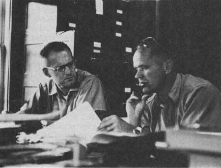
| Figure 82—Ranger Robert Hoag and Deputy Supervisor William Deshler in planning session at Bridgeport Ranger Station, 1962. |
By the late 1960's, after more than a decade of multiple-use planning in one form or another, the regional officers recognized that the numerous competing interests and the relative complexity of writing plans for critical environmental areas created considerable difficulty in the efforts to implement the ranger district multiple-use management plans. [15] A major problem came in dealing with the public—both commodity interests and preservationists—who tended to interpret the term "multiple use" as synonymous with development. Trying to explain that the Service intended to manage the lands both for optimum resource development or use and for other nondevelopmental activities on a sustained-yield basis was difficult, particularly when the users did not understand that if the Service gave needed protection to certain critical watersheds they could not develop all such areas. This was especially true when Congress failed to provide sufficient funding to rehabilitate fully areas like those previously logged, or when the region had to deal with critical environments like the Tahoe Basin, the South Fork of the Salmon River, or the west slope of the Teton Range.
Because they were trained as generalists, many of the rangers who wrote the district multiple-use plans lacked "adequate knowledge of ecologic systems and their interaction," At first, the region tried to remedy this situation by hiring specialists such as landscape architects, soil scientists, archeologists, wildlife biologists, and hydrologists. Engineering staffs were assigned to the smaller forests in the region as they had to the larger forests in the 1950's. [16] Beginning with the Boise, forest level specialists in personnel management and contracting were added to the staffs. [17] Such specialization extended to the purchase of computer equipment for data processing. [18]
H.H. "Rip" Van Winkle remembered returning from a staff position in the regional office to the Teton as forest supervisor. It "had changed a whole lot," he said, "We were developing into specialists all along the line . . . . There were game biologists, engineers, and range experts . . . . So that the staff was becoming specialized instead of centralized the way it had before. When I first started out in the Service you did pretty near everything yourself the best you knew how without knowing very much about it." [19] By 1963, the Teton had a staff of about 60 permanent employees. [20]
Specialization became most evident at the regional level. Numerous specialists were brought into the various regional office divisions to meet growing needs. For instance, Robert Safran came to the regional office in 1962 as special use expert to develop the necessary contract provisions to manage the increasing number of permits. [21] In 1963, a reorganization at the regional office led to the assignment of Don Braegger as Regional Construction Contracting Officer, and subsequent studies by the Washington Office indicated considerable savings through the use of contracts rather than force accounts. [22]
The increasing complexity of Forest Service operations required considerable additional training for existing employees. Led by Assistant Regional Forester Lester Moncrief, the region carried on a great array of expanding and diverse training programs. Subjects included decentralized contracting; workshops for wage-board wage determination; and how to write better letters, clearer directives, and more readable manuals and handbooks. Such traditional training as range reseeding, watershed management, and timber management continued as well. [23]
By the late 1960's, the increasingly frequent use of interdisciplinary teams created problems, since specialists often pushed for the interests represented by their disciplines without adequately recognizing the needs of other interests. In reviewing this problem, Floyd Iverson recognized that someone on each team had to represent the general interest, and after considering the options, he assigned line officers—rangers and supervisors—to these teams to help "assure understanding and adequate coverage of multiple-use coordination." In other words, the regional administration expected the line officers to provide the general knowledge that would serve as a balance to unduly single-minded interests of specialists.
Budgetary limitations, along with the need for efficient and effective work, necessitated the continued measurement of productivity with a view to cost reduction. [24] The Washington Office mandated continued workload analysis of regional offices, forest supervisor offices, and district ranger offices, which was completed in 1969. [25] Under Washington Office direction, the region continued studies under the supervision of Assistant Regional Forester Tom Van Meter, to identify the optimum size for ranger districts. The studies gave particular consideration to the possible consolidation of districts with headquarters in the same community, with seasonal headquarters, and with small workloads. [26]
In 1969, the American Institute of Industrial Engineers published research by two Washington Office employees, Ernst S. Valfer and Gideon Schwarzbart, who summarized the criteria for district consolidation. Based on questionnaires sent to each forest supervisor, the study took various responsibilities into consideration. After reviewing the responses, the researchers concluded that three factors seemed most important in determining optimum size: budget, base workload, and acreage. Devising a formula for computing optimum size, the researchers cautioned that "an effective organization must be more than purely an efficient one in that it must satisfy both its economic requirements and the sociotechnical demands of the organization's sponsors, its own members, and its clients (customers) or the public." [27] Foresters recognized the importance of taking all factors into consideration. If units were too small, the Service could not make effective use of the ranger's time. When the units were too large, however, relationships with forest users suffered because the rangers were unable to meet the users and to deal personally with critical problems.
In spite of the demand for economy, the regional office and some of the national forests were forced to seek new quarters, largely because of the increased size of staffs and complexity of the work. In the summer of 1965, the regional office moved from the Forest Service building on 25th Street and Adams Avenue to share a newly completed Federal building on 25th Street between Kiesel and Grant Avenues. Various divisional headquarters, which by that time had occupied offices in several buildings around the downtown area, were consolidated in the new building. The Intermountain Station headquarters remained in the old building until 1985.
Excellent new offices for the Challis, Targhee, and Teton National Forests were opened in Challis, St. Anthony, and Jackson. [28] In Boise, the old Assay Building office became so crowded that the Boise National Forest Supervisor and most of his staff moved to the Belcher Building. The engineering staff, the soils specialist, and the staff for one of the ranger districts occupied the Assay Building. [29]
The increase in staffs and the added paperwork necessitated by interdisciplinary functions created changes within the system. The job of the ranger became much more complex. [30] Forest rangers who had previously functioned as "kings of their own domain" became members of interdisciplinary teams and often spent more time in the office preparing reports than on the ground making management decisions. As conditions changed, Carl Haycock, by then retired, expressed the view of quite a few oldtimers when he said he would not like to be a forest ranger anymore. "The Forest Ranger," he said, "is no longer an administrator; he's a pencil pusher . . . . So much preparation of reports and related paper work is demanded of him that he doesn't have the time to get out and really manage the resources on his Ranger District." [31]
These complexities created additional difficulty for the region as the legal adoption of the concept of multiple use coincided with a change in the nature of the public with which the Service had to work. In practice, this change required careful application of techniques for working with the conflicting interest groups. In the past, the region had used advisory councils, ad hoc committees, town hall meetings, and formal hearings principally "in formalized consideration of areas where the Forest Service . . . [had] established its position well ahead of time." Forest advisory councils particularly were used "most frequently" as a "means of communicating...[the Forest Service] viewpoints and positions to others." [32] Show-me tours and press releases were used to achieve the same purposes. [33]
Ranger Jack Wilcox put it succinctly. "Around the early sixties the public finally got interested in what was happening to Federal lands . . . . They didn't like what they saw, and they started to get legislation to correct what they thought was wrong. I think that is good that they took an interest . . . . We were getting complacent." [34]
By at least the late 1960's, the use of an advisory board as a ratifying council seemed out of date. The many groups and individuals interested in Forest Service decisions were simply too diverse and their interests often too conflicting. Under the circumstances, the Service had to find ways "to solicit and listen to the ideas of others, so these ideas . . . [could] be utilized in planning and management decisions," As part of the 1969 Assistant Regional Forester-Forest Supervisor meeting, the region's managers resolved to move as rapidly as possible to develop skills and techniques "before decisions are reached . . . [to] involve a greater cross section of the general public in planning and decision-guiding [procedures]."
During the 1960's, the region began a program of annual field trips for educators. Although this proved an excellent means of developing closer relationships with university faculties and administrations, by the end of the decade, the Service had not devised a means of solving the problem of reconciling the interests of competing constituencies. In fact, the problem was not solved with any degree of satisfaction until after the passage of the National Forest Management Act in 1976. In many ways, it has not been solved yet, though the 1985 decisions on wilderness areas seem to indicate that it might be solved through some sort of conflict-resolution procedure emphasizing compromises. The major problem with this example, however, is that the resolution required congressional action, which is far too unwieldy and time consuming a solution for all but the most serious problems.
Inspections
After his appointment as Chief in 1962, Edward P. Cliff raised some questions about the existing inspection system. In response to Cliff's suggestions at the Regional Foresters and Directors meeting in 1964, several proposals were made for modifying procedures. [35]
Cliff asked for staff input, and the region referred the question to the forest supervisors. Boise supervisor Howard E. Ahlskog replied that, while the inspections were important, he objected to the imposition on the forest staffs when inspectors evaluating similar functions came within a few weeks of each other. On the Boise, for instance, the General Accounting Office, Fiscal, and Operations General Functional Inspections and an Internal Audit all had come in one year. Servicing these inspections had required about 5 labor-weeks from the operations division. Ahlskog suggested combining future inspections of similar functions. [36] This had been done to some degree during FY 1964, and he believed similar combinations could be used more extensively in the future. [37]
|
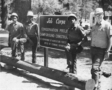
| Figure 83—Job Corps conservation project, Clear Creek Job Corps Center. |
Region 4 as Agent of Social Change
The roles played by the Forest Service became even more complex with the measures taken to relieve unemployment in the Kennedy administration and in the Johnson administration's War on Poverty. Programs such as the Accelerated Public Works Program, the Youth Conservation Corps, the Young Adult Conservation Corps, the Work Study program, and the Older Americans program contributed to the development of forest facilities, but also required considerable time and money to administer. [38]
In 1961, Kennedy sent to Congress a plan entitled "Development Program for the National Forests." Designed as a blueprint for action in meeting public needs, it was expected to provide the basis for Forest Service public works from 1962 to 1972. [39]
To implement this program, the Federal Government began an Accelerated Public Works program in 1963. Although the program was to have lasted 10 years, it was terminated in 1964 (though construction of forest facilities continued under the Operation Outdoors program). [40] Projects covered the full range of Forest Service activities and were undertaken on all forests. These projects included a warehouse on the Uinta, water improvements on the Fishlake, campground facilities on the Wasatch, riprapping and check dams on the Dixie, road construction on the Uinta, footbridges on the Bridger, and trail construction on the Payette. [41]
A good example of the region's role in the War on Poverty was its operation of the Clear Creek Job Corps Center south of Carson, NV, on the Toiyabe. The establishment of this camp created somewhat more local opposition than had the CCC camps of the 1930's. [42] A public hearing in Carson revealed that a considerable minority of the community opposed the center based on the low educational level of the trainees and the fear that boys at the camp might become involved with local girls. Those favoring the center thought it would help in educating deserving young people and preventing long-range welfare and criminal problems. [43]
Started in September 1965, the Clear Creek center had a number of advantages. These included its lovely forested location and the general support of local political leaders. Not the least of the advantages was the selection of Charles J. "Chuck" Hendricks as the first director. An engineer by profession, he was extremely capable and well liked by all. [44]
After arriving at the center, each enrollee was tested and assigned to classwork suited to his educational level. Training emphasized skills needed in jobs then available in the community. At the center, the trainees were expected to work 8 hours a day 5 days a week. Each spent part of the time in classwork and part in public service. [45]
The center achieved some degree of success between 1965 and its termination in May 1969. The average job corpsman was a school dropout. A 1968 study showed that the average enrollee entered with third-grade reading skills and second-grade math skills. On the average, a corpsman stayed in the program 5-1/2 months and during that time advanced an average of 2-1/3 grades. Although only 30 percent of those who entered the program completed their training, 93 percent of those who finished either entered the labor force, joined the armed forces, or returned to school. Although some corpsmen did have run-ins with the law, the crime rate at Clear Creek was lower than for others in the same age group throughout the Nation. In view of the disadvantaged background and low educational status of the trainees, this low crime rate in itself says much about the program. By the end of 1967, the corpsmen at Clear Creek had constructed for the Forest Service $497,000 worth of capital equipment that would probably not have been built without their labor. [46]
|
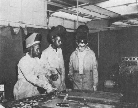
| Figure 84—Three enrollees welding at Clear Creek Job Corps Center. |
The Rural Area Development Program also affected the region. This program, designed to improve the well being of rural communities, required the cooperation of the regional office's State and Private Forestry Division, under H.S. "Hal" Coons, with other agencies of the Agriculture Department and the State foresters of the various States in the region. The program provided Forest Service technical assistance to rural communities seeking to improve employment opportunities for their citizens. [47]
The Civil Rights Act of 1964 also increased the responsibilities of the Forest Service. Executive orders required Service employees to work actively in hiring people from minority groups and in seeking contracts with minority businesses for various goods and services. Subsequent Service studies indicated general compliance, though integrating minority representatives into an organization dominated by white males was not always easy. [48]
Foyer Olsen, then a ranger on the Dixie National Forest, remembered an effort he had to make in this regard. He found it necessary to train his employees to help a youth hired from a poor neighborhood in Ogden understand how to fit into the working world. The effort proved successful for all concerned. [49]
|
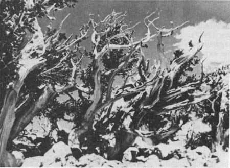
| Figure 85—Bristlecone pine, Wheeler Peak Scenic Area, 1968. These trees are the oldest living things in the world. |
Recreation
Perhaps no field in Region 4 increased in complexity as much as did recreation management, headed by Assistant Regional Forester John M. Herbert during the 1960's. Gone were the days when picnic tables, garbage cans, water faucets, privies, and access roads were the extent of developed recreational facilities. While the region continued to construct such things, it also expanded in a number of other areas, including cultural resource management.
The region undertook a program of determining which so-called "Near-Natural" areas required special treatment because of their unusual interest. These included virgin, scenic, geologic, archeological, and historical sites. The regional office sent instructions to the forests giving criteria for inventorying and designating such areas. [50]
Some of these areas were among the most beautiful and interesting in the Intermountain Region. In 1959, for instance, the Service designated the Wheeler Peak Scenic Area, consisting of 28,000 acres within the Snake Range in the Humboldt National Forest. The home of the bristlecone pine, the area contained 13,000-foot Wheeler Peak, gorgeous alpine lakes, and magnificent vistas. The scenic area also contained a number of examples of Indian petroglyphs that the Humboldt tried to protect. [51] The Service undertook an extensive construction program to provide campgrounds and roads for visitors. Managed under the multiple-use philosophy, the area provided for grazing, watershed protection, wildlife, and mining in addition to recreation. [52]
The Humboldt also contained the Ruby Mountain Scenic Area designated in 1964. [53] It too has magnificent scenic and recreation values, and includes a number of other uses.
Another example of the diversity of cultural resources is Minnetonka Cave on the Caribou National Forest. [54] It is one of only two caves (the other is Blanchard Caverns in Arkansas) currently operated by the Forest Service. During the 1930's, public works programs provided some capital improvements. The ranger district tried to operate the cave for public enjoyment for some time with little success; in the late 1950's the ranger got the St. Charles, Idaho, Lions Club to take it over under a special use permit.
After running the cave for about 14 years, until 1963, the Lions found the project too burdensome to handle. They lobbied the Idaho congressional delegation, particularly Senator Frank Church and Congressman Ralph Harding, to get the Service to take over operation of the cave and to get the Federal Government to construct needed improvements. The Federal Government improved the road up St. Charles Canyon to the cave, and the Forest Service secured a surplus generator and installed new lights. The Service keeps the cave open, with tour guides, from early June until Labor Day each year. Operation of the cave has become a regular budget item for the Caribou.
Much of the work of cultural resource management has been done in cooperation with outside parties—often with university professors. Examples are numerous: research on and recommendations for management of the Lander Trail, an important nineteenth-century transportation route in the Bridger and Caribou National Forests, by Peter T. Harstad, historian from Idaho State University; [55] a cooperative dendrochronological study of bristlecone pines—the world's oldest living things—on the Humboldt National Forest by W.C. Ferguson and J.O. Klemmedson of the University of Arizona; [56] and archeological excavation at the Redfish Lake Creek Indian Shelter on the Sawtooth National Forest by Earl Swanson, an archeologist from Idaho State University. [57]
|
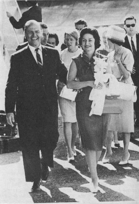
| Figure 86—Senator Frank E. Moss and Lady Bird Johnson at dedication of Flaming Gorge National Recreation Area, August 1963. |
The Forest Service undertook numerous cooperative projects with other Federal agencies. Perhaps the most complex example involved the Forest Service, Bureau of Reclamation, and National Park Service, in the establishment of the Flaming Gorge National Recreation Area. Since the Green River and a number of its tributaries flow through the Ashley National Forest, activities of the Bureau of Reclamation on the massive Colorado River Project designed to control the flow of the river at large dams also affected the Forest Service.
As the Bureau of Reclamation constructed the Flaming Gorge Dam near the Utah-Wyoming-Colorado borders in eastern Utah, both the Forest Service and Park Service proceeded with plans for recreation facilities in the area. Between October 1958 and March 1959, the two agencies carried on discussions and exchanged correspondence about administering the facilities at the lake that would be under both agencies. Proposing the creation of a national recreation area within the area of its jurisdiction, the Park Service wanted to control the lake and a 300-foot strip of shoreline around its perimeter. Under this concept, the Forest Service would have administered only the national forest land outside that perimeter. After discussions between regional officials from both the Park Service and Forest Service, the Park Service compromised, suggesting that it control facilities to the water line and that the Forest Service operate those on the shore. [58]
Emphasizing the problem of fragmented and overlapping jurisdictions, Floyd Iverson, in consultation with the Washington Office, proposed a different division. He pointed out that the Park Service plan would create a national recreation area administered by the Park Service within the boundaries of a national forest, which would produce inefficient administration and result in public confusion. He proposed instead that the Forest Service administer those facilities within the Ashley National Forest and that the Park Service supervise those outside. At the same time he offered to cooperate with the Park Service and the States of Utah and Wyoming in the adoption of uniform boating regulations. A 1963 agreement essentially confirmed Iverson's plan for joint administration of the national recreation area.
In its lobbying, the Forest Service had an advantage. Under its multiple-use management philosophy, it had already begun planning and constructing recreation facilities in the area whereas Park Service plans were still on the drawing board.
As the Forest Service began construction of its recreational facilities in 1960, Park Service activities remained in the planning stage. Although it kept the Bureau of Reclamation and Park Service officials apprised of its progress and shared its plans with them, the Forest Service resisted efforts by the Park Service to slow down the construction of the facilities and to fit Forest Service operations within the Park Service master plan. Three reasons seem to have been uppermost. First, the Forest Service resented dictation by the Park Service on the type and location of facilities because its installations were part of a larger multiple-use management plan for the Ashley. Second, the Forest Service could not afford to build the expensive and elaborate facilities contemplated by the Park Service. Third, the rapidity of Forest Service construction gave the agency greater recognition from Congress and the general public. [59]
|
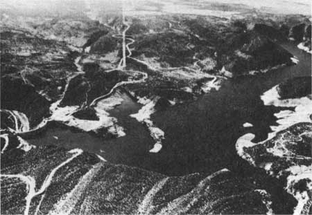
| Figure 87—Aerial view of Flaming Gorge Reservoir and National Recreation Area. |
By 1968, joint administration of Flaming Gorge seemed unwieldy, and both the Agriculture and Interior Departments concluded that sole administration by the Forest Service would be preferable. In this connection, it seems probable that the perception of the general public and elected officials that the Forest Service would manage the area under multiple-use rather than single-use principles helped rally support for Forest Service management. [60] Both the Senate and House reports on Flaming Gorge emphasized the permission granted for hunting and mining. The Senate Report also specifically mentioned the continuation of grazing. Although recreation was to be the primary activity in the national recreation area, the 1968 act allowed multiple-use management to continue. In addition, the Federal Government expected to save money on operation costs by using the Ashley's administrative structure and by having only one agency involved. [61]
In Idaho, the Forest Service cooperated with the Park Service in the investigation of the Sawtooth Mountain area, a scenic and recreational jewel on the Sawtooth, Boise, and Challis National Forests, The Forest Service begin multiple-use studies in the Sawtooth Mountain region in December 1959. Since the area had long operated within the multiple-use management philosophy of the Forest Service, it included the Sawtooth Primitive Area and such diverse activities as logging, grazing, and mining. Recreation played an increasingly important role as visits to the area increased from about 65,000 in 1956 to 252,000 in 1960. [62]
Given the importance of the area and the interest in its recognition as a national park or a national recreation area, further study seemed warranted. [63] Under a January 1963 agreement between the Secretaries of Agriculture and the Interior, the Forest Service and Park Service undertook a joint study of the Sawtooth area. [64] The study involved Assistant Regional Foresters John M. Herbert and John A. Mattoon, Sawtooth Supervisor P. Max Rees, and many others in the Regional Office and the three national forests. The investigation included a joint historical report by Victor O. Goodwin, a forester assigned to the Humboldt River Basin Survey, and John A. Hussey, regional historian for the Western Region of the National Park Service. [65]
As the interagency study continued, Chief Cliff wrote Senator Church enclosing a draft bill which became the model for the future Sawtooth National Recreation Area. [66] Church introduced the Forest Service bill in April 1966, with the cosponsorship of his colleague, Senator Len Jordan. Reintroduced in subsequent congresses by Church and other members of the Idaho delegation, the Sawtooth National Recreation Area Act finally passed in modified form in 1972. [67]
The Forest Service was involved in the development of a number of other important recreation sites, some in collaboration with other agencies and others on its own. After the designation of City of Rocks as a national monument under Park Service jurisdiction in 1966, recreation visits to the adjacent portions of the Sawtooth increased. [68] Historic charcoal kilns south of Leadore on the Targhee drew 3,000 visitor-days of use during 1968. [69] The Challis withdrew the old mining town of Custer in 1966 for preservation as a historic site. [70] The Forest Service undertook the restoration of Tony Grove Ranger Station on the Cache to provide an example of the operation of a station during the 1930's—early in his career, Chief Cliff had been assigned to Tony Grove. [71]
Not surprisingly, demands for increasing recreation use conflicted with pressure to maintain relatively stable ecological conditions in the national forests. An example with long-range implications was the battle between the Forest Service and its allies in the environmental community on the one hand and the Utah State Highway Commission on the other over plans to reconstruct Highway 89 within the Cache National Forest in Logan Canyon. Initial construction, begun in 1959, destroyed considerable fish habitat and, in the opinion of many, lessened the esthetic quality of the canyon. Concerns about safety and speed motivated the highway department, but not everyone agreed with its priorities. [72] As planning for the road continued during the 1960's, Floyd Iverson spearheaded the region's insistence that the Bureau of Public Roads take values other than highways into consideration. Chief Cliff backed the region to the hilt. A considerable body of public opinion supported the region as well, which seems to have been decisive in forcing the Bureau of Public Roads to raise its standards.
Conflicts developed over the use of off-road vehicles. General policy of the Service was to prohibit cross-country or off-road vehicles such as jeeps, trail bikes, and motor scooters where they might "cause erosion, damage young timber and forage, impair recreation values, and adversely affect fish and wildlife resources," [73] Under these restrictions, such vehicles were not allowed in wilderness or primitive areas. Certain critical areas such as Alaska Basin on the Targhee and a number of trails on the Toiyabe were closed. In general, however, the Service believed that the forests had places for the backpacker, the horseman, and the off-road vehicle operator, to the extent that significant damage did not occur. [74]
Motorized vehicle restrictions were not universally popular, and some groups challenged the regulations by entering the Idaho Primitive Area with motorized vehicles. Arrested and fined $100, they appealed the conviction, arguing that existing laws did not authorize the Forest Service to do anything on the national forests except protect timber and secure favorable conditions for water flow. In upholding the regulations, the Ninth Circuit Court of Appeals held that, while recreational considerations alone would not support the establishment of national forests, recreation activities were appropriate subjects for regulation therein. Citing the legislative history of the Multiple Use-Sustained Yield Act, the court ruled that Congress had recognized this interpretation by authorizing recreation and wildlife resources as legitimate purposes for forest management. [75]
Another recreation problem resulted from the disturbances and damage caused in campgrounds by motorcycle riders. Most forests had regulations limiting such use, but some cyclists roared through the campgrounds disturbing people and chewing up the ground cover. Since Forest Service officers visited the camps infrequently, the offended campers had little recourse except discussions with the bikers, which were often fruitless, and the problem was never completely resolved. [76]
Off-road vehicles were not the only offenders in damaging fragile watersheds. In some cases, horses used by outfitters and guides grazed too heavily on critical areas. The Service tried to solve the problem on the Boise by bringing the outfitters into the grazing permit system, but some of them resisted. [77] On the Toiyabe in the mid-1960's, excessive garbage left by outfitters and their parties was a problem. [78] At least one outfitter on the Challis, in complaints similar to those voiced by the stockmen a decade earlier, charged that the ultimate aim of the Service was to drive them out of business. In response, the Forest Service emphasized the need to protect the land from excessive deterioration and damage.
The Idaho outfitters succeeded in securing the passage in 1965 of State legislation dividing national forest territory among various companies. Some national forest officers regarded this legislation as not binding on the Forest Service as it sought to dictate management policy without considering the other needs of multiple-use management. The forest officers did consult with State officials to try to work out satisfactory outfitter arrangements. [79]
It should not be thought that the forests conducted recreation management through ad hoc measures. In the early 1960's, each forest prepared a recreation management plan projecting expected short- and long-range recreational development needs through the year 2000. [80] Tn addition, the Federal Government provided general evaluation of recreation facilities through the activities of the Outdoor Recreation Resources Review Commission, which continued its activities into the 1960's. [81] On heavy recreation forests such as the Wasatch and Targhee, for instance, the position of recreation and lands staff officer was created to provide general supervision and coordination of these functions. [82]
At recreation sites with a large demand, the region provided visitor information services. These included interpretive trails, demonstration areas, vista overlooks, wayside exhibits, guided walks, campfire programs, and contacts by forest officers. By 1964, with leadership from Assistant Regional Forester Alex Smith (I & E) and Supervisors Jay Sevy and Max Rees (Sawtooth) and A.R. McConkie (Ashley), the region had a visitor center in operation at Redfish Lake on the Sawtooth, joint visitor information services (in cooperation with Bureau of Reclamation) at Flaming Gorge, and another visitor center under construction in the Flaming Gorge National Recreation Area, at Red Canyon on the Ashley. [83]
Congress moved in 1964 to try to alleviate the pressure for needed recreation funds through the passage of the Land and Water Conservation Fund Act. The fund derived from three main sources: a recreation user fee for designated areas, dedication of a 4-cent-per-gallon tax on pleasure boat fuel, and receipts from the sale of certain Federal and other property. Money from the fund was to be used to provide additional Federal recreational facilities as well as grants-in-aid to the States on a matching basis for recreational purposes. [84]
In 1965, the region, along with other Forest Service units, began to designate areas at which the recreation user fee would be collected. In the first year, the fee applied to a total of 430 sites in Region 4, including 58 percent of all campsites, and 84 percent of the family units. The region set the initial fee at 25 cents per adult per day. In addition, the region set group fees for larger areas and special charges for boat-launching ramps. [85] In lieu of the daily payments, patrons could purchase $7 Federal recreation stickers or Golden Eagle Passports that allowed unlimited entry to the fee areas for one year. [86] Congress allowed the authorization for the Golden Eagle to expire in 1970. [87]
The region noted some problems in operating the fee system. During the first year, on heavy recreation forests like the Toiyabe rangers noted some deterioration in campground maintenance because recreation officers had to spend additional time selling stickers and tickets. The large number of different tickets confused some patrons. Some dissatisfaction developed because officers visited camps only three times per week, allowing some patrons to use facilities without paying. [88] In several southern Utah communities, citizens resented paying the fees to use local Forest Service picnic areas that had been developed in large part by volunteers and local service clubs from the communities. [89]
|
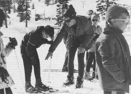
| Figure 88—Skiing at Slide Mountain, December 1968. |
While camping and hiking continued to increase, the forests noted a particularly large jump in water-related recreation and in skiing. As a result, new boating and camping facilities were constructed at high-demand areas like Pineview Reservoir on the Cache, Island Park and Palisades Reservoirs on the Targhee and Caribou, and Nevada Beach on the Toiyabe. [90] Grand Targhee near Driggs, ID, and Teton Village in Jackson Hole, WY, became the sites of new ski resorts under special use permits, and many existing areas increased their lift capacities. [91] Avalanche studies continued at Alta. [92]
Special Use Permits
Perhaps the most controversial change in the administration of special use permits was in the development of national forest summer home areas. In 1961, the Caribou and Targhee advertised the availability of a limited number of summer home sites near Palisades reservoir. [93] In about 1962, the Intermountain Region published a booklet promoting summer home development and providing information on obtaining permits for lots and on the standards required for construction. [94]
By the late 1960's, the increasing demand for public recreational facilities such as picnic areas and campgrounds prompted the Forest Service to do an about-face on the promotion of summer home areas. Because of the public demand for recreational facilities, in 1969 the Service prohibited the opening of new summer home areas. [95]
Though such a blanket policy was a new departure, as early as 1934 the Service had begun to have homes moved from a few critically needed public recreation areas such as Fish Lake. Permittees who had to move were allowed to construct a new home away from the lake shore. The Fishlake National Forest gave current permittees life tenure with the understanding that, if they sold their homes or died, the new owner had to move the home from the lake shore. By 1984, only 7 of the original 60 homes remained. [96] Similar requirements were initiated for the Big Springs summer home area on the Targhee in 1959. Permittee appeals through channels reached the Chief, who sustained the forest supervisors' decision. Complaints are still being raised, however, through the Idaho congressional delegation. [97]
In 1964, under its multiple-use policy, the Forest Service began to raise fees for special use permits for recreational uses, on the ground that if alternative uses existed for such lands, permittees should pay fees reflecting the current market value of the property. This policy raised considerable opposition from summer home permittees, many of whom had occupied their lots for years and had come to consider them their own. Appeals resulted; permittees applied considerable pressure to the Service to rescind increases. In general, although fees were raised, they were not increased to the fair market value of the lots. [98]
While summer home permittees seem to have been most vocal in their opposition to fee increases, the policy also impacted group camps such as those for Boy Scouts, Campfire Girls, 4-H organizations, and church groups. The policy was not applied across the board, however; ski areas paid on a graduated rate system based on the income from the operations, rather than on the value of the land they occupied. [99]
Most significant, perhaps, as population grew and development in the Intermountain West became increasingly complex, the diversity of special use permits broadened. Groups, companies, and individuals secured permits for a great variety of uses including boat marinas, transmission lines, farming, beehives, radio transmitters, and even radar sites. [100]
Public Relations and Wilderness Areas
These various developments, particularly opening virgin timber stands for logging and use of range-watershed lands for livestock grazing, did not enjoy universal popularity. As the variety of groups interested in national forest use multiplied, the Service came under fire, especially from preservationists opposed to development on national forest lands. At the Fifth World Forestry Congress in Seattle in 1960, the Sierra Club distributed literature attacking the Forest Service. From the point of view of Sierra Club president David Brower and his successor J. Michael McCloskey, the concepts of multiple-use and sustained yield evoked images of unrestrained high-yield commodity production and use. [101] The Sierra Club officers were particularly concerned that the Forest Service, despite holding public hearings before designating new wilderness areas, based the designation of new timber sale areas on internally generated multiple-use management plans. In addition, in the Pacific Northwest—though not in Region 4—the Service at that time opposed study of some lands considered as potential national parks. [102] Some of the attacks may have been generated by internal dissent within the Sierra Club itself; the more militant wing under Brower eventually split off to form Friends of the Earth. [103]
Region 4 was able to work out many of these problems. [104] When Floyd Iverson became regional forester in 1957 he entered with a backlog of good will, which he generally maintained. Both the Salt Lake Tribune and the Deseret News, Utah's two major dailies, supported the Forest Service. Moreover, publishers John F. Fitzpatrick and John Gallivan and environmental editor Ernest Linford of the Tribune, together with editor William Smart of the News, were strong supporters.
In some cases, conflict resolution took place through informal meetings. For example, a conflict developed in 1968 between the Sierra Club and stockmen over use of the Bridger Wilderness. Regional officials solved the problem by bringing Ed Wayburn of the Sierra Club and Leonard Hay of the Wyoming Woolgrowers together for a pack trip in the wilderness. After meeting together and gaining mutual understanding, the two developed a liking for one another and were able to work out the disagreement.
In the early 1960's, Congress had under consideration a series of bills proposing the statutory establishment of wilderness areas. Written by Howard Zahniser, executive secretary of the Wilderness Society, and originally introduced by Hubert Humphrey and John Saylor in 1956, one of these bills finally passed as the Wilderness Act in September 1964. [105] The Forest Service opposed the proposed wilderness bill at first as an infringement upon the concept of multiple use. After the Multiple Use-Sustained Yield Act in 1960 gave specific recognition to wilderness as a multiple use, the Service provided strong support for the wilderness bill. After all, the bill basically confirmed existing administrative policy.
|
| Figure 89—Bridger Wilderness near South Fork of Boulder Creek Guard Station, 1966. |
Opposition to the bill centered in a group of western senators who objected on essentially two grounds. First, they considered it elitist legislation of benefit only to that minute proportion of the population with the strength and inclination to backpack or money to hire pack animals. Second, they feared that provisions of the act would retard growth by locking up resources needed for western development. [106]
After the passage of the Wilderness Act, the Service had little trouble accommodating itself to its provisions. The act provided that all national forest wilderness areas would remain under Forest Service jurisdiction. It converted to statutory wilderness all wilderness, wild, or canoe areas previously designated under Forest Service regulations. [107] It required the Agriculture Department to review all designated primitive areas within 10 years for possible inclusion in the wilderness system.
The major change inaugurated by the Wilderness Act was to give Congress the sole power to designate new wilderness areas. Under the law, the president might, however, add up to 1,280 acres to a primitive area at the time of his recommendation to Congress, provided it was part of an area of not more than 5,000 acres recommended for designation as wilderness. While the law required the Interior Department to review roadless areas within its jurisdiction for possible inclusion in the wilderness system, the same provision did not apply to the Agriculture Department. In effect, then, these provisions made it more difficult for the Forest Service to create wilderness areas within the national forests since their designation by administrative regulation as had been done as recently as the establishment of the Jarbidge during the 1950's and the reclassification of the Bridger, Hoover, and Sawtooth to wilderness in the early 1960's was no longer possible. [108]
This tightening may have come about because of opposition from a number of western legislators to such administrative discretion. During 1962 and 1963, the region had considered a number of de facto wilderness tracts for possible formal designation under administrative rulings. [109] In 1963, as Region 4 considered reclassification of the Sawtooth and Idaho primitive areas, the Idaho Legislature expressed to Congress its opposition to the creation of further wilderness areas in the State. [110]
|
| Figure 90—Utah Congressman Howard Nielson and Fishlake National Forest Supervisor Kent Taylor at Utah Wilderness dedication, Mirror Lake, August 1965. |
In addition, some features of the Wilderness Act have either been misunderstood or misrepresented in parts of the West. Although the act generally prohibited motorized vehicles in wilderness areas, it specifically authorized certain exceptions that might be perceived as nonconforming. Motorized vehicles could be used to control "fire, insects, and disease," grazing and hunting could continue, prospectors could still continue to hunt for minerals until 1984, and citizens might develop water resources and works including roads, reservoirs, and transmission lines, as "needed in the public interest."
Under provisions of the Wilderness Act, the Forest Service began a review of its primitive areas for possible inclusion in the wilderness system. A number, like the Idaho Primitive Area, were included, but the High Uintas Primitive area was excluded because of Utah officials' fear that it might inhibit the development of reservoirs or water transmission lines, despite specific provisions of the act that allowed such facilities. [111]
Wild and Scenic Rivers and National Trails System
In 1968, following the passage of the Wilderness Act, Congress passed the Wild and Scenic Rivers Act [112] and the National Trails System Act. [113] The Wild and Scenic Rivers Act designated 8 rivers, including the Middle Fork of the Salmon River, as part of the system and 27 rivers, including the Bruneau River and Main Salmon River below North Fork in Idaho, for study. The National Trail system designated four trails in Region 4 including the Continental Divide, Lewis and Clark, Oregon, and Mormon trails for study.
Wildlife
Much recreation in Region 4 both inside and outside the wilderness areas included big-game hunting. Three developments of importance in big game management during the 1960's are particularly worthy of note. First, the Forest Service and the State wildlife authorities finally reduced the deer herds to manageable size. [114] Second, the various forests began extensive programs of wildlife habitat improvement. [115] Third, close cooperation between the Forest Service and the State game authorities became a standard feature of wildlife management. [116]
Most notable, perhaps, were the habitat improvement projects, many of which were completed in cooperation with State game authorities. [117] A number of forests undertook successful experiments in eradicating and trimming mountain mahogany and aspen to eliminate the overgrazed and high-lined old growth and give the smaller plants a chance to establish themselves. [118]
Some of the techniques for habitat improvement resulted from research conducted under the auspices of the Intermountain Station. Observations of 225 species of shrubs and forbs over a 4-year period showed at least 30 to be useful for improving the quality of wildlife forage. Most promising seemed to be a natural hybrid of bitterbrush and cliffrose that retained the adaptability of bitterbrush and the evergreen habit of cliffrose. [119] On the Boise and Sawtooth, browse utilization transects were established on a number of districts, and other techniques were used for the analysis of forage utilization and mouse damage. [120]

|
| Figure 91—Running the Middle Fork of the Salmon River on a rubber raft. |
Another area of significant change came in the attitude toward certain types of wildlife that had previously been thought of as predators or had been given only minimal consideration in making decisions about wildlife management policy. In practice, these species had been subjected to near-eradication or habitat destruction. During the 1960's, Assistant Regional Forester D.M. "Mike" Gaufin was particularly concerned about bald eagle habitat, and the region together with national forests, particularly the Boise, cooperated with the National Audubon Society in studying the bird's habits. Part of the concern came from accumulations of pesticides, especially DDT, detected in the carcasses of dead eagles and in their eggs, which, it was believed, might have contributed to the decline in the population of these raptors. [121] Regional officers also were concerned about the endangered trumpeter swans that wintered in a number of places in the Intermountain Region, including Island Park, ID, in the Targhee and Jackson Hole, WY, in the Bridger-Teton. [122]
Though the Forest Service continued to cooperate with the Interior Department's Bureau of Sport Fisheries and Wildlife in the eradication of damaging predators including coyotes, bears, and cougars, some people became concerned that these programs had become too wide-spread and too indiscriminate. [123] To study the problem, Interior Secretary Stewart Udall appointed a committee headed by A. Starker Leopold of the University of California. The Leopold report, issued in 1964 and widely circulated in Region 4, focused particularly on coyote control, and especially the use of compound 1080 (sodium fluoroacetate) bait stations. The report indicated that, under proper management control, the 1080 stations had proved effective in coyote control. It cautioned, however, that the use of 1080 was entirely unjustified in programs of rodent control, because the carcasses of these animals were often eaten by birds and other animals including endangered species such as condors and grizzly bears. [124] Acceptance of the report by Secretary Udall led to the abolition of the Division of Predator and Rodent Control and its replacement with the Division of Wildlife Services headed by Jack H. Berryman, formerly a professor at Utah State University. [125] In conformity with the Leopold report, Region 4 prohibited its crews from using bait treated with 1080 for rodent control. [126]
Earlier, some Region 4 officers had had difficulty in controlling the indiscriminate use of 1080. In the early 1960's, for instance, Richard Leicht, opposed the establishment of 1080 stations on his ranger district on the Salmon National Forest. No sheep grazed on this district, and it bordered a wilderness area. Leicht said that Interior's Division of Predator and Rodent Control "fought us tooth and toenail" to keep the 1080 stations. "We had some real big rows with them," he said. "They even threatened to try to get me fired." Leicht finessed the threat by offering to give them the Chief's phone number and by working behind the scenes through a local wildlife club to secure public support. The predator division had the support of sheepmen on the eastern side of the Salmon in the Baker, Tendoy, and Leadore areas. Nevertheless, Leicht and his supporters succeeded in getting rid of the 1080 stations on two ranger districts. [127]
Moreover, forest officers came increasingly to realize that indiscriminate predator control could work at cross purposes with the desire to control the size of deer herds. Foyer Olsen indicated that personnel on the Dixie became particularly concerned about the decline in coyote and cougar populations, since research had shown that these two species helped keep the deer population in check. [128]
It was not long before it was decided that something had to be done to protect those species most in danger of destruction. The solution proposed came in the passage of the Endangered Species Preservation Act of 1966. This act confirmed Forest Service policy for the preservation of certain species such as bald eagles and trumpeter swans, and it also gave statutory protection to other listed animals, birds, reptiles, and fish threatened with extinction. [129]
Considerable concern also existed over destruction of anadromous fish habitat, especially on the Salmon River and its tributaries. The Salmon River was particularly critical, as it was estimated that nearly 30 percent of the salmon and steelhead entering the Columbia River originated in Idaho. [130] Moreover, studies had shown that dams constructed on the Columbia and its tributaries inhibited the movement of anadromous fish from the ocean to their spawning beds. [131] During the winter of 1964-65, a saturated soil mantle contributed to landslides, particularly on the South Fork of the Salmon River, Secesh River, Cow Creek, and Maverick Creek. These slides caused considerable damage to salmon spawning beds. As a result of the damage, Region 4 and the Idaho Department of Fish and Game undertook a cooperative study of the South Fork. [132]
These studies and others together with general concern about fish habitat led to stream improvement projects on the Salmon River and its tributaries and on a number of other rivers and streams in Region 4. Projects included spawn bed improvement and stream barrier removal and redesign. [133] Other projects to stabilize streambanks and make pools in the streams for the fish included the installation of structures such as gabions, deflectors, and anchor chains. [134] In some cases, the Service cooperated in poisoning trash fish to improve the habitat for trout and other favored game species. [135]
Watershed Management
Closely associated with stream damage and improvement was the broad concern over watershed management. Legislation culminating in the Water Quality Act of 1965 significantly impacted national forest administration in Region 4. Forest officers included hydrologic surveys and analysis, watershed surveys, and other measurement techniques in their multiple-use surveys. A number of the projects were carried out under special acts of Congress, particularly the Flood Control Act of 1944, the Pilot Watersheds Project Act of 1954, and the Small Watershed Program under Public Law 83-566 (often referred to as PL 566 or Small Watershed projects). [136]
In many of its watershed management activities, the Service coordinated its efforts with the Bureau of Reclamation. [137] Perhaps the best example of such coordination was on the central Utah Project, which affected the Ashley, Uinta, and Wasatch National Forests. The Central Utah Project involved impoundment of streams flowing into the Colorado River drainage and its trans-montane diversion via Diamond Fork and Provo River and into the Great Basin, for use in the urban area of the Wasatch Front and for central Utah agriculture. Since the flows of streams and conditions of watersheds within the boundaries of national forests were vitally affected, close coordination was necessary. [138]
As planning on the project had begun, the Forest Service prepared a preliminary report in 1951 analyzing anticipated impacts on the national forests. Though the Bureau of Reclamation began the project without first consulting the Forest Service, beginning in 1962 the Service worked closely with the Bureau, the Utah Department of Fish and Game, the Central Utah Water Conservancy District, and other agencies on planning and development of the project. Since the Central Utah Project office was located in Provo, after consultation with Uinta forest supervisor Clarence Thornock, the regional office transferred Elmer Boyle from the Sawtooth where he had headed the Sawtooth National Recreation Area to Provo to provide liaison between the Forest Service and Bureau of Reclamation.
In connection with the hydrologic and watershed surveys, soil surveys provided valuable information for future planning. [139] In 1964, the Service assigned a granitic soils study team made up of representatives of the Washington Office, Regions 4 and 1, and the Intermountain Station to investigate soil conditions of the Idaho batholith. [140] From this and other surveys, the Payette, Boise, and Sawtooth National Forests applied information to a wide variety of resource use and activity plans. [141]
Hydrologic surveys followed well-established forms. Based on the same principles as the timber reconnaissance or range allotment analysis, hydrologists surveyed a given area, estimating the amount of bare ground, litter, and vegetation. Using these surveys and weather records and basing prescriptions on the assumption of a hundred-year flood occurrence (flooding likely to be the worst in 100 years), they then estimated the potential runoff from particular areas based on soil types, slope, and other factors. [142]
As the soil and hydrologic surveys continued, regional officers factored results into planning. In 1965, Deputy Regional Forester William D. Hurst instructed personnel to revise subregional multiple-use management and other guides to include information from the surveys, to issue instructions on procedures for work on "proposed potential soil-disturbing projects," to call upon hydrologists or soil scientists where necessary, and to train personnel to deal with soil and watershed problems. [143]
In connection with watershed problems, the region provided technical assistance for various types of studies. In June 1963, for instance, James Jacobs and Robert Rowen accompanied Toiyabe forest personnel over critical parts of watersheds in the Reese River area, helping to formulate recommendations for watershed rehabilitation. [144] Salmon National Forest engineer A.R. Bevan produced a reconnaissance report on Dump Creek, which posed a particularly severe erosion hazard to the Salmon River. [145] Crews initiated stabilization projects like the one on the East Carson Road on the Toiyabe. [146] Specialists provided functional assistance, as in the work on various portions of the White Pine Ranger District of the Humboldt in 1969. [147] Crews worked on rehabilitating burns in the Truckee River Basin on the Toiyabe and on the Boise Front. [148] Erosion control projects were undertaken on a number of sites including the old Bridger sheep driveway on the Bridger and the Ferron Watershed and Joes Valley on the Manti. [149] Forest Service officers continued to work with the Weber County Protective Corporation and the Wellsville Mountain group in watershed rehabilitation on the Wasatch Front in Weber, Box Elder, and Cache counties in Utah. [150]
In 1960, the Service and other USDA agencies began river basin investigations. [151] One study team worked on the Humboldt River drainage in central Nevada. [152] A second team studied, on the Boise River, drainage of the Boise and Sawtooth forests above Arrowrock Dam in Idaho. [153] Another team, including representatives from four forests and the Soil Conservation Service, investigated the Sevier River in southern and central Utah.
Unfortunately, on the Sevier project, after a time it appeared to some of the Forest Service officers that Soil Conservation Service personnel were delaying the final report. Carl Haycock, who had headed the Forest Service group within the study team, retired rather than continue to face what he perceived as SCS intransigence. [154]
Many of the watershed rehabilitation projects produced positive results. Residents of Turnerville, WY, reported a large reduction of sediment in their culinary water after rehabilitation of Willow Creek on the Bridger. [155] Work on the West Fork of Elk Creek on the Targhee in Idaho reduced sediment in Palisades. [156] Most important, perhaps, the Davis County Experimental Watershed where Intermountain Station scientists had developed techniques for watershed rehabilitation and improvement, had proved its value in greatly reducing flood damage in Wasatch Front communities north of Salt Lake City. [157]
Nevertheless, watershed problems continued. Forest Service officials have indicated that while they "did an awful lot of watershed rehabilitation," they "made mistakes," largely because of a "lack of knowledge." [158] In southern Utah, they found that they could not contour trench the Mancos shales because they "would just slide away with you." The techniques developed on the Davis County Experimental Watershed did not work well in controlling wet-mantle or frozen-mantle floods. Under those conditions, the soil was already saturated or impervious so contour trenches and increased vegetation often would not prevent landslides or control runoff. [159] Shallow soils on top of bedrock did not respond well to treatment. [160] Fortunately, the techniques worked where they were most needed, in the relatively deep but overgrazed soils of the Wasatch Front and the granitic soils of the Idaho Batholith.
Timber Management and Watershed Damage
During the early 1960's, the Washington Office placed almost unbearable pressure on the region to meet the annual sustained yield allowable cut. Between 1956 and 1963 Forest Service researchers completed a comprehensive timber survey. The findings, published in 1965, indicated that the timber supply in the United States was probably adequate to meet public needs at least through the early 1990's. [161] By the early 1960's, the United States was actually growing 17 percent more timber than loggers were cutting. [162] As a result of supply exceeding demand, the actual cut on all national forest lands never reached the sustained yield allowable cut until a major push in 1966. [163] In Region 4 demand was so low that great expanses of timber—especially the lodgepole pine type—continued to deteriorate. In certain particularly vulnerable watershed areas, however, Region 4 experienced serious difficulty in controlling logging damage to the land and vegetation. The silting on the South Fork of the Salmon mentioned earlier had largely resulted from logging road construction as large trucks, each hauling 10,000 board feet of 34-foot logs, pounded the roads. In 1963, in response to Regional Forester Floyd Iverson's request, Chief Cliff appointed a team of Division Chiefs from Washington to look at severe problems on the Payette and Boise. Vern Hamre, later Regional Forester in Region 4, represented the Washington Office Division of Watershed Management on the team. After the report showed the almost unbelievably bad damage that Iverson had expected, he pressed for an immediate reduction in the allowable cut, but the Washington Office refused to grant permission. Instead, it issued "a minor cautionary report."
In the absence of Washington Office direction, under the circumstances, Region 4 moved ahead by appointing a team headed by soil scientist John F. Arnold to work out hazard classification, identify suitable locations for logging roads, indicate places where roads could not be built without unacceptable damage, and designate locations that "had to have specialized logging or no logging." [164]
Arnold, following the lead of Regional Engineer James Usher, indicated that cost-benefit relationships had to be considered in all road construction. Going beyond Usher, however, he argued that if the engineers could not assure the needed road stability under existing conditions, the project ought to be postponed until safe methods such as helicopter logging became economically feasible. Most particularly, engineers ought to locate and design any road for stability under the particular geologic conditions. [165]
In order to correct existing damage, engineers on the Boise and Payette, with regional office support, undertook a major road reconstruction project. To accomplish this they took out and improved drainage systems, put in silt filter traps on the downside of the roads, installed small debris basins and other structures to stabilize the still-eroding soil and to keep it from silting the river, and reseeded the fills with brome, orchardgrass, wheatgrasses, and timothy. [166]
As indicated previously, similar problems had developed on the Teton. [167] When Bob Safran returned to the Teton as supervisor in 1963, he found that the Service had increased the annual allowable cut from 5 million to 54 million board feet. Over the period between 1957 and 1960, the actual cut had averaged 3.7 MMFBM. In 1963, the cut was actually 12.8 MMFBM. [168] Both these figures were considerably below the allowable annual cut, but the 1963 cut was nearly 3-1/2 times the previous average.
Although ostensibly prepared according to multiple-use management principles, the allowances seemed to Safran to have been determined without reference to watershed, wildlife, range, and recreation values. Landslides and erosion had become serious problems, and outside consultants who were brought in to study the situation presented their findings on inadequacies to the Washington Office. Instead of offering to reduce the cut, however, Washington Office personnel thought both the consultants and Safran had overreacted to public sentiment.
Safran himself began to take action to resolve the problems, but ran into conflict with representatives from the regional timber management, particularly Assistant Regional Forester Joel L. Frykman. Recognizing the seriousness of the situation, Safran succeeded in going over Frykman's head to Floyd Iverson in his effort to reduce the allowable cut to protect other national forest values. [169]
Some have argued that Safran, Iverson, and others overemphasized these problems. Large areas of Region 4 continued to consist of overaged and deteriorating stands and patterns in timber management in Region 4 were not unlike those in other regions. As George A. Roether, currently staff director of timber management in Region 4 pointed out, cutting practices in Region 4 during the 1960's were "just about in step with the whole history of the country," in increased mill capacity, allowable cut, and other matters. "Clearcutting, for example, peaked in Region 4 in the 1960's, just like it did nationally." The changes, he believed, "can best be explained by the concerns that arose in the mid to late 1960's over the amount of clearcutting that the Forest Service was doing." [170]
While some might agree, the efforts on the part of Floyd Iverson and others to reduce the allowable cut in Region 4 generated internal displeasure and considerable conflict with representatives of the Washington Office. [171] In the Regional Office itself, Assistant Regional Forester Joel L. Frykman thought that the regional administration paid too much attention to watershed management. Somewhat dissatisfied, Frykman retired in the late 1960's to enter private practice as a consulting forester, and Marlin C. Galbraith, who replaced him, did not share Frykman's views.
By the late 1960's, conditions began to change. Fortunately for Floyd Iverson, many national and local conservation leaders strongly support the region's early attempts to put the brakes on timber harvest if other values stood in jeopardy. The timber industry was somewhat unhappy at the region's efforts to reduce the allowable cut, but they did not have the political clout of former years, perhaps because of the increased power of conservation organizations like the Sierra Club. Still, some public relations problems developed because of the inability of companies like Boise Cascade and Intermountain Lumber Company to get all the timber they wanted on the Boise and Salmon National Forests. [172]
Improving Technology and Timber Management
Given the revelations about unsatisfactory watershed conditions, it was almost inevitable that the Forest Service and the timber industry should attempt to help in reducing damage to the land by improving yarding technology. As early as 1959, the Sawtooth Lumber Company tried skyline yarding on the Boise. [173] By 1963, the Service reported that experiments in other regions had shown that helicopters could reach and remove otherwise inaccessible timber while at the same time substantially reducing damage to watershed and scenic values. Balloon logging in other regions permitted longer yarding distances and reduction of skidding damage and facilitated the protection of soil on steep and rough terrains. [174] Probably because of excessive cost, helicopter and balloon logging were not introduced on the Boise until the 1970's. [175]
As in the past, large areas of unlogged, overaged, and deteriorating stands remained in Region 4, especially lodgepole pine. Regional and forest officers wanted to step up logging in these areas and pushed for companies to buy such stands of timber. In 1962, the Idaho Stud Mill Company opened a million-dollar plant in St. Anthony to take advantage of Targhee lodgepole pine. Headed by Frances M. Gibbons of Salt Lake City and managed by William Semmler of St. Anthony, the company began logging operations with a 300 million board foot multiyear sale on the Moose Creek Plateau. The mill manufactured 2 by 4 studs and produced chips for shipment to a paper mill. The company achieved a high degree of efficiency in the woods by adopting various mechanized techniques. [176] By 1969, the company had begun to use a Beloit tree shear which debranched topped, and sheared off a tree in under 30 seconds. [177]
|
| Figure 92—Balloon logging on the Boise National Forest, late 1960's. |
Installation of the Idaho Stud Mill was one phase of a larger effort on the part of the regional administration and the forests to utilize overaged and deteriorating stands. Although the region was concerned over the abuse of areas like the South Fork of the Salmon River and the certain areas of the Teton National Forest, it was nevertheless committed to logging "safe" areas containing mature timber. Efforts to accomplish this goal included continued studies of aspen stands, publicity over the use of mountain mahogany in Nevada for charcoal, and consideration of the establishment of a pulp mill on the Green River in Wyoming.
Still, by the late 1960's, increasing lumber production for export led some leaders in the West to become concerned over what they perceived as a significant decline in the volume of available sawlogs, particularly from western national forests. In 1967, Idaho Governor Don Samuelson wrote Secretary of Agriculture Orville Freeman inquiring about the possible need for overcoming a log shortage in Idaho. In response, Freeman indicated that the volume of exports from some coastal areas had risen too fast to correct immediately, but that the Federal Government had already inaugurated talks with the Japanese. On the other hand, Freeman doubted that the problem would affect the Mountain West since large volumes of lodgepole pine and other species remained unharvested and deteriorating in southeastern Idaho and north Utah. [178]
Timber Regeneration and Timber Pests
As the demand for favored species like ponderosa pine and Douglas-fir accelerated, reforestation activities seemed increasingly essential. Reforestation activities in Region 4 centered in the Lucky Peak nursery on the Boise, which by 1965 had the capability of producing 11 million seedlings, with the potential of expanding to 30 million on adjacent land.
The secret of successful reforestation was to return seedlings to the general areas from which the seed had been collected. [179] Some species, especially Douglas-fir, had a very narrow window of adaptability; planting 500 feet too high or low in elevation could cause difficulties in its regeneration. [180] In the 1960's, experiments with reforestation showed that, under such controlled conditions satisfactory regeneration of some species was possible. [181] Regeneration was generally quite good with ponderosa pine but poor with Engelmann spruce. [182]
Unfortunately, the continuing problem with forest pests, particularly bark beetles, posed a threat both to generally valuable timber and to the deteriorating stands of lodgepole pine. In many cases, regional officers found themselves in an extremely difficult situation. If they did not control the outbreak of a beetle infestation, they were blamed for allowing the loss of useful products and economic values. If they undertook massive programs to try to eradicate beetle infestations by offering bug-infested stands at distress-sale prices, they were accused of destroying esthetic values for the sake of timber production. [183]
During the early 1960's, the Service generally felt that control of the beetles was essential. The national forests tried to sell the infested timber or, failing that, sprayed the trees generally with ethelenedibromide (EDB), or felled and burned them. [184]
Often, the results of attempted distress sales could be quite disappointing. In at least one case, the large Idaho Stud Mill operators refused to bid on such a sale because they did not believe "the Targhee National Forest [had] available the amount of merchantable sawlog lodgepole pine in economic stands to sustain the proposed accelerated cut," and because such a purchase would have necessitated their investment in an additional sawlog manufacturing facility. [185]
Mountain pine beetles on the North Slope of the Uinta Mountains posed the worst problem of the decade. During 1960-61, the region undertook extraordinary measures to deal with the epidemic. Because of the extent of the damage, the region inaugurated "Operation Pushover" on the Wasatch, as a more economical alternative to spraying. This operation consisted of knocking down the timber, piling it in windrows, and burning it to prevent the spread of infestation. A 150-foot heavy anchor chain tethered and pulled between two large tractors leveled the trees. Bulldozers then pushed the trees into windrows where crews burned them. It was estimated that this method cost less than one-fifth as much as spraying. Since the beetles had killed most of the timber already, leaving a stand of old gray snags, forest officers believed that the actual esthetic damage from pushing over everything was minimal. [186]
Nevertheless, the region recognized the potential for negative public reaction to "Operation Pushover." The Division of Timber Management and Division of Information and Education together produced a booklet outlining the reasons for the radical treatment of the particular North Slope area. [187] Regional officers mounted a massive public relations effort with political and civic leaders to minimize the negative impact of the windrowing and burning. The project lasted only 2 years, because foresters and ecologists feared the unpredictable long-range consequences of continuing the operation. [188] Nevertheless, after the completion of the project in 1961, the region still considered the solution of this timber problem on the North Slope to be its number one priority. [189]
The Washington Office rated Utah and Wyoming as America's two worst areas for pine beetle infestation. During 1961 alone, the Service spent $1.2 million on insect control in the two States, most of it using conventional methods. [190]
While the situation on the Wasatch was unusually bad, perhaps conditions on the Teton during the 1960's were about average for the other northern Utah, western Wyoming, and eastern Idaho forests affected by the pine beetle infestation. [191] On the Teton, as on the other forests, the infestations had run in cycles. A 1958 beetle epidemic started an upswing that continued until about 1965. Though the Teton tried, it was unsuccessful in selling any infested timber until 1962, and thereafter only in small amounts. The problems on the Teton were compounded because the adjacent Grand Teton National Park also was infested and the park had insufficient funds to undertake extensive treatment. Moreover, the Regional Office and the forest recognized the inviolability of the Teton Wilderness, and a 1965 regional policy statement placed the wilderness out of bounds for treatment. In the 11 years between 1958 and 1968, the Teton expended $3.3 million to treat nearly a million trees, at an average cost of $3.46 per tree.
By the early 1960's, regional officers were beginning to question the advisability of continuing such expensive treatment. [192] In a 1962 GII of the Teton, John Herbert and Lewis Clark of the regional office raised three points for consideration. First, they pointed out that the timber on which the forest had expended so much had little current economic value and would probably have little for years to come. Second, the impact of the dead trees on the scenery was temporary, and it seemed possible that the untreated stands would regenerate satisfactorily. Third, much of the timber grew on steep slopes and would not be under management in the foreseeable future.
As a result of the questions, the Division of Forest Economics and Recreation Research was asked to undertake an economic study of the control efforts on the Teton. The absence of a market for lodgepole pine presented the immediate problem for the forest. Though the allowable cut stood at 53 million board feet, 24 million of that had been withdrawn because of problems with spruce regeneration and the absence of markets had reduced the actual cut in 1963 to 13.7 million. More timber had been offered for sale, but it remained unpurchased.
The opening of additional markets for overaged trees seemed unlikely, and the report suggested that the forest plan for future needs. This called for an emphasis on managing young stands rather than on protecting old timber. In 1963, however, the Teton spent only $502 on regeneration and young stand management while it put out $401,300 on beetle control projects. The priorities seemed skewed, and the report suggested that the Teton consider less expensive alternatives similar to Operation Pushover, especially as that program had enhanced the ability of the forest to regenerate itself.
The report went on to make what seems in retrospect to be obvious but was at the time a novel conclusion. Any pest control program ought to be related to multiple-use management objectives. Thus, "any insect control program on the Teton National Forest not specifically related to the timber management objectives is in danger of being less effective than desirable if not completely ineffective." Therefore, the Teton administration needed to identify those highly operable and highly productive timber areas. Other values, particularly recreation, needed to be considered—especially on the Teton. In any case, before a complete economic study of the forest could be made, "entomologists must describe more completely than has been done what the physical results of different control alternative actions might be."
In considering other values, the regional administration had to consider the potential ecological damage of the pesticides themselves. The public perceived this problem as particularly serious in the early 1960's in part because of the publication of Rachel Carson's Silent Spring in 1963 and because of the expressed concerns of conservationists such as Ira N. Gabrielsen, President of the Wildlife Management Institute, and Clarence Cottam, director of the Welder Wildlife Foundation, both of whom had previously held high positions in the Fish and Wildlife Service. Such concerns eventually led to the passage the National Environmental Policy Act in 1970. [193]
In response to these concerns, the region undertook a pesticide surveillance program in cooperation with the Fish and Wildlife Service. In general, the region received high marks for its careful use of pesticides. This was especially the case with EDB, a pesticide generally used in bark beetle control programs because it was relatively nontoxic to fish. Much more care had to be used in spruce budworm control, because it relied on DDT, which was highly toxic and persistent in the ecosystem. [194] In order to try to make these budworm control projects safer, the region experimented with other chemicals such as Sevin and Malathion. [195]
|
| Figure 93—DDT monitoring conducted as part of Spruce Budworm Project, Hughes Creek, July 1964. |
Fire Control
During the 1960's, the second thoughts that had arisen concerning the control of insect pests did not generally occur in fire control. On the contrary, fire suppression achieved an even more central role in defining the Forest Service mission and esprit de corps. Many forest officers perceived firefighting as their number one activity. For some it had become the "moral equivalent of war in the Forest Service." Firefighters constituted a "fire fraternity." Along with the continuing concentration on suppression techniques, an even greater emphasis on training and organization appeared. [196]
In part, the heavy emphasis on training and organization resulted from the Donner Ridge Fire experience of 1960. Originating in Region 5, the fire spread to the Toiyabe. It had broken out while Toiyabe crews were fighting another blaze at Scott's Lake. At the same time, crews in Region 5's Tahoe National Forest were fighting two other serious fires. Most important, the Donner Ridge Fire received great public attention since it affected the Carson City-Reno area by blackening the skies and knocking out electrical power for 25 hours. [197]
Since the crews on both national forests were already tied up and the lines of cooperation had not been well defined, the Toiyabe had a difficult time finding enough trained firefighters. After the fire, the Region 4 office told the fire control officers that the region "needed to get our training and organization together." Toiyabe Supervisor Ivan Sack secured funding for scholarships in forestry, and the regional office "made a tremendous change" in its training program. [198] The changes in organization included new standards. By 1964, crews of smokejumpers were expected to be on a fire 15 minutes after it was reported. [199]
Most important was the movement toward greater coordination. This movement led to the establishment of the Boise Interagency Fire Control Center (BIFCC) in 1967 and the dedication of BIFCC facilities at the Boise airport in 1969. Established under joint management of the Forest Service, the Bureau of Land Management, and the Weather Bureau, BIFCC provided backup forces and equipment for all Federal fire protection agencies in the West. Later joined by the Bureau of Indian Affairs and the National Park Service, the BIFCC complex near the Boise airport included an administration building, smokejumper loft, warehouse, barracks, and training facility. [200] More extensive use was made of American Indian crews than before, and interagency cooperation became the watchword. [201]
The region introduced increasingly greater mechanization to transport fighters, material, and equipment rapidly to fires. [202] As early as 1956, the region began using helicopters in conjunction with smokejumpers to move personnel rapidly from one point to another. [203] The regional office negotiated tanker contracts for all forests, and by the mid-1960's, it had tanker bases at Boise, McCall, Salmon, Challis, Twin Falls, and Halley in Idaho, Salt Lake City and Cedar City in Utah, and Minden in Nevada. Individual units rather than the regional office contracted for helicopter services, and any unit that could afford a helicopter and had need for one "could usually have their services provided." [204] In 1959 on the Boise, helicopters were assigned to the Garden Valley and Cascade ranger districts during periods of intense lightning activity. By 1968, the region inaugurated airplane fire spotters with infrared scanners that could record heat images; detailed pictures were in the hands of firefighters within 3 hours. [205]
Of course, traditional techniques were still used. Forests with high fire risk such as the Payette still had a great many lookouts—firefighters still got to a majority of the fires on foot. [206] The region continued to rely upon the smokejumpers at McCall and Idaho City. [207] Some forests without smokejumpers such as the Toiyabe wanted such crews, but funds were insufficient. [208]
Most important, the measures taken proved effective in reducing the extent of fires. In the decade 1910-19 the average fire on the Boise National Forest burned 231 acres. The average fire size for the 1960-69 decade was only 14 acres. [209] Significantly, in the West, the average fire was caused by natural forces, not by people. [210] Between 1956 and 1960 the region experienced an annual average of 895 fires. Of these fewer than one-third were human-caused, while nearly two-thirds resulted from lightning. [211]

|
| Figure 94—Kitchen at Swamp Creek Camp, Corn Creek Fire, August 1961. |
Urban areas experienced the major problems with human-caused fires. On the Wasatch above Davis County communities, for instance, children playing with matches caused a number of serious fires. The district ranger, Gordon Van Buren, gave interviews to the local papers and visited schools to distribute Smokey Bear kits, encouraging participation in the junior ranger program. Van Buren, with the help of Julian Thomas, conducted field practice sessions. Still, fires adjacent to urban areas continued to cause problems. At a fire in the foothills in 1963, for instance, Davis County officials described the fire line as an obstacle course—people would come as far as 3 miles to see the fire. [212]
To promote public awareness of the need for forest fire prevention, the Forest Service inaugurated its Smokey Bear awards. Several of these awards went to private citizens and organizations in Region 4, including Henry Norton of Reno, the Salt Lake City Junior League, the Idaho Junior Chamber of Commerce, Ernest Linford of the Salt Lake Tribune, Roger Pusey of the Deseret News, and Bernell Calderwood, a Salt Lake City television personality. [213]
The Service also placed an increased emphasis on cooperation with non-Federal agencies. In the United States by 1967, the 480 million acres of State and privately owned forest lands had protection through cooperative agreements with the Forest Service. [214] The Service also took the responsibility for leadership in the Rural Fire Defense program, which covered all rural lands throughout the United States. [215] Unfortunately, the amount of money the States in the Intermountain Region received for cooperative fire prevention under the Clarke-McNary Act was much less than some other areas received, Region 5, for instance. [216]
The regional officers cooperated in forest fire research. The Boise, Salmon, and Challis National Forests, for instance, worked with the Intermountain Station on Project Skyfire, research designed to try to learn about the electrical and physical characteristics of mountain thunderstorms. [217]

|
| Figure 95—Con Peters and crew at communications post, Swamp Creek Camp, Corn Creek Fire. |
Firefighting had grown very expensive, a point well understood by the regional administration. In 1963, Regional Forester Floyd Iverson pointed out that the costs of fire suppression had "skyrocketed." In dealing with the problem, he called upon forest supervisors to pay particular attention to the optimum use of traditional means of suppression and to avoid "excess and improper use of costly retardant operations and related air activities." [218]
Under the circumstances, however, as those on the Toiyabe learned from the Donner Ridge Fire, the incentives generally went against economy. During a fire, a supervisor could be blamed for what he did not do, whereas he was generally not faulted for what he did do to get the fire extinguished.
|
| Figure 96—Plane dropping bentonite fire retardant, 1963. |
Engineering
Essential in the work on fire control and timber, watershed, and recreation management was the Engineering Division under Regional Engineer James M. Usher. Because of the heavy emphasis on timber production during the 1960's, most road money went for logging road or fire control construction. The regional forester, however, had considerable discretion in the use of road funds, at least until the late 1960's, when the Washington Office began to earmark funds for timber management. With that discretion, the region constructed roads in the Wheeler Peak area on the Humboldt and in the Flaming Gorge National Recreation Area. In some cases, however, employees on the national forests felt it necessary to emphasize the utility of a road for timber management or fire control, when, in fact, they intended it to be used principally for recreation. [219]
Many observers have been critical of the overemphasis of timber access construction. Occasionally however, timber management may have been a convenient ruse for the construction of a recreation or grazing road. Don Braegger, for instance, remembered a road on the Ashley constructed ostensibly for a timber sale. In retrospect, however, Braegger said that he had been "on the road many times and I have yet to see a logging truck use the road." [220]
Engineering also emphasized the need for safety in various operations on national forest lands. In January 1961, for instance, at a meeting in Ogden, the Service adopted the American Standard Safety Code for Aerial Passenger Tramways of the American Standards Association. The code incorporated the experience of the Forest Service, tramway materials manufacturers, and ski lift operators in the design and operation of facilities on national forest winter sports areas. [221]
Increasingly, the Service placed emphasis on construction through contracts rather than force account. This change of emphasis led the Engineering Division to become involved to a greater degree in awarding and supervising contracts rather than in providing extensive services on the ground. In general, these contract relations were quite satisfactory. Such minor disputes as might arise were worked out through consultation. In rare cases, however, disputes ended up in appeals through the Forest Service administrative system or the Federal courts. [222]
The Engineering Division ordinarily followed a standard procedure in managing contracts. The procedure followed on the Middle Fork Trail on the Challis National Forest, was quite typical. [223] A forest engineer and crew located, staked out, and designed the trail. In some cases, necessary engineering design work was done by a private firm; however, in this case, it was done by the Forest Service staff. [224] After the contract was let following competitive bidding, Challis contracting officer Claude M. Bruce and members of the forest engineering staff held a prework conference with representatives of the contractor, Gray Landscaping, to discuss contract administration. One of the Forest Service engineers was designated as project inspector. Only he, the forest engineer, or the contracting officer was authorized to make any changes in the contract. Terms of payment were laid out, and other matters relating to cooperation were discussed. The contractor was required to secure a performance bond. After completion of the job and final inspection to ensure that the contract terms had been met, the contract was closed and final payment made.
There is little question that the push for an increase in logging during the 1960's placed considerable strain on the engineering staffs, particularly on the large timber forests. Supervisor Howard Ahlskog, for instance, reported in 1962 that the Boise needed either a larger engineering staff or more money to contract for engineering work. [225] At the same time, the regional office found the engineering staff of its blueprint and photo laboratory services considerably strained to complete all the orders coming from the forests. [226]
The pressure on the Regional Office and the national forests intensified in the early 1960's as the Washington Office issued revised Service wide standards for signs. During 1961, each forest inventoried its sign needs to provide an estimate of the cost of meeting the demand. In 1962, Region 4 established a sign shop to manufacture all major signs. Individual forests were instructed to have large signs constructed at this shop. Smaller signs could be constructed locally. [227]
Range Management
The range management activities of the 1960's essentially continued those of the previous decade. Two trends seem most apparent. First was the effort to get stockmen to pay the fair market value of the resources they used. Second was the continued effort to protect the land by limiting livestock to manageable numbers and seasons and conducting range improvement projects.
The move to adjust the basis for grazing fees began in 1959 with a Bureau of the Budget order directing that Federal agencies obtain the fair market value for all services and resources they provided the public. In 1962, USDA's Economic Research Service completed an evaluation of ranch operations using public rangelands. The results showed that grazing fees constituted only a small portion of each stockman's operating expenses. [228] In 1965, the Forest Service and the Departments of the Interior and Defense undertook a grazing fee study. A cooperative study at Utah State University began at the same time to determine the grazing values and appropriate fee levels for the national forests in Utah. The Forest Service planned to use the Utah study as a pilot program to develop procedures and computer models for evaluating grazing fees in the other western national forests. [229] Over the same period, the Bureau of the Budget undertook a study of charges for the use of all federally owned natural resources. [230] These studies were followed by a survey for the Forest Service and Bureau of Land Management begun in May 1967 by the Statistical Reporting Service. [231]
In 1967 the Federal agencies shared the findings of all these studies with the livestock industry. On November 14, 1968, the Secretaries of Agriculture and the Interior announced proposed policy changes in the method of determining grazing fees. In December 1969, the Department of Agriculture issued draft regulations under the new policy. Under the new system, fair market value of the land rather than the livestock values, as in the fee system in effect since 1931, became the basis for fee determination. [232] Land values in 1966 determined from a comparison of public and private lease charges became the baseline. The Forest Service planned to phase in the fee increases over a 10-year period and thereafter to recompute permit charges annually using the Economic Research Service index of forage values of the preceding year, which was based on average lease rates for private land grazing in the 11 Western States. [233]
Significantly, although national livestock association representatives approved the method, some western grazing groups and their allies were strongly opposed. The Department of Agriculture received petitions from various groups, especially from Nevada, including the Humboldt County Commissioners; [234] the Ruby Soil Conservation District; [235] and representatives of the Nevada State Farm Bureau, the Nevada State Cattle Association, and the Nevada Woolgrowers Association. [236] Some people applied pressure through congressional delegations in an unsuccessful attempt to block the increase. [237]
In its program of adjusting the number of animals and their seasons of use to the grazing capacity of the land, the region continued in the 1960's much as it had before. As before, the Service had to justify its program to the public and to Congress. A statement made before Senator Frank Moss's Subcommittee on Public Lands in 1960 outlined the allotment analysis procedures, the purposes of the analysis, and the appeals procedure. [238] The same year, representatives of the various land management agencies, including the Forest Service, met to explain their procedures to the National Woolgrowers Association in Salt Lake City. [239] As late as 1961, the Utah Farmers' Union passed a resolution asking for a moratorium on permit reductions. The Department rejected the moratorium as unacceptable in meeting its responsibility for land management. [240]
As indicated earlier, most reductions in the 1950's and 1960's did not go to appeal. Both the Service and the stockmen generally believed it to be in their interest to settle their differences amicably if possible. Differences were generally settled through negotiation. [241] Woolgrowers complained about the system of allotment analysis, but by the early 1960's, they generally recognized its validity. [242] By 1962, when William Hurst left the position as Assistant Regional Forester for Range and Wildlife Resources to become Deputy Regional Forester, the region "had established a strong position," and "reductions in numbers as well as range development programs were being worked out in the field rather than through the appeal process." [243]
Some former officers in Region 4 believe that after the early 1960's it became somewhat more difficult to achieve necessary range reductions. In the opinion of some, the Washington Office seemed less inclined to support the forest officers and discouraged them from allowing proposed reductions to go to appeal. [244] In some cases, as in an allotment in the Boise Valley, the region lost an appeal to the Chief. [245]
Still, the attempts to continue reductions continued. J. Kent Taylor, now Fishlake National Forest Supervisor, for instance, spent the years 1965-67 in the regional office working with Attorney-in-Charge Dean Gardner on appeals, including the Chalk Creek Allotment on the Fishlake and the Canaan Mountain allotment on the Dixie. [246]
At the same time, relationships with stockmen improved. An outstanding example occurred on the Spanish Fork District of the Uinta. [247] In 1960 Reed Christensen replaced Merrill Nielson as district ranger. Nielson had experienced so much abuse from the Hobble Creek permittees that he refused to attend their meetings.
Shortly after arriving on the district, Christensen sat at breakfast in a local cafe. Several of the Hobble Creek and Diamond Fork permittees were there at the same time. Apparently not recognizing Christensen, they talked about the range and its management. One permittee said he did not "know if the Forest Service knew too much about range and how it should be managed and what was suitable." Art Finley, the Hobble Creek association president, replied that, "if you have about $10,000 and 2 weeks they will tell you everything they do know."
About 2 weeks before the first annual meeting of the permittees after Christensen arrived, Finley asked him to come over for a little talk. Christensen had told him that he thought it was nonproductive to fight and that the appeals process would decide whatever "would be decided and, until it was, we ought to try to get along." Finley said he agreed.
On that basis, Christensen went to the permittees meeting. When he arrived, he found Finley and five association board members. First, Christensen said, they spent 20 minutes "telling me what a miserable cuss the Forest Supervisor was." After that, he said, "they put about the next 20 minutes on the District Ranger that preceded me." Then, he said, "they started on me." At that point, Christensen gathered up his briefcase and started for the door. Finley asked, "Where are you going?" "Well," Christensen replied, I can't do much about your feelings toward [Supervisor Clarence] Thornock or Merrill [Nielson] but I either have got to fight with you or leave—and this time I am going to leave." Finley tried to talk him into staying, but Christensen refused, saying, "No, you set up another meeting in my office and we will talk business the way it should be done, but I am not going to sit here and take personal abuse."
The next day, Finley called and set up a meeting. The two of them met and discussed the matter and got along well from that point on. Several times at association meetings some of the permittees wanted to get into "an argumentative mode." Finley would always stop the permittees and make sure they understood that they were there to conduct business.
Some trespass continued, though it was generally minimal compared with previous years. Chief Ed Cliff said that since newborn calves were not counted against the permitted numbers, on one central Utah allotment some ranchers tried to bring their weanlings on the public land as twins of the unweaned calves. [248]
In an effort to be certain that range conservationists completed the allotment analysis as professionally as possible, the Service continued regular inspections. In most cases, the technicians had conducted the analysis following proper procedures. When it appeared that irregularities might have occurred, as on the Boise in the early 1960's, a thorough review of the procedure was undertaken. [249]
Various techniques were used to improve the range allotments. On some of the allotments, rest-rotation systems based on those devised by August L. "Gus" Hormay were introduced. [250] In a number of cases, Hormay conducted training sessions on his system for national forest personnel. Treatment to improve the range usually involved eradication of sagebrush, pinyon-juniper, and other undesirable plants by spraying, chaining, disking, or plowing, and replacement with more palatable species, generally grasses. [251] In some cases, helicopters were used for weed spraying. [252] Ranchers often took non-use during the improvement operations. [253]
In general the ranges improved under this careful management program. As increased carrying capacity resulted, rangers invited stockmen to put on more stock. Some stockmen found that the weights of remaining stock improved substantially. [254] Louise Marvel in northern Nevada reported increased animal size. Charles Redd in southeastern Utah reported that by the late 1960's his cattle weighed 200 to 250 pounds more than in the 1916 to 1920 period. [255] In 1963, in a guest editorial in the Salt Lake Tribune, C. Wayne Cook, Research Professor of Range Management at Utah State University, who had served as an expert witness for the permittees in the Hobble Creek appeal, admitted that ranges had often deteriorated. Nevertheless, he said, while "many ranges still show the effects of this misuse," and "some of our range areas are still being misused, but it should be pointed out," he said, "that each year more scientific information becomes available and the management of our range resource improves." [256]
Mining
As in timber and range management the major problem on the national forests in managing mining claims was needless damage to the land. Often the first action of someone who located a mineral claim was to build a road to the site. In the period before strict environmental regulations, mining operators ordinarily located and built roads without consulting the Forest Service, and the standards were very low. [257] With the Multiple-Use Mining Act and environmental protection legislation, location and construction of such roads was regulated to protect the environment. In addition, after the passage of the Wilderness Act, although claimants could patent both the surface and mineral estate on ordinary national forest lands, they could not patent the surface within a wilderness area. [258]
In general, the designation of fraudulent mining locations that were actually used for the establishment of summer homes was not as great a problem in Region 4 as on Forest Service land in California, Washington, and Oregon and on Bureau of Land Management land in Nevada. The Intermountain Region had its principal problems in the Boise Basin. The Forest Service experienced additional fraudulent locations on the Salmon River, in the Sierras, and in the Ruby Mountains.
A fraudulent locator would ordinarily establish a mining claim along a drainage that he thought home seekers would find attractive. He would offer to do the required assessment work to keep the claim in good standing for $100 per year. Ordinarily, the Service was able to deal with the problem by contacting purchasers of the claims and informing them that they could use unpatented land only for mining. Usually, such claims did not go to patent. In some cases, using the mining law, the locator would slap another claim on top of an invalid one. In those cases, the Forest Service would sometimes secure an injunction against the individual or file a document in the county court house indicating that legal action was pending against the claim. The county clerk then usually warned the prospective buyers that they were risking a lawsuit if they bought the claim. Ordinarily, the losers in these deals were those who purchased claims believing that they were buying a summer home on a nice site, when in fact they were investing in land and a house they would eventually lose. [259]
By the late 1960's with the increased concern about the condition of the watersheds in particular and the environment in general, the Service had become much more careful about requirements for surface use of legitimate mining claims. Forests issued regulations for the construction of roads and other improvements needed to reach the claims. Under regulations issued in 1963, claimants were required to secure special use permits before constructing such roads. [260] In 1967, the Forest Service and some 15 other agencies participated in a study of strip and surface mining operations, with a view to determining the needs for surface reclamation. [261]
It should be understood that these efforts were not designed to restrict the activities of legitimate mining operations, either for locatable minerals under the 1872 Mining Act or leasable minerals under the 1920 act. Contrary to some misinformation, prospectors needed no permits to try to find minerals on national forest lands except those withdrawn for purposes such as campgrounds or administrative sites. [262] The Service was, however, conscious of public scrutiny of its operations and anxious that the activities of bona fide miners not needlessly mar other values such as scenery, wildlife, or recreation in the areas under its jurisdiction. [263]
Summary
While contradictory pressures obviously existed, limiting adverse impacts on the land was the central consideration in all Region 4 planning by the end of the 1960's. The range management problems continuing from previous decades and the experience with watershed damage from timber management had shown that such considerations were imperative. Experiences with recreation, wildlife management, minerals, and other activities further underlined concern for the land.
Increasingly, considerations for activities other than range and timber management became primary within the region. Pressures for wilderness designation, concerns over endangered species, and varied demands for recreation all became important factors. Congress underlined such priorities, by the creation of wildernesses and by mandating various activities, such as preservation of endangered species, studies of historic trails, and employment and poverty programs.
Behind all of these requirements was the urgent need for sound multiple-use management planning. The increasing number and complexity of management tasks in the 1960's necessitated the hiring of varied specialists for work on interdisciplinary teams and other activities. No longer were the national forests the sole domain of the forestry school graduates who had replaced the horseback rangers only a couple of decades before. The need for specialists placed additional demands on tight budgets and required additional office space and equipment. More often than not, the forest ranger became a "desk jockey," a condition many of the old timers deplored. Even the gospel of protection at any cost and the philosophy of timber shortage came into question, especially in fighting insect pests.
The principal continuity was in fire protection. Here, during the 1960's, the old traditions flourished. Everyone was subject to call for major fires, and involved employees continued to glory in the esprit de corps that firefighting brought to the outfit.
Complexity ruled in public pressures on the Forest Service. Advisory councils, town meetings, and other time-honored public relations activities no longer seemed adequate as conservationist groups, commodity interests, cities and towns, and other special interests placed conflicting demands upon the region's lands and resources. This diverse public pressure was to become increasingly pronounced into the 1970's, as we shall see in Chapter 10.
Reference Notes
1. For a general discussion of the passage of the act see: Harold K. Steen, The U.S. Forest Service: A History (Seattle: University of Washington Press, 1976, pp. 301-7; Lawrence W. Rakestraw, A History of the United States Forest Service in Alaska (Anchorage, Alaska: United States Forest Service, et al., 1981), p. 137.
2. William D. Hurst interview by Thomas G. Alexander, April 1984, p. 48, Historical Files, Regional Office.
3. 74 Statutes at Large 215, Section 2.
4. Leon R. Thomas, "PL 86-517—Legislative history and the significance of this law," in Assistant Regional Forester Forest Supervisor Conference Intermountain Region April 4-7, 1961, p. 15, Historical Files, Regional Office.
5. The following is based on Floyd Iverson, "Long-Range Objectives U.S. Forest Service - Region Four," MS, 1961, File: 1440, Inspection, 1961, Boise National Forest Records, Seattle FRC.
6. Neal M. Rahm, "Multiple Use Planning," MS, 1960, File: Multiple Use, 1960, Boise National Forest Records, RG 95, Seattle FRC.
7. Richard E. McArdle, "The Concept of Multiple Use of Forest and Associated Lands—Its Values and Limitations," MS, 1960, File: 2100, Multiple Use, Boise National Forest Records, RG 95, Seattle FRC.
8. "Forest Service Sets up New Division in Regional Office at Ogden, Utah," Ely Daily Times, September 21, 1960, File: 1630, Written Media, Press Clippings, Humboldt National Forest Records, RG 95, San Bruno FRC.
9. "Proceedings, Recommendations and Followup Action on ARF-FS Office Conference April 8-10, 1969, Ramada Inn - Ogden, Utah and ARF-FS Field Trip, July 8-10, 1969, Bridger and Teton National Forests," 9 parts, 5:7-8, MS, Historical Files, Regional Office.
10. Tabulation of Regional Progress, Multiple Use Planning, November 1, 1960, a table attached to Rahm, Multiple Use Planning, op. cit.
11. "National Forest Development and Multiple Use Programs," Loose papers, Historical Files, Toiyabe. See also multiple-use subregional guides in Historical Files, Regional Office.
12. For a summary of the method used see, "Ranger district multiple-use plans. Discussion of progress and problems encountered." (McConkie, Sack, Powers and Smith) in Assistant Regional Forester Forest Supervisor Conference Intermountain Region, April 4-7, 1961 (Forest Service, ca. 1961), pp. 8-9, Historical Files, Regional Office.
13. "National Forest Development and Multiple Use Programs."
14. This information was given with the promise of confidentiality.
15. The following discussion of the problems of implementing multiple use is based on: "Proceedings, Recommendations and Followup Action on ARF-FS Office Conference April 8-10, 1969."
16. Hurst interview, pp. 54-56.
17. Elizabeth M. Smith, History of the Boise National Forest 1905-1976 (Boise: Idaho State Historical Society, 1983, p. 52.
18. Floyd Iverson to Assistant Regional Foresters, July 6, 1967, File: 1340, Improvement, FY 1968, Regional Office Records, RG 95, Denver FRC.
19. H.H. "Rip" Van Winkle interview by Thomas G. Alexander, April 1984, pp. 12-13, Historical Files, Regional Office.
20. Robert L. Safran interview by Thomas G. Alexander, February 1984, p. 70, Historical Files, Regional Office.
21. Safran interview, pp. 63-64.
22. Don C. Braegger interview by Thomas G. Alexander, February 1984, p. 19, Historical Files, Regional Office. Forest Service Report, 1966, p. 36.
23. Forest Service Report, 1962, p. 34; 1963, p. 31. Ray H. Morrison interview by Thomas G. Alexander, March 1984, pp. 15-17, Historical Files, Regional Office. "Foresters' Training Tour, Fishlake National Forest, September 23, 1960," Typescript, Historical Files, Fishlake. Between 1934 and 1966, James L. Jacobs participated in more than 50 training sessions. The character of the courses began to increase in diversity during the 1950's including such topics as photography in 1955 and a reading and writing and rapid reading course in 1962 and 1966. Multiple-use training dominated during the 1960's. James L. Jacobs, "Individual Training and Development Plan," in folder entitled "Training Plan," James L. Jacobs, Personal Papers, Ogden, Utah.
24. Floyd Iverson, "Productivity Measurement and Cost Reduction," Statement of Floyd Iverson to the RF & D Meeting, March 1, 1965, MS, File: 1680, History, Wildlife Management (2600), Historical Files, Regional Office.
25. Forest Service Report, 1968, p. 43; 1969, p. 62. "A Special Study of Nevada's National Forests," ([Ogden, UT]: Forest Service, 1966); F.C. Curtiss to Forest Supervisor, October 31, 1967, File: 1310, Planning and Job Corps, FY 1968, Regional Office Records, RG 95, Denver FRC. Floyd Iverson to Assistant Regional Foresters and Forest Supervisors, April 24, 1968, File: 1200, Organization, FY 68, Regional Office Records, RG 95, Denver FRC.
26. Floyd Iverson to Assistant Regional Foresters and Forest Supervisors, April 24, 1968, File: 1200, Organization, FY 68, Regional Office Records, RG 95, Denver FRC.
27. Ernst S. Valfer and Gideon Schwarzbart, "Size of Administrative Units—Some Criteria and Decision Rules," Reprinted from AIIE Transactions: Industrial Engineering Research and Development 1 (March 1969): 62-69.
28. "Forest Officials Set Dedication," January 23, 1964, Clipping File, Targhee NF History, File 2, Targhee; "Challis Opens New Forest Office Bldg.," 1966, Folder: 1680, History CNF New Forest Headquarters, Challis; The Teton National Forest, MS, n.d., File: 1650, Historical Library, Historical Items (General) Teton, 1940-1970, Historical Files, Bridger-Teton.
29. George E. Kreizenbeck, "Statement of George E. Kreizenbeck, December 1975," p. 3, Typescript, Historical Files, Boise.
30. Archie A. Murchie to Ivan Sack, March 26, 1963, File: 1250, Work Load Analysis, FY 1963, Toiyabe National Forest Records, RG 95, San Bruno FRC.
31. Carl Haycock interview by Marie Loosle, March 1974, pp. 38-39, Historical Files, Fishlake.
32. The quotations are from "Proceedings, Recommendations and Followup Action on ARF-FS Office Conference April 8-10, 1969," section 9. A 1966 news story reported the annual spring meeting of the Targhee National Forest Advisory Committee. "The purpose of the meeting was to acquaint committee members with forest accomplishments during the past year and inform them of management programs and policies for the coming year, Supervisor Alvin F. Wright said," Chronicle News, May 12, 1966, Clipping file, Targhee NF History, File 2, Targhee.
33. See for instance "Forest 'Show, Tell' Tour Saturday," Fremont Chronicle News, July 27, 1967, Clipping File, Targhee NF History, File 5, Targhee; Jack H. Miller to Forest Supervisor, January 30, 1964, File: Targhee NF History, File 8, Targhee; "National Forest Basic Facts-1962, Idaho," (Ogden, UT: Intermountain Region, [1962]), Historical Files, Boise.
34. Jack Wilcox interview by Gary Schaffran, June 1984, pp. 13-14, Historical Files, Regional Office.
35. Edward P. Cliff to Regional Foresters and Directors, September 1, 1964, File: 1440, Inspection, 10, F—1, 1965, Boise National Forest Records, RG 95, Seattle FRC.
36. Howard E. Ahlskog to Regional Forester, September 11, 1964, File: 1440, Inspection, 10, F—1, 1965, Boise National Forest Records, RG 95, Seattle FRC.
37. See William D. Hurst to Assistant Regional Foresters and Forest Supervisors, March 28, 1963, File: 1440, Inspection, General Functional Inspection, FY 1964, Regional Office Records, RG 95, Denver FRC.
38. Forest Service Report, 1962, p. 11; Charles S. Peterson and Linda E. Speth, "A History of the Wasatch-Cache National Forest," (MS, Report for the Wasatch-Cache National Forest, 1980), p. 104; Rakestraw, Alaska, p. 138.
39. Forest Service Report, 1962, p. 111.
40. Forest Service Report, 1963, p. 4; 1964, p. 3.
41. Floyd Iverson to Chief, July 8, 1963, File: 1310, Planning, Accelerated Public Works, July 1963-August 1963, Regional Office Records, RG 95, Denver FRC. Reed C. Christensen interview by Thomas G. Alexander, March 1984, pp. 16-18, Historical Files, Regional Office.
42. John A. Mattoon to The Record, December 18, 1964, File: 1310, Planning, 5, Job Corps, Clear Creek Job Corps Center, Toiyabe.
43. R.W. Henthorne, to The Record, April 6, 1965, File: 1310, Planning, 5, Job Corps, Clear Creek Job Corps Center, Toiyabe National Forest, Nevada, Toiyabe. On the support of Governor Sawyer see: Charles J. Hendricks interview by Thomas G. Alexander, May 1984, pp. 7-8, Historical Files, Regional Office.
44. Clear Creek Job Corps Center (camp newspaper), October 1, 1965, and personal interview and other interaction with Hendricks. On Hendricks' subsequent assignments see Hendricks interview, p. 6.
45. Robert Scott, "Nevada's Job Corps Center," reprint attached to Edward C. Maw to Regional Forester, January 6, 1967, File: 1310, Planning, 5, Job Corps, Clear Creek, Toiyabe.
46. A.E. Smith to J.M. McConnell, January 8, 1968, File: 1310, Planning 5, Job Corps, Clear Creek, Toiyabe. Termination date is from Our Paper (camp newspaper), May 15, 1969, File: 1650, Contracts and Other, 1, Historical Data, Clear Creek Job Corps Center, Toiyabe. For a general assessment of the success of the center see Hendricks interview, pp. 2-5.
47. See correspondence in File: 3610, Rural Areas Development, September through June 1964, Regional Office Records, RG 95, Denver FRC; Forest Service Report, 1968, p. 6.
48. Forest Service Report, 1966, p. 35.
49. Foyer Olsen interview by Thomas G. Alexander, March 1984, pp. 18-20, Historical Files, Regional Office.
50. Ralph V. Minges to Forest Supervisors, November 19, 1962, File: 2310, Plans, 1963, Recreation Management Plans, Boise National Forest Records, RG 95, Seattle FRC.
51. Robert A. Rowen to Ely Ranger District, May 14, 1969, File: 1440, Inspection, FY 69, Humboldt National Forest Records, RG 95, San Bruno FRC.
52. "Forest Service Develops Wheeler Peak Region," Reno Evening Gazette March 3, 1967, File: 1630, Written Information, Newspaper Clippings, Humboldt National Forest Records, RG 95, San Bruno FRC.
53. T.H. Van Meter to Floyd Iverson, July 27, 1964, File: 2320, Humboldt National Forest Records, RG 95, San Bruno FRC.
54. This discussion is based on Floyd Lewis interview by Thomas G. Alexander, June 1984, Historical Files, Regional Office; "Minnetonka Cave: Area Attraction," Herald Journal (Logan), August 13, 1971, clipping, Historical Files, Caribou.
55. Peter T. Harstad, "Recommendations Concerning the Lander Trail in the Bridger and Caribou National Forests," Typescript, 1966, Historical Files, Caribou.
56. "Forest Service, Arizona U Set Bristlecone Pine Study," Ely Daily Times, September 19, 1966, File: 1630, Written Information, Newspaper Clippings, Humboldt National Forest Records, RG 95, San Bruno FRC.
57. P.M. Rees to District Ranger, July 29, 1968, File: E- Water Power General, Historical Files, Sawtooth.
58. This discussion is outlined in Hugh M. Miller to Floyd Iverson, February 12, 1959; Floyd Iverson to Chief, February 26, 1959, File: 2370, Recreation and Lands Files, Regional Office; John Sieker to Region 4, March 5, 1959, ibid.; Edward P. Cliff to Assistant Chiefs, March 12, 1959, ibid.; Floyd Iverson to Hugh M. Miller, March 20, 1959, ibid.; and E.L. Peterson to Secretary of the Interior, March 27, 1959, ibid. See also: Andrew R. McConkie to John Herbert, November 10, 1959, ibid.
59. A.R. McConkie to File Record, April 11, 1942, File: 2370, Flaming Gorge, Recreation and Lands Files, Regional Office; Floyd Iverson to Chief, September 14, 1962, ibid.; Meeting Among National Park Service, National [sic] Forest Service, and Bureau of Reclamation, Concerning Recreational Development of Flaming Gorge Reservoir Area, Held at Salt Lake City, July 18, 1961, Typescript, ibid.; E.J. Fortenberry to The Record, August 10, 1960, ibid.; William D. Hurst to Ashley and Wasatch, June 18, 1959, ibid.
60. George D. Clyde to Wallace F. Bennett, June 15, 1959, File: 2370, Flaming Gorge, Recreation and Lands Files, Regional Office.
61. Senate Report 1150, 90th Cong., 1st Sess.; House Report 1854, 90th Cong., 2nd sess.; 82 Statutes at Large 904.
62. "The Sawtooth Mountain Region: A Multiple Use Development Program," 1959 and 1960, and attachments, Typescript, File: 1650, Contacts and other, I, Historical Data, Sawtooth Division, Sawtooth.
63. Beginning in 1960, Senator Frank Church introduced, in successive congresses, bills for the creation of a Sawtooth Wilderness National Park in the area. See copies of the bills in "Sawtooth National Recreation Area: Chronology of Principal Actions - RO File, 1912-1972," (hereinafter cited as SNRA Chronology), currently in Historical Files, Regional Office, but to be deposited in Historical Files, Sawtooth.
64. "Position Statement on Joint Agency: Sawtooth Mountain Study," Typescript, January 1964, in SNRA Chronology.
65. Victor O. Goodwin and John A. Hussey, Sawtooth Mountain Area Study Idaho: History (n.p.: U.S. Forest Service and National Park Service, 1965).
66. Edward P. Cliff to Frank Church, December 16, 1965, SNRA Chronology.
67. See subsequent bills in SNRA Chronology.
68. Burley Reminder, May 26, 1966, File: 1650 Contacts and other, I, Historical Data, Records of Minidoka NF, 1939 to present, Sawtooth.
69. Salmon Recorder Herald, November 7, 1968, File: Targhee NF History, File 6, Targhee.
70. Challis Messenger, August 11, 1966, Historical Files, Challis.
71. Edward P. Cliff to Floyd Iverson, July 24, 1969, Historical Files, Wasatch-Cache.
72. Peterson, "Wasatch-Cache," p. 280; Frank A. Tinker, "The Battle for Logan Canyon," American Forests (March 1962), pp. 33-34, 46.
73. William A. Worf to Fred Eissler, December 17, 1962, File: 1650, Historical Library, Historical Items (General), Bridger, 1940-1970, Bridger-Teton.
74. "Forest Service Closes Trails to All Motorized Vehicles," (clipping, ca. 1964), File: Targhee NF History, File 6, Targhee. Edward P. Cliff to Frank Church, December 18, 1962, File: 2350, Administration, Motorized Vehicle Use, 1963, Boise National Forest Records, RG 95, Seattle FRC. Floyd Iverson to Forest Supervisors, March 19, 1962, ibid; Archie A. Murchie to L.A. Dunning, March 29, 1965, with attachments, Toiyabe National Forest Records, RG 95, San Bruno FRC.
75. George Cameron Coggins and Charles F. Wilkinson, Federal Public Land and Resources Law (Mineola, New York: Foundation Press, 1981), pp. 771-72.
76. James L. Sammons interview by Thomas G. Alexander, April 1984, pp. 17-18, Historical Files, Regional Office.
77. W.H. Sundell to The Files, October 20, 1964, File: 2630, Habitat, 1965, Boise National Forest Records, RG 95, Seattle FRC; W.H. Sundell to Forest Supervisor, January 29, 1965, ibid.
78. Lyle F. Smith to The Record, April 27, 1965, File: 2340, Cooperation, FY 65, Toiyabe National Forest Records, RG 95, San Bruno FRC.
79. Doris Guth to Lyndon B. Johnson, April 19, 1965, and M.M. Nelson to Doris Guth, May 14, 1965, File: 2630, Stocking and Harvesting, 1965, Boise National Forest Records, RG 95, Seattle FRC.
80. See William D. Hurst to Forest Supervisors, April 2, 1963, and Teton National Forest Recreation Management Plan," File: 2310, Plans, 1963, Recreation Management Plans, Boise National Forest Records, RG 95, Seattle FRC; and "Salmon National Forest Recreation Management Plan," File: 2310, Plans, 65, Salmon National Forest Records, RG 95, Seattle FRC.
81. Jack Miller to Forest Supervisor, March 15, 1961, File: Targhee NF History, File 6, Targhee; Thornock interview, pp. 31-32.
82. Safran interview, pp. 61-62.
83. Forest Service Report, 1964, p. 25.
84. Forest Service Report, 1964, pp. 3, 35; Salt Lake Tribune, May 6, 1963, File: Targhee NF History, File 6, Targhee.
85. Floyd Iverson to Chief, Assistant Regional Foresters, Forest Supervisors, and District Rangers, April 28, 1965, File: 2350, Administration, CY 1965, Toiyabe National Forest Records, RG 95, San Bruno FRC; Floyd Iverson to Forest Supervisors, June 11, 1965, ibid.
86. Forest Service Report, 1965, p. 2.
87. Richfield Reaper, June 4, 1970, Clipping, Historical Files, Richfield.
88. Richard O. Benjamin to Forest Supervisor, October 11, 1965; and Sam E. Warren to Forest Supervisor, September 23, 1965, File: 2350, Administration, CY 1965, Toiyabe National Forest Records, RG 95, San Bruno FRC.
89. The Progress, Fillmore, Utah, October 4, 1969; Richfield (Utah) Reaper, August 28, 1969, Clippings, Historical Files, Fishlake.
90. Maughan interview, pp. 61-63; (Idaho Falls) Post Register, June 22, 1967, and Undated Clipping, ca. 1962, File: Targhee NF History, File 6, Targhee; Ivan Sack to Regional Forester, October 14, 1963, File: 2350, Administration, FY 64, Toiyabe National Forest Records, RG 95, San Bruno FRC.
91. Salt Lake Tribune, May 16, 1965, Clipping, File: 1650, Historical Library, Historical Items (General) Teton, Since 1970, Bridger-Teton; and Post Register, August 24, December 19, 1967, August 4, 1969, Clippings, File: Targhee NF History, File 6, Targhee.
92. Dale Gallagher, ed., The Snow Torrents: Avalanche Accidents in the United States, 1910-1966 ([Salt Lake City]: Wasatch National Forest, 1967).
93. H. Newell Morris, "For Summer Home: There's No Place Like Palisades," Clipping from Deseret News, n.d. 1961, File: Targhee NF History, File 6a, Targhee.
94. Information for Prospective Summer Home Owners on National Forests of the Intermountain Region ([Ogden, Utah]: Forest Service, ca. 1962), File: 1658, Historical Data, 13, Land Uses, Uinta.
95. Forest Service Report, 1969, p. 11.
96. William Howard Shaw interview by Thomas G. Alexander, February 1984, pp. 51-53, Historical Files, Regional Office; J. Kent Taylor interview by Thomas G. Alexander, March 1984, pp. 3-5, Historical Files, Regional Office.
97. Comments of Gordon Watts on a draft of the manuscript.
98. F.C. Koziol to Regional Forester, April 2, 1964, File: 1570, Appeals (2200), Wasatch-Evergreen Summer Home Area Resident Fees, Regional Office Records, RG 95, Denver FRC; Shaw interview, pp. 51-53.
99. Forest Service Report, 1969, p. 14; Safran interview, pp. 8-9.
100. Shaw interview, pp. 45-46, 51; Taylor interview, pp. 5-6; "FAA builds radar station on Mt. Sawtelle," Clipping dated December 13, 1962, File: Targhee NF History, File 6a, Targhee; Clarence S. Thornock interview by Thomas G. Alexander, March 1984, pp. 31-33, Historical Files, Regional Office; Richfield Reaper, May 7, 1970, Clipping, Historical Files, Fishlake.
101. Steen, Forest Service, p. 310.
102. Edward C. Crafts to Regional Foresters and Directors, May 12, 1961, Historical Files, Toiyabe; Harve Brown to R.E. McArdle, November 1, 1960, Nathan C. Clark to Richard McArdle, November 15, 1960, Nathan C. Clark to Richard McArdle, December 30, 1960, with attachments, ibid.
103. Rakestraw, Alaska, p. 153.
104. The source of this information cannot be documented here because of the request for anonymity.
105. Michael Frome, Battle for the Wilderness (New York: Praeger, 1974), pp. 139-40.
106. "Minority Views on S. 4," in Senate Report 109, 88th Cong., 1st Sess.
107. See Public Law 88-577, 88th Congress (1984).
108. Forest Service Report, 1960, p. 20; Ivan Sack interview by Thomas G. Alexander, May 1984, pp. 39-41, Historical Files, Regional Office. (Hereinafter cited as Sack interview (Alexander).)
109. Forest Service Report, 1962, pp. 15, 22; 1963, p. 10. See William D. Hurst to Forest Supervisors, March 27, 1963 and attachments, File: 1310, Planning, 1963, Boise National Forest Records, RG 95, Seattle FRC.
110. See House Joint Memorial No. 3, January 29, 1963, and Orville L. Freeman to Arnold Williams, March 13, 1963, File: 1020, Laws, Regulations, Orders, 1963, Boise National Forest Records, RG 95, Seattle FRC.
111. Safran interview, pp. 13-14; Forest Service Report, 1967, p. 30; 1968, p. 10. See Floyd Iverson to Frank E. Moss, October 26, 1962, File: 2320, Wilderness and Primitive Areas, High Uintas Primitive Area, Recreation and Lands Files, Regional Office; Floyd Iverson to Frank E. Moss, January 12, 1965, ibid.; and Floyd Iverson to Harold B. Lamb, July 30, 1965, ibid.
112. 82 Statutes at Large 906. For a discussion of the legislative history of this act see Craig W. Allin, The Politics of Wilderness Preservation (Westport, Connecticut: Greenwood Press, 1982), pp. 172-76.
113. 82 Statutes at Large 919.
114. F.C. Koziol interview by A.R. Standing, May 1965, p. 9, Historical Files, Regional Office; Smith, Boise, p. 102.
115.> Forest Service Report, 1961, p. 12.
116. See John R. Woodworth, "Federal—State Relations in Regard to Resource Management," MS, Attached to Floyd Iverson to Forest Supervisors, October 21, 1964, File: 2610, Cooperative Functions, FY 65, Toiyabe National Forest Records, RG 95, San Bruno FRC.
117. Reports in 1968 indicated that approximately 56 percent of the total cost of wildlife habitat improvement in cooperative programs was paid for by the states. Forest Service Report, 1968, p. 12.
118. Clipping dated March 26, 1982, File: Targhee NF History, File 5, Targhee. Region 4, Narrative Section, Annual Wildlife Report, FY 1965, File: 2600, Wildlife, 1966, Boise National Forest Records, RG 95, Seattle FRC.
119. Forest Service Report, 1960, p. 15.
120. Smith, Boise, p. 101. "Damage to Bitterbrush Stands on the Sawtooth National Forest During Two Periods of High Mouse Population," MS, File: 4200, Range Management and Wildlife Habitat Research, FY 68, Toiyabe National Forest Records, RG 95, San Bruno FRC.
121. D.M. Gaufin to Forest Supervisors, February 1, 1969, File: 2600, Wildlife, 1966, Boise National Forest Records, RG 95, Seattle FRC; W.S. Rozynek to Regional Forester, November 1, 1965, ibid.; D.M. Gaufin to D.I. Rasmussen, November 3, 1965, ibid.
122. St. Anthony Chronicle, December 18, 1969, File: Targhee NF History, File 5, Targhee.
123. For cooperation see Riley D. Patterson to Ivan Sack, August 28, 1964, File: 2650, Control, FY 65, Toiyabe National Forest Records, RG 95, San Bruno FRC. Howard E. Ahlskog to Homer Ford, October 25, 1965, File: 2610, Cooperative Relations, 1965, Boise National Forest Records, RG 95, Seattle FRC.
124. "Predator Control—Why, When, Where and How Much?" MS, attached to Floyd Iverson to Forest Supervisors and District Rangers, April 20, 1964, File: 2650, Control, FY 64, Toiyabe National Forest Records, RG 95, San Bruno FRC.
125. "Udall Approves Changes for Predator and Rodent Control," Clipping, n.d., attached to D.M. Gaufin to Forest Supervisors, July 16, 1965, File: 2600, Wildlife, 1966, Boise National Forest Records, RG 95, Seattle FRC.
126. Gordon L. Watts to Forest Supervisors, January 29, 1969, File: 2340, Commercial Timber Sales, 1969, Humboldt National Forest Records, RG 95, San Bruno FRC.
127. Richard C. Leicht interview by Thomas G. Alexander, February 1984, pp. 37-39, Historical Files, Regional Office.
128. Olsen interview, pp. 8-12.
129. Forest Service Report, 1966, p. 4.
130. D.M. Gaufin to Idaho Forest Supervisors, December 23, 1965, File: 2600, Wildlife, 1966, Boise National Forest Records, RG 95, Seattle FRC.
131. T.C. Bjorn, D.R. Craddock, and D.R. Corley, "Migration and Survival of Redfish Lake, Idaho, Sockeye Salmon, Oncorhnchus nerka," n.d., n.p., File: Salmon (anadromous, History, Sawtooth National Forest, Sawtooth.
132. "Region 4, Narrative Section Annual Wildlife Report F.Y. 1965," MS, File: 2600, Wildlife, 1966, Boise National Forest Records, RG 95, Seattle FRC. Floyd Iverson to John R. Woodworth, June 10, 1966, File: 2600, Wildlife, 1966, Boise National Forest Records, RG 95, Seattle FRC.
133. Forest Service Report, 1968, p. 12.
134. Victor K. Isbell, Historical Development of the Spanish Fork Ranger District ([Spanish Fork, Utah]; Spanish Fork Ranger District, 1972), p. 126.
135. "Island Park Reservoir Fish Eradication Completed Friday," Idaho Falls Post Register, September 2, 1966, File: Targhee NF History, File 5, Targhee; Humboldt Star, October 8, 1960, File: 1630, Written Media, Press Clippings, Humboldt National Forest Records, RG 95, San Bruno FRC.
136. Forest Service Report, 1960, p. 9; 1963, p. 29. Reed Christensen interview, pp. 21-22.
137. Forest Service Report, 1965, pp. 12-13.
138. Floyd Iverson, "National Forest Management and the Central Utah Project," Remarks made before the Provo Rotary Club, June 3, 1966, MS, File: 1680, History, Soil and Water Management (2500), Historical Files, Regional Office. Central Utah Project: A Multiple Use Analysis of the Relationship of the Proposed Central Utah Project (Initial Phase) Bonneville Unit to the Management of the Ashley, Uinta, and Wasatch National Forests (Ogden, UT: Intermountain Region, 1963). Thornock interview, pp. 18-25.
139. Forest Service Report, 1967, pp. 26-27; 1969, p. 18.
140. William D. Hurst to Assistant Regional Forester, W & MU, May 22, 1964, File: 2510, Surveys, 1964, Boise National Forest Records, RG 95, Seattle FRC.
141. Forest Service Report, 1969, p. 18.
142. Edward Noble interview by Thomas G. Alexander, February 1984, pp. 52-54, Historical Files, Regional Office; for methods of improving conditions see Edward L. Noble, Sediment Reduction Through Watershed Rehabilitation ([Ogden, UT]: Intermountain Region, ca. 1963).
143. William D. Hurst to Forest Supervisors, February 19, 1965, File: 2510, Surveys, FY 65, Toiyabe National Forest Records, RG 95, San Bruno FRC.
144. R.A. Rowen and James Jacobs to the Record, June 6, 1963, File: 2500, Watershed, FY 64, Toiyabe National Forest Records, RG 95, San Bruno FRC.
145. A.R. Bevan, "Reconnaissance Report, Dump Creek Erosion Problem, Salmon National Forest," (n.p.: Region 4, 1964).
146. Stephen M. Rushton to The Record, January 5, 1965, File: 2350, Restoration, FY 65, Toiyabe National Forest Records, RG 95, San Bruno FRC.
147. Henry S. Lee to Forest Supervisor, April 7, 1969, File: 1440, Inspection, FY 69, Humboldt National Forest Records, RG 95, San Bruno FRC.
148. Noble interview, p. 48; Howard E. Ahlskog interview by Elizabeth Smith, October 1974, pp. 27-28, Historical Files, Boise.
149. Noble interview, pp. 46-48. Forest Service Report, 1969, p. 17.
150. Maughan interview, pp. 57-59.
151. Forest Service Report, 1961, p. 28.
152. See Victor O. Goodwin, The Humboldt: Nevada's River and Thoroughfare of the American West (USDA: Nevada Humboldt River Basin Study, 1966).
154. Haycock interview, pp. 31-34.
155. Forest Service Report, 1963, p. 8.
156. Forest Service Report, 1960, p. 24.
157. George W. Craddock and Reed W. Bailey, "Progress in Watershed Management," in Clepper, American Forestry, pp. 144-45. Forest Service Report, 1960, p. 13.
159. Ivan Sack interview by Mary Ellen Glass, November 1974—March 1975 p. 138, Special Collections, University of Nevada at Reno Library; R.M. "Jim" Nelson, conversation with the author, May 1984; A. Russell Croft and Reed W. Bailey, Mountain Water (Ogden, LIT: Forest Service, 1964). pp. 50-52.
160. Noble interview, pp. 57-58.
161. Forest Service Report, 1964, p. 7.
162. Forest Service Report, 1964, p. 1; 1963, p. 20.
163. Forest Service Report, 1961, p. 13; 1962, p. 12; 1966, p. 13.
164. Vern O. Hamre interview by Thomas G. Alexander, July 1984, pp. 18-20, Historical Files, Regional Office.
165. John F. Arnold, "Road Location to Retain Maximum Stability," MS, n.d., File: 1680, History—Soil and Water Management (2500), Historical Files, Regional Office.
166. Noble interview, pp. 42-46.
167. The following is based on Safran interview, pp. 72-75 and Laurence E. Lassen, Joseph F. Pechanec, R. Duane Lloyd, Carter B. Gibbs, Louise Kingsbury interview by Thomas G. Alexander, February 1984, (hereinafter cited as Lassen interview), pp. 29-30, Historical Files, Regional Office.
168. Statistics on the actual cut supplied by Philip B. Johnson, Interpretive Services and History, Regional Office.
169. In addition, Safran worked closely with the Wyoming State Game Department, and in part, because of his efforts, an interagency coordinating committee was established to coordinate efforts in connection with the Jackson Hole Elk Herd.
170. George Roether, Edward Harvey, Robert Cottingham, and Orville Engleby, interview by Thomas G. Alexander, February 1984 (hereinafter cited as Roether interview), pp. 1-2, Historical Files, Regional Office.
171. The source for the information in this paragraph has requested anonymity.
172. Horace H. Koessler to Edward P. Cliff, October 22, 1964, and William D. Hurst to the Record, June 30, 1965, File: 2400, Timber, Salmon National Forest Records, RG 95, Seattle FRC.
174. Forest Service Report, 1963, p. 19.
176. Deseret News, October 27, 1960; Salt Lake Tribune, July 17, 1960; unidentified clippings dated May 10, August 16, 1962, all in File: Targhee NF History, File 4, Targhee.
177. Post Register, August 22, 1966, File: Targhee NF History, File 4, Targhee.
178. Orville L. Freeman to Don Samuelson, December 19, 1967, File: 2430, Commercial Timber Sales, FY 69, Humboldt National Forest Records, RG 95, San Bruno FRC.
179. Lucky Peak Nursery ([Ogden, UT]: Intermountain Region, ca. 1964).
180. Roether interview, pp. 17-20.
181. Peterson, "Wasatch-Cache," p. 139; Ahlskog interview, pp. 8-9.
182. Olsen interview, pp. 12-15. Lucky Peak Nursery, Boise National Forest, "Annual Nursery Report, Fiscal Year 1964," August 15, 1964, p. 1. Salt Lake Tribune, May 18, 1961, clipping, File: Targhee NF History, File 4, Targhee.
183. Roether interview, pp. 61-65.
184. "Insect-Infested Timber Sold," clipping from Post Register 1964, File: Targhee NF History, File 8, Targhee.
185. Rem Kohrt to Marlin Galbraith, April 12, 1968, File: 3400, Mountain Pine Beetle Infestation (Bridger, Targhee, Teton), Proposed Sale, January 1968-December 1968, Regional Office Records, RG 95, Denver FRC.
186. Peterson, "Wasatch-Cache," pp. 165-67.
187. Division of T M and I & E, Wasatch Mountain Pine Beetle Control, Wasatch National Forest, 1960 (Ogden, UT: Forest Service, n.d.).
188. Peterson, "Wasatch-Cache," pp. 167-68.
189. Joel L. Frykman to Forest Supervisors, November 9, 1961, File: 1380, Reports, 1961, 5200, Forest Insect and Disease Control, Boise National Forest Records, RG 95, Seattle FRC.
190. Forest Service Report, 1961, pp. 25-26.
191. The following is based on Marlin C. Galbraith to Chief, November 1, 1968 and enclosure, File: 3400, Mountain Pine Beetle Infestation (Bridger, Targhee, Teton) Proposed Sale, January 1968-December 1968, Regional Office Records, RG 95, Denver FRC.
192. The following is based on S. Blair Hutchinson, John H. Wikstrom, Robert L. Safran, Ernest C. Hirsch, Roy E. Morgan, and Herman W. Gabriel, "In Service: The Need for Reorienting Mountain Pine Beetle Control Activities on the Teton National Forest" (Ogden, UT: [Region 4], 1964), File: 1650, Historical Library, Insect & Disease Control Project on Teton NF, 1967-1968, Bridger-Teton.
193. See H. Christian Thorup, "Clarence Cottam: Conservationist, The Welder Years," (Ph.D. Diss., Brigham Young University, 1983), pp. 145-76; Steen, Forest Service, 319.
194. See Robert L. Safran to Regional Office, April 28, 1966, with attachments, File: 3400, Suppression, Teton Suppression Plans, 1 of 2, June 1965-June 1966, Regional Office Records, RG 95, Denver FRC. D.F. Marsolek to Forest Supervisor, January 28, 1964, File: Targhee NF History, File 8, Targhee. Joel L. Frykman to Assistant Regional Foresters and Forest Supervisors, October 27, 1964, File: 2610, Cooperative Relations, 1965, Boise National Forest Records, RG 95, Seattle FRC.
195. Floyd Iverson to Assistant Regional Forester, FC & S & PF, File: 5240, Suppression, Spruce Budworm Project, Regional Office Records, RG 95, Denver FRC.
196. Douglas Bird, Warren "Hub" Harris, James Moore, Margie Peterson, and Roy Keck interview by Thomas G. Alexander, February 1984 (herein after cited as Bird Interview), pp. 8-12; Reed Christensen interview, pp. 19-20.
197. Sack interview, pp. 132-37; Bird interview, pp. 13-14.
198. Sack interview (Alexander), pp. 30-31; Bird interview, pp. 13-14.
199. Koziol interview, p. 16. While Koziol indicated that this was the new standard, Gordon Watts in reviewing a draft of this manuscript considered this an impossible standard and wondered whether it was really possible of achievement. He suggested that in practice the standard may have been interpreted as "on the way to" rather than "on" the fire.
200. Forest Service Report, 1969, p. 23; Smith, Boise, p. 124.
201. Bird interview, pp. 15-17. A.R. McConkie to Prospective Users of the Ute Indian Fire Crew, July 1, 1963, File: 5120, Presuppression, FY 65, Toiyabe National Forest Records, RG 95, San Bruno FRC.
202. Forest Service Report, 1961, pp. 18-19.
204. Braegger interview, pp. 25-30. "Region 4, Annual Narrative Fire Report, C.Y. 1961," File: 1380 (5100) Fire Control, 61-62, Boise National Forest Records, RG 95, Seattle FRC. See also "Changes in Methods of Fire Suppression," Undated MS, File: 1650, Contacts and other, I, Historical Data, Salmon.
206. Leicht interview, pp. 35-36.
207. See "Smokejumper Narrative Report 1962," MS, File: 5700, Air Operations, Fiscal Year 1963, Boise National Forest Records, RG 95, Seattle FRC. Ogden Standard Examiner, July 21, 1960, loose clipping, Historical Files, Payette. Howard E. Ahlskog to Regional Forester June 11, 1962, File: 5740, Smoke Jumping 1962, Boise National Forest Records, RG 95, Seattle FRC.
208. H.S. Coons to Forest Supervisor, June 25, 1965, with attachment, File: 5100, Fire Control, FY 65, Toiyabe National Forest Records, RG 95, San Bruno FRC.
210. Isbell, Historical, Spanish Fork, pp. 97-98.
211. "Region 4, Annual Narrative Fire Report, C.Y. 1961," MS, File: 1380 (5100), Fire Control, 61-62, Boise National Forest Records, RG 95, Seattle FRC.
212. Peterson, "Wasatch-Cache," pp. 156-57.
213. Forest Service Report, 1964, p. 17; 1965, p. 34; 1967, p. 21.
214. Forest Service Report, 1967, p. 21.
215. Forest Service Report, 1963, p. 33.
216. Robert S. McBride interview by Thomas G. Alexander, February 1984, pp. 23-24, Historical Files, Regional Office.
217. Howard E. Ahlskog to J.S. Barrows, June 25, 1963, with attachments, File: 4400, Forest Fire Research, Boise National Forest Records, RG 95, Seattle FRC.
218. Floyd Iverson to Forest Supervisors, August 7, 1963, File: 5100, Fire Control, FY 64, Toiyabe National Forest Records, RG 95, San Bruno FRC.
219. Braegger interview, pp. 22-24.
220. Braegger interview, p. 24. In a review of the manuscript, William Hurst suggested that the roads Braegger had in mind really were used for timber management over a long period of time.
221. Forest Service Report, 1961, p. 20.
222. Braegger interview, pp. 33-36.
223. See File: Contract No. 50-223, Bid No. R-4-66-6, Middle Fork Trail, Challis National Forest, Gray Landscaping, Inc., Regional Office Records, RG 95, Denver FRC.
224. For a case where a private firm was contracted to do the design see: File: Contract No 26-217, Negotiated Feasibility Study, Regional Office Records, RG 95, Denver FRC.
225. Don D. Seaman to J.M. Usher, April 13, 1962, File: 1380, Reports, 5600, Engineering, Roads, Monthly Construction Reports, Roads and Bridges, Boise National Forest Records, RG 95, Seattle FRC.
226. James M. Usher to All Division Chiefs and Forest Supervisors, March 5, 1962, File: 5660, Cartography, 1962, Boise National Forest Records, RG 95, Seattle FRC.
227. William D. Hurst to Forest Supervisors, October 25, 1963, File: 5630, Signs, FY 64, Toiyabe National Forest Records, RG 95, San Bruno FRC; and Floyd Iverson to Forest Supervisors, May 25, 1965, ibid.
228. Forest Service Report, 1962, p. 14.
229. Forest Service Report, 1965, p. 11.
230. For a review of these actions see: R.M. DeNio to Louie Bidart, February 29, 1968, File: 2230, Permits, FY 68, Humboldt National Forest Records, RG 95, San Bruno FRC.
231. Forest Service Report, 1967, p. 26.
232. Forest Service Report, 1968, p. 6.
233. Gordon L. Watts to Forest Supervisors, December 3, 1968, File: 2230 Permits, FY 69, DP, Caribou National Forest Records, RG 95, Seattle FRC. See R.M. DeNio to Regional Foresters, January 11, 1961, File: 2230 Permits, Humboldt National Forest Records, RG 95, San Bruno FRC.
234. Resolution of the Humboldt County Commission, February 5, 1968, File: 2230, Permits, FY 68, Humboldt National Forest Records, RG 95, San Bruno FRC.
235. Ruby Soil Conservation District to Orville Freeman, February 2, 1968, File: 2230, Permits, FY 68, Humboldt National Forest Records, RG 95, San Bruno FRC.
236. Ely Daily Times, February 5, 1968, Clipping, File: 160, Written Information, Newspaper Clippings, Humboldt National Forest Records, RG 95, San Bruno FRC. C.D. Ross to the Record, January 30, 1968, File: 2230, Permits, FY 68, Humboldt National Forest Records, RG 95, San Bruno FRC.
237. M.M. Nelson to Walter S. Baring, February 26, 1968, with attachments, File: 2230, Permits, FY 68, Humboldt National Forest Records, RG 95, San Bruno FRC.
238. R.M. DeNio to Regional Foresters and Directors, June 16, 1960, File: 2230, Permits, Humboldt National Forest Records, RG 95, San Bruno FRC.
239. Salt Lake Tribune, February 17, 1960; William D. Hurst to The Record, February 26, 1960, File: 2210, Surveys and Plans, 1960, Boise National Forest Records, RG 95, Seattle FRC.
240. Frank J. Welch to Frank E. Moss, April 20, 1961, File: 2230, Permits, Humboldt National Forest Records, RG 95, San Bruno FRC.
241. Wilcox interview (Schaffran), p. 9.
242. Wilburn G. Pickett, "Inexperience Rapped in Grazing Decision," clipping, ca. May 1961, File: Targhee NF History, File 33, Targhee.
243. Hurst interview, pp. 31-37.
244. The source of this information has asked for anonymity.
245. Hamre interview, pp. 9-10.
246. Taylor interview, pp. 29-30.
247. This information is based on Reed Christensen interview, pp. 3-15.
248. R.G. Lynch, "This is Your Land, Small Livestock Operations Complicate Erosion Problems," Reprinted from The Milwaukee Journal December 1962, (emphasis added) File: 1380, Reports, Valuable Records 1917 through 1950, 2200, Grazing, Historical Files, Uinta. For other examples of trespass see: "Owners Fined for Cattle Trespass on Targhee Forest," Fremont (illegible) News, October 16, 1960, File: Clipping, Targhee NF History, File 3, Targhee; Don S. Goodrich to Paul Siller, July 22, 1963, File: 2200, Range, 1964, Boise National Forest Records, RG 95, Seattle FRC.
249. "U.S. Forest Service Comments on Resolutions Adopted in 1964 by the American National Cattlemen, National Wool Growers, and State Livestock Associations," MS, 1964, Historical Files, Payette.
250. Wilcox interview (Schaffran), p. 12; Reed Christensen interview, pp. 29-32. Ahlskog interview, p. 16. Smith, Boise, p. 96. A.L. Hormay, Principles of Rest-Rotation Grazing and Multiple-use Land Management (Washington, D.C.: Forest Service, 1970).
251. Jacobs interview, pp. 53-54; Maughan interview, pp. 36, 38; Morrison interview, pp. 5-6; David V. Hagenbarth interview by James Jacobs, December 1968, p. 9, Historical Files, Regional Office; Sack interview (Alexander), pp. 18-21; James F. Mickelson interview by James Jacobs, June 1968, pp. 4-5, Historical Files, Regional Office. Humboldt Star, June 15, 1961, Clipping, File: 1630, Written Media, Press Clippings, Humboldt National Forest Records, RG 95, San Bruno FRC. Howard E. Ahlskog to District Forest Ranger, March 23, 1964, File: 2240, Improvements, 3, Vegetation, Windy Gap C & H Allotment, Boise National Forest Records, RG 95, Seattle FRC. F.C. Curtiss to Forest Supervisor, Boise, January 9, 1963, File: 2240, Improvements, 1963, ibid.
252. Floyd Iverson to Forest Supervisors, May 5, 1965, File: 2240, Improvements, FY 65, Toiyabe National Forest Records, RG 95, San Bruno FRC. "Helicopter Is Effective in Weed Spraying," Eastern Idaho Farmer, July 13, 1961, Clipping, File: Targhee NF History, File 3, Targhee. H.S. Coons to Forest Supervisor, Boise N.F., April 24, 1962, File: 5730, Aerial Applications, 1962, Boise National Forest Records, RG 95, Seattle FRC. Floyd Iverson to Forest Supervisors, April 6, 1967, File: 2240, Improvements, FY 68, Grazing Files, Humboldt.
253. R.M. DeNio to Mrs. Robert Robey, April 12, 1962, File: 2230, Permits, FY 68, Humboldt National Forest Records, RG 95, San Bruno FRC. W.L. Hansen To All Rangers, May 16, 1961, File: 2230, Permits, Humboldt National Forest Records, RG 95, San Bruno FRC.
254. Donald H. Hooper interview by Thomas G. Alexander, February 1984, pp. 14-19, Historical Files, Regional Office. Louise Marvel interview by James Jacobs, April 1968, p. 1, ibid. "Forest Service Increases Grazing Permits for 1967," Elko Daily, May 4, 1967, Clipping, File: 1630, Written Information, Newspaper Clippings, Humboldt National Forest Records, RG 95, San Bruno FRC.
255. Marvel interview; Charles Redd interview by James Jacobs, March 1968, p. 11, Historical Files, Regional Office.
256. C. Wayne Cook, Stockmen Value Range Management," Salt Lake Tribune, April 9, 1963, File: Targhee NF History, File 3, Targhee.
257. William L. Johnson and Donald A. Schultz interviewed by Thomas G. Alexander, February 1984, p. 8, Historical Files, Regional Office.
258. Johnson and Schultz interview, pp. 9-10.
259. Johnson and Schultz interview, pp. 11-15. See also Shaw interview pp. 46-48.
260. "Administration of Leases and Permits," MS, File: 1100, Directives, FY 1961, 1, Record Copies, Caribou National Forest Records, RG 95, Seattle FRC.
261. Forest Service Report, 1967, p. 26.
262. Lyle F. Smith to District Ranger, August 22, 1963, File: 2810, Mining Claims, Toiyabe National Forest Records, RG 95, San Bruno FRC.
263. Edward C. Maw to District Rangers, August 31, 1967, File 2810, Mining Claims, FY 68, Toiyabe National Forest Records, RG 95, San Bruno FRC. John R. Glen to the Record, February 27, 1968, File: 2810, Mining Claims, 1968, Humboldt National Forest Records, RG 95, San Bruno FRC.
| <<< Previous | <<< Contents>>> | Next >>> |
region/4/history/chap9.htm
Last Updated: 11-Feb-2008