|
Looking At History: Indiana's Hoosier National Forest Region, 1600 to 1950 |

|
HISTORY OF SOUTH CENTRAL INDIANA
Cultures in Transition: Native Americans, 1600-1800
It is common to date the beginning of the historic era in the Hoosier National Forest region to the late 17th century, with the arrival in the area of the first European traders and explorers. In fact, dramatic changes had already taken place in the entire Great Lakes region before these traders and the later settlers arrived.
When Europeans began colonizing the Eastern coastal areas of the North American continent, Indian populations were displaced from that region. Many of these groups moved westward, and in turn displaced other Native Americans who had been living in our area. The Iroquois and allied groups also raided or threatened the villages of other tribes, causing Indians in the areas that later became Indiana, Illinois, and Ohio to seek refuge elsewhere. [10]
Thus, the Native American groups encountered by the first European American settlers in Indiana were not those groups, or "tribes", which had originally inhabited the area. Information about the original native inhabitants comes primarily from archaeological study of prehistoric sites.
It is difficult to determine which tribal groups were present in the 1600s, for several reasons. Very little historic (that is, written) evidence for the area exists from this period. Also, archaeological evidence is of only limited use in answering questions about tribal identity. The Native American material culture of that era changed rapidly, as soon as Indian peoples had access to European trade goods. And many Indians stopped only briefly in our region, before moving farther west. Despite our gaps in knowledge, Native American groups present in southern Indiana and adjacent areas in the decades just before the arrival of European American settlers include the Miami and Piankeshaw, and possibly the Shawnee and groups speaking Muskogean and Dhegiha Siouan languages.
Some scholars think that at least some of the Miami Indians can be traced back to certain late prehistoric (Upper Mississippian) archaeological cultures. Upper Mississippian groups are known from the archaeological record to have lived in northwestern Indiana and northern Illinois during the 1400s through the 1600s. [11] Similarly, the Shawnee may have been linked with the Fort Ancient culture, an archaeologically known culture of the 1600s in Ohio. However, not all Fort Ancient culture sites of that period are necessarily Shawnee, and various bands of the Shawnee may be archaeologically linked to other prehistoric cultures. [12]

|
| Figure 9: "Open Door" (Ten-squat-a-way), known as the Shawnee Prophet (brother of Tecumseh); 1830 painting by George Catlin. |

|
| Figure 10: Drawing of a Delaware Indian, about 1800. |
In southwestern Indiana and adjoining portions of Illinois and Kentucky, European trade goods have been found at prehistoric Mississippian villages known on the basis of radiocarbon dates to have been occupied in the 1600s. No historic records mention this regional population, and thus its ethnic identity is unknown. Neither the Miami nor the Shawnee are likely candidates. Of the more distant Native American groups recorded by early European travelers, this unknown group's identity might be linked to some of the Muskogean-speakers south of our region or some of the Dhegiha Siouan-speakers to the west. [13]
The information for the 1700s is more definite, but still sketchy. Three related groups, the Miami, Wea, and Piankeshaw, were present in northern and west central Indiana after 1680. Apparently, the Miami claimed they held all lands from northern Indiana and central Ohio to the Ohio River. Around 1770, the Miami and Piankeshaw allowed Delaware from Ohio to occupy southern and central Indiana between the White and the Ohio rivers. There are said to have been a few Delaware towns in this area after that date, though most Delaware and related Munsee settled farther north.
Some groups of Shawnee were briefly in southern Indiana, though their homeland is to the east and south of Indiana. By 1788 this group is reported to have settled temporarily at the confluence of the White and Wabash rivers south of Vincennes, and possibly passed through the Hoosier National Forest region. The Delaware, like some Shawnee groups, originated farther east. The Wyandotte, a Huron-speaking group from the Great Lakes area, also migrated into our region at about the same time. The Kickapoo, also from the north, came to the central Wabash Valley and established villages in the 1740s in the vicinity of a trading center at Ouiatenon, and moved in the 1780s to the Vincennes area. As further indication of large-scale population shifts, some of the Miami, Piankeshaw, Delaware, Shawnee, and Kickapoo had settled along the Mississippi River by 1790; about the same time some of the Potawatomi moved from the Lake Michigan area to the central Wabash. [14]

|
| Figure 11: Painting of Potawatomi chief Kaw-kaw-kay, by George Winter, ca. 1837-39. |
County histories for the Hoosier National Forest region mention several Indian groups present at the time of European American settlement in the early 1800s, or just prior to it. The county histories are not always reliable sources, and we do not know what information their authors used in listing the specific Native American groups. The Piankeshaw and Delaware are named in histories of Jackson, Lawrence, Monroe, and Orange counties; the Shawnee are listed for Jackson, Lawrence, and Orange counties; and the Miami are listed for Monroe and Perry counties. Wyandotte Indians are said to have been present in Jackson, Orange, Crawford, and Perry counties. Sources list Potawatomi among the groups present in Lawrence and Monroe County, though most of this group was situated farther north and west of our region. [15]
Historic Era Native American Lifestyles
There is little direct knowledge of the way of life of the historic Native Americans in southern Indiana. However, anthropological information gathered in northern Indiana and elsewhere gives some clues about the Native American groups which lived in--or passed through--our region. [16]
The Miami Indians had a pattern of alternating between summer villages and winter hunting camps. In the earlier part of the 17th century reports tell of villages comprised of oval lodges, constructed from pole frames. By the late 17th century or earlier, one-room rectangular log houses replaced the traditional house, due to European influence. Villages typically consisted of a number of houses scattered along a river bank; one large village was reported to have been three miles in length. A council house, larger than the dwelling houses, apparently was a feature of each village. The Miami lived along major rivers in northern Indiana and Ohio. Early settlers in our region report meeting Indian hunting parties, but the arrangement of their hunting camps is not recorded.

|
| Figure 12: Reconstructed wig-warn (or wicki-up) typical of the Miami traditional house. The Miami cut saplings of hickory, maple, and willow to build the interior frame of the house. The frame was covered by mats of cattail leaves, which were sewn together by cord made from the bark of basswood trees. The house had an earthen floor and could be large or small, depending on the size of the family. |
The Shawnee seem to have had a settlement pattern and house structure similar to those of the Miami. The Shawnee occupied semi-permanent towns in summer. Their traditional houses were bark covered lodges. By the late 18th century the traditional house form was abandoned in favor of one-room log houses. Shawnee villages had a central council meeting house. Some of these settlements were used as forts during wars with the U.S. in the late 18th century.

|
| Figure 13: Deafman's village, a Miami Indian farmstead, ca. 1837-39, painting by George Winter. This picture illustrates log buildings—cabin, barn, and granary—adopted by native inhabitants soon after contact with Europeans. |
The Delaware apparently used a different settlement strategy. They reportedly occupied semi-permanent settlements in winter, and were mobile in summer. They built their villages on hilltops, either as concentrations of dwellings surrounded by a stockade or as scattered dwellings. Houses consisted of large, multiple-family long houses, which were pole framed and bark covered.

|
| Figure 14: Historic Indian sites and trails in the Hoosier National Forest region. |
Tools and utensils used by the earliest historic Indiana included: clay pots; pipes of clay and stone; arrowheads of stone and antler; shell beads; and ornaments of native copper. These items can survive through time at a site, and thus it may be possible to build our knowledge of the historic Native American presence in the region through identification and study of archaeological sites. Other more perishable items, which would be unlikely to last over time, include wooden mortars, gourd utensils, fiber baskets, wooden canoes, and leather clothing. Also, the Delaware and Miami are said to have dug storage pits to preserve food; these too can be preserved in the archaeological record if they have not been subjected to later disturbance.
Metal and glass items were obtained from European or European American traders, or from other Indians who had acquired these trade goods. Native Americans traded furs and hides for many types of European and American goods, including blankets and whiskey. Eventually, Indian groups adopted a wide array of new material items, as these became more readily available from traders. Brass and copper kettles replaced their earthenware pots, guns replaced bows and arrows, and European pipes and glass beads replaced traditional smoking and decorative items.
A map compiled in the 1930s shows historic Indian villages and trails in Indiana, including several sites in our region. Locating these or other historic Indian sites is difficult, however. The available material culture and settlement information suggests that early historic Native American sites appear very similar to prehistoric sites. Trade items originating in Europe, which would give a clear indication of dates of manufacture, occur rarely and probably were present at only some of the early historic sites. And, after Native American groups adopted the use of European goods and house styles to replace their own traditional material culture, their cultural remains appear much like early European American sites.
Another problem we face in identifying Indian sites from this period is the transitory nature of the historic Indian presence in the region. The scant documentation suggests that their presence spanned decades, not centuries, and was marked by nearly constant movement and adjustment between groups and territories. [17] Given these circumstances, it is not surprising that direct evidence for the early historic Native Americans in south central Indiana is still elusive.
There is one cultural feature dating from the period of historic Native American occupation known for the Hoosier National Forest. This is the segment of the Buffalo Trace, also called the Vincennes Trace, that runs through the Forest boundaries. This trail was sometimes called the "Lananzokimiwi Trace," a name which seems to be derived from a Miami language phrase, combining words translated to mean "cattle" and "road." It was the major land route across southern Indiana in early historic times, running from the Falls of the Ohio (near present-day Louisville) to Vincennes. The trail, created by buffalo during their migrations and used by Indians and later by Europeans and European Americans, was as wide as 20 feet. [18] It may still be possible to find and preserve sections of the trail in areas that have not been too disturbed. Thus far, the necessary research and field work to achieve this has not been done.
European American/Native American Interactions
The story of Indian and European American relations during the early historic era is a tale of conflict over territory. The land that now makes up our region is a small portion of a larger territory sought by several peoples: Native American groups, the French, and the British. The process by which the territory ultimately came into British, rather than French, dominion during the colonial period is recounted in a number of places. [19]
By the 1770s, British American settlers were living in present-day Kentucky very near our region, despite the Proclamation of 1763 which prohibited American settlement west of the Appalachians. These "squatter" settlements became vulnerable during the Revolutionary War, when the British supported Indian groups in attacks on American settlers in Kentucky and elsewhere. Attacks and counter-attacks established a pattern for the course of the war in the western territory: British and American forces each used the Indians in their fight against the other. Ultimately, the American side won the war, though the victory was based on battles east of the mountains. In our region and throughout the "west," neither side was able to dominate the other.
After the end of the Revolutionary War direct conflict between the Indians and European Americans increased in the Ohio River Valley region. The cause of the dispute was the land itself. The European Americans believed that they now had title to the territory, while Indian groups did not accept this claim of land ownership any more than they had accepted earlier French or British claims.

|
| Figure 15: Treaties between U.S. Government and various Indian tribes were soon followed by European American settlement. Most of the treaties in the Hoosier National Forest area were signed by William Henry Harrison, Governor of the Indiana Territory and Native American groups which included the Shawnee, Delaware, Potawatomi, and Miami. |
The conflict centered on European American expansion north across the Ohio River. Although only a few "squatters" had set up cabins along the north side of the Ohio River, there were already 70,000 settlers in Kentucky by 1790, and many were eager to acquire new lands in southern Indiana, Illinois and Ohio. The Native Americans were just as determined not to relinquish these lands. It took many years of scattered fighting to settle these conflicting claims. The years from 1790 to 1795 and from 1808 to 1814 were particularly marked by Indian/settler conflict in the region, but European Americans forced Indian communities to give up their claims to the land, and eventually most Native Americans signed treaties and moved farther west.
The movement of a European American population into our region was encouraged and organized by two important policy decisions on the part of the U.S. government. The Northwest Ordinance of 1787 provided for the system of government to be used in the area of Indiana and nearby states, then known as the Northwest Territory, including provisions for achieving statehood. The Land Act of 1800 allowed for relatively easy, legal land acquisition by private individuals from the federal government. This was partly accomplished by opening land sale offices within the Northwest Territory. The first office in what is now Indiana was established in 1807 at the former French trading settlement at Vincennes. Land was sold for $1.25 per acre.
An earlier act, the Ordinance of 1785, had provided for the survey of land into six mile square townships, subdivided into 36 sections, each 640 acres in size. These land subdivisions remain the basis for legal description of land ownership. In fact, the grid of land sections is still clearly apparent in flatter areas, where roads often follow north-south and east-west section lines. In much of our region, roads tend to follow ridges and hollows, so the work of the earlier surveyors is not so visible on the landscape.
A monument and small park in the Hoosier National Forest is dedicated to the work of the early surveyors, The site is the "Initial Point" in the surveying system and the center of our scheme of sections and townships. It is located south of Pine Valley off of State Highway 37 in Orange County.
We know very little about the day-to-day relations between the earliest settlers and the Native Americans in our area. There are only a few clues in the county histories. In Dubois County, the first European Americans settled in 1802, some six miles west of the Hoosier National Forest boundary. According to the 19th century county history, the first settlers lived near some Native Americans. It is recorded that when a family of settlers built a second house near their original one, the first house was used by Indians. "Soon" afterward, however, for reasons not recorded, these Indians "became hostile" and the European Americans vacated their homes and retreated south. The settlers returned, though, and built a block house near their homes in order to protect themselves against Indian attack. Crawford County settlers also built a block house described as a two-story log structure. Other accounts confirm that early settlers were indeed subject to raids by Indians who did not accept the legality of the land treaties, particularly during the War of 1812. [20]
Some of the most extensive contact between Indians and European American settlers in our area appears to have taken place in Jackson County. One location, Vallonia, has long been reported to have been the site of a pre-1800 French settlement, based on the discovery of some abandoned dwellings by the first English-descended settlers in the early 1800s. It could be that these old houses were in fact Indian homes. Native Americans were still in the vicinity in the early 1800s, and we have reports of one marriage between a white, European American man and an Indian woman; the seizing and lengthy captivity of a white boy by Indians; and bloodshed on both sides during fighting. The European American settlers built at least two blockhouses or "forts" in the immediate area, where people, livestock, and valuables could be protected. The locale is reported to have been a fort during the War of 1812, and a reconstruction stands today in the town.
Fighting between Indians and whites was known in other counties, too, though there are also mentions of "friendly" Indians in several instances. In Monroe County, for example, a long-lived resident wrote about the period of the 1820s:
When we first moved here Delaware and Pottawattomie were plentiful. They had a trading house within a half mile of where I now live. They were quite friendly and often would come with their squaws and papooses to stay all night with us.
On the whole, though, references to contact between the two groups in our region are scarce, despite the fact our region became settled by European Americans--and counties were first organized--while a sizable population of Indians remained in central and northern Indiana. There are no known cases of prolonged peaceful European American/Native American interactions, such as occurred in east central Indiana and at the trading centers which existed in western and northern Indiana. [21]

|
| Figure 16: The nine counties in our region were part of fewer but larger counties at the time of statehood. |
Transplanted Cultures: Pioneer Settlement, 1800-1850
The first decades of the 1800s in southern Indiana were remarkable in two ways. First, one population, the Native Americans, was nearly entirely replaced by another, the European American settlers. Second, the success of the U.S. government policies to encourage settlement meant that it took only a few years to meet the required number of settlers--60,000 residents--for application for statehood.
By 1816, when statehood was granted, the Hoosier National Forest region was populated by immigrants: persons who settled in a new area, bringing with them their own culture and means of livelihood. Who were these settlers? Where did they come from? How, and where, did they live?
Geographic Origins of the Settlers
Historical studies show that a high percentage of settlers came to our region from Kentucky, North Carolina, Virginia, and Tennessee. These southern migrants settled throughout the south central part of the state, including the Hoosier National Forest region. Pennsylvania, and later Ohio, contributed smaller, but significant, populations to the Hoosier National Forest counties. New York, Maryland, and the combined New England states contributed even fewer settlers.
The geographic and cultural origins of the region's most numerous settlers can be pinpointed even more specifically to the Upland South. The Upland South is a geographically and culturally unique area of the U.S. Stretching from western Virginia and North Carolina in the east to northern Mississippi in the west, this region is marked by its rugged, hilly terrain and by the particular character of its people, dialects, and lifestyles. [22]
Upland Southerners: Origins and Culture
Tracing the origins of the Upland Southerners reveals the roots of most of the pioneers in our region. The eastern areas of the Upland South were settled by British and continental Europeans in the 1700s; this population was comprised mainly of English and Scotch-Irish, with some German-speaking peoples. The hill country of the southern U.S. thus became an area in which a variety of cultures were brought together. A unique Upland South culture developed out of this combination of different European cultural traditions. For example, the particular style of log house that developed in the Upland South combined Germanic log building traditions with Scotch-Irish and English house plans. [23]
Upland Southerners for the most part belonged to a middle class of southerners. Often one encounters the stereotype that ante-bellum (pre-Civil War) southerners were divided into just three groups: black slaves, wealthy white slave holders, and poor whites. However, another large group of southerners existed, a middle class of white, land-owning "plain folk" who did not own slaves, but who were also not abjectly poor. The members of this "yeoman class' made their livings raising livestock and farming on their own land. [24]
The pioneer families in south central Indiana also lived by these means. Corn growing along with hog raising on their newly acquired lands was the main occupation of the early settlers. [25]
This basic economic mode was not the only practice brought to Indiana by the settlers from the south. Some of the values and customs described for the southern "plain folk" are echoed in descriptions of pioneer life in Indiana. Thus, in both regions a close-knit family was the core of the social structure, churches were central to community life, and community social and economic life was strengthened by cooperative efforts such as house-raisings and log-rollings. [26]
Settlement and Economy
What lands did these immigrants choose to settle in the Hoosier National Forest area? Steep and narrow stream valleys which abound in our region made the broader upland ridges a logical place of settlement. In our central section, the broader valleys of rivers and major streams offered better farm land and a nearby reliable source of water. Our county histories report that the upland ridges were the preferred terrain, and access to springs was important. It has been suggested that the uplands were preferred for health reasons; diseases such as malaria and "milk sickness" were associated with lowland areas. It could also be that the high ridges were chosen for their similarity to the regions left behind by the settlers. Both emotional ties, such as the comfort of familiar landscapes, and practical reasons, such as the benefits of knowing how to make a living on hilly lands, may have encouraged the immigrants to copy their previous settlement styles. As it stands we still know very little about which tracts of land were in fact the first selected for settlement. [27]
The basic economic pattern in the period of early settlement in our region was a combination of hog raising and corn growing, as mentioned above, with some reliance on hunting. Deer and wild turkey were especially important in the earliest years, though increasing numbers of settlers and the reduction in wild animal populations eventually made hunting unreliable as a means of putting meat on the table. Horses, mules, and sometimes oxen were important to farming, because these animals pulled plows and wagons. Even milk cows and chickens were brought here, or were later acquired through barter or purchase. Dogs--especially hounds--also came with the earliest settlers and were important for protection, companionship, and hunting.
Few records tell us about hunting in the earliest years of pioneer settlement, but one written account describes a bear hunt around 1819. Samuel Hazelett, an early Monroe County settler who was "... more a farmer than a hunter ...," and three other men "... who were called 'hunters' from the fact that they did little else but hunt for a living ...," tracked a bear into a local cave.
They prepared themselves with guns, shot pouches, knives, and two "sluts" (torches), and entered the cave. After squeezing around rocks, they located a bear, and while one man held a torch over it, another hunter shot it.
At the crack of the gun the concussion knocked the light out, and there they were with a wounded bear in darkness.... They had to grope their way back to where they had left their other slut burning.... [T]hey concluded best not to go back into the cave where there was a wounded bear, so they took the other branch of the cave ... and discovered another bear ..., fired on him and wounded him just enough to enrage him.
He came tearing at them, and they all broke for the outlet.... [One man] stepped into a hole and fell down. The bear ran over him, and as he did so gathered up [his] gun in his mouth.... [The other men] fired on him ..., but he had gotten too mad to die.... [One man] crept under the ledge of rock, pretending to be dead.... The bear came and put his nose to the back of [his] neck. He said he thought then that his turn had come, but the bear laid down against him without further molestation, only breathing his stinking breath.... [When] the bear saw proper to get up, ... they soon dispatched him. His head was shot into a jelly. They skinned and quartered him, each one taking a quarter, and left the cave forever. [28]
Early accounts of farm work are also rare, though one brief description includes a vivid picture of breaking the ground:
The farmer did his plowing with a jumping shovel, which had one long share. Nothing was more aggravating than such a plow. If the share caught behind a strong root the plow would either jerk a man severely or jump out of the ground and hit him in the ribs with the handles.... The grain was cut with a sickle or a cradle. Much later ... a reaper was used. [29]
Using both the evidence of reports from the early 1800s and examples drawn from studies of modern-day farmers in the Upland South, we can picture some of the methods used by pioneer farmers in our region. After clearing the land, building a house, and otherwise getting established, farmers probably followed a seasonal flow of activities timed to utilize their land efficiently. For instance, stock-raising and crop-tending could be synchronized so that livestock, particularly hogs, would feed in woodlands while the crops were growing, and then feed on field residue after the crops were harvested. To show ownership of hogs that ran free through the woods, farmers marked their ears with notches or slits; this practice contined as late as the 1880s, according to the a book of ear marks in the office of the Crawford County Recorder. The making of maple syrup in late winter fit into the sesonal cycle between harvest and planting. Reports of the amounts of syrup made show that "sugaring" was a significant part of the annual work cycle for early farm families. [30]
While such farming methods met the short-term requirements of year-to-year survival, the long-term effects on the environment were harmful. Though individual fields and pastures were small in comparison to today's standards, the early farmers soon damaged the shallow soils in the uplands. Later on we discuss the erosion caused by upland land-clearing and plowing, which devastated wide areas of our region.
Research on modern Upland South farmers indicates that they take pride in their ability to survive on their own skill, both in farming and in making and repairing houses, barns, fences, tools, and so on. It has been suggested that this cultural value system has contributed to the persistence of the lifestyle over time, and it is likely that this attitude of self-reliance and cultural conservatism was brought to our region by the early settlers from the Upland South. Though notions of self-reliance may have been a cultural ideal, in actuality cooperative labor--among families and neighbors--ensured the success of early farmers. [31]
While subsistence farming may have been the pattern for the earliest settlers in our region, it was not long before settlers were able to produce surpluses of goods for export. Export of produce and goods was especially important for those areas nearest to the Ohio River, which was a major transportation route for flatboats and later steamboats. Domesticated animal products, agricultural produce, timber, and the furs, hides, and meat of wild game were exported from Crawford and Perry counties; the Ohio River linked these places with national and international markets via the Mississippi River and New Orleans. Boat building itself was a major trade along the Ohio River in the pioneer era, and other enterprises related to export--such as pork packing--were also present.
The picture of pioneer life shows a true "subsistence" farming pattern, in which the major goal is to satisfy one's own needs on a yearly basis, without attention to surplus production. One account describes part of the pioneer farming strategy:
Certain years the farmers did not plant much corn. They would climb the beech and oak trees in the early spring and see if the trees would have a crop of the mast or beechnuts and acorns.... In case of fruit being grown on the trees then there was not need for much corn. The mast would fatten the hogs well and the meat was thought to be better. [32]

|
|
Figure 17: Drawing of early Ohio River shipping by flatboat. Ohio
River towns such as Leavenworth and Tell City were river ports in the
1800s for the export of lumber, line, pork, grain, whiskey, and hay.
Manufactures such as the making of line and barrels and the building of
flatboats and skiffs became important local industries. According to a Crawford County account: The boats were about the size of barges and were covered to protect the crew from the winds and the cargo from the rain and the snow. On the top of the boat and at each end was a steering oar by which the boat was guided.... There were about five men on the boat besides the cook. When the boat was loaded and ready to start the men guided it out into the river and let it drift gently down. Stops were made at most towns and the produce on the boat was sold and other cargoes taken on the boat too. By the time the boat arrived at New Orleans the cargo was sold and the boat was sold or the owner had some steamboat to tow it back. Yet he could hire a new one built cheaper than paying for the towing of the old one back, it was generally left. |
The hill country farther north also had access to the Ohio River through the use of small flatboats on tributary waterways. Farmers had to get their goods to waterways by primitive roads and trails, but once these smaller streams were reached they were navigable during high water in the springtime. One example is Clear Creek, which runs through southern Monroe County before flowing into Salt Creek, which in turn runs through north central Lawrence County to flow into the White River, the Wabash River, and then the Ohio. Lewis Brooks, later an officer during the Civil War, wrote this account of a flatboat trip to New Orleans:
[The trip] required eight weeks. Trips were sometimes made in six weeks in good weather and no intermediate landing.... The trip provisions were furnished and they did their own cooking and took deck or steerage passage back to nearest landing to point of departure and then walked home. The owners usually travelled [steamer] cabin passage home. I did that....
Brooks made the trip as part of his duties working at his father's Martin County store. He also told about the commerce carried out at the store:
The firm carried on a general merchandise business, you might say kept store. They could sell you a silk dress pattern or a fish hook, quinine [for treating fever] or a Webster spelling book, sugar or cream of tartar, sole or side leather or a pair of sewed high heeled boots. They would buy your fat hogs, dressed or alive, wheat, corn, furs, hides, or whiskey by the barrel. They sold merchandise on a January to January credit, and carried twelve hundred accounts. Almost all the cash received was from the sale of produce at New Orleans once a year. [33]
Thus, rather than being an isolated frontier area, the region had access to national markets, and took part in the national economy.
Economic endeavors in the region other than farming included milling (horse mills and water mills were both used, for grist [grain], and lumber); store keeping and inn keeping; blacksmithing; distilling; and tanning. Eventually towns and smaller rural communities dotted the landscape, providing these kinds of establishments for the rural populace.
It appears that some types of manufacturing began early in our region. Salt making was among the earliest; in Monroe County, for example, salt works date to the 1820s. The beginnings of sandstone quarrying and whetstone production occurred well before 1850, at least in Orange and Martin counties. Locally made whetstones, used for sharpening tools, were of high quality, and were exported to international markets. Another early enterprise was iron-making. An iron furnace is reported to have been operating in Vallonia, in Jackson County, in 1813. In Monroe County, an iron mine and furnace began operating in 1839. Pig iron bars were shipped out to Vincennes and Louisville in wagons, and cast-iron goods for domestic and farming use were produced for local sale. [34]

|
| Figure 18: A page from the 1837 daybook of the Stout's Mill, Paoli, illustrates some of the range of goods bought (cloth, screws, slate, steel yard scale, shirting, glass knobs, locks, back saw, calico, muslin, set of plates, and a cruet and mustard set). Stout's Mill also served for a period as a bank and a wool carding operation, as well as providing milling services. Another preserved daybook, from the H. M. Barbee store in 1845, lists goods brought in by local residents (hides, feathers, linen, tallow, eggs, butter, meat, and wood) to trade for goods available at the store (such as whiskey, sugar, spices, oil, tobacco, coffee, tea, shoes, cloth, yam, and spelling books). |
Social Patterns, Religion, and Education
The family was the core of pioneer society, with men, women, and children often traveling together to the newly acquired lands. Extended family ties, as well as relationships within the immediate or nuclear family, provided powerful social links. Often family members who had moved to our area would encourage their siblings or cousins "back home" to follow them to the Hoosier frontier. One example of this comes to us from the story of a Monroe County family, the Waldrips (we take a close look at a Waldrip family house later on). Genealogical research undertaken by family members reveals that the process of immigration occurred gradually, not all at once, with individuals moving to the area and sending word "home" to North Carolina encouraging others to make the move.
The nuclear family was also an economic unit, in which a set division of labor was determined by age and particularly gender. Children had chores, but there were also many children per family to spread out the work. Boys usually handled tasks that helped their fathers, and girls often worked together and with their mothers. Family groups came together and interacted with each other during cooperative activities such as house-building and other work gatherings; clearly, these occasions had both economic and social functions.

|
| Figure 19: The land for the Hickory Grove Church in Lawrence County was deeded in 1885, and the building was probably constructed shortly thereafter in a manner typical of early log churches. |
Churches were among the first group associations organized in the region. The church congregation was a focus of social activity as well as religious worship. The earliest church meetings took place in private homes, until separate church buildings were constructed. Churches were also important in pioneer education. Church buildings were often used for schools, and Bibles for teaching children to read, until public education was regularized in Indiana. A wide range of Christian denominations was present in our region during the pioneer years. Methodists and Baptists were most common, but Catholic, Lutheran, Presbyterian, Society of Friends, and African Episcopal Methodist organizations also existed. [35]
Religious life in the region during this period was marked by camp revivals, as well as regular church activities. Revivals were a common occurrence in the United States during the period. In rural areas they served as a unifying social force as well as providing spiritually uplifting occasions; apparently commercial activities were associated with the meetings as well. There are mentions of revivals in the Hoosier National Forest area in the county histories.
Schools, as well as churches, were established early but sporadically in each of the Hoosier National Forest counties. One provision of the Ordinance of 1785, which organized the survey and sale of lands in the Northwest Territory, was that the proceeds from the sale of one section of land (Section 16) in each township were to be set aside for the support of public education. Additionally, the first Indiana constitution, of 1816, stipulated that the state government create a free and open public education system for the state. However, the fulfillment of these constitutionally set goals was delayed by government inaction. The early schools tended to be small and irregularly attended, and were not always staffed by competent teachers. Also, pioneer period schools were not open equally to all students, and the education they offered was not free. Though it was not until much later in the 19th century that education in Indiana became more available and professionally conducted, the literacy figures for 1840 show that less than 15 percent of the children (ages 5 to 15) were unable to read and write. [36]
Social and political culture were closely mixed in the early period of European American settlement. The county histories give accounts of early county and township organization; these tend to give the impression that forming governments in the new counties was similar to forming a new club, charitable organization, or neighborhood association today. The few weekly newspapers in the region helped provide communication, commonly telling of political, social, and economic events, and advertised goods and services.

|
| Figure 20: Dates of organization of counties and county seats. In several of our counties, the county seat shifted as the distribution of population changed. |
Maintaining law and order was an important priority for the settlers. [37] The personal style of government may have contributed to the generally lawful behavior of the residents, by bringing a strong social element to the legal restrictions. Social, economic, legal, and political interactions were all relatively personal in nature. Pioneer society appears to have operated in almost all ways on an intimate basis.

|
| Figure 21: Early newspapers, such as those in Paoli, often reprinted articles from other newspapers and brought information on national and international events to the people of the region. These early papers also carried advertisements for locally available goods. Left: The Patriot, July 16, 1846; upper right: The Torch Light, November 24, 1838; lower right: The True American, December 18, 1841. |
Health
Most pioneers in the early years of the 1800s did not have access to professional health care, and relied on their own and their neighbors' knowledge to survive disease, injury, and childbirth. In particular, death in infancy or early childhood--often to diseases easily treated today--touched many families. Reports suggest that fevers, usually unspecified, sometimes called "ague" (malaria), were commonplace in the newly settled land, particularly in the fall. Residents of the frontier towns were at least as vulnerable as isolated settlers, for epidemics of diseases such as typhoid or diphtheria could spread in more densely populated areas and could devastate entire communities. Hindostan, the town noted for the processing and shipping of whetstones and the original county seat in Martin County, was swept by such an epidemic (perhaps cholera) in the mid-1820s. The result was that the town was abandoned and the county seat moved to another location. The same happened to Palestine, the original county seat of Lawrence County. [38]
Population Composition
While it is clear that Upland Southerners comprised the majority of pioneer settlers, and contributed significantly to the popular culture, several other groups were present in the region as well. We discuss three of these groups here--settlers from the northeastern U.S., European-born, German-speaking settlers, and African Americans--but our region was home to other groups, too, including French, English, and Russian immigrants.
Yankee Settlers
The northeastern "Yankees" came from a different cultural setting than did the Upland Southerners. The significance of the differences between these two groups, and the importance of their combined presence in the midwestern states, have been explored or noted in different historic accounts. The contrasting images of the two groups are almost stereotypic: the Yankees are portrayed as literate, industrious, and interfering, while the Upland Southerners are seen as unschooled, content to merely get by, and satisfied to mind their own business. [39]
This division is so sharply defined that one is tempted to ask whether the small percentage of settlers from the northeast contributed beyond their numbers to the economic and cultural vitality of our region. Certainly there are isolated mentions in the county histories of successful businesses run by Yankees. One 19th century county historian has written, concerning the early settlers of Brown County, that "a sprinkling of Yankees were among [the predominately southern settlers]--enough to give the Northern spirit to all public undertakings". [40] A neglected area of historical research in our region is the various roles the different cultural groups had in economic, social, and political life.
According to reports, Yankee settlers preferred to group themselves in communities with others from the Northeast. Whether Yankee immigrants had separate settlements in our region is not yet known, but architectural clues indicate that many New Englanders settled among Upland Southerners. This question might be answered by a study of census data and land transaction documents.
German Settlers
Germans were apparently the largest group of immigrants from Europe. Indeed, by 1850 half of all European immigrants to Indiana were German, or German-speaking Swiss and Austrians. Not all the Germanic settlers in the Hoosier National Forest region immigrated directly to the area from Europe. Individual and family biographies indicate that some German-born settlers lived, or stopped briefly, in other U.S. locations (such as Kentucky, Ohio, and Pennsylvania) before settling in Indiana. [41]
As with the settlers from the Upland South, the Germans came seeking a better life. Their commitment to this prospect had to be firm, for the crossing to this country was long and sometimes dangerous. One early German immigrant to Dubois County, while writing to his wife who was still in Europe, described an incident from his sea journey of 64 days:
Then we had a big storm with violent thunder and lightning ... Terriblel General confusion and misery reigned on board. It was horrible. Everyone thought that the last hour had come.... Imagine between heaven and water a ship full of shaking people tossed around like a leaf in the wind.... [42]
Despite the hardships of his crossing, he urged his wife to join him in America as soon as she could arrange it; he also suggested that others among their relations and friends consider the move. This was typical of the process by which German communities formed in this country:
... a small number of successful German immigrants on the land would attract others--often relatives or acquaintances from their hometowns in Europe--and slowly a rural cluster would develop, usually intermixed with native-born Americans or other immigrants, but sometimes almost exclusively German. [43]
In our region, some groups of German settlers clustered together in this way in the first half of the 19th century. One such concentration was the "German Ridge" area in southern Perry County. Here, place-names are critical evidence in defining their settlement area. Such names as Plock Knob, Krausch Hill, Anspaugh Flats, and Helwig Hollow appear on maps of the area. Another area of concentration of German peoples was in northern Perry County, and is also known as "German Ridge." The lack of German place-names in this area indicates that German-speaking people were probably not the first to settle in the vicinity, or that their settlement was not as extensive, exclusive, or long-lasting, as the southern "German Ridge." Each of these areas has a "German Ridge Cemetery."
German settlers are mentioned in the late 19th century county histories, particularly in the biographical sections, but their contribution to the region is not explored fully. Mention is made of preaching in German at the German Methodist Church in Tobin Township, Perry County, in the 1830s, and it is remembered for later county churches. The Swiss Colonization Society, which founded Perry County's Tell City, created a planned community in the wilderness for Swiss and German immigrants. It is not surprising then that Tell City's town records were originally kept in German. [44]
The highest concentration of settlers of Germanic origin in our area is in Dubois County, as is well known. In fact, according to the 1850 census, Dubois County had one of the highest percentages of foreign-born residents of all counties in the state, almost all of whom were immigrants from Germany. Though they began arriving before 1850, Germans were not the first settlers in the county. They were encouraged by the German Catholic church and various publications to come to Dubois County and buy land that was still available from the government, and they settled amongst already existing farms. It appears that these German immigrants were hospitably received by the earlier settlers, who taught them ways to cope with their new environment. Also, records indicate that German settlers were active in Dubois County politics. [45]
African American Settlers
The last group to be discussed, African Americans, are nearly invisible in the traditional county histories. The censuses and some of the county histories record the presence of a few blacks in Hoosier National Forest counties; their scarcity in most of the counties indicates that these individuals were probably isolated from larger black communities. In the early days, some African Americans were present as slaves, despite a ban on slavery in the Northwest Territory, and later in Indiana. Other blacks recorded in early censuses were free. [46]
Some blacks, especially many from North Carolina, are known to have immigrated to Jackson and Orange counties in connection with Society of Friends groups. In contrast to their experience in other counties, it appears that these African Americans were able to establish communities of their own. [47]
One such community of African Americans existed during the 19th century within what is now the boundary of the Hoosier National Forest. This was the Lick Creek community of Orange County. The settlement has in recent times been called "Little Africa," though this is certainly not the name the residents of Lick Creek used.
For a long time, little was known of this community, other than the bare fact of its former existence and the presence of an overgrown church cemetery in the woods south of Chambersburg. Though the graves at this cemetery date from the middle 1800s, neither a church nor the community are mentioned in the 1884 history of the county. Their omission is more an indication of the "mainstream" nature of the county histories published in the late 1800s than a reflection on the size or vitality of the community.
Over the past 20 years, private citizens, scholars, and Forest Service personnel have combined efforts in giving "Lick Creek" its place in history.
The first steps in this revival were taken in the early 1970s, when a local Boy Scout troop cleared the overgrown cemetery, reset fallen tombstones, and marked previously unmarked graves with wooden crosses. A memorial plaque was placed at the site, which is surrounded by Hoosier National Forest property. The cemetery can be visited by hiking an old road into this portion of the Forest. The cemetery is the final resting place of two veterans, Ishmael Roberts, who fought in the Revolutionary War, and Simon Locust, who was drafted from Orange County as a member of the Union Army, United States Colored Troops (Company E, 13th Infantry) in the Civil War.

|
| Figure 22: This photograph of the Lick Creek cemetery in Orange County was taken after the cemetery had been cleared and restored by local Boy Scouts. |
Documentary research has added much to our knowledge of the Lick Creek community. [48] The first black settlers in the area arrived prior to the 1820s. These first families moved from the south to Indiana to escape the increasingly restrictive laws and attitudes in their home states. Though a great majority of the Lick Creek settlers had been born free and had never been slaves in their home states, they were beginning to be legally denied many basic rights, limiting their abilities to preach, learn to read and write, own property, marry with whites, and vote.
Clearly these families had even more pressing reasons to re-settle in the new "western" states than did many of the white migrants to our region. The first black settlers were aided in their relocation by white Quaker families who had already moved into the Paoli area from North Carolina. Many of the black settlers carried certificates of freedom, sometimes known as "Freedom Papers," during their move. These were legal documents confirming their free status, signed by citizens of their former homes. These papers served as "passports," demonstrating their right to travel freely and not be seized as "runaway" slaves.
Some of the black settlers in Orange County established their own community around the area where the Lick Creek cemetery lies today. The community was not entirely exclusive--white landowners also settled within the area--and some clues exist suggesting the blacks had good relations with white neighbors. Some black youngsters under 14 years of age worked as apprentices to nearby white farmers until they reached adulthood, serving as laborers but also learning to farm. Their payment for the years of apprenticeship was a block of land, and sometimes other benefits, to be received on completion of the apprenticeship term.
We have little evidence as yet how the black families lived, what kind of houses they built, or where and how they educated their children. There was an African Methodist Episcopal church--the cemetery was associated with this church--established in the 1830s. Evidence from elsewhere suggests that the church may have been a vital center for the community, serving social, educational, and developmental needs, as well as religious functions. [49]
We will pick up the story of the Lick Creek settlement in the next section, when we look at its fate in the later part of the 1800s.
Note: Native Americans may be under-represented in early census tabulations. African Americans are listed in census tabulations as free, except as noted. European Americans include both European Americans and European immigrants. | ||||||||||||||||||||||||||||||||||||||||||||||||||||||||||||||||||||||||||||||||||||||||||||||||||||||||||||||||||||||||||||||||||||||||||||||||||||||||||||||||||||||||||||||||||||||||||||||||||||||||||||||||||||||||||||||||||||||||||||||||||||||||||||||||||||||||||||||||||||||||||||||||||||||||||||
| Figure 23: African American history is a growing field of interest in southern Indiana. These figures, compiled from U.S. Census Information, show that the black pioneer population was not uniformly distributed in the Hoosier National Forest counties. | ||||||||||||||||||||||||||||||||||||||||||||||||||||||||||||||||||||||||||||||||||||||||||||||||||||||||||||||||||||||||||||||||||||||||||||||||||||||||||||||||||||||||||||||||||||||||||||||||||||||||||||||||||||||||||||||||||||||||||||||||||||||||||||||||||||||||||||||||||||||||||||||||||||||||||||
The Lick Creek community may have been the only African-American pioneer community directly associated with Hoosier National Forest land, but population figures show that black pioneers were counted in all counties in our region. Though slavery was banned in Indiana, the state and the region did not generally welcome the settlement of free blacks. Crawford County, for instance, had a reputation of discouraging black settlers; it was an "unwritten law" that they were not allowed in the county, even temporarily. [50]
We have seen that our region attracted great numbers of immigrants from a variety of locations and cultural backgrounds. Often the process that brought them here was the same, even if the people were different: a small number of settlers would come to the new land and, if they found it suitable, would urge their kinsfolk, neighbors, and friends from their old home to join them. Much of what we have learned about the culture history of pioneer settlers dispels the popular romantic view that these people were self-sacrificing trail-blazers. One of Indiana's foremost historians, James Madison, tells us:
... most newcomers to Indiana acted out of no sense of uncommon valor or grand purpose. Their objectives were simpler and more straightforward--to create a slightly better life than the one that seemed possible in Virginia or Pennsylvania or Kentucky. And their methods were not heroic but quite commonsensical. They did what they had to do in that time and place to create a better life. Mostly they performed hard but repetitive and simple chores.... Their own feelings about such chores and about pioneer life were not romantic, not even accepting. For the pioneers' most important reaction to their frontier condition was not to preserve it but to attempt to change it, to move as soon as possible beyond log cabin, ax, and spinning wheel. [51]

|
| Figure 24: Deckard family log house, built around the 1820s by "Quiet" John Deckard. This photo was taken after a later addition to the house had been removed, and so shows the original form of the house. |
Material Culture in the Pioneer Period
There are many sources in discovering what kinds of material goods were used or made by the early settlers in southern Indiana. Written accounts from the period, folklore studies of house forms and tool types, and comparison with other regions with similar lifestyles are all helpful. From these we know that the rifle, the ax, and the "spider"--an iron skillet with legs--were the essential material items brought in.
Material culture is much more than basic equipment, however. The study of material culture also takes into account the context of items: what place did these objects have in the lives of the people who made, bought, or used them? One potential source of knowledge about the context of material culture is the study of actual remains from living and working sites dating to the early 1800s. Unfortunately, other than cemeteries, very few historic sites in our region have been positively dated to the pioneer period. As more homestead and farmstead sites are discovered and then studied, archaeologists should be able to fill in information about the life contexts of material artifacts of the pioneer era.
Using the variety of sources currently available, in this section we review several forms of material culture, including houses and other buildings, cemeteries, and roads. Together, their placement on the landscape comprises the "settlement pattern," which we also discuss.

|
| Figure 25: The Midland log house form. These drawings show some of the variations and additions which were common to this folk house form. |
Houses
While some of the very earliest shelters used by the pioneer settlers were temporary lean-tos or cabins, the majority of pioneer settlers in south central Indiana lived in houses. We may think of their small houses as "cabins," but they were family residences, solidly constructed out of logs. Written sources from the early 1800s suggest that the residents distinguished between temporary, round-log "cabins" and more solidly built, squared-log "houses." British and Germanic influences were combined to produce the simple, rapidly built Midland Tradition log house, which originated along the Atlantic Seaboard states and then became the dominant folk house type for the interior, southern portion of the eastern United States before 1860. [52]
The form of the Midland log house was simple: the basic construction unit consisted of a "pen," or room-sized rectangular unit measuring around 16 to 20 feet on a side. The pen could stand on its own, or be joined with another pen in various ways. The single-pen type was the simplest form of the Midland log house, and represents the "classic" one-room, early frontier home. Variations employing two pens include saddlebag, double-pen, and dogtrot houses. The pens were constructed of squared "hewn" timbers stacked into walls that were joined at flush corners with notches. The use of roughly finished timber was suited to pioneer building conditions. Mud and rock chinking was used to fill the spaces between the logs.
Initially, these houses were not necessarily covered by exterior, overlapping "weather-boards"; the timber walls themselves had to resist the elements, and thus were tightly constructed. As sawmills became more common locally and cut lumber became more widely available, these houses could be more easily covered with protective weather-boards, to seal them better. Such siding also served a stylistic purpose. Local sawmills also allowed for framed additions and porches constructed from cut lumber rather than hand-hewn logs. Some scholars believe that even the earliest log houses were built with the intention of covering them immediately with boards or shingles. In such houses, the timbers for the walls could be more roughly hewn, as they were not required to be as weather-proof. [53] An example of uncovered log construction is the Waldrip house, discussed and illustrated later; an old photograph of this house shows one section built of bare logs, while the adjoining section is frame-built and covered by weather-boards.
Midland log houses had simple pitched roofs, featuring a long central ridge with front and back roof sections sloping down to the eaves. The roofs were covered by shakes (shingles hand-split made from short segments of logs), and external chimneys were placed at the gable ends of the houses. (A gable is the part of the house formed by the angle of a pitched roof).
The method of construction of log houses can be a clue to cultural affiliation, but for most of the house sites in our area, this information is no longer available, the logs having been removed or rotted long ago. One example of a log saddlebag house was still standing in the hills just north of the Hoosier National Forest until the early 1970s. This house, which was probably built around 1850, was constructed with half-dovetail corner-notching, which suggests a southern heritage. [54]
Considering that various sources tell us what to expect the typical house in the first half of the 19th century to have looked like, it may seem odd that there are no such house sites on record among the known archaeological sites in the Hoosier National Forest. Several reasons probably contribute to this situation.
1. They would have left no easily visible surface features, especially if chimneys were made out of perishable sticks, as sometimes occurred, or if more durable chimney materials were re-used on later structures. The scarcity of metal hardware or of glass for windows during early settlement also would contribute to the relatively invisible nature of such sites.
2. Early structures were often incorporated into later houses, or were dismantled and the materials re-used.
3. Later houses were built on the same sites, obscuring indications of the earlier occupation.
4. Population densities were lowest in the early years of settlement, so early sites are rarer than later house sites.
Other Structures
Other structures used during the pioneer era include barns and additional farm buildings, stores, government buildings, inns, churches, schools, and mills.
The earliest settlers may not have constructed extensive outbuildings, but it is reasonable to assume that by 1850 farms were becoming relatively complex. There is a tendency to picture the pioneer period in terms of isolated log houses in the woods, and to picture the later part of the 19th century in terms of full farmstead complexes complete with house, barns, sheds, root cellar, smokehouse, springhouse, cistern or wells, etc. While the isolated log house image may be valid for the beginning of the pioneer era, and the complete farmstead complex correct for the later period, these two "snapshots" in time fail to show what must be a long period of growth and development in the region. Excavation of archaeological sites is one of the best ways to learn how and when farm units gradually increased in complexity, but so far only one late historic house site in the region has had any excavation.
One type of structure that probably existed at all but the very earliest house sites was the privy. Privies are still recognizable on the landscape. In a region which did not feature underground house foundations, privies often provide one of the few "below ground" features on historic archaeological sites. The remains of privies can be an important source of information about everyday life, because when they became too full for use as latrines, the holes were often used to dispose of household trash.

|
| Figure 26: Variation in log barns and the later, frame-built transverse-crib barn, unlike log houses, chinking was not used between the logs of barns, because ventilation was desired. |
In the Upland South core region, barns as well as houses were constructed of hewn logs. Barns were likely to have been less carefully made though, and chinking was not used because ventilation was desirable. Both single-crib and double-crib log barns are known for the Upland South. A larger log form in areas such as Tennessee and Kentucky was the four-crib barn, featuring four log pens separated by wide aisles for access and storage of equipment; the whole structure was covered by a common roof. Over time this type evolved into the frame-built transverse-crib barn, which has a single, wide central aisle with three bays on each side. In our area, the earliest barns were probably single- or double-crib log forms. Remaining examples of single-crib log barns in southern Indiana are usually surrounded by frame-built shed additions on all four sides. Double-crib log examples are also known, but no four-crib log barns have been recorded in our region. Larger barns, such as frame-built transverse-crib barns, appeared in the area as farmers began to prosper. [55]
Less is known of the form of other buildings that once existed in the region. Some may have been similar, or identical, to the houses in their basic configuration. Stores, churches, schools, and businesses such as blacksmith shops and inns may have been built with similar construction plans and techniques. In fact, some buildings served multiple functions in the early years of settlement, with churches and schools operating in private homes. Government buildings were built using tax money; some of the earliest were log buildings, such as the first Monroe County courthouse, but others were grander structures, as was the case at Rome, the early Perry County seat. [56]

|
| Figure 27: Rome Court House in Perry County, built 1819-1820, is now listed on the National Register of Historic Places. The building was used as a school after the county seat moved to Cannelton in 1859, and it is now used as a community center. |
Mills were a vital economic enterprise in the pioneer days and later, even into the 1900s. We have a good description of a mill in our area, Carter's Mill in southeastern Monroe County, based on interviews with elderly residents.
... the mill was an overshot type which was spring fed into a pond on a bluff overlooking the mill.... From the pond the water flowed through a trough or chute or flume, to the top of the water wheel. The force and the weight of the water then drove the wheel forward. It could be run only one or two hours a day in dry weather, but in wet weather the old granite burrs [millstones] would take the shelled corn, oats, or wheat from the settlers from miles around. [57]
There is at least one water mill location (with some structural remains still present) on Hoosier National Forest property. This site is Carnes' Mill, on the Little Blue River in Crawford County. This unusual mill was built over a natural tunnel in the rock, with a dam over the main water stream forcing water to flow through the tunnel to provide the power to turn the mill stone. We do not yet know when this mill was built. It was operated by John Carnes, who was born in 1826 and who was active in business in our region from the 1840s into this century. He ran a post office from the mill location in the later 1800s, and had a store and a flatboat enterprise in Leavenworth. The Carnes' Mill site is being studied by the Forest Service and holds the promise of providing information on the important economic function of milling in the 1800s. [58]
Another mill site in our region is at Spring Mill State Park, where log homes and shops and a working grist mill have been restored or reconstructed at a Lawrence County settlement established in 1815. [59]
To close this section on early building, we quote Warren Roberts, a leading scholar of material culture in our region:
Those log buildings that were built in southern Indiana in the nineteenth century are a valuable testimony to a vanished way of life. They were built at a time when careful hand craftsmanship and cooperative labor were parts of daily life. The buildings survive into an era when neither is common. It is not surprising, therefore, that these log structures excite wonder, admiration and affection today. [60]

|
| Figure 28: Billy Carter mill (no longer standing) was located near the former settlement of Buena vista, Monroe County, and was powered by water from a spring above Little Indian Creek. |
Cemeteries
Small cemeteries are common in our region. As few systematic studies of cemeteries or grave markers in our region have been undertaken, it is difficult to generalize about the cemeteries of the pioneer era. [61] However, the location of these cemeteries, as well as information gleaned from their grave markers, can be used to help gain a better understanding of the period.
Traditional Upland South cemeteries were usually placed on high ground, and were often begun as family plots and later expanded; some were associated with churches. The graves at these cemeteries were not generally placed in regular rows, though they often faced toward the east. We do not know whether any of the cemeteries in and around the Hoosier National Forest show evidence for special grave-tending practices which are known to be associated with Upland South cemeteries, but most are located on prominent ridges and the headstones often show clusters of family names. And, as in the Upland South, annual "homecomings" or family reunions were held in small cemeteries associated with a particular family; such homecomings continue today. [62]
Many of the small cemeteries in our region were once associated with churches, and can serve as indications of former church locations if these are not otherwise known. Others were probably family cemeteries not connected with a church. The locations and affiliations of cemeteries can be useful in reconstructing rural social networks, if this information is used in conjunction with documentary records. The gravestones themselves are cultural artifacts: they offer evidence of cultural connections and economic or social status in their styles, forms, and materials, and also provide clues to family size, health, and marriage patterns in their inscriptions.

|
| Figure 29: Tombstones in a now abandoned cemetery in Perry County tell about life, death, and social status. The example on the left is hand-carved (Sarah J. Grant, 1860-1899), while the one on the right is commercially produced (Ella C. Grant, 1887-1891). |
Transportation
Transportation routes are important historic cultural features, but their locations can be elusive. In most cases, it is not the road (or trail) itself which is important, but the places that it connects, and the ease of travel along it. Identification of historic roads on the landscape is not easy. If roads consisted of cleared pathways, or were lain with timber logs or planks but not paved, their impression on the landscape probably will be transitory once they are abandoned. Alternatively, if such roadways continue to be used into later periods, they are generally improved, so evidence of their age will be indirect, such as through the associated presence of older sites or structures. Documentary evidence--maps or survey descriptions--can be vital in determining former road locations, but map sources generally show only principal routes. Clues to the presence of old roads could be supported by the presence of physical features, including bridge footers or abutments at stream crossings.
Some of our region's important early transportation routes are known. One is the previously mentioned Buffalo or Vincennes Trace, a wide path that went from the Falls of the Ohio to Vincennes. Settlers and travelers used the route extensively in the early historic era when it was the principal means of crossing southern Indiana. State Highway 56 and U.S. Highway 150 run roughly parallel to the trail along some stretches.
Another early historic road which passed through the Hoosier National Forest region was Kibbey's Road, or the Cincinnati Trace, which was laid out around 1800 and went from Cincinnati, to French Lick in our area, and on to Vincennes. A Cincinnati newspaper account of the making of this road shows how rugged the landscape was for the earliest travelers and settlers:
Captain E. Kibbey, who some time since undertook to cut a road from Vincennes to this place, returned on Monday, reduced to a perfect skeleton. He had cut the road 70 miles, when, by some means, he was separated from his men. After hunting them some days without success, he steered his course this way. He had undergone great hardships and was obliged to subsist upon roots, etc., which he picked up in the woods. [63]
A half-mile portion of an old trail on Forest Service property in Martin County has been identified tentatively as a segment of Kibbey's Road. [64]

|
| Figure 30: Drawing ot the interior of a log house showing hand-made wooden furnishings (bed, table, three-legged stool, bench, and bucket) and iron kettles and "spider" (skillet on legs). |
Household Goods and Tools
It is difficult to locate household goods and tools dating from the pioneer era. For the very early years of historic settlement, it would appear that durable examples of material culture were rare. The early pioneers came to Indiana with few goods and probably took good care of those they possessed. The basic tools--axes, knives, iron cooking ware, and rifles--were essential to survival and difficult to replace. With these tools, many other utensils and goods--such as clothing, bedding, buckets, looms, kitchen and dining utensils, saddles, harnesses, and wagons--were fashioned out of wood, cloth, leather, and other perishable materials. [65] These would be unlikely to last into the 20th century, unless preserved carefully.
Over time, as settlement expanded and manufactured goods became more readily available, the types and varieties of material goods possessed by families in the region probably increased. A general national trend toward the use of manufactured goods may have been offset in the region by the cultural conservatism and the self-sufficiency associated with Upland Southerners. [66]
Articles such as window glass, ceramic and glass house wares, and even nails, horseshoes, and wagon wheels, were probably rare early on, but it is likely that by 1830 or so at least some households would have grown enough beyond the subsistence phase of settlement to acquire greater numbers of these "bought" goods. Also, some ceramic goods began to be produced within the region, with the opening of stoneware potteries in the middle 1800s. [67]
Settlement Pattern
The "settlement pattern" of a culture consists of the way in which houses, barns, churches, mills, stores, cemeteries, and roads are placed on the landscape in relation to each other and to natural features such as ridge tops, flood plains, springs, and streams. As the preceding account of the cultural settlement components must indicate, we are just beginning to collect the information needed to reliably reconstruct a settlement pattern for the pioneer era in south central Indiana. What is known about housing, material goods, and social and economic change suggests that the period should be divided into two sections, the early pioneer and the late pioneer phases, in order to examine developmental trends. As well as taking note of time variations, settlement pattern studies need to look for cultural variations between Upland Southerner, Yankee, German, and African American groups.

|
| Figure 31: An engraving from the 1870s, showing what must be an idealized portrait of rural life. Images such as this one helped to romanticize what was usually a very strenuous and demanding lifestyle. |
Regional Distinctiveness: Tradition and Change, 1850-1915
The period from 1850 to 1915 was one of major changes in the nation and the state, but the most significant aspect of the period for the Hoosier National Forest region was that most of these changes bypassed the region. While cities were growing and factories were being built in northern and central Indiana, in southern Indiana the lifestyle remained predominantly rural, and farming remained the principle vocation. While mechanized farm machinery was becoming the rule elsewhere in the state, south central Indiana farmers continued to rely on hand or animal powered farming tools. And, while railroads became the major form of freight transport elsewhere in the state, the steep terrain in our region made railway building difficult.
Our region thus became more isolated than other rural areas in the state. Consequently, the period is marked by a continuation of earlier modes of living, and only gradual change in the areas of economics, transportation, education, politics, and society. In overview, the region appears to have remained the same more than it changed. It is through this conservatism that south central Indiana became "an ever more distinct part of the state." [68]

|
| Figure 32: In this photograph, taken shortly before World War I, a horse-pulled spring tooth harrow is in use. |
Economic Conditions
For much of America, the second half of the 19th century was a time of major transformation in farming technology and knowledge. Many of the improvements were not felt in the Hoosier National Forest region, for a practical reason: the rugged upland terrain was not suitable for large farm machinery. It has been suggested that the terrain was not the only reason new ways did not come into use in southern Indiana, though. Perhaps "a stronger attachment to traditional ways" may have been a factor, as James Madison suggests. This idea is in accord with the picture of the Southern Upland farmer as a conservative, self-reliant individual. [69]

|
| Figure 33: Sorghum making, using oxen to power the extraction process, was another cooperative venture. |
Nonetheless, south central Indiana farmers were not without interest in new farming methods. As in areas of more extensive, rich farm lands elsewhere, agricultural fairs and societies were formed in the Hoosier National Forest counties during the later 1800s. County fairs represented a blending of economic and social activities; they featured displays of farm produce and home crafts, as well as mechanical equipment and manufactured goods. For the state, modern farming information was spread through publications such as The Indiana Farmer, which began printing in 1866. [70] It would be interesting to discover whether support for fairs and agricultural societies, and farm magazine readership, was differentially distributed between the various regions of the state.
We are fortunate to have the recollections of an area resident telling what it was like to grow up on a farm in Orange County around 1900:
I lived the life of the farm boy of that time. Very early I helped plant, hoe and harvest corn, plow land, clear land, sow and harvest wheat, pick apples, snare wild rabbits, trap furs in the cliffs, make maple sirup [sic], kill hogs, care for sheep and hogs, build fence, milk and all the work farm boys did.... [71]

|
| Figure 34: A threshing crew with their machinery. In the earlier years of the 1800s, farm neighborhoods would cooperate in large scale tasks such as building and threshing. Later, as power machinery came into use, neighbors would combine to pay the costs of hiring crews and machinery to do the threshing. |
This man also described the effort required to run a "self-sufficient" family farm, one which produced almost all that was needed, except for fertilizer and tools:
My father ... always ordered 3 tons of 13% phosphate and gave a note ... for $39 with interest at 6%. When we threshed the wheat we paid the old note and made a new one. Think of the work entailed in producing a crop of wheat. In the first place three tons of bone dust meant three day[-]long trips ... with a good team and wagon. One that could pull a ton up the big hills and through mud holes. Not all teams could do it. Then after threshing it took at least two trips to haul the 40 bushels of wheat at 85 cents to $1.00 per bushel to pay off the note.... Then realize all the plowing, sowing, preparation of seed and seed bed, swapping labor at threshing time, cooking for the wife and more. In spite of all these many farmers made a profit on a wheat crop and bought more land. [72]
A day-to-day view of the life of a Monroe County farmer who worked in the later 1800s comes from a diary that was rescued from discarded papers and has been preserved and published. The following passages from 1893 are typical; though short, they illustrate both the hard work of farming and the cooperation among neighbors in our region.
| Oct. | 9 | Plowed for all day Warm |
| 10 | Finished harring to day warm clear | |
| 11 | Plowed for wheat at home all day. Hailed one load of manure on wheat ground | |
| 12 | Plowed at home untill noon then went up to Johns to sow wheat sowed ? | |
| 13 | At home all day Quill John Allen, Ike Carter and Wm P Sexton was here | |
| 14 | Went to the [shooting] match at Hills Sheep. Went in with Jim Pate got 2 - 3 choice | |
| 15 | [Sunday] Home all day John Florence was here | |
| 16 | Finished drilling wheat to day 5 1/2 acr a big Frost this morning cold clear | |
| Nov. | 13 | Went and helped Frank Payne kill beef. Helped John after noon 1/2 day clear warm |
| 14 | Halled lumber 3 load for myself and one for John. clear cool | |
| 15 | Made a shaving horse and shaved some hoops for Mack. clear cold | |
| 17 | Helped Jon shingle his house all day. Cloudy and rain, tolerable warm | |
| 18 | Helped Mack shave hoops till noon. halled fowder. cut hoop poles rest | |
| 19 | [Sunday] At home about all day Went to Abe Chestnuts this evening | |
| 20 | Cut poles till noon Went to Chestnut Billey and hailed in some poles Mack and me Charley Parnell baby was buried today [73] |
The diary also shows the continued importance of hunting and the farmer's total expenditures for 1893: $10.97, of which more than 15 percent went for taxes and the rest for such items as nails, shoes, gunpowder, coal oil, and candy.

|
|
Figure 35: Large walnut logs, which were prized for use in making
veneer, were sold to furniture factories in towns such as Tell City,
Jasper, and Bloomington. One man who worked at getting veneer logs to Jasper each springtime remembered the experience vividly. Logs were hauled from where they were cut to the banks of the Patoka River, using log sleds or wagons (pictured); the logs were then bound together in the river using poles and chains, involving about three days work to build one log raft. Then the workers would wait for the rains to raise the level of the river high enough to float the raft down river to Jasper. Once on our way, that was when the thrills begun, one after another. There was no way to stop on a minutes notice or slow down. We would come around a sharp bend, look ahead to find the river blocked by a big drift... At the day's end, we would tie up to a tree for the night.... [T]he next thing was to find a place to spend the night. We would take up over the hill, looking for a farmhouse. We was never turned down.... There was beauty on both sides of the river as far as we could see.... The river was crooked, large trees on both sides. Coming around a sharp bend was something to be reckoned with. Since the raft was 100 feet long, it took some maneuvering to get around ... all in one piece. There was always something to look out for. We could not see around these bends, so it was like driving in a... car in the dark. Hoping the road would be clear ahead, [which] most time it would be. One nice thing about the trip was there was no oncoming traffic and it was a one way street.... We would ride the train back to Taswell, walk home from there. Our job was finished until another year. |

|
| Figure 36: Sawmill located in southern Orange County in the early 1900s. Timbering was a major industry in our region, and Indiana was a leading lumber producer in the late 1800s and early 1900s. |
Other economic developments in the Hoosier National Forest region included an increase in commercial activities, and development of some manufacturing concerns. Cannelton, in Perry County, early on became a manufacturing center for the region, due to the adjacent Ohio River transportation route and the existence of a supply of local coal. Coal mines, cotton mills, brick, paper, and shingle mills, furniture factories and ceramic potteries operated here in the second half of the 19th century. The Indiana Cotton Mill, a venture started by New Englanders, became the largest textile operation west of the Allegheny Mountains. The mill building is now listed on the National Register of Historic Places.

|
| Figure 37: The Indiana Cotton Mills building, in Cannelton, Perry County. The site of an operational cotton mill from 1851 to 1954, this building was once a "centerpiece" of industrial activity for the town and area. Today, it is hoped that once again the mill will be a center of economic vitality in Cannelton, as planners envision a new role for the building, as a shopping mall, museum, or tourist and cultural center. |
Elsewhere in the region, there were local instances of pottery manufacturers, furniture factories, lime kilns, and other economic endeavors, most based on locally available natural resources. Gold panning was for a time a Brown County enterprise. During this period quarrying was becoming an important activity. The well-known limestone industry of Lawrence and Monroe counties had its beginnings in the mid-1800s, growing in later years when railroads eventually made it economical to transport building stone over long distances.

|
| Figure 38: The limestone industry developed into a vital part of the regional economy in the later part of the 1800s with advancing technology, such as railroad lines and steam drills. |
One economic activity vital to the region was store-keeping. General stores in small towns provided residents with a wide variety of goods for kitchen, home, and farm. For many rural families the nearest store was too far from home, or not complete enough, to meet their routine requirements. In these cases, the huckster wagon filled the need. Such a service is described in the writings of a Brown County resident who recalled the years around the turn of the century.
There were many needs of the farmer that the country stores could not supply. That is the reason the huckster, sometimes called the peddler, made his weekly trips over the townships where roads were good enough to allow him to travel.
He came in a large covered wagon drawn by two or four horses depending on the weather and the condition of the roads, very impressive to youngsters. He announced his approach at about half a mile away by blowing ("tooting") a very long metal horn repeating a long familiar string of notes. This alerted housewives to get produce ready for trade, such as fowl, eggs, and butter....
He carried many kinds of dry goods which could be ordered ahead of time.... These included shoes, coats, hats, most wearing apparel. We had to have our feet measured for shoes.
Inside the covered wagon were shelves on each side containing sugar, coffee, tea, spices, rice, crackers, canned oysters, and the delight of the children--rows of glass jars of candy and long sticks of chewing gum called "Long Tom." These were staples the people could not produce.
In lieu of pennies we children ran out with an egg in our hands ... and we bought our sweets, several, for an egg....
In the center of the covered wagon was a long counter to measure out yard goods which filled most of the shelves. The mothers made nearly all the clothing, even men's shirts.... My mother ordered our Easter hats and [the driver] made the choices....
The huckster ate dinner for fifty cents at whatever home he happened to be in at mealtime--most often our house on his trip down Crooked Creek. [74]

|
| Figure 39: Stone for the Empire State Building and other buildings came from the Lawrence County quarry for the Indiana Limestone Company. By the early 1900s limestone quarrying and stone carving were dominant industries in Lawrence and Monroe counties. "Just before World War I 1,528 men were employed in stone quarries and 1,359 in mills in the district ... working hours by today's [1980s] standards were atrocious." |
Social Patterns
Society appears to have become more complex during this period, but remained rooted in a rural community lifestyle. Accounts of the time continue to mention the importance of neighbors, and how people relied on each other to share farm tasks as well as lend assistance during times of illness and other problems. [75]
County histories indicate that voluntary associations such as fraternal and business clubs, including the Odd Fellows, Knights of Pythias, Masons, and The Ancient Order of United Workmen, helped to forge social ties outside of family-based, religious, or residential links. These organizations were probably more influential in towns and their surrounding rural areas than in the more remote rural areas. In one description of Dubois County, such "secret, benevolent, fraternal, and social" orders are described as "not numerous;" despite this characterization, fully 15 such organizations--some of which had three to five branches or lodges in the county--are listed. Most were restricted to men, but two were for women, and one had members of both sexes. [76] Even with the presence of these organizations, traditional social relationships were not as threatened in the southern hills as they were elsewhere in the state, where urbanization and the emergence of large factories served to alter the daily pattern of social contacts.

|
| Figure 40: During the later 19th century various fraternal organizations were important elements in local social relations. In this photo, taken before 1875, Monroe County resident Martin Cornman—a transplanted Pennsylvanian of German descent—displays his 33rd Degree Masonic Pin. |
We have some glimpses of the pattern of social life around the beginning of the 20th century, provided by a resident who later recalled the time of her girlhood:
Oh, back in those days there wasn't nothing for you to do. We lived out in the country. And the roads were mud, and we only had horses and wagons to go in. We didn't go very much. You know, back in those days people didn't get out much and go and do things.
Went to school and spelling matches and pie suppers, and things like that--that's about all we had to do.
Well, we didn't think anything about walkin' two or three miles to a pie supper or a dance or anything. Now they can't walk at all. But that's the only way we had to go. [77]
Another long-time area resident described the custom of the pie supper. At these events pies were sold to raise money for schools or other organizations.
We girls would decorate the boxes that held our pie with crepe ribbons and roses, each hoping our favorite boyfriend would buy ours.
There was one boy who always bought mine. I thought he really liked me very much, until he told me he always wanted mine because my mother baked such good pies. [78]

|
| Figure 41: Mt. Ebal Church, built in 1872 south of Smithville in Monroe County, with separate front doors for men and women. The construction of this church building was truly a community effort. The land and many of the materials were donated, as was a large number of cash gifts. The labor was supplied by men of the community. The structure is now owned by Bloomington Restorations, Inc., which restored the building and rents it out for private and religious functions. |
Churches
Churches maintained their central role during this period. One area resident recalled the importance of churches during his youth, around the turn of the century:
As was the custom in those days everyone in the community, young and old took part in the church as a social institution. Many went there that were not Christians at all in fact they were far from it, for they came to meet others. [79]
Interestingly, this man also had a childhood memory of one of the older members of his church speaking on what churches meant to folks in earlier days, perhaps around 1840:
When men of my age first came to this place there was no church. It was not a good place to live. All of us desired a better place to be so we worked hard and gave of our scanty means to built [sic] a church so that we could worship God. [80]
The vitality of the church organizations in the later 1800s is shown in the fact that many church buildings were built or rebuilt during this period, with larger frame structures replacing the earlier log churches. Many of these church buildings are still standing.
The U.S. census reports list the numbers and denominations of churches. In 1860, to use an example, there were over 200 churches in our region; the population of the nine Hoosier National Forest counties in that year was just over 100,000, so there was one church organization for about every 450 people. When we compare the church accommodation totals with regional populations, we find that the churches combined to accommodate about 80 percent of the population. Church denominations listed for the counties in our region are Baptist, Christian, Society of Friends, Lutheran, Methodist, Presbyterian, Roman Catholic, Union, and Universalist. Included within these categories are churches associated with particular church factions or cultural groups. Examples of the latter include African Methodist Episcopal and Independent Colored Baptist churches. Methodist churches comprised approximately one-third of all churches, and Baptist and Christian churches each made up about one-fifth the total; thus three-quarters of all churches in our region belonged to one of these three denominations. [81]

|
| Figure 42: Baptisms, like this 1884 ceremony at the Lost River in Orange County, were also important social occasions. |
Population Composition
The ethnic composition of the region also remained much the same. One cultural and religious group new to our region were the Amish, who began to arrive and settle in Martin County and adjacent Daviess County in the 1860s. The major changes which occurred in northern and central Indiana, with the influx of large numbers of European immigrants and southern African Americans, after the Civil War, did not occur in our region. [82]
However, it appears that life in south central Indiana was often difficult for black residents. As early as the 1840s and 1850s there was enough anti-black feeling in the state to fuel a provision in the 1851 constitution which prohibited the settlement of any more blacks in the state. The new constitution enabled the passage of legislation which required all black citizens who had been living in Indiana before November of 1851, even those born in the state, to register at their county courthouses. In Orange County, 140 blacks registered--but quite possibly many others did not. The registration process was opposed and feared by the black population, because it represented to them the kinds of legal repression their families had faced in the southern states. [63]
Not long after the registration law was enacted the Lick Creek community began to disband. There is documentary evidence that seven families sold their land holdings in September of 1862. We do not know why they left, or where they went. The remaining families sold out too, over the next 40 years, until by 1900 virtually no black landowners were left in the Lick Creek area.

|
| Figure 43: The Showers Brothers Furniture Company, in Bloomington, was significant to area residents and especially African Americans, because of the employment opportunities it offered. Some black men began employment in their early teens and worked at the factory for several decades, witnessing its transition from a "few sheds" to the large brick complex. The former factory building still stands today; Indiana University and the City of Bloomington plan to adapt the structure for a complex of public and private offices and research facilities. |
Perhaps many forces were responsible for the blacks' abandoning the Lick Creek area. Increasing industrialization elsewhere offered greater economic possibilities, especially in comparison with the difficulties of making a living in the hill country around Lick Creek. Within our region, the black population was growing in Lawrence and Monroe Counties, probably due to increasing manufacturing and other employment opportunities in these counties; some of the new African American residents in Monroe County came from Orange County. The Showers Brothers Furniture Factory in Bloomington, founded in 1862, had a record of employing black workers at least as early as the 1880s. In fact, one of several black communities in Monroe County grew up around the furniture-making facility. Other African Americans in Bloomington operated their own businesses, practicing a variety of trades. [84] It could be, too, that the social environment in parts of our region was growing worse for non-white residents. New waves of racism swept through many northern states after the Civil War, and this phenomenon could help account for the abandonment of the Lick Creek community in Orange County. More research into the question of why the black residents left the Lick Creek area may reveal much about this former settlement, and perhaps the social atmosphere of the area as a whole.
The Civil War and Political Concerns
The Civil War was the most important event of the period. While very little fighting occurred in Indiana, this event changed all parts of the state politically, socially, and culturally.
The issues which led up to the Civil War were much debated in our local area in the years leading up to the war itself. As may be expected from the southern origins of so many of the residents, there was sympathy for southern causes. Many held that the federal government had no right to interfere with the institution of slavery in the South, and believed that states had the right to withdraw from the "union" of the United States, if their interests were threatened. On the other hand, there were those in our area who vehemently opposed slavery, and many more who opposed the idea of secession, and who ultimately proved themselves willing to fight for the Union cause.
In the years before the war, some individuals opposed to slavery helped slaves escape from the south through the "Underground Railroad." This was a network of northern abolitionists who secretly offered their homes as havens to runaway slaves, hiding these determined individuals on their journey toward freedom in northern states and Canada. The Underground Railroad was especially active after 1850, when the national Fugitive Slave Law allowed southern slave holders to legally reclaim their slave "property" from northern states.

|
| Figure 44: Recruitment posters like this broadside were used to convince men to enroll in the union army during the Civil War. Note the strong emotional reactions the ad was designed to invoke. |
A description by one of the leading organizers of the Underground Railroad, Levi Coffin, who lived for a time in north central Indiana, gives some idea of the hardship and fear that the escaping slaves experienced:
Sometimes fugitives have come to our house in rags, foot-sore, and toil-worn and almost wild, having been out for several months traveling at night, hiding in canebrakes or thickets during the day, often being lost and making little headway at night, particularly in cloudy weather, when the north star [which guided them] could not be seen, sometimes almost perishing for want of food, and afraid of every white person they saw, even after they came into the free State, knowing that slaves were often captured and taken back after crossing the Ohio River. [85]
In our region, the full story of the Underground Railroad and its actual extent has not yet been written. There are folk stories of "depots" that operated in the years before the Civil War. Local stations are said to have been located in Orange County, near Orleans and at Chambersburg--near the black Lick Creek settlement--and others are claimed for Bedford in Lawrence County and Bloomington in Monroe County. Area Quakers are thought to have been prominent among those involved, based on their religious beliefs in equality and freedom. [86]
Economic interests as well as political, philosophical, and religious concepts contributed to regional attitudes before the war. Southern Indiana relied on the southern states as trade partners, and this connection was threatened by the possibility of war. [87]
Despite the range of sentiments and interests expressed before the outbreak of the Civil War, once fighting began in 1861 many regional residents were quick to oppose the break up of the Union, and area men volunteered to fight for the Union cause just days after the war began. This willingness to risk their lives for the sake of the unity of the country is commemorated in local lore. For instance, there is the story of the "Muster Elm" at Trinity, in Martin County. A company of volunteers was organized under this tree in 1861; in 1865 the survivors of this company were mustered out under this tree, and later on reunions of veterans were held there.

|
| Figure 45: Few photographs were taken of Civil War soldiers from our region, except during later reunions. Col. George Washington Riddle, from the community of Riddle in Crawford County, served the union Army as a lieutenant with the 49th Indiana Volunteers and then formed the 144th Indiana Volunteers. |
Initially the Union army was able to achieve and maintain the numbers necessary to fight Southern forces through such volunteerism, but later in the war, beginning in 1862, it was necessary to draft men to fill the rosters. This was accomplished through quotas for each state, and was operated by officials working within each county and township. In our region, most of the necessary numbers were filled by volunteers, but some men were also drafted. For Indiana as a whole, approximately eight percent of the men who served in the Union forces were draftees. Though this percent was small, the establishment of conscription and draft was a controversial issue in our state. [88]
Ultimately, the Hoosier National Forest counties contributed somewhere between fifteen to twenty percent of their total population toward the war effort. When we compare enlistment figures with the male population between the ages of 15 and 49, we see that nearly three out of every four of men of this age from our counties served in the Union army. [89]
The war itself entered into our region in the summer of 1863, when Confederate cavalry crossed the Ohio River from Kentucky. In June a party led by Captain Thomas Hines crossed into Indiana near Cannelton, and went as far north as Paoli on a quest for supplies. One report of this raid states that the Confederate men were able to pose as Union troops rounding up deserters, and traded counterfeit Union vouchers for fresh horses. When the real identity of the soldiers became known, local men organized in opposition. Still, the Southerners continued northward on their raiding mission; most of them were captured before they were able to re-cross the Ohio River and return to Kentucky. [90]
The largest and best-known Confederate cavalry raid into our area occurred in July of 1863, and was led by General John Hunt Morgan. Morgan and his men were able to temporarily capture the former state capital of Corydon, in Harrison County very near our region, despite the opposition of local "home guard" volunteers. After looting Corydon, the Confederate troops continued north through Salem and Paoli before turning eastward into Ohio; Morgan was captured there later in the month.
Morgan's raid through the counties of Harrison, Crawford, Orange, Floyd, and Washington in southern Indiana resulted in the capture of hundreds of horses, the plunder of houses and stores, and over ten million dollars' worth of damage to bridges, railroads, steamboats, and stores. In all 600 Federal troops and local home guards are said to have been killed or wounded. [91]
Even in time of fear and loss, when suffering the war first hand, it seems that area residents could keep a sense of perspective, and humor, about their experience, judging by this excerpt from a letter written by a young Corydon woman:
We have had rather exciting times in Indiana for the last few weeks, and have had a few of the miseries of the south pictured to us in a small degree.... [A] visit was paid to the citizens of Corydon and vicinity by Morgan and his herd of horse thieves.... Our home guards skirmished with the rebs from the river to [Corydon] and on one of the hills overlooking the town had a great battle. The battle raged violently for thirty minutes, just think of it! and on account of the large number of the rebs we were forced to retire which our men did in good earnest[;] every one seemed determined to get out of town first but which succeeded remains undecided to this day. [92]

|
| Figure 46: Steam powered paddle-wheel boats, such as the "Tarascon," transported goods of every description (including livestock), mail, and people on the Ohio River, stopping regularly at river towns in our region. These boats also stopped at rural landings; a Crawford County resident recalls that her great-grandmother used a lantern at night to signal for the boat to stop and get their family's load of tobacco and other farm goods. The "Tarascon," built in 1863 for the Louisville and Henderson Mail Line, was almost immediately used in service during the Civil War, traveling as far as the Alabama River and Mobile, before returning to the Ohio River. |
Morgan's raid was especially threatening for our region because many feared that Southern sympathizers--known as "Copperheads"--would rise in support of the Confederate soldiers. Though this did not transpire, there was strong local opposition to the war as it continued. Many local residents had family, cultural, economic, and philosophical ties with southern states and causes. The Knights of the Golden Circle organization was active in area counties. This was a secret society whose members pledged to support the southern cause by resisting payment of Federal taxes, preventing enlistment in the Union Army, and encouraging and aiding desertion. Aversion to the war was not restricted to this covert group, however; at least three area counties (Jackson, Lawrence, and Martin) passed resolutions in opposition to the war during its course. [93]
Letters written by a Union private, Samuel T. Smith, to his wife Elizabeth, back home in Lawrence County with their two children, give some idea of how the war was experienced by the soldiers. Smith wrote the letters over a two and a half year period from many places, first from training camps in Indiana, and then from Ohio, then Virginia, Kentucky, Tennessee, Mississippi, Alabama, then again from Tennessee and Kentucky. Many of the recurring topics in the letters are prosaic: Private Smith's health, which for the most part was good; the weather and conditions he encountered; the food he was getting in the Army; whether and when he would receive his Army pay, and how he might send part of it home to Elizabeth; and his shortage at different times of stamps, writing paper, tobacco, warm clothes, and boots. Only once did he write about being involved in a battle; another time, his regiment arrived just after a battle had been fought, and a few times he wrote of serving on picket duty or foraging for supplies. Private Smith's passion emerged when he wrote about the people back home who supported the Confederate cause, and who were trying to convince Union soldiers to desert. A sample of passages from his letters tells its own story:
Feb. 9, 1863: . . . the poor cowardly pups they think that they can do more than to come in the service on either side. They stay at home and work against us and we are here to defend their property as well as property of loyal men.
Feb. 17, 1863: I have strong hopes of getting home sometimes but God knows whether I will or not and knows the length of time as he is an all wise Being.
Feb. 19, 1863: You said that you wanted me to take the best possible care of myself and that I try to do but try is all I can do for [if] a man does his duty he has not much chance to take care of himself. Sometimes we have to wade mud and water nearly knee deep and just exposed to everything and every kind of weather.... You said that you thought that they would have war back there. I would like for them to have war enough there to put an end to all of them traitorous devils for I hate them worse than I do the Rebels in arms against us. [94]
On October 19, 1863, Smith wrote to his wife from Chattanooga, Tennessee:
The Rebs are pretty close to us. I can step out of my tent and see their camps in large quantities. ... I think that they will get the worse thrashing they have had for some time.... I am as ever your husband, write soon.... [95]
Just over a month later, on November 25, 1863, Private Smith was killed at Missionary Ridge in Chattanooga.
The long-term effect of the war itself on our particular region has not yet been studied. Clearly the war caused major disruption and hardship for area families. Fully three-quarters of the adult men saw military duty during the war; as many as twelve percent--one in eight--of those who served were killed or died of wounds or disease. Aside from this human cost, the Civil War cost the region economically. During the war, our region suffered from the loss of business with Southern states that had once been customary, and afterwards local counties were called on to support injured or ill veterans, and war widows and children.
In some areas the war resulted in increased industrialism and prosperity. Our region experienced little of this gain. In southern Indiana the rate of growth slowed after the Civil War when compared with growth in northern and central Indiana. In addition to its lowered economic position, our area experienced a post-war crime wave, with violent gangs operating in some of our counties. One example is the Monroe County gang led by Cornelius "Crook" Mershon, a man who had been a "slave-catcher" in the 1850s and then a soldier in the war. He and his brothers were involved in notorious crimes in the 1860s and 1870s; Mershon's fate was settled by vigilantes who took him from jail before his trial, and then shot and hung him. Some attribute this "outlaw era" to returning war veterans, dissatisfied with post-war conditions and psychologically disturbed by their wartime experiences. [96]
After the war, a national trend toward party politics was intensified. [97] In our region, this would have meant some departure from the more intimate personal politics of earlier days. These changes were probably crucial mainly in terms of national- and state-level issues. Because the small community and rural lifestyles continued, local political relations in the region remained rooted in township and county government issues, such as education, taxes, transportation, and local economic development.

|
| Figure 47: Honey Creek School, in Monroe County, is a one-room school house which has been restored and now serves again as a teaching facility, allowing young school children to learn more about life in the time of their grandparents and great-grandparents. |
Education
In education, the region as well as the state saw change during the period. Public schools were organized in all areas, and education was regulated state-wide. Regional residents were no longer limited to local township or church schools, with their irregular record of success, for the education of their children. [98] Still, the rural one-room school was the foremost educational institution in the countryside. An area resident wrote this description of his fourth grade experience in such a school:
The building was a one-room school with one door and windows on the side. There was a large wood-burning stove which did not keep the room warm. The outside of the building was not insulated; the inside was cheaply sealed with lots of blackboards. There was a table to keep the water bucket on and a drinking cup that was used by all the pupils. The teacher had a large chair and table and a bell in the belfry.
The seats were all for two persons and sometimes three persons sat in them. There were fifty students and they were divided into eight grades. Lots of days the little ones did not recite, for the pupils in the higher grades got all the attention and most of them knew more than Elsie the teacher.
All the children brought their own lunches and had an hour off at noon to eat, and then play games. They divided themselves up--some played in the little creek and some played games. There was an outside toilet, one for boys and one for girls. Just outside the school yard was a graveyard and lots of the girls would go out there for their toilet and always kept someone on guard in case some boys would wander up there. [99]
The effect educational change brought on literacy and general knowledge, as well as the benefits to economic production, can be imagined without difficulty. Less obvious is the effect these new public schools had on social organization within the region. The schools, particularly high schools, began to be important focus for community activity, gradually reducing some of the influence of churches. Because the public schools were supported by local taxes and governed by citizens, they held interest and appealed to a broad section of the community, not being restricted to any one religious denomination. Also, schools helped shape a village's or town's identity in relation to other communities, through spelling meets and other competitions. Sporting events such as baseball and, later, basketball games provided a great deal of entertainment in a small community, as well as providing symbols for community identity.
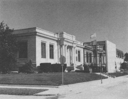
|
|
Figure 48: Bedford's Carnegie Library, built in 1902-03 with funds
contributed by the philanthropist Andrew Carnegie, was typical of the growing interest in
educational facilities for the public. The modern addition, built 1984,
reflects the facade of the historic limestone building. County libraries
were among the earliest educational institutions. The first library in Lawrence County was established in 1819, just one year after the county was created by the state legislature. Ten percent of the proceeds from the sale of lots in the county seat was reserved to operate a library and to purchase books. Fees and then taxes funded the library in later years. |
Transportation and Communication
Transportation underwent great change in the period from 1850 to 1915. Both railroads and cars came into use during this period, and both brought major changes to the economic and social order. However, the network of railroads which was established by 1880 almost completely bypassed our region. The two significant exceptions are the Louisville, New Albany and Chicago line which passed north-south through Bedford and Bloomington, taking advantage of the flatter terrain of the Mitchell Plain, and the Ohio and Mississippi line which crossed east-west from Vincennes to Cincinnati, generally paralleling the old Cincinnati Trace. The lack of rail lines in the area was most probably due to the hilly terrain, although without high-production farming or many factories, there would have been limited incentive to build railways through the region.
The scarcity of rail lines in the region, when they were being built and used elsewhere, had long-term consequences. Economic outcomes included a lack of direct access to larger markets for farm produce and manufactured goods, which discouraged development in these areas. Social effects included a lack of population build-up along rail lines and particularly at transportation intersections, which helped contribute to the continued rural nature of the region. The near absence of railways also had cultural implications; with few trains, travel between our region and other regions or cities remained difficult, so residents of the hill country became relatively isolated from the larger culture of the state and nation, particularly before postal delivery was improved around 1900.

|
| Figure 49: The Hoosier National Forest boundaries projected onto a map showing railroads in Indiana in 1880. |
In the beginning of the 20th century, the increasing use of automobiles may have countered some of the consequences of the scarcity of rail lines, by opening up possibilities for travel and communication as well as commerce. The impact of the automobile was only just beginning before 1915, however; and its effect would not have been felt as quickly in our rural area as in more wealthy and developed areas.
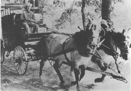
|
| Figure 50: Stage coach (around 1890). |
Some roads underwent improvement during this period, enabling use of automobiles as well as making older means of transport easier. However, road improvements were focused on the routes that linked more prosperous areas. Similarly, the coming of the telephone to larger population centers provided no links to farm families and small settlements. As people in towns and cities gradually became increasingly connected within and beyond their communities, the rural population in our region lagged behind in new means of communication. These factors contributed to the distinctiveness of our region. [100]

|
| Figure 51: Double-header train at the Helmsburg depot in Brown County. The Illinois Central Railroad built a rail line across Brown County in 1905, opening up the county to quick access from the outside for the first time. The existence of this line helped encourage the development of the county's well-known artists' colony during the first part of the 1900s. Two large galleries and many artists are still present in Brown County. |

|
| Figure 52: The 368 foot long covered bridge over the East Fork of the White River, Lawrence County, was built in 1884. Today it is listed on the National Register of Historic Places, and--thanks to repairs and restoration--still used. |
Material Culture
Much more is known about the material culture of the later 1800s and early 1900s than is true for the earlier pioneer period. Buildings constructed during the later period still stand, and period advertisements illustrate a wide array of merchandise. A range of items--clothing, equipment, books, and household furnishings--are collected as antiques and also preserved in museums for study and display.
Houses
As with other cultural manifestations, the houses built or altered during the years 1850-1915 reflect both continuity and change.
Throughout the eastern United States, folk housing styles were less restricted to geographical regions after the advent of rail transportation. [101] Still, we wonder to what degree our region deviated from this pattern, due to cultural conservatism and limited access to railroads. In Upland South areas, including southern Indiana, Illinois, and Ohio, log houses were still common in rural contexts well into the 20th century. This description of log building techniques helps to explain the perseverance of the craft:
. . . the log buildings of southern Indiana are built in a special way of carefully hewn timbers, flat on each side, joined at the corners in such a way that the corners are flush, chinked between the timbers, and covered on the exterior with horizontal, lapping siding. These elements, the hewn logs, the flush corners, the chinking and the siding, belong together and form a definite complex of traits which are inter-dependent.... The individual elements work together to make a practical and aesthetically pleasing whole. It is practical because a structure using this complex is superbly insulated and because, as long as it is kept in good repair, it will last indefinitely. It is aesthetically pleasing because the builders must have thought that a structure built of logs and not covered with siding looked rough and unfinished. [102]
Where hewn log construction was abandoned, it was replaced by light balloon framing or braced framing construction. This change was tied to a generally increased availability of cut lumber due to the railroads, but of course would have been possible in any area which had both timber and sawmills present, as was common throughout our region. Two distinct house forms became popular during this era, the I-house and the two-pen house, both of which followed from the Midland log house form.
The dominant frame folk house form in southern Indiana was the two-pen house. This house form was basically the same as the double-pen log house form, being two rooms wide, one room deep, one-story, with a side gabled roof. Chimneys were placed at one or both ends, or in the center. Other variations include one or two front doors, and the presence or absence of a hall to one side of the center division. Southern Indiana examples characteristically had a wide front porch, two front doors, and a rear lean-to extension or addition.
The I-house, named for its simple, linear floor plan, was built throughout Indiana, but was less frequent in the south central hill region, based on existing examples. This house form is also one room deep and two rooms wide, and features a side gabled roof, but is two full stories high. It can have one or two end chimneys, or a central chimney, as with the two-pen house. Additions can include front porches and rear rooms. It has been suggested that this house form was associated with a relatively high economic status in the Upland South, and this appears to be the case in southern Illinois. The Rickenbaugh House, which is located on Hoosier National Forest property in Perry County, and is listed on the the National Register of Historic Places, represents a variation of the I-house plan. It has a T-plan, with a rear extension forming a third gabled end.

|
| Figure 53: The Rickenbaugh House, Perry County. |
Other folk house forms found in south central Indiana, but not as common here as they were elsewhere, include the one-and-a-half-story house, which is basically similar to the two-pen house but with an added upper half-story typically used as a sleeping area, and the massed-plan pyramidal-roof house, possibly of southern origin. One-story, gable-front-and-wing houses can also be observed in our region; these became popular in the south during the early decades of the 20th century, and represent an adaptation of the two-pen plan.
A few examples of small Gothic Revival houses, with steeply pitched, gable-ended roofs with a smaller gable centered at the front, can also be seen in our region. Houses of this style, which were generally built during the middle of the 19th century, were most common in the northeastern states. The Gothic Revival style may have served as a form of folk housing, but it was inspired by architect-designed houses. Indeed, houses of this style in our region resemble many of the "cottages" pictured in 19th century home plan pattern books.

|
| Figure 54: This 1870s engraving of the town square in Paoli shows a Gothic Revival style house (on the left) and commercial buildings. |
The ground plans of the two-pen, I-house, and one-and-a-half-story houses are basically similar in form and size, and are the same as the older tradition of one- or two-story, double-pen log houses. Unfortunately, their similarity makes it difficult to distinguish one from another after the wooden structure of the house has been removed or allowed to decay.
The problem is compounded by the scarcity of information about customary house foundation patterns. What is known suggests that stone "piers" were the usual foundation form used in the Upland South. In southern Indiana, the use of stone piers or blocks under the four corners of the building, and sometimes under side walls in larger structures, raised the structure off the ground and helped prevent the lower timbers of the building from rotting. [103] Barns as well as houses had stone piers. The house and farmstead site information from the Hoosier National Forest itself suggests that stone supports were commonly used in our region, but when this construction tradition began, or how long it lasted, is not yet known.
One distinctive house type in our region which probably dates from this era is the German American log house form, found in Dubois County. This house form features two rooms and one-and-a-half stories, but differs from similar log house forms in our area. Differences include a larger overall size in the German houses, different sizes in the two main rooms, and framed front porch and back room sections which were built at the same time as the log rooms. The porch and back rooms are supported by log extensions from the main room section. Though there is no known European model for this house type, it appears that the German settlers brought this design with them into our area. [104]

|
| Figure 55: Side view of a typical one-and-one-half-story German American log house, Dubois County. This view shows the logs and the siding-covered upper part of the end wall. A porch was built at the front of the house, while back rooms were built of frame construction. The cantilevered overhanging roof shows that the porch and back rooms, as well as the use of frame construction, were not simply later additions but integral parts of the initial building plan of this type of log house. |
Other Structures
Houses rarely stood alone on the landscape, but usually were part of farm complexes consisting of several other buildings and features. A typical farmstead of the period might include a house, a privy, a livestock barn, other farm sheds for storage of equipment or produce, a poultry house, a smokehouse, a springhouse, a root cellar, and a well or cistern.
Though use of log barns continued, the most common surviving barn type from this period in south central Indiana is the frame-built transverse-crib barn. This type features a wide central aisle, stalls or bins along each side, and an upper loft for storing hay. Many examples in southern Indiana are enlarged by a full-length, single-level shed addition along one side. If such additions appear along both sides, the type is known as a "broken gable" barn and may indicate a higher economic status. [105]
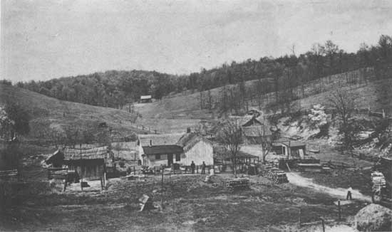
|
| Figure 56: Family house and farm complex in Brown County's Selmier Hill area, 1890. |

|
| Figure 57: Log barn, Monroe County. Note the shed addition at the back. A small corn crib is to left of the doors, which cover the central aisle, and a large stall is on the right. The double-pen log structure was built at an unknown date in 1800s on the Joseph Mitchell farm, near State Highway 37. The property and an adjacent tract were acquired as a land grant in 1823 to Mitchell and his brother, who were veterans of the War of 1812 and previously resided in Kentucky. A log house was built near the site of the log barn, followed in 1835 by a house made from bricks of locally dug and fired clay. Dates of 1800 and 1871 are carved into the barn's timbers. The barn apparently incorporated some earlier timbers, because several have notches that do not match. |
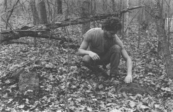
|
| Figure 58: Sometimes the most visible traces of an old farmstead site left on today's landscape are the stone piers on which a house or barn stood. This example is from a farmstead site located near the Waldrip house. |
One account of the building of a barn around 1940 may describe older construction practices. It comes from an interview with a long-time Monroe County farmer, who recalled:
[I] just figured out how I wanted it built, and I drawed it out on paper, till it looked to suit me.... I went to the woods and cut the sills, put my pillar rocks [piers] in, and started from the scratch up . . . me and the neighbors.... [106]
Another important element in the configuration of homesteads and farmsteads was the vegetation. Both local and non-native plants, shrubs, and trees made up the landscape of individual holdings. Their presence and placement can have specific cultural meaning, and certainly were of great importance to the residents both for economic and aesthetic reasons. Some of the plants favored by homeowners were daffodils, peonies, iris, yuccas, and spruce.
We are fortunate to have two examples of farmstead plans from locations now part of the Hoosier National Forest. Both of these are "memory maps" drawn from the recollection of former residents of the homes. One is from the northern part of our region, and illustrates a modest farmstead in southeastern Monroe County, the Waldrip house. The other is from a larger establishment, the Rickenbaugh house, from the southern part of the region, in Perry County.
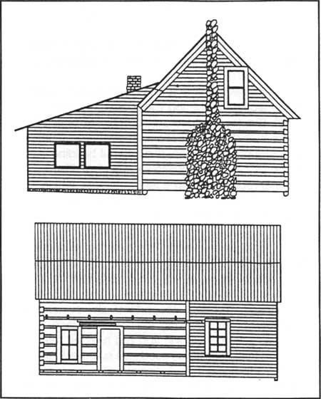
|
| Figure 59: West (upper) and south (lower) views of the Waldrip House, Monroe County, drawn to show original chimney. |
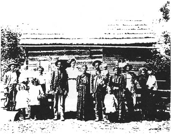
|
| Figure 60: 1907 photo of Srepta (Bond) and Joshua Waldrip, and their children and grandchildren, standing in front of the south side of the Waldrip House. |
WALDRIP HOUSE
The Waldrip farmstead is located along a ridge top in southeastern Monroe County. The original house was built around 1877, a few years after Joshua Waldrip bought 30 acres of land, married Srepta Bond, and their first child was born.
The house originally consisted of two rooms downstairs and one upstairs. One of the downstairs rooms consisted of four hand-hewn log walls, seemingly indicating a typical "single-pen" log house beginning. However, there is ample structural evidence that the second downstairs room and the upstairs room, which feature frame construction, were built at the same time as the log room. This seems to be unusual, for other than the German American log house form found in Dubois County, we know of no other example in which log and frame construction were combined from the outset in a house. Like most log houses in our area, it was set on stone piers and did not have a basement.
Sometime later a one-room addition was made alongside the log room, and an open, porch-like room added adjacent to the original frame-built downstairs room. According to Joshua and Srepta's grandson, the original building made use of locally available materials. The original root cellar and a large chimney which once stood at the outside end of the log room were built from field stone.
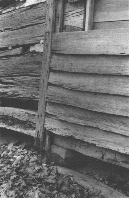
|
| Figure 61: View of construction detail at the Waldrip House, showing the junction of the log room (left) and frame room (right), as seen from the south. Note the stone pier beneath the intersection of the two rooms. |
Furniture in the house included a long wooden dining table with cane-bottom chairs, caned by Joshua, and two full beds and one half-bed in the upstairs room and one full bed downstairs. Waldrip descendants also remember a wood-burning cooking stove inside, lace curtains in the windows, and rag rugs on the floors. The addition was used as a summer kitchen during warm weather. A dinner bell hung outside the house, and was used to call the men in from the fields. The bell was donated to the family church, the Burgoon Baptist Church, when the homestead property passed out of family possession in 1941.
The Waldrip place was an economically successful farmstead, according to descendants and judging by archaeological evidence at the site. Outbuildings included a barn, a corncrib, and a combined henhouse and woodshed, as well as a privy. A stone-lined cistern and a root cellar were also present. Two orchards stood on the property. The apples and peaches were taken into Bloomington to sell. Hay was cut from between the fruit trees as well as in the hay field. Joshua Waldrip also harvested timber from his property to sell as another "cash crop."
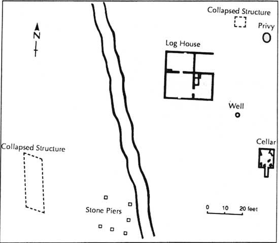
|
| Figure 62: Map of the Waldrip House site, showing locations of the house, the outbuilding remains, and other features, as they apeared in 1990. |
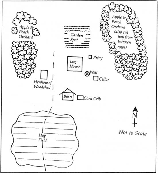
|
| Figure 63: "Memory map" of the Waldrip House site, drawn from information provided by Joshua and Srepta Waldrip's grandson. Compare this map with the measured site plan drawn in 1990, Figure 61. |
RICKENBAUGH HOUSE
Jacob Rickenbaugh, who was born in Maryland, married Elizabeth Ester Kerr, and the couple moved to Indiana in 1855. They purchased property in Perry County which already had a log house on it; the family lived in this house for the next 19 years. Jacob was a tanner by profession, and it is said that he chose the property because of the large number of chestnut oak trees, the bark from which was used in the tanning process.
In 1874, the Rickenbaughs had a new house built. This house was constructed of sandstone blocks by hired Belgian masons. These masons, the George brothers, also worked on a stone church in Leopold and on the abbey at St. Meinrad. The sandstone is said to be local, but no specific quarry site is known; some accounts say that the rock was cut from outcrops near the house site. The cut stones are massive and heavy, because the walls of the house are solid stone. Oxen were used to transport the cut stone, and ramps were needed to place the stones. The floor joists were made from massive hand-hewn beams.
The floor plan of the new two-story house was simple. It was laid out in the shape of a "T" with its top at the front, and its leg forming a rear extension. There were sandstone chimneys at each of the three ends. The front of the house was symmetrical, with four windows and two doors on the lower story and four windows on the upper story.
The interior plan was also simple, having just three rooms on each floor. The downstairs consisted of two parlors at the front of the house, each with its own outside door, and a kitchen in the rear extension. The upstairs consisted of three bedrooms. Each of the downstairs rooms had its own fireplace, the one in the kitchen used for both heating and cooking. A granddaughter of Jacob and Elizabeth, who grew up in the house in the early 1900s after her mother's death, remembers the house being warm in the winters and cool in the summers. The house had attic space under the roof, and a full basement.
The Rickenbaughs' granddaughter recalls that the house was sparsely furnished. There were two wooden beds in each of the three bedrooms, and each had a lower straw mattress while the upper mattress and pillows were filled with goose and duck feathers. A long wooden table in the kitchen was used for dining, and contained a drawer where pies were kept. The house had two spinning wheels, and the Rickenbaugh women made rag rugs on a loom that stood in one of the bedrooms.
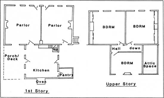
|
| Figure 64: Floor plan of the Rickenbaugh House, Perry County. |
The grounds had the usual array of outbuildings, including a barn, a granary, a chicken house, a privy, and a springhouse. There were also the buildings and vats associated with Jacob's tannery business. Jacob is said to have ceased tanning in the late 1870s to concentrate on farming. His granddaughter remembers the farmstead property divided into pasture and field areas. There was a cane field, where cane for molasses was grown, and she also remembers apple trees behind the house. There were no trees in the front yard originally, and in the early 1900s cows and sheep were allowed to graze in the yard to keep the grass down. Two springs on the property provided the family with its water supply. A family cemetery lies about 100 yards from the house.
The house was the location of the Celina Post Office from 1878 until 1961, when it was closed due to decreased use. The position of postmaster was held by various women of the family, who operated the post office out of the corner of one of the parlors.
During the early 1900s, the nearest store was in St. Croix, about three miles away, and the closest doctor in Bristow, seven miles away. The Rickenbaugh granddaughter remembers that her aunt, who lived in the stone house and raised her, tended to the sick in the neighborhood, and also acted as a midwife. Rickenbaugh family descendants owned and lived in the house until they sold it to the Forest Service in 1968.
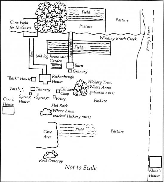
|
| Figure 65: "Memory map" of the Rickenbaugh House site, drawn from a description provided by the granddaughter of Joseph and Elizabeth Rickenbaugh. |
The Rickenbaugh and Waldrip houses offer some interesting comparisons and contrasts. Both were constructed in the 1870s from local stone and wood materials. Each was a single-family home, though sometimes the residents included more than just a "nuclear family" of parents and children. Each property was kept within the family for more than one generation. Each was the center of an active farm.
These similarities tend at first to be overshadowed by the differences in the two houses. The Rickenbaugh house is unusual for the region in that it was built of stone by professional masons, blending a variant of the widespread I-house folk housing form with the Greek Revival decorative style which is inspired by architectural design. Also, the Rickenbaugh house was the location of a tannery business and a post office, as well as a farming concern.
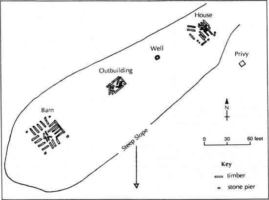
|
| Figure 66: Map of an historic site found in Orange County. This site was a farmstead in the later 1800s, and was located at the end of a steep upland ridge, near the town of French Lick. |
The Rickenbaugh house is located next to Celina Lake, a reservoir constructed in the 1970s, and has been placed on the National Register of Historical Places. Plans for its renovation and interpretation to the public are under way. The Waldrip house was in such poor repair by the time the Forest Service attained possession of the property (in 1990) that it is not eligible for the National Register, and restoration is not possible.
It is interesting to compare the "memory maps" associated with these two farmsteads with maps of typical historic sites found on Forest Service property. The accompanying drawings illustrate the archaeological remains found at two farmstead sites in Orange and Perry counties; our understanding of the scant remains observed at these sites is enhanced by the information we have for the Waldrip and Rickenbaugh homes and farms.
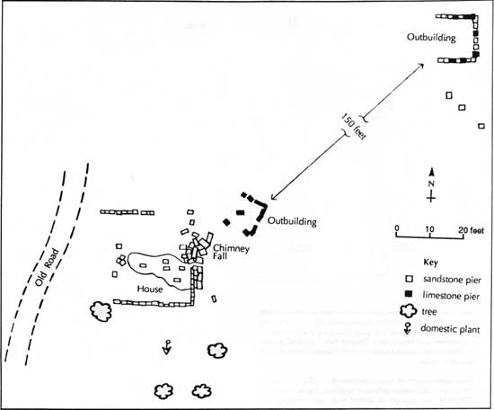
|
| Figure 67: Map of 19th century farmstead site located on a ridge top in Perry County. |
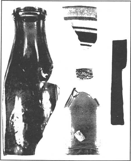
|
|
Figure 68: These artifact fragments recovered from historic sites in
the Orange, Lawrence, and Jackson counties illustrate some of the sorts
of objects commonly found at sites, as well as show that such remains of
past lifeways are almost always fragmentary and deteriorated. Despite
their condition, experts can date certain artifacts based on their
method of manufacture and other clues: Glass bottle fragments, made between the 1920s and 1950s; blue banded stoneware milk bowl fragment, made around 1920-1945; red sponge decorated white ware ceramic fragment, dated around 1835-1865; and wood handled knife, not dated. Differences in artifact types found at sites can be valuable clues to the economic status and social position of the residents. |
|
| Figure 69: Maker's mark on a fragment of a stoneware vessel recovered from a historic archaeology site in Crawford County. Such marks can help pinpoint the origin of stoneware, some of which was produced locally while some originated outside our region. |
Household Goods and Tools
There were important changes in household goods and tools during this period. Overall, there was a trend toward mass-produced goods. This was the case for material objects associated with all aspects of daily life. The regional interest in new farming techniques, shown in the organization of agricultural societies, would have had an impact on the farm implements used, even though equipment for large-scale farming was rare in our area.
Automatic-production techniques changed the availability, cost, and uniformity of household goods such as ceramic and glass wares during this period. The use of mail order purchasing from companies such as Sears, Roebuck increased access to such goods. So, not only were more mass-produced goods being made, these goods were becoming more available to rural areas through direct mail delivery. The combination of these factors was beginning to result in a more uniform material culture by the end of the period. [107]
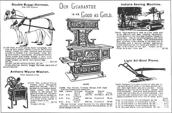
|
| Figure 70: Mail order companies provided a wide range of goods for farm and home in the later 1800s. |
|
| Figure 71: While the stores in most towns in our region had limited ranges of clothing supplies, a great variety of clothing ("thousands of styles") could be purchased for men, women, and children from "catalogue stores." (The men's suit in "cassimere" wool sold for $7.50 and in finest quality crepe for $24.00) |
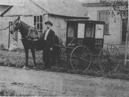
|
| Figure 72: The first Rural Free Delivery mailman and his horse and mail wagon, Nashville, Brown County, 1907. RFD routes were established in Indiana in 1902, and horse and buggy deliveries continued into the 1920s, when Model-T Fords began to be used to deliver the mail. |
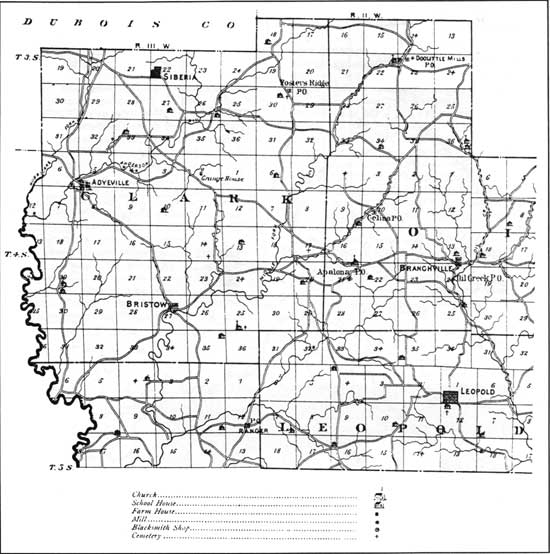
|
| Figure 73: This map of northwestern Perry County is reproduced from a 1876 atlas. Note the presence of roads, small towns and communities, post offices, churches, mills, cemeteries, and school buildings on the landscape. Houses were not shown on the Perry County map, though there are some noted on maps of other counties. The "Celina P.O." label does not refer to the Rickenbaugh House; though built in 1874, the house did not become the post office site until 1878. |
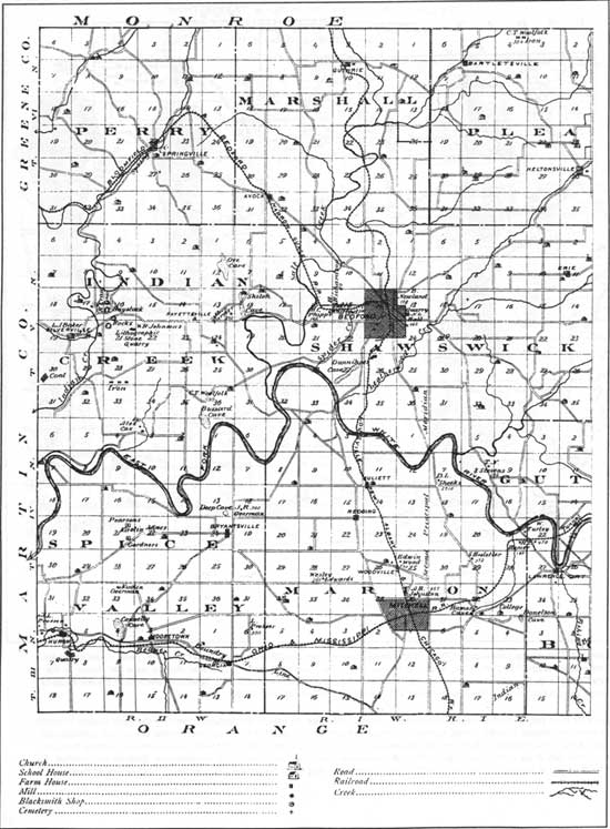
|
| Figure 74: Eastern Lawrence County, from the 1876 atlas. As well as the features shown on the Perry County example, this map also locates houses, caves, quarries, iron works, kaolin mines, and rail lines, very few houses are shown, perhaps only those of the more prosperous families. The presence of natural resources, as well as the relatively level terrain featured through the central part of the county, helps account for the presence of railroads and two sizable communities, Bedford and Mitchell. By 1876, the town of Spring Mill had declined; it is not identified on this map, though the "Hamers Cave" label shows its location. |
Settlement Pattern
As with the previous period, various forms of material culture--such as rural houses and outbuildings, churches, cemeteries, stores, mills, roads, and so on--are linked together to form the settlement pattern. For this time period, though, we have more evidence of the location of different elements on the landscape. The pattern is a blending of cultural and environmental factors, and it represents the particular way of living that characterizes the region.
Our sketch of the settlement pattern for 1850 to 1915 is still preliminary, because no large tracts of land have been thoroughly researched. We can offer a "working" description, however, one to be filled out, modified, or even countered by future documentary, oral history, and archaeological research.
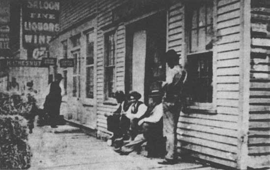
|
| Figure 75: A photo from the 1890s, taken on 16th Street in Bedford. Though the Hoosier National Forest land holdings include no major towns (past or present), such towns, particularly county seats, were the focus of much governmental, economic, and social activity for residents of the entire region. Even in their early years, taverns were a common feature in towns. |
The settlement configuration for the period was a network of regional centers, small towns, and loosely structured rural neighborhoods in some instances, and more isolated rural homesteads or farmsteads in others. These elements were linked by a network of roads. The regional centers consisted of county seats, such as Paoli, which provided government services and served as the largest transportation and commercial hubs. Small towns, such as Orleans where a railroad and a major highway intersected, were smaller commercial centers. Most of the towns appear to have remained very small, and were located between the county seats or along more minor roads. Towns appear to have been situated in flatter areas near streams, rather than on narrow ridge tops. Most of the Forest Service holdings are in the hilly upland areas, and so no substantial community existed on what is now Hoosier National Forest property. In addition to being commercial centers, these small towns served as social meeting places and as locations for post offices, churches, and schools. Town schools became a center of community identity during this period.
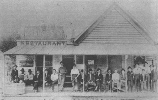
|
| Figure 76: This view of the Smithville, Monroe County, department store in 1890 helps make the point that commercial establishments were also important social gathering places. |
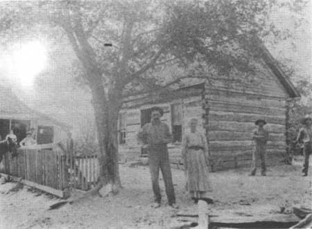
|
| Figure 77: A view of a small community in Monroe County. the building at the left is the Chapel Hill Post Office, and on the right is the log home of George and Lizzy Cracraft, with the owners standing in front of their home. |
Still smaller communities--or "rural neighborhoods"--were family-based or centered around country churches or stores. These neighborhoods consisted of homesteads or small farmsteads located within a few miles of each other, perhaps strung out along a ridge top. Some neighborhoods apparently had private cemeteries associated with them. We do not know how these clusters of houses were viewed by their inhabitants. For instance, were they seen as distinct social units? This would be a good question to put to area residents who remember rural life in the early 1900s. Another element of this rural cultural landscape were the schools, which were distributed at least one to a township. Small stores, mills, and often post offices provided necessary services to rural areas. These establishments came to be spaced no more than roughly six to seven miles apart, which allowed people from even the most isolated households to make use of their services on a one-day round trip by wagon.
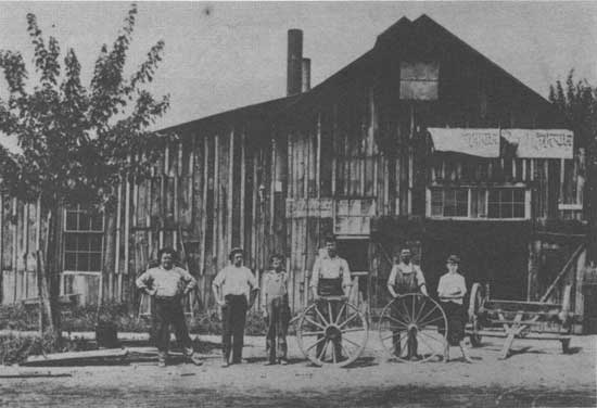
|
|
Figure 78: Preserved photographs of blacksmith shops, such as this one
(early 1900s) of the
Hess Blacksmith Shop, Tell City, are few, in contrast to the number of
such shops once serving the region and their economic importance. The son of a Brown County blacksmith remembered: "The blacksmith shop was a meeting place in the community, much like the general store. People came from all around to get work done and visit with one another. Politics and religion were topics frequently discussed, sometimes rather heatedly. My father kept a Bible lying nearby and often consulted it to prove his point in a religious discussion." |
We end this account of cultural life from 1850 to 1915 with the following "word picture" of a small town in 1905, left to us by an observant and long-memoried resident of Orange County:
The long winter is past. The roads leading to the country side are dry except for a few mud holes. The farmers in the nearby fields are plowing for corn, tearing up the ... foot paths across the land made by travelers on foot going to the store during the winter and spring when the roads were almost impassable. The 100 day school is out and the school house with its silent bell is deserted.... Teams hitched to wagons are tied to the hitching racks while their owners and their wives trade in the nearby store. ... A raft of logs is tied to a sycamore tree by the mill. It was too late to ride the spring flood waters down stream to Jasper.... The store keeper's team and wagon are standing by the warehouse door. The wagon is being loaded by the hired driver to be taken to the railroad ... and return with merchandise.... The clang, clang of the blacksmith's hammer as he pounded the hot steel came from the shop on the hill.... All these sounds have ceased now but to this day there is one thing I can't understand, "Why were the village daughters always pumping water when the farm boys came to town?" [108]
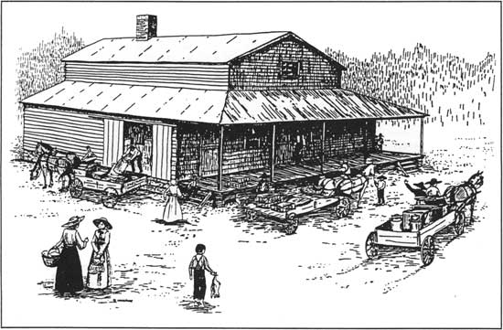
|
|
Figure 79: A line drawing of a scene at the T.A. Park store. In the early 1900's the general store was the center of activity in the Newton Stewart (Orange County) area. The store bought everything local people couldn't grow or make such as: dry goods, furniture, clothing, drugs, farm machinery, saddles and even coffins. The T.A. Parks store bought and sold just about anything the local people had to sell or trade. Eggs, butter, rabbit pelts, sheep wool, and all types of poultry, and nuts. The store owner paid for these items with 'trade tokens' [or 'rabbit checks']. These were brass pieces of various shapes marked in denominations from 1 cent to a dollar. These tokens could be spent like money at the store. The few people who preferred to be paid in government currency had to take a "discount" on the amount they were paid! |
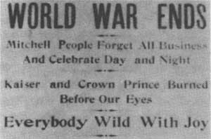
|
| Figure 80: Headlines from the Mitchell Tribune, November 14, 1918. "The Tribune almost never mentioned anything outside of Lawrence County." |
Twentieth Century Changes, 1915-1950
The first half of the twentieth century in our region was a time when the pace of change increased. As in all parts of the nation, the effects of two world wars and a major economic depression were felt. Local participation in World War I and II, and the effect of nationally planned relief efforts during the Great Depression, helped to bring new ideas and attitudes into the region. Modernization in public communication, utility services, and transportation also brought national cultural trends into the area, as well as dramatically changing the everyday lives of residents.
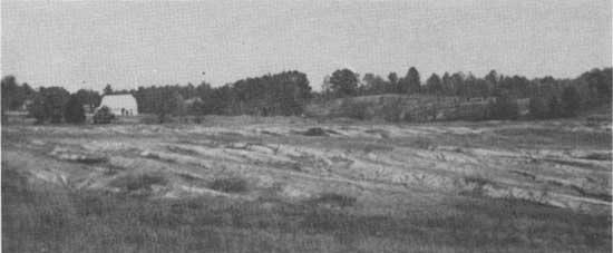
|
| Figure 81: Over-grazed pasture land in Brown County, 1940s. |
Economic Conditions
One of the most significant trends for our region at the beginning of this period was an overall economic decline, both in comparison to other areas in the state and in absolute terms. Small-scale farming techniques suited to our steep terrain were increasingly overshadowed by the large-scale agricultural production being accomplished elsewhere on flat lands. For residents of our area, the transition to mechanized farming is an easily remembered process, one which took place in the 1940s and 1950s. One Monroe County farmer recalled the changes to a folklore student, who reported:
In 1940 [he] bought his first tractor, a John Deere, 'the first new one that went out down in that county.' Before that he had worked with four head of horses. He kept one team of horses after he had gotten the tractor, using them for hauling and planting his corn, until 'I got me a four row planter, and that was too much for the team.' Then he used the pair of mares for shucking. [109]
With poor soils hindering agricultural success, many farmers relied on hunting and trapping in making a living. Both meat and hides could provide a "cash crop," as is told in a recollection of the early 1900s.
. . . limits were non-existent and sale of game was legal. In one season, grandpa killed over 1,500 rabbits; largest single day's haul was 68 rabbits, 4 quail, and 1 woodcock.... Fur-bearing animals were also plentiful. Grandpa kept hunting dogs for fox hunting by day or other fur-bearers at night. Raccoons, 'possums, skunks, mink, muskrats, weasels, foxes were taken by hunting or trapping. He had over 300 steel traps. He frequently hunted all night. He would designate a landmark several miles from home and tell [his sons] to meet him there at sunrise with the horses. He skinned animals while hunting to lessen weight in hunting coat or gunny sack. [110]
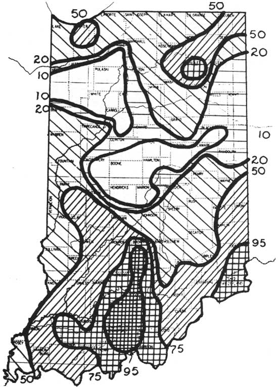
|
| Figure 82: 1935 map showing percent of sheet erosion and guilying by county, based on a study of information collected by the Soil Conservation Service--U.S. Department of Agriculture. The Hoosier National Forest region closely follows the most eroded lands. That study also noted that the greatest overall erosion was in Crawford County (99.4%), Orange County (95%), and Brown County (92%). |
By the 1920s and 1930s the economic disadvantage of the terrain was made far more devastating by the effects of massive land erosion in the hilly regions. In fact, various upland ridges in southern Indiana had earned a special designation, being called:
'ten-year' land ... . [D]uring ten years of tillage by the customary methods so much of the soil washes away that further tillage is unprofitable. [111]
Many landowners could not pay taxes and others were forced to abandon their holdings because of the condition of the land. This environmental devastation, together with the economic problems associated with the Great Depression of the 1930s, meant that our region was in a dire economic situation by the mid-1930s.
One result of these conditions was the formation of a national forest in south central Indiana. Federal funding to purchase lands for national forests was initially authorized by the U.S. Congress through the Week's Act of 1911. The Clarke-McNary Act of 1924 established cooperative agreements between the federal government and states. In 1931, a survey of game animals and environmental conditions by Adolph Leopold was especially significant in highlighting land abandonment and soil depletion. The Indiana General Assembly officially determined in 1935 that Indiana's national forest would be located in the southern uplands of the state. The original name proposed for our Forest was the Benjamin Harrison National Forest, but ultimately the name "Hoosier National Forest" was selected. By 1951, when enough land had been acquired, the Forest was officially designated. [112]
The lands for the Hoosier National Forest were purchased by the Forest Service from willing landowners, who were often anxious to divest themselves of their eroded acreage no longer productive for agriculture. A contemporary newspaper account reported that by August of 1935, the Forest Service had over 2,000 offers to sell from area landowners--totaling over 200,000 acres! [113] This amount is higher than the acreage owned by the Hoosier National Forest in 1990. From this perspective, it becomes obvious why the Hoosier National Forest holdings correlate with the two rugged landforms, the Crawford and Norman Uplands; it was in these hilly areas that farm lands had suffered the most soil erosion.
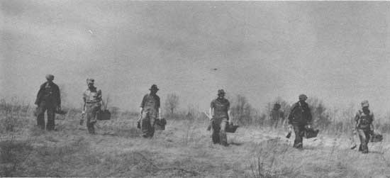
|
| Figure 83: Civilian Conservation Corps crew planting shortleaf pine in an abandoned field in 1940. |
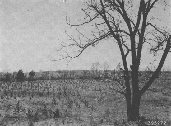
|
| Figure 84: View of a young red pine plantation in 1940, three years after it was planted by CCC workers. |
|
| Figure 85: Planted pines after a quarter-century of growth, Hoosier National Forest, Monroe County. |
During the 1930s the state of Indiana acquired other depleted lands for state forests, most of which are in or near our region. Like the land acquisitions for the Hoosier National Forest, studies of erosion and economic conditions guided the acquisition of property, keeping the focus on the southern hill country. A portion of one state area, near today's Martin State Forest, was transferred to the U.S. Government for the Crane Naval Weapons Depot, when weapons manufacture became a national concern. One significant difference between state and federal land acquisition programs involved the Resettlement Administration, a New Deal program for economic recovery that was used by the state to help marginal farmers become established on more suitable lands.
The presence of the Forest fulfilled many purposes for our region. By acquiring vast amounts of poorly maintained farm land and bringing this land under one management scheme, the Forest Service was able to reclaim a badly deteriorated natural resource--the land itself--and restore it to a more stable condition. The replanting of thousand of acres of former farm land in pine trees, and later in hardwoods, helped check the problem of erosion. By 1936, the Indiana furniture industry had become nearly dependent on lumber from out-of-state, while 40 years earlier the state had been the leading timber producer in the nation. Reforestation and other Forest Service strategies helped to revive timber production in the region. [114]
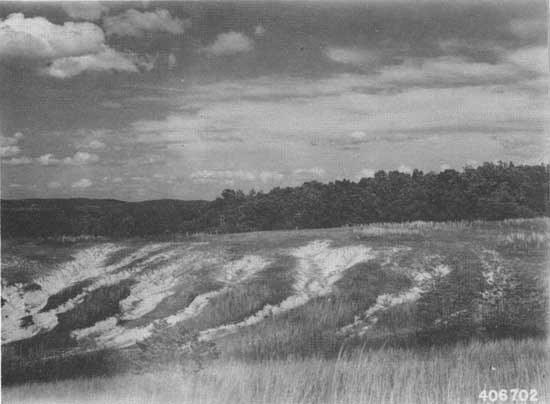
|
| Figure 86: Soil erosion on ridge slope along German Ridge Road in Perry County, 1941. |
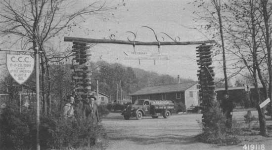
|
| Figure 87: Entrance to the CCC camp at Kurtz, in Jackson County, 1941. |
One area forester who began his association with the Hoosier National Forest in its earliest days remembered what the land was like in the 1930s. He recalled that erosion had left gullies everywhere, and remarked that the only topsoil left in southern Indiana was "in the Ohio River." Only a few pockets of privately owned original forest remained in southern Indiana by the middle of the 20th century. [115] Today, the two best known tracts of uncut original forest are located on public lands: the Pioneer Mothers Memorial Forest, in the Hoosier National Forest near Paoli, and Donaldson's Woods in Spring Mill State Park near Mitchell.
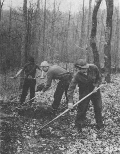
|
| Figure 88: Workers from the Tell City CCC camp fighting a ground fire. |
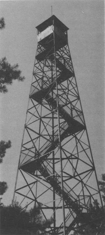
|
| Figure 89: The Hickory Ridge Firetower was built by CCC workers in 1936. The tower featured a telephone line to the nearby community of Kurtz--the first phone line in the area The tower was used to watch for forest fires from 1937 to the 1970s. Visitors can now climb the tower to view the Charles C. Deam Wilderness Area and nearby Lake Monroe. The tower is listed on the National Historic Lookout Tower Register. |
Another way in which the Federal government became involved in the economic recovery of our region was through the formation of several Civilian Conservation Corps (CCC) camps. This program, initiated by President Franklin Roosevelt as one aspect of national recovery, provided paid employment for out-of-work men during the Great Depression. The U.S. Army operated these camps, and held night classes for CCC workers to learn trades, but it was the U.S. Forest Service (as well as the Indiana Department of Conservation and state parks) that arranged the jobs to be done. Most of the money these men earned was sent home to their families, many of them in cities outside the region. But, the region benefited directly from the work they did, and the pocket change they were allowed to keep for themselves provided a welcome boost to local merchants.
The CCC men did the work of replanting barren acreage in the new national forest and state forests, as well as executing many other tasks, such as fighting fires and completing many construction projects. The Hickory Ridge Fire Tower, still standing, was one of their projects. The CCC workers also put in some of the first telephone lines and built many miles of roads in the region. CCC workers not only took on public building projects but also built new homes for local residents who lived in deteriorated houses, using salvaged material. The CCC and the Forest Service as well stepped in to provide emergency aid when necessary. After the famous 1937 flood, which devastated riverside areas of the country from Pennsylvania to New Orleans, workers from the CCC camp in Tell City, on the Ohio River, offered rescue and relief assistance, and the Forest Service provided funds to help with flood recovery in the area. Another local project which the CCC men worked on was the reconstruction of the pioneer era buildings at Spring Mill State Park. [116]
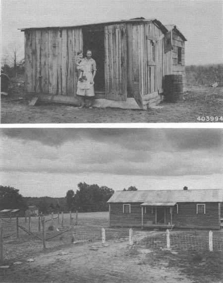
|
| Figure 90: CCC workers helped to provide area residents with adequate housing. Top: a woman and her child in front of their old house, replaced by a newly built structure. Bottom: a new family home, built by CCC men. |
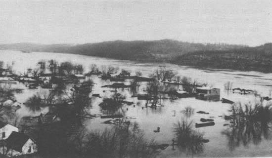
|
| Figure 91: The 1937 flood along the Ohio River affected all low-lying towns, such as Leavenworth, where boats had to be used to salvage goods and furnishings. Leavenworth was rebuilt on higher land after this flood. |
How was the Great Depression experienced from the point of view of local residents? The accounts we have from the period are reminiscent of stories of the earliest pioneer days in our region: people lived without much in the way of cash resources, and relied on their abilities to make a significant portion of their living directly from their land. One woman from our area recalled acquiring outside supplies by barter, rather than purchase:
We had chickens and I took eggs to town, and that was what I got my groceries with. I remember one time I took nine dozen to town, and it didn't buy a sack full. [117]
Another area woman remembered a more far-reaching consequence of the Depression:
When I got out of [high] school there wasn't any money to go to school further, and there wasn't any jobs for girls or women, because there were so many men out of work, and they had to be served first. [118]
Despite these hardships and privations, some recalled that the Depression helped to make them resourceful with what they did have, and emphasized that their family relationships helped them to survive the experience. [119]
|
| Figure 92: Official Navy Photograph, assembly of rockets during World War II at Crane Naval Weapons Depot. |
The Depression was followed by World War II, and our nation's entry into international conflict. In our region, World War II had a marked economic effect in the creation of the Crane Depot in northern Martin County. The idea for this ammunitions base was developed in 1940, before the U.S. entered the war, to supply the Atlantic Fleet. More than half of the land required for the project had already been purchased by the state through the federal recovery program. The area was rural, yet near major roads and railroads, and thus was a favorable location for storing and supplying military ordnance. The Crane facility hired local workers for its construction and operation during the war years, employing over 10,000 civilian workers and 2,000 military personnel in 1945, and continues to be a major employer in our region. [120]
The Hoosier National Forest and private landowners were also involved in the war effort, providing needed raw materials. A period newspaper report listed several types of timber supplied by the Forest for war production: hickory, used in building truck beds; walnut, for gun stocks; beech, for food containers; and ash, used in making hammer handles and for construction lumber. [121]
|
|
Figure 93: Grand resort hotels in French Lick and West Baden were
popular in the early 1900s and drew visitors from throughout the
country, who came for recreation and gambling, as well as for the
mineral water. The domed rotunda of the West Baden Springs Hotel was
also used for conventions. The resort industry provided employment for African Americans, bringing a significant number of people particularly from the southern states. Blacks owned one hotel in West Baden (and were prohibited by State law to stay as guests at the other area resorts); other signs of a thriving black community include churches and at least one school in the French Lick/West Baden area. |
Social Patterns, Issues, and Institutions
The social fabric of the region changed during the first half of the twentieth century with the intensification of the rural-to-urban migration begun in the late 1800s. Growing factories in the towns of our region, along with the development of resort hotels in Orange County, brought changes in society as well as the economy. Still, the importance of the extended family continued and was celebrated, as is evident in the wide spread practice of holding family reunions. Similarly, "homecomings" at towns and churches were events that reinforced traditional social ties.
Another factor in the social scene was the effect of two world wars. Both wars removed a large portion of the male population from the region, at least temporarily. This meant that women could--or had to--enter areas of the work force previously held by men, but it also changed the dynamics of local social experience. The effect of World War II is remembered by two area women:
All the boys were getting drafted. We would go to dances, church, and all the boys in a certain age group were gone. It was an odd feeling to see more girls than boys. [122]
The summer I was fifteen, there were no boys around. It was the patriotic duty to write to the boys in service. My neighbor had a brother and she asked me to write him. We started corresponding. Two years, and many letters, later, we were married. . . [123]
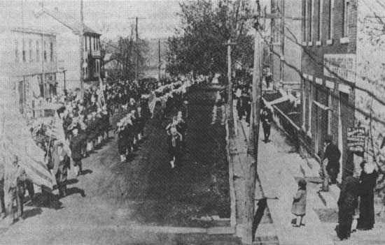
|
| Figure 94: A 1919 photo taken in the Perry County town of Troy, showing John Phillip Sousa's military band parading for a Liberty Bond drive during World War I. A "baby tank" was also part of the parade. The band was additionally hosted in Teil City and Cannelton. |
Of course, having neighbors or family members in the service had a more ominous effect for many who were left behind. One woman, whose four sons were in the army or navy, had this recollection of her experience:
You know, I was always whistling and singing, but when the boys were in service, I never sang. Three years I never sang.
You never knew whether they would ever come home or not. You just didn't know what kind of word you'd get the next day. A person don't have no idea how hard it was.
But, thank God, my boys all come home. [124]
The world wars affected social patterns in other ways. The German American residents of the area may have suffered the effects of ethnic prejudice during the period of World War I, as has been documented in other communities in the state and nation. To quote one scholar:
In effect, there was a war against German language and culture for a short time, as individual citizens of German origin were harassed and persecuted. [125]
Nationally, this persecution included such acts as vandalism and restricting German language instruction in schools. Many churches during this period switched from German to English in their services. Even material culture can reflect such social relations. We wonder whether rural German cemeteries in our area show a change from German to English wording on tombstones before and after World War I, as has been noted elsewhere. [126]
Also during this era, the Ku Klux Klan was a strong political and social force in Indiana. The Klan, which originated in the South just after the Civil War, found new popularity and political influence in the early part of this century. The group based its influence on widespread distrust and anxiety toward elements which were perceived as outside the "mainstream" of American life; those persecuted by the KKK included people of the Roman Catholic and Jewish faiths, and foreigners, as well as African Americans. In Indiana, the KKK also took advantage of considerable public concern about political corruption.
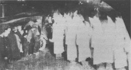
|
| Figure 95: Monroe County Ku Klux Klan members, photographed in their white robes and hoods. |
The Klan was active in our south central region, though not to the extent that it was in some parts of the state. Klan membership in the Hoosier National Forest counties ranged from over 1,500 men in Monroe County, to just over a hundred men in Perry County. Expressed in percentages, we find that Klan members in Monroe County accounted for about 25 of every 100 native-born white men whose parents were also native-born; in Perry County, the figure was fewer than four in a hundred. For the state as a whole, Klan membership "was many times larger, for instance, than any of the veteran's organizations ... and even larger than the Methodist church, the state's leading Protestant denomination." [127]
At the state level, the Klan became deeply involved in Indiana politics and government, and examination of published Klan records shows that this also occurred to an extent in our region. These records not only list membership figures and Klan officers, they also note which county officials were in sympathy with the Klan. For Brown County, for instance, the Klan document records that the "Judge, Prosecutor, Sheriff and Recorder are O.K.; all other officers in sympathy." Other area counties showed a more mixed slate; surprisingly, in light of its high Klan membership, Monroe County was not listed as having any active Klansmen among its chief officials. One of the main authors of Klan-inspired legislation in the Indiana legislature was based in Bloomington, however. [128]
It is difficult to understand the popularity of the Klan in the 1920s from the point of view of today's more open society. A partial explanation is that the organization appealed to a deep sense of morality found in Indiana's residents. We have noted the strong influence churches had in the state throughout the 1800s and into this century; the Klan tapped into the wellspring of public morality so basic to the people by associating itself with Protestant churches and ministers. As one scholar of the Klan puts it, the Klan professed to be in favor of the same things that churches stood for: "cleaning up morals and virtues ... a general return to God and piety." [129]
It has been suggested that the Klan purposely cultivated a public image of morality and sobriety, but meanwhile carried out a "secret" agenda of racism and anti-Catholicism. Some people may have joined because of this public image, only to have learned of the other, more virulent elements later. [130]
Klan membership also must be viewed in terms of the social patterns of the period. Joining exclusive, fraternal societies was both common and accepted, even expected; many such organizations, as we have already mentioned, developed in the later part of the 1800s. Some of these groups, such as the Masons, also had secret components. In other words, not all Klan members of this period joined because they were strongly anti-black, anti-Catholic, or anti-Jewish, though clearly those elements were vital to the inner circle of Klansmen.
Support for the Klan was not universal, by any means. Some southern Indiana residents who were children at the time recall their parents' disapproval of the KKK, though they also admit to an interest in the pageantry and mystery embodied in the Klan and its operations. [131]

|
| Figure 96: Still near Weed Patch, Brown County. |
|
| Figure 97: "It was a long time before manufacturers put rubber tires on tractors, but good roads demanded the change and by the mid-1930s everyone wanted tires, almost. The FREE in this ad meant a demonstration, in 1934." |
A major issue both nationally and in our state and region was Prohibition. Part of the appeal of the Klan in Indiana was its alliance with the anti-liquor movement. The movement had strong support as part of the general issue of moral reform, based on belief in the destructive and disruptive affects of alcohol consumption on the populace. Clearly, though, the ban on alcohol was not universally popular. Illegal liquor production, sale, and consumption were rampant. For instance, it is said that the Germans of Dubois County were famous for their "moonshine," known as "Dubois County Dew." One area resident recalls that during Prohibition her father, who lived in Indianapolis, would travel down to our region, where he kept a still hidden in one of Monroe County's many caves. The constitutional amendment which started the federal prohibition period in 1920 was repealed in 1933, partly because of the view that the strength of the illegal liquor trade undermined both public morality and the country's legal system. [132]
One institution which consciously promoted advancement in our region was the agricultural extension service, established in 1911 by the state experimental farming program at Purdue University. The service brought information and advice on improving farming to Indiana's farmers through various programs, including the supervision of county agricultural extension agents. Though paid by the individual counties, these agents had for the most part received their educations at Purdue, and were able to bring scientific farming practices to area farmers. In some counties, the agents concerned themselves with the general quality of rural life, in addition to agricultural methods. Agents also supervised children's 4-H clubs, promoting and teaching scientific agriculture to the next generation of farmers. [133]
The women's version of these organizations was the Indiana Extension Homemakers Association. This informational organization, begun in 1913, seems to have both affected and reflected social change, especially in small towns and rural areas. The association had clubs in every county in the state. Typically, local women would meet weekly, at a member's house, or at a public building, and would be given presentations by a homemakers extension agent or by local members who had attended workshops at the association headquarters at Purdue. While receiving lessons about food preparation and hygiene, members were also given the chance to socialize with each other. Years later, many "Club" members spoke fondly of the ties they formed with other neighborhood homemakers. The extension clubs also introduced--and promoted--modernization in rural areas, in particular encouraging the success of rural electricity programs by demonstrating the usefulness of electric appliances in the home. Extension clubs also provided a different kind of role model for local women; the extension leader was often an energetic and independent woman, who was admired by club members. [134]
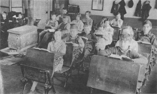
|
| Figure 98: The one-room school house was still a fixture in our region well into the 20th century. This photo was taken in 1924 at Young's Creek school in Orange County. |
Just as Purdue University promoted modern farming and home crafts, Indiana University and other state universities were also involved in transforming society, particularly in the area of public education. Their faculty trained professionals in many fields and advised local governments and organizations on a host of social and economic matters.
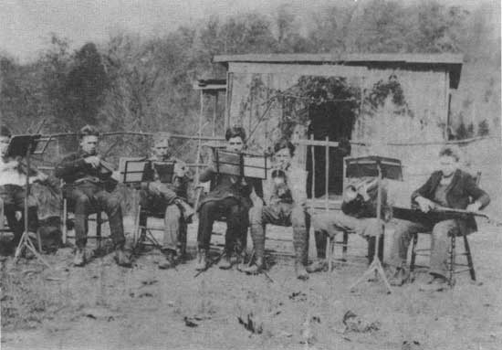
|
| Figure 99: Even one-room schools went beyond instruction in "reading, writing, and 'rithmatic." This photo at Young's Creek school shows the school orchestra; the wooden building in the background is a chemistry laboratory where experiments were undertaken. |
Communication and Transportation
The trend toward improved communication seen earlier in population centers finally reached the rural areas in the mid-1900s. First radio was introduced, as federally-assisted rural electric companies were established in the 1940s. Then, small telephone companies came to the hill country of south central Indiana, some as late as the 1950s. More recently, television arrived. These mass communications media expanded the viewpoints of the region's residents. They connected the region more closely with national- and state-level concerns, but also helped to weaken reliance on immediate neighbors and other local sources of news and entertainment.
We can best illustrate the changes that occurred in our region during the first half of the 20th century by quoting from the recollections of a lifelong resident, one whose ancestors were among the pioneer settlers of Monroe County.
When winter winds howled we stuffed old socks in the cracks around doors and rattling windows. We warmed our beds with well wrapped hot flatirons and bricks. In the morning, with frosty breaths, we scampered down the stairs to hover around the wood-burning stoves.
My mother made apple butter outside in the big kettle and stirred it with the long-handled wooden paddle that her aunts had used. She wove rugs and carpets on the ceiling-high, hand-carved loom.... Clothes were usually remade once or twice by our capable mother before she consigned them to the carpet rag box.
To take care of the farm work and provide for their eight children . . . our parents put in grueling hours of work. Our food supply throughout my childhood was almost entirely home-grown and processed.... I did not appreciate then how well we were fed and yearned for more of the things I saw in the grocery stores. How excited I was when my father brought home our first box of "Post's Toasties" (corn flakes)!
My father butchered our own beef or pork. Mother cooked and canned the meat. Lard was squeezed from the "cracklings" in the heavy lard press. Sugar-cured hams were strung in the near-by smokehouse. I would not dare estimate how many chickens or turkeys our mother "dressed" so expertly for our own use or for selling....
Rural electrification did not come to that area until the 1940's. Only afterwards did our parents get to enjoy such conveniences as "getting water out of a wall." Before then, even radios were not common in that rural area.... Before REA [electricity] even the wash water for our big family was carried or hauled from the spring downhill. Mother always had some sort of a washing machine, albeit hand-powered, but it was a great day when we got a Maytag with a gasoline engine! Each improvement, however primitive in retrospect, was experienced with downright excitement and pride. [135]
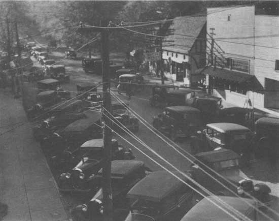
|
| Figure 100: West Main Street, Nashville, Brown County, 1927. Towns were often the leaders in acquiring the new technologies which entered our region during the years 1915-1951, bringing changes in communication. transportation, and entertainment, and altering the social arid economic life of the area. Note the automobiles and the telephone and electric wires. A movie theater and the first art gallery stood to the right. |
This account of growing up among the hills of south central Indiana brings our narrative to its end. We have tried to weave together a portrait of past times, by telling about the people of our region, and how they lived, worked, played, and worshipped. When we could, we used the words of area residents, to help bring the past closer. We have also highlighted the material culture of the past, in order to demonstrate the role that houses, archaeological sites, and objects can play in understanding the past.
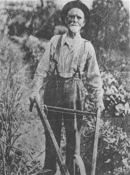
|
| Figure 101: The new technologies that entered our region in the 20th century did not always alter the old patterns of work. In this photo, taken around 1930, an elderly resident of Monroe County who immigrated from Ireland in 1857 tends his garden. |
For those of you who are interested in learning more about our region's history, and contributing to the discovery and interpretation of our past, the remaining sections of this book may help guide you in that process.
| <<< Previous | <<< Contents>>> | Next >>> |
|
9/hoosier/history/sec1.htm Last Updated: 21-Nov-2008 |