|
MESA VERDE
The Archeological Survey of Wetherill Mesa Mesa Verde National Park—Colorado |

|
THE ARCHEOLOGICAL SURVEY OF WETHERILL MESA (continued)
site data
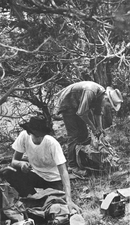
Field data for each site were recorded on the spot. Here the site was first numbered and marked. Sites in caves, along cliffs, or among large fallen rocks were usually marked by carving the number into the rock. Where this was impossible, as it usually was on the mesa top, a 2-foot length of 3/4-inch steel reinforcing rod was numbered with dies and driven into the ground, leaving approximately 6 inches above the surface.
Next, the location was recorded by bearings to known points and estimated distances plus a prose description of the spot, such as: "On talus, right bank of Rock Springs Canyon 200 feet below confluence with its west fork and 50 feet in elevation above canyon bottom. In dense oak brush." Any remark that would aid in the relocation of the site by a man on the ground was entered.
A sketch map was made with the use of standard symbols and with distances estimated by pacing. The map was supplemented with notes on the estimated number of rooms, type of construction, height of standing walls, depth of mound, relative amount of trash, and the presence or absence of kiva depressions, towers, pictographs, or evidence of vandalism. If sherds were collected, it was so noted with the area from which they came.
|
| Recording site data. |
After cataloging was completed in the laboratory, the file numbers of photographic negatives and catalog numbers of field specimens, other than sherds, which may have been collected at a site were entered on the cards.
The duplication of record cards for all the sites surveyed is too formidable a project for publication. Pertinent data have been reduced to the tabulation in table 10 in the back of the book.
Some explanation of terms and abbreviations is necessary for the reader.
Estimated number of rooms: Size in terms of the number of rooms is, in some cases, accurately stated but for most sites this has to be estimated from the size of the mound. Some early sites exhibit such scant or scattered surface evidence as to make any reasonable estimate impossible.
Location: Location of sites is indicated by the initials M, C, T, or B for mesa top, cliff, talus, or canyon bottom.
The presence of various architectural features is indicated on the tables by a check.
Spall and adobe: the low mound or thin scattering without relief of small sandstone spalls and an occasional piece of burnt adobe; remains of adobe or jacal wall (figs. 9-10, 15).
Figure 9—Small rocks and scattered spalls typical of surface indications of Pueblo I house. Site 1824.
Figure 10—Wall of rough masonry and adobe at Site 1344. Scattered rocks in figure 9 are probably remains of this type of construction. Slabs: a sandstone slab on edge whether a small slab used to line the base of a wall or a large megalith making up the greater part of a wall's height (figs. 11-13).
Figure 11—Upright slabs typical of many late Pueblo I and early Pueblo II sites. Site 1815.
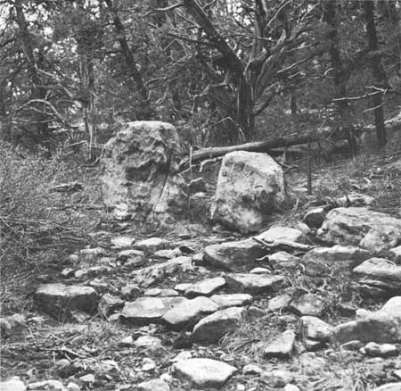
Figure 12—Megalithic slabs which formed the base of some late Pueblo II and early Pueblo III walls. Site 1439.
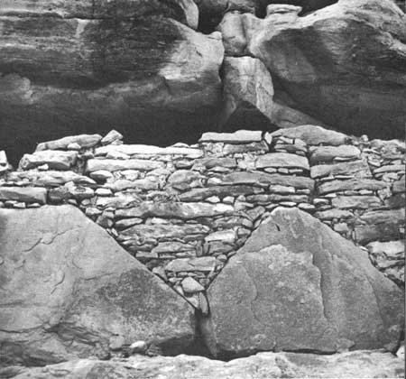
Figure 13—Megalithic slabs supporting wall of scabbled stone. Site 1447. Dry wall: a masonry wall laid without mortar. Impossible to determine at exposed sites where mortar, if used, is usually washed out (fig. 14).
Figure 14—Dry-laid wall. Site 1409. Rough masonry: masonry of unworked, unshaped stone (figs. 15-16).
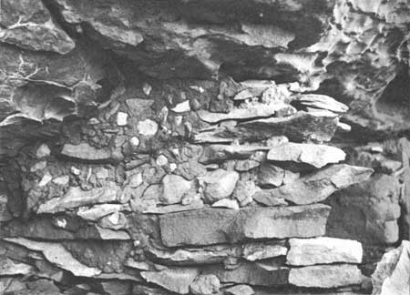
Figure 15—Wall of rough, unshaped rock and spalled adobe. Site 1504.
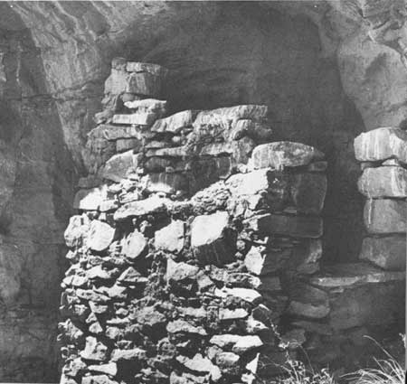
Figure 16—Rough wall, 2 or 3 stones showing some scabbling. Site 1266. Scabbled masonry: masonry of stone which has received some primary shaping (figs. 17-19). The term includes, but is not confined to, the common wedge-shaped, "chipped edge" stone.
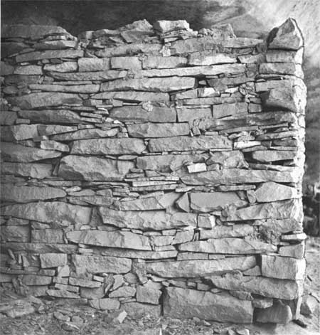
Figure 17—Wall of scabbled stone in "chipped edge" style. Many spalls but little mortar. Site 1446.
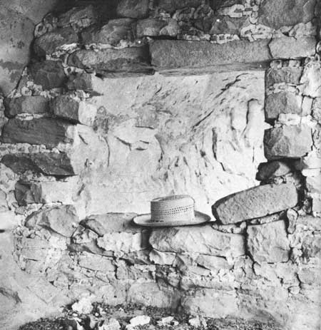
Figure 18—Scabbled stone wall in small cliff dwelling in Bobcat Canyon. Site 1373.
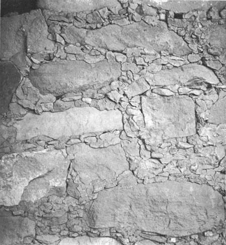
Figure 19—Scabbled masonry wall: stones are shaped bu not pecked or ground on the surface. Site 1202. Finished masonry: coursed masonry in which some stones have been shaped by means of pecking or grinding (figs. 20-24).
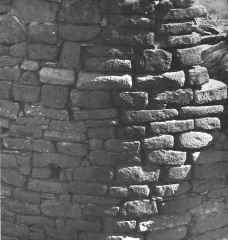
Figure 20—Finished masonry. Pecked surfaces of rock in classic wall of tower on Wildhorse Mesa. Site 1138.
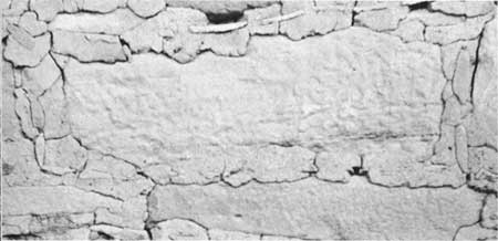
Figure 21—Typical pecked surface of stone in classic, finished masonry of Pueblo III period. Site 1890.
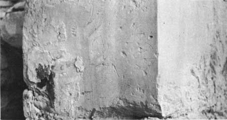
Figure 22—Finished stone with ground surfaces. Site 1320.

Figure 23—Corner of a doorway that has been shaped to receive a door slab. Site 1500 (Lancaster House).
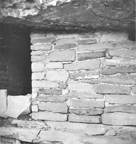
Figure 24—Closeup of wall in figure 23. Size of stone and regularity of sources denote a classic Pueblo III wall. Compound wall: a wall in which some or all of the stones are exposed on only one face of the wall. The term includes double walls in which each face of the wall is laid independently (fig. 25).
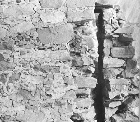
Figure 25—Exposed section of compound wall. Site 1355. Retaining wall: a wall built to hold level ground for a house site or working surface.
Terrace: masonry wall in a watercourse or on a slope for the purpose of holding agricultural soil and moisture. The number of individual walls, either actual or estimated, included under the site number is given.
Tower: an aboveground, usually circular structure, an adjunct of many kivas. Not included are rooms connected by passageway to a kiva that are otherwise undifferentiated from ordinary dwelling rooms.
Kiva: kivas and kiva depressions indicated by the number for which there is evidence.
Ceremonial only: sites which consist of a kiva, a tower, or a shrine or a combination but with no domestic structure present.
Storage only: small room separated from all others which shows no evidence of use as living quarters.
Phase: A discussion of phases and their attributes will be found in a later chapter. A continuous occupation is indicated by a hyphen: P-M, meaning Piedra through Mancos Phases. Reoccupation or discontinuous use is indicated by a comma: P, M.
Pottery typology in the Southwest is not an exact science and there is almost as much variation in descriptions of the various types as there are archeologists working with them. In order to define my terms the local pottery types are discussed at considerable length in a separate chapter. Under each type is the number of sherds of that type picked up at the site. Unidentified sherds are not listed.
| <<< Previous | <<< Contents>>> | Next >>> |
archeology/7a/survey3.htm
Last Updated: 16-Jan-2007