|
Minute Man National Historical Park Massachusetts |
|
 NPS photo | |
Discontent smoldering in the American colonies under British rule flared into open hostilities on April 19, 1775. On a stretch of country road outside Boston a prolonged skirmish between 3,500 colonial militia men and 1,700 of His Majesty's redcoats opened the American Revolution. The initial fighting in the war was a local action between Britain and her recalcitrant colony of Massachusetts. The government had clamped down in reaction to the colony's resistance to the Mother Country's economic policies. For a year a British army under Gen. Thomas Gage had occupied Boston. Pressed by the ministry in London to quell rebellion by arresting the rabblerousers Samuel Adams and John Hancock, Gage chose instead to take what he thought was the less inflammatory step of confiscating the patriots' arms supply in Concord. But incompetence and miscalculation doomed what he meant to be a limited, routine operation. Gage depended on secrecy to seize the arms before the people of Concord could resist, but Boston knew of the operation before the troops left, and the arms at Concord were soon hidden. Couriers Paul Revere and William Dawes notified Adams and Hancock in Lexington that the British were on their way. Mixups delayed the British departure for hours, giving the colonists more time to prepare. Finally the local militia and minute men were not the contemptible, undisciplined mob Gage took them to be. They had trained for months and had well-rehearsed plans for immediate reaction to a British incursion.
Gage gave command of the British troops to Lt. Col. Francis Smith, a ponderous, tactically unimaginative officer who slowed an already delayed operation. By the time Smith's advance troops under Maj. John Pitcairn arrived in Lexington it was dawn and Capt. John Parker had his militia lined up on Lexington Common. Because he had only 77 men, Parker had no thought of impeding the 700 British soldiers. He wanted to make a display of patriot resolve. But as the militia men slowly obeyed Pitcairn's order to disperse, a shot was fired—it is not clear from which side—and the green British soldiers, ignoring orders to stop, began firing at will at the fleeing Americans. When Pitcairn and Smith regained control, eight Americans lay dead. As the British troops continued down the road to Concord, news of the shooting spread to neighboring communities, and militia men flocked to the British line of march between Boston and Concord.
At Concord, British soldiers began searching house-to-house for arms. Smith sent seven companies across the North Bridge to seize the supplies hidden at Col. James Barrett's farm. The militia men who had fallen back to Punkatasset Hill advanced on the three companies left to guard the bridge. As the militia approached they saw the smoke of burning military supplies rising from town. Fearing that their homes were being put to the torch, they set out to save them. After the British withdrew across the bridge the colonials continued to advance until the British fired a volley that killed two minute men. Maj. John Buttrick of Concord then gave the order, "Fire, fellow soldiers, for God's sake, fire!" and for the first time Americans fired a volley into the ranks of British soldiers. Two British soldiers were killed. The British, outnumbered four to one and with half of their officers wounded, retreated to the center of town. The troops returning from Barrett's farm were allowed to march by unharassed. After pausing about two hours to regroup and feed his troops. Smith began the march to Boston. Flankers moved along the mile-long ridge on the left that separated the column from the colonials. At Meriam's Corner, where the ridge ended, the flankers had to be drawn in to cross the narrow bridge, and the militia, reinforced by companies from towns to the north, gathered near the road, taking cover where they could. Here began the running skirmish that continued to Boston. The British encountered heavy, unrelenting fire from the hundreds of militia men behind building, wall, and tree, but the range was too great for the muskets to do much damage, and the British escaped with relatively few injuries.
From this point on, the British ranks had to run a gauntlet of colonial fire. Already there seemed to be a musket behind every tree, and fresh militia men were pouring in from towns like Reading, Salem, and Lexington. When the flanking parties could operate, most of the militia men were driven out of range. But British soldiers fell steadily at every hill or curve where the Americans had position. After the column had passed one spot, the militia men would cut across country and be ready for them farther up the road. Exhausted and near panic, the British troops staggered into Lexington at about 2:30 and were met at last by 1,000 reinforcements under Lord Percy. Under cover of artillery the British rested briefly before starting the final retreat to Boston. Percy knew that his troops were in danger of annihilation unless they kept moving. The worst fighting occurred on the road into Menotomy (now Arlington), where more than 5,000 men were involved and both sides lost more men than in any other fighting along the road. After escaping Menotomy, Percy had to use cannon several times to scatter the Americans concentrated at his rear. That was probably the edge that allowed him to make it across Charlestown Neck after nightfall to the safety of Bunker Hill, where he was protected by the guns of HMS Somerset in Boston Harbor. But he had lost 73 dead and 174 wounded, with 26 missing. The American losses were 49 dead, 40 wounded, and 5 missing. Soon after, Boston was under siege and Gage was reduced from governor to a general of forces occupying the city. The performance of the militia that day convinced Percy that this rebellion ran deeper than he or the ministry had suspected. The Americans were indeed prepared to fight for their rights.
In Service of the King
Lt. Gen. Thomas Gage, Commander in Chief of the British Army in America and Governor General of Massachusetts, knew conflict was inevitable. "The first stroke will decide a great deal," he told London. Maj. John Pitcairn, a respected officer, was appalled at the uncontrolled firing by British soldiers. Lt. Col. Francis Smith headed the expedition. Though experienced, he was slow and deliberate—a disadvantage in a surprise operation. Lord Hugh Percy, commanding the relief column, countered American tactics with artillery and saved the British column from annihilation.
American Resistance
Paul Revere, a propagandist and courier for the Committee of Correspondence, rode to warn provincial leaders that the British were marching. Patriot firebrand Samuel Adams hoped the fighting in Massachusetts would spur other colonies to take up arms. Dr. Joseph Warren was an orator and fighter who encouraged militia with the words "They have begun it—we will end it."
"A People Armed and Numerous"
Believing that a full-time army was a threat to their liberties, the colonists relied upon part-time militia for their defense. By 1775 many towns in Massachusetts had recruited from among their militia elite companies of "minute men" ready to march at a moment's warning. The militia who fought on April 19, 1775, came from all walks of life and included about 20 "patriots of color."
Public Reaction
The Provincial Congress's official narrative of the day's events exaggerated British atrocities and American helplessness. The account was sped by couriers to newspapers along the coast that further embellished the story. The Salem Gazette broadside, complete with coffins, was typical. As a propaganda tool, the report was highly successful. Colony after colony, enraged by the "dismal carnage," called up militia and prepared to fight. In England the Whig opposition also profited, lampooning the King's army in widely circulated cartoons.
Visiting Minute Man
Where the Revolution Began
It was an unusual field of battle for the opening of the American Revolution: 20 miles of winding, hilly road connecting a port city and several country towns. But word of the fighting on Lexington Common, at the North Bridge, and on the road to Boston raced throughout the American colonies to unite men and women behind the patriot cause. What had begun as a struggle between British authorities, determined to enforce the will of Parliament, and the people of Massachusetts, determined to retain their rights as English citizens, soon grew into a war for independence that lasted more than eight years. Today, much of that country road is an urban highway, but the Battle Road still follows generally the same route, passing the sites of the bitterest fighting and the buildings nearby, helping to recall the dramatic events of April 19, 1775.
Touring the Park
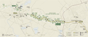 (click for larger map) |
Begin your visit at the Minute Man Visitor Center near the eastern entrance of the park. "The Road To Revolution," a multimedia theater program, provides an excellent introduction to the park story, depicting Paul Revere's Ride and the battles at Lexington Green, North Bridge, and along Battle Road.
Battle Road Trail
Connecting many of the park's
historic sites, this pathway follows remnants of the historic road and also
crosses farming fields, wetlands, and forests. You can explore this five-mile
route on foot, bicycle, or by wheelchair. Take time to discover the trail and
enjoy the rich historical and natural resources that the park offers. Battle
Road Trail was not designed for high-speed use. Bicyclists: watch out for
pedestrians, wheelchairs, and children in strollers. Walk bicycles on wetland
boardwalks.
If you wish to experience the entire trail, begin at Meriam's Corner and follow the course of the Battle Road from west to east. You may also visit portions of the trail from any of the following parking areas:
Minute Man Visitor Center The Nelson house sites along Battle Road echo family stories. At Parker's Revenge, the Lexington Militia attacked the British column in retaliation for the deaths incurred at dawn. If you walk east from the visitor center, you can follow Battle Road to Fiske Hill and loop back via a walking trail through historic pasture land.
Paul Revere Capture Site A monument marks the approximate site where the famous "midnight ride" of Paul Revere came to an end.
Hartwell Tavern If your time is limited, be sure to stop here. The home of Ephraim and Elizabeth Hartwell and their children was a prosperous farm and tavern. Travelers to and from Boston stopped and shared the latest news of the day. Living history demonstrations bring this site to life. From Hartwell Tavern walk on the restored Battle Road through one of the most evocative historic landscapes in the park.
Brooks Beyond the historic Brooks houses a boardwalk leads through the Elm Brook wetland. The trail then follows the route of the colonists uphill along stone walls to the Bloody Angle, where they set up an ambush and caught the British column in a crossfire.
Meriam's Corner Walk a short distance west from the parking area to Meriam's Corner, where spontaneous gunfire between colonists and British soldiers initiated the six-hour fight known as "Battle Road." Walk east to view Historic Farming Fields; follow farm lanes traversed by the colonists on the day of the battle. In the 19th century, author Henry David Thoreau was born near here and wrote about this landscape.
The Wayside and North Bridge Traveling west from Meriam's Corner, stop at The Wayside, where 19th-century authors kept the spirit of the Revolution alive by helping to create a uniquely American literature.
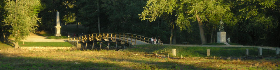
Continue on to the North Bridge, site of "the shot heard 'round the world." Next to the bridge is the Minute Man statue. Here along the Concord River is an ideal place to reflect upon what you have learned and experienced.
About Your Visit
For Your Safety
Sections of the Battle Road coincide with Mass. 2A. Because of heavy traffic,
use caution.
Please respect the rights of private families living within the park boundary.
Historic and natural features within the park are protected by federal law. Do not excavate, remove, disturb, deface, or destroy any structure, exhibit, artifact, animal, or plant life. The park has instituted a "Park Watch" program to protect the park and to provide a safer environment for our visitors. You can help by reporting any criminal activity or safety hazard to park rangers.
In an emergency call 911.
Source: NPS Brochure (2004)
|
Establishment Minute Man National Historical Park — September 21, 1959 |
For More Information Please Visit The  OFFICIAL NPS WEBSITE |
Documents
A Management Plan to Balance Cultural and Natural Resources: The Minute Man National Historic Park Case Study Massachusetts Agriculture Experiment Station Research Bulletin Number 744 (Beth J. Gavrin, Meg Rasmussen, Julius Gy. Fabos and Jack Ahern, Summer 1993)
Acoustical Monitoring 2008-2009: Minute Man National Historical Park NPS Natural Resource Technical Report NPS/NRSS/NRTR—2013/791 (Charlotte Formichella, August 2013)
Amphibian and Reptile Inventory: March-September 2001, Minute Man National Historical Park NPS Natural Resource Technical Report NPS/NETN/NRTR—2011/505 (Robert P. Cook, David K. Brotherton, John L. Behler and Brad C. Timm, November 2011)
An Inventory of Terrestrial Mammals at National Parks in the Northeast Temperate Network and Sagamore Hill National Historic Site U.S. Geological Survey Scientific Investigations Report 2007-5245 (Andrew T. Gilbert, Allan F. O'Connell, Jr., Elizabeth M. Annand, Neil W. Talancy, John R. Sauer and James D. Nichols, 2008)
Anthropogenic Climate Change in Minute Man National Historical Park, Massachusetts (Patrick Gonzalez, August 14, 2018)
April 19, 1775: A Historiographical Study (Douglas P. Sabin, September 17, 1987)
Archeological Collections Management at Minute Man National Historical Park, Massachusetts: Vol. 1 ACMP Series No. 4 (Linda A. Towle and Darcie A. MacMahon, eds., 1987)
Archeological Collections Management at Minute Man National Historical Park, Massachusetts: Vol. 2 ACMP Series No. 4 (Linda A. Towle and Darcie A. MacMahon, eds., 1986)
Archeological Collections Management at Minute Man National Historical Park, Massachusetts: Vol. 3 ACMP Series No. 4 (Linda A. Towle and Darcie A. MacMahon, eds., 1986)
Archeological Collections Management at Minute Man National Historical Park, Massachusetts: Vol. 4 ACMP Series No. 4 (Linda A. Towle and Darcie A. MacMahon, eds., 1986)
Archeological Documentation of Gas Utility Trench, Rego House, North Great Road, Lincoln, MA, Minute Man National Historical Park (Steven R. Pendery, September 21, 2009)
Archeological Investigation at the Hovagimian Barn, Stow-Hardy House, Minute Man National Historical Park, Concord, Massachusetts (James M. Harmon, December 2010)
Archeological Investigations of Minute Man National Historical Park — Volume I: Farmers and Artisans of the Historical Period Cultural Resources Management Study No. 22 (Alan T. Synenki, ed., 1990)
Archeological Investigations of Minute Man National Historical Park — Volume II: An Estimation Approach to Prehistoric Sites Cultural Resources Management Study No. 23 (Duncan Ritchie, Marsha K. King, Cristy Vogt and Patricia Fragola, 1990)
Archaeological Overview And Assessment, Minute Man National Historical Park, Concord, Lincoln, and Lexington Massachusetts Final Report (Holly Herbster, June 2005)
Battle Road: Memorial or Arterial? (1983)
Battle Road: No Turning Back? (John Muse, undated)
Battle Road Structure Survey, Minute Man National Historical Park (October 2005)
Bridging the Past: An Administrative History of Minute Man National Historical Park (Joan Zenzen, July 2010)
Completion Report: Repairs To The John Nelson Barn, Minute Man National Historical Park, Concord, Massachusetts (January 1979)
Condition & Treatment Report, Minute Man Sculpture Report, Minute Man National Historical Park (Carol Warner, 2007)
Cultural Landscape Report for Battle Road Unit, Minute Man National Historical Park — Volume I: Site History, Existing Conditions, and Analysis & Evaluation Olmsted Center for Landscape Preservation (Deborah Dietrich-Smith, 2005)
Cultural Landscape Report for Minute Man National Historical Park (Julius Gy. Fabos, Jack Ahern, Beth J. Gavrin and Meg Rasmussen, 1993)
Cultural Landscape Report for the Wayside Unit, Minute Man National Historic Park: Site History, Existing Conditions, Analysis and Treatment (Deborah Dietrich-Smith and Jacob Tisinger, 2008)
Cultural Landscape Report: North Bridge Unit, Minute Man National Historic Park: Site History, Existing Conditions, Analysis & Evaluation, Treatment Recommendations (Deborah Dietrich-Smith, January 2004)
Cultural Landscapes Inventory: Battle Road, Minute Man National Historical Park (2007)
Cultural Landscapes Inventory: Brooks Farm, Minute Man National Historical Park (2012)
Cultural Landscapes Inventory: Fiske Hill, Minute Man National Historical Park (2015)
Cultural Landscapes Inventory: Hartwell Area, Minute Man National Historical Park (2012)
Cultural Landscapes Inventory: Jones/Stow Farm, Minute Man National Historical Park (2012)
Cultural Landscapes Inventory: Meriam's Corner, Minute Man National Historical Park (2007)
Cultural Landscapes Inventory: Nelson Farm Area, Minute Man National Historical Park (2012)
Cultural Landscapes Inventory: North Bridge, Minute Man National Historical Park (2012)
Cultural Landscapes Inventory: Wayside, Minute Man National Historical Park (2013)
Documentation Of Physical Evidence 2009-10: John Nelson House and Barn, Minute Man National Historical Park, Concord, Massachusetts (James J. Lee III, 2010)
Environmental Assessment for "Save Historic Structures and Cultural Landscapes", Minute Man National Historical Park (April 1999)
Everyday Life in Eighteenth Century Lincoln, Massachusetts (Teresa Wallace, September 1997)
Farming And Land Uses General Study, Minute Man National Historical Park, Concord, Massachusetts (Ricardo Torres-Reyes, July 26, 1969)
Finishes Assessment of Select Interior Spaces of the Stedman Buttrick House, Minute Man National Historical Park (Carole Louise Perrault, April 2008)
Foundation Document, Minute Man National Historical Park, Massachusetts (February 2015)
Foundation Document Overview, Minute Man National Historical Park, Massachusetts (February 2015)
General Management Plan, Minute Man National Historical Park, Massachusetts (September 1989, errata May 1990)
General Report: House and Land in the Park (Robert Ronsheim, 1968)
Geologic Resources Inventory Report, Minute Man National Historical Park NPS Natural Resource Report NPS/NRPC/GRD/NRR-2017/1523 (T.L. Thornberry-Ehrlich, September 2017)
Geophysical Survey at MIMA, The Bull Tavern Site, Lexington,MA 2010 Draft (William A. Griswold, 2011)
Historic Data: Captain Brown's House, Minute Man National Historical Park, Concord, Massachusetts (Ricardo Torres-Reyes, September 29, 1969)
Historic Furnishings Plan: The Wayside, Minute Man National Historical Park, Concord, Massachusetts (Doris Fanelli, 1983)
Historic Furnishings Report: The Wayside (Carol Petravage, 2003)
Historic Furnishings Report: The Wayside, 2003 Clarifications (2010)
Historic Grounds Report: Hartwell Tavern, Minute Man National Historical Park (John Luzader, undated)
Historic Grounds Report: The Wayside, Minute Man National Historical Park, Massachusetts (Anna Coxe Toogood, March 1970)
Historic Structure Assessment: John Nelson House and Barn, Minute Man National Historical Park (John Milner Architects, Inc., November 2008)
Historic Structure Report: A Comparative Study — Ephraim Hartwell Tavern, Minute Man National Historical Park, Massachusetts (Anna Coxe Toogood, September 1974)
Historic Structure Report: Architectural Data Section on the Hartwell Tavern, Minute Man National Historical Park, Concord, Massachusetts (Christopher H. Mulhern and Orville W. Carroll, January 1975)
Historic Structure Report: Elisha Jones House and Shed, Minute Man National Historic Park (James J. Lee III, 2007)
Historic Structure Report: Gowing-Clark House, (Daniel Taylor House), Minuteman National Historical Park, Concord, Massachusetts (Maureen K. Phillips, February 2000)
Historic Structures Report/Historical Data Section: Ebenezer Fiske House, Building #2 (Part I) (Robert D. Ronsheim, July 1964)
Historic Structures Report/Administrative Data Section: Ebenezer Fiske House, Building #2 (Part I) (Edwin W. Small, July 1964)
Historic Structures Report/Architectural Data Section: The Ebenezer Fiske House, Building Number LEX-1, Minute Man National Historical Park, Lexington, Massachusetts (Russell V. Keune, March 1963)
Historic Structures Report: The Great North Bridge and Historic Wall West, Minute Man National Historical Park (David L. Leonard, April 1973)
Historic Structures Report/Administrative Data Section: Hartwell Tavern, Minute Man National Historical Park, Concord, Massachusetts (Part I) (Benjamin J. Zerbey, April 1968)
Historic Structure Report: Job Brooks House, Concord, Massachusetts, Minuteman National Historical Park Draft (Judith A. Quinn and David Bittermann, November 1992)
Historic Strutures Report/Architectural Data Section: The Josiah Nelson House, Building Number LIN-3, Minute Man National Historical Park (Part I) (Russell V. Keune, February 1963)
Historic Structure Report: Joshua Brooks Jr. House Draft (Maureen K. Phillips, December 2000)
Historic Structures Report: Major John Buttrick House, Minute Man National Historical Park, Concord, Massachusetts — Part I, Historical Data Section (John F. Luzader, September 9, 1968)
Historic Structure Report: Meriam House, Part 1, Administrative Data, Minute Man National Historic Park (Barbar A. Yocum, written 1994, published 2004)
Historic Structure Report: Noah Brooks Tavern Site, Brooks Tavern, Hartwell Carriage House and Rogers Barn Draft (Maureen K. Phillips, December 2000)
Historic Structure Report: North Bridge, Developmental History, North Bridge Unit, Minute Man National Historical Park (Judith Q. Sullivan, February 2004)
Historic Structures Report/Historical Data Section: Widow Olive Stow House (Part II) (Carolee Dane Funk, March 2, 1973)
Historic Structure Report: Olive Stow House, Minute Man National Historical Park Final Draft (Barbara A. Yocum, February 2003)
Historic Structure Report: Samuel Brooks House Draft (Maureen K. Phillips, December 2000)
Historic Structure Report: The Captain William Smith House, Minute Man National Historic Park (Marlene Rockmore and Orville W. Carroll, prepared 1980-81, printed December 2007)
Historic Structure Report: The Farwell Jones House, Minute Man National Historical Park — Part II: Historical Data Section (Earl R. Harris, September 1978)
Historic Structure Report: The Wayside, Minute Man National Historical Park — Part II: Historical Data Section (Robert D. Ronsheim, February 29, 1968)
Historic Structure Report: The Wayside Barn, Minute Man Historical Park, Massachusetts — Architectural Data Section (Orville W. Carroll, March 1973)
Historic Structures Report on The Wayside, Minute Man National Historical Park, Concord, Massachusetts — Part III: Architectural Data Section (Orville W. Carroll, 1971)
Historic Structures Report: Part I on Building Number LEX-3, The Jacob Whittemore House, 21 Marrett Street, Lexington 73, Massachusetts, Minute Man National Historical Park Project, Architectural Data Section (Russell V. Keune, January 1963)
Historic Structures Report: Part I on Building Number LEX-3, The Jacob Whittemore House, 21 Marrett Street, Lexington 73, Massachusetts, Minute Man National Historical Park Project, Historical Data Section (Robert D. Ronsheim, March 1963)
Historic Structures Report: Samuel Hartwell House and Ephraim Hartwell Tavern, Minuteman National Historical Park — Part I, Historical Data Section (John Luzader, September 9, 1968)
Historical Handbook, Minute Man National Historical Park, Massachusetts (John Luazader, September 1973)
Historical Handbook, Minute Man National Historical Park alternate text (undated)
Historical Handbook, Minute Man National Historical Park first draft (John Luazader, 1972)
Historical Research Report: The Job Brooks House (Arthur L. Sullivan, May 1963)
Historical Research Report: The Joshua Brooks House, Lincoln, Massachusetts (Arthur L. Sullivan, March 1963)
In Praise of Sweet Corn: Contemporary Farming at Minute Man National Historical Park in Massachusetts (Steven M. Parish, 1996)
Interior Paint Study, First and Second Stories: John Nelson House, Minuteman National Historical Park (James J. Lee III and Judith Q. Sullivan, September 2010)
Interpretation Plan of the Battle Road Homestead of Samuel Brooks of 1775: A Living History of Early American Farm Life in Concord (and Lincoln), Massachusetts (Judith Broggi, June 2007)
Interpretive Prospectus, Minute Man National Historical Park, Massachusetts (1971)
Junior Ranger Guide (Ages 4-7), Minute Man National Historical Park (Date Unknown; for reference purposes only)
Junior Ranger Guide (Ages 8-11), Minute Man National Historical Park (Date Unknown; for reference purposes only)
Land in the Park: Nelson Road Area (Robert Ronsheim, 1968)
Long-Range Interpretive Plan, Minute Man National Historical Park (1999)
Margaret Sidney and How She Grew (Lisa M. Stepanski, December 9, 1983)
National Register Corrections — August 25, 2006 (2006)
National Register District Data Sheet (2002)
National Register District Data Sheet (August 2006)
National Register District Map Key (November 29, 2002)
National Register District Map Key (August 16, 2006)
National Register Documentation (2002)
National Register Documentation, 2006 Revisions (2006)
National Register Documentation Photos (undated)
National Register Listing Just Witness Houses (undated)
National Register of Historic Places Nomination Forms
Minute Man National Historic Park (Boundary Increase) (Mary Kate Harrington, Emily Paulus, Duncan Ritchie and Stephen Olausen, June 2001)
The Wayside (Bronwyn Krog, August 15, 1978)
National Register Supplementary Listing Record (December 2, 2002)
Natural Resource Condition Assessment for Minute Man National Historical Park NPS Natural Resource Report NPS/NER/NRTR-2009/141 (Mary-Jane James-Pirri, August 2009)
Natural Resource Assessment of the Barrett's Farm Unit, Minute Man National Historical Park NPS Science Report NPS/SR-2024/216 (Teá Montagna, Nina McDonnell, Douglas Woodhams, Luis De León and Robert Stevenson, November 2024)
Notes on The Wayside's red leather armchair (Pamela J. Licht, January 2011)
Parker's Revenge Archaeological Project, Minute Man National Historical Park, Lexington, Massachusetts (Margaret Watters Wilkes, Final Report for the Friends of the Minute Man National Park, October 2016)
Parker's Revenge Narrative Report: Phase I (2014)
Patriots of Color: 'A Peculiar Beauty and Merit' African Americans and Native Americans at Battle Road & Bunker Hill (George Quintal Jr., 2004)
Peter Salem (Teresa Wallace, June 2000)
Phase I Archeological Survey—Create Safe Visitor Access And Parking Project, Minute Man Visitor Center And Brooks Tavern/Rogers Barn Project Areas, Minute Man National Historical Park, Towns of Lincoln and Lexington, Massachusetts (Nichole A. Gillis and Kristen Heitert, January 2010)
Reenactors in the Parks: A Study of External Revolutionary War Reenactment Activity at National Parks (Cathy Stanton, November 1, 1999)
Report of a Specialized Intensive (Locational) Survey, Lexington Battle Road, Hanscom Air Force Base, Middlesex County, Massachusetts (John Milner Associates, Inc., May 2007)
Results of Research Conducted on the Thomas Nelson Farm Site (19-MD-347/HA.6) in Hanscom Air Force Base, Middlesex County, Massachusetts (Barbara Donohue, March 1, 2010)
Revolutionary Changes to an American Landscape: Invasive Plant Species at the Minute Man National Historical Park NPS Natural Resource Technical Report NPS/NER/NRTR-2005/009 (Brad Agius, December 2003)
Sacredness of Home: Literary Culture and Concord's Historic Houses (Kristi Martin, December 8, 2009)
Site Examination of the Col. James Barrett Farm Property, Concord, Massachusetts Cultural Resource Management Study No. 25 (Christa M. Beranek, 2008)
Special Study: Historic Motor Trails and Disposition of Structures in Minute Man National Historical Park (February 1968)
Structural Assessment Report: The Barn at the Farwell Jones House, Minute Man National Historical Park (Earth Tech, September 2004)
Summary—Land in the Park, Josiah Nelson Farm (undated)
Summary of Findings: The Wayside (May 28, 2003)
The First Stroke: Lexington, Concord, and the Beginning of the American Revolution (Thomas Fleming, 1978)
The Hartwell Tavern and the Harwell Family in Closer Detail (2010)
The Lexington-Concord Battle Road: Interim Report of the Boston National Historic Sites Commission to the Congress of The United States (June 16, 1958)
The Life and Writings of Harriett Mulford (Stone) Lothrop (Heidi Brautigam, December 9, 1999)
The Minute Man Pedestal and Its Two Time Capsules (Terrie Wallace, July 2014)
The New England Tavern: A General Study (Douglas P. Sabin, October 1, 1982)
The Scene Of The Battle, 1775, Historic Grounds Report, Minute Man National Historical Park Cultural Resources Management Study No. 15 (Joyce Lee Malcolm, 1985)
The Underground Railroad in Concord and at The Wayside, Special Resource Study/Management Concepts/Environmental Assessment (September 1995, 1997)
The Wayside, Piazza Room and Una's Room Wallpaper, Minute Man National Historical Park (James J. Lee III, October 2012)
The Willow Pond Kitchen: On a Twentieth-Century Road to the Colonial Past (Judith M. Adams, undated)
Transportation Study, Minute Man National Historical Park (December 1976)
Vegetation Mapping Inventory Project: Minute Man National Historical Park, Massachusetts NPS Natural Resource Report NPS/MIMA/NRR—2017/1450 (Susan C. Gawler and Robert E. Zaremba, May 2017)
mima/index.htm
Last Updated: 01-Jan-2025