|
EBEY'S LANDING
Ebey's Landing National Historical Reserve Reading the Cultural Landscape |

|
READING THE LANDSCAPE
Introduction
Historic settlement patterns, natural features and cultural elements are all important pieces in the landscape we see. Identifying these resources is the first step in learning to look at and "read" the whole landscape. One may consider them individually in order to see them clearly, but it is the relationship among these resources that most often describes the "character" of a landscape. It is these landscape patterns and relationships over time that imprint and reflect human history in the fabric of the land itself. The significance, meaning or value in the landscape depends on our ability to read and understand these patterns over time.
Identifying landscape relationships and components is discussed in the document Cultural Landscapes: Rural Historic Districts in the National Park System (see bibliography). The following section selects a few of those components and reviews portions of that discussion as it helps us "read" the landscape of the reserve.
Above: View of Ebey's Prairie looking east (c. 1900). Below: Same view today.
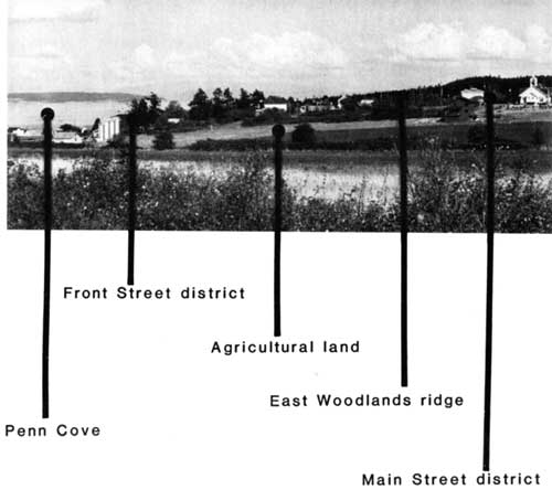
Overall Landscape Patterns
The first level of identification describes the patterns and relationships among several large landscape systems including major landforms, primary circulation networks and broad land use patterns. Identification of character for other elements, and can be accomplished using aerial photographs, topographic maps or direct observation.
Identification of large settlement patterns is valuable because, while smaller elements such as houses, crops, building materials, fence lines and property boundaries may change frequently, these broad patterns of settlement often remain for generations.
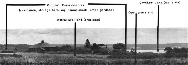
Land Use Patterns
The next level of identification describes the ways in which individual units of land are used. Common kinds of land use designations include agriculture and open space, woodlands, residential, commercial, park and natural areas. These general designations are often called land use categories.
More specific uses within these categories include a number of related activities that can also be identified. For example, within the land use category of "agriculture and open space," the more specific activities of crop production, dairy farm, pasture land or grazing may occur, impacting the land in different ways.
General land use categories can be identified from aerial photographs and direct field observation. Although the same is true for specific land use activities, these uses are better identified by direct field observation.
Identifying land use patterns contributes to understanding the ways cultural practices, technologies, economic conditions and available natural resources such as soils, topography and water, influence the development of a community.
|
Land Use Categories | |
 |
 |
|
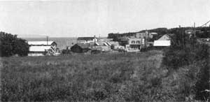
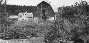
Land Use Activities | |
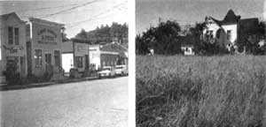 Within the general land use category urban, pictured at the top, are the more specific land use activities: commercial and residential. |
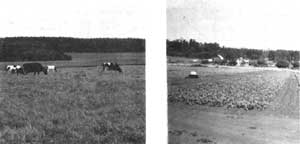 Within the general land use category agriculture, pictured at the top, are the more specific land use activities, pasture land and crop land. |
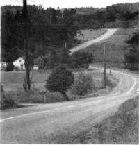
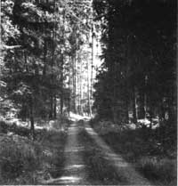
Circulation Patterns
The systems of movement through a landscape, from foot trails to major highways, are described as circulation networks.
Larger networks that link entire regions can be identified by aerial photographs or topographic maps. Smaller systems such as secondary roads, access roads, or paths within complexes, may best be identified by direct field observation.
Circulation networks are often the first patterns established in a cultural landscape. Identifying the kind of road or system, its location and purpose, can help establish the relationship among key locations and significant access points.
|
|
|
|
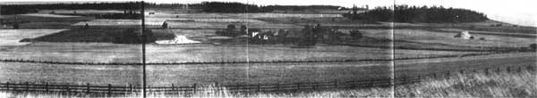
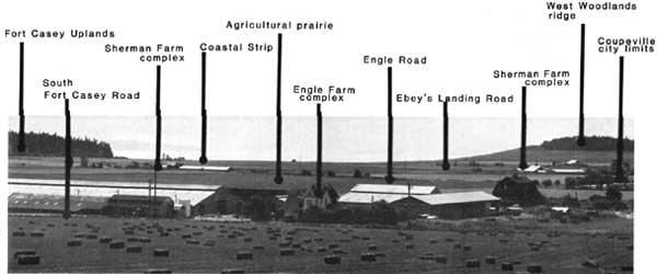
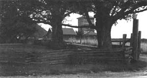
Boundaries
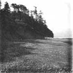
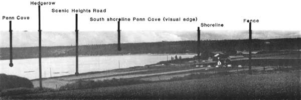
The shoreline creates both a natural boundary and visual edge.
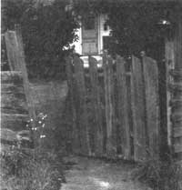
Boundaries in a landscape are those features that create edges or demarcations between individual land units. Boundary elements include natural features like ridges and shorelines; cultural elements like roads, fences, or property lines; and visual edges, as in cases where visual access to a scene is restricted by vegetation or other structures.
Boundaries may be identified by aerial photographs and maps but are best understood by direct observation. The identification of boundaries helps organize the landscape into discrete units within which smaller or more detailed relationships occur.
Political jurisdictions, like city limits, are also
considered boundaries.
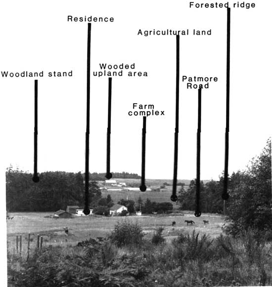
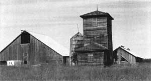
Cluster Arrangement
The arrangement of individual buildings, driveways, paths, gardens, fences, work areas and open spaces within discrete land units is called cluster arrangement. Typical cluster organizations include various farm complexes, ranches, and residences with outbuildings. Identification of cluster arrangement can be done with aerial photographs and topographic maps but is most accurate when done by direct observation.
Description of function, use and activities associated with the spatial organization of any cluster can often reveal cultural practices within a community.
Landscape Development and Settlement Patterns | Looking at Landscapes | Reading the Landscape
Preservation Principles | Appendix | Bibliography
rcl/rcl5.htm
Last Updated: 07-Dec-2015